
Historical and modern centers
| Overview | Details |
|---|---|
 |
Lithuania
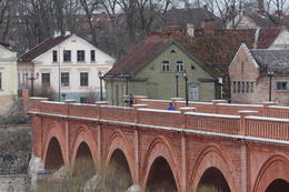
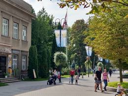
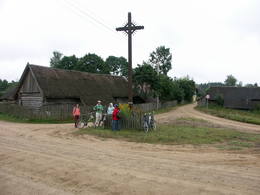
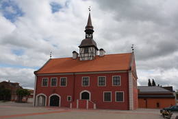
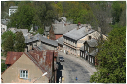
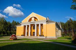
Zemaisu Kalvarija (Zemaicių Kalvarija)Pirmo reizi vēstures avotos 1253. g. šī vieta ir minēta kā kuršu apdzīvota apmetne. Laikā no 1637. – 1639. g. te uzcēla pirmās 19 kapelas – t.s. „Krusta ceļa stacijas", kas atgādināja Jeruzalemes Krusta ceļu. Kopš tā laika Žemaišu Kalvarija ir pazīstama kā nozīmīgs svētceļnieku galamērķis. Dažas no Krusta ceļa kapelām ir veidotas 17. – 18 gs., bet citas – 19. gs. Jāatceras, ka vēl pavisam nesen – Padomju laikos svētceļniekus nežēlīgi vajāja un represēja. Mūsdienās pilsētā ir izveidots 21 svētceļnieku „pieturas punkts". Te ik gadu (parasti no 2. – 12. jūlijam) notiek Žemaišu Kalvarijas katoļu draudzes svētki, kas pulcina daudz ļaužu no dažādām Eiropas valstīm. Iespaidīgā katoļu bazilika ir slavena ar Vissvētākās Jaunavas Marijas Katoļu Ģimeņu Karalienes gleznu, kas 17. gs. atvesta no Romas. Tai piedēvē brīnumdarītājas spējas. Interesants ir pilsētas ielu tīklojums, kas atgādina 9. – 13. gs. apdzīvotas vietas ielu plānojumu. Noteikti apskatāms iespaidīgais Žemaišu Kalvarijas pilskalns, kas slejas mazās Varduvas (Varduva) upītes krastā.  311 311
Services
311km - Distance from countries capital city |
 |
Estonia
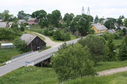
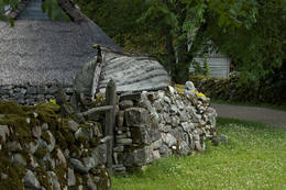
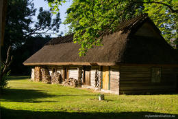
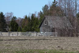
Koguva village and Muhu MuseumKoguva village on Muhu island is an outstanding example of peasant architecture in Estonia. Farmsteads with dry stone walls are protected as an architectural monument. The museum complex comprises a wealthy seaside farm Tooma (Juhan Smuul, an Estonian author, was born here) with all its outbuildings and tools, a former village school and a textile exhibition. 162
 1-12 1-12
Services
162km - Distance from countries capital city
1-12 Active season months |
 |
Latvia
DundagaDundaga baron once was one of the largest landowners of Courland, therefore during the second half of 19th century around the estate formed centre of economic and social life. Dundaga Central Square is dominated by its water tower, behind which starts Dakterleja, where from 1844 to 1854 worked one of the first ethnic Latvian doctors and linguist, J. Bars. Until the sixties of the 20th century from the Dundaga through Mazirbe and fishermen villages to Ventspils ran a Narrow gauge train. Today Dundaga attracts tourists with its spectacular castle, the Lutheran church, crocodile sculpture, Eizenberga pottery workshops and other objects. 152
Services
152km - Distance from countries capital city |
 |
Latvia
LIVANIOrigins of Livani as a bigger place of population are linked to the 1533, when the then owner of the land Lieven established the manor and called it after his own name Lievenhof. The 1678, the first Catholic Church was built here. The city suffered considerably during the two world wars. Name of Livani is associated with the glass. In 1887 a glass factory was founded here, which today has ceased operation. 167
Services
167km - Distance from countries capital city |
 |
Lithuania
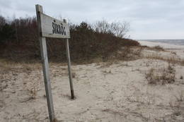
Strazdi (Strazdai)Ja mērķis ir savākt pilnvērtīgu etnogrāfisko ciemu fotokolekciju, ir jāapskata Strazdi (no lietuviešu valodas strazdai tulkojumā nozīmē strazds), kas ir pavisam neliela apdzīvota vieta Balošas (Baluošas) ezera ziemeļu krastā. Strazdi pirmoreiz rakstos minēti 1783. g. un ciema nosaukums cēlies no kādas mežziņu dzimtas uzvārda. 128
Services
128km - Distance from countries capital city |
 |
Estonia
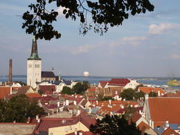
TallinnThe capital of Estonia. The Old Town of Tallinn - excellent medieval (14.-15th century) building monument. The former city of Hanza. |
 |
Latvia
Madonas Saieta laukumsMadonas centrālais laukums, kas vēl 20. gs. sākumā bija tirgus laukums. Pēc apjomīgās restaurācijas tas ir kļuvis par ievērības cienīgu pilsētvides objektu. Laukuma ziemeļu pusē atrodas pilsētas un novada pašvaldība un Madonas novada TIC. 165
Services
165km - Distance from countries capital city |
 |
Latvia
The Jersika castle hillThis location is important in terms of Latvia’s history, because during the 12th and 13th century, this was the administrative and spiritual centre of the Lettigalian tribe, with the ruler of Jersika being Visvaldis. The castle stood on the shore of the Daugava at a height of 18 m, and this was a mighty castle hill. The flat part of the hill measured 100 x 75 m, and it was surrounded by a barrier and a defensive wall made of logs. People entered the castle via guarded gates beyond which there were residential and household buildings, as well as a small church. Archaeologists have found the remnants of log buildings, as well as many antiquities from the 10th to the 13th century that speak to extensive trade relations with other parts of Europe, including ancient Russia. In 1209, the forces of Bishop Albert fooled the people in the castle and sacked it and the ancient town that was around it. Visvaldis’ family was taken hostage, and so the Lettigalian ruler was forced to become a vassal of the bishop. The castle hill is privately owned, so please contact the owner before planning a visit. 175
Services
175km - Distance from countries capital city |
 |
Lithuania
JuodkrantėOld fishermen village, which was first mentioned in 1429. Before WW2 Juodkrante was popular resort in Europe and it still has its traditions nowadays. Village has an unique scenery with its wooden houses, promenade, Lutheran Church (1885), Lithuania's Art Museum Hall and much more. 328
Services
328km - Distance from countries capital city |
 |
Latvia
The ruins of the Koknese CastleThe ruins of the Koknese Castle are found where the Daugava and Pērse rivers flow together. The castle, which is on a floodplain, was built for the bishopric of Rīga in 1209, and it replaced an ancient Latvian castle that was made of wood. The castle was blown up by Saxon forces in 1701. A visitors centre is near the ruins, and there you can carve a Medieval coin or rent a boat to sail down the Daugava. Make sure to stroll through the Koknese park, which is alongside the ruins. 100
Services
100km - Distance from countries capital city |
 |
Latvia
CesisThe history of Cēsis begins at the Riekstu hill, which is 18 m high and the surrounding area. There was a wooden castle built by the Vendian tribe that stood there from the 11th to the 13th century. The hill is in the central part of the castle’s park, and it offers a fine view of the park, a pond and the ruins of the Cēsis Castle. A long staircase leads to the hill. The Cēsis Castle was built in the early 13th century as the residence of masters of the Livonian Order, and it was one of the most fortified forts in the Baltic region. Alongside is the New Cēsis Castle, which was built in 1777 in a place where gate fortifications had been before. The building houses the Cēsis Museum of History and Art, and an annex contains the Castle Visitor Centre and the Cēsis Tourism Information Centre. From the tower of the castle, we get a good view of the castle ruins, St John’s Lutheran Church and the northern stretches of the city. Opposite the new castle is the stable of the Cēsis Castle Estate and a wheelhouse (both from the first half of the 19th century). Today these house the Cēsis Exhibition Hall. Other buildings include a granary, a hut for coachmen and an old brewery. On the other side of the street is the romantic May park, which was installed during the 1830s. Streets in Cēsis include Lielā Katrīna, Mazā Katrīna, Mazā Kalēju, Kalēju and Lielā Līvu streets and Līvu square with wooden buildings from the late 18th and early 19th century. Torņa Street stretches along the walls of the Medieval castle. Outside the church is a sculpture, “As the Centuries Pass By,” and legend has it that anyone who rubs the lantern of the Old Time Man can see the future. One of the most impressive buildings in Cēsis is St John’s Lutheran Church, which was built in the late 13th century by the Livonian Order. The Roman-style three-segment basilica has elements of Gothic design and a 65 m steeple that was installed in 1853. The building was reconstructed several times during the 20th century and contains grave plaques relates to masters of the Livonian Order and local bishops. The pulpit dates back to 1748, the oak altar was manufactured in 1858, and the altar painting “Crucified One” was painted in 1862. The windows of the altar part of the church contain artistically valuable stained glass. The organ was manufactured in 1907 by the E.F. Walker firm, and it is one of the best concert organs in Latvia. The solar clock with the number 1744 is in the south-wester corner of the church. It is worth scaling the viewing tower of the church. At its foot is Rose Square, which was a market square from the mid-13th century until 1927 and was restored in 2008. This is the central square in the city. During the Middle Ages, a punishment pole and the city well were here. Rīgas Street has been the main street in the old part of the city from the very start, and here we find most of the architecturally distinguished buildings from the 18th and 19th century – the former city hall, the Fābers house and the Princess house. At one end of the street is Liv Square, where there a church, cemetery and the Rīga gate in the city’s walls existed in the 13th century. Today the square is decorated by a lighted fountain at a place where a well was found in the 13th century. On the other end of the street we find a reconstruction of the foundations of the Rauna gate from the 14th and 15th century, offering a good look at Medieval walls and the size and strength of the gates. It is commonly claimed that the national flag of Latvia was born in Cēsis, but it must be emphasised that the flag that is mentioned in chronicles was designed in Cēsis in 1279 as the ideological prototype of the current Latvian flag, while the story of the first national flag actually comes from Valmiera, where it was sewn in 1916. 87
Services
87km - Distance from countries capital city |
 |
Estonia
PärnuMost popular Estonian resort with wide range of leisures and SPA offers. One of the rare Estonian sandy beaches. The Old Town has the main walker street - Rüütli tee. 130
Services
130km - Distance from countries capital city |
 |
Latvia
Lielirbe (Ira)This village is at the place where the Irbe (Dižirve, Īra) River flows into the sea, and it is on both shores of the river (sea side and land side). The name of Irbe was recorded for the first time in a 1310 border agreement between the bishop of Kurzeme and the Rīga Dome Capitol. The name of Lielirbe (Irvemūnde) was recorded for the first time in a document from an arbitration court in 1387. At the end of the 19th century, the small port at Lielirbe was an active centre for the sale and transport of timber materials. In the late 19th and early 20th centuries, the largest number of sailing ships among villages on the western shore of Kurzeme was built there. In 1939, the village had some 300 residents, more than 70 houses and a Baptist church which is now at the Ventspils Open Air Museum. A narrow-gauge railroad passed through the village, which had a post and telegraph office, two grocery stores, an elementary school, a choir and a brass band. Lielirbe was one of the largest villages to disappear after World War II. Cultural historian Valda Marija Šuvcāne (1923-2007) was born in Lielirbe, and her daughter, Baiba Šuvcāne, is continuing her mother's work by writing important papers about life along the Livonian coastline. By 2019, a bridge is to be reinstalled across the Irbe River. 171
1-12
Services
171km - Distance from countries capital city
1-12 Active season months |
 |
Latvia
KuldigaKuldiga is deservedly considered the most beautiful small town of medieval times in Latvia. Instead of it already in the 13th century the Bandava centre of the ancient Cours land was located. In 1242 construction of stone castle was begun at Venta Falls by the Livonian Order. Populated area formed beside the castle, which was the first to acquire the rights of a city in Kurzeme (in 1378). Significant was also its participation in the Hanza Union. From 1561 until 1795 Kuldīga was the capital city of Kurzeme Dukedom. Naturally, in the first half of the 17th century it experienced rapid economic growth, which was terminated by the beginning of the Northern War and plague epidemic. The pride of Kurzeme residents and the lack of larger industrial objects was the reason, why during the Soviet times larger masses of immigrants did not flood the city, therefore today Kuldiga is one of the most Latvian cities in Kurzeme. It is worth to visit Kuldiga and stay there for more than one day, because there is plenty to do here. Nature fans may observe the flying fish, but for researchers of cultural history a really vast field of work opens here. 152
Services
152km - Distance from countries capital city |
 |
Latvia
KrimuldaThe Lutheran Church of Krimulda is considered one of the oldest churches in Latvia. It was originally built in the 13th century, soon after the conquest of Kubesele and later rebuilt many times. Near the church a meditation labyrinth "Lily Flower" is set up. When Liv chief Kaupo fell during the battle at Viljandi in 1217, according to the legend, the ash was buried at the church. A small hill adjacent to Runtinupite (Runtins) is popularly known as a grave site of Kaupo, at its right bank is located ~7 m long, artificially dug Kubesele or Runtin cave. On the left bank of Runtinupite columns the Kubesele hill fort. Kubesele nature trail starts at the church. This trail leads to the Gauja River, where the Great (Runtina) stone lies. Here can be seen anchor pads installed by Gauja raftsmen. Krimulda medieval castle (4 km east of Krimulda Church) was built the second half of the 13th century in the place where the right bank of Gauja valley is split by deep ravine of Vikmeste. Castle (residence of Riga dome capitol - Riga's Archbishop Council) was an imposing building, whose big inner yard was included by 1.5 m thick defensive wall. In 1601, while retreating, Swedish military leader Heinrich Lieven blasted Krimulda castle. Now at the hill fort, grown with the forest a small castle ruins can be seen. Nearby is located air cableway and starts Krimulda mountain road. Located nearby Krimulda manor was first mentioned in writings in the 15th century. Present manor castle was built in the 19th century in neoclassical style (owner - First Lieven). During the twenties of the 20th century, the castle after its alienation became a property of the Latvian Red Cross, which established here children's sanatorium. Nowadays the castle houses rehabilitation hospital "Krimulda", but from the farm buildings, manor stables, barn, servant, manager houses and the so-called Swiss Cottage and Park have been preserved. Thematic tours are offered here. If we go down the Gauja by boat, then we will be able to take a close look at about 15 m high Velnalas cliffs. They can be well seen also from the opposite - left bank of Gauja (resting place is established). In the middle of the cliff about 19 m deep and 4.7 m high Krimulda Velnala cave is located. If we go from the Velnala cave cliffs along the lower part of the right bank of Gauja in Turaida direction, you will see Pikenes cliff, rich with sandstone outcrops. At its foot ~ 1 km long Pikenes beaver trail is established. The Little Devil's Cave (5 m long) is on the side of the trail, with the Gudribas (Wisdom) spring that springs out of the cave, as well as Aunapieres cave which is the same length as Devils cave. Small oxbow lakes also can be seen. 50
Services
50km - Distance from countries capital city |
 |
Latvia
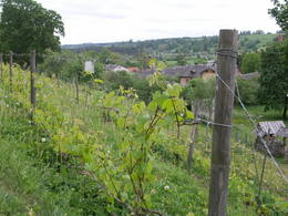
SabileAlready in the 10th century, an ancient village was located at the Sabile hill fort. After the division of Course land, Sabile was won by the Livonian Order, which built a stone castle (not preserved) here. Sabile is first time mentioned in written sources in 1253. During the 15th century an urban area started to develop at the castle. Town right was awarded to Sabile in 1917. Today Sabile is a small town, surrounded by many notable monuments. Roma culture is an integral part of Sabile and therefore, Sabile is also known as the Latvian capital city of Roma. Sabile has long been known for its wine-growing and oenological traditions, which have been reborn and enjoyable during the Sabile wine festival. 112
Services
112km - Distance from countries capital city |
 |
Lithuania
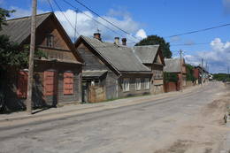
Kretonu vienielas ciems (Kretuonių gatvinis kaimas)Kretoņu (Kretuonas) ezera dienvidu krastā (ezeru gan neredz aizauguma dēļ) meklējams Kretoņu ciems. Šķiet, ka šī vieta ir „aizķērusies" pagātnē. Cauri ciemam iet viena iela, kurai abās pusēs izvietojušās 19. – 20. gs. mijā (dažas pat mazliet agrāk – 19. gs. vidū) celtās saimniecības. Te redzamas gan dzīvojamās, gan saimniecības ēkas, kuras rada etnogrāfiska brīvdabas muzeja sajūtu. Dažas no tām gan ir „padevušās" laika zobam. Lai vai kā, šis ir viens no neparastākajiem nacionālā parka etnogrāfiskajiem ciemiem, kuru pa „galveno ielu" vērts izstaigāt visā garumā. Šim, tāpat kā pārējiem etnogrāfiskajiem ciemiem ir piešķirts kultūras mantojuma objekta statuss. 106
Services
106km - Distance from countries capital city |
|
|
Latvia
KalkisKaļķis is a populated area where
dolomite is still extracted from quarries in
the region (Kalnciems2 is one such
quarry). Some of the quarries are flooded.
46
Services
46km - Distance from countries capital city |
 |
Latvia
OgreMaterials of archaeological excavations show that the Ogre river banks were inhabited by the Livs. Ogre as a larger populated area and a major resort developed after the construction of Riga-Daugavpils railway in 1861. Until the World War I about 300 cottages offered their services in Ogre, most of them were destroyed during the war. The next "major" event took place 1965 when one of the largest knitwear plants in Europe was built in Ogre, which was staffed by guest workers from Vietnam and countries. Today, Ogre has still not recovered its glory of a resort, but has become a rather exclusive site of mostly low-rise residential buildings. 36
Services
36km - Distance from countries capital city |
 |
Latvia
ValmiermuizaLocated in the northern part of Valmiera, the Valmiermuiža Estate mansion (Neo-Baroque Style) was built between 1764 and 1771 by Prince August Friedrich of Schleswig, Holstein and Soderburg. Over the course of time it has been owned by other people. According to modern evidence, the mansion was a one-story building with a Baroque tower and a two-story addition in the early 20th century, which made it appropriate as a summer home and hunting lodge. The building burned down in 1918. Two years later, Valmiermuiža became a prison camp for captured soldiers. Later the addition to the mansion was restored and used as an elementary school. In 1936, the building became a prison, and it was once again a prison camp for captured soldiers during World War II. Later the building burned down again, and the ruins were removed. Still surviving is the Valmiermuiža tower, with ceiling paintings that are a cultural monument, as is the surrounding park. The Valmiermuiža brewery is alongside the historical monument, thus providing second wind for the whole region. 111
1-12
Services
111km - Distance from countries capital city
1-12 Active season months |
 |
Latvia
AlsungaKnown as Alšvanga in the past, this place was mentioned for the first time in 1231 in an agreement that was signed between the deputy legate of the pope in Rome and the Courlandian tribes of the region. The Livonian Order ruled the territory until 1561, and from 1573 until 1738 the order’s castle belonged to the von Schwerin dynasty from Pomerania. It during the rule of this aristocratic family that a stone church was built in honour of Archangel Michael, and local residents began to convert to Catholicism. Alsunga became the Catholic centre for all of Kurzeme, and local residents became known as the Suiti (from the Schwerin suite). For nearly 400 years, Alsunga has been the historical centre of the Suiti territory. This is Latvia’s most conservative region and is widely known with unusual songs, colourful folk costumes and various folk traditions and beliefs. The Suiti have their own dialect, foods and many other things that have been long since abandoned or forgotten elsewhere in Latvia. The religious has commingled with the folk here in one unique whole. The Alsunga District covers 191 km2 and has some 1,500 residents. 176
1-12
Services
176km - Distance from countries capital city
1-12 Active season months |
 |
Latvia
MadonaMadona is probably the only town in Latvia, in whose area a lake settlement was located around the 9th century. Its residues are preserved in the northern part of Salas Lake (Baznicezers) under water. Until the end of 19th century, a small estate with the same name (Madona) was located in place, where present town is located, Latvians called the place Bizi. In 1898 construction of narrow gauge railway between Stukmani (Plavinas) and Valka was started. The development of railway helped the development of the town. Today Madona is well maintained Vidzeme town with its own charm typical for small town. Interestingly that it can also be considered as one of the most highly placed towns in relief of Latvia. 169
Services
169km - Distance from countries capital city |
|
|
Latvia
The historical centre of SubateThe town of Subate was first listed in documents in 1570, when Duke Gotthard Kettler of the Duchy of Courland sold the Subāte marketplace to Count G. Plater-Sieberg. When the Plater-Sieberg dynasty converted to Catholicism in the mid-17th century, Lutherans in Subate protested by moving to the eastern bank of Lake Subate. That was the property of the Prode Estate (only ruins remain at this time), which was owned by the Osten-Sacken dynasty. In 1685, the Osten-Sackens built a Lutheran church for the “refugees,” and Jaunsubate was established around it. Both parts of the town were merged again in 1894. During Latvia’s liberation battles in 1919, Subate was liberated by Lithuanians, at which time the town was divided up between Latvia and Lithuania (though the border between the two countries was set at the previous line in 1921). The historical centre of Subate was established between the 16th and the 19th century, and it includes four churches for various congregations and low wooden buildings which stretch along narrow and curvy streets. The town is on the shores of a sub-glacial depression with Great Lake Subate and Lesser Lake Subate therein. This provides the town with unusual landscapes for Latvia. 171
Services
171km - Distance from countries capital city |
 |
Latvia
TukumsTukums in the historical sources is mentioned in 1253 agreement of the Livonian Order and the Bishop on the division of Kursa. If the town's name is translated from the Liv language, it means "a pile, mountains of sand". at the beginning of 14th century German merchants and craftsmen settlement was formed at the Livonian Order stone castle, whose flowering was facilitated by the proximity of Riga - Prussian road. Later the city was largely influenced by the construction of Riga - Tukums railway in1877. During the Soviet period the on the eastern outskirts of Tukums, the largest Soviet military airfield and military town in the Baltic States was deployed. Today Tukums is a district centre of the same name with a wide range of services offered to tourists. 68
Services
68km - Distance from countries capital city |
 |
Latvia
Mazirbe (Ire)In a document from 1387, the village is named Minor Irva. Until the mid-20th century, Mazirbe was the largest Livonian village on the coast of Kurzeme. It was a fishing village and a centre for fishing. The village had a church, school, pharmacy, forestry company, several stores, a post and telegraph office, train station, barber shop, bakery and photo workshop, as well as a brick kiln. During the 1930s, a local fishing co-operative built a fish processing plant here. The Livonian Association was established here in 1923, and the Livonian People's Centre was opened in 1939. Oppoite the centre is the Stūrīši homestead (the home of the Taizel dynasty), where you can learn about everyday household objects and, by ordering it advance, taste local foods. The first chairmen of the Livonian Association, Kārlis Stalte and Māritņš Lepste, lived in Mazirbe. Cultural worker Kārlis Stalte (1870-1978) spent man years as the verger and organist of a church in Mazirbe. Mārtiņš Lepste was a Livonian language teacher in the 1930s. The former Maritime School building can be viewed from the outside. Some 2,000 students attended the school between 1894 and 1914. During Soviet years, the army had a base here. 175
Services
175km - Distance from countries capital city |
 |
Lithuania
NidaThe most populated place in The Curonian Spit - old curonian village - Nida. Until 19th century Nida's citizens were mainly fishermen. Later it became a popular resort. Like other villages here Nida has been "moved" because of "wandering dunes". There are a lot of museums to see. During tourism season there is around ~ 200 000 – 300 000 tourists here.
357
Services
357km - Distance from countries capital city |
 |
Latvia
DobeleDobele name in historical sources for the first time is mentioned in1254. Dobele was one of the most fortified Semigallian places; therefore from 1279 until 1289 it survived six attacks by German crusaders. In 1289 Semigallians was forced to retreat. In 1335 conquerors instead of Semigallian castle began construction of new - stone castle. On the opposite shore of Berze - on the left bank merchants and craftsmen village began to form. Town suffered greatly during the Northern War and during the subsequent plague. A significant event in the economic life was the 1927, when Liepaja-Gludas railway line was built. After World War II in Dobele and its vicinity came to the Soviet militaries, who built one of the largest Soviet tanks range "Dobele-2". Now Dobele travellers are offered a range of interesting sites to be visited. 77
Services
77km - Distance from countries capital city |
 |
Lithuania
Dorf ZervynosEin der ethnografischen Dörfer in Dzūkija mit Holzgebäuden und Kruzifix. 98
Services
98km - Distance from countries capital city |
 |
Latvia
Daugavpils1275 is considered as a year of foundation of Daugavpils. This is the time when the Master of Livonian Order Ernst von Ratceburgs built Dinaburg castle at the Naujene hill fort. It suffered several Lithuanian and Russian invasion until in 1577 the castle was destroyed by Russian troops under the command of Ivan the Terrible. After this event Dinaburg was restored 17 km further on the right bank of the river, where now the town of Daugavpils is located. From 1810-1833a new fortress was built. In 1826 started the building of what is now the historic centre of the town. During the World War I the major industrial companies with workers were evacuated to Russia. During first Latvian Republic, the cultural life in Daugavpils flourished. Most part of the town was destroyed during World War II – in the July of 1944. Nowadays the town is the second largest town in Latvia and is an important economical centre of Latgale historic region. Restoration of Daugavpils Fortress was launched recently; this project can be considered as a unique on the European scale. 229
Services
229km - Distance from countries capital city |
 |
Lithuania
PalangaPalanga is known to be the biggest by-the-sea resort in Lithuania because of its seacoast's main attractions - dunes and white sand. And because Palanga is a resort there are plenty of cafes, restaurants, bars and more for those who would like to enjoy a meal or a drink, for those who like active sport - there is possibility to cycle, go horseback riding, swim and much more. 331
Services
331km - Distance from countries capital city |
 |
Latvia
The Old Town of KandavaThe Old Town of Kandava is located around the old Market Square and dates back to 1881, after a fire in the town. The urban environment in Kandava is made up of farms with various buildings, closed yards, passageways and walls made of fieldstones. These can be seen in Talsu Street and Sabiles Street. Uncommon for Latvia is Lielā Street. At the foot of the Bruņinieku Castle Hill is a model of the Castle of the Livonian Order that was created in 2010. 94
Services
94km - Distance from countries capital city |
 |
Estonia
Muhu IslandThird biggest island in Estonia. Full of beautiful grown junipers, little dolomite outcrop on the coast of the sea and fishermen villages on the coastline. 153
Services
153km - Distance from countries capital city |
 |
Latvia
AinaziName of Ainazi is an integral part of the Latvian maritime history. The first Naval School, which was able to learn the Latvian peasant children, was established here in 1864. Naturally - Ainazi became an important Latvian coastal shipbuilding centre and port. Economic life of the town was also facilitated by the opening of Smiltene -Valmiera-Ainazi narrow-gauge railway line in1913. Today Ainazi is a small and quiet town on the Latvian - Estonian border with a number of interesting sightseeing objects. 114
Services
114km - Distance from countries capital city |
 |
Latvia
Peterupe VillageOn the right bank of the River Pēterupe is one of the historical areas of Saulkrasti – Pēterupe Village. It is believed that the village began to form around a chapel during the so-called Swedish or Catholic times. The chapel was named after the Apostle St. Peter, and therefore the river and the village also carries his name. Pēterupe Village can be considered the oldest village in the Saulkrasti region. The oldest witnesses of the origin of Pēterupe Village are: Rectory, Pēterupe Evangelical Lutheran Church, Outpatient Clinic and the wooden buildings in the old village centre. 50
Services
50km - Distance from countries capital city |
 |
Latvia
CesvaineCesvaine was first mentioned in written sources in 1209. For each traveller in Latvia, the town is associated with the family of Baron Woolf, who bought the Cesvaine estate in 1815. Cesvaine experienced the economic boom after establishment of Plavinas Gulbene railway. Town suffered significantly during the World War II. At the end of 2002, the Cesvaine Castle was struck by the tragedy - a fire, which damaged most of the castle. Cesvaine Castle is "recovering" by means of large public, state and local government support and still keeps the status as a significant tourism attraction in a scale of Vidzeme and Latvia. 185
Services
185km - Distance from countries capital city |
|
|
Latvia
KudraNeliela apdzīvota vieta, kuras apkārtnē jau izsenis iegūta kūdra un ārstniecības dūņas, kas izmantotas Ķemeru kūrortā. Kūdrā atrodas padomju laikā celtā dzelzsbetona rūpnīca, kura nodrošināja ar būvniecības materiāliem tagadējo Kauguru mikrorajonu.
41
Services
41km - Distance from countries capital city |
 |
Latvia
Saunags (Sǟnag)This village appears in historical documents from 1310. A census in 1582 and 1583 recorded eight farms in the village, while a 1731 census conducted by the Dundaga Estate found only three. In 1826, each farm had 16 or 17 people, with some 60 in total. A census in 1935 showed that all 49 Livonians in Saunags spoke the Lithuanian language, but only 11 of them spoke the language at home. There was a store that was owned by Kārlis Tilmanis, who also owned a factory where sprats were salted. Also born in Saunags was the seafaring captain Arvīds Ludeviks (1912-1996). In May 1945, he captained a tugboat, the Rota, in an attempt to bring Latvian refugees to Sweden. The ship was detained, and the captain was sent to Siberia. Another seafaring captain from Saunags was Visvaldis Feldmanis (1938-2017). 185
Services
185km - Distance from countries capital city |
|
|
Latvia
AizputeOne of the oldest towns in Latvia, about which data can be found already beginning from 1378. As a populated area it formed at the banks of the Tebra River (the side of Riga-Prussia road), where once the fortified wooden castle Beida of the Cours Land Bandava was located. In the medieval times Aizpute was the centre of Kurzeme bishopric. After joining Kurzeme to Russia in 1795, Jews settled for living in Aizpute. Today travellers in Aizpute are most attracted by the ancient city environment that is still alive here, as well as by the historical centre of the city and the castle ruins. 178
Services
178km - Distance from countries capital city |
 |
Latvia
DagdaDagda is mentioned in the historical sources of 17th century as a trader village. In 1772, Dagda district was included the Pskov province, but in 1802 - Vitebsk province. In 1905 widespread peasant unrest took place here, during which many important architectural monuments were destroyed. Town was not spared also by the two world wars. What's to see for the tourist here? In the centre of Dagda historical buildings - houses, built of red brick - the so-called "Jewish tradesmen houses" are preserved. Dagda is the only place in the Latvia, where every year is celebrated Anne's Day in the town's park! 266
Services
266km - Distance from countries capital city |
 |
Latvia
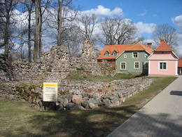
PiltenePiltene is one of the smallest and oldest cities in Latvia, first mentioned in 1295, and being granted the rights of a city in 1557. Between the 14th and 16th century, Piltene was the administrative centre for the Bishopric of Kurzeme. The historical streets that surround the castle ruins feature wooden buildings from the first half of the 19th century. The bishop’s castle in Piltene was built at the turn of the 14th century and used until the 16th century. Only its foundations and fragments of its tower on the banks of the Vecventa River survive. 175
1-12
Services
175km - Distance from countries capital city
1-12 Active season months |
|
|
Lithuania
Dorf MinijaEin einzigartiges Örtchen beiderseits des Flusses Minija, wo der Fluss eine „Hauptstraße” ist. Litauens Venedig. 329
Services
329km - Distance from countries capital city |
 |
Lithuania
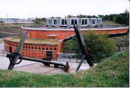
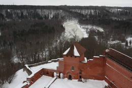
KopgalisSchon seit der früheren Zeiten – ein Platz von der militärischen und strategischen Bedeutung. Für den Schutz des Hafens von Klaipeda wurde 1866 von preussischer Militär den Bau einer Festung angefangen. Im Laufe des 2.Weltkriegs wurde die Festung in die Luft gesprängt. Die Renovierung begann 1979. 311
Services
311km - Distance from countries capital city |
 |
Lithuania
Salos II (Salos II)Maza apdzīvota vieta ar dažām viensētām uz pussalas (salos tulkojumā no lietuviešu valodas nozīmē „sala") starp vairākiem ezeriem. Salos II ir viens no sešiem Augštaitijas nacionālā parka etnogrāfiskajiem ciemiem. Ciems patiks tiem, kas meklē ļoti nomaļas vietas ar vecām guļbaļķu dzīvojamām un saimniecības ēkām. No Salos II pa sauszemes maršrutu var doties pārgājienā līdz Ladakalnim un Ginuču pilskalnam (sk. iepriekš). 121
Services
121km - Distance from countries capital city |
 |
Latvia
LiepajaThe city of wind, amber and musicians. In the literature sources Liepaja was mentioned for the first time in 1253. The city strived as a trade harbour already at the end of the 16th century. Especially important was the ruling period of Kurzeme Dukes Jacob and Friedrich, when the export and import of Lithuania and Kurzeme goods was provided through Liepaja harbour. Instead of the Līva River that was filled with dune sand a channel was excavated and wharf was formed. The growth of the city continued in the 18th century also after the Northern War and the plague epidemic. When in 1795 Kurzeme was added to the Russian Empire, as one of the most important western harbours of the Empire the harbour of Liepaja developed even more rapidly. From the end of the 18th century until the 19th century Liepaja also became a popular recreation place for the aristocrats of Petersburg. At the end of the 19th century the construction works of War Port and fortress begun. The city became a military strategic place. It suffered hard during World War II. In 1967 the sea trade harbour terminated its operation in Liepaja and Liepaja became a closed city where the War Port was "a city within a city". Today the War Port and its offer is one of the top tourism spots in Latvia. 217
Services
217km - Distance from countries capital city |
 |
Latvia
PiedrujaThe largest town in South-Eastern Latvia is on the banks of the Daugava River, which is the border between Latvia and Belarus at this location. The border runs down the middle of the river. Piedruja has two parts – Piedruja and Aleksandrova, which are separated by a central street (the V 631 road). Piedruja emerged from the Druja town that was on the left bank of the Daugava. During the 17th century, the two parts were owned by the Stapekha dynasty of Lithuanian aristocrats. It is worth strolling through the town, because the low-level wooden houses are reminiscent of buildings that are exhibited in open-air ethnographic museums. Piedruja is neat and tidy, with two churches and the Daugava rock that are part of a local hiking trails. Aleksandrova has a tourist accommodation, “Piedruja,” which offers special soirées in the Lettigalian, Russian and Belarusian style. Please be aware that you need a temporary permit to enter the border zone. The Border Guard facility is in Piedruja and at a place where there was a Daugava crossing point comparatively recently. 289
1-12
Services
289km - Distance from countries capital city
1-12 Active season months |
 |
Latvia
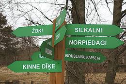
Kosrags (Kuostrõg)is seen as the newest village along the Livonian coastline. It was established during the 17th century. Košrags had 78 residents in 1826. The first reading school for Livonian children in the Dundaga seashore villages was opened at the Žoki homestead in 1832. One of the teachers was Nika Polmanis, who was the first Livonian to have completed a professional education. He also translated the Gospel of Matthew into the Eastern Livonian dialect. Košrags had a windmill, water mill and boat building facility. During the spring, job seekers from Saaremaa stopped here. A port was installed in 1932, and a breakwater to collect sea fertiliser followed in 1938. During the 1930s, Košrags was regularly visited by Finnish and Estonian linguists to study the folklore of the Livonians. The Norpiedagi homestead was built by Livonian activist Didriķis Volganskis (1884-1968). His son, Livonian cultural worker and pastor (in Finland) Edgars Vālgamā (Volganskis, 1912-2003) was born there. He translated the Andrejs Pumpurs epic "Lāčplēsis" into Finnish. Košrags today is a cultural monument of national importance. 182
Services
182km - Distance from countries capital city |
 |
Latvia
The Bauska City HallIn 1615, Courlandian Duke Friedrich Kettler (1569-1642) allowed Bauska to build a new city hall. At the beginning of the 17th century, Market Square in Bauska featured the largest city hall in the entire duchy. A lack of money led to the dismantling of the hall’s tower in 1852 and its second floor in 1871. A new city hall was built in 2011, and now Bauska can be proud of a new and outstanding tourist destination that can also be entered. The restored city hall offers a chance for people to weigh themselves and measure their height with old-time measurements. Each person who does so receives a certificate to attest to his or her height and weight. 65
Services
65km - Distance from countries capital city |
 |
Latvia
GipkaĢipka is a village that once was the site of the first maritime school in Kurzeme. It was opened in 1869, just a few years after a similar school in Ainaži. This was a Category 2 maritime school, which trained helmsmen for long-distance trips and captains for short-distance trips. The school was moved to Mazirbe in 1894. Before the maritime school, the building housed a different kind of school, and a second floor was added in 1867 specifically for the maritime school. Today this is a residential building. During 28 years, the school trained more than 200 professional sailors, and it was of great importance in facilitating ship building in shoreline Liv villages. (Source: Roja TIC) |
 |
Latvia
RendaRenda is a very old town, first mentioned in historical sources in 1230. During the 13th century, Renda was one of the centres of the ancient Courlandian land of Vanema. When Courland was split up in 1235, Renda was taken over by the German Order, and local residents were forcibly drafted into its military. During the age of the Duchy of Courland (1562-1795), the region flourished despite wars, the bubonic plague and other problems, particularly during the rule of Duke Jacob (1642-1682). During the 17th century, Renda became something of a manufacturing centre, churning out timber products, with local lime kilns, watermills, flax weaving facilities, a glass factory and a boiling house for saltpetre and soap. Wine, perfumes and barrels were produced in Renda, as was cast iron for nails and many other things. The court at the Jelgava Castle loved the sour wines from Renda. All of this was destroyed during the Great Northern War (1700-1721). During the 19th century, a chemicals factory was built on the site of the burned Renda castle, and nearby was one of the largest leather tanning plants in Kurzeme, along with a manufacturing facility for turpentine. Cultural life began to develop in parallel to this. Renda suffered much during the two world wars and the subsequent Soviet repressions. The so-called Courelian Battalion of partisans went into the forests after the occupation to continue their struggle against the Soviet regime. Renda today is a small and quiet village with the Lielrenda Estate, a local church, the “devil’s boat” at the Abava River, and the Īvande waterfalls. 131
1-12
Services
131km - Distance from countries capital city
1-12 Active season months |
 |
Latvia
VentspilsThe largest city near the Liv Coastline, where visitors will find the Ventspils branch of the Liv Association and the Liv ensemble "Rāndalist." In nearby Tārgale are the Liv ensembles "Kāndla" and "Piški kāndla." 187
Services
187km - Distance from countries capital city |
 |
Lithuania
PreilaEin ehemaliges Fischerdorf am Ufer des Kurischen Haffs. Hierher sind die Bewohner der Dörfern umgezogen, deren Dörfe unter dem Sand der Wanderdünen begraben wurden. Holzbebauung des 19 – 20 Jh. 349
Services
349km - Distance from countries capital city |
 |
Latvia
MelnsilsThis is an ancient Liv village, known as Mustanumm is the last village in the south-easterly direction, and during the mid-20th century, just a few Livonians lived there. Of 307 inhabitants in 1935, only 15 were Livonians. At the beginning of the 19th century, there were six farms and a lagoon here, but at the end of the century there were 63 farms. The valley of the Baķupīte River and the sea had remnants of pilings that provided evidence about a Medieval port. Legends say that the sea robber Trommel had a castle on the left bank of the river during the 14th century. Sailing ships were once built in the region, as well. Two locations of cultural and historical importance in Melnsils are the ancient cult location that is the Baķi castle hill, and the castle hill of a sea pirate Trommel. 144
1-12
Services
144km - Distance from countries capital city
1-12 Active season months |
 |
Latvia
SalacgrivaAn ancient territory inhabited by Livs already since the 5th – 6th century. In 1226 Bishop Albert built a castle on the right bank of Salaca river estuary, which has not been preserved until now. Salacgriva development also (similar to Ainazi) has been associated with the establishment of the port in the turn of the 19th – 20th century. Salacgriva became an important handling and transport hubs of products manufactured in Northern Vidzeme (especially timber). During the Soviet period, in the Northern part of Salacgriva established the Fishermen Park with one of the best small town stadiums and open air stage. During that time, the products of fish processing plant "Brīvais vilnis" was well known in the territory of USSR - especially sprats. Salacgriva is one of the two places in Latvia, where the weirs are still used for lamprey fishing. 104
Services
104km - Distance from countries capital city |
 |
Latvia
Kraslavas centralais laukumsArī 18. novembra laukums. Tas sācis veidoties 18. gadsimtā kā tirgus laukums. Tā dominantes bija 1752. g. celtais rātsnams (nav saglabājies) un aptieka, kas šajā ēkā darbojas no 1810. g. līdz pat mūsdienām. 2010. gadā laukumā izveidota strūklaka, kam ir pilsētas ģerboņa forma. 264
1-12
Services
264km - Distance from countries capital city
1-12 Active season months |
 |
Latvia
Sikrags (Sikrõg)This is one of the oldest Livonian villages, recorded in documents for the first time in 1387. The old road from the Dundaga Estate to Sīkrags existed in the Middle Ages. During the 17th century, Sīkrags was one of the most important small ports in Northern Kurzeme, receiving ships from England, Holland and Lubeck that carried coal, grain and other products. Before World War I, there were five sprat smokehouses in the village, and some 55 fishermen lived there during the 1920s and 1930s. Among those to have been born in Sīkrags was the Livonian cultural activist Hilda Grīva (Cerbaha, 1910-1984), seafaring captain Kārlis Anbanks (1884-1937), Baptist preacher Kārlis Lāceklis (1904-1970), linguist and tradition specialist Pēteris Dambergs (1909-1987), and graphic artist Baiba Damberga (b 1957). Today the village is a cultural monument of national importance. It is crossed by a bike route, with a commemorative stone where the narrow-gauge railroad station once stood. Sīkrags, like neighbouring villages, is in the Slītere National Park. 173
Services
173km - Distance from countries capital city |
 |
Estonia
Mulgimaa historic regionMulgima or Mulgi is a cultural and historical region in the south of Estonia. The part of Viljandi county located south of the rivers Raudna and Tenasilma was considered to be region of Mulgimaa. In ancient times, Mulgi farmers were famous for their sharp minds and determination, which helped to buy land from German-Baltic nobles and become rich farmers. The icons of Mulgi culture - the dialect, the well-known men's long black jacket and the traditional Mulgi porridge - have survived to this day.  160
1-12
160
1-12
Services
160km - Distance from countries capital city
1-12 Active season months |
 |
Latvia
The Old Town of CesisCēsis is in the centre of the Gauja National Park, but it is not part of the park as such. There are many interesting places in Cēsis to visit and examine. The oldest part of the town is of key interest. The origins of Cēsis can be found at Riekstu hill, which is 18 metres high. Between the 11th and 13th century, there was a wooden castle here built by the Vendians. The hill is in the central part of the castle park, and it offers a good view of the park, pond and the ruins of the Cēsis castle, which can be accessed via a long cascade of stairs. The Cēsis castle (see below) was built in the early 13th century as a residence for masters of the Livonian Order, and it was one of the strongest fortresses in the Baltic territories. Alongside it is the New Cēsis castle, which was built in 1777 where the gate fortifications once stood. The Cēsis Museum of History and Art is in the building, alongside which is a visitors centre and the Cēsis Tourism Information Centre. From the tower of the castle, there is a fine view of the castle ruins, St John's Lutheran church and the northern part of the town. Opposite the New Cēsis castle are stables and a wheelhouse (both from the first half of the 19th century). The Cēsis Exhibition Hall is there today. You can look at the exteriors of the granary, the hut for coachmen, and the old brewery. On the other side of the street is the romantic Maija park, which was installed in the 1830s. The park is popular among parents with children, because there is a playground there. From this area, you can walk down some of the old streets of the town – Lielās Katrīnas, Mazās Katrīnas, Mazā Kalēju, Kalēju and Lielā Līvu streets, plus Līvu Square. The wooden buildings along the streets date back to the late 18th and early 19th century. Torņa Street, which weaves its way along the defensive walls of the Medieval castle, offers a look outside the church of a sculpture by Matiass Jansons, "As the Centuries Pass". Legend says that if you rub the lantern carred by the Old Man of Time, you can see the future. One of the most impressive buildings in Cēsis is St John's Lutheran Church, which was built in the late 13th century for the Livonian Order. It is a basilica built in the Roman style and with Gothic elements. The tower, which is 65 m high, was built in 1853. The building was reconstructed several times during the 20th century. Inside the building are grave epitaphs for masters of the Livonian Order and for bishops. The pulpit was installed in 1748, the oak altar followed in 1858, and the altar painting "The Crucified One" dates back to 1862. The stained glass windows around the altar are of great artistic value. The organ was built in 1907 by the E.F. Walker Company, and the instrument is one of the best concert organs in Latvia. A sun clock featuring the year 1744 is at the south-western corner of the church. It is worth climbing the church's tower. At the foot of the building is Rose Square, which began as a market square in the mid-19th century, remained in place until 1927, and was restored in 2008. This is the central square in the town today. During the Medieval Era, there were stockades here, along with the city's well. Rīgas Street has been the main street of the old town from the very beginning, and it is here that you will find the most architecturally outstanding buildings in town from the 18th and 19th centuries. They include the former Cēsis City Hall, the Fābers building, and the Princess building. At one end of the street is Līvu Square, where, during the 13th century, there was a church, a cemetery and a gate in the town walls. Today the square features a lighted fountain which is on the site of a 13th century well known as Lejas Šķimbēgs. At the other end of the street is a reconstruction of the foundations and surface elements of the Rauna gate that was a part of the town walls in the 14th and 15th centuries. The site offers a good idea about Medieval fortifications and the size and mightiness of gates therein. |
 |
Latvia
Rozu laukumsИстоки площади Роз уходят в 1911 - 1913 гг., когда на этом месте разбили открытый сад с > 500 кустами роз. В советское время рядом с площадью Роз был установлен памятник Ленину. Восстановленную в 2000 году площадь окружает Лиепайская Педагогическая академия, гостиница «Лива», Центр бизнеса и сделок De Rome (построен в XIX веке, архитектор Пауль Макс Берчи, бывшая гостиница «Рим») и Лиепайский дом латышского общества (камень в основание заложил Карлис Ульманис в 1934 г.). По бордюрам грядок роз размещены памятные знаки городов содружества Лиепаи. К площади Роз подходит улица Зивью (Рыбная), получившая свое название от когда-то существовавшего рыбного рынка. На улице Зивью находится Аллея славы латвийских музыкантов (с 2006 г.), где установлено 35 плит с бронзовым рельефом ладоней музыкантов, 10 плит, посвященные популярным латвийским музыкальным группам, а 5 – ушедшим в мир иной. Здесь же установлена самая большая гитара Латвии. 216
Services
216km - Distance from countries capital city |
 |
Latvia
DurbeDurbe is the smallest town in Latvia with a distinguished history, as well as the smallest city in the country in terms of population (some 500 residents). Durbe was first mentioned in a Courlandian document. In 1260, there was a legendary battle at Durbe between the joint forces of the Livonian Order and the German Order and local tribes, including Courlandians who left the German forces to join the tribes. One of Latvia's first professional gardeners, Sīmanis Klevers (1834-1922) lived and worked in Durbe, and it is thanks to him that the local gardens feature many rare types of apple trees. The herald of Durbe, which was approved in 1925 features a silver apple tree. Several local farms have fruit orchards, and there are many active gardeners. An apple festival is held each September in Durbe.  188
1-12
188
1-12
Services
188km - Distance from countries capital city
1-12 Active season months |
 |
Lithuania
KaunasThe second biggest city in Lithuania and from 1920 – 1939 - a temporary capital. The Old Town, The Town Hall (16th century), St. Peter and Pavil cathedral - basilica (15th century), Thunder building (15th century), Laisves alley, Ciurlionis Art and Devil Museum. 103
Services
103km - Distance from countries capital city |
 |
Latvia
PriekuleVēstures avotos pirmoreiz minēta 1483. g. Pilsētas uzplaukums bija vērojams pēc dzelzceļa uzbūvēšanas 19. gs. beigās, kad barons Korfs sadalīja un iznomāja apbūvei muižas zemi. Pilsētas tiesības Priekule ieguva 1928. g. Pilsēta smagi cieta 2. pasaules kara pēdējos mēnešos, - t.s. Kurzemes katla laikā, kuru laikā tika sagrautas 410 no 450 ēkām. Mūsdienās tā ir neliela pilsētiņa ar mazstāvu apbūvi un nesteidzīgu dzīves ritmu. 232
Services
232km - Distance from countries capital city |
|
|
Latvia
IlukstePilsētā nebija lielu rūpniecības uzņēmumu, un tās iedzīvotāji
nodarbojās galvenokārt ar amatniecību, tirdzniecību un lauksaimniecību.
Ilūkste tika pilnībā nopostīta 1. pasaules kara laikā un smagi cieta arī
2. pasaules kara laikā. Šodien Ilūkste ir klusa pierobežas mazpilsēta, ko
ieskauj gleznains dabas apvidus. Apskates objekti: bijušā jezuītu klostera ēka
un Ilūkstes katoļu baznīca.
201
Services
201km - Distance from countries capital city |
 |
Latvia
The historical centre of TalsiThe historical centre of Talsi, which is known as the town of nine hillocks. The historical construction around Baznīckalns hill, Lake Talsi and Lake Vilkmuiža mostly dates back to the 19th century. Lielā Street is particularly beautiful with its low-rise buildings (two or three floors and ridged roofs). There are beautiful views from the area around Lake Talsi and Ķēniņkalns hill. 115
Services
115km - Distance from countries capital city |
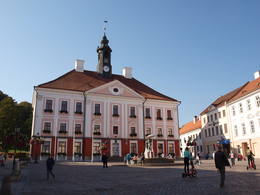 |
Estonia
Tartu Old TownFormed on the left side of river Emajõgi, in the valley of Doma Hill. The centre of The Old Town of Tartu is Town Hall Square with Town Hall and the fountain "The Kiss of the Students" (symbol of the city). 185
Services
185km - Distance from countries capital city |
 |
Latvia
PREILIIn the 15th century, Preili manor became the property of Count Borhs family. Borhs were living here until the 60ties of 19th century. The city itself formed in the first half of the 19th century by fusion of Preili Manor, the village and free village - settlement of traders and craftsman. In the 19th century a luxurious palace was built in Preili and Landscape Park was created. Today Preili is an important economic centre of Latgale (cheese and sewing plants), where t folklore, crafts and Catholicism traditions are fostered. Preili tour in the guidance of TIC employee Irena Kjarkuza is highly recommended. 203
Services
203km - Distance from countries capital city |
 |
Latvia
KandavaKandava is first mentioned in the articles in 1230. In 1253 the Livonian Order built a stone castle at the upper part of Abava valley shore, at the foot which of an urban area formed. In the 17th century Kandava became an important trading centre. The plague epidemic and developments of World War I hit the town and its people hard. Kandava got the town rights in 1917. During soviet Soviet times, Sports Complex of Jaunkandavas agricultural Technical School became a popular training venue. 96
Services
96km - Distance from countries capital city |
 |
Latvia
SaulkrastiThe largest town in the region dates back to the 19th century, when three local fishing villages – Neibāde, Pēterupe and Katrīnbāde – became a popular location for leisure and swimming. This led to the construction of many summer homes, and the development of the spa was facilitated by the opening of a rail line between Rīga and Saulkrasti in 1905. New spas and restaurants were opened, and the spa infrastructure was developed. During the summer there were various entertainments, including balls and concerts featuring orchestras from Rīga. Also facilitating the development of the spa was a road and railroad line between Rīga and Saulkrasti that were installed during the 1930s. During the Soviet occupation, leisure homes, sanatoriums and new summer homes were built in Saulkrasti, which was given the status of a city. Today Saulkrasti is attractive because of its white sand beach, as well as various annual events, the Saulriets trail, the White Dune, the unique bicycle museum, Sea Park, the “Centrs” swimming facility, Sun Square, etc. 46
1-12
Services
46km - Distance from countries capital city
1-12 Active season months |
|
|
Latvia
ValkaTogether with Valga on Estonian side - a peculiar frontier twin town. 158
Services
158km - Distance from countries capital city |
 |
Latvia
JurkalneAncient legends say that ship sank in the sea near the old cemetery during a storm and during a worship service. The pastor and members of the congregation volunteered to use a rowboat to save the crew of the ship. Some of the men were rescued, while others were washed ashore. In honour of this tragic, but also happy solution, the captain called the place Feliksberga, or the Lucky Shore. Later it became known as Pilsberga, and it was renamed Jūrkalne only in 1925. 191
Services
191km - Distance from countries capital city |
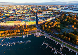 |
Finland
HelsinkiHelsinki is the capital of Finland and the biggest city in Finland. It offers a lot to see as it is seaside city surrounded by islands but city itself is full of wonderful parks. This city has everything to attract all kinds of people - from architecture and culture to nature and even has wide range of places where to enjoy night-time Helsinki. |
 |
Latvia
SalaspilsOne of the youngest Latvian towns, in 2013 it will celebrate its twenty year anniversary. A number of significant scientific institutions in a Latvian scale is located in Salaspils (in Soviet times it was built as a science centre) - Institute of Biology, Institute of Inorganic Chemistry, Institute of Physics, National Botanic Gardens, former Salaspils nuclear reactor and the Forest Research Institute "Silava". Over the last decade the infrastructure has been developed, as well as wide areas of private houses are developed. In 1996 a new Catholic church was built in Salaspils. Most of the town residents commute each day to Riga for work. 18
Services
18km - Distance from countries capital city |
 |
Latvia
SiguldaExploring of Sigulda can be started with a visit to Sigulda castle ruins. The construction of the castle was begun by the Knights of the Sword Order in 1207, but in 1236 it was rebuilt for the needs of the Livonian Order. Sigulda castle suffered much from the wars in the second half of the 16th century and in the beginning of 17th century. During the Northern War, it is burned down and is no more restored. Today south-western building of the convent and the tower of the main gate, behind which is the inner forefront of the castle with open air stage, which offers impressive views over the Gauja valley. Currently the reconstruction of castle ruins is in progress. Construction of New castle (owner - Prince Kropotkin) in the South of the Sigulda took place from the 1878 until 1881. From 1923 - 1940 the building was the Palace of Writers, but during the Soviet years - Cardiology sanatorium. Since 2003 Sigulda district council is located there. The manor complex includes wooden house (middle of 19th century), which was Kropotkin's family home, barn (turn of the 18th - 19th century), gardener's house (19th century) and a stone fencing (19th century.) If we make our way from New Castle in a north-eastern direction, after almost 2 km we will reach Vejupite ravine. There you can see the shallow (3.6 m) but high (6.1 m) in Peter's Cave and deep Pucu ravine with Krauklupite. At the conjunction of ravines of both streams rises a Satezele hill fort (plateau 90 x 75 m), where in the beginning of 13th century was the oak castle of Liv land chief (eldest) - Dabrelis. Near can be found Krauklu gorge - ravine of Vejupite left bank, with 11 m high sandstone walls and 5.2 m deep Krauklu cave. At the conjunction of Vejupite ravine and Gauja valley columns Paradise (Gleznotaju) Hill - a very picturesque place, painted and photographed since old times! The Paradise Hill can be reached with a electric vehicle. In the west part of Sigulda is located Ferris wheel (works during the summer) and Air cableway (streetcar) - the only this type of vehicle in Baltics (built in the 1969). Its self-supporting cable extends in 1060 m length and without any support joins the Gauja River valley banks between Sigulda and Krimulda ~ 40 m above Gauja River. Here you can enjoy excellent views! In the south-western part of Sigulda one can walk to mighty Beites precipice, which is split by the deep ravine of stream. On the west side of the ravine lies Keizarskats, which is located ~ 67 m above the Gauja level and offers good views of Krimulda and Turaida castle. Sight place was arranged here already in the 1862 when Russian Tsar Alexander II visited Sigulda. In the eastern part of the ravine wooden Keizarkrēsls (Emperor Stool) is located. 52
Services
52km - Distance from countries capital city |
 |
Latvia
ValdemarpilsValdemārpils is a small and quiet town along the shore of Lake Sasmaka. A village of craftsmen and merchants was established on the land of the Sasmaka Estate in the 17th century. There were quite a few Jewish merchants and craftsmen in towns in Kurzeme during the mid-19th century, and Sasmaka was known as their capital city. The city was named Valdemārpils in 1926. Its historical 19th century centre is a monument to urban construction. The town has a Lutheran church, an Orthodox church, a former synagogue, a monument to Krišjānis Valdemārs, and an outstanding linden tree. 131
1-12
Services
131km - Distance from countries capital city
1-12 Active season months |
 |
Latvia
LudzaThe wooden buildings with few floors emerged in the 19th century. Tourists can look at typical closed yards, verandas, wooden elements and decorations. The city suffered from fires in 1866 and 1938. The Market Square is the historical centre of Ludza, while the Ludza castle hill dominates the region. The streets of the city were established around the hill, which had an ancient Lettigalian wooden castle late in the 14th century. The Livonian Order replaced with the mightiest brick castle in Latgale. It was sacked in 1654 by the forces of Tsar Alexei Mikhailovich. The castle hill offers a lovely view of Latgale and the oldest city in Latvia and its historical centre.  266
266
Services
266km - Distance from countries capital city |
 |
Latvia
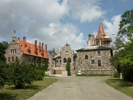
Sigulda, TuraidaConstruction of the Sigulda castle was begun by the Order of Brethren of Swords in 1207, but in 1236 it was rebuilt for the needs of the Livonian Order. The building suffered much damage during wars in the latter half of the 16th century and the early part of the 17th century. It was burned down during the Great Northern War and was not restored. Visible today is the south-western wing of the castle’s convent building and the main gate tower, behind which is the internal forecastle with an open-air stage that offers an impressive view of the ancient Gauja River valley. The new Sigulda castle was built between 1878 and 1881, and it was owned by Count Kropotkin. From 1923 until 1940, the castle housed a centre for writers, and during the Soviet Union it was a hospital for cardiology patients. Since 2003, the Sigulda Administrative District Council has been located here. The buildings that have been preserved include a wooden home (mid-19th century), where the Kropotkin family used to live, a granary (late 18th or early 19th century), the home of the gardener (19th century) and a brick wall (19th century). If we go to the north-eastern direction, we will find the Vējupīte valley less than two kilometres away. It includes the shallow (3.6 m) but high (6.1 m) Pēteris cave and the deep Pūču valley with the little Kraukļupīte River. At the place where the two valleys come together we find the Satezele castle hill (its flat surface is 90 x 75 m), where, in the early 13th century, the oak castle of the ruler of Livonian lands, Dabrelis, was once found. Nearby is the Kraukļu valley, with 11 m sandstone walls and a cave that is 5.2 m deep. Nearby is the Paradise (Painter) hill, which offers a lovely landscape that has been painted and photographed since ancient times. There is a Ferris wheel in the western part of Sigulda that is open during the summer, as well as an aerial tram that is the only transport vehicle of its type in the Baltic States and was installed in 1969. The cable that carries the tram is 1,060 metres long and links the shores of the ancient Gauja River valley between Sigulda and Krimulda. The cable is approximately 40 metres above the Gauja. The south-western part of Sigulda features the mighty Beite cliff which is split by a deep stream valley. To the west of the cliff is the Emperor’s View viewing area that is 67 m above the Gauja and offers a good view of Krimulda and the Turaida Castle. A viewing area was established here in 1862, when Tsar Alexander II of Russia visited Sigulda. The wooden Emperor’s chair is to the east of the viewing area. The Turaida Museum Reserve is in the place where the shore is split by deep valleys carved out by streams. It features several outstanding monuments that are as much as 1,000 years old. Of note are the Turaida Estate (21 buildings), the grave of the Rose of Turaida, the Turaida Lutheran Church (1750), which is one of the oldest wooden churches in Latvia) and the Turaida Castle. Folksong hill, which is nearby, is used for various thematic events. 53
1-12
Services
53km - Distance from countries capital city
1-12 Active season months |
 |
Latvia
PavilostaPavilosta is a comparatively new city that has formed at the mouth of the Saka River in the Baltic Sea. True is the fact that in the medieval times the harbour of sea ships was located 6 km from the sea – at the junction of the Tebra and the Durbe Rivers. Important period in the life of the harbour was during the ruling of Duke Jacob, when sea ships arrived here. As a result of the Polish-Swedish war the Saka harbour had to be closed. The harbour that's visible nowadays in the mouth of the Saka River was formed in the middle of the 19th century at the so called Akagals fishermen village. In 1878 the river mouth was excavated and piers were built. Here two-masted ships were built. The World Wars destroyed the fleet, but the fishery traditions remained alive. In 1991 the populated area acquired the status of a city. Nowadays Pavilsota is a popular target for yachtsmen and windsurfers, as well as summer recreation place. Yachtsmen are awaited at the yacht harbour. 217
Services
217km - Distance from countries capital city |
 |
Latvia
SedaSeda is one of the most unusual towns in Latvia. It began its life as a housing area for people from the local peat moss factory, and that happened in the 1950s and 1960s. This is a “vivid” example of Soviet architecture, with a central square (complete with a monument to the Leader) and streets radiating from it. Worth a visit is the cultural centre at the end of Uzvaras Street. It is a great example of so-called Stalinist Classicism architecture. 134
Services
134km - Distance from countries capital city |
 |
Lithuania
PervalkaEin ehemaliges Fischerdorf am Ufer des Kurischen Haffs. Aufgrund der Wanderdünen hat seinen Standort mehrmals seit dem Anfang des 19.Jh. geändert. Holzbebauung mit einheitlichem Stil und Traditionen. 344
Services
344km - Distance from countries capital city |
 |
Latvia
TuraidaOn the way to Turaida you must definitely stop at Gutmana cave. It is the widest (12 m) high (10 m) and in terms of volume - one of the biggest Latvian caves (cave like niche), which is also an important cultural and historical site, place rich with stories (most popular of Turaida Rose), surrounded by ancient walls and ceiling inscriptions (oldest from the end of 17th century). A spring originates from the cave; it is believed that it has healing properties. Turaida Museum reserve with Batlic scale outstanding monuments whose history stretches over 1000 years in the distant past is located at the point where the right mainland of Gauja valley is split by deep ravines of several small streams. Their exploration can be started with Turaida manor (first mentioned in 16th century), which is an outstanding example of Vidzeme manors. 21 buildings, built between the 18th century until the beginning 20th century are preserved until now. Visitors can see the manor stables, coach house, sauna, forge, fish cellar, barn, foreman house, the old residential buildings of landlord, and residential building of manor servants, oust house, etc. While walking in Turaida direction, we will reach the grave of Turaida Rose, which relates with the legend of Turaida Maija, who sacrificed her life for love. Near the grave grows a great linden tree (poor condition), wich is believed to be planted on the grave of Maija. Turaida Lutheran Church that lies further is the third church in a row and one of the oldest (1750) Latvian wooden churches – single volume wood log building with a baroque tower. Here you can see the altar and pulpit (Middle of the 18th century), altarpiece "Golgotha" (end of the 17th century – beginning of the 18th century) and historical exposition. Tautasdziesmu (folksongs) Park stretches at the Dainu Hill, the development of which started in 1985, noting the 150th anniversary of father of Latvian folk songs – Krisjanis Barons. More than 26 stone sculptures created by the sculptor I. Ranka are exhibited here. This is also a place of annual folklore events. Before the construction of Turaida stone castle (started in 1214), wooden Liv castle stood here. Turaida castle belonged to the Bishop. It existed for a long time - until to the 1776 when it was burned down. In 1953 an extensive restoration works was started here; upper storey of main tower, barn building (exposition on Sigulda district), semi-circular tower and castle complex in the southern enclosure was restored. Now the museum exhibition is established at the castle premises, which tells about the historical events in the surroundings. 57
Services
57km - Distance from countries capital city |
 |
Latvia
ValmieraFor the first time Valmiera is mentioned in the historical sources in 1323. Until the 13th century this place was in the composition of Talava, inhabited by Latgalians. Construction of Valmiera medieval castle began in the beginning of the 13th century, but in 1283, between the Gauja River and Rate River towered church. Location near to the Tartu-Pskov and Novgorod trade routes greatly facilitated the economic development of the populated area. During the 14th-16th century Valmiera was a part of the Hanseatic League. It suffered greatly from wars, epidemics and fires in 16th to 18th century. In the second half of the 19th century the economic boom started again. It was also facilitated by the building of wooden bridge across the Gauja in 1866 and Riga-Pskov railway opened in 1899. Historic centre is destroyed in 1944. During post-war years, large industrial companies such as - Valmiera glass fiber factory (to this day) are opeating in the town. Today, Valmiera is economic, educational and sports centre of Vidzeme. 107
Services
107km - Distance from countries capital city |
 |
Latvia
Old LiepajaFrom the historical and architectural perspective, this is an interesting monument to urban construction between the 17th and 19th centuries. Old Liepāja is in the area of the old market and Kuršu Square, where merchants sold their wares beginning in the 1560s. Until 1792, Kuršu Square was also where punishments were implemented. The current Pētertirgus pavilion was installed alongside the square in 1910. A map shows that the network of streets has partly preserved the chaos of street planning that was typical in Medieval towns. 217
Services
217km - Distance from countries capital city |
 |
Latvia
KraslavaAn ancient Latgalian settlement. During the 10th century Kraslava district was under authority of the Prince of Polotsk, but the 13th century - under the authority of the Livonian Order. Until the beginning of 18th century it existed as a manor centre. In 1729 Kraslava was bought for 1400 thalers by Johan Ludvig Plater. Plater family ruled Kraslava for two centuries. In the of the18th century Platers began construction of Krāslava palace. After first division of Poland in 1772 Latgale was annexed to Russia. Kraslava began to perish. After construction of Riga - Daugavpils - Vitebsk railway (1865) economic life flourished again. Kraslava was little affected by the World War II, therefore, early wooden buildings of 20th century remained almost untouched. 268
1-12
Services
268km - Distance from countries capital city
1-12 Active season months |
 |
Latvia
SmilteneUntil 13th century, Smiltene region was a part of Talava country, inhabited by Latgalians. After Crusaders invasion it was won by the Archbishop of Riga, and he built a stone castle on the steep river bank of Abuls in 1370. The following wars and epidemics did not spare the development of settlement, nor the people. Present shape of the town began to emerge in 19th century along with the vigorous activities of owner of Smiltene manor first Lieven. Until the World War I, wood working factory, hydroelectric power plant (established in 1901, first in the Baltics), and other companies were operating in Smiltene. In 1944 when the German forces retreated, much of the Smiltene historical buildings were destroyed in the fire. 134
Services
134km - Distance from countries capital city |
 |
Lithuania
DruskininkaiDer älteste und größte Kurort Litauens (seit 1794). Mikroklima (Luft der Umgebungswälder), salzhaltigee Quellen, Heilschlamm. Die Altstadt ist ein städtebauliches Denkmal. 128
Services
128km - Distance from countries capital city |
 |
Latvia
Jaunciems (Uzkila)Jaunciems has always been a small village, and only a few homes are populated today. Nearby there are leisure locations on the right bank of the Irbe River. Jaunciems is linked to Sīkrags by the former tracks of the narrow-gauge train. There is also a bridge for hikers and bicyclists. 166
1-12
Services
166km - Distance from countries capital city
1-12 Active season months |
 |
Latvia
Liktendarzs GardenTo the south of Koknese, the Destiny Garden is on an island that is surrounded by the waters of the Pļaviņas hydroelectric power plant (there is a bridge to the shore). The aim of this fundamental open-air object was to commemorate people in Latvia who suffered because of totalitarian regimes. The first work here began in 2008, and the designer of the landscape was a Japanese landscape architect, Shunmyo Masuno. Work on the garden continues, but it is already a popular tourist destination. The first permanent structure is a terrace that offers a view of the Koknese castle ruins and the local Lutheran church. This means that there will be something new each time that people visit the park. People are invited to bring rocks for this nationally important location that commemorates Latvia’s history. 102
Services
102km - Distance from countries capital city |
|
|
Latvia
IecavaA small town on the way from Riga to Bauska. Town's name is first mentioned in written sources in 1492. Here you can see Lutheran Church and former Manor Park 42
Services
42km - Distance from countries capital city |
 |
Latvia
LigatneLigatne history is inextricably linked to Ligatne paper mill. At the end 19th century and beginning of 20th century here was built houses, schools, maternity homes, hospitals, clubs, guest houses and other buildings for workers that have survived to the present. During the Soviet period Ligatne mill produced mainly school exercise books, which was sent to all the Soviet republics. Nowadays, the main raw material is recovered paper used for production of wrapping paper. Ligatne paper mill is the only one functioning Latvian company of this kind, and it can be explored with a local guide. Historic centre of Ligatne paper mill has been awarded the status of cultural monument. In the northern part of Ligatne - Gauja river bank the only functioning Gauja river ferry can be found and the only river ferry in the Baltic States, which is powered by river current. The ferry is vehicle of local scale. In the west of Ligatne, Ligatne nature trails are located; where close to natural environment conditions (the best object of this type in the Baltic States) lives red deer, roe deer, wild boar, fox and lynx. Within the territory of Ligatne nature trail a dense network of hiking trails and paved road - cycling route has been created, during the winter it becomes a cross-country ski track. A modern visitor centre is available here. East of Ligatne at Ligatne rehabilitation centre a unique place on the Europen scale can be found - a former Soviet secret bunker that was built as the main living and working place of Latvian senior military and civilian persons in case the nuclear or chemical weapons were used. Bunker was opened in 2003; therefore it remained intact to this day. On the way from Augsligatne to Ligatne go to see Vienkoci Park, where you can explore boats made of single wood peace by the creator of Park Richard Vidzicka, look at the different building models, sand home, and participate in themed activities. 69
Services
69km - Distance from countries capital city |
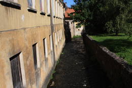 |
Latvia
The historical centre of Kuldiga around the Aleksupite RiverThis is a unique small town in a certain sense, and it is the only one in the Baltic States which has remained in place since the 17th and 18th century. The town is around the small Alekšupīte River, and in some places the stream runs along the walls of the buildings. Because of this fact and the many bridges that are in town, Kuldīga has become known as “the Venice of Latvia.” Baznīcas, Liepājas, Kalna and other streets are full of interesting cultural monuments. 154
Services
154km - Distance from countries capital city |
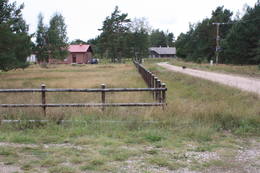 |
Latvia
LuznaA long village stretching along both banks of the Lūžņa River. In 1937, there were 36 houses and two boat piers here. During the 1860s, ships were built here, but during the Soviet occupation, there were military bases there. During the 1930s, the village was visited several times by the Finnish linguist Lauri Ketunen and Estonian student Oskar Lorits. They were working on a Livonian dictionary. Another resident of Lūžņa was the first Livonian artist, Jānis Belte (1893-1946). The "Dēliņi" fisherman's homestead has been transferred to the Latvian Ethnographic Open-Air Museum and can be seen there. 213
Services
213km - Distance from countries capital city |
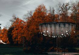 |
Latvia
BalviFor the first time, Balvi as populated area was mentioned in 1224. In the turn of 19th and 20th century, Balvi as manor and the parish centre formed as a larger settlement. During the Latvian freedom fights in 1919 Balvi was a place of establishment of Latgale guerrilla regiment. In 1926 Balvi obtained village rights, but by the 1928 became a town. During the World War II, while retreating, the German burnt down Balvi almost completely. People of Balvi are proud that the sun rises here about three minutes earlier than in the capital. Also the centre of the town has changed over the recent years. 219
Services
219km - Distance from countries capital city |
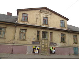 |
Latvia
SaldusSaldus is mentioned in the historical documents already in 1253. Until the 13th century an ancient Cours castle Salden was located here, which is also represented in the coat of arms of the town. Around the 1341 Livonian Order built a castle near the Cours hill fort, where settlement formed. Its peak of development, like the other settlements of Courland, was during the reign of Duke Jacob 1642 – 1682. 1856 is mentioned as the year of the foundation of Saldus, when restoration of town perished during the Northern War begun. At the end of the World War II a big fights took place at the town, but town remained in German-occupied part of Latvian until the May 8, 1945. Modern Saldus attracts with its activities - town days, the music festival "Saldus Saule", as well as a variety of sightseeing objects, among which A/S 'Druvas Partika" can be mentioned, where you can watch how the ice cream is made and Saldus Food Factory, where you can taste the delicious candy "Gotina" and watch the production process. 120
1-12
Services
120km - Distance from countries capital city
1-12 Active season months |
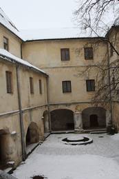 |
Latvia
JaunpilsJaunpils development is linked to the Livonian Order's castle, which until now has hardly changed its building volume and appearance. From 1561 until 1919 it belonged to the barons Reki family. In 1905 the castle was burned down, but later it was reconstructed under the supervision of architect V. Bockslaff. Substantial castle restoration work began during the sixties of 20th century. Now in the castle is a museum, but gourmets can taste medieval dishes at the castle tavern. 88
Services
88km - Distance from countries capital city |
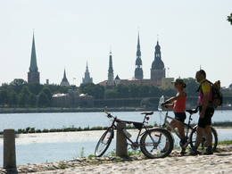 |
Latvia
Old Town RigaThe Capital of Latvia. The Old Town of Riga (included in UNESCO Cultural Heritage list) - an excellent medieval building monument. The pearl of Art Noveau in Europe. The former city of Hanza. |
|
|
Latvia
StrenciEine Floßhauptstadt Lettlands mit dem jährlichen Flößerfest im Mai. 129
Services
129km - Distance from countries capital city |
 |
Latvia
PlavinasPlavinas and Stukmani region was inhabited already in the third century. During the Polish-Swedish War (1600-1629) at estuary of Aivekste in the Daugava River the Swedish war camp was formed, from which are preserved fortifications - bastions. They are one of the most impressive military formations of this kind in Latvia. Plavinas as a larger populated area started to develop in the nineties of the 19th century and in the beginning of 20th century after the construction of railway. Today Plavinas are more commonly known with dolomite production sites and spring flood area. 121
Services
121km - Distance from countries capital city |
 |
Latvia
LapmezciemsAlthough out of 104 village houses 97 were destroyed during World War I, at the end of the 30ies of the 20th century Lapmezciems "recovered" fast, and one of the most powerful coastal fishermen cooperatives in Latvia were operating in it. During the Soviet times here one of the largest fishery collective farms – "Selga" was founded here, the blocks of which can be seen at the mouth of the Siliņupe River. Today Lapmezciems is a popular area for summer cottages, a recreation and bathing place. As an interesting history monument of fishery the sedum of Lapmezciems is available for viewing – it is the former wharf of fishing boats, where fishermen built nest cabins and stored their equipment. Between Pīlādži Street and the left bank of the Siliņupe River in the 3rd and 2nd millennium BC settlement of fishermen and hunters were located, where a memorial stone is erected. This is the most ancient known location populated by humans within the territory of Kemeri National Park. Part of the findings is displayed at Lapmezciems museum, where local history research exposition is formed and materials about Finnish Jeager fights within the territory of Klapkalnciems are gathered. 44
Services
44km - Distance from countries capital city |
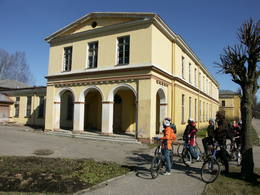 |
Latvia
KemeriKemeri (Kemmer) are mentioned in the literature sources for the first time in 1561. In the second half of the 18th century and in the beginning of the 19th century the curative properties of Kemeri sulphur spring waters and swamp mud are well known, therefore here representatives of the highest Kurzeme social circles arrive for treatment. The local foresters welcome the guests. During this time the first mud baths are organised. For some time the development of Jurmala and Kemeri beach is terminated by the Fatherland War of 1812. Two decades later – from 1833 until 1835 the benefits of Kemeri were enjoyed by General Governor of the Baltics Graf K. M. Palen, who addresses the Tsar of Russia Nicholas I for supporting further development of the health resort. Plead is supported and in 1836 Tsar allocates 700 ha of state land and grants 100 000 roubles for the construction of sanatorium and paving of the road from Kemeri till Sloka-Tukums high-way. Two years later (in 1938) the first state bath institution is opened. This is also considered the year of founding the health resort. In several stages the formation of Kemeri Landscape Park is begun, which is an important part of the health resort. In the middle and second half of the 19th century further development of the health resort is promoted by steamboat, as well as railroad traffic that are opened in 1877 from Riga till Tukums. In 1912 direct railroad line Kemeri-Moscow is opened. Early before World War I the number of patients reaches 8300 per year. The 1st battlefront of World War I is held in Kemeri swamp for several years and the health resort is significantly destroyed. Despite this fact after the war it develops rapidly and Kemeri becomes a beloved recreation place for the residents of Riga and one of the most modern health resorts in Europe. In 1924 a new bath institution with mud-baths is built in Kemeri, which at the time is one of the most modern in Europe, but in 1936 State President Kārlis Ulmanis opens one of the most prominent buildings of the first independent state of Latvia period – hotel "Ķemeri". Also after World War II – during the Soviet times the health resort is significantly expanded and almost 10 sanatoriums are established within its territory, in which about 100 doctors are employed. In 1971 Kemeri is awarded the status of All-Union health resort. From 1975 until 1985 the largest of sanatoriums is constructed in Kemeri – Līva (initially – Latvija), which has two blocks of eleven storeys. Up to 1200 patients at the same time could receive treatment at Līva, but within a year – up to 140 000 patients. The sanatorium is closed in the beginning of the 90ies of the 20th century as unprofitable. Up to 1994 five sanatoriums operate in Kemeri: "Čaika", "Daugava", "Dzimtene", "Ķemeri" and "Līva" (Latvija) and resort policlinic "Ķemeri". The latter period may be considered the declining fame period of Kemeri as a large-scale health resort. 46
Services
46km - Distance from countries capital city |
|
|
Estonia
PaldiskiVom 18. Jh wurde die Stadt ein russischer Marinestützpunkt. Von 1962 bis 1994 war Paldiski ein Übungszentrum für atomare U-Boote der Sowjetischen Marine mit zwei auf dem Festland befindlichen Kernreaktoren (ung. 16.000 Beschäftigte) und eine "geschlossene Stadt". 49
Services
49km - Distance from countries capital city |
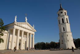 |
Lithuania
VilniusThe Capital of Lithuania. One of the biggest East Europe's old towns (included in UNESCO World's Cultural Heritage list) where there is a lot of representation of various architecture styles like Classicism, Baroque, Gothique, etc. |
|
|
Latvia
SmardeSmarde is an ancient place, mentioned in the 13th century documents. Today it is a small village with railway station and shops. Northeast of Smārde - former peat extraction places are located in Smārde marsh. During World War I the front line was near Smārde, the vicinity of which is witnessed by the memorial sites. 58
Services
58km - Distance from countries capital city |
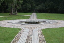 |
Latvia
SkriveriA small settlement on the banks of the River Daugava, between Aizkraukle and Jaunjelgava. Skriveru region is associated with the life and work of popular Latvian author A. Upitis. Near Skriveri lies the oldest arboretum in Latvia. Its establishment in 1891 was started by the owner of Skriveru manor Maximilian von Siverss. In the park there are about 400 plant species, varieties and forms. One of the finest views of the Daugava will open from the so-called Krauklu Mountains – steep upper part of the right riverbank, which is an ancient hill fort. 80
Services
80km - Distance from countries capital city |
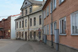 |
Latvia
Aizputes vesturiskais centrsAizputes pilsdrupas, akmens tilts pār Tebru, Jaunā pilsmuiža, ūdensdzirnavas un Sv. Jāņa luterāņu baznīca, kā arī 19. gs. beigās celtās koka ēkas starp Jāņa, Katoļu un Atmodas ielu veido neparastu pilsētbūvniecības kompleksu, kam piešķirts kultūras pieminekļa statuss. Staigājot pa vēsturisko centru, uzmanība jāpievērš ēku durvīm un to vērtnēm, logu ailēm, balkonu margām u.c. elementiem. 176
Services
176km - Distance from countries capital city |
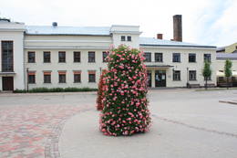 |
Latvia
Jekabpils Old Town SquareOld Town Square is the city’s historic centre. It was here, on February 12, 1670, that Duke Jacob of the Duchy of Courland proclaimed the establishment of a town. During the early 20th century, the square was covered in paving stones, and the city market was held there. On the sites of the square are the People’s Centre, the Unitarian Church and a tourism information centre. In the square are a water pump, an enormous scale, and a sculpture of a cougar, which is the symbol of Jēkabpils. From here you can tour the historical centre of Jēkabpils with its narrow streets and low-story buildings. 141
Services
141km - Distance from countries capital city |
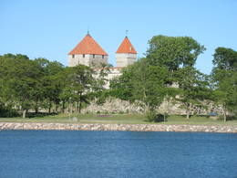 |
Estonia
KuressaareThe Capital of Saaremaa island. Popular resort. The Town Hall is built in the style of Baroque. 217
Services
217km - Distance from countries capital city |
 |
Latvia
Mikeltornis(formerly Pize and Pizā in Livonian). The current name of the village comes from a lighthouse (Mihailovskii majak) that was built during the age of the Russian Empire and named for the nephew of Tsar Alexander II. The lighthouse that is there now is the third one to be built on the site. It was built in 1957 and is the highest lighthouse in Latvia (57 m, can only be viewed from the outside). The Lutheran church in Mikeļtornis was built in 1893, and nearby is the Pize Saloon (1857), which is terrible condition. The saloon has a typical design from the 19th century and is the only venue of its type on the Livonian coastline. The first Livonian cultural activist, Jānis Princis (1796-1868), was born in Miķeļtornis, and he and son Jānis translated the Gospel of Matthew into the Western Livonian language. The two of them also wrote a collection of poetry, "Holy Songs and Prayers for Sailors." The only poetry book in Latvia prior to that was published by Blind Indriķis. A student of Vilhelms Purvītis, Livonian painter Andrejs Šulcs (1910-2006), was born at the Olmaņi homestead in Miķeļtornis. A monument to Livonian poets was installed at the local cemetery in 1978 and was the first monument dedicated to Livonians. There are plans to open an environmental object by artist Ģirts Burvis, "Century of Sailing Ships", in 2019. 187
1-12
Services
187km - Distance from countries capital city
1-12 Active season months |
 |
Latvia
OvisiThis is an ancient populated area. There were 50 homesteads here during the 1930s, with only ten remaining in 1990. The Livonian scholar and entomologist Kārlis Princis (1893-1978) was born in Oviši. In 1944, he emigrated to Sweden. The Oviši lighthouse (1814) is 38 metres high and is the oldest functioning lighthouse in Latvia. There are lovely views from the top of the lighthouse. The building in which employees of the lighthouse used to live was erected in 1905 and has been preserved. A narrow-gauge train station was in the building at one time. The Oviši Lighthouse Museum is nearby, as is the metal Tree of Austra. Opposite Cape Oviši is a great place for bird watching. 203
Services
203km - Distance from countries capital city |
 |
Latvia
Historical center of KraslavaThe central part of the town of Krāslava is an historical monument because its low-story and beautiful wooden buildings. The best views of the historical centre relate to the carp park near the Adamova trail, the Karņicskis hill, the bridge across the Daugava (Prospekta Street), and the Priedaine viewing tower on the left bank of the Daugava River. 263
1-12
Services
263km - Distance from countries capital city
1-12 Active season months |
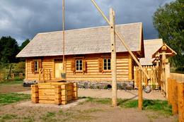 |
Latvia
The Slutiski villageThe Slutiški village is a very ethnographic village with a layout and buildings typical of the Latgale region, complete with decorated windows and facades. The Slutiški Old Believers House features a museum focusing on the cultural environment and traditions of the Old Believers. One of Latvia’s most unusual landscapes can be seen from the ancient banks of the Daugava River. Services
252km - Distance from countries capital cityServices - amenities
Place for tentsServices - other
Accepts individual travellers
Accepts tourist groups
This destination has specific opening hours which you must determine in advanceDarba laiks maijs – septembris |
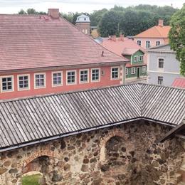 |
Latvia
LimbaziIt is believed that at the Kezberkalnins of Limbazi has been Lemisele castle of Metsepole Liv district. It is also found in the reports that merchants travelled to this place from the sea by Svētupe and Dunezers until the 16th century. In 1223 Bishop Albert built a stone castle in Limbazi. Like Valmiera, Limbazi became the member of Hanseatic League. At the beginning of 16th century it economic role declined significantly since Svētupe and Dunezers became unusable for shipping. Between the 16th and 18th centuries, the town and its people suffered from wars, diseases and fires. As a result, the population reached its utmost fall - eight people. In the turn of 19th and 20th century and in the beginning of 20th century the economic life of the town was renewed. 92
Services
92km - Distance from countries capital city |
|
|
Latvia
LielvardeEvidence found at Dievukalns tells that Baltic tribes lived at this place 3,000 years ago the, but in 7th and 9th here at the Daugava Livs tribes settled. Bishop of Riga built stone castle at the bank of the river Daugava (first mentioned in the 1229), whose ruins you can see today as well. Lielvarde is an inspiration for such people of cultural awakening time as Andrejs Pumpurs (1841-1902) and Auseklis (1850-1879). During World War I (almost three years Daugava served as front line) Lielvarde was completely destroyed. After the World War II, here, as well as elsewhere in the Latvian territory, begins the establishment of collective farms. During this time Lielvarde became known for another symbol - "Lacplesa" beer. Today Lielvarde is a favourite of travellers, who have chosen to make their route along the right bank of the Daugava. 52
Services
52km - Distance from countries capital city |
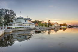 |
Estonia
HaapsaluHaapsalu was once loved by aristocrats who stayed here during summers, nowadays this town is very appealing to its visitors because of its essence - tiny streets, old wooden buildings and promenade. Worth mentioning are also town's SPAs which were one of the reasons why Haapsalu was so popular its earlier years. Interesting enough, the famous composer Tchaikovsky considered this place one of his favorite's for spending the holidays.  100
100
Services
100km - Distance from countries capital city |
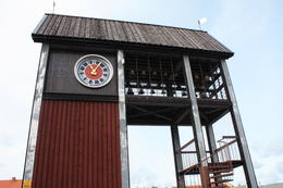 |
Latvia
Ventspils Tirgus laukumsTāpat kā Ventspils Rātslaukums, arī Tirgus laukums ir uzskatāms par pilsētas vēsturiskā centra nozīmīgu daļu, kura apkaimē ir saglabājies senais ielu plānojums. Kādreizējā Rātsnama vietā tagad slejas kariljonu zvana pulksteņu tornis. Tas zvana katru stundu, bet 12:33:44 un 00:33:44 ar īpašu melodiju ieskandina astronomisko Ventspils laiku. Tirgus laukumā ir aka, kas saulainā laikā darbojas arī kā Saules pulkstenis. Monētu automātā var izkalt īpašu piemiņas monētu. 191
Services
191km - Distance from countries capital city |
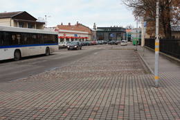 |
Latvia
Liepajas Kursu laukumsAp 200 m garajā un izstieptās formas laukumā no 16. – 20. gs. atradās Liepājas tirgus. Laukuma malās tolaik bija izveidojusies vienstāvu apbūve – iebraucamās sētas, viesnīcas un dārzi. Līdz ar Pētertirgus izveidi 1910. gadā, izmainījās arī laukuma apveidi un to ieskaujošā apbūve. Laukuma DA malā slejas iespaidīgā Liepājas Svētās Annas Luterāņu baznīca. 217
Services
217km - Distance from countries capital city |
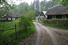 |
Lithuania
Vaisnoriske (Vaisnoriskė)Liela meža masīva vidū gleznainās Būkas (Būka) upes krastos starp kokiem ieslēpies teiksmainais Vaišnoriškes ciems. Šis ir viens no skaistākajiem nacionālā parka etnogrāfiskajiem ciemiem. Vaišnoriške kā apdzīvota vieta sākusi veidoties 1756. g., kad šeit sena vēsturiska ceļa malā darbojies krogs. Pirmā viensēta ciematā ir zināma no 1830. g. Šodien redzamā apbūve ir tapusi g.k. 20. gs. sākumā. Ciems ir palicis cilvēku atmiņās ar liepu medu, jo meža velšu vākšana un biškopība bija viena no galvenajām šejieniešu nodarbēm. Tagad ciemā ir piecas sētas. No Vaišnoriškes var uzsākt laivu braucienu pa seklo un dzidro Būku. 129
Services
129km - Distance from countries capital city |
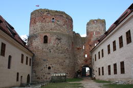 |
Latvia
BauskaBauska's name in historical sources for the first time is mentioned in 1443. This is the time when on the peninsula between Musa and Memel confluence construction of last Livonian Order castle on the present-day territory of Latvia was begun. At the castle – in Ķirbaksalā populated area so-called Vairogmiests developed. During the 17th century rapid boom of the town was observed. Here were working goldsmiths, silversmiths, carpenters, potters, shoemakers and other craftsmen. In later centuries the city suffered from wars, plague and Napoleon army. Today Bauska old town with reconstructed City Hall and the restored Bauska Castle is one of the most interesting Latvian historical town centres. Bauska is known for its annual events - Ancient Music Festival, Bauska town festival, country music festivals, and other events. 67
Services
67km - Distance from countries capital city |
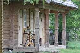 |
Lithuania
Sumina (Suminai)Ļoti skaists un ainavisks etnogrāfiskais ciems Balošas (Baluošas) ezera ziemeļu krastā, netālu no diviem iepriekš minētajiem ciemiem. Te apskatāmas interesantas un skaistas koka ēkas, kas celtas no guļbaļķiem, ar niedru vai lubiņu jumtiem un izrotātas ar dažāda veida dekoratīvajiem elementiem. Pirmo reizi rakstos Šumini minēti 1784. g. Savu vārdu ciems ieguva no kādreiz dzīvojošas ģimenes uzvārda. Kā interesantākā ir jāpiemin sena klēts. 127
Services
127km - Distance from countries capital city |
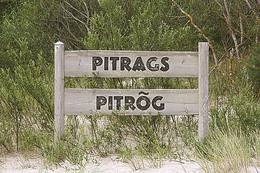 |
Latvia
Pitrags (Pitrõg)was first recorded in documents in 1582. The shallow water around the village contains many sunken ships. In 1826, Pitrags had 11 farms and 190 residents. A saloon was opened in the mid-19th century. In 1937, the village had 12 old farms and 38 fishing operations (mostly new farms). There were several fish processing plants in the village. One of the local residents was the distinguished Livonian language storyteller Marija Šaltjāre (Bertholde, 1860-1930). She shared more than 200 fairy tales and legends, more than 90 songs and games, etc. The Pitrags Baptist Prayer House was built in 1902. It was burned down during World War I, rebuilt in 1925, and renovated in the late 20th century. The Krogi homestead in the centre of Pitrags has a collection of 27 old types of Livonian coastline fencing. The owner also offers a chance to help with the smoking of fish and then to taste the resulting product. 181
Services
181km - Distance from countries capital city |
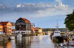 |
Lithuania
KlaipėdaThe former Memele. The only port city with a old town in Lithuania. 308
Services
308km - Distance from countries capital city |
|
| |
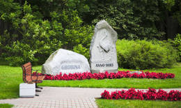 |
Latvia
GrobinaFrom the 6th century until the 8th century instead of the current Grobina the largest known Scandinavian trade and warrior colony in the Baltic States was located. Settlers from the inlands of Gotland and Sweden established their settlement at the hillock that was then located at the bank of the navigable Alande River. It is believed that the Cours Castle – Seeburg mentioned in the chronicles of the 9th century was located exactly here. After the loss of the order castle in the 13th century Grobina became the centre of the region. The most ancient construction of the city was formed around Lielā Street, as well as around Saules and Parka Streets. 207
Services
207km - Distance from countries capital city |
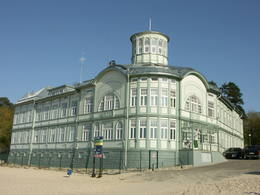 |
Latvia
JurmalaJurmala town (the second largest in Latvia) was founded in 1959, by combining Kemeri and Sloka towns in the Riga city Jurmala district. It stretches 32 km along the coastal line of Gulf of Riga. Jurmala resort once was one of the most important objects of this type in the Northern Europe. This was facilitated by the development of local and interstate transport and traffic (coaches, steamers, train). The first guests was accommodated in Dubulti, where in 1834 the first hotel was built, but in 1847 - The first wellness centre. In the 19th the first medical institution launched. Starting from 1834 the rapid construction of summer cottages began. Development of the resort was ended by the World War I. After the war the number of resort vacationers boomed from 12 thousand (in 1920) to 32 thousand (in 1935). Kemeri resort developed along with Jurmala, which received a massive of vacationers' amount during the Soviet period. 22
Services
22km - Distance from countries capital city |
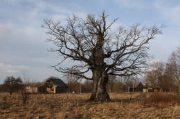 |
Latvia
VidaleA small settlement with a school, library and shop. North from the Vidale are visible remains of the windmill. Going towards the Gulf of Riga, the road crosses Shlitere Zilie mountain precipice with spectacular views during late autumn, early spring and winter, when there are no leaves on the trees and sandstone outcrops. To the left you can see Zilie mountain spring - a landscaped water taking place. Road that runs from the Vidale to Melnsils side, is called by the locals Knipeldambi. They say that it was built by the German army first During World War I, putting logs on the road and covering them with sand. 150
Services
150km - Distance from countries capital city |
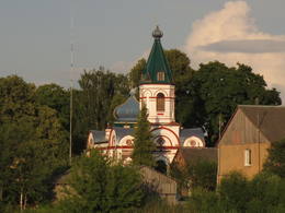 |
Latvia
The historical centre of JaunjelgavaThis is an urban construction monument that was created between the 17th and 19th century, and it is of national importance. The street layout around Jelgavas and Rātūža streets forms closed blocks of buildings. There are Lutheran, Catholic, Orthodox and Baptist churches in Jaunjelgava. One of the most outstanding architectural monuments is City Hall, which was built in 1912 and features Art Nouveau forms. None of the city’s five synagogues has survived. The historical centre of Jaunjelgava features a promenade that runs along the banks of the Daugava River. This is a popular place for strolls, leisure and swimming. 86
1-12
Services
86km - Distance from countries capital city
1-12 Active season months |
 |
Lithuania
Karaimų StraßeDie zentrale und auch schönste Straße in Trakai mit bunten Holzhäusern. Eins der seltenen Kenesa-Gebetshäuser der Welt – ein eingeschossiges Holzhaus mit einem bläulichen Dach. 29
Services
29km - Distance from countries capital city |
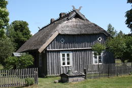 |
Latvia
Konuciems of PapeKoņuciems of Pape is one of the few seashore fishing villages in Latvia to have preserved an authentic environment to the present day. The Latvian Open-Air Ethnographic Museum has a branch here, “Vītolnieki”, and this is an authentic and ancient fisherman’s farm. +371-2926-2283. The sad fact is that some people have built modern buildings in the village, and it has now lost its earlier untouched charm. 267
Services
267km - Distance from countries capital city |
|
|
Latvia
GulbeneThe town's name in historical sources was first mentioned in 1224. In 1340 Archbishop of Riga built a stone castle at the Latgalian hill fort (now - the Lutheran Church). In 1802 (owned until 1920) Vecgulbene estate was bought by Baron G. Wolf. Manors in the surroundings of Gulbene and Vecgulbene castle substantially suffered during the Revolution in 1905 and in the further historical events. Today, there is a substantial change in the landscape, especially in the area of White Castle, where a large-scale restoration works occurred in recent years. Either way, - Gulbene is the place worth visit to get new impressions and knowledge. 185
Services
185km - Distance from countries capital city |
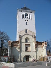 |
Latvia
JelgavaThe most significant period for the town is the time from 1561 to 1795, when the Jelgava district is a part of the Duchy of Courland and Zemgale. When Jelgava obtains the status of residence of the Duke of (1567t) and becomes the capital of the Duchy (1616) a rapid urban development begins, which is highest of during the reign of Duke Jacob. During the reign of last two Dukes of Courland - Ernst Johann Biron and his son Peter (1775) St. Peter's Academy (Academia Petrina) - the first Latvian Institute is founded, in 1816 is founded Courland Society of Literature and Art, in 1822 the first newspaper in Latvian "The Latvian newspaper" is published, in 1802 the first Latvian theatre building is built, but in 1898- the first building intended for museum. In 1937 Latvian agriculture camera is located in the Jelgava palace, but after two years Jelgava Agriculture Academy is opened. Nearly all the town's historic buildings and art treasures perished in the summer of 1944. After the World War II, Jelgava was rebuilt. Recently the Trinity Church tower has been restored, in which now is located one of the best Latvian interactive museums (very friendly for families with children). 42
Services
42km - Distance from countries capital city |
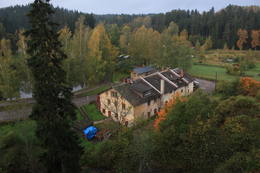 |
Latvia
The historical centre of the Ligatne Paper Factory villageThe history of Līgatne cannot be separated from the paper factory which was once the only factory of its kind in Latvia. Tours are available in the company of a guide. During the late 19th and early 20th century, the company built homes, a school, a birthing centre, a hospital, a club, a guesthouse and other buildings for its employees, and most of these buildings have survived to this day. There are more than 200 interesting underground passageways which are still used as warehouses for various items, including vegetables. 72
Services
72km - Distance from countries capital city |
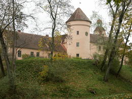 |
Latvia
EdoleEvery traveller in Latvia relates the name of Edole to Edole Castle. The beginning of it dates back to the middle of the 13th century, but the outbuildings of it were constructed in the 16th and 19th centuries, when patio was formed. During reconstruction of the castle implemented in the 30ies of the 19th century the facades of the castle acquired their current – Neo-Gothic appearance. From the16th century until 1920ies Edole Castle was located within the property of a baron family. In 1905 during rebellions it was burnt down, but in 1907 it was reconstructed. Many legends and ghost stories are told about Edole Castle. 170
Services
170km - Distance from countries capital city |
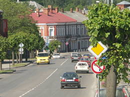 |
Latvia
Rezekne"The heart of Latgale", where during the 9th – 12th century stood a fortified Latgalian castle. In 1285 Livonian Order began the construction of stone castle instead of Latgalian castle. After the collapse of Livonia (Rezekne in the composition of Poland) the city languished. Economic life in Rezekne restored in the second half of the 18th century. After the construction of St. Petersburg – Warsaw highway (1836) and railway (1861), Rezekne became a holiday destination for holidaymakers from St. Petersburg. During the World War II, buildings of the city significantly suffered. Today the town is an important economic and cultural centre of Latgale region. 242
Services
242km - Distance from countries capital city |
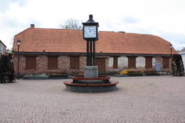 |
Latvia
Ventspils RatslaukumsVentspils Vecpilsētas vēsturiskais centrs. Nelielā Rātslaukuma (40 x 60 m) rietumu malā atrodas Starptautiskā rakstnieku un tulkotāju māja, kas ierīkota 18. gs. dzīvojamā ēkā ar baroka un klasicisma iezīmēm (19. gs. vidū te atradās pilsētas Rātsnams), bet austrumu malā – vēlīnā klasicisma stilā celtā evaņģēliski luteriskā Nikolaja baznīca. Iepretim baznīcai atrodas modernā stilā pārbūvētā Ventspils Galvenā bibliotēka un Digitālais centrs, kas ierīkots greznā 19. gs. savrupmājā. 191
Services
191km - Distance from countries capital city |
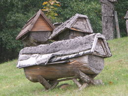 |
Lithuania
Dorf StripeikiaiDas bekannteste Museum der Geschichte der Bienenzucht Litauens mit den Bienenhäusern verschidener Arte, der Arbeitsmittel der Bienenzüchter, Holzskulpturen und Hönigankauf. 125
Services
125km - Distance from countries capital city |
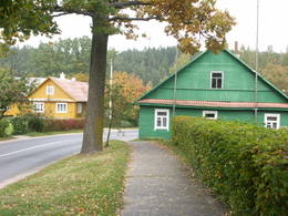 |
Lithuania
Paluse (Palusė)Palūšē atrodas nacionālā parka administrācija (izveidota neliela ekspozīcija) un tūrisma informācijas centrs, kempings, nesen atjaunotā laivu bāze un viens no biežāk apmeklētajiem parka objektiem – Palūšes baznīca (Palūšės bažnyčia), kas celta 1757. gadā. 2008. g. No dievnama apkārtnes paveras jauks skats uz Lūšu (Lūšiai) ezeru, īpaši saulrietos, kad baznīca iegūst teiksmainu nokrāsu. Blakus baznīcas žogam aug vecais Palūšes ozols. Uzskata, ka tā vecums varētu būt ~ 350 – 400 gadi. 113
Services
113km - Distance from countries capital city |
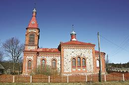 |
Latvia
Kolka (Kuolka)Was mentioned in 1387, where it was called Domesnes. That was the name until the early 20th century. A ledger at the Irbe-Ģipka church states that there were four farms in Kolka in 1770 -- Krogi, Ūši, Vecvagari and Kabriki. In 1844, a school for vergers was established, and Nika Polmanis worked there as a teacher. Kolka's first school was built in 1881, and Livonian Kārlis Bernšteins (1881-1951) worked there for nearly half a century as a teacher. The Dundaga riots that began in 1859 were led by Livonian Nika Šūbergs (1833-1884), the son of the owner of the Sārnasti farm. At the end of the 19th century, there were 392 residents in Kolka, and in 1935, 145 of the 343 residents were Livonians. During the mid-1980s, 13 Livonians spoke their language freely. Kolka is the only coastal Livonian village that continued to develop during the frontier regime of the Soviet Union, because it was the centre of a fishing kolkhoz. The number of residents increased rapidly in the 1950s and 1960s because new homes, a school, a people's centre, a kindergarten and several fish processing factories were built there. Today Kolka has 700 residents and is the largest village along the Livonian coastline. The "Līcis-93" fish processing factory is there, and local fishermen and smokers of fish work in the village. The Kūolka Livonian Centre and the Livonian ensemble Laula operate there, as well. The Ūši farm offers tastings of Livonian foods. 156
Services
156km - Distance from countries capital city |
|
|
Lithuania
VisaginasEntstanden als eine 6 km entfernte Arbeiterstadt des schon geschlossenen Ignalina-Atomkraftwerks. In der Stadtbebauung dominieren die für die Sowjetzeit typischen architektonischen Formen und Monumentalbauten. 150
Services
150km - Distance from countries capital city |
|
|
Latvia
JurmalciemsОдно из сравнительно редких мест, где на побережье можно понаблюдать за рыбаками в работе. Ветряная мельница «Клаюми» (1930 г.) является одним из самых высоких сельских строений. Рядом с мельницей находится Юрмалциемский Туристический информационный пункт, информационный стенд и место для отдыха.Здесь же видны старые деревянные корпуса барж, брошенных рыбаками. Экспозиция«Старинные предметы жителей Юрмалциемса» находится в восточной части поселка, где в деревянном сарае представлены собранные местными энтузиастами предметы быта и орудия труда окрестных жителей. 242
Services
242km - Distance from countries capital city |
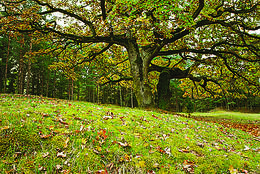 |
Latvia
Vaide (Vaid)was first mentioned in written form in 1582. A census in 1736 found two farms, Lekši and Žonaki. A census in 1935 found that there were 106 people in Vaide, including 40 Livonians, 60 Latvians and a few Estonians and Germans. In 1939, there were 21 homesteads in the village. Nika Polmanis (1823-1903) was born at the Lāži homestead. He was the first educated Livonian and lived in the region for all his life. Livonian poet Alfons Bertholds (1910-1993) wrote a poem about a noble oak tree that grows alongside the homestead. The vast Berthold family is linked to Žonaki -- Livonian storyteller Marija Šaltjāre, yacht captain Andrejs Bertholds (USA), his son, library scholar Artūrs Benedikts Bertholds (USA), Livonian poet Alfons Bertholds, Livonian language specialists Paulīne Kļaviņa and Viktors Bertholds, Swiss doctor Marsels Bertholds, globally renowned pianist Arturs Ozoliņš (Canada), and Livonian language storyteller and poet Grizelda Kristiņa (1910-2013), who was the last native speaker of Livonian. The Ozolnieki homestead is also linked to the Bertholds family. Paulīne Kļaviņa (1918-2001), a specialist in the fields of Livonian traditions and language, and her mother, Livonian storyteller Katrīna Zēberga, both lived there. Paulīne collected ethnographic objects that can be seen at the Latvian Ethnographic Open Air Museum in the granary of the Livonian Dēliņi farm. The Purvziedi homestead in Vaide is owned by forest ranger Edgars Hausmanis, who has a collection of forest animal horns and antlers. 166
Services
166km - Distance from countries capital city |
|
|
Latvia
Ventspils OstgalsPilsētas rajons dienvidos no Ventas grīvas, kura mūsdienās redzamā mazstāvu koka apbūve sāka veidoties 19. gs. vidū. Ostgala pirmsākumi meklējami 1836. g., kad Krievijas valdība, solot priekšrocības, aicināja apkārtnes zvejniekus apdzīvot smilšaino un kustīgo kāpu pārņemto piekrastes daļu. Ostgals ir atzīts par valsts nozīmes pilsētbūvniecības pieminekli. 191
Services
191km - Distance from countries capital city |
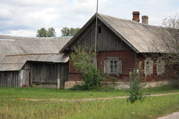 |
Latvia
Lielie MulkiApdzīvota vieta ~ 1 km dienvidos no Daugavpils – Krāslavas (A 6) ceļa, kas pazīstama ar savu neparasto nosaukumu. Interesanti, ka vietvārds saistīts arī ar iedzīvotāju uzvārdiem, ko var redzēt tāda paša nosaukuma kapos. Ciema apkaimē pazīstams ir Lielo Muļķu svētavots, kuru gan nezinātājam ir grūti atrast, tādēļ ieteicams izmantot vietējā gida pakalpojumus, apvienojot šīs vietas izziņu ar biškopības saimniecības „Cīruļi” apskati. 254
Services
254km - Distance from countries capital city |
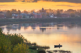 |
Latvia
Jekabpils / KrustpilsKrustpils was first recorded in documents in 1237 in relation to the construction of the Kreutzburg castle on the right bank of the Daugava River. A 1511 document lists it as a village. In 1585, Polish King Stefan Báthory gifted the town to Nicholas Korff, whose family continued to own it until 1920. Battles between Swedish and Polish forces occurred outside of Krustpils in 1626, and the sacked village was in poor shape until the mid-19th century. Jēkabpils, in turn, was constructed as a settlement for Old Believers who were persecuted in Russia. The Daugava has rapids opposite Krustpils and Jēkabpils, which means that boats had to dock there and reload their goods into wagons. The settlement flourished, and in 1670 it was given the rights of a city. It is named after Duke Jacob. When the Rīga-Daugavpils rail line opened in 1861, Krustpils flourished, and Jēkabpils did not flourish. The two cities were administratively merged in 1962, keeping the name of Jēkabpils. There are typical one-story wooden buildings from the 19th century, red brick buildings built at the turn of the 20th century, as well as seven churches used by different denominations. The dam along the left bank of the Daugava was built in 1861, and it was aimed at protecting the city against flooding. Today it is a promenade that is popular among local residents for strolling and leisure. 143
1-12
Services
143km - Distance from countries capital city
1-12 Active season months |


