
Historische und moderne Zentren
| Überblick | Details |
|---|---|
 |
Lettland
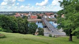
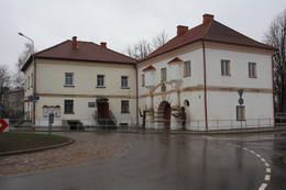
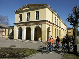
DobeleDer Name von Dobele ist in den historischen Quellen im Jahr 1254 erwähnt worden. Dobele war einer der am besten befestigten Orte der Semgallen, darum hat dieser Ort von 1279 bis 1289 sechs Einfälle der Kreuzritter überlebt. Doch im Jahr 1289 waren die Semgallen gezwungen zurückzutreten. Im Jahr 1335 haben die Eroberer an der Stelle der Burg von Semgallen mit dem Bau einer neuen – gemauerten Burg begonnen. Am gegenüberliegenden – am linken Ufer des Flusses Bērze begann sich eine Ortschaft der Händler und Handwerker zu bilden. Die Stadt hat sehr stark im Nordischen Krieg und in der darauf folgenden Pestzeit gelitten. Ein bedeutendes Ereignis im wirtschaftlichen Leben der Stadt war das Jahr 1927, als die Eisenbahnlinie Liepāja – Glūda ausgebaut wurde. Nach dem Ersten Weltkrieg kamen nach Dobele Militärpersonen der Sowjetarmee, die einen der größten Panzerschießplätze der UdSSR Dobele-2 gebaut haben. Jetzt können die Besucher von Dobele interessante Sehenswürdigkeiten besichtigen.  77 77
Leistungen
77km - Entfernung von der Hauptstadt |
 |
Lettland
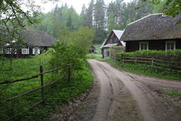
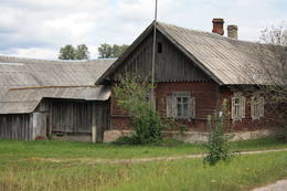
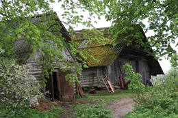
Fischerdorf Koni in PapeDieses Dorf ist eines von den zwei Fischerdörfern in Lettland, das bis heute (soweit es möglich war) seine authentische Atmosphäre erhalten hat. Hier befindet sich eine Niederlassung des Ethnographischen Freilichtmuseums Lettlands mit dem Fischerhof Vītolnieki. Zurzeit werden in dem Dorf moderne Häuser gebaut, darum verliert es mit jedem Tag seine Unberührtheit. 267
Leistungen
267km - Entfernung von der Hauptstadt |
 |
Lettland
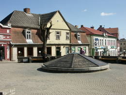
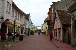
Liepajas Kursu laukumsAp 200 m garajā un izstieptās formas laukumā no 16. – 20. gs. atradās Liepājas tirgus. Laukuma malās tolaik bija izveidojusies vienstāvu apbūve – iebraucamās sētas, viesnīcas un dārzi. Līdz ar Pētertirgus izveidi 1910. gadā, izmainījās arī laukuma apveidi un to ieskaujošā apbūve. Laukuma DA malā slejas iespaidīgā Liepājas Svētās Annas Luterāņu baznīca. 217
Leistungen
217km - Entfernung von der Hauptstadt |
 |
Lettland
KudraNeliela apdzīvota vieta, kuras apkārtnē jau izsenis iegūta kūdra un ārstniecības dūņas, kas izmantotas Ķemeru kūrortā. Kūdrā atrodas padomju laikā celtā dzelzsbetona rūpnīca, kura nodrošināja ar būvniecības materiāliem tagadējo Kauguru mikrorajonu.
41
Leistungen
41km - Entfernung von der Hauptstadt |
 |
Litauen
PreilaEin ehemaliges Fischerdorf am Ufer des Kurischen Haffs. Hierher sind die Bewohner der Dörfern umgezogen, deren Dörfe unter dem Sand der Wanderdünen begraben wurden. Holzbebauung des 19 – 20 Jh. 349
Leistungen
349km - Entfernung von der Hauptstadt |
 |
Litauen
KaunasDie zweitgrößte Stadt Litauens und von 1920 bis 1939 die vorläufige Hauptstadt. Altstadt, Rathaus (16 Jh.), Basilikum-Kathedrale St. Peter und Paul (15 Jh.), Perkūnas-Haus (Donnerhaus, 15 Jh.), Laisves Alee, Čiurlionis-Kunstmuseum und Teufelsmuseum. 103
Leistungen
103km - Entfernung von der Hauptstadt |
 |
Lettland
SmilteneBis zum 13. Jh. gehörte der Kreis von Smiltene zu dem von den Letgallen bewohnten Land Tālava. Nach der Invasion der Kreuzritter hat den Kreis der Erzbischof von Riga bekommen und am steilen Ufer des Flusses Abuls hat er im Jahr 1370 eine Burg gebaut. Die nachfolgenden Kriege und Seuchen haben weder die Bebauung der Ortschaft, noch die Einwohner geschützt. Die heutigen Konturen der Stadt begannen sich am Ende des 19. Jhs. mit den aktiven Tätigkeiten des Barons von Lieven – des Landgutinhabers von Smiltene – zu bilden. Bis zum Ersten Weltkrieg arbeitete in Smiltene eine Holzverarbeitungsfabrik, ein Wasserkraftwerk (1901, das erste in den Baltischen Ländern) und andere Unternehmen. Als sich im Jahr 1944 die deutschen Streitkräfte zurückgezogen haben, wurde in einem Brand der größte Teil der historischen Bebauung der Stadt zerstört. 134
Leistungen
134km - Entfernung von der Hauptstadt |
 |
Lettland
Saunags (Sǟnag)In den historischen Quellen wurde das Dorf 1310 erwähnt. Im Jahr 1582/1583 waren im Gemeinderegister von Piltene im Dorf acht Bauernhöfe eingetragen, in Jahr 1731 im Registerbuch des Landguts Dundaga (Dondangendrei. 1826 wohnten in jedem Bauernhof 16–17 Personen, im Dorf insgesamt rund 60 Einwohner. Die Angaben von 1935 besagen , dass in Saunags alle 49 Liven die livische Sprache beherrschten, aber nur 11 von ihnen in der Familie Livisch gesprochen haben. Im Haus Rūpnieki von Saunags befand sich ein Geschäft, dessen Eigentümer Kārlis Tilmanis gewerblich Sprotten gesalzen hat. In Saunags wurde der Kapitän auf hoher See Arvīds Ludeviks (1912–1996) geboren. 1945 führte er den Schleppdampfer „Rota“ mit lettischen Flüchtlingen von Ventspils nach Schweden. Das Schiff wurde festgenommen und der Kapitän nach Sibirien deportiert. In Saunags wurde der Kapitän auf hoher See Visvaldis Feldmanis (1938–2017) geboren. 185
Leistungen
185km - Entfernung von der Hauptstadt |
 |
Lettland
Jaunciems (Uzkila)Jaunciems war früher ein kleines Dorf. Auch heute sind hier nur ein paar Häuser bewohnt. In der Nähe, am rechten Ufer des Flusses Irbe, befinden sich Erholungsplätze. Jaunciems wird mit dem Dorf Sīkrags durch eine Schneise der ehemaligen Schmalspurbahn verbunden, an der eine Fußgänger- und Fahrradbrücke über den Fluss Ķikans führt. 166
 1-12 1-12
Leistungen
166km - Entfernung von der Hauptstadt
1-12 Aktive Saisonmonate |
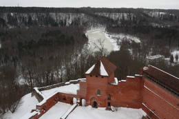 |
Lettland
Sigulda, TuraidaDen Bau der Burg von Sigulda begann der Schwertbrüder-Orden (Brüder der Ritterschaft Christi von Livland) im Jahre 1207, 1236 wurde sie für die Bedürfnisse des Livonischen Ordens umgebaut.Die Burg von Sigulda nahm schweren Schaden in den Kriegen Ende des 16., Anfang des 17. Jh. Im Nordischen Krieg wurde sie heruntergebrannt und weiter nicht mehr aufgebaut. Heute kann man den südlichen Korpus der Konventgebäude der Burg und den Turm am Haupttor besichtigen, hinter dem sich die innere Vorburg und eine Freilichtbühne befinden. Von dort aus hat man einen eindrucksvollen Blick auf das alte Flusstal der Gauja. Südlich davon ließ der russische Fürst Kropotkin von 1878 -1881 das neue Schloss von Sigulda erbauen. Von 1923 bis 1940 beherbergte das Schloss den Schriftstellerverband, in der Sowjetzeit ein Kardiologie – Sanatorium. Seit 2003 hat der Stadtrat von Sigulda hier seinen Sitz. Vom Schloss-Ensemble sind heute ein Wohnhaus aus Holz, in dem die Familie Kropotkins lebte, eine Scheune (aus der Jahrhundertwende 18./19. Jh.), ein Gartenhaus und eine Mauerumzäunung aus dem 19.Jh. erhalten. Wenn man sich vom neuen Schloss in Süd-Ost Richtung begibt, gelangt man nach etwa 2km zum Graben des Vējupīte (Windflüsschen). Dort kann man die nicht sehr tiefe (3,6m), aber hohe (6,1m) Pētera ala (Peterhöhle) und den tiefen Pūču grava (Eulengraben) mit dem Kraukļupīti (Krähenflüsschen) sehen. An der Stelle, an der die Gräben der beiden Flüsschen aufeinandertreffen, erhebt sich der Satezele-Burghügel (Satezeles pilskalns) mit einer Fläche von 90m x 75m, wo sich im 13. Jh. die Eichenholzburg des Ältesten von Livland – Dabrelis befand. Nicht weit davon ist die Kraukļu aiza (Krähenschlucht) – ein Graben am linken Ufer des Vējupīte – Flüsschen mit 11m hohen Sandsteinwänden und der 5,2m tiefen Kraukļu ala (Krähenhöhle). 53
1-12
Leistungen
53km - Entfernung von der Hauptstadt
1-12 Aktive Saisonmonate |
|
|
Lettland
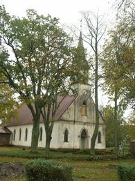
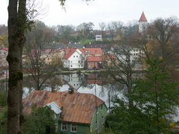
Historisches Zentrum von SubateDer Name von Subate ist zum ersten Mal im Jahr 1570 erwähnt worden, als der kurländische Herzog Kettler dem Grafen G. Plater-Sieberg den Platz des Marktes verkauft hat. Als im 17. Jh. die Familie Plater-Sieberg zum katholischen Glauben übergegangen ist, protestierten die evangelisch-lutherischen Einwohner von Subate und sind zum östlichen Ufer des Sees von Subate umgezogen, der das Eigentum der Familie von Osten-Sacken war, der auch das Landgut von Prode (heute nur Ruinen) gehörte. Im Jahr 1685 hat die Familie von Osten-Sacken den Überläufern eine evangelisch-lutherische Kirche gebaut, um die sich die Ortschaft Jaunsubate herausbildet hat. Beide Stadtteile wurden im Jahr 1894 vereint. Während der Freiheitskämpfe im Jahr 1919 wurde Subate von Litauern befreit, danach folgte die Teilung der Stadt zwischen Lettland und Litauen (im Jahr 1921 wurde die Grenze auf der ehemaligen Linie festgelegt). Das historische Zentrum von Subate bildete sichvom 16. bis 19. Jh. heraus. In dem Zentrum kann man Gotteshäuser von vier verschiedenen Konfessionen und eine Bebauung aus kleinen Holzhäusern besichtigen, die sich am Rand von schmalen und sich windelnden Straßen befinden. Die Stadt liegt an den Ufern einer subglazialen Bettung, in der sich auch die Seen Lielais Subates ezers und Mazais Subates ezers befinden, darum bieten auch die Naturverhältnisse der Stadt einen für Lettland nicht charakteristischen Blickwinkel. 171
Leistungen
171km - Entfernung von der Hauptstadt |
 |
Lettland
ValmieraValmiera ist in den historischen Quellen zum ersten Mal 1323 erwähnt worden. Bis zum 13. Jh. gehörte diese Ortschaft zu dem von den Letgallen bewohnten Land Tālava. Mit dem Bau der mittelalterlichen Burg wurde am Anfang des 13. Jhs. begonnen, aber um 1283 wurde zwischen den Flüssen Gauja und Rāte eine Kirche gebaut. Die wirtschaftliche Entwicklung der Ortschaft hat die Nähe der Handelswege von Pleskau und Dorpat-Novgorod gefördert. Vom 14. bis 16. Jh. gehörte Valmiera zur Hanse. Die Stadt hat sehr stark unter den Kriegen, Seuchen und Bränden zwischen dem 16. bis 18. Jh. gelitten. In der zweiten Hälfte des 19. Jhs. begann die Stadt wieder wirtschaftlich aufzublühen. Die Entwicklung förderte auch die im Jahr 1866 gebaute Brücke aus Holz über den Fluss Gauja und die im Jahr 1899 eröffnete Eisenbahnlinie Riga-Pleskau. Im Jahr 1944 wurde das historische Zentrum der Stadt zerstört. In den Nachkriegsjahren haben in der Stadt große Industrieunternehmen gearbeitet, z.B., Glasfaserunternehmen (arbeitet noch heute). Heute ist Valmiera das Wirtschafts-, Bildungs- und Sportzentrum der Region Vidzeme. 107
Leistungen
107km - Entfernung von der Hauptstadt |
 |
Lettland
TukumsTukums ist in den historischen Quellen zum ersten Mal im Jahr 1253 in dem Vertrag über die Teilung der Region Kursa zwischen dem Livländischen Orden und dem Bischof erwähnt worden. Wenn der Name der Stadt aus der livischen Sprache übersetzt wird, dann bedeutet er Sandhaufen, Sandberge. Am Anfang des 14. Jhs. hatte sich an der gemauerten Burg des Livländischen Ordens eine Siedlung der deutschen Händler und Handwerker herausgebildet, die dank der nahen Straße Riga – Preußen aufblühte. Später beeinflusste die Entwicklung der Stadt der Ausbau der Eisenbahn Riga – Tukums im Jahr 1877. Während der Sowjetzeit befanden sich östlich von Tukums der im Baltikum größte Flugplatz und die sogenannte Kriegsstadt der Armee der UdSSR. Heute ist die Stadt Tukums das Zentrum des gleichnamigen Kreises mit einem breiten Angebot an Dienstleistungen für Touristen. 68
Leistungen
68km - Entfernung von der Hauptstadt |
 |
Lettland
VentspilsEine Hafenstadt. In der Altstadt ist das älteste Straßennetz erhalten. Holzbebauung des 19. Jh. im Stadtbezirk Ostgals. Die Promenade der Ostas Straße mit der Burg des Livländischen Ordens, dem Ausflugsschiff „Hercogs Jēkabs”, dem Denkmal für Kr. Valdemars und den kleinen architektonischen Formen. 187
Leistungen
187km - Entfernung von der Hauptstadt |
 |
Litauen
Paluse (Palusė)Palūšē atrodas nacionālā parka administrācija (izveidota neliela ekspozīcija) un tūrisma informācijas centrs, kempings, nesen atjaunotā laivu bāze un viens no biežāk apmeklētajiem parka objektiem – Palūšes baznīca (Palūšės bažnyčia), kas celta 1757. gadā. 2008. g. No dievnama apkārtnes paveras jauks skats uz Lūšu (Lūšiai) ezeru, īpaši saulrietos, kad baznīca iegūst teiksmainu nokrāsu. Blakus baznīcas žogam aug vecais Palūšes ozols. Uzskata, ka tā vecums varētu būt ~ 350 – 400 gadi. 113
Leistungen
113km - Entfernung von der Hauptstadt |
|
|
Litauen
Dorf MinijaEin einzigartiges Örtchen beiderseits des Flusses Minija, wo der Fluss eine „Hauptstraße” ist. Litauens Venedig. 329
Leistungen
329km - Entfernung von der Hauptstadt |
 |
Lettland
Historical center of KraslavaThe central part of the town of Krāslava is an historical monument because its low-story and beautiful wooden buildings. The best views of the historical centre relate to the carp park near the Adamova trail, the Karņicskis hill, the bridge across the Daugava (Prospekta Street), and the Priedaine viewing tower on the left bank of the Daugava River. 263
1-12
Leistungen
263km - Entfernung von der Hauptstadt
1-12 Aktive Saisonmonate |
|
|
Litauen
VisaginasEntstanden als eine 6 km entfernte Arbeiterstadt des schon geschlossenen Ignalina-Atomkraftwerks. In der Stadtbebauung dominieren die für die Sowjetzeit typischen architektonischen Formen und Monumentalbauten. 150
Leistungen
150km - Entfernung von der Hauptstadt |
 |
Lettland
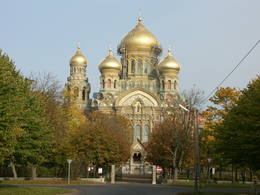
JelgavaDie bedeutendste Periode der Stadt ist mit der Zeit von 1561 bis 1795 verbunden, als der Kreis von Jelgava dem Herzogtum von Kurland und Semgallen gehörte. Als Jelgava zur Residenz des Herzogs (1567) und zur Hauptstadt des Herzogtums (1616) wurde, blühte die Stadt schnell auf. Der höchste Punkt der Entwicklung war in der Regierungszeit des Herzogs Jacob. In der Regierungszeit der letzten zwei Herzoge – Ernst Johann von Biron und seines Sohnes Peters – wurde die Academia Petrina (1775) – die erste Hochschule in Lettland – gegründet, im Jahr 1816 wurde die Gesellschaft für Literatur und Kunst gegründet, im Jahr 1822 wurde die erste lettische Zeitung Latviešu Avīzes veröffentlicht, im Jahr 1802 wurde das erste Theatergebäude, aber im Jahr 1898 – das erste Museumsgebäude in Lettland gebaut. Im Jahr 1937 zog im Schloss von Jelgava die Lettische Landwirtschaftskammer ein, aber in zwei Jahren wurde die Landwirtschaftliche Akademie von Jelgava geöffnet. Im Sommer 1944 wurden fast die ganze historische Bebauung und die Kunstwerte der Stadt zerstört. Nach dem Zweiten Weltkrieg wurde Jelgava erneuert. Vor einer kurzen Zeit wurde auch der Turm der Heiligen Dreieinigkeitskirche erneuert, wo zurzeit eines der besten interaktiven Museen in Lettland (kinder- und familienfreundlich) eingerichtet ist. 42
Leistungen
42km - Entfernung von der Hauptstadt |
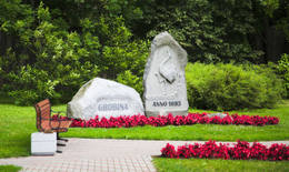 |
Lettland
GrobinaVom 6. – 8. Jh. befand sich an der Stelle der heutigen Stadt Grobiņa die größte in den baltischen Ländern bekannte skandinavische Händler- und Soldatenkolonie. Die Einwanderer aus Gotland und Schweden hatten ihre Inlandsiedlung auf einem Hügel eingerichtet, der sich am Ufer des damals schiffbaren Flusses Ālande befand. Es wird angenommen, dass sich genau hier die in den Chroniken aus dem 9. Jh. erwähnte Burg der Kuren – Seeburg – befand. Nach dem Bau der Ordensburg im 13. Jh. wurde Grobiņa zu einem Kreiszentrum. Die älteste Bebauung der Stadt hat sich um die Lielā Straße, sowie um die Saules Straße und Parka Straße herausgebildet. 207
Leistungen
207km - Entfernung von der Hauptstadt |
 |
Lettland
The Old Town of CesisCēsis is in the centre of the Gauja National Park, but it is not part of the park as such. There are many interesting places in Cēsis to visit and examine. The oldest part of the town is of key interest. The origins of Cēsis can be found at Riekstu hill, which is 18 metres high. Between the 11th and 13th century, there was a wooden castle here built by the Vendians. The hill is in the central part of the castle park, and it offers a good view of the park, pond and the ruins of the Cēsis castle, which can be accessed via a long cascade of stairs. The Cēsis castle (see below) was built in the early 13th century as a residence for masters of the Livonian Order, and it was one of the strongest fortresses in the Baltic territories. Alongside it is the New Cēsis castle, which was built in 1777 where the gate fortifications once stood. The Cēsis Museum of History and Art is in the building, alongside which is a visitors centre and the Cēsis Tourism Information Centre. From the tower of the castle, there is a fine view of the castle ruins, St John's Lutheran church and the northern part of the town. Opposite the New Cēsis castle are stables and a wheelhouse (both from the first half of the 19th century). The Cēsis Exhibition Hall is there today. You can look at the exteriors of the granary, the hut for coachmen, and the old brewery. On the other side of the street is the romantic Maija park, which was installed in the 1830s. The park is popular among parents with children, because there is a playground there. From this area, you can walk down some of the old streets of the town – Lielās Katrīnas, Mazās Katrīnas, Mazā Kalēju, Kalēju and Lielā Līvu streets, plus Līvu Square. The wooden buildings along the streets date back to the late 18th and early 19th century. Torņa Street, which weaves its way along the defensive walls of the Medieval castle, offers a look outside the church of a sculpture by Matiass Jansons, "As the Centuries Pass". Legend says that if you rub the lantern carred by the Old Man of Time, you can see the future. One of the most impressive buildings in Cēsis is St John's Lutheran Church, which was built in the late 13th century for the Livonian Order. It is a basilica built in the Roman style and with Gothic elements. The tower, which is 65 m high, was built in 1853. The building was reconstructed several times during the 20th century. Inside the building are grave epitaphs for masters of the Livonian Order and for bishops. The pulpit was installed in 1748, the oak altar followed in 1858, and the altar painting "The Crucified One" dates back to 1862. The stained glass windows around the altar are of great artistic value. The organ was built in 1907 by the E.F. Walker Company, and the instrument is one of the best concert organs in Latvia. A sun clock featuring the year 1744 is at the south-western corner of the church. It is worth climbing the church's tower. At the foot of the building is Rose Square, which began as a market square in the mid-19th century, remained in place until 1927, and was restored in 2008. This is the central square in the town today. During the Medieval Era, there were stockades here, along with the city's well. Rīgas Street has been the main street of the old town from the very beginning, and it is here that you will find the most architecturally outstanding buildings in town from the 18th and 19th centuries. They include the former Cēsis City Hall, the Fābers building, and the Princess building. At one end of the street is Līvu Square, where, during the 13th century, there was a church, a cemetery and a gate in the town walls. Today the square features a lighted fountain which is on the site of a 13th century well known as Lejas Šķimbēgs. At the other end of the street is a reconstruction of the foundations and surface elements of the Rauna gate that was a part of the town walls in the 14th and 15th centuries. The site offers a good idea about Medieval fortifications and the size and mightiness of gates therein. |
 |
Lettland
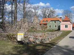
Old LiepajaFrom the historical and architectural perspective, this is an interesting monument to urban construction between the 17th and 19th centuries. Old Liepāja is in the area of the old market and Kuršu Square, where merchants sold their wares beginning in the 1560s. Until 1792, Kuršu Square was also where punishments were implemented. The current Pētertirgus pavilion was installed alongside the square in 1910. A map shows that the network of streets has partly preserved the chaos of street planning that was typical in Medieval towns. 217
Leistungen
217km - Entfernung von der Hauptstadt |
 |
Lettland
LimbaziEs wird angenommen, dass sich auf dem Hügel Ķezberkalniņš die Burg Lemisele der Liven des Kreises Metsepole befand. Genauso kann man Angaben darüber finden, dass bis zum 16. Jh. aus dem Meer über den Fluss Svētupe und den See Dūņezers bis hier Händler gefahren sind. Im Jahr 1223 hat der Bischof Albert in Limbaži eine gemauerte Burg gebaut. Die Stadt Limbaži wurde wie die Stadt Valmiera zum Mitglied der Hanse. Am Anfang des 16. Jhs. verringerte sich die wirtschaftliche Rolle der Stadt, weil der Fluss Svētupe und der See Dūņezers für die Schifffahrt nicht mehr nutzbar waren. In der Zeit zwischen dem 16. – 18. Jh. haben die Stadt und die Einwohner unter verschiedenen Kriegen, Krankheiten und Bränden gelitten. Im Ergebnis ist die Einwohnerzahl auf acht Menschen gefallen. In der Jahrhundertwende 19.-20. Jh. und am Anfang des 20. Jhs. erneuerte sich hier das wirtschaftliche Leben. 92
Leistungen
92km - Entfernung von der Hauptstadt |
 |
Lettland
KraslavaEine alte, von den Letgallen bewohnte Ortschaft. Im 10. Jh. gelang der Kreis von Krāslava in den Händen der Fürsten von Polock, aber im 13. Jh. – in den Händen des Livländischen Ordens. Bis zum Anfang des 18. Jhs. bestand Krāslava als das Zentrum des Landgutes. Im Jahr 1729 hat Johann Ludwig Plater Krāslava für 1400 Taler gekauft. Die Familie Plater hat in Krāslava zwei Jahrhunderte geherrscht. In der Mitte des 18. Jhs. hat die Familie mit dem Bau des Schlosses begonnen. Nach der ersten Polnischen Teilung im Jahr 1772 wurde die Region Latgale an Russland angeschlossen. Krāslava begann zu verkümmern. Nach dem Bau der Eisenbahn Riga – Daugavpils – Witebsk (1865) blühte das wirtschaftliche Leben der Stadt wieder auf. Krāslava wurde wenig von den Ereignissen des Zweiten Weltkriegs betroffen, darum hat sich die Holzbebauung der Stadt aus dem Anfang des 20. Jhs. fast unberührt erhalten. 268
1-12
Leistungen
268km - Entfernung von der Hauptstadt
1-12 Aktive Saisonmonate |
 |
Estland
PärnuDer populärste Kurort Estlands mit breiten Erholungs- und SPA-angebote. Eine der seltenen Sandküsten Estlands und warmes (flach) Wasser des Pärnu-Meerbusens. Die Altstadt mit Hauptfussgängerstrasse Rüütli tee. 130
Leistungen
130km - Entfernung von der Hauptstadt |
 |
Lettland
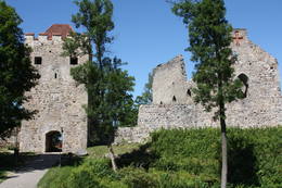
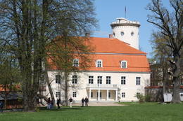
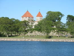
SiguldaDie Besichtigung der Stadt Sigulda kann man mit dem Besuch der Burgruinen anfangen. Mit dem Bau der Burg hat der Schwertbrüderorden im Jahr 1207 begonnen, aber im Jahr 1236 wurde die Burg für die Bedürfnisse des Livländischen Ordens umgebaut. Die Burg hat sehr stark in den Kriegen in der zweiten Hälfte des 16. Jhs. und am Anfang des 17. Jhs. gelitten. Während des Nordischen Krieges wurde die Burg niedergebrannt und danach nicht mehr erneuert. Heute kann man das südwestliche Gebäude des Konvents und den Turm des Haupttors besichtigen, hinter dem sich die innere Vorburg mit einer Freilichtbühne befindet, aus der sich eine eindrucksvolle Aussicht auf das Urstromtal von Gauja eröffnet. Zurzeit werden in den Burgruinen Rekonstruktionsarbeiten durchgeführt. Das Neue Schloss von Sigulda, das sich im Süden befindet, wurde von 1878 bis 1881 (der Inhaber – Fürst Kropotkin) gebaut. Von 1923 – 1940 befand sich in diesem Gebäude das sogenannte Schloss der Schriftsteller, aber während der Sowjetzeit – ein kardiologisches Sanatorium. Seit 2003 befindet sich hier die Kreisverwaltung von Sigulda. In dem Landgutkomplex haben sich ein Wohnhaus aus Holz (Mitte des 19. Jhs.), wo die Familie von Kropotkin wohnte, eine Kornkammer (Jahrhundertwende 18.-19. Jh.), ein Gartenhaus (19. Jh.) und ein gemauerter Zaun (19. Jh.) erhalten. Falls wir von dem Neuen Schloss nach Nordosten gehen, werden wir in fast 2 km an dem Tal des Flusses Vējupīte kommen, wo man die flache (3,6 m), aber hohe (6,1 m) Höhle Pētera ala (die Höhle von Peter) und das Tal Pūču grava (Eulental) mit dem kleinen Fluss Kraukļupīte besichtigen kann. An der Stelle, wo sich die beiden Täler zusammentreffen, erhebt sich der Burgberg von Satezele (Hügelfläche 90 x 75 m), wo sich im 13. Jh. die Burg aus Eichenholz von Dabrelis befand, der der Leiter (der Älteste) der Liven war. Unweit kann man das Tal Kraukļu aiza (Rabenschlucht) – das Seitental des linken Ufers von Vējupīte mit 11 m hohen Sandsteinwänden – und die 5,2 m tiefe Höhle Kraukļu ala (Rabenhöhle) finden. An der Stelle, wo sich das Tal von Vējupīte und das Urstromtal von Gauja zusammentreffen, erhebt sich der Hügel Paradīzes (Gleznotāju) kalns (Paradiesberg oder Malerberg), der landschaftlich ein sehr schöner Ort und schon seit alten Zeiten gemalt und fotografiert worden ist! Zum Hügel Paradīzes kalns kann man mit einem Elektromobil gelangen. Im Westen von Sigulda kann man das Panoramarad (geöffnet während der Sommersaison) und die Luftseilbahn benutzen, die 1969 gebaut wurde und in den baltischen Ländern als einziges Transportmittel seiner Art ist. Das Tragseil der Bahn ist 1060 m lang und ohne Stützen verbindet es in der Höhe von ungefähr 40 m über den Fluss Gauja die Ufer des Urstromtales Gauja zwischen Sigulda und Krimulda. Hier eröffnen sich wunderbare Aussichten! Im Südwesten von Sigulda kann man bis zur Steilwand Beites krauja spazieren, die von einem Tal eines Baches durchgespaltet wird. Im Westen des Tals befindet sich der Ort Ķeizarskats (Kaiseraussicht), der sich ungefähr 67 m über den Fluss Gauja erhebt und aus dem man eine gute Aussicht nach Krimulda und zur Burg von Turaida hat. Dieser Aussichtspunkt wurde hier schon 1862 eingerichtet, als Sigulda der russische Kaiser Alexander III besucht hat. Im Osten des Tals befindet sich der aus Holz gebildete Ķeizarkrēsls (Kaiserstuhl). 52
Leistungen
52km - Entfernung von der Hauptstadt |
 |
Estland
Insel MuhuDie drittgrößte Insel Estlands. Ist mit schönem Wachholderhain, kleinen Dolomitaufschlüssen und den Fischerdörfern an der Küste bedeckt. 153
Leistungen
153km - Entfernung von der Hauptstadt |
|
|
Lettland
GulbeneDer Name der Stadt ist in den historischen Quellen zum ersten Mal 1224 erwähnt worden. Im Jahr 1340 hat der Erzbischof von Riga auf dem Burgberg (heute – evangelisch-lutherische Kirche) der Letgallen eine Burg gebaut. Im Jahr 1802 hat das Landgut von Vecgulbene Baron von Wolf (im Besitz bis 1920) gekauft. Die Landgüter der Umgebung von Gulbene und Vecgulbene haben unter der Revolution von 1905 und auch unter anderen weiteren historischen Ereignissen wesentlich gelitten. Heute ändert sich die Landschaft der Stadt sehr stark, besonders in der Gegend des Weißen Schlosses, wo in den letzten Jahren große Restaurationsarbeiten durchgeführt worden sind. Auf jeden Fall ist Gulbene ein Ort, wo man neue Eindrücke sammeln und Kenntnisse erwerben kann. 185
Leistungen
185km - Entfernung von der Hauptstadt |
 |
Lettland
The Old Town of KandavaThe Old Town of Kandava is located around the old Market Square and dates back to 1881, after a fire in the town. The urban environment in Kandava is made up of farms with various buildings, closed yards, passageways and walls made of fieldstones. These can be seen in Talsu Street and Sabiles Street. Uncommon for Latvia is Lielā Street. At the foot of the Bruņinieku Castle Hill is a model of the Castle of the Livonian Order that was created in 2010. 94
Leistungen
94km - Entfernung von der Hauptstadt |
 |
Lettland
LiepajaDie Stadt des Windes, der Bernsteine und der Musiker. In den schriftlichen Quellen ist Liepāja zum ersten Mal im Jahr 1253 erwähnt worden. Die Stadt blühte als ein Handelshafen schon am Ende des 16. Jhs. auf. Sehr bedeutend für die Stadt war die Regierungszeit der kurländischen Herzoge Jacob und Friedrich Kasimir, als durch den Hafen von Liepāja der Export- und Importhandel mit litauischen und kurländischen Waren gewährleistet wurde. An der Stelle, wo der Fluss Līva mit Dünensand zugeschüttet worden war, wurde ein Kanal ausgegraben und eine Anlegestelle für Schiffe gebaut. Das Wachstum der Stadt setzte sich im 18. Jh. auch nach dem Nordischen Krieg und der Pestzeit fort. Als im Jahr 1795 Kurland in das Russische Reich eingegliedert wurde, hat sich der Hafen von Liepāja als einer der bedeutendsten westlichen Häfen des Reiches noch schneller entwickelt. Am Ende des 18. Jhs. bis zum 19. Jh. wurde Liepāja gleichzeitig auch zu einem beliebten Erholungsort der St. Petersburger Aristokraten. Am Ende des 19. Jh. wurde mit dem Bau des Kriegshafens und der Festung begonnen. Die Stadt wurde zu einem militärstrategischen Ort. Die Stadt hat wesentlich im Zweiten Weltkrieg gelitten. Im Jahr 1967 beendete der Seehandelshafen von Liepāja seine Tätigkeit und die Stadt Liepāja wurde zu einer geschlossenen Stadt, wo der Kriegshafen als eine ‘Stadt in der Stadt‘ war. Heute ist der Kriegshafen und das dort geschaffene Angebot eine der Top-Sehenswürdigkeiten in der lettischen Tourismusbranche. 217
Leistungen
217km - Entfernung von der Hauptstadt |
|
|
Lettland
SmardeSmārde ist ein alter Ort, der schon in den Quellen aus dem 13. Jh. erwähnt worden ist. Heute ist Smārde eine kleine Ortschaft mit einem Bahnhof und einem Geschäft. Nordöstlich von Smārde – im Moor von Smārde – befinden sich die ehemaligen Torfgewinnungsstellen. Während des Ersten Weltkriegs befand sich unweit von Smārde die Frontlinie, von der auch die Gedenkstätten in der nächsten Umgebung zeugen. 58
Leistungen
58km - Entfernung von der Hauptstadt |
|
|
Lettland
LielvardeDie auf dem Berg Dievukalns (Gottesberg) gefundenen Zeugnisse erzählen davon, dass sich an diesem Ort vor 3000 Jahren baltische Stämme, aber vom 7. – 9. Jh. an dem Fluss Daugava – livische Stämme niedergelassen hatten. An dem felsigen Ufer von Daugava (zum ersten Mal im Jahr 1229 erwähnt) hat der Bischof von Riga eine Burg aus Feldsteinen gebaut, deren Ruinen man auch heute besichtigen kann. Lielvārde hat solche lettischen Kulturmitarbeiter wie Andrejs Pumpurs (1841-1902) und Auseklis (1850-1879) inspiriert. Während des Ersten Weltkriegs (der Fluss Daugava war fast drei Jahre lang die Frontlinie) wurde Lielvārde völlig zerstört. Nach dem Zweiten Weltkrieg wurden hier genauso wie im ganzen Lettland Kolchosen eingerichtet. In dieser Zeit wurde Lielvārde noch mit einem Symbol – mit dem Bier Lāčplēsis bekannt. Heute haben Lielvārde die Reisenden beliebt, die ihre Reiseroute entlang dem rechten Ufer des Flusses Daugava gewählt haben. 52
Leistungen
52km - Entfernung von der Hauptstadt |
 |
Lettland
Sikrags (Sikrõg)Es ist eines der ältesten livischen Dörfer, das bereits 1387 erwähnt wurde. Die alte Straße vom Landgut Dundaga (Dondangen) nach Sīkrags bestand bereits im Mittelalter. Im 17. Jh. war Sīkrags einer der wichtigsten kleinen Häfen in Nordkurland, zu dem Schiffe aus England, Holland und Lübeck kamen, die Kohle, Getreide und andere Güter hereinführten. Vor dem Ersten Weltkrieg wurden hier Sprotten umfangreich produziert. In den 20er–30er Jahren des 20. Jh. waren im Dorf ca. 55 Fischer tätig. In Sīkrags wurden die livische Kulturarbeiterin Hilda Grīva (Cerbaha, 1910–1984), Kapitän auf hoher See Kārlis Anbanks (1884–1937), Baptistenpastor Kārlis Lāceklis (1904–1970), Pfleger der livischen Sprache und Traditionen Pēteris Dambergs (1909–1987), Grafikerin Baiba Damberga (1957) geboren. Heute ist Sīkrags ein nationales Kulturdenkmal. Durch das Dorf verläuft die Fahrradstrecke der Schmalspurbahn mit einem Gedenkstein an der Stelle des ehemaligen Bahnhofs. Sīkrags ebenso wie die weiteren Dörfer in Richtung Ost liegen im Nationalpark Slītere. 173
Leistungen
173km - Entfernung von der Hauptstadt |
 |
Litauen
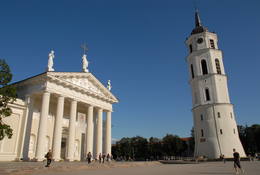
VilniusDie Hauptstadt Litauens. Eine der größten Altstädte Osteuropas, ist in die UNESCO Liste des Weltkulturerbes aufgenommen worden. In der Altstadt sind verschiedene architektonische Stile dargestellt: Klassizismus, Barock, Gotik, Renaissance u.a. |
 |
Lettland
Peterupe VillageOn the right bank of the River Pēterupe is one of the historical areas of Saulkrasti – Pēterupe Village. It is believed that the village began to form around a chapel during the so-called Swedish or Catholic times. The chapel was named after the Apostle St. Peter, and therefore the river and the village also carries his name. Pēterupe Village can be considered the oldest village in the Saulkrasti region. The oldest witnesses of the origin of Pēterupe Village are: Rectory, Pēterupe Evangelical Lutheran Church, Outpatient Clinic and the wooden buildings in the old village centre. 50
Leistungen
50km - Entfernung von der Hauptstadt |
 |
Lettland
CesvaineDer Name von Cesvaine ist in den schriftlichen Quellen zum ersten Mal im Jahr 1209 erwähnt worden. Jeder, der Lettland bereist, denkt an Cesvaine in Verbindung mit der Familie der Barone von Wolf, die im Jahr 1815 das Landgut von Cesvaine erworben hat. Die wirtschaftliche Blütezeit von Cesvaine begann nach dem Bau der Eisenbahn zwischen Pļaviņas und Gulbene. Die Stadt hat während des Zweiten Weltkriegs gelitten. Im Jahr 2002 fand in dem Schloss von Cesvaine eine Tragödie statt: In einem Brand wurde der größte Teil der Burg zerstört. Nach einer großen Unterstützung der Gesellschaft, des Staates und der Selbstverwaltung ‘erholt sich‘ jetzt das Schloss und es hält immer noch den Ruf als eine bekannte Sehenswürdigkeit nicht nur in der Region Vidzeme, sondern auch im ganzen Lettland. 185
Leistungen
185km - Entfernung von der Hauptstadt |
|
|
Lettland
Lielirbe (Ira)Das Dorf liegt auf beiden Seiten des Flusses Irbe (Dižirve, Īra) an der Mündung des Flusses in die Ostsee („Meeresseite“ und „Landseite“). Die Irbe wurde zum ersten Mal 1310 in einem Grenzvertrag zwischen dem Kurländischen Bischof und dem Rigaer Domkapitel erwähnt, der Name Lielirbe (Irvemünde) erschien zum ersten Mal 1387 in einem Dokument des Schiedsgerichts. Ende des 19. Jh. war der kleine Hafen von Lielirbe ein aktives Holzhandel- und Verkehrszentrum. Ende des 19. Jh. und Anfang des 20. Jh. wurde hier die größte Anzahl von Segelschiffen unter den Dörfern der kurländischen Westküste gebaut. 1939 gab es im Dorf ca. 300 Einwohner, mehr als 70 Häuser und eine Baptistenkirche (jetzt im Freilichtmuseum von Ventspils). Durch das Dorf verlief eine Schmalspurbahn, es gab ein Post- und Telegrafenamt, zwei Lebensmittelgeschäfte, eine Grundschule der ersten Stufe, Chor und Blaskapelle. Lielirbe war eines der größten Dörfer, die nach dem Zweiten Weltkrieg verschwanden. In Lielirbe wurde die Kulturhistorikerin Valda Marija Šuvcāne (1923–2007) geboren, deren Arbeit durch ihre Tochter Baiba Šuvcāne fortgesetzt wird, die wichtige Werke über das Leben an der Livischen Küste schreibt. Bis 2019 ist geplant, die Seilbrücke über den Fluss Irbe erneut zu errichten. 171
1-12
Leistungen
171km - Entfernung von der Hauptstadt
1-12 Aktive Saisonmonate |
 |
Lettland
SalacgrivaEin altes, von Liven schon vom 5. – 6. Jh. bewohntes Gebiet. Im Jahr 1226 hat der Bischof Albert in der Mündung des Flusses Salaca am rechten Ufer eine Burg gebaut, die sich bis heute nicht erhalten hat. Auch die Entwicklung von Salacgrīva (ähnlich wie von Ainaži) war mit der Bildung des Hafens verbunden. In der Jahrhundertwende 19.-20. Jh. wurde Salacgrīva zu einem bedeutenden Transport- und Umladungsknoten für die in Nord-Vidzeme hergestellten Waren (besonders für Holz). Während der Sowjetzeit wurde im nördlichen Teil von Salacgrīva der Park Zvejnieku parks (Fischerpark) mit einem der besten Stadien der lettischen Kleinstädte und mit einer Freilichtbühne eingerichtet. Während dieser Zeit ist auch in der ganzen Sowjetunion die Produktion – besonders die Sprotten – der Fischverarbeitungsfabrik Brīvais vilnis bekannt. Salacgrīva ist einer von den zwei Orten in Lettland, wo die Neunaugen immer noch mit der alten Methode – mit den Fischzäunen – gefischt werden. 104
Leistungen
104km - Entfernung von der Hauptstadt |
 |
Litauen
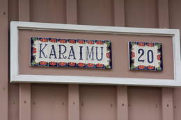
Karaimų StraßeDie zentrale und auch schönste Straße in Trakai mit bunten Holzhäusern. Eins der seltenen Kenesa-Gebetshäuser der Welt – ein eingeschossiges Holzhaus mit einem bläulichen Dach. 29
Leistungen
29km - Entfernung von der Hauptstadt |
 |
Lettland
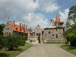
KrimuldaDie evangelisch-lutherische Kirche von Krimulda wird als eines der ältesten Gotteshäuser von Lettland angesehen. Die Anfänge der Kirche sind im Anfang des 13. Jhs. gleich nach der Eroberung von Kubesele zu suchen, später wurde die Kirche mehrmals umgebaut. Neben der Kirche ist das Labyrinth für Meditationen Lilijas zieds (Lilienblüte) eingerichtet. Als im Jahr 1217 im Kampf von Viljandi der livische Häuptling Kaupo gefallen ist, wurden seine Aschen laut Erzählungen in der Kirche beigesetzt. Als die Grabstätte von Kaupo wird im Volke ein kleiner Hügel neben dem kleinen Fluss Runtiņupīte (Runtiņš) genannt, an dessen rechten Ufer sich die ungefähr 7 m lange und künstlich gegrabene Höhle Kubeseles ala (Runtiņala) befindet. Am linken Ufer des Flusses Runtiņupīte erhebt sich der Burgberg von Kubesele. An der Kirche beginnt der Naturpfad von Kubesele. Wenn man den Pfad folgt, gelangt man bis zum Fluss Gauja, an dessen Ufer der Stein Lielais (Runtiņa) akmens liegt. Hier kann man auch die von den Flößern von Gauja aufgestellten Ankerklötze besichtigen. Die mittelalterliche Burg von Krimulda (4 km östlich von der Kirche von Krimulda) wurde in der zweiten Hälfte des 13. Jhs. an der Stelle gebaut, wo der Grundufer des Urstromtales von Gauja von dem Tal Vikmestes grava durchgespaltet wird. Die Burg, in der das Domkapitel von Riga – der Rat der Erzbischöfe von Riga – gewirtschaftet hat, war ein eindrucksvolles Gebäude, dessen breiter Innenhof von einer 1,5 m dicken Schutzmauer eingeschlossen war. Im Jahr 1601 hat der schwedische Feldherr Heinrich von Lieven die Burg beim Zurückziehen gesprengt. Heute kann man auf dem von den Wäldern bewachsenen Hügel einige Burgreste besichtigen. Neben den Burgresten befindet sich die Luftseilbahn und beginnt der Serpentinweg von Krimulda. Unweit befindet sich das Landgut von Krimulda, das in den schriftlichen Quellen zum ersten Mal schon im 15. Jh. erwähnt worden ist. Das heutige Schloss des Landgutes wurde im 19. Jh. im Neoklassizismus (der Inhaber – Baron on Lieven) gebaut. In den 1920er Jahren gelang das Schloss nach der Enteignung im Eigentum des Roten Kreuzes, das dort ein Sanatorium für Kinder eingerichtet hat. Heute befindet sich in diesem Schloss das Rehabilitationskrankenhaus Krimulda, aber von den wirtschaftlichen Häusern des Landgutes haben sich die Ställe, das Haus der Diener und der Verwalter und das sogenannte Haus der Schweiz, sowie der Park erhalten. Hier werden thematische Führungen angeboten. Wenn man eine Bootsfahrt auf dem Fluss Gauja unternimmt, kann man in der Nähe die 15 m hohe Steilwand Velnalas klintis (Felsen der Teufelshöhle) besichtigen. Die Steilwand kann man sehr gut auch aus dem anderen – dem linken – Ufer des Flusses Gauja besichtigen, wo ein Picknickplatz eingerichtet ist. In der Mitte der Steilwand befindet sich die ungefähr 19 m tiefe und 4,7 m hohe Höhle Velnala (Teufelshöhle) von Krimulda. Wenn wir von dieser Steilwand das rechte Grundufer des Flusses Gauja Richtung Turaida am unten gehen, können wir die Sandstein-Steilwand von Piķene besichtigen. Unten an der Steilwand ist der ungefähr 1 km lange Biberpfad von Piķene eingerichtet. Am Rande des Pfades befindet sich die 5 m lange Höhle Mazā Velna ala (die kleine Teufelshöhle) mit der Quelle Gudrības avotiņš (Quelle der Weisheit), sowie die genauso lange Höhle Aunapieres ala. Hier kann man auch einige zugewachsene Nebenflüsse sehen. 50
Leistungen
50km - Entfernung von der Hauptstadt |
 |
Lettland
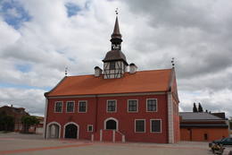
Das Bauskaer RathausBereits 1615 teilte der kurländische Herzog Friedrich Kettler der Stadt Bauska das Privileg für den Bau eines neuen Rathauses zu, was dann im 17.Jh. auch verwirklicht wurde. Der Marktplatz konnte nun stolz das größte Rathaus im ganzen Herzogtum vorweisen. Aus Geldmangel wurde 1852 dessen Turm abgebaut, 1871 das obere Stockwerk. 2011 wurde der Bau des neuen Rathauses endlich abgeschlossen, und Bauska kann nun wieder stolz auf ein neues, hervorragendes Touristik-Objekt sein, das auch von innen besichtigt werden kann. Im erneuerten Rathaus kann man sich in alten Maßeinheiten messen und wiegen lassen, in Ellen und Fuß, in Pud (ein altes russisches Gewichtsmaß, A.d.Ü.) und in Pfund, und dafür eine entsprechende Urkunde erhalten. 65
Leistungen
65km - Entfernung von der Hauptstadt |
 |
Lettland
The historical centre of TalsiThe historical centre of Talsi, which is known as the town of nine hillocks. The historical construction around Baznīckalns hill, Lake Talsi and Lake Vilkmuiža mostly dates back to the 19th century. Lielā Street is particularly beautiful with its low-rise buildings (two or three floors and ridged roofs). There are beautiful views from the area around Lake Talsi and Ķēniņkalns hill. 115
Leistungen
115km - Entfernung von der Hauptstadt |
 |
Lettland
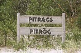
Pitrags (Pitrõg)Zum ersten Mal wurde das Dorf im Jahr 1582 urkundlich erwähnt. Auf den Sandbänken in der Nähe von Pitrags liegen viele versunkene Schiffe. Im Jahr 1826 wurden in Pitrags elf Bauernhöfe und 190 Einwohner registriert. Um die Mitte des 19. Jh. wurde hier ein Wirtshaus eröffnet. 1937 gab es im Dorf 12 alte Bauernhöfe und 38 Fischerhöfe (vor allem neue Bauernhöfe). Im Dorf gab es mehrere Fischverarbeitungsstellen. In Pitrags lebte die hervorragende Erzählerin der livischen Sprache Marija Šaltjāre (Bertholde, 1860–1930), die mehr als 200 Märchen und Sagen, mehr als 90 Lieder, Spiele, etc. veröffentlicht hat. Das Baptisten-Gebetshaus von Pitrags wurde 1902 erbaut. Während des Ersten Weltkriegs brannte es aus, wurde 1925 wiederhergestellt und Ende des 20. Jh. renoviert. Im Zentrum von Pitrags im Bauernhof Krogi sind 27 Muster der Zäune von der Livischen Küste ausgestellt und hier werden auch Fischräucherei und Verkostung angeboten. 181
Leistungen
181km - Entfernung von der Hauptstadt |
 |
Lettland
AinaziDer Name Ainaži ist untrennbar von der lettischen Seefahrtsgeschichte. Im Jahr 1864 wurde hier die erste Seefahrtsschule gegründet, in der auch die Kinder der lettischen Bauern lernen konnten. Es ist gesetzmäßig, dass Ainaži zu einem bedeutenden Zentrum für den Bau von Schiffen für Küstenschifffahrt und zu einem Hafen wurde. Das wirtschaftliche Leben der Stadt hat die im Jahr 1913 eröffnete Schmalspurbahnlinie Smiltene-Valmiera-Ainaži begünstigt. Heute ist die Stadt Ainaži eine kleine und stille lettische Stadt, die mit mehreren interessanten Sehenswürdigkeiten an der Grenze zu Estland liegt. 114
Leistungen
114km - Entfernung von der Hauptstadt |
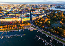 |
Finnland
HelsinkiHelsinki is the capital of Finland and the biggest city in Finland. It offers a lot to see as it is seaside city surrounded by islands but city itself is full of wonderful parks. This city has everything to attract all kinds of people - from architecture and culture to nature and even has wide range of places where to enjoy night-time Helsinki. |
 |
Lettland
PriekuleVēstures avotos pirmoreiz minēta 1483. g. Pilsētas uzplaukums bija vērojams pēc dzelzceļa uzbūvēšanas 19. gs. beigās, kad barons Korfs sadalīja un iznomāja apbūvei muižas zemi. Pilsētas tiesības Priekule ieguva 1928. g. Pilsēta smagi cieta 2. pasaules kara pēdējos mēnešos, - t.s. Kurzemes katla laikā, kuru laikā tika sagrautas 410 no 450 ēkām. Mūsdienās tā ir neliela pilsētiņa ar mazstāvu apbūvi un nesteidzīgu dzīves ritmu. 232
Leistungen
232km - Entfernung von der Hauptstadt |
 |
Lettland
Mazirbe (Ire)1387 wurde die Ortschaft urkundlich als Minor Irva bezeichnet. Bis zur Mitte des 20. Jh. war Mazirbe das größte livische Dorf an der kurländischen Küste: ein Fischerdorf und Zentrum für Schiffsverkehr. Im Dorf gab es eine Kirche, eine Schule, eine Apotheke, Forstwirtschaft, mehrere Läden, ein Post- und Telegraphenamt, einen Bahnhof, ein Sägewerk, ein Friseurgeschäft, eine Bäckerei und eine Fotowerkstatt. In Brauskas wurde eine Ziegelbrennerei betrieben. In den 30er Jahren des 20. Jh. wurde von der Fischergenossenschaft ein Fischverarbeitungswerk errichtet. 1923 wurde hier die Livische Gemeinschaft gegründet und 1939 das Livische Volkshaus eröffnet. Gegenüber dem Volkshaus befindet sich der Bauernhof Stūrīši (Familienhaus von Taizeļi), in dem man livische Haushaltsgegenstände besichtigen und auf Bestellung die lokalen Spezialitäten verköstigen kann. In Mazirbe lebten die ersten Vorsitzenden der Livischen Gemeinschaft, Kārlis Stalte und Mārtiņš Lepste. Der Kulturarbeiter Kārlis Stalte (1870–1978) war ein langjähriger Küster und Organist von Mazirbe und Mārtiņš Lepste Lehrer der livischen Sprache in den 30er Jahren des 20. Jh. Von außen ist das Gebäude der ehemaligen Seefahrtschule zu sehen, in der im Zeitraum von 1894 bis 1914 ca. 2.000 Studenten ausgebildet wurden. Während der Sowjetzeit befand sich hier ein Militärposten – „zastava“. 175
Leistungen
175km - Entfernung von der Hauptstadt |
 |
Lettland
SaulkrastiAls die größte Ortschaft begann sich Saulkrasti am Ende des 19. Jahrhunderts zu bilden, wenn kleine Fischerdörfer – Neibāde, Pēterupe und Katrīnbāde zum populären Erholungs- und Badeort der Rigenser wurden. Das hat sich rasch den Bau der Sommerhäuser beigetragen. Auf die Entwicklung des Kurorts hat sich auch den 1905 eröffneten Schiffsverkehr zwischen Rīga und Saulkrasti ausgewirkt. Es wurden neue Kurhäuser, Restaurants gebaut und eine andere mit dem Kurort verbundene Infrastruktur entwickelt. Zur Verfügung der Besucher standen in der Sommerzeit verschiedene Veranstaltungen, Bälle und Konzerte mit dem Teilnahme der Orchester aus Rīga. Die nächste Etappe der Entwicklung des Kurorts waren eine in den 30er Jahren des 20. Jahrhunderts gebaute Automobilstraße und eine Eisenbahnlinie zwischen Rīga und Saulkrasti. In der Sowjetzeit wurden Erholungshäuser, Sanatorien und neue Sommerhäuschen gebaut. Saulkrasti wird eine Stadt. Heutzutage lockt die Stadt Saulkrasti nicht nur durch den weißen Sandstrand, sonder auch durch verschiedene jährliche gesellschaftliche Veranstaltungen, den Pfad des Sonnenuntergangs und die Weiße Düne, das einzigartige Fahrradmuseum von Saulkrasti, den Meerespark und die Badestelle „Centrs”, den Saules Platz u.a. Objekte an. 46
1-12
Leistungen
46km - Entfernung von der Hauptstadt
1-12 Aktive Saisonmonate |
 |
Lettland
Vaide (Vaid)In den historischen Quellen wurde das Dorf bereits 1582 erwähnt. Im Jahr 1736 waren im Gemeinderegister von Dundaga zwei Bauernhöfe in Vaide eingetragen: Lekši und Žonaki. Nach Angaben der Volkszählung im Frühjahr 1935 wohnten in Vaide 106 Menschen, darunter 40 Liven, 60 Letten, ein paar Esten und Deutsche. Am befanden sich im Dorf Vaide 21 Bauernhöfe. Auf dem Bauernhof Lāži von Vaide wurde der erste ausgebildete Live Nika Polmanis (1823–1903) geboren. Sein ganzes Leben verbrachte hier der livische Dichter Alfons Bertholds (1910–1993), der sein Gedicht einer neben dem Haus wachsenden Großeiche gewidmet hat. Mit dem Bauernhof Žonaki ist die große Familie Bertholds verbunden: die livische Erzählerin Marija Šaltjāre, der Segelschiffkapitän Andrejs Bertholds (USA), sein Sohn, der Bibliothekswissenschaftler Arturs Benedikts Bertholds (USA), der livische Dichter Alfons Bertholds, die livischen Sprachkenner Paulīne Kļaviņa und Viktors Bertholds, der Schweizer Arzt Marcel Berthold, der weltbekannte Pianist Arturs Ozolins (Kanada) und die livische Erzählerin und Dichterin Grizelda Kristiņa (1910–2013), die als letzte Muttersprachlerin der livischen Sprache gilt. Auch der Bauernhof Ozolnieki ist mit der Familie Bertholds, der Pflegerin livischer Traditionen und der Sprache Paulīne Kļaviņa (1918–2001) und deren Mutter, der livischen Erzählerin Katrīna Zēberga, verbunden. Die von Paulīne erstellte Sammlung der livischen ethnographischen Gegenstände ist im Lettischen Ethnographischen Freilichtmuseum, in der Scheune des livischen Bauernhofs „Dēliņi”, zu besichtigen. Im Bauernhof Purvziedi in Vaide ist eine Sammlung von Hörnern der Wildtiere zu sehen, die vom Förster Edgars Hausmanis gesammelt wurde. 166
Leistungen
166km - Entfernung von der Hauptstadt |
 |
Lettland
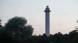
Der MichelsturmFrüher Pize, livisch Pizā. Der jetzige Name stammt von dem während der Kaiserzeit erbauten Leuchtturm (Michailowski Majak), der im Namen des Neffen des alten Kaisers Alexander II. genannt wurde. Der heute bestehende Leuchtturm – insgesamt der dritte – Miķeļbāka wurde 1957 erbaut und ist der höchste Leuchtturm in Lettland : 57 m hoch (nur von außen zu besichtigen). Die lutherische Kirche von Miķeļtornis wurde 1893 erbaut. In der Nähe kann man das 1857 erbaute Gebäude des Wirtshauses von Pize (in schlechtem Zustand) mit der für das 19. Jahrhundert typischen Planung und Konstruktion sehen, das als einziges an der Livischen Küste gilt. In Miķeļtornis wurde der erste livische Kulturarbeiter Jānis Princis (1796–1868) geboren, der zusammen mit seinem Sohn Jānis das Evangelium nach Matthäus in den westlichen Dialekt der kurländisch-livischen Sprache übersetzt hat. J. Princis Senior und J. Princis Junior waren auch Autoren der 1845 herausgegebenen Dichtung „Geistliche Lieder und Gebete der Seemänner“. Vorher wurde ein lettisches Dichtungsbuch nur vom Blinden Indrick herausgegeben. Auf dem Bauernhof Olmaņi in Miķeļtornis wird ein Schüler des Künstlers Vilhelms Purvītis, der livische Maler Andrejs Šulcs (1910–2006), geboren. Auf dem Friedhof von Miķeļtornis wird 1978 ein Denkmal für livische Dichter (das erste Denkmal für Liven) eröffnet. Es ist geplant, bis 2019 im Dorfzentrum das Kunstobjekt des Künstlers Ģirts Burvis „Jahrhundert der Segelschiffe“ zu eröffnen. 187
1-12
Leistungen
187km - Entfernung von der Hauptstadt
1-12 Aktive Saisonmonate |
 |
Lettland
Jekabpils / KrustpilsKrustpils wurde das erste Mal 1237 in Zusammenhang mit einem Bau der Kreuzburg am rechten Daugava-Ufer historisch erwähnt. 1511 wurde Krustpils als eine Ortschaft erwähnt. 1585 hat der König von Polen Stephan Báthory die Ortschaft Krustpils dem Nikolaus von Korff geschickt und gehörte Krustpils den Baronen von Korff bis 1920. 1626 geschahen nahe Krustpils die Schlachten zwischen schwedischen und polnischen Truppen. Die ruinierte Ortschaft hatte keine Entwicklung bis zum 19. Jahrhundert. Seinerseits wurde Jēkabpils in der Mitte des 17. Jahrhunderts als eine Siedlung der verfolgten Altgläubigen aus Russland – Sloboda gegründet. Auf dem Fluss Daugava befinden sich gegenüber Krustpils un Jēkabpils die Flussschnellen, deswegen mussten die Flößer anhalten und die Waren auf die Fuhren verladen. Demzufolge blühte die Siedlung auf und 1670 verlieh die die Stadtrechte und den Namen Jēkabpils zu Ehren des Herzogs von Kurland. 1861 begann das Aufblühen von Krustpils nach der Eröffnung der Eisenbahnstrecke Rīga – Daugavpils und endete sich von Jēkabpils. 1962 wurden Krustpils und Jēkabpils zu einer Verwaltungseinheit mit dem Namen Jēkabpils. Bis heutzutage sind in Jēkabpils eine für das 19. Jahrhundert typische einstöckige Holzbebauung, die um die Wende des 19. und 20. Jahrhunderts errichteten Gebäude aus rotem Stein, Kirchen von sieben verschiedenen Konfessionen erhalten geblieben. Einer das linke Daugava-Ufer umschließende Schutzdamm (Anfang des Baues 1861) wurde mit dem Ziel gebaut, die Stadt von Überflutungen zu schützen. Heutzutage ist der Damm zu einer Promenade umgebaut, die ein beliebter Platz der Bewohner für Spaziergänge und Erholung ist. 143
1-12
Leistungen
143km - Entfernung von der Hauptstadt
1-12 Aktive Saisonmonate |
 |
Litauen
Dorf StripeikiaiDas bekannteste Museum der Geschichte der Bienenzucht Litauens mit den Bienenhäusern verschidener Arte, der Arbeitsmittel der Bienenzüchter, Holzskulpturen und Hönigankauf. 125
Leistungen
125km - Entfernung von der Hauptstadt |
 |
Litauen
Vaisnoriske (Vaisnoriskė)Liela meža masīva vidū gleznainās Būkas (Būka) upes krastos starp kokiem ieslēpies teiksmainais Vaišnoriškes ciems. Šis ir viens no skaistākajiem nacionālā parka etnogrāfiskajiem ciemiem. Vaišnoriške kā apdzīvota vieta sākusi veidoties 1756. g., kad šeit sena vēsturiska ceļa malā darbojies krogs. Pirmā viensēta ciematā ir zināma no 1830. g. Šodien redzamā apbūve ir tapusi g.k. 20. gs. sākumā. Ciems ir palicis cilvēku atmiņās ar liepu medu, jo meža velšu vākšana un biškopība bija viena no galvenajām šejieniešu nodarbēm. Tagad ciemā ir piecas sētas. No Vaišnoriškes var uzsākt laivu braucienu pa seklo un dzidro Būku. 129
Leistungen
129km - Entfernung von der Hauptstadt |
 |
Lettland
Ventspils RatslaukumsVentspils Vecpilsētas vēsturiskais centrs. Nelielā Rātslaukuma (40 x 60 m) rietumu malā atrodas Starptautiskā rakstnieku un tulkotāju māja, kas ierīkota 18. gs. dzīvojamā ēkā ar baroka un klasicisma iezīmēm (19. gs. vidū te atradās pilsētas Rātsnams), bet austrumu malā – vēlīnā klasicisma stilā celtā evaņģēliski luteriskā Nikolaja baznīca. Iepretim baznīcai atrodas modernā stilā pārbūvētā Ventspils Galvenā bibliotēka un Digitālais centrs, kas ierīkots greznā 19. gs. savrupmājā. 191
Leistungen
191km - Entfernung von der Hauptstadt |
 |
Lettland
KandavaZum ersten Mal ist der Name von Kandava in den schriftlichen Quellen im Jahr 1230 erwähnt worden. Im Jahr 1253 hat der Livländische Orden auf dem steilen Ufer des Urstromtales des Flusses Abava eine gemauerte Burg gebaut, an deren Fuß sich eine Siedlung herausgebildet hat. Im 17. Jh. wurde Kandava zu einem bedeutenden Handelszentrum. Die Stadt und ihre Einwohner haben schwer unter der Pest und den Ereignissen des Ersten Weltkriegs gelitten. Die Stadtrechte hat Kandava im Jahr 1917 erlangt. Während der Sowjetzeit wurde der Sportkomplex der Landwirtschaftlichen Fachschule von Jaunkandava zu einem bekannten Ort für Training. 96
Leistungen
96km - Entfernung von der Hauptstadt |
|
|
Lettland
JurmalciemsОдно из сравнительно редких мест, где на побережье можно понаблюдать за рыбаками в работе. Ветряная мельница «Клаюми» (1930 г.) является одним из самых высоких сельских строений. Рядом с мельницей находится Юрмалциемский Туристический информационный пункт, информационный стенд и место для отдыха.Здесь же видны старые деревянные корпуса барж, брошенных рыбаками. Экспозиция«Старинные предметы жителей Юрмалциемса» находится в восточной части поселка, где в деревянном сарае представлены собранные местными энтузиастами предметы быта и орудия труда окрестных жителей. 242
Leistungen
242km - Entfernung von der Hauptstadt |
|
|
Estland
PaldiskiVom 18. Jh wurde die Stadt ein russischer Marinestützpunkt. Von 1962 bis 1994 war Paldiski ein Übungszentrum für atomare U-Boote der Sowjetischen Marine mit zwei auf dem Festland befindlichen Kernreaktoren (ung. 16.000 Beschäftigte) und eine "geschlossene Stadt". 49
Leistungen
49km - Entfernung von der Hauptstadt |
 |
Lettland
Historisches Zentrum der Stadt JaunjelgavaEin Stadtbaudenkmal der 17 – 19 Jahrhunderte von staatlicher Bedeutung. In den Umgebungen der Straßen Jelgavas und Rātūža ist eine ehemalige Straßenplanung erhalten, die eine geschlossene Bebauung des Stadtviertels bildet. In Jaunjelgava befinden sich lutherische, katholische, orthodoxe und baptistische Kirchen. Eins der hervorragenden Architekturdenkmäler ist das 1912 in den Jugendstilformen gebaute Rathaus. Bis heutzutage ist keine der fünf Synagogen erhalten. Entlang des historischen Zentrums von Jaunjelgava ist am Daugava-Ufer eine Uferpromenade errichtet – ein beliebter Platz der Stadtbewohner für Spaziergänge, Erholung und Baden. 86
1-12
Leistungen
86km - Entfernung von der Hauptstadt
1-12 Aktive Saisonmonate |
 |
Lettland
KemeriDer Name Ķemeri (Kemmer) ist in den schriftlichen Quellen zum ersten Mal im Jahr 1561 erwähnt worden. In der zweiten Hälfte des 18. Jhs. und am Anfang des 19. Jhs. war der Heilcharakter der Schwefelquellen und der Schlammbäder von Ķemeri sehr gut bekannt, darum ließen sich hier die höheren Kreise von Kurland behandeln. Die Gäste wurden von den einheimischen Forstaufsehern aufgenommen. Zu dieser Zeit wurden hier die ersten Schlammbäder genommen. Die Entwicklung der Badeorte Jūrmala und Ķemeri wurde für eine Weile von dem Vaterländischen Krieg im Jahr 1812 unterbrochen. Zwei Jahrzehnte später – von 1833 bis 1835 hat die Qualitäten von Ķemeri der baltische Generalgouverneur Graf Carl Magnus von der Pahlen ausprobiert, der die Aufmerksamkeit des russischen Zaren Nikolai I auf die Unterstützung der Entwicklung des Kurortes wendete. Die Bitte wurde unterstützt und im Jahr 1836 stellte der Zar 700 Hektar Staatsland und 100 000 Rubel für den Bau einer Heilanstalt und für das Pflastern der Straße von Ķemeri bis zu der großen Straße Sloka – Tukums bereit. Zwei Jahre später (1938) wurde die erste staatliche Badeanstalt eröffnet. Dieses Jahr wird auch als das Gründungsjahr des Kurortes angenommen. Der Ruf des Kurortes verbreitete sich im ganzen Russischen Reich und er wurde immer mehr bekannter. In mehreren Etappen wurde mit der Einrichtung des Parks von Ķemeri begonnen, der ein bedeutender Teil des Kurortes ist. In der Mitte und in der zweiten Hälfte des 19. Jhs. förderte die weitere Entwicklung des Kurortes sowohl der Dampferverkehr, als auch die im Jahr 1877 eröffnete Eisenbahnlinie von Riga nach Tukums. Im Jahr 1912 wurde die direkte Bahnverbindung Ķemeri – Moskau eröffnet. Kurz vor dem Ersten Weltkrieg erreichte die Zahl der Patienten 8300 Menschen pro Jahr. Das Moor von Ķemeri war für mehrere Jahre die Frontlinie des Ersten Weltkriegs und der Kurort wurde erheblich zerstört. Trotzdem blühte der Kurort nach dem Krieg schnell auf und Ķemeri wurde zu einem beliebten Erholungsort der Einwohner von Riga und zu einer der modernsten Kuranstalten in Europa. Im Jahr 1924 wurde in Ķemeri eine neue Badeanstalt mit Schlammbädern gebaut, die zu dieser Zeit eine der modernsten Badeanstalten in Europa war. Im Jahr 1936 hat der Staatspräsident Kārlis Ulmanis einen der bedeutendsten Bauten der ersten Unabhängigkeit Lettlands – das Hotel Ķemeri – eröffnet. Auch nach dem Zweiten Weltkrieg – während der Sowjetzeit – hat sich der Kurort erweitert und in seiner Umgebung wurden fast 10 Sanatorien eingerichtet, wo ungefähr 100 Ärzte gearbeitet haben. Im Jahr 1971 hat Ķemeri den Status als der Kurort der Sowjetunion erlangt. In der Zeit zwischen 1975 – 1985 wurde in Ķemeri das größte Sanatorium mit dem Namen Līva (in seinen Anfängen Latvija) gebaut, das zwei Gebäude, jedes mit elf Etagen hatte. In dem Sanatorium konnten gleichzeitig bis zu 1200, aber in einem Jahr – bis zu 140 000 Patienten behandelt werden. Das Sanatorium wurde am Anfang der 1990er Jahre als unrentabel geschlossen. Bis 1994 arbeiteten in Ķemeri diese fünf Sanatorien Čaika, Daugava, Dzimtene, Ķemeri und Līva (Latvija) und die Poliklinik des Kurortes Ķemeri. Die folgende Zeit kann man als den Niedergang des Rufes des Kurortes betrachten, der davor weit und breit bekannt war. 46
Leistungen
46km - Entfernung von der Hauptstadt |
 |
Lettland
TuraidaUnterwegs nach Turaida muss man an der Höhle Gūtmaņa ala (Gutmannshöhle) halten. Diese Höhle ist die breiteste (12 m), die höchste (bis 10 m) und in Bezug auf den Umfang – eine der größten Höhlen in Lettland (eine höhlenartige Nische), die auch ein bedeutender kulturhistorischer und sagenumwobener Ort (die bekannteste ist Sage über die Rose von Turaida) ist, wo man auf den Wänden und auf der Decke auch alte Schriften (die ältesten – aus dem Ende des 17. Jhs.) finden kann. Aus der Höhle fließt eine Quelle, die eine Heilquelle sein soll. An der Stelle, wo das rechte Ufer des Urstromtales von Gauja von Tälern mehrerer kleinen Bäche durchgespaltet wird, befindet sich das Museum-Schutzgebiet von Turaida mit hervorragenden Denkmälern, die im ganzen Baltikum bekannt sind und dessen Geschichte 1000 Jahre alt ist. Die Besichtigung der Denkmäler kann man mit dem Landgut von Turaida (zum ersten Mal im 16. Jh. erwähnt) anfangen, das ein ausgezeichnetes Beispiel der Landgüter der Region Vidzeme ist. Bis heute haben sich hier 21 Gebäude erhalten, die vom 18. Jh. bis zum Anfang des 20. Jhs. gebaut worden sind. Besucher können hier den Pferdestall, den Wagenschuppen, die Sauna, die Schmiede, den Fischkeller, die Kornkammer, das Aufseherhaus, das alte Wohnhaus des Gutsverwalters, das Wohnhaus der Diener, das Darrhaus und andere Gebäude des Landgutes besichtigen. Wenn man Richtung der Burg von Turaida geht, gelangt man an der Grabstätte der Rose von Turaida, mit der die Sage über die Maija von Turaida verbunden ist, die ihr Leben aus Liebe geopfert hat. Neben der Grabstätte wächst eine große Linde (im schlechten Zustand), die auf der Grabstätte von Maija gepflanzt worden sein soll. Wenn man weiter geht, kommt man an der evangelisch-lutherischen Kirche von Turaida, die hier das dritte Gotteshaus und eine der ältesten Kirchen aus Holz (1750) – ein einschiffiger Blockbau aus Holz mit einem Barockturm – in Lettland ist. In der Kirche kann man den Altar und die Kanzel (Mitte des 18. Jhs.), das Altargemälde Golgata (Ende des 17. Jhs. – Anfang des 18. Jhs.) und eine historische Ausstellung besichtigen. Auf dem Berg Dainu kalns (Volksliederberg) breitet sich der Park Tautasdziesmu parks (Volksliederpark) aus, mit dessen Einrichtung 1985 begonnen wurde, als das 150. Jubiläum des Volksliedersammlers Krišjānis Barons gefeiert wurde. Heute befinden sich in dem Park mehr als 26 von dem Bildhauer Indulis Ranka geschaffene Skulpturen aus Stein. Hier finden jährliche Folkloreveranstaltungen statt. Vor dem Bau der gemauerten Burg von Turaida (1214) befand sich hier die aus Holz gebaute Burg der Liven. Die Burg von Turaida gehörte dem Bischof von Riga und bestand bis zum Jahr 1776, als sie niedergebrannt ist. Im Jahr 1953 fingen hier größere Restaurationsarbeiten an, bei denen das Obergeschoß des Hauptturms, die Kornkammer (Ausstellung über die Geschichte des Kreises von Sigulda), der halbrunde Turm und der südliche Teil des Burgkomplexes restauriert wurden. Heute ist in den Räumen der Burg eine Ausstellung eingerichtet, die die historischen Ereignisse der Umgebung schildert. 57
Leistungen
57km - Entfernung von der Hauptstadt |
 |
Lettland
PiltenePiltene ist eine der kleinsten und ältesten Städte in Lettland. Historisch wurde Piltene das erste Mal 1295 erwähnt, aber Stadtrechte erhielt Piltene im Jahr 1557. Vom 14. bis zum 16. Jahrhundert war Piltene ein Verwaltungszentrum des Kurländischen Bistums. Auf den historischen Straßen, die halbrund die Burgruinen umschließen, ist die Holzbebauung der ersten Hälfte des 19. Jahrhunderts erhalten. Die Bischofsburg von Piltene wurde am Ende des 13. und Anfang des 14. Jahrhunderts gebaut und bis zum 16. Jahrhundert genutzt. Bis heutzutage sind nur die Grundlage und die Turmfragmente am Ufer des Flusses Vecventa erhalten geblieben. 175
1-12
Leistungen
175km - Entfernung von der Hauptstadt
1-12 Aktive Saisonmonate |
|
|
Lettland
ValkaZusammen mit der Stadt Valga in Estland ist Valka eine einzigartige grenznahe Zwillingsstadt. 158
Leistungen
158km - Entfernung von der Hauptstadt |
 |
Lettland
Kosrags (Kuostrõg)Košrags wird als das jüngste livische Dorf des Küstengebietes angesehen (im 17. Jahrhundert gegründet). Im Jahr 1826 gab es in Košrags 78 Einwohner. Im Jahr 1832 wurde in Žoki die erste Leseschule für livische Kinder in den Küstendörfern der Region Dundaga eröffnet, in der als Lehrer der erste fachlich ausgebildete Live Nick Polmanis arbeitete, der im östlichen Dialekt das Evangelium nach Matthäus übersetzt hat. In Košrags gab es eine Windmühle, eine Wassermühle und Bootswerften. Im Frühjahr legten hier Boote mit den Arbeitssuchenden von der Insel Saaremaa an. 1932 wurde der Hafen ausgebaut und 1938 eine Mole zur Sammlung von Seetang errichtet. In den 30er Jahren des vergangenen Jahrhunderts wurde Košrags regelmäßig von finnischen und estnischen Linguisten besucht, die hier die meisten Einheiten livischer Folklore gesammelt haben. Das Haus Norpiedagas wurde vom gesellschaftlichen Arbeiter livischer Abstammung, Didriķis Volganskis (1884–1968), erbaut. Dort wurde sein Sohn geboren, livischer Kulturarbeiter, Pfarrer (Finnland) Edgar Vaalgamaa (Volganskis, 1912–2003), der das Epos „Lāčplēsis“ (Bärenreißer) von A. Pumpurs ins Finnische übersetzt hat. Heute ist Sīkrags ein nationales Kulturdenkmal. 182
Leistungen
182km - Entfernung von der Hauptstadt |
 |
Lettland
BalviAls eine Siedlung ist Balvi zum ersten Mal 1224 erwähnt worden. In der Jahrhundertwende 19.-20. Jh. bildete sich Balvi als das Zentrum des Landgutes und der Gemeinde zu einer größeren Siedlung heraus. Während der lettischen Freiheitskämpfe im Jahr 1919 wurde in Balvi das Partisanenregiment der Region Latgale gebildet. Im Jahr 1926 hat Balvi die Ortschaftsrechte, aber im Jahr 1928 – die Stadtrechte erworben. Während des Zweiten Weltkriegs hat die deutsche Armee beim Zurückziehen fast die ganze Stadt niedergebrannt. Die Einwohner von Balvi sind darauf stolz, dass hier die Sonne drei Minuten früher als in Riga aufgeht. Das Zentrum der Stadt hat sich in den letzten Jahren sehr stark verändert. 219
Leistungen
219km - Entfernung von der Hauptstadt |
 |
Lettland
Der Schicksalsgarten (Liktendarzs)Befindet sich südlich der Stadt Koknese auf einer Insel mit einem Verbindungsweg zum Ufer, die von den Stauwässern des Wasserkraftwerkes Pļaviņas umgeben ist. Das fundamentale Objekt unter freiem Himmel wurde zum Gedenken an all jene Bewohner Lettlands errichtet, die unter den totalitären Regimen gelitten haben. Die ersten Arbeiten erfolgten hier 2008. Der Autor dieses Garten-Landschaft Projektes ist der japanische Landschaftsarchitekt Shunmyo Masuno. Obwohl der Garten noch nicht fertig gestellt ist, wurde er schnell zu einem beliebten Touristik-Objekt. Das erste eigenständige Bauwerk, das hier errichtet wurde, ist die Aussichtsterasse mit Blick auf die Burgruine Koknese und die lutherische Kirche. Durch dieses offene Konzept kann man bei jedem wiederholten Besuch hier etwas Neues entdecken. So entsteht hier ein wichtiger historischer Gedenkort des lettischen Volkes, an dem sich auch Besucher beteiligen dürfen, wenn sie einen Stein mitbringen und ihn dort niederlegen. 102
Leistungen
102km - Entfernung von der Hauptstadt |
 |
Lettland
Historisches Zentrum der Papierfabrik von LigatneDie Papierfabrik von Līgatne ist das einzige noch arbeitende Unternehmen seiner Art in Lettland, aber ihr historisches Zentrum steht unter Denkmalschutz. Das Zentrum kann man unter der Leitung eines örtlichen Reiseleiters kennenlernen, der über das soziale Modell der Arbeiter und der Verwaltung der Fabrik am Ende des 19. Jhs. und am Anfang des 20. Jhs. erzählt, als hier für die Bedürfnisse der Fabrik Wohnhäuser, eine Schule, ein Entbindungshaus, ein, Krankenhaus, ein Club und andere Gebäude gebaut wurden, die sich bis heute gut erhalten haben. 72
Leistungen
72km - Entfernung von der Hauptstadt |
 |
Lettland
RendaRenda ist eine alte Ortschaft, die schon 1230 urkundlich erwähnt wurde. Im 13. Jahrhundert war Renda ein der Zentren der alten kurischen Staat Vanema. Nach einer Aufteilung von Kursa im Jahre 1235 war der Bezirk von Kursa ein Eigentum des deutschen Ordens und die Einwohner von Renda an die Kriegszüge des Ordens teilnehmen mussten. Während des Herzogtums von Kurland (1562 – 1795), abgesehen von Kriegen, der Pest und anderen Nöten entwickelte sich die Gegend, besonders während der Herrschaftszeit des Herzogs Jakob (1642 – 1682). Im 17. Jahrhundert wurde Renda zum entwickelten Manufakturzentrum, in dem sich Holzverarbeitung entwickelte, Kalkbrennöfen, Windmühle, Flachsspinnerei, Glasfabrik, Salpeterfabrik und Seifensiederei funktionierten. Hier wurde Wein, Parfümerieerzeugnisse, Fässer, Nagel und vieles andere hergestellt, sowie Roheisen gegossen wurde. Einen in Renda hergestellten säuerlichen Wein genossen im Schloss von Jelgava. Dieses Schloss wurde im Großen Nordischen Krieg (1700 – 1721) zerstört. Im 19. Jahrhundert wurde anstelle der verbrannten Burg von Renda eine Chemiestofffabrik gebaut, es funktionierte eine der größten Ledermanufakturen Kurlands und eine Terpentinherstellung. Parallel begann es ein Kulturleben sich zu entwickeln. Zwei Weltkriege des 20. Jahrhunderts und nachfolgende Repressionen haben die Bewohner von Renda nicht verschont. Demzufolge hat sich ein sogenanntes Bataillon “Kurelieši” herausgebildet – die Waldbrüder, die gegen der Sowjetmacht kämpften. Heute ist Renda eine kleine und leise Siedlung, in der das Landgut von Lielrenda, die Kirche von Renda, die alte Grabanlage Teufelsboot (Velna laiva) neben dem Fluss Abava und das Wasserfall des Flüsschens Īvande zu besichtigen sind. 131
1-12
Leistungen
131km - Entfernung von der Hauptstadt
1-12 Aktive Saisonmonate |
 |
Lettland
Dorf Slutiski, Traditionen der AltgläubigenDas Dorf der Altgläubigen Slutiški (das einzige seiner Art in Lettland) befindet sich an einem sehr landschaftlich schönen Ort – in dem Naturpark der Bögen des Flusses Daugava. In dem Haus der Altgläubigen ist ein Museum eingerichtet, wo man eine Vorstellung von der Lebensart der Altgläubigen bekommen kann. Hier wird das thematische Programm Das Erbe der Altgläubigen der Region Latgale angeboten. Leistungen
252km - Entfernung von der HauptstadtLeistungen - komfort
ZeltplatzLeistungen - andere
Hier werden individuell Reisende empfangen
Hier werden Gruppen von Touristen empfangen
Ort mit einer festgelegten Arbeitszeit, über die man sich vorher informieren mussDarba laiks maijs – septembris |
 |
Lettland
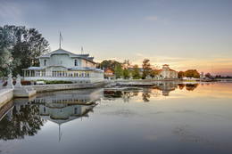
JurmalaDie Stadt Jūrmala (die fünftgrößte in Lettland) ist im Jahr 1959 gegründet worden, indem die Städte Ķemeri und Sloka mit dem Bezirk Jūrmala der Stadt Riga vereinigt wurden. Die Stadt dehnt sich 32 km entlang der Küste der Rigaer Bucht. Der Kurort von Jūrmala war früher einer der bedeutendsten seiner Art in Nordeuropa. Diese Tatsache hat auch die Entwicklung des einheimischen und des internationalen Transports und des Verkehrs (Postwagen, Dampfer, Zug) gefördert. Die ersten Kurgäste wurden in Dubulti aufgenommen, wo im Jahr 1834 das erste Sommerhaus, aber im Jahr 1847 – das erste Kurhaus gebaut wurde. Im 19. Jh. wurden die ersten Heilanstalten geöffnet. Ab dem Jahr 1834 wurde mit dem Bau der Sommerhäuser begonnen. Die Entwicklung des Kurortes wurde von dem Ersten Weltkrieg unterbrochen. Nach dem Krieg begann der Kurort aufzublühen und die Zahl der Feriengäste stieg von 12 000 (1920) auf 32 000 (1935). Neben Jūrmala entwickelte sich auch der Kurort Ķemeri, der während der Sowjetzeit zum Ort des Massentourismus geworden war. Heute ist Jūrmala als ein Ort bekannt, wo Konzerte, Festspiele, Ausstellungen, Sportwettbewerbe und andere öffentliche Veranstaltungen stattfinden. 22
Leistungen
22km - Entfernung von der Hauptstadt |
 |
Lettland
Landgut von ValmiermuizaBefindet sich im Nordteil von Valmiera. Das Herrenhaus des Landguts (im Stil des Neobarocks) wurde vom Herzog Peter August von Schleswig-Holstein-Sonderburg-Beck von 1764 bis1771 gebaut. Später gehörte es anderen verschiedenen Besitzern. Gemäß den heutzutage gefundenen Informationen kann man behaupten, dass das Herrenhaus des Landguts am Anfang des 20. Jahrhunderts ein einstöckiges Gebäude mit einem barockalen Türmchen und einem nebenstehenden zweistöckigen Korpus war. Das Haus diente als Sommer- und Jagdhaus. 1918 wurde das Gebäude verbrannt. Zwei Jahre später wurde im Landgut von Valmiermuiža ein Gefangenenlager eingerichtet. Später wurde den Anbau des Herrenhauses erneuert und als Schule verwendet. 1936 wurde im Gebäude ein Gefängnis eingerichtet, das während des Zweiten Weltkriegs als Haftanstalt der Gefangenen diente. Später wurde das Gebäude verbrannt und die Ruinen abgebaut worden sind. Bis heutzutage ist der Turm von Valmiermuiža erhalten geblieben. Die Deckenmalerei der Turmräume sowie der Park sind Kulturdenkmäler. Heutzutage ist neben dem historischen Ort die Brauerei von Valmiermuiža errichtet und das Landgut von Valmiermuiža hat die zweite Luft bekommen! 111
1-12
Leistungen
111km - Entfernung von der Hauptstadt
1-12 Aktive Saisonmonate |
|
|
Lettland
KalkisKaļķis – ein bewohnter Ort, wo immer noch
in offenen Steinbrüchen („Kalnciems2“)
Dolomit gewonnen wird. Ein Teil von den
Steinbrüchen ist überflutet.
46
Leistungen
46km - Entfernung von der Hauptstadt |
 |
Litauen
Kretonu vienielas ciems (Kretuonių gatvinis kaimas)Kretoņu (Kretuonas) ezera dienvidu krastā (ezeru gan neredz aizauguma dēļ) meklējams Kretoņu ciems. Šķiet, ka šī vieta ir „aizķērusies" pagātnē. Cauri ciemam iet viena iela, kurai abās pusēs izvietojušās 19. – 20. gs. mijā (dažas pat mazliet agrāk – 19. gs. vidū) celtās saimniecības. Te redzamas gan dzīvojamās, gan saimniecības ēkas, kuras rada etnogrāfiska brīvdabas muzeja sajūtu. Dažas no tām gan ir „padevušās" laika zobam. Lai vai kā, šis ir viens no neparastākajiem nacionālā parka etnogrāfiskajiem ciemiem, kuru pa „galveno ielu" vērts izstaigāt visā garumā. Šim, tāpat kā pārējiem etnogrāfiskajiem ciemiem ir piešķirts kultūras mantojuma objekta statuss. 106
Leistungen
106km - Entfernung von der Hauptstadt |
 |
Lettland
Lielie MulkiApdzīvota vieta ~ 1 km dienvidos no Daugavpils – Krāslavas (A 6) ceļa, kas pazīstama ar savu neparasto nosaukumu. Interesanti, ka vietvārds saistīts arī ar iedzīvotāju uzvārdiem, ko var redzēt tāda paša nosaukuma kapos. Ciema apkaimē pazīstams ir Lielo Muļķu svētavots, kuru gan nezinātājam ir grūti atrast, tādēļ ieteicams izmantot vietējā gida pakalpojumus, apvienojot šīs vietas izziņu ar biškopības saimniecības „Cīruļi” apskati. 254
Leistungen
254km - Entfernung von der Hauptstadt |
 |
Estland
HaapsaluHaapsalu was once loved by aristocrats who stayed here during summers, nowadays this town is very appealing to its visitors because of its essence - tiny streets, old wooden buildings and promenade. Worth mentioning are also town's SPAs which were one of the reasons why Haapsalu was so popular its earlier years. Interesting enough, the famous composer Tchaikovsky considered this place one of his favorite's for spending the holidays.  100
100
Leistungen
100km - Entfernung von der Hauptstadt |
 |
Lettland
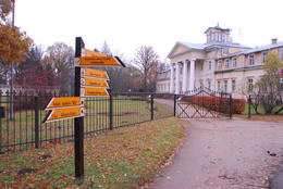
Cesis Der Ursprung der Stadt ist auf dem 18m hohen Riekstu kalns (Nussberg) und dessen Umgebung zu suchen, denn im 11. -13. Jh. befand sich hier die Holzburg Venden. Der Nussberg befindet sich in der Mitte des Burgparks, von dort hat man eine schöne Aussicht auf den Park, den Weiher und die Burgruine von Cēsis , wohin man gelangt, wenn man die lange kaskadenartige Treppe hinuntersteigt. Die im 13. Jh. gebaute Burg von Cēsis war Residenz des Ordensmeisters und eine der stärksten Ordensfestungen im gesamten Baltikum. Daneben befindet sich das neue Schloss, das 1777 an der Stelle der Torbefestigungen erbaut worden ist. Das Gebäude beheimatet das Museum für Geschichte und Kunst der Stadt, in einem Anbau befindet sich das Besucherzentrum des Schlosses und das Touristikinformationszentrum von Cēsis. Wenn man den Turm besteigt, hat man Aussicht auf die Burgruine, auf die lutherische Kirche und den Nordteil der Stadt. Gegenüber des neuen Schlosses gibt es noch mehrere Gebäude – den Stall und den Wagenunterstand des Schlosshofes (beide Gebäude wurden Anfang des 19. Jh. gebaut), wo heute das Ausstellungshaus Cēsis (Cēsu Izstāžu nams) eingerichtet ist. Auf dem Schlossgelände kann man von außen noch die Scheune, das Kutscherhäuschen sowie die alte Bierbrauerei sehen. Auf der gegenüberliegenden Seite der Straße befindet sich der romantische Mai-Park (Maija parks), der in den 30er Jahren des 19. Jh. angelegt worden war. Begibt man sich weiter in die Straßen der Stadt (Lielās Katrīnas, Mazās Katrīnas, Mazā Kalēju, Kalēju, Lielā Līvu iela un Līvu laukums), kann man Holzbauten des 18. und 19. Jh. sehen. In der Torņa ielā (Turmstraße), die entlang der Schutzmauer der mittelalterlichen Burg verläuft, kann man an der Kirche die Skulptur mit dem Namen „Durch die Jahrhunderte“ von Matthias Janson sehen. Der Sage nach kann man, wenn man die Laterne des Nachtwächters reibt, in die Zukunft sehen. 87
Leistungen
87km - Entfernung von der Hauptstadt |
 |
Estland
KuressaareDie Hauptstadt von der Insel Saaremaa. Der populäre Kurort. Das Rathaus im Barockstil. 217
Leistungen
217km - Entfernung von der Hauptstadt |
 |
Litauen
Salos II (Salos II)Maza apdzīvota vieta ar dažām viensētām uz pussalas (salos tulkojumā no lietuviešu valodas nozīmē „sala") starp vairākiem ezeriem. Salos II ir viens no sešiem Augštaitijas nacionālā parka etnogrāfiskajiem ciemiem. Ciems patiks tiem, kas meklē ļoti nomaļas vietas ar vecām guļbaļķu dzīvojamām un saimniecības ēkām. No Salos II pa sauszemes maršrutu var doties pārgājienā līdz Ladakalnim un Ginuču pilskalnam (sk. iepriekš). 121
Leistungen
121km - Entfernung von der Hauptstadt |
 |
Estland
Mulgimaa historic regionMulgima or Mulgi is a cultural and historical region in the south of Estonia. The part of Viljandi county located south of the rivers Raudna and Tenasilma was considered to be region of Mulgimaa. In ancient times, Mulgi farmers were famous for their sharp minds and determination, which helped to buy land from German-Baltic nobles and become rich farmers. The icons of Mulgi culture - the dialect, the well-known men's long black jacket and the traditional Mulgi porridge - have survived to this day.  160
1-12
160
1-12
Leistungen
160km - Entfernung von der Hauptstadt
1-12 Aktive Saisonmonate |
 |
Lettland
Kolka (Kuolka)Zum ersten Mal wurde Kolkaurkundlich als Domesnes 1387 erwähnt und war mit diesem Namen bis zum Anfang des 20. Jh. bekannt. Nach den Angaben des Kirchenbuches von Irbe – Ģipka gab es 1770 in Kolka 4 Bauernhöfe: Krogi, Ūši, Vecvagari und Kabriki. 1844 wurde in Kolka eine Küsterschule eröffnet, in der Nika Polmanis als Lehrer gearbeitet hat, das erste Schulgebäude von Kolka wurde 1881 erbaut. Fast ein halbes Jahrhundert arbeitete dort als Lehrer der Live Kārlis Bernšteins (1881–1951). Als Führer des Aufstandes von Dundaga, der 1859 begann, ist der Sohn des Bauern von Sārnasti in Kolka, der Live Nika Šūbergs (1833–1884) anzusehen. Ende des 19. Jh. gab es in Kolka 392 Einwohner, aber 1935 sind von 343 Einwohnern 145 Liven gewesen. In den 30er Jahren des 20. Jh. sprachen in Kolka 13 Liven fließend livisch. Kolka ist das einzige Dorf an der livischen Küste, das sich auch während der sowjetischen Regelung des Küstengebietes weiter entwickelte, da es zu einem Zentrum der Fischerkolchose wurde. In den 50er–60er Jahren nahm die Bevölkerungszahl schnell zu, es wurden neue Häuser, eine Schule, ein Gesellschaftshaus, ein Kindergarten und Fischverarbeitungsfabriken gebaut. Heute ist Kolka mit 700 Einwohnern das größte Dorf an der livischen Küste. Hier gibt es die Fischverarbeitungsfabrik Līcis-93, lokale Fischer und Fischräuchereien, das Livische Zentrum „Kūolka“ und die livische Musikgruppe „Laula“. Im Bauernhof Ūši kann man livische Gerichte verköstigen. 156
Leistungen
156km - Entfernung von der Hauptstadt |
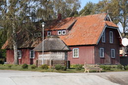 |
Litauen
PervalkaEin ehemaliges Fischerdorf am Ufer des Kurischen Haffs. Aufgrund der Wanderdünen hat seinen Standort mehrmals seit dem Anfang des 19.Jh. geändert. Holzbebauung mit einheitlichem Stil und Traditionen. 344
Leistungen
344km - Entfernung von der Hauptstadt |
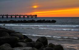 |
Litauen
PalangaPalanga is known to be the biggest by-the-sea resort in Lithuania because of its seacoast's main attractions - dunes and white sand. And because Palanga is a resort there are plenty of cafes, restaurants, bars and more for those who would like to enjoy a meal or a drink, for those who like active sport - there is possibility to cycle, go horseback riding, swim and much more. 331
Leistungen
331km - Entfernung von der Hauptstadt |
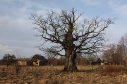 |
Lettland
VidaleEine kleine Ortschaft mit einer Schule, einer Bibliothek und einem Geschäft. Nördlich von Vīdale kann man die Reste einer Windmühle besichtigen. Wenn man die Richtung Rigaer Bucht nimmt, kreuzt die Straße die Blauen Berge von Šlītere mit Sandsteinwänden und mit eindrucksvollen Aussichten in den Jahreszeiten, wenn die Bäume keine Blätter haben. Auf der linken Seite kann man die Quelle der Blauen Berge sehen, wo eine Stelle zum Wassernehmen eingerichtet ist. Die Straße, die von Vīdale nach Melnsils führt, nennen die Einheimischen den Damm Knipeldambis. Die Straße soll von der Deutschen Armee während des Ersten Weltkriegs gebaut worden sein, indem auf dem Weg Rundhölzer gelegt und mit Kies beschüttet wurden. 150
Leistungen
150km - Entfernung von der Hauptstadt |
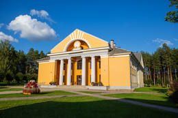 |
Lettland
SedaSeda is one of the most unusual towns in Latvia. It began its life as a housing area for people from the local peat moss factory, and that happened in the 1950s and 1960s. This is a “vivid” example of Soviet architecture, with a central square (complete with a monument to the Leader) and streets radiating from it. Worth a visit is the cultural centre at the end of Uzvaras Street. It is a great example of so-called Stalinist Classicism architecture. 134
Leistungen
134km - Entfernung von der Hauptstadt |
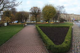 |
Lettland
Rozu laukumsИстоки площади Роз уходят в 1911 - 1913 гг., когда на этом месте разбили открытый сад с > 500 кустами роз. В советское время рядом с площадью Роз был установлен памятник Ленину. Восстановленную в 2000 году площадь окружает Лиепайская Педагогическая академия, гостиница «Лива», Центр бизнеса и сделок De Rome (построен в XIX веке, архитектор Пауль Макс Берчи, бывшая гостиница «Рим») и Лиепайский дом латышского общества (камень в основание заложил Карлис Ульманис в 1934 г.). По бордюрам грядок роз размещены памятные знаки городов содружества Лиепаи. К площади Роз подходит улица Зивью (Рыбная), получившая свое название от когда-то существовавшего рыбного рынка. На улице Зивью находится Аллея славы латвийских музыкантов (с 2006 г.), где установлено 35 плит с бронзовым рельефом ладоней музыкантов, 10 плит, посвященные популярным латвийским музыкальным группам, а 5 – ушедшим в мир иной. Здесь же установлена самая большая гитара Латвии. 216
Leistungen
216km - Entfernung von der Hauptstadt |
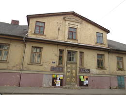 |
Lettland
SaldusSaldus ist in den historischen Quellen schon im Jahr 1253 erwähnt worden. Bis zum 13. Jh. befand sich hier die alte Burg der Kuren Salden, die auch im Wappen der Stadt dargestellt ist. Um 1341 hat der Livländische Orden unweit von dem Burgberg der Kuren eine Burg gebaut, an der sich eine Siedlung herausgebildet hat. Wie andere Ortschaften von Kurland hat Saldus ihre Blütezeit während der Regierungszeit des Herzogs Jacob von 1642 bis 1682 erlebt. Als das Gründungsjahr von Saldus wird das Jahr 1856 genannt, als mit den Erneuerungsarbeiten des im Nordischen Krieg zerstörten Ortes begonnen wurde. Am Ende des Zweiten Weltkriegs ereigneten sich in der Nähe der Stadt schwere Kämpfe, aber bis zum 8. Mai 1945 blieb die Stadt in dem Teil von Lettland, der von der deutschen Armee besetzt war. Heute zieht die Stadt Saldus mit ihren Veranstaltungen – mit den Stadttagen, mit dem Musikfestival Saldus Saule (Die Sonne von Saldus), sowie mit verschiedenen Sehenswürdigkeiten an, unter denen man die Druvas pārtika AG, wo man den Prozess der Eisherstellung beobachten kann, und die Saldus pārtikas kombināts GmbH nennen kann, wo man die leckeren Bonbons Gotiņa probieren und den Herstellungsprozess beobachten kann. 120
1-12
Leistungen
120km - Entfernung von der Hauptstadt
1-12 Aktive Saisonmonate |
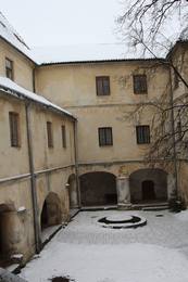 |
Lettland
JaunpilsDie Entwicklung von Jaunpils ist mit der Burg des Livländischen Ordens verbunden, die bis heute ihre Gestalt und ihr Aussehen kaum verändert hat. Von 1561 bis 1919 war die Burg im Besitz der Familie von der Recke. Im Jahr 1905 brannte die Burg, aber später wurde sie unter der Leitung des Architekten Wilhelm Bockslaff erneuert. Wesentliche Restaurationsarbeiten wurden in den 1960er Jahren angefangen. Heute kann man in der Burg ein Museum besichtigen, aber Feinschmecker können in der Burgkneipe mittelalterliche Gerichte genießen. 88
Leistungen
88km - Entfernung von der Hauptstadt |
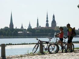 |
Lettland
Riga, Altstadt (Vecriga)Die Hauptstadt Lettlands. Die Altstadt Rigas ist in die UNESCO Liste des Weltkulturerbes aufgenommen worden. Die Jugendstilperle Europas. Die ehemalige Hansestadt. |
 |
Lettland
Ventspils Tirgus laukumsTāpat kā Ventspils Rātslaukums, arī Tirgus laukums ir uzskatāms par pilsētas vēsturiskā centra nozīmīgu daļu, kura apkaimē ir saglabājies senais ielu plānojums. Kādreizējā Rātsnama vietā tagad slejas kariljonu zvana pulksteņu tornis. Tas zvana katru stundu, bet 12:33:44 un 00:33:44 ar īpašu melodiju ieskandina astronomisko Ventspils laiku. Tirgus laukumā ir aka, kas saulainā laikā darbojas arī kā Saules pulkstenis. Monētu automātā var izkalt īpašu piemiņas monētu. 191
Leistungen
191km - Entfernung von der Hauptstadt |
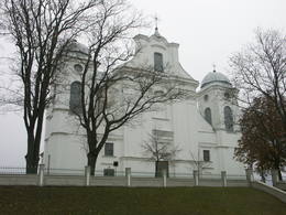 |
Lettland
DagdaDagda ist in den historischen Quellen im 17 Jh. als eine Ortschaft der Händler erwähnt worden. Im Jahr 1772 wurde der Kreis von Dagda dem Gouvernement Pleskau, aber im Jahr 1802 – dem Gouvernement Witebsk hinzugefügt. Im Jahr 1905 fanden hier große Bauernaufstände statt, während denen viele bedeutsame Baudenkmäler zerstört wurden. Die Stadt wurde auch von den beiden Weltkriegen nicht geschützt. Was kann sich der Reisende hier anschauen? Im Zentrum von Dagda hat sich die historische Bebauung aus dem 20. Jh. erhalten. Diese Bebauung bilden die sogenannten Häuser der jüdischen Händler, die aus roten Ziegeln gebaut wurden. Dagda ist der einzige Ort in Lettland, wo jedes Jahr im Stadtpark der Anna-Tag gefeiert wird! 266
Leistungen
266km - Entfernung von der Hauptstadt |
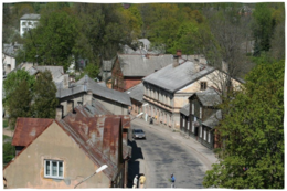 |
Lettland
ValdemarpilsValdemārpils ist ein kleines und leises Städtchen am Ufer des langen Sasmaka-Sees. Schon am Anfang des 17. Jahrhunderts entstand auf dem Boden des Landguts von Sasmaka eine Siedlung der Handwerker und Kaufleute. In der Mitte des 19. Jahrhunderts wohnten in den Städten von Kurland viele jüdische Kaufleute und Handwerker, deswegen nannte man damals Sasmaka die jüdische Hauptstadt. 1926 wurde die Stadt in Valdemārpils umbenannt. Das historische Zentrum der Stadt mit der Bebauung des 19. Jahrhunderts ist ein städtebauliches Denkmal. In Valdemārpils sind die lutherische und orthodoxe Kirchen, die ehemalige Synagoge, ein Denkmal für K. Valdemārs, sowie die großartige Elku-Linde zu besichtigen. 131
1-12
Leistungen
131km - Entfernung von der Hauptstadt
1-12 Aktive Saisonmonate |
|
|
Lettland
IecavaEine kleine Stadt unterwegs von Riga nach Bauska. Der Name der Stadt ist in den schriftlichen Quellen im Jahr 1492 erwähnt worden. Hier kann man die evangelisch-lutherische Kirche und den Park des ehemaligen Landgutes besichtigen. 42
Leistungen
42km - Entfernung von der Hauptstadt |
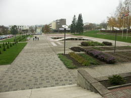 |
Lettland
MadonaDie Stadt Madona ist möglicherweise die einzige Stadt in Lettland, auf deren Gebiet sich im 9. Jh. eine Wassersiedlung befand. Die Reste dieser Siedlung haben sich unter Wasser im Norden des Sees Salas ezers / Baznīcezers (Inselsee oder Kirchensee) erhalten. Bis zum Ende des 19. Jhs. befand sich an der Stelle der heutigen Stadt ein kleines Landgut, das denselben Namen Madona hatte und das die Letten Birži genannt haben. Im Jahr 1898 wurde mit dem Bau der Schmalspurbahn zwischen Stukmaņi (Pļaviņas) und Valka begonnen. Mit der Entwicklung der Eisenbahn entwickelte sich auch die Stadt selbst. Heute ist die Stadt Madona eine gepflegte Stadt mit ihrem der Kleinstadt charakteristischen Charme. Es ist interessant, dass diese Stadt als eine der am höchsten ü.d.M. gelegene Stadt in Lettland angesehen werden kann. 169
Leistungen
169km - Entfernung von der Hauptstadt |
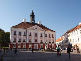 |
Estland
Altstadt von TartuGelegen am linken Ufer des Emajõgi Flusses, am Fuß des Dombergs. Der Mittelpunkt der Altstadt ist der im Stil des Klassizismus gebaute Rathausplatz mit dem Rathaus und dem Springbrunnen „Die küssenden Studenten“, der ein Stadtsimbol ist. 185
Leistungen
185km - Entfernung von der Hauptstadt |
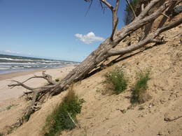 |
Lettland
JurkalneDer frühere Name von Jūrkalne war Felixberg, der übersetzt den glücklichen Berg bedeutet. Den heutigen Namen hat die Ortschaft im Jahr 1925 bekommen. Heute ist Jūrkalne nicht nur ein beliebter Ort von Touristen (die Steilküste von Jūrkalne), aber auch einer der seltenen Orte der Welt, wo man die Blauen Kühe besichtigen kann. 191
Leistungen
191km - Entfernung von der Hauptstadt |
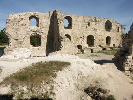 |
Lettland
Mittelalterliche Burg von KokneseDie Geschichte von Koknese ist mit dem Bau der gemauerten Burg des Bischofs im Jahr 1209 an dem Zusammenfluss der Flüsse Daugava und Pērse verbunden. Die Burg von Koknese war ein bedeutender Kontrollpunkt auf dem Wasserweg Daugava, der nicht besetzt bis zum Jahr 1701 bestand, als die Burg von dem sächsischen Heer gesprengt wurde. Bis zur Bildung des Stausees des Wasserkraftwerks von Pļaviņas befand sich an diesem Ort der Felsen von Daugava, der einer der landschaftlich schönsten und von den Touristen am meisten besuchten Orte in Lettland war. Nördlich von den Burgruinen befindet sich der im Jahr 1900 eingerichtete Park von Koknese mit mittelalterlichen Friedhofsdenkmälern und schwedischen Kanonen aus dem 17. Jh. Die Reisenden können hier die Burg besichtigen, eine Bootsfahrt unternehmen, sowie mittelalterliches Geld prägen. 100
Leistungen
100km - Entfernung von der Hauptstadt |
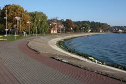 |
Litauen
NidaEin altes Dorf, die größte Ortschaft auf der Kurischen Nehrung. Ein populärer Kurort seit dem 19 – 20 Jh. 357
Leistungen
357km - Entfernung von der Hauptstadt |
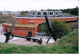 |
Litauen
KopgalisSchon seit der früheren Zeiten – ein Platz von der militärischen und strategischen Bedeutung. Für den Schutz des Hafens von Klaipeda wurde 1866 von preussischer Militär den Bau einer Festung angefangen. Im Laufe des 2.Weltkriegs wurde die Festung in die Luft gesprängt. Die Renovierung begann 1979. 311
Leistungen
311km - Entfernung von der Hauptstadt |
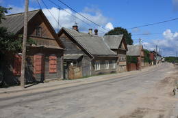 |
Lettland
LudzaDie Siedlung wenigstöckiger Holzhäuser entstand im 19.Jh. Hier kann man für Latgale typische geschlossene Innenhöfe, Veranden, Holzverzierungen und Dekors sehen. Die Holzarchitektur der Stadt litt schwere Schäden in Bränden 1866 und 1938. Als das historische Zentrum der Stadt kann man den Marktplatz betrachten, als herausragende Dominate den Burghügel von Ludza, um den herum sich das Netz der Straßen der Stadt gebildet hat. Ende des 14. Jh. befand sich auf dem Burghügel eine alte lettgalische Holzburg, an deren Stelle der Livonische Orden die mächtigste Steinburg Latgales erbaute. 1654 wurde diese von den Streitmächten des russischen Zaren Alexej Michailowitsch zerstört. Vom Burghügel aus bietet sich einer der interesantesten Blicke über Latgale und die älteste Stadt Lettlands mit ihrem historischen Zentrum.  266
266
Leistungen
266km - Entfernung von der Hauptstadt |
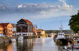 |
Litauen
KlaipėdaDie ehemalige Stadt Memel. Die einzige Hafenstadt Litauens mit einer Altstadt. 308
Leistungen
308km - Entfernung von der Hauptstadt |
|
|
Lettland
AizputeEine der ältesten Städte in Lettland: Aizpute ist in den historischen Quellen schon im Jahr 1378 erwähnt worden. Als eine Ortschaft bildete sich Aizpute an den Ufern des Flusses Tebra (an der Straße Riga – Preußen) heraus, wo sich früher die hölzerne Burg Beida des kurischen Landes Bandava befand. Im Mittelalter war Aizpute das Zentrum des Bistums Kurland. Nach der Eingliederung von Kurland in das Russische Reich im Jahr 1795 haben sich in Aizpute Juden niedergelassen. Heute werden die Reisenden in Aizpute von der alten Stadtbebauung, von dem historischen Stadtzentrum und von den Burgruinen angezogen. 178
Leistungen
178km - Entfernung von der Hauptstadt |
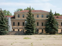 |
Lettland
DaugavpilsAls das Gründungsjahr von Daugavpils wird das Jahr 1275 angesehen. Das ist die Zeit, als der Heermeister des Livländischen Ordens Ernst von Ratzeburg auf dem Burgberg von Naujene die Burg Dinaburga (Dünaburg) gebaut hat. Die Burg hat mehrmals unter litauischen und russischen Einfällen gelitten, bis sie im Jahr 1557 von dem russischen Heer unter der Leitung von Iwan dem Schrecklichen zerstört wurde. Nach diesem Ereignis wurde die Dünaburg 17 km weiter am rechten Ufer des Flusses erneuert, wo sich heute die Stadt Daugavpils befindet. In der Zeit zwischen 1810 – 1833 wurde eine neue Festung gebaut. Im Jahr 1826 wurde mit dem Bau des heutigen historischen Zentrums begonnen. Während des Ersten Weltkriegs wurden die wichtigsten Industrieunternehmen mit ihren Mitarbeitern nach Russland abtransportiert. Während der ersten Unabhängigkeit Lettlands blühte das Kulturleben von Daugavpils auf. Der größte Teil der Stadt wurde während des Zweiten Weltkriegs – im Juli 1944 – zerstört. Heute ist Daugavpils die zweitgrößte Stadt in Lettland und ein bedeutendes wirtschaftliches Zentrum der historischen Region Latgale. Vor einiger Zeit wurden Rekonstruktionsarbeiten in der Festung von Daugavpils begonnen, die auch in Europa einzigartig ist. 229
Leistungen
229km - Entfernung von der Hauptstadt |
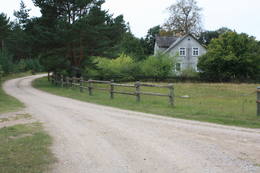 |
Lettland
OvisiEine alte Ortschaft. In den 30er Jahren des 20. Jh. gab es hier 50 Bauernhöfe, aber im Jahr 1990 nur noch zehn. In Oviši ist der Wissenschaftler livischer Herkunft; der Entomologe Kārlis Princis (1893–1978) geboren, der 1944 nach Schweden ausreiste. Oviši Leuchtturm (1814) ist der älteste immer noch funktionierende Leuchtturm in Lettland mit einer Höhe von 38 m. Von hier oben bietet sich eine herrliche Aussicht. Das Personalgebäude des Leuchtturms wurde 1905 erbaut und war einst der Bahnhof der Schmalspurbahn. Im Nebengebäude wurde das Museum des Oviši Leuchtturms eingerichtet. In der Nähe des Leuchtturms befindet sich das Kunstobjekt Austra-Baum aus Metall. Dem Kap Oviši gegnüber ist ein guter Ort zurVogelbeobachtung. 203
Leistungen
203km - Entfernung von der Hauptstadt |
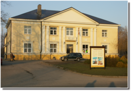 |
Lettland
LapmezciemsObwohl von den 104 Dorfhäusern im Ersten Weltkrieg 97 Häuser zerstört wurden, hat sich das Dorf Lapmežciems am Ende der 1930er Jahre schnell erholt, und da arbeitete eine der stärksten Fischergenossenschaften der lettischen Küste. Während der Sowjetzeit wurde hier eine der größten Fischerkolchosen Selga gegründet, deren Gebäude bei der Mündung des Flusses Siliņupe zu sehen sind. Heute ist Lapmežciems ein beliebter Sommerhäuserbezirk, Erholungs- und Badeort. Als ein interessantes Denkmal der Fischereigeschichte kann man hier die ehemalige Anlegestelle der Fischerboote von Lapmežciems besichtigen, wo die Fischer Netzhütten gebaut und ihre Werkzeuge aufbewahrt haben. Zwischen der Pīlādžu Straße und dem linken Ufer des Flusses Siliņupe befand sich vom 3. – 2. Jahrtausend v. Ch. eine Fischer- und Jägersiedlung, an deren Stelle ein Denkmal aufgestellt ist. Dieser Ort ist die älteste bekannte Siedlung auf dem Gebiet des Nationalparks von Ķemeri. Ein Teil der Funde kann man im Museum von Lapmežciems besichtigen, wo eine heimatkundliche Ausstellung eingerichtet und das Material über die Kämpfe der finnischen Jäger in der Umgebung von Klapkalnciems gesammelt worden ist. 44
Leistungen
44km - Entfernung von der Hauptstadt |
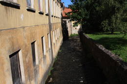 |
Lettland
Historisches Zentrum am Fluss AleksupiteDas einzige Baukomplex aus dem 17. – 18. Jh. solcher Art im Baltikum, entstanden an den Ufern eines kleinen Flusses. Stellenweise fließt der Fluss entlang den Hauswänden. Das lettische Venedig. 154
Leistungen
154km - Entfernung von der Hauptstadt |
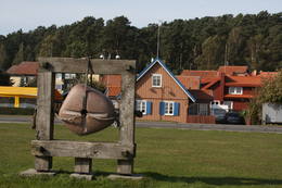 |
Litauen
JuodkrantėEin altes Fischerdorf, das schriftlich 1429 erwähnt wurde. Heute – ein populärer Kurort. 328
Leistungen
328km - Entfernung von der Hauptstadt |
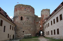 |
Lettland
BauskaDer Name von Bauska ist in den historischen Quellen zum ersten Mal 1443 erwähnt worden. Das ist die Zeit, als auf der Halbinsel zwischen den Flüssen Mūsa und Mēmele mit dem Bau der Burg begonnen wurde, die die letzte Burg des Livländischen Ordens auf dem Gebiet Lettlands war. An der Burg – auf der Insel Ķirbaksala hat sich die Ortschaft Vairogmiests herausgebildet. Im 17. Jh. blühte die Stadt schnell auf. Hier arbeiteten Goldschmiede, Silberschmiede, Tischler, Töpfer, Schuhmacher und andere Handwerker. In den späteren Jahrhunderten haben die Einwohner der Stadt unter Kriegen, unter der Pest und der Napoleonischen Armee gelitten. Heute ist die Altstadt von Bauska mit ihrem neu gebauten Rathaus und mit der erneuerten Burg von Bauska eines der interessantesten historischen Zentren der lettischen Städte. Bauska ist mit ihren jährlichen Veranstaltungen bekannt: Mit dem Festival der Alten Musik, dem Stadtfest von Bauska, dem Festival der Countrymusik u.a. 67
Leistungen
67km - Entfernung von der Hauptstadt |
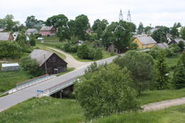 |
Litauen
Zemaisu Kalvarija (Zemaicių Kalvarija)Pirmo reizi vēstures avotos 1253. g. šī vieta ir minēta kā kuršu apdzīvota apmetne. Laikā no 1637. – 1639. g. te uzcēla pirmās 19 kapelas – t.s. „Krusta ceļa stacijas", kas atgādināja Jeruzalemes Krusta ceļu. Kopš tā laika Žemaišu Kalvarija ir pazīstama kā nozīmīgs svētceļnieku galamērķis. Dažas no Krusta ceļa kapelām ir veidotas 17. – 18 gs., bet citas – 19. gs. Jāatceras, ka vēl pavisam nesen – Padomju laikos svētceļniekus nežēlīgi vajāja un represēja. Mūsdienās pilsētā ir izveidots 21 svētceļnieku „pieturas punkts". Te ik gadu (parasti no 2. – 12. jūlijam) notiek Žemaišu Kalvarijas katoļu draudzes svētki, kas pulcina daudz ļaužu no dažādām Eiropas valstīm. Iespaidīgā katoļu bazilika ir slavena ar Vissvētākās Jaunavas Marijas Katoļu Ģimeņu Karalienes gleznu, kas 17. gs. atvesta no Romas. Tai piedēvē brīnumdarītājas spējas. Interesants ir pilsētas ielu tīklojums, kas atgādina 9. – 13. gs. apdzīvotas vietas ielu plānojumu. Noteikti apskatāms iespaidīgais Žemaišu Kalvarijas pilskalns, kas slejas mazās Varduvas (Varduva) upītes krastā. 311
Leistungen
311km - Entfernung von der Hauptstadt |
|
| |
 |
Lettland
SalaspilsEine der neuesten Städte in Lettland. Im Jahr 2013 wird die Stadt ihr 20. Jubiläum feiern. In Salaspils befinden sich mehrere in Lettland bedeutende wissenschaftliche Institutionen (während der Sowjetzeit wurde die Stadt zu einem Zentrum für Wissenschaft gebildet): Institut für Biologie, Institut für anorganische Chemie, Institut für Physik, der Nationale Botanische Garten. Während der Sowjetzeit befanden sich hier der ehemalige Kernreaktor von Salaspils und das Institut für Forstwissenschaft Silava. In den letzten zehn Jahren hat sich die Infrastruktur der Stadt entwickelt, es sind mehrere große Bezirke mit Einfamilienhäusern entstanden. Im Jahr 1996 wurde in Salaspils eine neue katholische Kirche gebaut. Ihrem Wesen nach ist die Stadt ein Schlafbezirk der Hauptstadt Riga. 18
Leistungen
18km - Entfernung von der Hauptstadt |
|
|
Lettland
StrenciEine Floßhauptstadt Lettlands mit dem jährlichen Flößerfest im Mai. 129
Leistungen
129km - Entfernung von der Hauptstadt |
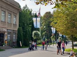 |
Lettland
OgreDie archäologischen Ausgrabungen zeugen davon, dass die Ufer des Flusses Ogre von Liven bewohnt waren. Zu einer größeren Ortschaft und zu einem bedeutenden Kurort entwickelte sich Ogre nach dem Ausbau der Eisenbahn Rīga-Daugavpils im Jahr 1861. Bis zum Ersten Weltkrieg haben in der Stadt Ogre ihre Dienstleistungen ungefähr 300 Sommerhäuser angeboten, die während des Krieges hauptsächlich zerstört wurden. Das nächste ‘große‘ Ereignis geschah im Jahr 1965, als in Ogre eine der in Europa größten Wirkwarenfabriken gebaut wurde, wo Gastarbeiter aus Vietnam und anderen Ländern arbeiteten. Heute hat die Stadt ihren Ruf als ein Kurort nicht wiedererlangt, aber sie ist zu einem ziemlich exklusiven Ort für den Bau von Privathäusern geworden. 36
Leistungen
36km - Entfernung von der Hauptstadt |
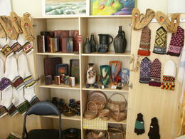 |
Lettland
LIVANIDie Anfänge von Līvāni als eine Ortschaft sind mit dem Jahr 1533 verbunden, als der damalige Grundbesitzer von Lieven ein Landgut herausgebildet und es in seinem Namen Lievenhof genannt hat. Im Jahr 1678 wurde hier die erste katholische Kirche gebaut. Die Stadt hat wesentlich unter beiden Weltkriegen gelitten. Der Name von Līvāni ist mit der Glasindustrie verbunden. Im Jahr 1887 wurde hier eine Glasfabrik gegründet, die heute nicht mehr arbeitet. 167
Leistungen
167km - Entfernung von der Hauptstadt |
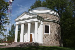 |
Lettland
PREILIIm 15. Jh. kam das Landgut von Preiļi im Besitz der Familie des Grafen von Borch. Die Familie von Borch hat hier bis in die 1860er Jahre gewirtschaftet. Die Stadt hat sich in der ersten Hälfte des 19. Jhs. herausgebildet, indem das Landgut, das Dorf und das Freidorf – die Niederlassung der Handwerker und der Händler – von Preiļi zusammengeflossen sind. Im 19. Jh. wurde in Preiļi ein prächtiges Schloss gebaut und ein Landschaftspark eingerichtet. Heute ist die Stadt ein bedeutendes Zentrum für Wirtschaft (für Käseherstellung und Näharbeiten) der Region Latgale, das seine Traditionen der Folklore, der Handwerker und des Katholizismus pflegt. Besonders empfehlenswert ist eine Führung in der Leitung von Irēna Kjarkuža, die bei der Touristeninformation von Preiļi arbeitet. 203
Leistungen
203km - Entfernung von der Hauptstadt |
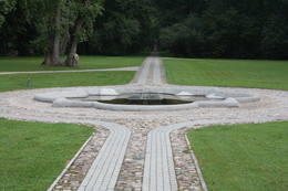 |
Lettland
SkriveriEine kleine Ortschaft an den Ufern des Flusses Daugava zwischen den Städten Aizkraukle und Jaunjelgava. Die Umgebung von Skrīveri ist mit dem Leben und den Arbeiten des bekannten lettischen Schriftstellers Andrejs Upītis verbunden. Unweit von Skrīveri befindet sich das älteste Dendrarium in Lettland. Mit der Einrichtung des Parks hat der Landgutinhaber von Skrīveri Maximilian von Sivers begonnen. In dem Park wachsen mehr als 400 Pflanzenarten, -sorten und formen. Eine der schönsten Aussichten auf Daugava kann man von den sogenannten Hügeln Kraukļu kalni (Rabenberge) genießen, die ein steiler Oberteil des linken Grundufers von Daugava ist und früher ein Burgberg war. 80
Leistungen
80km - Entfernung von der Hauptstadt |
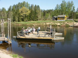 |
Lettland
LigatneDie Geschichte von Līgatne ist untrennbar von der Papierfabrik von Līgatne. Am Ende des 19. Jhs. und am Anfang des 20. Jh. wurden hier Wohnhäuser für Arbeiter, eine Schule, ein Entbindungshaus, ein Krankenhaus, ein Club, ein Gästehaus und andere Gebäude gebaut, die sich bis heute erhalten haben. Während der Sowjetzeit wurden in der Papierfabrik von Līgatne hauptsächlich Schulhefte hergestellt, die in alle sozialistischen Sowjetrepubliken geschickt wurden. Heute ist der Hauptrohstoff Altpapier, aus dem Einwickelpapier hergestellt wird. Die Papierfabrik von Līgatne ist das einzige noch arbeitende Unternehmen seiner Art in Lettland, und die Fabrik kann unter der Leitung eines einheimischen Reiseleiters besichtigt werden. Das historische Zentrum der Papierfabrik von Līgatne ist ein Kulturdenkmal. Im Norden von Līgatne, am Ufer von Gauja muss die Fähre aufgesucht werden, die als einzige Fähre über Gauja heute noch arbeitet und in den baltischen Ländern die einzige Fähre ist, die mit der Stromkraft des Flusses geleitet wird. Diese Fähre ist ein örtliches Transportmittel. Im Westen von Līgatne befinden sich die Naturpfade von Līgatne, wo in naturnahen Verhältnissen (die beste Sehenswürdigkeit dieser Art im Baltikum) Edelhirsche, Rehe, Wildschweine, Fuchse und Luchse leben. Auf dem Gebiet der Naturpfade von Līgatne sind ein dichtes Netz an Spazierpfaden und ein asphaltierter PKW- und Radweg eingerichtet worden, der im Winter für Langlauf verwendet wird. Hier befindet sich ein modernes Besucherzentrum. Im Osten von Līgatne – im Rehabilitationszentrum von Līgatne – kann man einen auch in Europa einzigartigen Ort finden: Den ehemaligen Bunker aus der Sowjetzeit, der als ein Wohnort und Arbeitsplatz für die höchsten lettischen Militär- und Zivilpersonen im Falle eines Atomkriegs oder beim Einsatz von chemischen Waffen gebaut wurde. Der Bunker wurde im Jahr 2003 geöffnet, darum ist es bis heute unberührt erhalten geblieben. Unterwegs von Augšlīgatne nach Līgatne muss der Park Vienkoču parks (Park der Einbäume) besucht werden, wo man die von Rihards Vidzickis gefertigten Einbäume, verschiedene Gebäudemodelle, ein Haus aus Sand besichtigen, sowie an verschiedene thematische Veranstaltungen teilnehmen kann. 69
Leistungen
69km - Entfernung von der Hauptstadt |
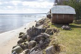 |
Lettland
MelnsilsEine alte livische Siedlung. Der livische Name der Siedlung lautet Mustanumm. Noch in der Mitte des 20. Jahrhunderts wohnten hier die Liven. Die Vertreter der Familien Landmaņis, Morics un Otomers haben in Melnsils bei der Mündung des Flusses Baķupīte in die Rigaer Bucht drei Segelschiffe gebaut. In Melnsils befinden sich zwei kulturhistorische Orte: der Kirchenberg Baķu – einen alten Sakralort und die Wallburg des Seeräubers Trommel. (Die Quelle: Roja TIZ) 144
1-12
Leistungen
144km - Entfernung von der Hauptstadt
1-12 Aktive Saisonmonate |
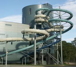 |
Litauen
DruskininkaiDer älteste und größte Kurort Litauens (seit 1794). Mikroklima (Luft der Umgebungswälder), salzhaltigee Quellen, Heilschlamm. Die Altstadt ist ein städtebauliches Denkmal. 128
Leistungen
128km - Entfernung von der Hauptstadt |
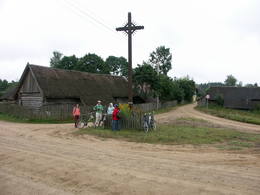 |
Litauen
Dorf ZervynosEin der ethnografischen Dörfer in Dzūkija mit Holzgebäuden und Kruzifix. 98
Leistungen
98km - Entfernung von der Hauptstadt |
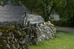 |
Estland
Dorf Koguva und Museum von MuhuDas Dorf Koguva an der Westküste der Insel Muhu ist ein hervorragendes Beispiel für die estnischen Bauernarchitektur. Die relativ gut erhaltenen Bauerngebäuden und Steinzaunen liegen alle unter Baudenkmalschutz. Im Museum von Muhu kann man einen ehemaligen reichen Strandhof Tooma erkundigen, der vor allem als Geburtsort des Schriftstellers Juhan Smuul bekannt. Hier sind auch eine alte Dorfschule und Textilausstellung. 162
1-12
Leistungen
162km - Entfernung von der Hauptstadt
1-12 Aktive Saisonmonate |
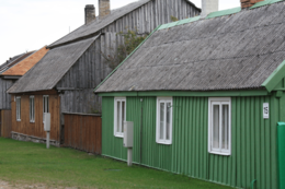 |
Lettland
PavilostaDie Stadt Pāvilosta ist eine ziemlich neue Stadt, die sich an der Küste der Ostsee bei der Mündung des Flusses Saka herausgebildet hat. Im Mittelalter befand sich der Hafen für Seeschiffe 6 km von der Küste entfernt – an dem Zusammenfluss der Flüsse Tebra und Durbe. Eine bedeutende Zeit war im Leben des Hafens die Regierungszeit des Herzogs Jacob, als hier Seeschiffe angelegt haben. In Folge des Polnisch-Schwedischen Krieges musste der Hafen von Saka geschlossen werden. Der heutige Hafen an der Mündung von Saka hat sich in der Mitte des 19. Jhs. an dem Fischerdorf Āķagals herausgebildet. Im Jahr 1878 wurden die Mündung des Flusses vertieft und die Molen gebaut. Hier wurden zweimastige Segelschiffe gebaut. Die Weltkriege haben die Schiffsflotte zerstört, aber die Fischereitraditionen wurden immer fortgesetzt. Im Jahr 1991 hat die Ortschaft den Status der Stadt erlangt. Heute ist Pāvilosta als ein beliebter Ort der Segler und Windsurfer, sowie der Sommerferiengäste bekannt. Auf die Segler wartet hier der Jachthafen. 217
Leistungen
217km - Entfernung von der Hauptstadt |
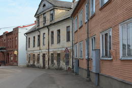 |
Lettland
Aizputes vesturiskais centrsAizputes pilsdrupas, akmens tilts pār Tebru, Jaunā pilsmuiža, ūdensdzirnavas un Sv. Jāņa luterāņu baznīca, kā arī 19. gs. beigās celtās koka ēkas starp Jāņa, Katoļu un Atmodas ielu veido neparastu pilsētbūvniecības kompleksu, kam piešķirts kultūras pieminekļa statuss. Staigājot pa vēsturisko centru, uzmanība jāpievērš ēku durvīm un to vērtnēm, logu ailēm, balkonu margām u.c. elementiem. 176
Leistungen
176km - Entfernung von der Hauptstadt |
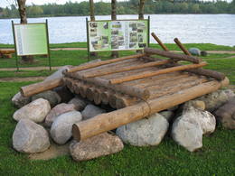 |
Lettland
PlavinasDie Umgebung von Pļaviņas und Stukmaņi war schon um 3. Jh. bewohnt. Während des Polnisch-Schwedischen Krieges (1600-1629) hatte an der Mündung des Flusses Aiviekste in den Fluss Daugava das schwedische Kriegslager Platz gefunden, von dem sich Befestigungsanlagen – Schützengraben erhalten haben, die einer der eindrucksvollsten militärischen Bauten dieser Art in Lettland sind. Als eine Ortschaft begann sich Pļaviņas in den 1890er Jahren und am Anfang des 20. Jhs. nach dem Bau der Eisenbahn zu bilden. Heute ist die Stadt Pļaviņas mehr mit der Herstellung der Dolomitsplitter und mit ihren Überschwemmungen im Frühling bekannt. 121
Leistungen
121km - Entfernung von der Hauptstadt |
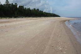 |
Lettland
Siedlung GipkaIn Ģipka wurde die erste Seefahrtschule in Kurland gegründet! Es geschah 1869 – einige Jahre nach der Gründung der Seefahrtschule in Ainaži. Diese Seefahrtschule war der 2. Kategorie, die die Steuermänner auf großer Fahrt und Kapitäne der Küstenschifffahrt vorbereitete. 1894 wurde die Schule nach Mazirbe verlegt. Vor der Eröffnung der Seefahrtschule befand sich seit 1860 in diesem Gebäude eine Schule, aber 1867 wurde für die Bedürfnisse der Seefahrtschule einen zweiten Stock gebaut. Das Gebäude ist bis heutzutage erhalten geblieben und ist in ein Wohnhaus umgebaut. Die Seefahrtschule (in Ģipka und Mazirbe) hat während ihrer 28-jahrigen Existenz mehr als 200 professionelle Seeleute vorbereitet und den Schiffbau in den livischen Küstensiedlungen gefördert. (Die Quelle: Roja TIZ) |
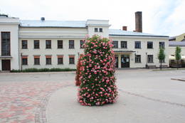 |
Lettland
Jekabpils AltstadtplatzDieser Platz ist das historische Zentrum der Stadt. An diesem Ort hat am 12. Februar 1670 der kurländische Herzog Jakob die Gründung der Stadt verkündet. Am Anfang des 20. Jhs. wurde auf den runden Steinen des Altstadtplatzes der Stadtmarkt veranstaltet. Heute befinden sich am Rand des Platzes das Kulturhaus, die Kirche der Uniaten unddas Zentrum für Touristeninformation. Auf dem Platz sollte man die Wasserpumpe, die große Waage und die Skulptur des Luchses (des Symboles von Jēkabpils) besichtigen. Von hier aus kann man mit einem Spaziergang durch das historische Zentrum vonJēkabpils beginnen, dem schmale Straßen und eine Bebauung mit kleinen Häusern charakteristisch sind. 141
Leistungen
141km - Entfernung von der Hauptstadt |
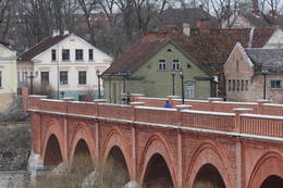 |
Lettland
KuldigaDie Stadt Kuldīga hat es verdient, als die schönste mittelalterliche Stadt in Lettland angesehen zu werden. An ihrer Stelle befand sich schon vor dem 13. Jh. das Zentrum des alten kurischen Landes Bandava. Im Jahr 1242 hat der Livländische Orden an der Stromschnelle des Flusses Venta mit dem Bau einer gemauerten Burg begonnen. An der Burg bildete sich eine Siedlung aus, die als erste in Kurland (1378) Stadtrechte erlangt hat. Eine bedeutende Rolle spielte auch ihre Mitgliedschaft der Hanse. Von 1561 – 1795 war Kuldīga die Hauptstadt des Herzogtums von Kurland. Es ist gesetzmäßig, dass in der ersten Hälfte des 17. Jhs. die Stadt einen schnellen wirtschaftlichen Aufschwung erlebte, der mit dem Nordischen Krieg und mit dem Anfang der Pestzeit endete. Der Stolz der Kurländer und das Fehlen von industriellen Objekten ist ein Grund dafür, dass während der Sowjetzeit keine größere Massen von Einwanderern in die Stadt gekommen sind, darum ist heute Kuldīga eine der lettischsten Städte von Kurland. Es ist wert, in Kuldīga mehr als einen Tag zu verbringen, weil hier es sehr viel zu tun gibt. Naturliebhaber können hier fliegende Fische beobachten, aber die Forscher der Kulturgeschichte haben hier ein breites Arbeitsfeld. 152
Leistungen
152km - Entfernung von der Hauptstadt |
|
|
Lettland
Ventspils OstgalsPilsētas rajons dienvidos no Ventas grīvas, kura mūsdienās redzamā mazstāvu koka apbūve sāka veidoties 19. gs. vidū. Ostgala pirmsākumi meklējami 1836. g., kad Krievijas valdība, solot priekšrocības, aicināja apkārtnes zvejniekus apdzīvot smilšaino un kustīgo kāpu pārņemto piekrastes daļu. Ostgals ir atzīts par valsts nozīmes pilsētbūvniecības pieminekli. 191
Leistungen
191km - Entfernung von der Hauptstadt |
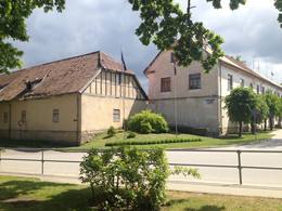 |
Lettland
AlsungaKnown as Alšvanga in the past, this place was mentioned for the first time in 1231 in an agreement that was signed between the deputy legate of the pope in Rome and the Courlandian tribes of the region. The Livonian Order ruled the territory until 1561, and from 1573 until 1738 the order’s castle belonged to the von Schwerin dynasty from Pomerania. It during the rule of this aristocratic family that a stone church was built in honour of Archangel Michael, and local residents began to convert to Catholicism. Alsunga became the Catholic centre for all of Kurzeme, and local residents became known as the Suiti (from the Schwerin suite). For nearly 400 years, Alsunga has been the historical centre of the Suiti territory. This is Latvia’s most conservative region and is widely known with unusual songs, colourful folk costumes and various folk traditions and beliefs. The Suiti have their own dialect, foods and many other things that have been long since abandoned or forgotten elsewhere in Latvia. The religious has commingled with the folk here in one unique whole. The Alsunga District covers 191 km2 and has some 1,500 residents. 176
1-12
Leistungen
176km - Entfernung von der Hauptstadt
1-12 Aktive Saisonmonate |
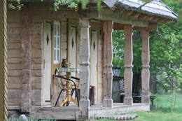 |
Litauen
Sumina (Suminai)Ļoti skaists un ainavisks etnogrāfiskais ciems Balošas (Baluošas) ezera ziemeļu krastā, netālu no diviem iepriekš minētajiem ciemiem. Te apskatāmas interesantas un skaistas koka ēkas, kas celtas no guļbaļķiem, ar niedru vai lubiņu jumtiem un izrotātas ar dažāda veida dekoratīvajiem elementiem. Pirmo reizi rakstos Šumini minēti 1784. g. Savu vārdu ciems ieguva no kādreiz dzīvojošas ģimenes uzvārda. Kā interesantākā ir jāpiemin sena klēts. 127
Leistungen
127km - Entfernung von der Hauptstadt |
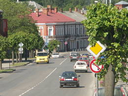 |
Lettland
RezekneDiese Stadt ist das Herz der Region Latgale, wo vom 9. bis 12. Jh. eine hölzerne Burg der Letgallen sich erheben hat. Im Jahr 1285 hat der Livländische Orden begonnen, an der Stelle dieser Burg eine gemauerte Burg zu bauen. Nach dem Zerfall des Livländischen Ordensstaates verkümmerte die Stadt (Rēzekne war ein Teil von Polen). Das wirtschaftliche Leben wurde in der zweiten Hälfte des 18. Jhs. wieder aktiv. Nach dem Ausbau der Straße (1836) und der Eisenbahn (1861) zwischen St. Petersburg und Warschau wurde Rēzekne zu einem Reiseziel für Urlauber aus St. Petersburg. Während des Zweiten Weltkriegs wurde die Bebauung der Stadt wesentlich zerstört. Heute ist die Stadt ein bedeutendes Zentrum für Wirtschaft und Kultur der Region Latgale. 242
Leistungen
242km - Entfernung von der Hauptstadt |
|
|
Lettland
IlukstePilsētā nebija lielu rūpniecības uzņēmumu, un tās iedzīvotāji
nodarbojās galvenokārt ar amatniecību, tirdzniecību un lauksaimniecību.
Ilūkste tika pilnībā nopostīta 1. pasaules kara laikā un smagi cieta arī
2. pasaules kara laikā. Šodien Ilūkste ir klusa pierobežas mazpilsēta, ko
ieskauj gleznains dabas apvidus. Apskates objekti: bijušā jezuītu klostera ēka
un Ilūkstes katoļu baznīca.
201
Leistungen
201km - Entfernung von der Hauptstadt |
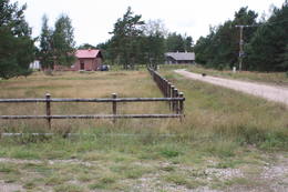 |
Lettland
LuznaEs ist ein langes Dorf, das sich zu beiden Seiten des Flusses Lūžņa befindet. 1937 befanden sich hier 36 Häuser und zwei Bootsanlegestellen. In den 60er Jahren des 19. Jh. wurde Lūžņa zu einem Ort des Schiffbaus, während der sowjetischen Besatzung wurden in der Nähe Militärbasen errichtet. In den 30er Jahren des 20. Jh. besuchte diese Ortschaft mehrmals der finnische Linguist Lauri Kettunen zusammen mit dem estnischen Studenten Oscar Loorits, die das Wörterbuch der livischen Sprache erarbeiteten. In Lūžņa lebte der erste livische Künstler Jānis Belte (1893–1946). Der Bauernhof „Dēliņi“ eines livischen Fischers und Bauern ist im lettischen Ethnographischen Freilichtmuseum zu besichtigen. 213
Leistungen
213km - Entfernung von der Hauptstadt |
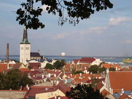 |
Estland
TallinnDie Hauptstadt von Estland. Die Altstadt (auf der UNESCO-Liste des Weltkulturerbes) ist ein hervorragendes mittelalterliches Baudenkmal (14. – 15. Jh). Die ehemalige Hansestadt. |
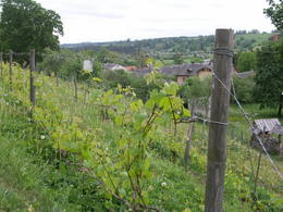 |
Lettland
SabileAuf dem Burgberg von Sabile befand sich schon im 10. Jh. eine befestigte Stadt. Nach der Teilung der kurischen Länder gelang Sabile in den Händen des Livländischen Ordens, der eine gemauerte Burg (hat sich nicht erhalten) gebaut hat. In den schriftlichen Quellen ist Sabile zum ersten Mal im Jahr 1253 erwähnt worden. Im 15. Jh. begann sich an der Burg eine Siedlung herauszubilden. Die Stadtrechte hat Sabile im Jahr 1917 erlangt. Heute ist Sabile eine Kleinstadt, in deren Umgebung sich mehrere bedeutende kulturhistorische Denkmäler befinden. Ein untrennbarer Bestandteil des Kulturlebens der Stadt Sabile sind die Zigeuner, darum wird Sabile umgangssprachlich die Hauptstadt der Zigeuner von Lettland genannt. Sabile ist schon seit langem mit ihrer Weintraubenzucht und ihren Traditionen der Weinherstellung bekannt, die heute während des Weinfestes von Sabile zu neuem Leben erweckt und genießbar sind. 112
Leistungen
112km - Entfernung von der Hauptstadt |
 |
Lettland
Der Burghügel von JersikaEin bedeutender Ort der lettischen Geschichte, denn hier befand sich im 12. und 13. Jh. das amtliche und auch kulturelle Zentrum des alten lettgalischen Landes Jersika mit der Burg des Herrschers Visvaldis am 18m hohen Ufer der Daugava, wo sich der mächtige Burghügel erhebt. 175
Leistungen
175km - Entfernung von der Hauptstadt |
 |
Lettland
Madonas Saieta laukumsMadonas centrālais laukums, kas vēl 20. gs. sākumā bija tirgus laukums. Pēc apjomīgās restaurācijas tas ir kļuvis par ievērības cienīgu pilsētvides objektu. Laukuma ziemeļu pusē atrodas pilsētas un novada pašvaldība un Madonas novada TIC. 165
Leistungen
165km - Entfernung von der Hauptstadt |
 |
Litauen
Strazdi (Strazdai)Ja mērķis ir savākt pilnvērtīgu etnogrāfisko ciemu fotokolekciju, ir jāapskata Strazdi (no lietuviešu valodas strazdai tulkojumā nozīmē strazds), kas ir pavisam neliela apdzīvota vieta Balošas (Baluošas) ezera ziemeļu krastā. Strazdi pirmoreiz rakstos minēti 1783. g. un ciema nosaukums cēlies no kādas mežziņu dzimtas uzvārda. 128
Leistungen
128km - Entfernung von der Hauptstadt |
 |
Lettland
EdoleJeder, der Lettland bereist, kennt die Ortschaft Ēdole bei ihrem Schloss. Die Anfänge des Schlosses sind im 13. Jh. zu suchen, aber die Anbauten des Schlosses sind im 16. und 19. Jh. entstanden, als der Innenhof eingerichtet wurde. Während der Umbauten, die in den 1830er Jahren durchgeführt wurden, hat die Fassade des Schlosses die heutige – neogotische Gestalt bekommen. Ab dem 16. Jh. bis zum Jahr 1920 befand sich das Schloss von Ēdole im Besitz der Familie der Barone von Behr. In den Aufständen von 1905 wurde das Schloss niedergebrannt, aber im Jahr 1907 – erneuert. Das Schloss von Ēdole ist mit vielen Legenden und Spukgeschichten verbunden. 170
Leistungen
170km - Entfernung von der Hauptstadt |
 |
Lettland
DundagaDer Baron von Dundaga war früher einer der größten Grundbesitzer in Kurland, darum bildete sich in der zweiten Hälfte des 19. Jhs. um das Landgut ein Zentrum für Wirtschaft und Kultur heraus. Die Dominante des zentralen Platzes von Dundaga ist der Wasserturm, hinter dem der mit der ärztlichen Behandlung verbundene Teil der Ortschaft Dakterleja beginnt, wo von 1844 bis 1854 einer der ersten lettischen Ärzte und der Sprachwissenschaftler Juris Bārs gearbeitet hat. Bis zu den 1960er Jahren fuhr von Dundaga durch das Dorf Mazirbe und den Fischerdörfern bis Ventspils eine Schmalspurbahn. Heute zieht das Dorf Dundaga die Reisenden mit ihrer eindrucksvollen Burg, mit der evangelisch-lutherischen Kirche, mit der Skulptur Krokodil, mit der Werkstatt der Töpferin Velga Eizenberga und mit anderen Sehenswürdigkeiten an. 152
Leistungen
152km - Entfernung von der Hauptstadt |
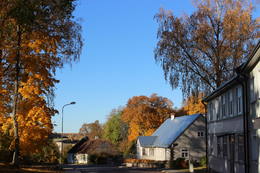 |
Lettland
DurbeDurbe ist der Einwohnerzahl nach die kleinste Stadt (etwa 500 Einwohner) in Lettland hat jedoch eine ruhmreiche Vergangenheit. Durbe wurde schon 1230 im Vertrag der Kuren mit dem päpstlichen Gesandten Balduin d'Aulne erwähnt. In der Umgebung von Durbe fand 1260 die berühmte Schlacht an der Durbe zwischen Deutschem Orden und Litauern statt, wobei die in den Dienst gepressten Kuren während der Schlacht auf litauische Seite überliefen. In Durbe lebte und arbeitete einer der ersten lettischen Spezialisten im Obstbau, Sīmanis Klevers (1834–1922). Dank seiner Tätigkeit kann man in den Gärten der Umgebung zahlreiche alte Apfelsorten finden. Im Wappen von Durbe, wie es 1925 genehmigt wurde, befindet sich ein silberner Apfel. Hier gibt es mehrere Höfe und viele aktive Gärtner, die Obst anbauen. Jährlich im September findet das Apfelfest statt.  188
1-12
188
1-12
Leistungen
188km - Entfernung von der Hauptstadt
1-12 Aktive Saisonmonate |
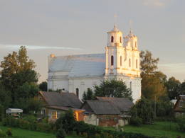 |
Lettland
PiedrujaDie größte Ortschaft im Südosten Lettlands, die vom Süden vom Fluss Daugava umgeströmt wird. Der Fluss ist gleichzeitig die Grenze zwischen Lettland und Weißrussland. Die Mitte des Flusses ist die Grenze zwischen zwei Ländern. Piedruja besteht aus zwei Teilen – Piedruja und Aleksandrova, die von der Zentralstraße (Straße V 631 ) getrennt sind. Piedruja hat sich als ein gegenüberliegendes Territorium der Stadt Druja entwickelt, die sich am linken Daugava-Ufer befindet. Zwei Teile gehörten im 17. Jahrhundert dem Hochadelgeschlecht Sapieha des Großfürstentums Litauens. Die Häuser mit wenig Stockwerken von Druja und eine zerstörte Kirche sind gut vom Piedruja-Ufer zu sehen. Es lohnt sich, Piedruja und die Umgebung, zu Fuß zu gehen, weil die Holzhäuser mit wenig Stockwerken stellenweise an die Häuser in den Freilichtmuseen erinnern. Piedruja sieht gepflegt aus, zwischen zwei Kirchen ist ein malerischer Garten angelegt. Mit bedeutenden Objekten – mit zwei Kirchen und Daugava-Stein macht der Piedruja-Pfad bekannt. Im Teil Aleksandrova befindet sich das Hotel „Piedruja”, das ein besonderes touristisches Produkt anbietet – eine Abendunterhaltung im lettgallischen, russischen und weißrussischen Stil. Vor der Reise nach Piedruja muss man die Aufenthaltserlaubnis fürs Grenzgebiet erhalten. Eine Grenzkontrollstelle befindet sich in Piedruja am Daugava-Ufer, wo noch relativ vor nicht langer Zeit eine der Überfahrten über den Fluss Daugava in Betrieb war. 289
1-12
Leistungen
289km - Entfernung von der Hauptstadt
1-12 Aktive Saisonmonate |
 |
Lettland
Kraslavas centralais laukumsArī 18. novembra laukums. Tas sācis veidoties 18. gadsimtā kā tirgus laukums. Tā dominantes bija 1752. g. celtais rātsnams (nav saglabājies) un aptieka, kas šajā ēkā darbojas no 1810. g. līdz pat mūsdienām. 2010. gadā laukumā izveidota strūklaka, kam ir pilsētas ģerboņa forma. 264
1-12
Leistungen
264km - Entfernung von der Hauptstadt
1-12 Aktive Saisonmonate |


