
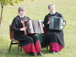
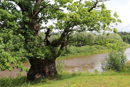
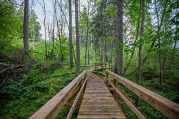
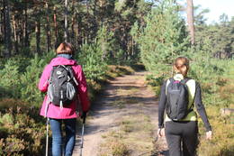
Маршруты - активный отдых
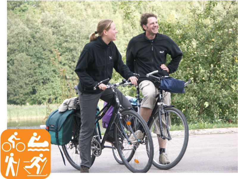
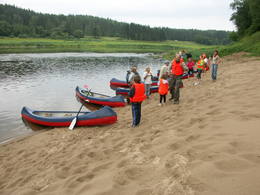
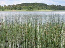
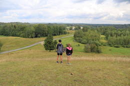
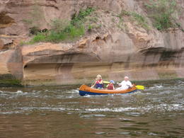
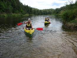
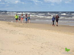
Все наши активные туры доступны с мая по август. Ежедневная дистанция обычно составляет от 20 до 55 км (асфальт, лесные или гравийные дороги) для туров на велосипеде, до 15 км (4-5 часов) для пеших туров вдоль морского побережья, по природным тропам, лесным тропинкам, асфальту, и 9-18 км (2-5 часов) для путешествий на байдарках вдоль спокойных потоков с небольшими порогами.
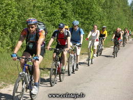
Ниже вы найдете список всех наших активных туров. Вы можете отфильтровать их по типу (на велосипеде, пешком, на байдарке, на лыжах), нажав на соответствующую иконку. Нашим клиентам часто нравится объединять три вида путешествий (езда на велосипеде, ходьба, катание на байдарке) в одном туре. Вы найдете примеры подобных туров в списке под каждым видом деятельности. Не все наши туры доступны на русском, поэтому мы советуем вам посмотреть на английском или немецком языке.
 |
 |
 |
 |
| Туры на байдарках | Туры на велосипеде | Пешие туры | Катание на лыжах |
| Обзор | Подробности |
|---|---|
 1 день
|
Латвия
от 150 EUR / перс.
Тур под руководством гида в Национальный парк КемериБолото, озеро, морское побережье и прогулки по лесу 
|
 8 дней

Общее расстояние на велосипеде 157 км, пешком 9 км, на лодке 17 км
|
Латвия
от 405 EUR / перс.
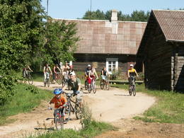
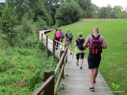
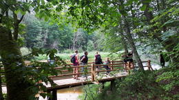
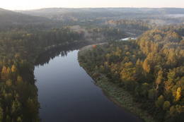
Захватывающий тур по Национальному парку ГауяВ этом туре вам предлагается езда на велосипеде, байдарке, и пешие прогулки. Если вам по душе активный отдых, этот тур — отличная возможность насладиться наследием, таящимся в Национальном парке Гауя, с различных перспектив. Велосипедная часть маршрута начинается в Стренчи и проходит через две местные пивоварни в Бренгули и Валмиермуйже, где найдете отличные кафе и хорошее пиво. Из Валмиеры маршрут проходит через красивый лес в Цесис с его очаровательным Старым городом. От Цесиса в Лигатне сплавитесь на байдарке, по одной из красивейших частей реки Гауя, с ее берегами из песчаника, отдаленными друг от друга фермерскими хозяйствами, и старинной переправой, работающей от силы течения. Исторический центр Лигатне связан с развитием там бумажной фабрики. Здесь вы также сможете посетить местных производителей вина и ремесленников, которые расположились в одной из искусственно созданных пещер, типичных для данной местности. Пройдясь по Природным тропам Лигатне, увидите диких животных в лесной обстановке. А проехав на велосипеде по удивительно холмистым, петляющим дорогам Сигулды, увидите средневековые замки Турайду и Сигулду, пещеру Гутмана, и насладитесь красивыми пейзажами. 

 5-10 5-10
Услуги
5-10 Месяцы активного сезона |
 10 дней
Общее расстояние на автомашине 630 км, пешком 68 км
|
Эстония, Латвия
Grand Forest Trail hiking tour in Latvia and Estonia: Riga – Tallinn, self-drive and hiking (LV/EE)This grand hiking tour includes some of the best and most beautiful parts of the Forest Trail in Latvia and Estonia. Hikes in the forest trails and villages are combined with trips and excursions in cities, as well as other popular tourist sights in both countries. You will get a detailed impression about the forest diversity and most popular national parks in Latvia and Estonia. You will start the tour in Riga, where you will enjoy the beautiful Old Town included in the UNESCO and Art Nouveau District. Then you will drive to Sigulda and see the most scenic ancient valley of the River Gauja, visit Turaida Museum Reserve, hike in Gauja National Park till the historic Ligatne papermill village. Further on you will visit the famous Lake Āraiši Castle, hike on the Cirulisi nature trails and see the beautiful medieval town of Cesis. On the way to Estonia you will stop at the Sietiņiezis big sandstone cliff to have picturesque views of the River Gauja. Then you will stay in Estonia’s second biggest city – Tartu, and visit the recently opened Estonian National Museum. Further on you will drive to Alutaguse National Park and hike along the picturesque Kurtna landscape reserve among the bright coniferous forests ornamented by the mirror surfaces of its many lakes. At the end of the tour you will hike in Estonia’s oldest national park – Lahemaa, which means the “land of bays” in Estonian. The Forest Trail goes along the bays and peninsulas of Lahemaa National Park, introducing the hikers to its most significant natural and cultural heritage. The forests are rich with blueberries and mushrooms in autumn and the air is very clean. This tour will end with sightseeing in Tallinn, Estonia’s capital city, with the Old Town also included in UNESCO. |
 12 дней
Общее расстояние на велосипеде 470 км
|
Латвия, Литва
Латгале – Аукштайтия: посещая сельские хозяйства вдоль границы ЕСЭто путешествие предлагает испытать одни из наиболее аутентичных впечатлений, которые вы можете получить, путешествуя по краю голубых озер в восточной чати Латвии и Литвы. В этом регионе нет туристических масс, люди здесь добры и гостеприимны, здесь находятся традиционные деревни, множество религиозных объектов и хозяйств сельского наследия. Маршрут проходит через национальный парк Разнаc, который расположен на живописном озере Разнас, вблизи традиционных сельских хозяйств и древних замков. Здесь вы можете увидеть Аглонскую базилику – святое место для паломников, а также посетить Музей хлеба в Аглоне. Далее маршрут проходит через Даугавпилс, где находится впечатляющая крепость 19-го века, в которой расположен Арт-центр Им.Марка Ротко. По дороге встречаются гончарные мастерские, где изготавливают традиционную керамику. Вы сможете узнать больше о разведении лошадей и коров, а также о том, как приготовить традиционный сыр и чай из трав. Далее маршрут пролегает через Аукштайтский национальный парк вдоль самой границы Литвы через этнографические деревни, деревянные церкви, вдоль множества озер. Стоит посетить Музей пчеловодства в Стрипейкиай, Музей искусства под открытым небом, а также Европейский центр. И, конечно же, вы сможете попробовать местное латгальское пиво и традиционное литовское блюдо - цепелины. 
|
 2 дня
Общее расстояние пешком 23 км
|
Эстония
Along the banks of the River Piusa and discovering the Land of Setos: Vana-Vastseliina – Piusa (EE)The first part of this section of the Forest Trail winds along the magnificent River Piusa valley, then, at Härmä Village, it turns towards Obinitsa, an important cultural centre of Setomaa, the Land of Setos. Here you can discover the traditions of the local Seto people, for example the fine handicraft of the Seto women. After Obinitsa, the Forest Trail leads through beautiful pine forests rich in heather, descends back into the depths of the River Piusa valley and ends at the Piusa caves. The Piusa sandstone caves are the result of hand-mining glass sand from 1922-1966. The biggest wintering colony of bats in Eastern Europe is located in the caves. When accompanied by the guide, you can visit the observation platform at the Museum cave. |
 6 дней
Общее расстояние пешком 113 км
|
Латвия
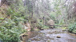
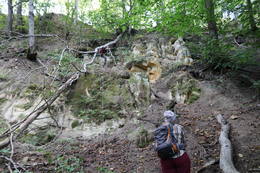
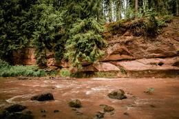
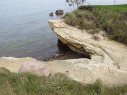
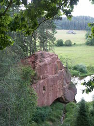
Along the ancient valley of the River Gauja through Gauja National Park: Ramkalni – ValmieraThis section of the Forest Trail leads through the entire Gauja National Park and gives an opportunity to see all the most beautiful places and sights of this national park of more than 100 km. Gauja National Park is the oldest and largest national park in Latvia. The ancient valley of the River Gauja is the deepest river valley in the Baltic states. The banks of the River Gauja reveal colourful sandstone outcrops, which are reflected in the water. The sights are most wonderful in springtime, when bird cherry trees are in full bloom, and in autumn, as the trees turn red and yellow. The ancient valley of the River Gauja has a distinctive terrain relief that can fluctuate by up to 80 m. The largest part of the road leads through forest paths, along the river, and exits the woods in Līgatne and Sigulda. Almost half of the park is covered by forest. Gauja National Park is known for the great diversity of specially protected forests, featuring herbaceous spruce forests, slope and ravine forests, as well as mixed broadleaf forests.
|
 3 дня
Общее расстояние пешком 46 км
|
Эстония
Challenges in the Kurtna and Ontika landscape reserves: Vasavere – Toila – Saka (EE)This is the most challenging Forest Trail section, especially on the second day. Here, on the coast of the Gulf of Finland, rises the North-Estonian Klint – a steep, rocky and forest-covered cliff that stretches non-continuously to Tallinn and further to the islands of West-Estonia. The Forest Trail runs on top of the cliff and occasionally descends into valleys. It crosses the deep and vast Pühajõgi valley in Toila-Oru park and comes to Toila, a popular coastal resort. One of the most unusual sections of the Forest Trail in Northern Estonia, which leads along the foot of the impressive North-Estonian Klint in good weather, then climbs to the top of the klint in the villages of Valaste and Saka, revealing breathtaking views of the Gulf of Finland. |
 6 дней
Общее расстояние пешком 64 км
|
Эстония
A hiking tour along the western coast of Estonia and the resort towns: Parnu and HaapsaluOn this hiking route you will see the most part of the western coast of Estonia from Pärnu to Tallinn. You will visit Estonia’s most popular resort cities: Pärnu and Haapsalu. You will pass along many bays, cape horns, fishermen’s villages and overgrown meadows. In the northern part you will walk along the spectacular Pakri cliffs, where you will see some of the most beautiful scenery in the area. There will also be sandy beaches and dolomite outcrops in places. In some rocky and wet sections you will use coastal forests and trails. During the route, you will see the Soviet military heritage in Paldiski.  5-9
5-9
Услуги
5-9 Месяцы активного сезона |
 2 дня
Общее расстояние пешком 47 км
|
Эстония
Along Pärnu Bay: Häädemeeste – PärnuThis section of the Baltic Coastal Hiking Route is suitable to hardy hikers who like to travel across uninhabited places. In many places, reeds, floodplains with pastures and wetlands stretch across the Estonian seacoast, which is why the itinerary often leads you along forest and country roads. In the second half of summer you can pick the mushrooms and berries in the coastal forests. Pärnu is a popular resort city with many cafés, live music, SPAs, hotels and a beautiful Old Town.
5-9
Услуги
5-9 Месяцы активного сезона |
 1 день
Общее расстояние пешком 23 км
|
Эстония
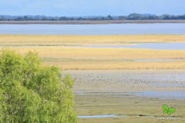
Bird watching in Matsalu National Park Haeska – PuiseOne of the most beautiful sections of the Baltic Coastal Hiking Route in Matsalu National Park, which leads through the agricultural lands and coastal meadows located near Matsalu Bay, where thousands of migrating cranes and geese gather in autumn. There are excellent birdwatching sites with towers near Haeska village (coastal meadows, shallow coves, small islets, cattle pastures) and at Cape Puise (coastal meadows with pastures, shoals). The most panoramic views of the sea and strings of islands can be seen in the surroundings of Põgari-Sassi and Puise nina
5-9
Услуги
5-9 Месяцы активного сезона |
 1 день
Общее расстояние пешком 23 км
|
Эстония
Walk the Kihnu Island, EstoniaKihnu Island is the largest island in the Gulf of Rīga and the seventh largest island in Estonia. Its total area is 16.9 km², the island is 7 km long and up to 3.3 km wide. The former seal hunter and fishermen’s island, with around 600 inhabitants, is currently eager to maintain its identity in spite of everything. The unique characteristics of the Kihnu cultural space, like the lifestyle of the community, the diverse cultural traditions, the Kihnu language, music, national costumes and nature, are included in the UNESCO cultural heritage list. A coastal route that goes through four villages – Sääre, Linaküla, Rootsiküla and Lemsi - will help you to discover the cultural and natural values of Kihnu Island. You can visit Kihnu Museum all year round and get insight into the history of the island, including the life of the famous local captain, Kihnu Jõnn. It is also worth seeing Kihnu Church and the cemetery located across from the museum. In the summer, you can enjoy a beautiful view of the island, the surrounding sandbanks and the sea from the lighthouse. The commemorative stone by the former house of Kihnu Jõnn introduces you to the island’s legendary “wild captain”.
5-9
Услуги
5-9 Месяцы активного сезона |
 16 дней
Общее расстояние пешком 166 км
|
Эстония, Латвия
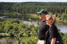
Grand hiking tour on the coast of Latvia and EstoniaThis grand hiking tour is provided for experienced hikers wishing to walk along a large part of the coasts of Latvia and Estonia, gain a detailed impression about the diverse coastal landscape, nature, birds and animals of the Baltic Sea. The Baltic Coastal Hiking Route sometimes runs through sandy beaches, sometimes along sections of beach covered in stones and pebbles. Sometimes the trail goes through coastal forests or stops at a fishermen’s village. There are many floodplain meadows, lagoons and shallow bays on the Estonian side, so sometimes the path goes along coastal trails and roads. In the end section of the route you will feel Estonia’s Nordic nature more. Part of the route runs along a sparsely populated seashore where you can be alone with yourself, but you will also be able to visit the most prominent cities. You will visit both capitals: Rīga and Tallinn. Enjoy the hospitality of the resort towns of Jūrmala, Pärnu and Haapsalu. During the hike, you will also get acquainted with the regions of small ethnic cultures: the Livonians in Latvia and the inhabitants of Kihnu in Estonia.
5-9
Услуги
5-9 Месяцы активного сезона |
 1 день
|
Латвия
In the heart of Gauja National Park: Sigulda – LigatneAfter passing through Sigulda, the Forest Trail follows the River Vējupīte to Paradīzes Hill, where a steep staircase leads down into the ancient valley of the River Gauja and the ravine of the River Vējupīte. It continues to wind down smaller paths through meadows, crossing small rivers whose banks reveal sandstone outcrops. The last six kilometres of this section follow a smaller path down the Līgatne Nature Trails. You can see local wildlife animals and birds on this 5.5 km long trail. Further on the Forest Trail moves up the hills of the ancient valley of the River Gauja, before descending back down into the deep ravine of the River Līgatne, where the village of the former Līgatne paper mill is located. You can explore this attractive small village, visit the Līgatne spoon factory, winery and Līgatne caves. There is also the Līgatne Net Park with 4-7 m high net labyrinths among the treetops. This part of the Forest Trail and Gauja National Park is characterised by a gradual transition from diverse, deciduous forests (ash, grey alder, oak, birch, linden) to coniferous stands.
|
 2 дня
|
Латвия
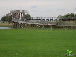
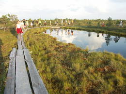
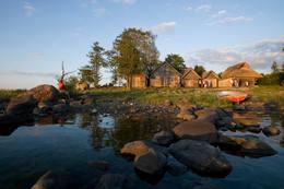
Большой круг национального парка «Кемери»Маршрут подходит для активных туристов, интересующихся многообразием природной и культурной среды национального парка «Кемери». Национальный парк «Кемери» (основан в 1997 г.) создан, прежде всего, для защиты водноболотных угодий – мелководного побережья Рижского залива, заросших прибрежных озер, болот, влажных лесов (трясин и др.) и пойменных лугов, как значимых мест произростания многих растений (~ 25 % от видов растений, занесенных в Красную книгу Латвии) и обитания животных, особенно мест скопления гнездящихся и перелетных птиц. На территории парка находится один из крупнейших заболоченных массивов Латвии – Большое Кемерское болото. Заболоченные массивы являются значимым местом образования и выхода сероводородных вод, а также местонахождения лечебных грязей, используемых в медицине, которые в свое время послужили основанием для создания известного курорта «Кемери». Информация о маршруте от Latvijas Lauku forums
 45 45
Услуги
45km - Расстояние от столицы |
 2 дня
|
Латвия
Ринда и ИрбеМаршрут походит для любого путешественника, желающего насладиться красотой природы и средой Северного Курземе, где, кроме водных туристов, нет других людей. Ирбе за короткое время стала популярной рекой благодаря красивым береговым ландшафтам. Мест для ночлега здесь нет, поэтому необходимо взять с собой палатку и заночевать на какой-нибудь стоянке для водных туристов. Информация о маршруте от Latvijas Lauku forums
5-9
Услуги
5-9 Месяцы активного сезона |
 3 дня
Общее расстояние на велосипеде 25 км
|
Латвия, Литва
от 80 EUR / перс.
На автомобиле и велосипеде на Куршскую косуТрехдневный маршрут позволит Вам познакомиться не только с одним из красивейших творений балтийской природы – Куршской косой, но также посетить некоторые интересные сельские хозяйства в Латвии. Вы сможете осмотреть пасеку, понаблюдать за работой гончара, посетить хозяйсто экзотических животных . Незабываемые впечатления оставит посещение двух своеобразных человеческих творений - «Каменного города» и парка инсталляций «Город абсурда», которые не имеют аналогов не только в странах Балтии, но и в более широком масштабе. |
 3 дня
Общее расстояние на велосипеде 58 км
|
Эстония, Латвия
от 80 EUR / перс.
На машине и велосипеде на остров СааремааИз Риги маршурт ведет на исторический эстонский морской курорт, а затем на пароме на остров Муху. На пути вы увидите этнографическую деревню Когува, церковь Лиива и элегантное поместье Падасте. Ночь на острове Муху. Проезжая на велосипеде на протяжении 28 км вы увидите можжевельниковые поля , маленькие рыбацкие деревни и удивительные скалы Юйгу, которые открывают вид на другие маленькие острова Монзундского архипелага. Затем отправляйтесь на Сааремаа и остановитесь в Курессааре, столице острова. Затем маршрут включает в себя посещение таких достопримечательностей, как метеоритный кратер Каали, впечатляющую церковь Вальяла и остов замка, скалу Пиретикиви и церковь Пойде. Проедьте на велосипеде вдоль полуотстрова Тагамейса, около 30 км. По дороге на паром сделайте крюк вдоль Национального парка Виидумаэ с его обзорной башней, церковью Кихельконна, ручьями Одалетси и природной тропой и доломитовыми скалами Панга.
|
 12 дней
Общее расстояние на велосипеде 477 км
|
Латвия, Литва
от 485 EUR / перс.
Through lake districts along the borderland of European UnionThe route includes some of the most authentic local expediencies travelling through blue lake districts along the Eastern part of Latvia and Lithuania. This is a region where mass tourism has not yet arrived, and you find very sincere and hospitable people, traditional villages, many churches and cult locations which bring together paganism, Roman Catholicism, Lutheranism, Russian Orthodoxy and Old believers,

|
 2 дня
Общее расстояние пешком 19 км
|
Эстония
Through the onion villages of Lake Peipsi: Varnja – Alatskivi (EE)A scenic and tradition-rich stretch of the Forest Trail symbolised by the onion. Onions were brought to the region by Old Believers in the 17th century. Ladies and gentlemen selling home-made onion strings on the roadside have become somewhat of a business card of the villages. The villages on the twenty-four kilometre stretch of road between Varnja and Kallaste are connected by the tourist route called Onion Road. The landscape is decorated by colourful wooden houses, small fish shops and a restaurant where you can enjoy tea made in the samovar, true to the traditions of Old Believers. You can visit the Kostja’s onion farm, where the host welcomes the guests and shows them onion cultivation. It is also worth visiting the Chicory Museum in Kolkja to get acquainted with the history of chicory cultivation in row villages near Lake Peipus. At the end of the trail you will reach Alatskivi, where the famous Alatskivi Castle is located. |
 6 дней
|
Эстония
Diversity of Peipsimaa: Varnja – Avinurme (EE)Onions, fish, villages that stretch out for several kilometres where the buildings are lined along the main street, ornate Old Believers' churches, small harbours with fishing boats and wooden houses, each painted in a different colour! Cafés, shops and a view of Lake Peipus, which looks more like a sea than a lake. This could be the description of this tour. This tour is a very interesting part of the Forest Trail, which will give you an opportunity to see and enjoy the Lake Peipsi region, the culture and lifestyle of local people as well as the nature. The tour will start in Tartu – Estonia’s second biggest city. You will go by bus from Tartu to Varnja where you will start to hike. During the tour you can visit Kostja’s onion farm, where the host welcomes guests and presents onion cultivation. It is also worth visiting the Chicory Museum in Kolkja to get acquainted with the history of chicory cultivation in row villages near Lake Peipus. You will also see Alatskivi Castle. In Avinurme we suggest visiting the Avinurme wooden handicraft centre and get acquainted with the local woodcraft, spend quality time in woodworking workshops and taste or even prepare yourself a selection of Estonian traditional foods. At the end of the tour you will return to Tartu by bus. |
 3 дня
|
Латвия
Национальный парк «Гауя»: Сигулда – ВалмиераМаршрут предусмотрен для опытных туристов, кому нравиться объединять наплюдения за природой с познанием культурной среды и истории. Это путешествие по самой впечатляющей речной долине в Балтии – древней долине Гауи. Маршрут начинается в Сигулде, которую с давних пор называют «Видземской Швейцарией». В окрестностях Сигулды открываются одни из красивейших пейзажей в Латвии. Маршрут пересекает глубокие овраги многих притоков Гауи и открывает внушительные в масштабах Балтии обнажения песчаника девонского периода. Природные тропы Лигатне – это единственное место в Латвии, где в условиях, максимально приближенных к естественной жизни в природе – в широких вольерах – можно увидеть разные виды диких животных. Поселок бумажной фабрики Лигатне – это великолепный пример индустриального наследия европейского масштаба со своеобразной средой поселка 19-го – 20-го веков. Цесисский средневековый замок – это мощная крепость средневековой Ливонии с современным центром для посетителей. Конечный пункт маршрута в Валмиере, одном из старейших городов Латвии. Информация о маршруте от Latvijas Lauku forums
|
 11 дней
Общее расстояние на велосипеде 404 км
|
Латвия
от 575 EUR / перс.
Замки, поместья и дворцы в ЛатвииЭтот тур предлагает вниманию путешестенников самые изысканные объекты культурного и исторического наследия, оставленного на протяжении нескольких веков — средневековые замки, различные поместья и восхитительные дворцы. Маршрут частично проходит через Национальный парк Гауя с отличными видами на луга и старинный лес, где фермерские хозяйства живут по своим неизменным устоям. Живописная дорога соединяет три замка — Сигулду, Турайду и Кримулду, расположенных на высоких берегах долины реки Гауя. Далее маршрут идет через одну из старейших церквей в Латвии и направляется в сторону двух примечательных поместий 19 века — Бирини и Игате. На следующий день отдохните с шиком в поместье — гостинице Дикли. Маршрут следует дальше, через очаровательный средневековый город Цесис с величественными руинами замка и новым замком вблизи. Вторая часть тура охватывает кольцо примечательных замков и дворцов в Земгале. Она включает в себя Яунпилский Замок, который незначительно изменился со времен средневековья, руины замка в Добеле и старинное городище в Тервете. Недалеко друг от друга находятся Баусский замок 15 века, стратегически расположенный между двух рек, Дворец Межотне в классическом стиле и самая знаменитая жемчужина Балтии - великолепный Рундальский Дворец в стиле барокко и рококо, окруженный французским парком.
 5-10
5-10
Услуги
5-10 Месяцы активного сезона |
 1 день
|
Эстония
The highest point in the Baltic states: Haanja – Tsiistre (EE)The Forest Trail leads down from the highest point of the Haanja Upland. The most important sight on this route is the Suur Munamägi Hill – 318 m above sea level. The highest point of the Baltics with its observation tower provides its visitors with a splendid 50 km range view of the Estonian nature. The 150 year-old western taiga spruce forests grow on the slopes of Suur-Munamägi. Further on the trail circles around the southern part of Lake Vaskna, and continues down small country roads surrounded by solitary homesteads and small clusters of farms. The route ends in a small village, Tsiistre, where the Linen Museum is located. The museum has a collection of folk linen. Flax is one of the oldest cultural plants in Estonia and a few decades ago, blue flax fields were a common sight in southern Estonia. |
 12 дней
Общее расстояние на автомашине 890 км, пешком 85 км
|
Эстония, Латвия
Walking forest nature trails in Latvia and EstoniaThis is the longest of the Forest Trail tours, where you will hike on many beautiful forest nature trails in Latvia and Estonia. These nature trails are part of the Forest Trail and this tour is suitable for self-drive tourists, who wish to hike different sizes of trails and get an impression of the forest diversity in both countries. You have the possibility to see the northern coniferous forests with spruces and pines, broadleaf forests, wet floodplain forests and picturesque forests growing on slopes and ravines. You will also see the most interesting tourist sights in Latvia and Estonia, which are close to the Forest Trail. In Latvia you will visit Sigulda, the historic Ligatne papermill village, medieval Cesis, the River Amata valley, which is located in Gauja National Park. Then you will drive to the less populated eastern part of Latvia – the Northern Gauja protected landscape area, Aluksne Town and hike in the Korneti-Peļļi subglacial depression, one of the most impressive ravines in Latvia. You can climb to Drusku castle mound – the highest and steepest of all the castle mounds in Latvia, When entering Estonia, you will see the highest point of the Baltics – Suur Munamagi Hill, where the observation tower is built. Further on the tour will lead you to the River Piusa valley, Obinitsa, with the culture of Seto people. You will hike in the historic Varska resort town, which is very close to the Russian border. Then you will reach Tartu and Lake Peipsi, which is the 5th biggest lake in Europe. You will hike in the Kurtna landscape reserve, see the Ontika limestone cliff, Valaste waterfall – the highest in Estonia. Finally you will hike in one of the beautiful wooded areas in Estonia – Lahemaa National Park. The tour ends in Tallinn, where you can enjoy the medieval Old Town and many other attractions. 85км
|
 2 дня
Общее расстояние пешком 29 км
|
Латвия
Along the Northern Gauja forests: Valmiera – StrenciThis part of the Forest Trail passes through the historical centre of Valmiera. In Valmiera you can visit St. Simon’s Church, the Ruins of the Livonian Order Castle and Valmiera Museum. We also suggest walking the barefoot trail in “Sajūtu Parks” (Park of Senses). After sightseeing in Valmiera, the Forest Trail goes through Atpūtas (Recreation) park, the beautiful pine forest and Baiļi winter ski centre. Further on you will walk along the River Abuls Trail, curving along the banks of the river until reaching the Brenguļi brewery built in an old Hydroelectric power plant. You can enjoy unfiltered and unpasteurised beer here. Further down you will enter unpopulated forest areas and the Northern Gauja protected landscape area. The forests in Northern Gauja (“Ziemeļgauja”) are very diverse. There are old or natural boreal (northern) forests and marsh forests, oak forests, alluvial forests (formed on river sediments which periodically flood) and mixed oak, wych elm and ash forests along the river. The tour will end in Strenči Town.
|
 2 дня
Общее расстояние пешком 43 км
|
Латвия
Cliffs in Gauja National Park: Cesis – ValmieraThe Forest Trail follows small roads and trails through the woods. Along the route you will see the Ērģeļu Cliffs, where the observation terrace provides a great view of the impressive 700 m wide sandstone cliff and the beautiful natural landscape in the ancient River Gauja valley. One of the most beautiful places on the banks of the River Gauja is at “Caunītes” tourist lodging, where you will end the first day of the route. Further on the trail leads through pine forests and wetlands, across and around hills and slopes. One of the most beautiful views of the River Gauja opens from Sietiņiezis Rock, a 15 m high sandstone cliff where a circular 1.5 km trail has been constructed. Coming to Valmiera, you will reach the so-called “Dzelzītis” bridge (a narrow-gauge railway bridge) and continue walking along the River Gauja to Valmiera Centre. Sites of interest in Valmiera: St. Simon’s Church, ruins of the Livonian Castle and Valmiera Museum. There is also an adventure park “Sajūtu Parks” (“Park of Senses”), where you can walk on the barefoot trail, the tree-top trail and enjoy other activities.
|
 4 дня
|
Латвия
Салаца: Мазсалаца – СалацгриваСалаца с точки зрения водного туризма является интересной рекой, на которой даже в период маловодья будут радовать береговые ландшафты и объекты осмотра, а также многообразие самой реки. Для похода на лодках самыми привлекетельными будут окрестности Мазсалацы и участок Мерниеки – Вецсалаца, где на карте видны топонимы, связанные с заколами. Заколы (лат. tacis) – бывшие места ловли миноги – это та уникальность, характерная только для Салацы на участке реки ниже впадения реки Иге. В наши дни о прежнем существовании заколов свидетельствуют топонимы – Гедерту тацис, Жвигулю тацис и др. Заколы для миног строили в местах, где река самая мелкая, самая узкая, более богата островами и стремнинами, поэтому топоним «тацис» означает также самые интересные обстоятельства для сплава. Сами заколы сохранились только в нижнем течении реки у Салацгривы. Ночлег в основном на стоянках для водных туристов (в палатках). Маршрут проходит по территории Северовидземского биосферного заповедника. Информация о маршруте от Latvijas Lauku forums
5-9
Услуги
5-9 Месяцы активного сезона |
 2 дня
|
Латвия
Абава: Кандава – РендаМаршрут, для прохождения которого не требуется специальная подготовка, если его проходить летом. Абава – это река с самой впечатляющей древней долиной в Курземе. Она есть и остается «классикой» Курземе. На Абаве несколько выраженных стремнин, обычно в местах, где в ее русле и по берегам появляются небольшие обнажения доломитовых пород. На участке между Веги и Рендой падение реки уменьшается и она становится более спокойной. Информация о маршруте от Latvijas Lauku forums
5-9
Услуги
5-9 Месяцы активного сезона |
 2 дня
|
Латвия
Излучины Даугавы: Краслава – КрауяМаршрут проходит по территории природного парка «Излучины Даугавы». Парк создан с целью сохранения уникальных ландшафтов древней долины Даугавы, биологического многообразия и богатейшего культурно-исторического наследия. Наибольшую высоту берега реки достигают в т.н. «Воротах Даугавы», где возвышаются Верверский и Слутишкский обрывы. С Приедайнской смотровой вышки открывается вид на древнюю долины Даугавы с высоты птичьего полета. В 2015 году в Васаргелишках и на горе Лаздукалнс были построены новые смотровые вышки. Информация о маршруте от Latvijas Lauku forums
5-9
Услуги
5-9 Месяцы активного сезона |
 11 дней
Общее расстояние пешком 98 км
|
Литва
A tour of Lithuania’s national and regional parksThis tour of the Forest Trail covers the national parks of Dzūkija and Žemaitija and the Nemunas Loops Regional Park in Lithuania. The starting point of the route is Druskininkai, a popular SPA and mineral water resort on the banks of the river Nemunas. Here, we recommend dipping yourself in mineral water baths, enjoying the trip with the cable car over the river Nemunas, visiting the musical fountain, and walking along the river promenade. For the next two days from Druskininkai, the Forest Trail passes through the Dzūkija National Park to the town of Merkinė. In this most forested and unpopulated region in Lithuania you can enjoy hiking along solitary forest roads, visit ancient mounds and ethnographic villages, where the traditions of bee-keeping, crafts, mushrooms and berry harvesting are still kept alive. You will then head to Birštonas, one of the key resorts in Lithuania with its valuable mineral waters. The town finds itself in the Nemunas Loops Regional Park, which includes four large and one smaller loops of the river. The Forest Trail stretches from Birštonas through the entire Nemunas Loops Regional Park up till the town of Prienai. Next, hikers will get to Kaunas, the second largest city in Lithuania and its former capital city. Kaunas is notable for its modernist architecture. The catchment area of the river Nemunas and the river Neris is situated here. Heading on, from Lampėdžiai to Vilkija, the Forest Trail runs for two days along trails and small countryside gravel roads next to the right bank of the river Nemunas, also crossing resort territory of Kulautuva. This section is characteristic of beautiful riverscapes, waterfront meadows and small villages. For the final section, first you must get to the Žemaitija National Park, where the Forest Trail runs around the Lake Plateliai, which is the largest lake in the historic Samogitian region. Old pine and fir forests and mixed forests are among the most precious natural values of 5-9
Услуги
5-9 Месяцы активного сезона |
 1 день
Общее расстояние пешком 22 км
|
Латвия
Engure Nature Park: Mersrags - EngureRoute meanders between a rocky seacoast richly overgrown with reeds and other grasses on one side and wooded seaside dunes on the other side. In some places, the beach is paved with small round stones, in other places you can see grey dunes with a rich variety of plants. Near Bērzciems village, there are large coastal meadows with shoals appearing far away in the sea that are suited for birdwatching. During this route, it is possible to visit the fishermen’s homestead “Dieniņas”, where you can buy local smoked fish. Also it is worth to see Engure port and Engure Evangelical Lutheran Church.
5-9
Услуги
5-9 Месяцы активного сезона |
 7 дней
Общее расстояние пешком 102 км
|
Латвия
A hiking route across the diverse coastal landscapes of LatviaThis long tour of Latvia includes some of the best and most beautiful parts of Jūrtaka in Latvia. Hikes along the sea alternate with trips and excursions in the cities. You will go along the coast of the Baltic Sea from Mazirbe to Kolka, seeing Slītere National Park and Livonian villages. You will see Engure Nature Park and the overgrown seaside meadows that are suitable for bird watching. Along the way, you will be able to purchase smoked fish from local fishermen and learn about fishing traditions in Latvia. Further, the route will take you through the most popular seaside resort in Latvia, Jūrmala; you will also have time to visit the capital city - Rīga. The second part of the route runs along the Vidzeme coast from Saulkrasti to Svētciems. In terms of landscapes and views, the most multifaceted section of the Baltic Coastal Hiking Route in Latvia, which includes both sandy and rocky beach, coastal meadows, reeds, dunes, sandstone outcrops, forests, capes and small coves, fishing villages and pubs.
5-9
Услуги
5-9 Месяцы активного сезона |
 8 дней
Общее расстояние на автомашине 685 км, пешком 225 км
|
Эстония, Латвия
Walking Nature Trails in Latvia and EstoniaThe tour from Rīga to Tallinn combines natural and cultural heritage and includes lovely landscapes and 15 nature trails which cross marshlands, meadows and forests along the shores of the Baltic Sea, including several protected nature reserves. Many trails are equipped with viewing towers for birdwatching. Randu meadows near Ainaži contains one third of Latvia’s entire plant species. A boardwalk leads through reeds to a viewing platform with views over the meadow and the sea. Saaremaa island is interesting with very different natural attractions to the mainland - dolomite cliffs, juniper heaths, a meteorite lake and rocky sea shore. The tour passes rural farms and traditional villages typical of the coastal areas. Hiiumaa island is a laid back place and retains a very Estonian atmosphere with an important bird reserve at Käina Bay, unusual Sääre Tirp as well as several small islets off its south-eastern coast. Back on the mainland, Paldiski peninsula gives a glimpse of the recent history with its former Soviet military base
5-9
Услуги
5-9 Месяцы активного сезона |
 7 дней
Общее расстояние пешком 57 км
|
Латвия
от 420 EUR / перс.
Пешком по Национальному Парку ГауяЭтот маршрут включает в себя лучшие пешие тропы и достопримечательности в Национальном парке Гауя. Походы организованы таким образом, что путешественники постоянно находятся в движении. Главная «артерия» парка — это старинная долина реки Гауя с множественными притоками, и глубокие ущелья с массивными обрывами из песчаника времен девонского периода. Поход начинается от одной из самых старинных церквей в Латвии и идет вдоль реки, заканчиваясь у бобслейной трассы в Сигулде. На следующем этапе путешествия вас ждут живописные виды на реку, обрывы и природные тропы. Водный путь реки Амата вьется через девственные леса, и здесь же находится икона латвийского пейзажа — скала Зварте. В Цесисе откройте для себя маленькие улочки, взберитесь на башню церкви Св. Иоанна и посетите руины средневекового замка, прежде чем отправиться по природной тропе Цирулиши для исследования геологической истории края. Поместье Унгурмуйжа — единственное уцелевшее в странах Балтии деревянное поместье в стиле барокко. Короткая тропа вьется между вековыми дубами. В парке находятся также несколько важных культурных достопримечательностей: музей-резерват Турайда, поместье Кримулда и исторический центр Лигатне.
5-9
Услуги
5-9 Месяцы активного сезона |
 8 дней
Общее расстояние пешком 114 км
|
Литва
Lithuania’s regional parks and the river NemunasThe route brings you to Kaunas, multiple Lithuanian regional parks and allows to enjoy the landscapes of the river Nemunas. Kaunas is Lithuania’s second largest city. It is notable for its modernist architecture. The city is located at the confluence of the two largest Lithuanian rivers: Nemunas and Neris. Moving further from Lampėdžiai to Vilkija, the Forest Trail runs for two days along trails and small countryside gravel roads next to the right bank of the river Nemunas. This section is shaped by beautiful landscapes with views of the river, the waterfront meadows and small villages. Do not miss the ferry in Vilkija crossing over the river Nemunas, one of the few still in operation in the Baltic States. For the next two days from Vilkija, the Forest Trail runs through its most spectacular sections in the Dubysa Regional Park from Kirkšnovė to Šiluva with mounds on riverbanks and historical churches now and there. This regional park covers the impressive Dubysa river valley, which reaches a depth of 40 m and a width of up to 500 m. Be prepared for a rolling terrain. Next, the route will take you to the town of Šiluva – the Catholic pilgrimage site – and to the Kurtuvėnai Regional Park. It is among the most forested areas of Central Lithuania; thus, the regional park with its glaciated valleys is a wonderland of forests, waters and wetlands. The Forest Trail leads along small forest paths, tourist trails, beautiful tree alleys and wetlands. The walk ends in Šaukėnai village, from where the city of Šiauliai is easily reached. 5-9
Услуги
5-9 Месяцы активного сезона |
 1 день
Общее расстояние пешком 20 км
|
Эстония
The legendary Suurupi Peninsula: Vääna - Jõesuu - TabasaluThis tour is suitable only for experienced hikers. The itinerary circles the Suurupi Peninsula where the dense forests conceal the military heritage of different eras. The Baltic Coastal Hiking Route meanders through overgrown and rocky seacoasts, birch groves, along former pioneer camps and sand-stone cliffs protecting coves with sharp capes. At the end of the itinerary, one of the most astounding outcrops of the Estonian littoral rises before your eyes – the Rannamõisa Cliffs, which gives views of Kakumäe Bay and Peninsula and the towers of Tallinn’s Old Town
5-9
Услуги
5-9 Месяцы активного сезона |
 3 дня
Общее расстояние пешком 48 км
|
Эстония
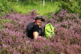
Towards the popular Värska resort: Vana-Vastseliina – VärskaThis part of the Forest Trail gives an opportunity to see Setomaa or “the Land of Setos” which is inhabited by Setos – an ethnographic group with specific ancient traditions and a unique language dialect. Forest Trail hikers can visit the traditional Setos homestead and enjoy Setos cuisine. The forests of the region are especially charming in early autumn, when the ground is coloured lilac by the blooming heather. There is a good chance to pick wild mushrooms and berries. One of the most beautiful sections of this trail in Setomaa leads along the River Piusa, where the river is surrounded by sandstone outcrops. You will also visit the Piusa caves. The tour will end in Värska resort – with its sanatorium and SPA, which use the strengths of local nature: mineral water and lake mud. Värska mineral water is well known in Estonia and elsewhere. |
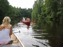
 2 дня
Общее расстояние на лодке 35 км
|
Латвия
Латгальские озераМаршрут подходит для водных туристов, которым не нравится однообразие. Латгальские озера до сих пор остаются территорией, мало освоенной водными туристами, но очень привлекательной с точки зрения как ландшафтов, так и культурной среды. Информация о маршруте от Latvijas Lauku forums
5-9
Услуги
5-9 Месяцы активного сезона |
 2 дня
Общее расстояние на автомашине 200 км, пешком 22 км
|
Латвия
The most beautiful sights of Northern Latvia: Ape – KornetiThis tour will give you an impression of the eastern part of Latvia, which is less populated and also less popular among tourists. You will first arrive in Aluksne and explore the town, which is located at Alūksne highland, on the shore of Lake Alūksne. It is worth visiting Temple Hill – an old Latgalian castle mound and the place of the old town, Sun bridge, and the Castle manor park, Alūksne Lutheran Church and the Bible Museum. After staying there overnight you will go by bus to the start point of the hike in Ape. This Forest Trail section winds through a hilly farmland landscape, then enters a large dark forest, occasionally interrupted by the blue surfaces of lakes. After Peļļi, it crosses the Latvian/Estonian border and winds along the shores of the lakes Smilšājs, Sūneklis and Ilgājs for 2 km on the Estonian side, known as Paganamaa (translation: Devil's Land). There it descends and enters the Korneti-Peļļi subglacial depression, one of the most impressive ravines in Latvia. The Forest Trail returns to Latvia at Lake Ilgājs and, after a steep climb, takes you through a hilly area to the Drusku castle mound. Here you can enjoy a beautiful view. At the end of this tour, you will reach Korneti. The section is located in the protected landscape area “Veclaicene”.
|
 2 дня
|
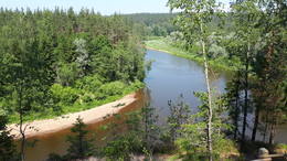
Латвия
Гауя: Цесис – СигулдаГауя – это самая популярная река Латвии у водных туристов. Водных туристов влекут сюда красивые обнажения песчаника, спокойное течение реки, природное многообразие и большое многообразие памятников культуры. На описанном участке река течет через древнюю долину Гауи, которая является одной из самых впечатляющих форм балтийского рельефа. Самое технически сложное место на маршруте – пороги Кукю, где нередко случается, что опрокидывается лодка. Информация о маршруте от Latvijas Lauku forums
5-9
Услуги
5-9 Месяцы активного сезона |
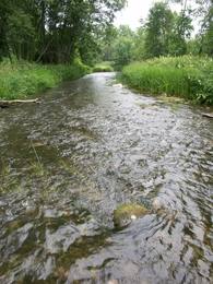
 2 дня
Общее расстояние на лодке 47 км
|
Латвия
от 120 EUR / перс.
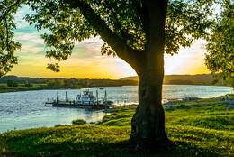
На байдарках в Национальном парке ГауяГауя — это самая красивая река в Латвии, с впечатляющей речной долиной, доходящей в глубине до 80 метров. Живописные обнажения пород песчаника возвышаются над рекой. Гауя — это спокойная река, с всего лишь несколькими маленькими порогами. Катание на лодке для отдыха здесь замечательно. Между Цесисом и Сигулдой, Гауя течет через Национальный парк Гауя. На берегах реки находятся несколько хорошо оборудованных причалов для лодочников, со скамейками, столами, местами для костров, хворостом и информационными стендами. На пути встретятся несколько достопримечательностей культурного наследия — старомодный паром Лигатне, средневековый замок Турайда и поместье Кримулда.
|
 2 дня
|
Латвия
Древняя долина Аматы - ЛигатнеМаршрут предусмотрен для путешественников, которых привлекает большой и частый перепад рельефа, а также для тех, кто жаждет увидеть и на себе испытать впечатляющие берега глубокой древней долины Аматы, передвигаясь по мало тронутым лесным тропам. Тропа, проложенная на правом берегу реки, петляет как по нижней, так и по верхней части долины, поэтому местами необходимо преодолевать перепад высоты более чем 40 метров. Maršruta informācija no Latvijas Lauku foruma
5-9
Услуги
5-9 Месяцы активного сезона |
 10 дней
|
Литва
Through national parks, vivid towns along the picturesque river banks of Latvia and LithuaniaFrom Vilnius the route goes to picturesque Trakai Castle surrounded by lake from which it continues to Dzūkija National Park. The park introduces with traditional Lithuanian way of living, closeness with forest as well as valuable natural resources. Information centre and centre of etnoculture is located at Marcinkonys but Čepkelių raistas provides atmospheric vast bog landscape. Pleasant forest trails and quite roads are pleasant for cycling. Druskininkai is a historic spa resort with charming old town, many spa hotels, walking trails and entertainment facilities. There is the Grutos Park where monuments from Soviet area is collected in order to demonstrate the former oppressive ideology. From there the road heads to lively Kaunas which sits between two rivers -Nemunas and Neris. |
 2 дня
|
Латвия
Жемчужины национального парка «Слитере»Маршрут подходит для тех, кто любит наслаждаться природными и культурными ценностями! Сказочные Слитерские Синие горы известны уже с давних времен, когда на них «пираты» жгли ложные костры, чтобы корабли налетали на мель мыса Колки. В наше время берега национального парка «Слитере» образно наывают геологическим музеем Балтийского моря под открытым небом, так как здесь можно увидеть древний берег Балтийского ледникового озера, береговой уступ Анцильского озера и дюнные образования Литоринского моря (валообразные дюны (кангари) и заболоченные междюновые впадины (виги)), которые наглядно отображают историю развития Балтийского моря за последние 10 000 лет. Этот берег исторически населяли ливы, рыбацкие поселки которых являются значимой культурной средой одного из самых малых национальных меньшинств в мире. Маршрут на участке от Мазирбе до Колки ведет по старой прибрежной дороге, которая петляет через ливские поселки – Кошрагс, Питрагс, Саунагс и Вайде. Национальный парк «Слитере» – одна из наиболее флорестически богатых территорий Латвии, а мыс Колка – одно из популярнейших мест для наблюдения за птицами во время их миграции. Информация о маршруте от Latvijas Lauku forums
150
Услуги
150km - Расстояние от столицы |
 1 день
Общее расстояние пешком 20 км
|
Эстония
Around Pakri Peninsula: Paldiski - KersaluThe Baltic Coastal Hiking Route leads around the Pakri Peninsula, from whose rocky shores you will discover the most beautiful coastal landscapes in northwest Estonia. It goes through the centre of Paldiski and, after having reached the fortress bastions of Peter I, it turns towards the Pakri Lighthouse going across the upper part of the impressive Pakri Cliffs. Further on up to Kersalu, there are both ups in the shape of rocks and downs where the Baltic Coastal Hiking Route meanders along a sandy and rocky seacoast and a beautiful pine forest.
5-9
Услуги
5-9 Месяцы активного сезона |
 3 дня
Общее расстояние пешком 32 км
|
Эстония
Impressive dunes of Lake Peipsi: Lohusuu – Remniku (EE)The first half of this section leads through magnificent coniferous forests, especially in the Järvevälja landscape reserve, where the trail is surrounded by beautiful dunes in the north and a raised bog in the south. It is well worth visiting the kiosk at Rannapungerja to buy smoked fish – the Lake Peipus vendace (rääbis) and some local farm produce. In the second part, the Forest Trail winds along the coast of the beautiful Lake Peipus. During the summer, when the water level in the lake is lower, beautiful, sandy beaches with wide shallows appear. Past Alajõe, the highest dunes of Lake Peipus (up to 20 m) rise on the landscape, providing a distant view of Lake Peipus, one of the largest lakes in Europe. |
 17 дней
Общее расстояние на велосипеде 620 км, на лодке 7 км, пешком 4 км
|
Эстония, Латвия
от 750 EUR / перс.
На велосипеде по национальным паркам и эстонским островамМаршрут проходит через Национальный парк Гауя, который расположен на двух берегах древней долины реки Гауя. Обрывы из песчаника и пещеры, холмистый ландшафт и дремучие леса, а также замки — это неотъемлемая характеристика парка. Позже,в поместье Игате, остановитесь на обед в их таверне, расположенной на мельнице, и отведайте традиционную латвийскую кухню. Затем маршрут поворачивает к побережью, принадлежащему Резервату Биосферы Северного Видземе, и продолжается вдоль старых эстонских рыбацких деревень, прежде чем доходит до морского курорта Пярну с его элегантными виллами. Затем вас ждет день на природе в Национальном парке Соомаа под руководством гида, где вы сможете прогуляться по болоту в специальной старомодной обуви и поплавать на байдарках. А далее по маршруту вы проедете мимо Поотси с его поместьем 19 века и старинную деревню Варбла. Переедьте на пароме на остров Муху и остановитесь в этнографической рыбацкой деревне Когува на пару дней, для того, чтобы ознакомиться с местностью. Затем отправьтесь на велосипеде вдоль дамбы на остров Сааремаа, откуда вы сможете на пароме переправиться на спокойный остров Хиумаа и провести там день в атмосфере истинно эстонского духа. А по возвращении на Сааремаа, вас ждет свободный день для знакомства со столицей острова Курессааре, с его многообразием спа и релаксационных заведений. Затем на автобусе держите путь на Таллинн, очаровательный город с его средневековым Старым Городом. Оттуда направляйтесь на день на бывшую военную базу на острове Найссаар, где специальные маршруты для велосипедистов знакомят с его военной историей, рудником и природными резерватами.
5-9
Услуги
5-9 Месяцы активного сезона |
 8 дней
Общее расстояние на велосипеде 90 км, пешком 28 км, на лодке 17 км
|
Латвия
Soft adventure tour in Gauja National ParkIf you enjoy an active lifestyle, then this tour is the perfect way to enjoy the heritage hidden in Gauja National Park, from several different perspectives. Cycling starts at Strenči and passes two local breweries at Brenguļi and Valmiermuiža with nice cafés and good beer. You will hike through beautiful forests and along the Sietiņiezis sandstone cliff towards Cēsis with its charming medieval Old Town. Canoeing takes place from Cēsis to Līgatne, which is one of the nicest parts of the River Gauja with its sandstone banks, remote farmsteads and old fashioned water-powered ferry. Līgatne historic centre is connected with the development of its paper mill. Here you can also visit local wine and handicraft producers located in one of the artificial caves typical of the area. Walk the Līgatne Nature Trails to see local wild animals in a forest setting. At the end you will cycle from Līgatne to Sigulda, which is one of the most popular tourist sights in Latvia. You'll see the Turaida and Sigulda medieval castles, Gutman’s Cave and other picturesque views.
|
 11 дней
Общее расстояние на велосипеде 367 км
|
Латвия
от 465 EUR / перс.
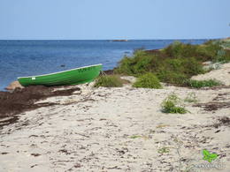
На велосипеде вдоль Курземского побережья Балтийского моряМаршрут начинается с поездки на поезде из Риги в Лиепаю, город с белыми песчаными плюжами и оживленной культурой уличных кафе. Маршрут проходит через пригороды Лиепаи в бывший военный город, где вы увидите православную церковь, старинные морские фортификационные укрепления,бывшие бараки и внушительную военную тюрьму, которая сейчас является туристическим объектом. Павилоста — небольшой прибрежный город и любимое место среди виндсерфингистов. Затем маршрут проходит вдоль живописного побережья, включая крутые берега Юркалне, и заканчивается в содержащемся в идеальном порядке городе Вентспилсе. Затем отправляйтесь вдоль рыбацких деревень, являющихся местом жительства для очень маленькой этнической группы финно-угров, ливов. На мысе Колка Балтийское море встречается с Рижским заливом. Здесь вы просто обязаны отведать рыбы местного копчения. Далее маршрут пересекает три различных типа морского побережья — каменный пляж в Калтене, песчаный в Упесгриве и прибрежные луга в Энгуре. Заканчивайте маршрут в Национальном парке Кемери и возвращайтесь в Ригу через популярный курорт Юрмалу.
|
 11 дней
Общее расстояние на велосипеде 378 км
|
Эстония, Латвия
от 590 EUR / перс.
Национальный Парк Гауя, Залив Пярну и СааремааМаршрут начинается в Риге с ее районом Югендстиля и Старым Городом. Затем отправляйтесь на поезде в Сигулду. Холмистая дорога ведет через Пещеру Гутмана, Турайдский Замок и Кримулдский Замок, которые стоят на берегах долины реки Гауя. Дорога затем идет в Лимбажи — типичный латвийский провинциальный город. Далее вы достигнете побережья Балтийского моря и Салацгриву, город, славящийся своими рыбацкими традициями и заколами для миног. За Салацгривой находятся редкие прибрежные луга и лагуны. После пересечения латвийско-эстонской границы, дорога вьется через старые прибрежные деревни — Икла, Треймани, Кабли и Хядеместе, прежде чем сливается с Виа Балтика. В Пярну прогуляйтесь по дороге для пешеходов Руутли и по старым укреплениям. А затем время переехать на острова — маршрут проходит через небольшой остров Муху. Посетите местное рыбное кафе в Ливи и этнографическую рыбацкую деревню Когува. Затем маршрут по дамбе ведет на остров Сааремаа. Основные достопримечательности во время маршрута - «Валъяла маалин» - один из наиболее впечатляющих холмовых фортов в Эстонии, церковь Валъяла и метеоритный кратер Каали. Оттуда на автобусе вы направитесь в столицу Эстонии Таллинн, с его очаровательным средневековым Старым Городом. А из Таллинна отправляйтесь на экскурсию на бывшую советскую базу для подводных лодок в Палдиски, незабываемом свидетельстве о недавнем историческом прошлом.
|
 1 день
Общее расстояние пешком 14 км
|
Латвия
Coastal Nature Park: Vecaki – CarnikavaThis section of the Baltic Coastal Hiking Route is a comparatively short hike across a beautiful sandy beach, the coastal side of which is bounded by brightly colored pine forests with spectacular dunes and dams of dunes. To get from the beach to Carnikava, the Baltic Coastal Hiking Route will take you through a forest via a promenade. Then it takes a stroll around the Old Gauja River via a levee and reaches the pedestrian bridge over the Gauja River. Both as you start and end the hike, it is nice to sit in one of the pubs and summer cafés located on Vecāķi beach and in Carnikava.
5-9
Услуги
5-9 Месяцы активного сезона |
 2 дня
Общее расстояние пешком 52 км
|
Латвия
The rocky beach of Vidzeme: Saulkrasti - SvetciemsThis section of the seacoast of Vidzeme is of outstanding scenic beauty with a lot of rocky capes and boulders in the sea alternating with small, sandy coves where the small streams and rivulets, which dry out in summer, flow into. Occasionally, the beach is completely covered with the gray backs of stones. In Zvejniekciems you need to make a detour around the estuary of the Aģe River and the Skulte port. In some places, small patches of reeds appear, while near Tūja you will see the first sandstone outcrops. Some part of the route can be covered via the beach or via a trail meandering through the dune forest with old pines. At the end of the route, you can see the unique lamprey fishing method - Svētupes nēģu tacis.
5-9
Услуги
5-9 Месяцы активного сезона |
 6 дней

Общее расстояние на велосипеде 213 км
|
Латвия
от 295 EUR / перс.
Средневековые замки и поместья в ВидземеЭтот маршрут позволит Вам увидеть самые впечатляющие средневековые замки Латвии или их руины, равно как и знаменитые особняки в аристократических поместьях, датируемые 18 и 19 веками. Особняк поместья Унгурмуйжа – единственный из уцелевших в Латвии деревянных дворцов из тех, что были построены в начале 18 века. Развалины Цесиского замка – в числе наиболее впечатляющих средневековых развалин в стране. Башня Турайдского замка предлагает панорамный вид на старинную долину реки Гауя. Около половины маршрута проходит через Национальный парк Гауя. Вы прибудете в место существования самой старинной переправы на балтийских реках – плоты, которые перевозят людей через реку, до сих пор приводятся в движение течением. В качестве мест для ночлега выбраны баронские поместья и замки, где это возможно. Вас будут кормить в ресторанах высшего класса или в местах, где Вы сможете попробовать традиционную латышскую еду и насладиться местной атмосферой.
5-10
Услуги
5-10 Месяцы активного сезона |
 1 день
Общее расстояние пешком 23 км
|
Латвия
Slitere National Park: Mazirbe - KolkaThe Baltic Coastal Hiking Route starts at the center of Mazirbe village where you can see the Livonian National House. Continuing through small forest and country roads past the former Mazirbe Naval school, it winds through small coastal Livonian villages: Košrags, Pitrags and then Saunags. The Livonian coast is the only place where you can get to know the cultural history heritage of one of the smallest peoples in the world, the Livonians. In this section, the indicating signs are in both the Latvian and Livonian language. At the end of route you will see Cape Kolka, the point where the Great Wave Sea meets the Little Wave Sea. It is one of the most popular bird-watching sites on the Baltic seacoast.
5-9
Услуги
5-9 Месяцы активного сезона |
 1 день
|
Латвия
Riga surroundings: Vangazi – RamkalniThe Forest Trail leads through smaller paths, arching around Vangaži Lutheran Church and the Werewolf Pine. On its way to the Hunting Palace, it passes the garden created by opera singer Anna Ludiņa and then follows the Hunting trail. The first side ravines with the pronounced relief of the ancient valley of the River Gauja can be seen here. One of them is located by Inčukalns Velnala (Devil’s Cave), surrounded by small river channels of the old Gauja. From there, the Forest Trail continues through meadows and crosses the Murjāņi–Valmiera motorway, where the recreation park “Rāmkalni” is located. In this park, there is a café, shop and active leisure centre with a sledge track. On this route you will mainly see pine forests of various ages, as well as the botanical plantation with 80 tree and 120 shrub species. By the end of the section, the landscape features sandstone outcrops – Devonian sedimentary rocks and habitats protected in Latvia.
|
 1 день
Общее расстояние пешком 21 км
|
Эстония
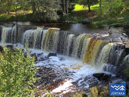
Along the banks of the River Jägala: Kaberneeme ‒ JõelähtmeFrom Kaberneeme the route runs through a forest where you can see piles of stones carried here during the last ice-age. The trail soon climbs about 20 m up to the hiking trail, which runs on the old shore line of Lake Ancylus. The trail continues to the Linnamäe HES and a suspension bridge. Follow the trail over the ancient fortress hill of Linnamäe and continue on the right bank of the River Jägala, until reaching the Jägala waterfall. This is the highest natural waterfall in Estonia, more than 8 m high. The Suka bridge is about 500 metres up from the waterfall. After crossing the river, the trail passes through the Jägala waterfall park. Finally, the trail runs through the village of Koogi and arrives at Jõelähtme. |
 6 дней
Общее расстояние пешком 92 км
|
Латвия
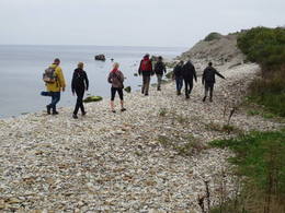
The Greate Wave Sea: Liepaja - VentspilsThe Baltic Sea littoral on the West coast of Kurzeme is called the Great Wave Sea. The seacoast is mainly sandy. While the Great Wave Sea section is the least populated coastal area in Latvia, at the same time, the third biggest city in Latvia, Liepāja, is also located there. Steep bluffs rise before your eyes on the seacoast between Pāvilosta and Sārnate. The villages are quiet and sparsely populated. At the beginning of the route, you can see the Soviet military heritage in Liepāja Karosta Prison, taste smoked local fish in Pāvilosta and then enjoy one of the most beautiful views of the entire route to the seacoast from Užava lighthouse. The route closes in the port city of Ventspils, where there are various entertainment and sightseeing places, especially for families with children.
5-9
Услуги
5-9 Месяцы активного сезона |
 8 дней
|
Эстония
Estonian islandsSaaremaa and Hiumaa are the two largest ones amongst 1500 other Estonian islands. In fact Saaremaa is the common name for Muhu and Saaremaa islands which are connected by the causeway like Hiumaa and Kassari islands. |
 3 дня
|
Латвия
от 100 EUR / перс.
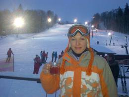
Зимние каникулы в Северной ЛатвииОтправляйтесь на поезде из Риги в Цесис и остановитесь на ночлег в самом центре этого очаровательного города. Это один из самых привлекательных провинциальных латвийских городов со средневековым замком Ливонского Ордена, Новым Замком, где располагается отличный музей истории региона и творческие мастерские, очаровательный Старый город с собором Св. Иоанна и несколько уютных кафе и ресторанов, где по выходным играют живую музыку. В пригороде найдете два горнолыжных центра, Жагаркланс и Озолкалнс, где можно взять напрокат снаряжение, снегоходы, где находятся лыжные склоны (самый длинный 500 м), парк сноубординга, склоны для начинающих и детей, тренированные инструкторы, пункт первой помощи и кафе.  90
11-3
90
11-3
Услуги
90km - Расстояние от столицы
11-3 Месяцы активного сезона |
 7 дней
Общее расстояние на велосипеде 233 км
|
Эстония
от 375 EUR / перс.
На велосипеде на остров СааремааЭтот маршрут предлагает вам отличную возможность посетить самый большой остров Эстонии – Сааремаа, который является своеобразным символом для туризма по Эстонии. На острове находятся один из наиболее впечатляющих метеоритных кратеров в Северной Европе, Епископский замок Курессааре, самая крутая отвесная скала в Эстонии и множество других интересных туристических объектов.
4-9
Услуги
4-9 Месяцы активного сезона |
 2 дня
Общее расстояние пешком 44 км
|
Эстония
Bays and cape horns in the northwestern part of Estonia: Rooslepa – VihterpaluThe Baltic Coastal Hiking Route goes through Nõva Nature reserve where you will have exceptional views of the white and grey dunes. The beaches are popular for fishing and kite-surfing. In Dirhami you can spend some time in a cafe and from its terrace you will have a beautiful view of the sea and the port. Along the way you can also see ancient Swedish hamlets with a different cultural environment and landscape, as well as shallow lakes that have been separated from the sea.
5-9
Услуги
5-9 Месяцы активного сезона |
 6 дней
Общее расстояние на автомашине 190 км
|
Латвия
от 370 EUR / перс.
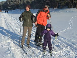
Зимние забавы в ЛатвииЭтот тур позволит вам насладиться латвийской зимой в лучшем ее проявлении. Он начинается в шумной столице Латвии — Риге, с ее рождественскими базарами, украшениями, торговыми центрами, множеством культурных мероприятий и музеев, а также очаровательным Старым Городом. Затем маршрут ведет за город, где вы сможете насладиться зимними забавами — катанием на лыжах и санках со склонов. После активного дня приходит время для релаксации в спа-гостинице, а также возможность испробовать оздоровительный и уникальный ритуал латвийской сауны. Для ознакомления с достопримечательностями посетите руины средневекового замка в Сигулде, Турайдский замок и отведайте домашнее вино в поместье в Кримулде. На природных тропах Лигатне сможете понаблюдать за местными дикими животными: волками, медведями, лосями и другими, а затем насладиться катанием на санной упряжке на близлежащей ферме.
12-3
Услуги
12-3 Месяцы активного сезона |
 5 дней
Общее расстояние пешком 52 км
|
Эстония
Through Lahemaa National Park: Eisma – Kasispea (EE)On this tour you will enjoy the diversity of nature in Lahemaa National Park – the oldest national park in the Baltic states. Lahemaa – means “the land of bays” in Estonian. It is characterised by many bays, peninsulas, forests and villages rich in cultural heritage. The Forest Trail will go along the bays and peninsulas of Lahemaa National Park, introducing the hikers to its most significant natural and cultural heritage. The forests are rich with blueberries and mushrooms in autumn, and the air is very clean. You will start the tour from Tallinn, going by bus to Lahemaa National Park, where you stay overnight in one of the beautiful manors. On the next day you will hike till Oandu. En route you will see Altja – a scenic traditional fishing village, where a traditional Estonian tavern is located and you can enjoy traditional meals. In Oandu there is the visitor centre of the Estonian State Forest Management (RMK), where hikers can learn more about forest habitat types and forest management traditions. Then you will reach Käsmu Peninsula with its wooded dunes and moss-covered rock fields, giving the feeling of being in a fairy tale. Käsmu is also a popular Estonian sea captains´ village. There you can visit the Marine Museum and lighthouse, as well as have an extra walk to the Vana-Jüri rocks. During the day from Käsmu to Kasispea you will see some of the most impressive boulders in Lahemaa National Park, the Tammispea and Jaani-Tooma boulders, which resemble huge monoliths. You will end the tour in Viinistu Village, where we suggest visiting Viinistu Art Museum. |


