
Other natural areas
Natural areas
| Overview | Details |
|---|---|
 |
Latvia
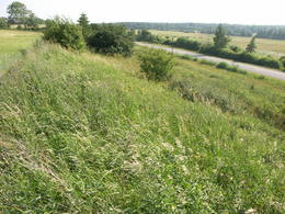
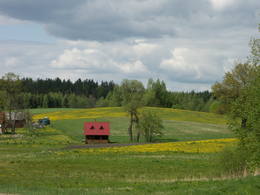
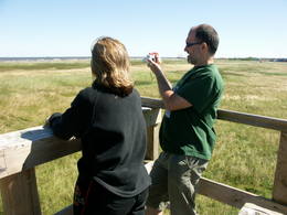
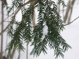
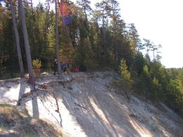
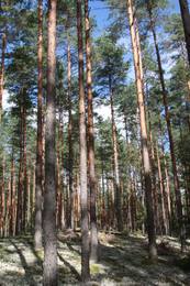
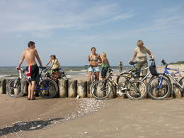
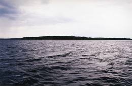
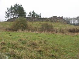
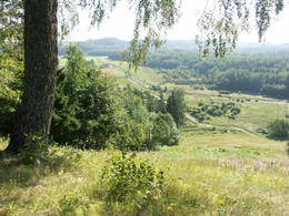
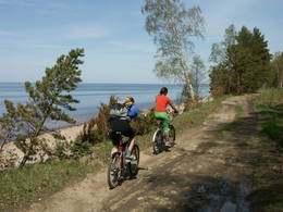
Piejuras dabas parksThis is a segment of the shore of the Bay of Rīga that is around 40 km long and features the valleys of three major rivers – the Lielupe, Daugava and Gauja river. There are dune formations, biotopes, seashore meadows and forested seashore dunes which are an important recreational resource. |
 |
Latvia
MedzeThis territory protects the shore of the onetime Baltic lake of ice, which most significant part stretches for 10 kilometres on the eastern side of the Grobiņa-Ventspils highway from Kapsēde till Vērgale bus stop. From the top of this ancient shoreline there is a lovely view of the Piejūra lowlands, but no specific viewing areas or information stands have been installed. There are protected species and habitats in the territory. |
 |
Latvia
VecdaugavaThis is a large set of coastal meadows, ancient rivers and areas of reeds. It is found at a location where the Daugava River used to flow – between Vecmīlgrāvis and Vecāķi. There are inland dune meadows here, complete with the very rare silver grass. Vecdaugava is an important location for nesting birds and several uncommon plant species. On the southern end of the Vecdaugava peninsula, at a place called Skanstnieki, one can find remnants of medieval Swedish fortifications. The Vecdaugava Regional Research and Fishing Museum is here, as well.
|
 |
Latvia
TerveteThe Tērvete Nature Park is located in an area which is not particularly typical of the Zemgale region – the distinct Tērvete River valley. Along its banks there are vast forests which have been nicely adapted to leisure activities. There are natural treasures, as well as an outstanding cultural and historical heritage in the area. The Tērvete Nature Park is one of the most popular tourist destinations in Zemgale. People are interested in the Park of Old Pines, the lovely pine forest, the Sprīdīši arboretum, the Tērvete, Klosterkalns and Svētkalns castle hills, the memorial museum “Sprīdīši” which commemorates the great Latvian author Anna Brigadere, various attractions for children, lovely landscapes, a dense network of pathways, etc. The nature park was nominated as the most family-friendly location in Latvia in 2004. Services
65km - Distance from countries capital cityServices - recreational
FishingGulbju ūdenskrātuvē.

Horseback ridingBraukšana pajūgā, jāšana pa apli vai parka teritorijā instruktoru pavadībā. 
Picnick areaParka teritorijā ir izveidotas atpūtas vietas, ugunskura vietas, telšu vietas, bērnu rotaļu laukumi u.c.

Nature trailTērvetes dabas parku "caurauž" ļoti blīvs taku tīkls - atkarībā no katra iespējām un interesēm.

Nature watchingTērvetes ielejas krastos, no Tērvetes pilskalna un skatu torņa.
|
 |
Latvia
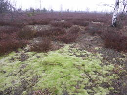
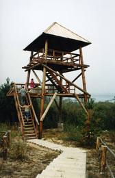
Teicu dabas rezervatsThe Teiči Nature Reserve was established in 1982 and is one of the largest areas of moss swamps in the Baltic region. It consists of the Teiči and the Pelečāre swamps, with a variety of plants and animals, as well as adjacent territories which are under protection. The Teiči swamp is the largest nesting ground for a number of bird species, including the common crane, the whimbrel, the golden plover and the wood sandpiper. During migratory seasons, thousands of geese of various kinds are found in the area. The reserve can be toured only in the company of a guide from reserve headquarters, and one must apply in advance for such a tour. Visitors will see the pathway of footbridges on Lake Silda, as well as Siksala island, which offers a magnificent view of Latvian swampland from a viewing tower. Services
200km - Distance from countries capital cityServices - recreational
Tour guide servicesRezervāts apmeklējams tikai un vienīgi rezervāta gida vai reindžera pavadībā, iepriekš savulaicīgi piesakoties un noteiktā laikā.
Nature trailSildu - Siksalas dabas taka (ap 5 km).
Nature watchingTeiču purvs - Sildu - Siksalas dabas taka. Rezervāta administrācijas gidi, vides gidi un reindžeri piedalās un organizē dažādus ar vides izglītību un dabas vērošanu saistītus pasākumus. Teiču rezervāta administrācijas ēkā ir izveidota izglītojoša ekspozīcija, blakus ēkai - neliela laipu taka, informācijas stendi un kartes. |
 |
Latvia
KaucersSamērā liela teritorija ar mozaīkveida ainavu - mežiem, atklātām ainavām un ezeriem (Salmejs, Kaučers, Stupānu ezers, Limanu ezers u.c.), kas atrodas Latgales augstienes Feimaņu pauguraines rietumdaļā. Aizsargājamo ainavu apvidus veidots šejienes dabas un kultūrainavas (apdzīvotās vietas, Tišas vecticībnieku lūgšanas nams, krucifiksi) un daudzveidīgo biotopu (t.sk. - sugu) aizsardzībai. Apvidū atrodas arī samērā populārs tūrisma objekts - Šnepstu pilskalns.
|
 |
Latvia
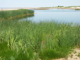
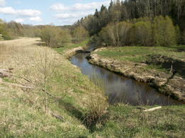
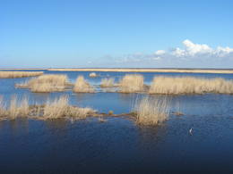
The Randu Meadows Nature ReserveThis area is full of coastline meadows, lagoons, muddy little lakes and sandy shallows, all full of reeds. This area of the eastern shore of the Bay of Rīga is found between Ainaži and Kuiviži. The Randa meadows are an enormously important location for water birds and rare plants – some 500 in all. A new bird-watching tower and a nature trail have been established for those who wish to study the meadows.
Services
100km - Distance from countries capital cityServices - recreational
Picnick areaRīgas - Pērnavas šosejas malā izveidota autostāvvieta ar galdu un soliem.
Nature trailRandu pļavu dabas taka ar skatu torni un dzīvei savvaļā pielāgotiem mājlopiem.
Nature watchingRandu pļavu dabas takā.
|
 |
Latvia
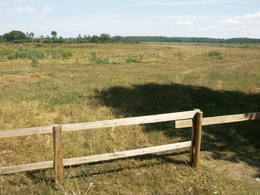
Uzavas lejteceOpen landscape area within farming lands on both banks of Uzava River about 10 km before it flows into the Baltic Sea. There is a good open view over the area from the Vendzava-Ziri road going through the nature park. Protection of migratory birds and corncrakes has been one of the main reasons for establishment of the nature park. Bird watching is possible from the road Vendzava-Ziri during migration period in spring and fall. There is no tourist infrastructure in the nature park.
|
 |
Latvia
The Tervete Nature ParkThis park is located along the shores of the Tērvete River Valley. It is a vast forested area which has been adapted successfully for travellers. In 2004, it was nominated as the most family - friendly destination in the land. There is a web of trails for one-day hikes. Viewing tower on the shore of the Tērvete River, views also from the Tērvete castle hill and Zviedru (Swedish) Hill.
|
 |
Latvia
RiezupeRiežupes dabas parks veidots g.k. Riežupes izteksmīgās ielejas, tai raksturīgo dabas vērtību – nogāžu un gravu mežu, dažādu ģeoloģisku dabas pieminekļu - smilšakmens atsegumu, alu, ūdenkritumu, upes straujteču posmu, dažādu sugu, mežu masīvu un ainavas aizsardzībai. Parka atrodas viens no Kurzemes populārākajiem tūrisma objektiem – Riežupes alas - garākais mākslīgo alu labirints Latvijā, kura eju kopgarums ir 460 m. Sākotnēji dabas veidotās alas 19. gs. vidū mākslīgi paplašināja baltās smilts ieguves nolūkos, kuras izmantoja stikla ražošanai. Parkā izveidots velotūrisma maršruts. Services
150km - Distance from countries capital cityServices - recreational
FishingVentā saskaņā ar esošo kārtību.

Bicycle trailVelomaršruts "Kuldīga - Riežupe" (ap 16 km).
Nature watchingDabas un ainavas vērošana Ventas krastos un Riežupes silos. Netālu no dabas parka izveidots skatu tornis. |
 |
Latvia
AugszemeThis territory is meant to protect the large hillocks and lakes of the Augšzeme highlands – Lake Svente, Lake Medums, Lake Ilga and others, with their islands, landscapes and species. The nature park which has been established around Lake Svente and Lake Medums is part of this territory, and there are several areas that are restricted for environmental reasons – Lake Bardinskis, Lake Skujine, and the islands of Lake Medums and Lake Svente. There is a viewing tower on Egļukalns Hill, along with downhill ski routes. Services
230km - Distance from countries capital cityServices - recreational
FishingSventes un Medumu ezeros saskaņā ar pastāvošo kārtību.

SkiingEgļukalna kalnu slēpošanas trases.

Boat tourSventes un Medumu ezeros.
Nature trailEgļukalna dabas izziņas taka.
Nature watchingEgļukalna dabas izziņas takā un no Egļukalna skatu torņa (viens no fantastiskākajiem dienvidlatvijas skatiem!), no citiem pauguriem (skati uz Daugavas ieleju), kā arī ezeru apkārtnē.
|
 |
Latvia
Kemeri National ParkThe Ķemeri National Park was established in 1997 and mostly involves wetlands – the shallow shores of the Bay of Rīga, an overgrown seaside lake, vast swamps, damp forests and fens, and flood-land meadows. The park is enormously important for protecting plants (25% of those recorded in Latvia’s Red Book are found in the park) and animals, particularly nesting and migrating birds. The Great Ķemeri Bog is one of the largest swamps in Latvia, and there are other swamps, as well – the Zaļais swamp and the Raganu swamp. The massive swamps are important, too, in the flow of sulphuric waters and medicinal mud. The once-famous Ķemeri Spa was based on the availability of these resources. Most of the cultural and historical objects in the Ķemeri National Park relate to the seashore as a place for leisure and recuperation. Educational nature trails, bicycle trails, hiking trails, bird-watching towers and other facilities are available. The visitors centre is at the recently renovated “Forest House” in Ķemeri. Services
30km - Distance from countries capital cityServices - amenities
Accommodation availableGuest house "Stērstītes"
Village house "Monikas" Guest house "Jūras mols" Self-catering cottage "Līdakas" Guest house "Valguma pasaule" Guest house "Pilsētnieki" Guest house "Eglieni" Self-catering cottage "Nordes" Services - recreational
FishingFishing is allowed according to the local regulation in all public water resorts; boat rental offered in Lake Kaņieris and Lake Valgums. Only rented boats are permitted on the Lake Kaņieris, fishing permit is required!

BoatsBoat rental at Lake Kaņieris;
www.seakayak.lv 
Bicycles
Cross-country skiingCorss-country skiing "From Jaunķemeri to Klapkalnciems" 2-15 km
Tour guide servicesGuide services offered in the territory. It is suggested to attend also nature education events organized in the National Park
Boat tourCanoeing "From Jaunķemeri to Klapkalnciems" ~ 4 h
Bicycle trailThere are three marked cycling routes in the surrounding of Lake Valgums: Circle of Šlokenbeka Manor, Forest circle and Circle of Lustūžkalns Hill. There is also one marked cycling route in Ķemeri: Ķemeri – Lake Sloka – Kūdra – Ķemeri.
Nature trailThere are several nature trails in the territory of ĶNP: walking trail of Lake Sloka with a bird-watching tower (main circle ~3km, there are alternatives to extend it up to 12 km), the Dumbrāji trail (550m), the restored Slampe River with livestock adopted to life in the wild watching at Dunduri meadows. The Kupskalns Nature Trail in Bigauņciems.
Nature watchingĶemeri National Park is one of the best places for woodpecker watching. In the autumn and spring, thousands of migrating geese and cranes use the park to rest and spend the night.
Nature watchingAlong the nature trails, on the seashore (please follow the code of ethics once bird-watching), etc. Livestock adapted to life in the wild graze can be seen from the bird-watching tower in the Dunduri Meadows. The Bird-watching events and Night of Bats are worth attending!
For bird watchers "Birds at Ķemeri" Excursions guided by nature guides - www.takas.lv, +371 29224618 |
 |
Latvia
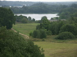
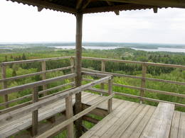
VestienaThe main goal of the Vestiena protected landscape area is to protect the landscape values in the Vidzeme highlands. The protected area is in the middle of the Vidzeme highlands with the highest and most prominent relief, including Gaiziņkalns, the highest spot in the country. The many lakes found in the area - Viešūrs, Talejas, Kāls, Pulgosnis and others – not only add to the variety of the landscape, but also offer tourism and recreation options. The Vestiena protected landscape area encloses several other especially protected/Natura2000 sites – the Gaiziņkalna nature park, the island of the lake Kāla, the lake Ilziņa restricted natural area. Among the most interesting tourist attractions are the Vestiena estate, the Piekūnu wandering trails, the Gaiziņkalna nature trail. The area is rich in landscapes, however, there are no viewing spots or towers installed to observe the landscape. On the top of the Gaiziņkalns, the Latvia’s highest spot, there still stands the wreck of the former viewing tower.
|
 |
Latvia
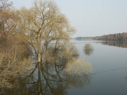
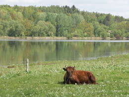
The Lake Engure Nature ParkThe key treasure in this park is that it has a lake that is one of the most intensive sites for birdwatchers in all of Latvia. It also features outstanding flora and the shallow waters of the Bay of Rīga. Recommended: Hike along the seashore from Mērsrags to Engure (20 km). See wild domestic animals (horses and cows) on the eastern shore of Lake Engure. There’s a bird-watching tower on the NW shore of the lake (approach from Kūļciems, where you can see domestic animals adapted to life in the wild, including the Blue Cows of Latvia). A bird-watching tower can be found at a place called Jomiņa near Mērsrags, where the seashore meadow is an uncommon biotope
Services
1-12 Active season monthsServices - recreational
Nature trail
Nature watchingPārgājiens gar jūras piekrasti: Mērsrags – Engure (20 km); Dzīvei savvaļā pielāgotie mājlopi (zirgi, govis) Engures ezera A krastā; Putnu vērošanas tornis ezera ZR krastā (piebraucams no Ķūļciema puses, kur dzīvei savvaļā pielāgotie mājlopi, t.sk. Latvijas Zilās govis), Putnu vērošanas tornis Mērsraga piejūras pļavā (Latvijas piekrastē – reti sastopams biotops) – t.s. Jomiņā. |
 |
Latvia
Open sea to the West of TujaThis is an important territory to protect the little gull during spring migration. It is opposite the Salacgrīva, Limbaži, Saulkrasti and Carnikava administrative districts, with a total area of 58,600 hectares.

|
 |
Latvia
Razna National ParkLatvia’s newest national park (2007) is in the “land of the blue lakes” – the region of Latgale. One of the goals of establishing a national park was to preserve the natural treasures of the region. Lake Rāzna, which is the second largest in Latvia, is there, as is Lake Ežezers, which has more island than any other lake in Latvia. There are other bodies of water, as well as typical landscapes of hillocks and a unique cultural environment. One of the most popular destinations in the park is Mākoņkalns Hill, which offers a lovely view of Lake Rāzna. Administrators of the newly established park are working on the tourist infrastructure – trails, routes, etc. Perhaps visitors would be advised to postpone their trip to the Rāzna National Park for awhile. Services
240km - Distance from countries capital cityServices - amenities
Accommodation availableSelf-catering cottage "Osmany"
Self-catering cottage "Pie Rāznas" Guest house "Rāznas līcis" Guest house "Rāznas gulbis" Guest house "Zīdu kolns" Country house "Priedes" Guest house "Vītoli" Services - recreational
FishingRāznas u.c. ezeros saskaņā ar pastāvošo kārtību. 
SwimmingRāznas ezera krastos (īpaši D krastā) ir atrodamas labiekārtotas peldvietas.
Jāievēro, ka Rāznas, Salāja, Zosnas ezerā un Ežezerā nav atļauts pārvietoties ar motorizētiem peldlīdzekļiem.
BicyclesRāznas Gulbis, tālr. +371 29994444; Selēna, tālr. +371 29179338.
Horseback ridingYou are welcome to tour the Rāzna National Park on horseback in the most beautiful display of every season: during bird-cherries’ blooming, in blossoming meadows, with pink autumn leaves or in deep winter snowdrifts.
Route The Latgale Trotters

Berry and mushroom pickingRāznas nacionālajā parkā var staigāt, vērot augus, dzīvniekus un ainavas, ogot, sēņot, peldēties, sauļoties, braukt ar divriteni un laivu.
Tour guide services
Boat tourRāznas un Ežezera apkārtnē pieejama laivu noma un tiek piedāvāti (Rāznas ezerā) braucieni ar dažādiem ūdens peldlīdzekļiem.
Bicycle trail
Picnick areaUgunskurus kurināt drīkst tikai speciāli ierīkotās vietās.
Nature trail
Nature watchingVisā parka teritorijā - ainavas, dabas, augu un putnu vērošanas iespējas.
|
 |
Latvia
Nida - PerkoneThe “Nida-Pērkone” protected marine territory is one of the most biologically diverse marine territories along the shore of the open part of the Baltic Sea, and it is enormously important for environmental protection. The most important reef territories are found here. During migration season, most species of migrating birds that are found in Latvia cross the area. The territory is particularly important to protect the goosander and the little gull. The territory is opposite the Rucava and Nīca administrative districts and covers 36,703 hectares. It overlaps the marine section of the Pape Nature Park and the Bernāti Nature Park.
|
 |
Latvia
Daiku ivju audzeThe forest covered area formed to protect tort protected plant species as yew-tree etc. Territory is not suitable for visitors as visitor without environmental knowledge will see “regular” forest.
|
 |
Latvia
Durbes ezera plavasNature restricted area includes eastern side of the lake with Lanupe River and North-east and South-east coastal areas. Restricted area has been established for protection of birds and floodplain meadows of the lake. To see the nature restricted area visitors do not have to enter it. There are great view points with wind generators of Grobina on the background from the road Vecpils – Rava – Aistere. Coastal areas which are not included in the restricted area are perfectly suitable for bird watching. There is located the smallest city by its population in Latvia to the South from the lake.
|
 |
Latvia
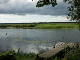
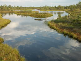
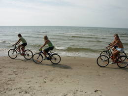
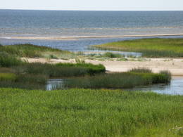
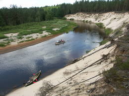
PapeThis is a shallow lagoon-type lake which, along with the area around it, is a wetland of international importance. The presence of 271 species of birds has been found in the area, including 43 birds which are listed in the Latvian Red Book and 15 that are listed in the European Red Book. The nature park includes the Nida swamp and the part of the sea which is alongside the park - newly estabilshed sea protected area "Nida - Pērkone". Between Lake Pape and the Baltic Sea we find Latvia’s oldest bird ringing station, where rings are attached not only to birds, but also to bats. Lake Pape is the first territory in Latvia where livestock adapted to life in the wild have been released for the proper management of the lake’s flood-land meadows. First there were wild horses (“Konik” horses), then aurochs and the European bison. Visitors can use bird and nature observation towers, nature trails, etc. The Ķoņi village is a unique example of a seaside fishing village. Pape is popular among bird-watchers, and the park’s visitors centre is found in the “Nature House” of the Worldwide Fund for Nature. Services
270km - Distance from countries capital cityServices - recreational
BoatsLaivu noma braucienam pa Papes ezeru.
Boat tourŪdenstūrisma maršruts pa Papes ezeru
Bicycle trailVelomaršruts "Jūrmalciema velotakas".
Nature trailPapes dabas procesu taka (9,1 km). Kājinieku maršruts apkārt Papes ezeram. Pastaigas gar Baltijas jūras krastu.
Nature watchingDzīvei savvaļā pielāgotie mājlopi - "Konik" zirgi, taurgovis, sumbri (vietējā gida pavadībā!). Putnu vērošanas slēpņi, putnu vērošanas tornis. Dabas māja ar izglītojošu ekspozīciju. |
 |
Latvia
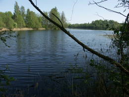
Carmana ezersDabas parks, kura lielāko daļu aizņem neprastās formas un līčiem bagātais Cārmaņa (arī Cārmins) ezers. Ezera ūdens ir ļoti tīrs, tādēļ tajā sastopamas Latvijai retas augu sabiedrības. Tā kā parka teritorijā nav tūristiem veidota infrastruktūra, interesenti var baudīt skatus, kas paveras uz ezera un tā apkārtni no Aulejas – Grāveru ceļa.
|
 |
Latvia
AdaziBaltijas mērogā unikāls dabas un cilvēkizmantots apvidus, kas veidojies kādreiz - padomju, mūsdienās - Latvijas Nacionālo bruņoto spēku pārvaldītā armijas poligona teritorijā. Poligona lielāko daļu aizņem smilšains vai ar zemiem lakstaugiem un krūmāju apaudzis kāpu masīvs ar atsevišķiem lielākiem kāpu vaļņiem. Rudens laikā šeit lielās platībās zied virši. Unikālā virsāju un aprimušo kāpu ainava un daudzu sugu dzīves vieta bija daži no iemesliem, kādēļ šai militārai teritorijai ir piešķirts arī aizsargājamas dabas teritorijas statuss. Jāatgādina, ka poligona apmeklējumi privātpersonām bez iepriekšēja saskaņojuma ir aizliegti!
|
 |
Latvia
AugsdaugavaThe aim of this territory is to regulate the natural and cultural landscapes of the upper reaches of the Daugava River valley, where there is a great deal of biological diversity. Nature trails have been installed in the park, as have bicycle routes. The river is good for boating in this area, too. The Curves of the Daugava nature park is part of the territory (see “Nature Parks”). |
 |
Latvia
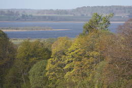
The Western Shore of the Bay of RigaThis is an area where migrating birds seek shelter and food all around the year. Seen most often here are the red-throated and black-throated loon, the common shelduck, the long-tailed duck, the velvet scoter and the little gull. The territory is also important for the protection of reefs. It lies opposite the Dundaga, Roja and Engure administrative districts, as well as the city of Jūrmala, and it covers 132,173 hectares of territory. The marine parts of the Engure Nature Park and the Ķemeri National Park are covered.
|
 |
Latvia
Jurmalas parks LiepajaViens no lielākajiem cilvēka veidotajiem Latvijasparkiem (70 ha), kas izstiepies no Liepājas ostas līdz Dienvidu fortam > 3 km garumā. Tā izveidi uzsāka jau 1870. g. pēc pilsētas mēra K. Ūliha iniciatīvas, uzbūvējot kūrmāju un strūklaku. 19. - 20. gs. mijā ap Dzintaru un Liepu ielām parādījās greznu villu un savrupmāju apbūve. Viena no skaistākajām ir jūgendstilā celtā savrupmāja Liepu ielā 27, kurā atrodas Krievijas ģenerālkonsultāts. Ēkai ir slēgta uzeja, balkoni, pildrežģa konstrukcijas un kārniņu jumts (arhitekti G. Jenike un P. M. Berči). Jūrmalas parks visās sezonās ir iecienīta pastaigu un dažādu aktivitāšu norises vieta. Te meklējams stadions „Daugava”, tenisa korti, koncertestrāde “Pūt, vējiņi!”, vasaras kafejnīcas, minigolfa laukums, bērnu rotaļu laukums, skeitparks. Šeit meklējamas lielākās Latvijas bungas – vides dizaina objekts. 217
Services
217km - Distance from countries capital city |
 |
Latvia
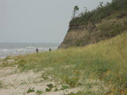
Bernatu dabas parksThis nature park covers an area of the Baltic Sea coast and part of newly established sea protected area "Nida - Pērkone" with sand dunes which once used to move around but have now settled. These are the highest dunes in Latvia. Visitors will enjoy the coastal landscape, sandy beaches and small fishing villages of the area. A nature trail has been established on Pūsēni Hill (one of the highest dunes in Latvia) for those who wish to tour the nature park. |
 |
Latvia
ZiemupeThe Ziemupe nature restricted territory is on the shore of the Baltic Sea, and it protects a wide variety of coastline biotopes. The distinguished grey dunes are found here, as are various kinds of forest biotopes, some of them quite rare in Latvia. There are many protected plants and animals in the area, too. The Akmensrags lighthouse and several tourist accommodations, like camping Laikas who "Sējējs" award, are in the territory. On the sea shore not far from center of Ziemupe there is well-appointed parking area with information stands. |
 |
Latvia
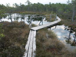
Slitere National ParkThe Slītere National Park (established in 2000) is known, with good reason, as an open-air museum which shows the historical development of the Baltic Sea. Nowadays evidence of geological events is seen in the Blue Hills of Slītere, which stand 20 to 30 metres high above what was the shore of the Baltic lake of ice 10,000 years ago. The Stiebri hills were former 8,000 or 9,000 years ago, while the Littorina Sea formed Europe’s largest set of dune ramparts and damp hollows between those ramparts. This occurred between 4,000 and 7,000 years ago. The gentle climate of Northern Kurzeme is the reason why so many rare plants are found in the park – some 860 in all including Common Yew (Taxus baccata) and Baltic Ivy (Hedera helix var. baltica). Of certain value in the preservation of these treasures was the Soviet military machine, which has left behind army bases and other military objects in the area. The presence of the military meant that the area of what is now the Slītere National Park remained largely undisturbed for 50 years. The park includes one of the most popular tourist destinations in Latvia – the Cape of Kolka, which is visited by more than 50,000 travellers each year. During the spring migration of birds, more than 60,000 birds cross the cape each hour. Along the shore of the Baltic Sea is the so-called Livonian coast, which stretches from Kolka to Sīkrags and Ovīši. Fishing villages and other cultural objects established by the world’s smallest ethnic minority, the Livonians, can be found here. Tourists will enjoy interesting four nature trails, bicycling routes, viewing tower, etc. The visitors centre is located at the Slītere lighthouse. Administration of National park is organising environmental education events on regular basis open to everyone. Services
170km - Distance from countries capital cityServices - amenitiesServices - recreational
Cross-country skiingCross-country skiing route "Pa lībiešu ciemiem", ~ 2 h
Tour guide servicesAt Šlītere lighthouse and SNP administration:
Boat tourCanoeing tour "Around the Kolka lighthouse",15 km
Bicycle trailBicycle route "Kolka - Mazirbe", route is marked, ~ 30 km
Nature trailIn the Slītere National Park are Šlītere Nature Trail (only with guide), Kolkasrags Pines Trail (1,2 km), Pēterezers Nature Trail(3,5 km), Ēvaži Shoreline Walking Trail (0,3 km). Hiking route "The Kolkasrags circle", 3kmHiking route "Learn about Mazirbe", 7-10 km Hiking route "Along the seashore and coast"
Nature watchingFor animal watchers "Animals in the Slītere"
|
 |
Latvia
Ainazi-SalacgrivaThis is another important territory for the protection of reefs, is also opposite the Salacgrīva Administrative District, and covers 7,239 hectares.
|
|
|
Latvia
Paradize (Gleznotaji) HillThis is a lovely place in Sigulda which has been painted (as the word "gleznotāji", which means "painters" suggests) and photographed for centuries. This is basically not a hill at all, it's just the place where the shore of the ancient Gauja River valley is split by the mighty Vējupīte ravine. You will have an excellent view of the Turaida Castle and the river valley. There are leisure facilities and a viewing platform there. You can ride to Paradīze hill via an electric car. 54
Services
54km - Distance from countries capital city |
 |
Latvia
Kristus Karala kalnsAtrodas nepilnus 2 km austrumos no Aglonas, Aglonas – Dagdas ceļa malā. Tā ieceres autors ir Ēriks Delpers, kurš 2006. g. uzsāka vietas labiekārtošanu, izveidojot brīvdabas skulptūru dārzu un stādījumus. Kristus Karaļa kalns šobrīd atrodas izveides procesā, taču neskatoties uz to – objekts, ko ir vērts redzēt! 232
Services
232km - Distance from countries capital city |
 |
Latvia
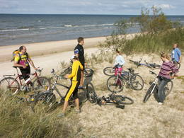
Abava River Valley Nature ParkThe ancient Abava River Valley between Kandava and the place where the river flows into the Venta River is the most expressive river valley segment in Kurzeme in terms of landscape and terrain. The valley is 30 to 40 metres deep and as much as 300 metres wide. The territory is distinguished by great diversity of a biological nature (more than 800 kinds of plants), featuring many different biotopes and natural monuments such as streams, waterfalls, cliffs, huge rocks, and many cultural and historical monumentssmall towns such as Kandava and Sabile. In both cases, the town centres are national monuments of urban construction. Popular tourist destinations include Vīnakalns hill in Sabile, where wine-making grapes are grown, as well as the open-air art museum at Pedvāle. To protect cultural treasures, a cultural and historical territory, “Abava River Valley” has been established. Wild livestock live at Drubazas and Tēvkalni to “maintain” the landscape. There are nature trails for tourists, and the Abava is the most popular river for water tourists in Kurzeme. Information is available at the tourist information centres in Kandava and Sabile. such as castle hills, churches, ancient burial grounds, and
Services
100km - Distance from countries capital cityServices - amenitiesServices - recreational
BoatsBoat rent:
Boat tourCanoeing tour "From Kandava to Renda", 42 km
Bicycle trailVelomaršruts " Skaistākās skatu vietas"
Citi velomaršruti:
Nature trailDrubazu botānikas taka (ap 1 km), pārgājiens pa Abavas senleju z/s "Tēvkalni", Abavas ielejas takas, Čužu purva dabas taka. Visas takas ejamas tikai gida pavadībā!
Nature watchingSkatu punkti/vietas Abavas ielejas krastos, no iespaidīgajiem pilskalniem, dzīvei savvaļā pielāgotie mājlopi z/s Tēvkalni un Drubazu botānikas takā u.c. |
 |
Latvia
The Little Sigulda of PilskalneThe Little Sigulda of Pilskalne is a place for longer or shorter hikes. Here you will find a number of trails – the Sprīdītis trail (1.6 km, featuring wooden sculptures of characters from fairy tales by Anna Brigadere), the Forest landscape educational trail (3.8 km), and the Highland landscape trail (8 km in each direction). The trails are in a sub-glacial depression with a number of little lakes and swamps that are connected by streams. This is a restricted environmental area aimed at protecting the landscape and its treasures. At the beginning of the trails (near Pilskalne) there is the Melnaiskalns (Rāmavas) castle hill, which is around 30 m high. Services
240km - Distance from countries capital cityServices - recreational
Nature trailTrīs dabas takas, no kurām viena speciāli bērniem - Sprīdīša taka. Jāņem vērā, ka Augšzemes takas garums - 8 km ir tikai vienā virzienā (jānāk arī atpakaļ tikpat, vai arī sagaida transports!)
Nature watchingTrīs dabas taku teritorijā.
|
 |
Latvia
EmbuteThis lovely territory includes the hillocks of Embūte, which are in the ancient Embūte valley. The aim of establishing the park was to protect the landscape, biotopes and species of the region. An ecological tourism trail has been established in the valley, as has a forest trail through the nature park (accessibly only in the company of a guide). Visitors will learn about the hillocks and ravines left behind by the Ice Age. The ravines and the forests along their sides are protected biotopes. There are also important natural and cultural monuments, including the Embūte castle hill and the ruins of a baronial estate, castle and church. Other points of interest include the death place of the Courlandian warrior Indulis, the Joda dam, meadows, a viewing tower, etc. Three unmarked bicycle trails are in the area. Services
170km - Distance from countries capital cityServices - recreational
Bicycles
Bicycle trailTrīs nemarķēti (plānots ieviest marķējumu) velomaršruti 20 - 25 km garumā.
Nature trailEmbūtes senlejas ekotūrisma taka un Embūtes dabas parka meža taka. Vēlams izmantot vietējā gida pakalpojumus.
Nature watchingAinavas vērošana no Embūtes pauguraines augstākajām virsotnēm, Embūtes pilskalna un skatu torņa. Embūtes ekotūrisma informācijas un izglītības centrs.
|
 |
Latvia
A region of protected landscapes along the northern stretch of the Gauja RiverThis is a stretched-out territory from Valmiera to the Ape Administrative District, and its primary “axis” is the unregulated Gauja River valley with a dense web of old rivers, park-like meadows of oak trees on their banks, and stands of oaks and other broadleaf trees. Many rare and protected birds, including corn-crakes, woodpeckers, wood grouses and others live and breed here. This is also one of the most important places in Latvia in terms of where the deciduous tree hermit beetle lives.
Services
180km - Distance from countries capital city
1-12 Active season monthsServices - recreational
Boat tourBoat down the Gauja River from Vireši to Valmiera (133 km).
Nature trailHike the Zīle nature trail (2.2 km), the Vekši nature trail (600 metres) with its “wild” cows, the Gaujiena nature trail (6 km), the Randāti nature trail (1 km), and the Vizla nature trail (1.2 km).
Nature watching |
 |
Latvia
MezoleThese are hillocks at the northern end of the Vidzeme highlands, and this is an important location for boreal (Northern) forests and swamps. Various kinds of swamps are found here, and the area is home to a variety of protected invertebrates.
|
 |
Latvia
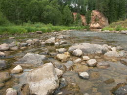
The Amata River valleyThe Amata is one of Latvia's swiftest river, and water tourists congregate there each spring to engage in extreme activities. From the Rīga-Veclaicene highway, the Amata flows into a deep valley, with an average drop of more than 3 m/km or, downriver, as much as 8-10 m/km. Water tourists usually use the segment of the river between Melturi and the Zvārte cliff or the Veclauči bridge that spans the Līgatne-Kārļi road. Please remember that the Amata is not a friendly river for beginners. After lengthy rainfall, the river can be navigable during other times of the year, as well. The surrounding valley is attractive because of impressive sandstone and dolomite cliffs, among which the best known are the Vizuļi cliff (which can be the site of beautiful frozen waterfalls in winter), the Ainavu cliff, the Ķaubju cliff, the Dzilna cliff, the Zvārte cliff, and the Lustūzis cliff. Between Melturi and Veclauči, there is the Amata geological trail, which is marked with orange paint on tree trunks. There are three segments to the trail – from Melturi to the Kārļi fish farm, from the fish farm to the Zvārte cliff (both segments can be extreme!), and from the Zvārte cliff to the Veclauči bridge. You can hike the trail at any time except when there is deep snow. The most impressive views will be found when the trees are bare. If you boat down the river, you will not have time to look at or photograph the cliffs, because all of your attention will be focused on the river itself and the obstacles therein. |
 |
Latvia
The Ance swamps and forestsThis comparatively large territory is found to the South of the Irbe River and Stende River, and it is unique with more or less virginal forests and dunes. The Irbe River has a system of ancient tributaries, and the Dižpurvs swamp is parallel to the shoreline. The Irbe has become a popular river for water tourism in recent years, but the tourist infrastructure on its banks remains insufficient. Territory has good road connections and has potential for nature education activities. |
 |
Latvia
ParabaineSalīdzinoši liela un cilvēka mazskarta teritorija ziemeļos no Lubāna ezera, kas izceļas ar lielu purvu un mitro mežu, kā arī tajā dzīvojošo organismu daudzveidību. Cauri teritorijas austrumu daļai tek Aiviekste. Dabas liegums ir grūti pieejams, tajā nav izveidota ar tūrismu saistīta infrastruktūra, tādēl vislabākais veids ir to aplūkot no Lubānas - Gaigalavas ceļa, kā arī putnu vērošanas torņa pie Gomeļa ezera (Gūmelis), kurš gan 2007. g. rudenī bija cietis no apmeklētāju vandālisma. Teritorija ietilpst Lubāna mitrāja kompleksā.
|
 |
Latvia
The Pavasaru-Odinu polderThis is an open territory which is 3.5 km long and 2 km wide. It is located on the left bank of the Lielupe River between the village of Pavasari and the Odiņi homestead. The polder was established during the Soviet era to obtain farmland, and back then it was used very intensively. Today, it is slowly becoming overgrown, and despite this, this is one of the most important locations in Europe for corn-crakes. A gravel road crosses the polder from the North to the South, and this is an excellent place to hear the songs of the corn-crake. 40
Services
40km - Distance from countries capital city |
 |
Latvia
The Irbe NarrowsThis is an enormously important territory for migrating birds. The most commonly spotted protected species of birds are the velvet scoter, the black scoter, the long-tailed duck, the little gull, the red-throated and black-throated loon, and the black guillemot. The territory is opposite the Dundaga and Ventspils administrative districts, and it covers 172,412 hectares.
|
 |
Latvia
Bauskas dabas parksThe Bauska Nature Park runs for several dozen kilometres along the Lielupe River and its tributaries – the Mūsa and the Mēmele. This is a protected territory. The shores of these rivers contain some of the largest dolomite cliffs in Zemgale. These are protected both as biotopes and as geological monuments. The rivers are important places for river lampreys and vimbas to spawn. Tourists will be attracted by the cultural landscape of the area, as well as the cultural monuments such as the Bauska castle, the Jumpravmuiža park, the Mežotne castle hill, Vīna Hill, the Mežotne castle, etc. The rivers are used for water tourism. Services
70km - Distance from countries capital cityServices - recreational
Bicycle trailBauskā sākas velomaršruts "Iecavas augšteces loks" (138 km).
Nature trailMežotnes pilskalna labiekārtošanas gaitā ir izveidotas kāpnes un takas šī nozīmīgā kultūrvēstures pieminekļa iepazīšanai.
Nature watchingNo Mežotnes pilskalna skatu platformas, Jumpravmuižas parka.
|
 |
Latvia
The Pape Nature ParkThe most important aspects of this park are a shallow lagoon-type lake – Lake Pape, with its flood land meadows, the shore of the Baltic Sea, the Nida swamp, and the more than 270 different types of birds that have been spotted here. The oldest bird ringing station in Latvia (est. 1966) is found between Lake Pape and the Baltic Sea. Birds and bats are caught and ringed there. Lake Pape is the first place in Latvia where so-called “wild” horses (the “Konik” breed) were released with the aim of managing the flood land meadows.
Services
1-12 Active season monthsServices - recreational
Nature trailDabas procesu taka (9,1 km) ar skatu torni, pārgājiens apkārt Papes ezeram (26 km, var būt ekstrēms!);
Nature watchingDzīvei savvaļā pielāgoto zirgu, taurgovju un sumbru vērošana gida pavadībā; Putnu vērošana migrāciju laikā; Putnu vērošanas tornis Papes ezera D krastā. |
 |
Latvia
Vitrupe-TujaThis is an important territory for the protection of reefs. It is opposite the Salacgrīva Administrative District and covers 3,577 hectares. The marine part of the “Rocky Shore of Vidzeme” nature reserve is a part of the territory.
|
 |
Latvia
Klanu purvsThere is picnic area and information stand at the end of the forest path leading from Muiznieki to Klanu Bog. Klanu Lake was formed in the place of Littorina marine lagoon. Nature restricted area was established to protect biotopes in the area of Klanu, Dziru and Stavu Lakes. There is wide information about the area available on the information stand.
 230
230
Services
230km - Distance from countries capital city |
 |
Latvia
Uzavas augsteceNature restricted area is located to the South from former railroad Ventspils-Liepaja and includes approximately 6 km of Uzava River (and the old drainage system). The territory was used for agriculture during Soviet time, now it starts overgrow by scrubs. The protected nature values – rare bird species, including corncrakes, variety of grassland habitats and plant species. Territory is not useable for tourism activities. There is a possibility to get good insight into the North part of restricted area from the road Alsunga – Berzkalns where information stand is located.
|
 |
Latvia
Moricsalas dabas rezervatsThis is Latvia’s oldest nature reserve and, indeed, the country’s oldest protected natural territory. Moricsala is an island in Lake Usma, which is the fifth largest lake in Latvia. The reserve was established in 1912 at the initiative of a group of nature students from Rīga. They wished to protect the deciduous forest of oak trees on the island, along with the local flora and fauna. The nature reserve also includes the Lielalksnīte island. Visits to the reserve, however, are strictly prohibited. |
 |
Latvia
The Meadows of Lake Burtnieks Nature ReservePeriodically flooded flood-land meadows on the eastern and southern shores of Lake Burtnieks are an important nesting location for the rarely seen corncrake. A nature and information trail has been established at Vīsrags with directions, information stands and a viewing tower.
Services
120km - Distance from countries capital cityServices - recreational
Nature trailLieliska dabas taka, kurā apvienota Burtnieku apkārtnes dabas vērtību un kultūras mantojuma izziņa.
Nature watchingNo Vīsraga dabas takas un tajā uzceltā putnu vērošanas torņa paveras labs kopskats uz apkārtnes palieņu pļavām u.c. biotopiem. Burtnieku parkā informācijas stendi par šejienes bioloģisko daudzveidību. |
 |
Latvia
Kalkupes ielejaThe Kaļķupe River valley was established as the Pilsupe River (formed by Kaļķupe River and Mazupe River) crossed the Blue hills of Šlītere to the South of Vīdale and Kaļķi. The distinct river valley has a branched network of gullies in which Devonian sandstone has been uncovered and can be seen in some locations. Puiškalns Hill (located at confluence of Kaļķupe River and Mazupe River), which was used as a castle hill and as a sacred location long in the past, is one of the most distinctive parts of the area. It is a popular tourist destination in the Talsi District. Hillside forests, various kinds of meadows and a wide range of plants are also of value in the local environment. |
 |
Latvia
Krustkalni Nature ReserveThe Krustkalni Nature Reserve was established in 1977, and the diversity of plants in the region is based both on the terrain – the Madona-Trepe embankment, a series of hillocks with low areas among them, swamps and small lakes – and on the biotope – natural meadows, forest glades, places where underground streams bubble up to the surface, and vast areas of forest with very old stands of trees. Some 800 types of plants have been defined in the reserve. It can be toured only in the company of a guide from reserve headquarters, and one must apply in advance. Visitors can visit the Krāku streams, Lake Svēte-Dreimaņi, and other sites. Services
160km - Distance from countries capital cityServices - recreational
Tour guide servicesRezervāts apmeklējams tikai un vienīgi rezervāta gida vai reindžera pavadībā, iepriekš savulaicīgi piesakoties un noteiktā laikā.
Nature watchingAinavas un lieliski skati no skatu torņa, izglītojošas ekskursijas, atsevišķu dabas objektu un apmeklētāju centra "Dreimaņos" apskate tikai un vienīgi Teiču rezervāta gidu un reindžeru pavadībā, iepriekš savulaicīgi piesakoties. Rezervāta administrācijas gidi, vides gidi un reindžeri piedalās un organizē dažādus ar vides izglītību un dabas vērošanu saistītus pasākumus. Teiču rezervāta administrācijas ēkā ir izveidota izglītojoša ekspozīcija, blakus ēkai - neliela laipu taka, informācijas stendi un kartes. |
 |
Latvia
Naturpark Daugavas loki (Daugavabögen)This nature park is one of the richest and most unusual nature parks in Latvia in terms of its natural resources, the surrounding environment, the landscapes, the biological diversity of the area, and the cultural monuments which are found there. The main treasure there is the little-changed Daugava River valley, where there are eight major curves in the river at a length of four to eight kilometres. There are also the gullies of river tributaries. Outstanding views can be found on the steep shores of the Daugava River valley, particularly the Slutiški and Ververi cliffs and the Elerne gravel hill. There are some 20 archaeological monuments on the shores of the valley -- ancient castle hills at Najene, Markova, Vecračina, etc., countless churches -- the Juzefova, Sprukti, Borovka, Elerne, Sīķele, Kaplava and other churches, the Rozališki, Lielborne and other baronia estates, and the unique village of Slutiški, which is home to the Old Believers. There are interesting nature trails and bicycling trails in the area. Horseback riding is available, and there is a viewing tower along with other elements for tourists. Boating down the Daugava River is an interesting way to spend time. Services
260km - Distance from countries capital cityServices - amenities
Place for tentsServices - recreational
FishingDaugavā saskaņā ar esošo kārtību.
BicyclesMeklējama Krāslavā.
Horseback ridingZemnieku saimniecībā "Klajumi" (Sējējs - 2007. laureāti). Viena no retajām saimniecībām, kas piedāvā vienas - vairākdienu pārgājienus ar zirgiem. Pieejami reiterapijas pakalpojumi.

Ride in horse driven sledgeZ/s "Klajumi"
Boat tourPopulārs ūdenstūrisma maršruts no Krāslavas līdz Naujenei vai Daugavpilij.
Bicycle trailVairāki velomaršruti Krāslavā un tās apkaimē, no kuriem kā interesantākais jāmin "Daugavas loki" (ap 46 km).
Nature trailDinaburgas taka, Markovas izziņas taka (ap 1,6 km), Adamovas taka u.c.
Nature watchingAinavas un putnu vērošana no skatu torņiem Vasargeliškos un Krāslavā. |
 |
Latvia
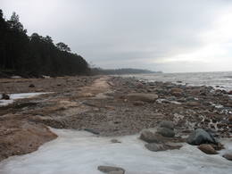
Grinu dabas rezervatsThe word grīnis in Latvian refers to a very unusual type of forest – pine trees growing on sandy soil. There are two types of this environment – the heather type and the grass type. This is the result of long-lasting interaction between nature and humankind, and such sites are found in just a few places along the shores of the Baltic Sea in Latvia. A very rare plant which grows in the area – cross-leaved heath – was the main reason why a nature reserve was established here in 1936. An abandoned former rail line between Ventspils and Liepāja crosses the reserve from the North to the South. Visits to the reserve are strictly prohibited.  250
250
Services
250km - Distance from countries capital city |
 |
Latvia
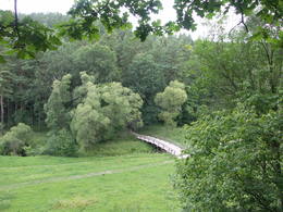
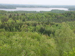
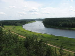
Gauja National ParkThe Gauja National Park, established in 1973, was Latvia’s first national park, and it has a wealth of tradition in environmental protection and tourism. Indeed, the GNP is one of the most popular tourist destinations in Latvia. The main “artery” of the park is the ancient Gauja River valley, which was left behind when Ice Age glaciers receded. The valley is 95 kilometres long, with many tributaries that are also in deep ravines with massive sandstone cliffs from the Devonian period. The deepest part of the river valley is at Sigulda, where it is 85 metres deep. The territory has a great diversity of species – some 900 plant species in all. The Gauja is Latvia’s most popular river for water tourism, and many tourist accommodations are found along its shores. The Gauja National Park is one of the best-appointed protected territories in Latvia in terms of nature trails and tourism routes. Nature trails at Līgatne pass along paddocks of wild animals – the largest and most complete object of its kind in the Baltic States. The park also features cultural monuments of pan-Baltic importance – the Turaida Museum Reserve, the medieval old town of the city of Cēsis with its famous castle ruins and St John’s Church, the lake castle at Āraiši, etc. Visitors centres are found in Sigulda, along the Līgatne nature trails, and at the Zvārte rock. The administration of the GNP is building a new and modern visitors centre in Sigulda.
Services
50km - Distance from countries capital cityServices - amenities
Place for tentsfor water tourists
Services - recreational
BoatsŽagarkalns, Siguldas pludmale
BicyclesJāmeklē Valmierā, Cēsīs un Siguldā.
Cross-country skiingLigatne nature trails
Tour guide servicesNational park administration
Boat tourCesis - Ligatne - Sigulda (1-2 days trip)
Nature trailGaujas nacionālā parkā ir salīdzinoši blīvs taku, maršrutu un dabas taku tīkls. Starp tām ir jāmin: Sietiņieža dabas taka (1,5 km), Cīrulīšu dabas takas (līdz 6 km), Ieriķupītes dabas taka, taka "Meža mātes valstībā", Amatas taka (2,2 km), Līgatnes dabas takas (taku komplekss), taku tīkls Siguldas, Turaidas un Krimuldas apkārtnē, Kubeseles taka u.c. Šobrīd Gaujas nacionālā parka administrācija lveido un labiekārto kājinieku tūrisma maršrutu Gaujas krastos posmā no Murjāņiem līdz Siguldai.
Nature watchingGaujas krastos, braucot pa Gauju, kā arī daudzajās dabas takās. Ieteicams izmantot arī Gaujas nacionālā parka gidu sniegtos pakalpojumus!
|
 |
Latvia
Aiviekstes palieneTeritorija, kas aptuveni 20 km garumā „piekļāvusies” abiem Aiviekstes upes krastiem. Dabas parka galvenā vērtība ir palieņu pļavas (un citi pļavu biotopi), kas ir ļoti nozīmīga daudzu augu un dzīvnieku (īpaši – putnu) sugu dzīves vieta. Ūdenstūristiem, kas laivo pa Aivieksti, nakšņošana ir jāplāno tikai šim mērķim paredzētās vietās!
|
 |
Latvia
SventeThe Svene Nature Park is in the central part of the Augšzeme highlands, and Lake Svente is at its centre. This is one of the cleanest lakes in Latvia. There is also Egļukalns Hill, which offers one of the most beautiful views in all of Zemgale from its viewing tower. Visitors can gaze at the hillocks and lakes of the Svente area. Egļukalns Hill also has ski trails and a nature trail. |
 |
Latvia
BeberbekiThis territory is meant to protect the “green zone” of Rīga. Most of the park is covered with pine forest and dunes with shrubs on them, but Lake Beberbeķi is found at the southern end of the park. The area around the lake has been improved. Services
10km - Distance from countries capital cityServices - recreational
Cross-country skiingTeritorijā piemērotā laikā distanču slēpotāji izveido špūru tīklu ar jaukiem nobraucieniem no stāvajām kāpu mugurām.
Nature trailLai arī teritorijā nav speciāli veidotu dabas taku, tā piemērota pastaigām un nelieliem pārgājieniem, apvienojot tos ar citiem pierīgas mežiem un apskates objektiem.
|
 |
Latvia
Istras pauguraineNo ģeogrāfiskā un kultūrvēsturiskā viedokļa interesanta teritorija Latgales augstienes Rāznavas paugurainē, kuras nozīmīgākie resursi ir dažāda veida biotopi, ainavas, reljefs un Šķaunes ezers. Istras pauguraines dabas parkā nav ar tūrismu saistīti labiekārtojumi, bet šo teritoriju var apskatīt arī „no malas”, braucot pa grantēto ceļu no Soboļinas uz Osinovku, kas iet līdztekus parka ziemeļu robežai (skats uz Šķaunes ezeru).
 290
290
Services
290km - Distance from countries capital city |
 |
Latvia
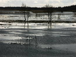
The Dviete ancient river valleyThe Dviete ancient river valley is a unique territory of environmental, cultural and historical importance between Kaldabruņas, Bebrene and Dviete. The small Dviete River flows through the ancient river valley, through Lake Skuķi and Lake Dviete, and through the wetland meadows that are alongside the valley. During flooding season, these wetlands store up water from the Daugava River, rapidly absorbing masses of floodwater and then slowly returning the water to the river. The views during wet springs are incomparable to anything else that can be seen in Latvia. The specifics of the shifting water level in the ancient river valley are the reason why this is an important place for plants and birds during migration and nesting season. The Dviete Wetlands Nature Park has been set up to protect the territory. It is interesting that higher areas which do not disappear underwater during the floods are known as islands. Archaeologists who have studied the Dviete ancient river valley have found 15 possible settlements of the ancients (from the Stone Age, Bronze Age and Iron Age). They found a wealth of ancient objects of various kinds. There is reason to believe that this is one of the oldest and most important settlements in what is now southern Latvia. 211
Services
211km - Distance from countries capital city |
 |
Latvia
VecpiebalgaThis area was established to protect the cultural and lake-related landscapes of the central section of the Vidzeme highlands, with Lake Alauksts, Lake Inesis, Lake Tauns, etc., with their species and biotopes. There are many important cultural objects in this territory – the Vecpiebalga Lutheran Church, the Vecpiebalga castle ruins, the Vecpiebalga baronial estate, as well as locations where several distinguished figures from the Latvian world of culture have lived and worked. Memorial museums have been established to commemorate them. The lakes are great for fishing, and cross-country competitions are traditionally held in the area of Lake Alauksts during the winter. The Sproģi nature reserve has been established on the islands and peninsula of Lake Inesis.
|
 |
Latvia
Daugavas ielejaThe nature park in the Daugava River valley is the only place between the cascades of the Daugava hydroelectric power plants there is still a chance to see the Daugava River valley and the ravines of its tributaries as they appeared before the area was flooded so that the power plants could be constructed. Particularly lovely views are found on the right bank of the river near the Aizkraukle church and castle hill. Forests, meadows, origins of streams and small dolomite cliffs in this area are all protected biotopes. Leisure facilities have been installed on the Aizkraukle castle hill, and the Aizkraukle castle ruins are not far away. |
 |
Latvia
ViresiThis is a segment of the Gauja River which is full of rapids in some places. It stretches from Vidaga and the place where the Vecpalsa River flows into the Gauja. Along the Gauja and its tributaries, dolomite outcrops can be seen on the shores, and the largest of these are the Randati cliffs. The restricted area was established mostly to protect various kinds of forests, meadows, outcrops and their habitats. This is an interesting part of the central section of the Gauja for people who enjoy beautiful landscapes and for those who are water tourists.
Services
150km - Distance from countries capital cityServices - recreational
Boat tourIespējami vairākdienu nobraucieni ar laivu pa Gauju no Virešiem līdz Valmierai un tālāk - Cēsīm un Siguldu.
Nature trailVizlas lejtecē un pie Randātu klintīm izveidotas divas interesantas un labiekārtotas dabas takas.
Nature watchingLabs veids - brauciens pa Gauju ar laivu. Gaujas ielejas vērošana no Randatu klintīm.
|
 |
Latvia
Korneti-PelliOne of the most distinct sub-glacial depressions in Latvia, with 11 lakes of various sizes and depths. This is a magnificently lovely territory, with particularly good views from the Drusku castle hill. On a clear day, one can even see the Hanja highlands of Estonia. The restricted territory was set up to protect boreal and hillside forests I the area.
|
 |
Latvia
VeclaiceneThis territory was established so as to preserve the natural and cultural landscape of the most distinct part of the Alūksne highlands – a landscape which is made up of the highest hillocks in the area – Dēliņkalns Hill, Dieva Hill, Saules Hill, the Drusku castle hill, and the Kornetu-Peļļu sub-glacial river bed (one of the most significant terrain differences in Latvia). There are lakes, too – Lake Pilskalns, Lake Dzērve, Lake Ieva, Lake Raipals, etc. There are also significant biotopes – hillside and gully forests, various kinds of swamps and meadows, damp forests, etc., all with their own species of flora and fauna. There are nature trails and tracks for cross-country and downhill skiing in the area. There are three restricted natural areas in the territory – Korneti-Peļļi, the Avotu forest, and Dēliņkalns Hill. Services
170km - Distance from countries capital cityServices - recreational
FishingEzeros saskaņā ar pastāvošo kārtību.
SkiingĶauķu kalnā.
Cross-country skiingDēliņkalna un Ķauķu kalna apkārtnē.
Tour guide servicesIeteicams izmantot vietējo gidu pakalpojumus. Alūksnē - "Vides labirints" ar vides izglītību saistīts pasākums.
Bicycle trailJaunalūksnes apkārtnē tiek piedāvāti lokāli nemarķēti velomaršruti.
Nature trailDrusku pilskalnā.
Nature watchingNo pauguriem, īpaši Drusku pilskalna, Dēliņkalna, Ķauķu kalna u.c. paveras fantastiskas ainavas.
|
 |
Latvia
Dviete WetlandsThe Dviete Wetlands Nature Park contains a unique natural territory – the ancient Dviete River valley with the Lake Skuķi and the Lake Dviete and the surrounding wetland meadows. During flooding season, these wetlands store up waters from the Daugava River. They absorb a lot of floodwater at first and then slowly return it, thus reducing the level of floods in the Daugava River valley. This process is the reason for the unique ecosystem which exists in this area. It is an important location for plants and birds both during migration and nesting season. The river valley is important for birds during migration and nesting. In 2006, wild cows were released into the meadows. There is also work to improve the tourist infrastructure in the area. Services
200km - Distance from countries capital cityServices - amenities
Accommodation availableServices - recreational
Boat tourBoating route Boating During the Flooding of the Dviete, , distance 13 km
Bicycle trailVelobraucējiem un autoceļotājiem maršruts pa Dvietes
palienes dabas parku un tā tuvāko apkārtni.
Nature trail
Nature watchingDvietes senlejas un Daugavas ielejas ainavas. Dzīvei savvaļā pielāgotie
mājlopi, putni. Ir izvietoti informācijas stendi. Ievērojiet putnu
vērošanas ētikas kodeksu!
Maršruts dabas vērotājiem spāres Dvietes palienē Maršruts putnu vērotājiem putni Dvietes palienē. |
 |
Latvia
Rakupes ielejaThis territory is on both sides of the central section of the Raķupe River. On the banks of the river, there are many different meadow habitats, as well as massive oaks growing in the places of former farmsteads which are uninhabited by now. This is an important place for rare plants and animals. There is no tourism infrastructure for visitors in the area. Visitors who are especially interested in the environmental cognition are advised to visit the territory in attendance of experienced local guide. Raķupe is not usable for water tourism because of tilts of trees and beaver dams. |
 |
Latvia
Puzes smilsu krupja atradneNature restricted area has been established in old and overgrowing gravel pit and where rare species in Latvia - Natterjack toad (Bufo calamita) can be found. Natterjack toad needs open sand – gravel area therefore the population of it is decreasing once gravel pit is overgrowing by bushes. The population of this amphibian is depending on the activity of people in the area. There is very little chance to find Natterjack toad just by entering the restricted area, therefore please respect this area as especially sensitive.
150
Services
150km - Distance from countries capital city |
 |
Latvia
Ziemelvidzemes biosferas rezervatsThe largest NATURA 2000 territory in Latvia covers 6% of the country’s area. It is located in parts of the Limbaži, Valmiera and Valka districts, and it is a place of an enormously diverse range of landscapes, biotopes and species. The Salaca River is one of the most important rivers in the entire Baltic Sea region in terms of spawning grounds for salmon. The river valley and its sandstone cliffs attract many visitors. It is no accident that this is the second most popular river in Vidzeme for water tourism. The shore of the Bay of Rīga, which is not very long, also features a great diversity in landscapes and biotopes. At the northern end, we find the Randu meadows. In the central part there are sandy beaches, but at the southern end – 22 kilometres of rocky shoreline. The so-called Northern swamps are found on the border with Estonia, while the Seda heath is one of the most important places in the region for birds to rest and feed during migration. The reserve also features a diverse forest in which one can find all of the types of forest which are common in Latvia. Nature trails and viewing towers or platforms are found in the Randu meadows, on the banks of Lake Burtnieks, along the Planči and Niedrāji-Pilka swamps, on the banks of Lake Dziļezers and Lake Lielezers, and elsewhere. The Skaņākalns park in Mazsalaca is one of the most popular tourist destinations in Northern Vidzeme. The territory boasts many important cultural monuments, including one of the earliest known settlements in Latvia – a fishing settlement and burial ground which date back to the 5th to the 2nd millennium BC.
Services
50km - Distance from countries capital cityServices - amenities
Accommodation availableBrīvdienu māja "Vējavas"
Kempings "Rakari" Brīvdienu māja "Roķi" Viesnīca "Kapteiņu osta" Viesnīca "Brīze" Brīvdienu māja "Ķurmrags" Brīvdienu māja "Saules ligzda" Lauku māja "Duntes urdziņas" Services - recreational
FishingSalacā, Burtniekā, Rīgas līcī u.c. ūdeņos - saskaņā ar pastāvošo kārtību.
Cross-country skiingMazsalacas apkārtnē u.c.
Berry and mushroom picking
Tour guide servicesZiemeļvidzemes biosfēras rezervāta administrācijā strādā vides gidi,
kas piedāvā un organizē dažādus ar vides izglītību saistītus pasākumus.
Gidi pieejami arī citos tūrisma objektos
ZBR pieejamo servisu lapu un karti, kurā apkopoti rezervātā pieejamie pakalpojumi skatieties šeit.
Boat tourSalaca ir viena no populārākajām ūdenstūristu upēm. Tās krastos ir
izveidotas ūdenstūristu apmetnes (daudzas no tām apsaimnieko
privātīpašnieki - maksas). Ieteicamais maršruts no Mazsalacas līdz
Staicelei vai Vecsalacai.
Laivotājiem maršruts no Tūjas lidz Salacgrīvai, maršruta garums 13 km.
Bicycle trailTeritorijā ir vairāki nemarķēti velomaršruti: Sigulda - Aloja - Ainaži
- Salacgrīva (136 km), Ainaži - Sarkanās klintis (10 km), Rūjiena -
Karksi Nuia (32 km) u.c.
Velomaršruts pa Vidzemes piekrasti, maršruta garums ~ 56 km
Nature trailZBR ir dabas un
izziņas takas, kuras veidojusi gan rezervāta administrācija, gan
vietējie uzņēmēji un pašvaldības. Starp tām ir jāmin: Randu pļavu taka,
Planču
purva taka (0,5 km), Niedrāju
- Pilkas purva taka (ap 1 km), Dziļezera
dabas taka (ap 3 km), Minhauzena
meža taka (5,3 km), Vīsraga
dabas taka, Jēču dabas
maršruti (5 - 7 km), Augstrozes pilskalna taka, Dabas taka
apkārt Ozolmuižas Mazezeram, Skaņākalna
takas, Ķirbižu meža izziņas taka, Oleru taka u.c. 2007. g.
ZBR administrācija ir izveidojusi jaunu, ap 10 km garu dabas taku,
kuras sākums atrodas pie Skaņākalna.
Pārgājiena maršruts gar Vidzemes akmeņaino jūrmalu, garums 19 km. Pārgājiena maršruts botānikas tūre kājāmgājējiem, garums ~ 14 km.
Nature watchingDabas vērošanai ir piemērota ZBR piekraste, ūdeņi (Salaca, Burtnieks),
purvi, kuros ir šim nolūkam izveidotas takas, skatu torņi (Randu pļavu
un Vīsraga dabas takās) u.c. Randu pļavas un Sedas tīrelis ir populāras
putnu vērošanas vietas. Ievērojiet putnu vērošanas ētikas kodeksu!
Putnu vērošanas maršruts gar Vidzemes piekrasti. Maršruts autoceļotājiem gar Vidzemes krastu: Ainaži - Dunte. |
 |
Latvia
VilceThe Vilce Nature Park is small in size and exists alongside the deep valleys of the Vilce River and its tributaries. Biotopes include visible sandstone cliffs, rapids on the rivers, forests typical of such areas, and the plants and animals that are found therein. The well-appointed Vilce castle hill is next to the Zaķu meadow, which is a nicely appointed and popular place for recreation. |


