
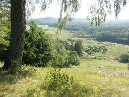
Andere Naturgebiete
Naturgebiete
| Überblick | Details |
|---|---|
 |
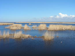
Lettland
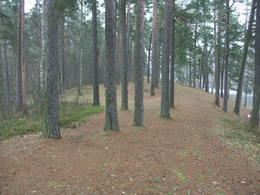
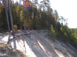
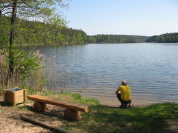
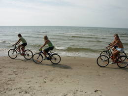
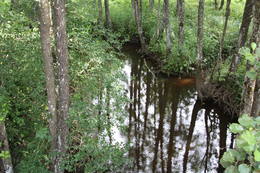
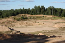
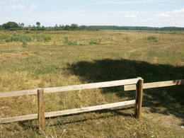
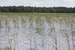
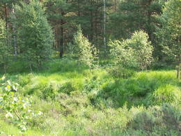
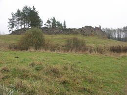
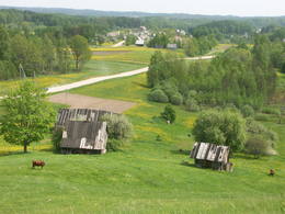
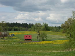
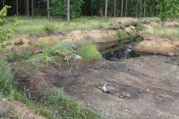
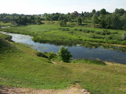
BeberbekiDieses Territorium soll die “grüne Zone” von Riga schützen. Der größte Teil des Parks ist mit Kiefernwald und Dünen mit Sträuchern darauf bedeckt. Der See Beberbeķi befindet sich im südlichen Teil des Parks. Das Gelände um den Park herum wurde verbessert.
Leistungen
10km - Entfernung von der HauptstadtLeistungen - erholung
LanglaufTeritorijā piemērotā laikā distanču slēpotāji izveido špūru tīklu ar jaukiem nobraucieniem no stāvajām kāpu mugurām. 
NaturpfadLai arī teritorijā nav speciāli veidotu dabas taku, tā piemērota pastaigām un nelieliem pārgājieniem, apvienojot tos ar citiem pierīgas mežiem un apskates objektiem.
|
 |
Lettland
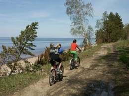
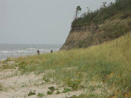
MedzeDieses Territorium schützt die Küste des ehemaligen Baltischen Eismeeres, das sich über mehrere Kilometer auf der östlichen Seite der Straße Grobiņa-Ventspils erstreckt. Von einem hohen Punkt der alten Küste hat man einen schönen Blick auf die Piejūra – Tiefebene, leider gibt es keinen speziellen Aussichtturm. Geschützte Arten und Biotope sind in diesem Territorium vorhanden.
|
 |
Lettland
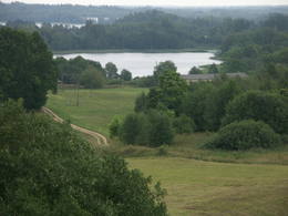
Durbes ezera plavasNature restricted area includes eastern side of the lake with Lanupe River and North-east and South-east coastal areas. Restricted area has been established for protection of birds and floodplain meadows of the lake. To see the nature restricted area visitors do not have to enter it. There are great view points with wind generators of Grobina on the background from the road Vecpils – Rava – Aistere. Coastal areas which are not included in the restricted area are perfectly suitable for bird watching. There is located the smallest city by its population in Latvia to the South from the lake.
|
 |
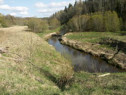
Lettland
Aiviekstes palieneTeritorija, kas aptuveni 20 km garumā „piekļāvusies” abiem Aiviekstes upes krastiem. Dabas parka galvenā vērtība ir palieņu pļavas (un citi pļavu biotopi), kas ir ļoti nozīmīga daudzu augu un dzīvnieku (īpaši – putnu) sugu dzīves vieta. Ūdenstūristiem, kas laivo pa Aivieksti, nakšņošana ir jāplāno tikai šim mērķim paredzētās vietās!
|
 |
Lettland
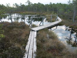
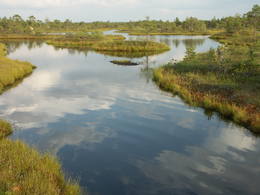
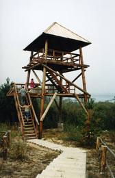
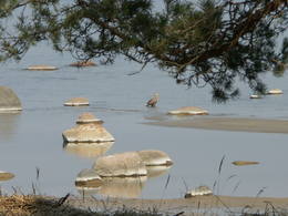
Teicu dabas rezervatsDas Naturreservat Teiči wurde 1982 eingerichtet und ist eins der größten Hochmoore in der baltischen Region. Es besteht aus dem Teiči und dem Pelečāre Moor, mit einer Vielfalt an Pflanzen und Tieren sowie den angrenzenden Territorien, die unter Schutz stehen. Das Teiči - Moor ist das größte Nistgebiet für eine Reihe von Vogelarten einschließlich dem Kranich, dem Regenbrachvogel, dem Goldregenpfeifer und dem Strandläufer. Während des Vogelzugs gibt es hier Tausende von Gänsen verschiedener Art. Das Reservat kann nur gemeinsam mit einem Führer der Reservatsverwaltung durchquert werden. Man muß sich für so eine Tour vorher anmelden. Besucher begehen den Pfad auf Holzplankenwegen entlang dem See Silda sowie auf der Siksala Insel, wo man von einem Aussichtsturm einen phantastischen Blick auf das lettische Moorland hat.
Leistungen
200km - Entfernung von der HauptstadtLeistungen - erholung
ReiseführerRezervāts apmeklējams tikai un vienīgi rezervāta gida vai reindžera pavadībā, iepriekš savulaicīgi piesakoties un noteiktā laikā.
NaturpfadSildu - Siksalas dabas taka (ap 5 km).

NaturbeobachtungTeiču purvs - Sildu - Siksalas dabas taka. Rezervāta administrācijas gidi, vides gidi un reindžeri piedalās un organizē dažādus ar vides izglītību un dabas vērošanu saistītus pasākumus. Teiču rezervāta administrācijas ēkā ir izveidota izglītojoša ekspozīcija, blakus ēkai - neliela laipu taka, informācijas stendi un kartes. |
 |
Lettland
The Pape Nature ParkThe most important aspects of this park are a shallow lagoon-type lake – Lake Pape, with its flood land meadows, the shore of the Baltic Sea, the Nida swamp, and the more than 270 different types of birds that have been spotted here. The oldest bird ringing station in Latvia (est. 1966) is found between Lake Pape and the Baltic Sea. Birds and bats are caught and ringed there. Lake Pape is the first place in Latvia where so-called “wild” horses (the “Konik” breed) were released with the aim of managing the flood land meadows.
Leistungen
1-12 Aktive SaisonmonateLeistungen - erholung
NaturpfadDabas procesu taka (9,1 km) ar skatu torni, pārgājiens apkārt Papes ezeram (26 km, var būt ekstrēms!);
NaturbeobachtungDzīvei savvaļā pielāgoto zirgu, taurgovju un sumbru vērošana gida pavadībā; Putnu vērošana migrāciju laikā; Putnu vērošanas tornis Papes ezera D krastā. |
 |
Lettland
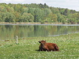
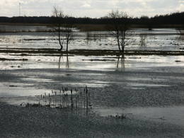
Dviete WetlandsDas ist ein wirklich einzigartiges Naturterritorium – das uralte Tal des Dviete-Flusses, die Seen Skuķi und Dviete und die Auenwiesen, die an das Flusstal angrenzen. Während der Überschwemmungszeit sind sie eine Art Sicherheitsventil für das Wasser der mächtigen Daugava. Die Wiesen können ein Grossteil des Flutwassers auffangen und später geben sie es langsam wieder an den Fluss zurück. All das erzeugt ein ziemlich ungewöhnliches Ökosystem. Das Flusstal ist wichtig für die Vögel während des Vogelzugs und zum Nisten. Im Jahre 2006 wurden Wildkühe in die Wiesen ausgewildert. Die touristische Infrastruktur muss in diesem Gebiet verbessert werden.
Leistungen
200km - Entfernung von der HauptstadtLeistungen - komfort
ÜbernachtungsmöglichkeitLeistungen - erholung
Fahrten mit Schiff/BootBoating route Boating During the Flooding of the Dviete, , distance 13 km

RadrouteVelobraucējiem un autoceļotājiem maršruts pa Dvietes
palienes dabas parku un tā tuvāko apkārtni.
Naturpfad
NaturbeobachtungDvietes senlejas un Daugavas ielejas ainavas. Dzīvei savvaļā pielāgotie
mājlopi, putni. Ir izvietoti informācijas stendi. Ievērojiet putnu
vērošanas ētikas kodeksu!
Maršruts dabas vērotājiem spāres Dvietes palienē Maršruts putnu vērotājiem putni Dvietes palienē. |
 |
Lettland
Kemeri National ParkDer Ķemeri Nationalpark wurde 1997 gegründet und umfaßt vor allem Feuchtgebiete – die flachen Küsten der Rigaer Bucht, einen überwucherten Küstensee, riesige Sümpfe, feuchte Wälder, Moore und überschwemmte Wiesen. Der Nationalpark ist enorm wichtig für den Schutz der Pflanzen (25% der in Lettlands Roter Liste erfaßten Pflanzen findet man hier) und Tiere, besonders Nist- und Zugvögel. Das Große Ķemeri Moor ist eins der größten Moore in Lettland. Es gibt auch andere, wie das Zaļais und das Raganu Moor. Die gewaltigen Moore sind auch wichtig wegen der Schwefelquellen und dem Heilschlamm. Für das einst berühmte Ķemeri Kurbad war das die Grundlage. Die meisten der kulturellen und historischen Objekte im Ķemeri Nationalpark stehen in Verbindung mit der Meeresküste als Ort für Freizeit und Erholung. Es gibt Naturlehrpfade, Fahrradrouten, Wanderwege, Vogelbeobachtungstürme und andere Einrichtungen. Das Besucherzentrum befindet sich im kürzlich renovierten „Meža mājā” (Waldhaus) in Ķemeri.
Leistungen
30km - Entfernung von der HauptstadtLeistungen - komfort
ÜbernachtungsmöglichkeitGuest house "Stērstītes"
Village house "Monikas" Guest house "Jūras mols" Self-catering cottage "Līdakas" Guest house "Valguma pasaule" Guest house "Pilsētnieki" Guest house "Eglieni" Self-catering cottage "Nordes" Leistungen - erholung
AngelnFishing is allowed according to the local regulation in all public water resorts; boat rental offered in Lake Kaņieris and Lake Valgums. Only rented boats are permitted on the Lake Kaņieris, fishing permit is required!

BooteBoat rental at Lake Kaņieris;
www.seakayak.lv 
Fahrräder
LanglaufCorss-country skiing "From Jaunķemeri to Klapkalnciems" 2-15 km
ReiseführerGuide services offered in the territory. It is suggested to attend also nature education events organized in the National Park
Fahrten mit Schiff/BootCanoeing "From Jaunķemeri to Klapkalnciems" ~ 4 h
RadrouteThere are three marked cycling routes in the surrounding of Lake Valgums: Circle of Šlokenbeka Manor, Forest circle and Circle of Lustūžkalns Hill. There is also one marked cycling route in Ķemeri: Ķemeri – Lake Sloka – Kūdra – Ķemeri.
NaturpfadThere are several nature trails in the territory of ĶNP: walking trail of Lake Sloka with a bird-watching tower (main circle ~3km, there are alternatives to extend it up to 12 km), the Dumbrāji trail (550m), the restored Slampe River with livestock adopted to life in the wild watching at Dunduri meadows. The Kupskalns Nature Trail in Bigauņciems.
NaturbeobachtungĶemeri National Park is one of the best places for woodpecker watching. In the autumn and spring, thousands of migrating geese and cranes use the park to rest and spend the night.
NaturbeobachtungAlong the nature trails, on the seashore (please follow the code of ethics once bird-watching), etc. Livestock adapted to life in the wild graze can be seen from the bird-watching tower in the Dunduri Meadows. The Bird-watching events and Night of Bats are worth attending!
For bird watchers "Birds at Ķemeri" Excursions guided by nature guides - www.takas.lv, +371 29224618 |
 |
Lettland
Bernatu dabas parksDieser Naturpark umfaßt ein Gebiet der Ostseeküste mit Sanddünen, die einst gewandert sind, jetzt aber in Folge der Bepflanzung nicht mehr aktiv sind. Es sind die höchsten Dünen in Lettland. Besucher können die Küstenlandschaft bewundern, Sandstrände und kleine Fischerdörfer. Ein Naturpfad wurde für Touristen, die den Park durchqueren möchten, auf dem Pūsēni Berg eingerichtet.
|
 |
Lettland
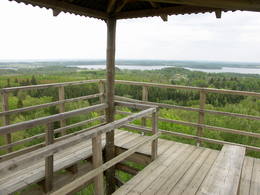
Paradize (Gleznotaji) HillThis is a lovely place in Sigulda which has been painted (as the word "gleznotāji", which means "painters" suggests) and photographed for centuries. This is basically not a hill at all, it's just the place where the shore of the ancient Gauja River valley is split by the mighty Vējupīte ravine. You will have an excellent view of the Turaida Castle and the river valley. There are leisure facilities and a viewing platform there. You can ride to Paradīze hill via an electric car. 54
Leistungen
54km - Entfernung von der Hauptstadt |
 |
Lettland
EmbuteDieses reizvolle Gebiet schließt die Hügel von Embūte, die sich im Embūte - Urstromtal befinden, ein. Ziel der Einrichtung des Parks war der Schutz von Landschaft, Biotopen und Arten dieser Region. Ein ökologischer Tourismuspfad wurde im Tal eingerichtet und ein Waldpfad durch den Naturpark (nur gemeinsam begehbar mit einem Führer). Besucher werden etwas über die Hügellandschaften und Schluchten erfahren, die die Eiszeit hinterließ. Die Schluchten und die sie umgebenden Wälder sind geschützte Biotope. Es gibt hier auch wichtige Natur- und Kulturdenkmäler, wie z.B. den Embūte - Burgberg sowie die Ruinen von Gutshof, Schloss und Kirche. Andere interessante Objekte sind der Indulis - Burgberg, der Joda - Damm, Wiesen, ein Aussichtsturm usw. Es gibt 3 unmarkierte Fahrradrouten in diesem Gebiet.
Leistungen
170km - Entfernung von der HauptstadtLeistungen - erholung
Fahrräder
RadrouteTrīs nemarķēti (plānots ieviest marķējumu) velomaršruti 20 - 25 km garumā.
NaturpfadEmbūtes senlejas ekotūrisma taka un Embūtes dabas parka meža taka. Vēlams izmantot vietējā gida pakalpojumus.
NaturbeobachtungAinavas vērošana no Embūtes pauguraines augstākajām virsotnēm, Embūtes pilskalna un skatu torņa. Embūtes ekotūrisma informācijas un izglītības centrs.
|
 |
Lettland
Vitrupe-TujaVitrupe – Tūja ist ein wichtiges Naturschutzgebiet für Riffe. Das Gebiet befindet sich gegenüber der Region Salacgrīva. Die Fläche beträgt 3577 ha. Das Gebiet enthält den Meeresteil vom Naturverbot „Die Steinküste von Vidzeme“

|
 |
Lettland
Urstromtal von AmataEins der tiefsten Flussstromtäler Lettlands (bis zu 50 m). Entlang des rechten Ufers des Flusses ist eine Naturpfad eingerichtet. |
 |
Lettland
AugsdaugavaDas Ziel dieses Territoriums besteht im Schutz der natürlichen und kulturellen Landschaften im Gebiet des Oberen Flusstals der Daugava, wo es eine große biologische Vielfalt gibt. Naturpfade und Fahrradrouten wurden im Naturpark eingerichtet. Der Fluss ist auch für Bootstouren geeignet. Die Flusswindungen im Daugava – Naturpark sind Teil dieses Territoriums (siehe “Naturparks”).
|
 |
Lettland
Ziemelvidzemes biosferas rezervatsDas größte NATURA 2000 Territorium in Lettland bedeckt 6% der Landesfläche. Es befindet sich in den Regionen von Limbaži, Valmiera und Valka und ist ein Gebiet mit einer großen Vielfalt an Landschaften, Biotopen und Arten. Der Fluß Salaca ist einer der wichtigsten Flüsse in der gesamten Ostseeregion hinsichtlich der Laichplätze für Lachs. Das Flußtal und seine Sandsteinfelsen ziehen viele Besucher an. Es ist kein Zufall, daß der Salaca der zweitbeliebteste Fluß für Wassertourismus in Vidzeme ist. Die Küste der Bucht von Riga, die nicht sehr lang ist, weist auch eine große Vielfalt an Landschaften und Biotopen auf. Am nördlichen Ende finden wir die Randu Auen. Im zentralen Teil befinden sich Sandstrände, aber am südlichen Ende – 22 km felsige Küste. Die sogenannten Nördlichen Moore befinden sich an der Grenze zu Estland, während die Seda - Heide einer der wichtigsten Plätze in der Region zum Rasten und zur Futteraufnahme für Vögel während des Vogelzugs ist. Das Reservat weist auch einen mannigfaltigen Wald auf, in dem man alle Waldtypen, die in Lettland verbreitet sind, findet. Naturpfade und Aussichtstürme oder – plattformen findet man in den Randu Auen, am Ufer des Sees Burtnieks, entlang den Planči- und Niedrāji-Pilka- Mooren, an den Ufern der Seen Dziļezers und Lielezers und anderswo. Der Skaņākalns Park in Mazsalaca ist einer der beliebtesten touristischen Ziele in Nordvidzeme. Das Gebiet hat viele wichtige Kulturdenkmäler aufzuweisen, einschließlich eine der ältesten bekannten Ansiedlungen Lettlands – eine Fischersiedlung und ein Gräberfeld, die auf die Zeit zwischen dem 5. und 2. Jahrtausend v.Chr. rückdatiert werden.
Leistungen
50km - Entfernung von der HauptstadtLeistungen - komfort
ÜbernachtungsmöglichkeitBrīvdienu māja "Vējavas"
Kempings "Rakari" Brīvdienu māja "Roķi" Viesnīca "Kapteiņu osta" Viesnīca "Brīze" Brīvdienu māja "Ķurmrags" Brīvdienu māja "Saules ligzda" Lauku māja "Duntes urdziņas" Leistungen - erholung
AngelnSalacā, Burtniekā, Rīgas līcī u.c. ūdeņos - saskaņā ar pastāvošo kārtību.
LanglaufMazsalacas apkārtnē u.c.

Beeren- und Pilzesammeln
ReiseführerZiemeļvidzemes biosfēras rezervāta administrācijā strādā vides gidi,
kas piedāvā un organizē dažādus ar vides izglītību saistītus pasākumus.
Gidi pieejami arī citos tūrisma objektos
ZBR pieejamo servisu lapu un karti, kurā apkopoti rezervātā pieejamie pakalpojumi skatieties šeit.
Fahrten mit Schiff/BootSalaca ir viena no populārākajām ūdenstūristu upēm. Tās krastos ir
izveidotas ūdenstūristu apmetnes (daudzas no tām apsaimnieko
privātīpašnieki - maksas). Ieteicamais maršruts no Mazsalacas līdz
Staicelei vai Vecsalacai.
Laivotājiem maršruts no Tūjas lidz Salacgrīvai, maršruta garums 13 km.
RadrouteTeritorijā ir vairāki nemarķēti velomaršruti: Sigulda - Aloja - Ainaži
- Salacgrīva (136 km), Ainaži - Sarkanās klintis (10 km), Rūjiena -
Karksi Nuia (32 km) u.c.
Velomaršruts pa Vidzemes piekrasti, maršruta garums ~ 56 km
NaturpfadZBR ir dabas un
izziņas takas, kuras veidojusi gan rezervāta administrācija, gan
vietējie uzņēmēji un pašvaldības. Starp tām ir jāmin: Randu pļavu taka,
Planču
purva taka (0,5 km), Niedrāju
- Pilkas purva taka (ap 1 km), Dziļezera
dabas taka (ap 3 km), Minhauzena
meža taka (5,3 km), Vīsraga
dabas taka, Jēču dabas
maršruti (5 - 7 km), Augstrozes pilskalna taka, Dabas taka
apkārt Ozolmuižas Mazezeram, Skaņākalna
takas, Ķirbižu meža izziņas taka, Oleru taka u.c. 2007. g.
ZBR administrācija ir izveidojusi jaunu, ap 10 km garu dabas taku,
kuras sākums atrodas pie Skaņākalna.
Pārgājiena maršruts gar Vidzemes akmeņaino jūrmalu, garums 19 km. Pārgājiena maršruts botānikas tūre kājāmgājējiem, garums ~ 14 km.
NaturbeobachtungDabas vērošanai ir piemērota ZBR piekraste, ūdeņi (Salaca, Burtnieks),
purvi, kuros ir šim nolūkam izveidotas takas, skatu torņi (Randu pļavu
un Vīsraga dabas takās) u.c. Randu pļavas un Sedas tīrelis ir populāras
putnu vērošanas vietas. Ievērojiet putnu vērošanas ētikas kodeksu!
Putnu vērošanas maršruts gar Vidzemes piekrasti. Maršruts autoceļotājiem gar Vidzemes krastu: Ainaži - Dunte. |
 |
Lettland
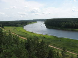
Daugavas ielejaDer Naturpark im Tal der Daugava ist der einzige Ort zwischen den Kaskaden der Wasserkraftwerke, wo man noch die Chance hat, das Flusstal der Daugava und die Schluchten der Nebenflüsse so zu sehen, wie sie waren, bevor das Gebiet geflutet und die Kraftwerke gebaut wurden. Einen besonders schönen Blick hat man vom rechten Flussufer in der Nähe von Kirche und Burgberg von Aizkraukle. Wälder, Wiesen, Flussquellen und kleine Dolomitfelsen sind in dieser Region alles geschützte Biotope. Freizeitangebote gibt es auf dem Burgberg von Aizkraukle, die Schloßruinen von Aizkraukle sind nicht weit entfernt.
|
 |
Lettland
Naturpark Daugavas loki (Daugavabögen)Dieser Park ist einer der reichsten und ungewöhnlichsten Naturparks in Lettland in Bezug auf seine natürlichen Ressourcen, die umgebende Natur, die Landschaften, die biologische Vielfalt des Gebiets und seiner Kulturdenkmäler, die man hier findet. Der größte Schatz ist das kaum veränderte Daugava-Flusstal mit seinen acht großen Windungen auf einer Länge von vier bis acht Kilometern. Dort sind ebenfalls die Schluchten der Nebenflüsse. Einen besonders schönen Blick kann man von den Steilufern des Daugava - Flusstales werfen, besonders bei den Slutiški- und Ververi - Klippen und dem Elerne - Hügel. Es gibt mehr als 20 archäologische Denkmäler an den Ufern des Tales, uralte Burgberge in Najene, Markova, Vecračina usw., unzählige Kirchen – wie die Kirchen Juzefova, Sprukti, Borovka, Elerne, Sīķele, Kaplava und andere, die Gutshöfe Rozališki, Lielborne und andere, das einzigartige Altgläubigendorf Slutiški. Es gibt interessante Naturpfade und Fahrradrouten in diesem Gebiet. Man kann auf Pferden ausreiten und es gibt einen Aussichtsturm mit weiteren Möglichkeiten für Touristen. Die Daugava hinunter zu paddeln ist eine interessante Möglichkeit, seine Zeit zu verbringen.
Leistungen
260km - Entfernung von der HauptstadtLeistungen - komfort
ZeltplatzLeistungen - erholung
AngelnDaugavā saskaņā ar esošo kārtību.
FahrräderMeklējama Krāslavā.

ReitenZemnieku saimniecībā "Klajumi" (Sējējs - 2007. laureāti). Viena no retajām saimniecībām, kas piedāvā vienas - vairākdienu pārgājienus ar zirgiem. Pieejami reiterapijas pakalpojumi.

Fahrten mit PferdeschlittenZ/s "Klajumi"
Fahrten mit Schiff/BootPopulārs ūdenstūrisma maršruts no Krāslavas līdz Naujenei vai Daugavpilij.
RadrouteVairāki velomaršruti Krāslavā un tās apkaimē, no kuriem kā interesantākais jāmin "Daugavas loki" (ap 46 km).
NaturpfadDinaburgas taka, Markovas izziņas taka (ap 1,6 km), Adamovas taka u.c.
NaturbeobachtungAinavas un putnu vērošana no skatu torņiem Vasargeliškos un Krāslavā. |
 |
Lettland
Nida - PerkoneDas geschütze Meeresgebiet „Nida – Pērkone“ ist ein von den biologisch vielfältigsten und für den Naturschutz wichtigsten Meeresgebieten an der offenen Küste der Ostsee. Hier kann man die hervorragendsten Riffe anfinden. Während der Vogelmigration wird das Territorium vom größten Teil der in Lettland festgestellten migrierenden Vogelarten überquert. Das Gebiet ist besonders wichtig zum Schutz vom Gänsesäger und der Zwergmöwe. Es befindet sich gegenüber der Regionen Rucava und Nīca. Die Fläche beträgt 36 703 ha. Das Gebiet überdeckt sich Teilweise mit dem Meeresgebiet vom Naturpark „Pape“ und enthält das Meeresgebiet vom Naturpark „Bernāti“.
|
 |
Lettland
Daiku ivju audzeThe forest covered area formed to protect tort protected plant species as yew-tree etc. Territory is not suitable for visitors as visitor without environmental knowledge will see “regular” forest.
|
 |
Lettland
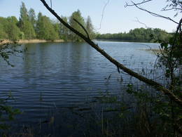
Carmana ezersDabas parks, kura lielāko daļu aizņem neprastās formas un līčiem bagātais Cārmaņa (arī Cārmins) ezers. Ezera ūdens ir ļoti tīrs, tādēļ tajā sastopamas Latvijai retas augu sabiedrības. Tā kā parka teritorijā nav tūristiem veidota infrastruktūra, interesenti var baudīt skatus, kas paveras uz ezera un tā apkārtni no Aulejas – Grāveru ceļa.
|
 |
Lettland
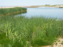
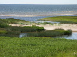
The Randu Meadows Nature ReserveDieses Gebiet ist voller Küstenwiesen, Lagunen, kleinen morastigen und sandigen, flachen Seen, die alle voller Schilf sind. Dieses Territorium befindet sich an der Ostküste der Rigaer Bucht zwischen Ainaži und Kuiviži. Die Randa – Wiesen sind von enorm wichtiges Gebiet für Wasservögel und seltene Pflanzen – insgesamt mehr als 500. Ein neuer Vogelbeobachtungsturm und ein Naturpfad wurden eingerichtet, damit man die Wiesen studieren kann.
|
 |
Lettland
Rakupes ielejaDieses Gebiet befindet sich auf beiden Seiten des mittleren Abschnitts des Flusses Raķupe. An den Ufern des Flusses gibt es sowohl viele verschiedene Wiesenbiotope als auch mächtige Eichen. Das ist ein wichtiger Platz für seltene Pflanzen und Tiere.
|
 |
Lettland
VeclaiceneDieses Territorium wurde errichtet, um die natürliche und kulturelle Landschaft des ausgeprägtesten Teils der Alūksne – Hochebene zu erhalten – eine Landschaft, die durch die höchsten Erhebungen in diesem Gebiet - die Berge Dēliņkalns, Dieva, Saules, dem Drusku – Burgberg und dem subglazialen Flussbett (eines der bedeutsamsten Oberflächenformen) des Kornetu-Peļļu gebildet wird. Hier gibt es mehrere Seen – die Seen Pilskalns, Dzērve, Ieva, Raipals usw. Es existieren bedeutsame Biotope – Hang- und Schluchtenwälder, verschiedene Arten von Mooren und Wiesen, Feuchtwälder usw. mit all den ihnen eigenen Arten der Flora und Fauna. Es gibt in diesem Gebiet Naturpfade und Strecken für Langlauf- und Abfahrtsski. Drei Gebiete sind gesperrt - Korneti-Peļļi, der Avotu – Wald und der Berg Dēliņkalns.
Leistungen
170km - Entfernung von der HauptstadtLeistungen - erholung
AngelnEzeros saskaņā ar pastāvošo kārtību.

SkifahrenĶauķu kalnā.
LanglaufDēliņkalna un Ķauķu kalna apkārtnē.
ReiseführerIeteicams izmantot vietējo gidu pakalpojumus. Alūksnē - "Vides labirints" ar vides izglītību saistīts pasākums.
RadrouteJaunalūksnes apkārtnē tiek piedāvāti lokāli nemarķēti velomaršruti.
NaturpfadDrusku pilskalnā.
NaturbeobachtungNo pauguriem, īpaši Drusku pilskalna, Dēliņkalna, Ķauķu kalna u.c. paveras fantastiskas ainavas.
|
 |
Lettland
ParabaineSalīdzinoši liela un cilvēka mazskarta teritorija ziemeļos no Lubāna ezera, kas izceļas ar lielu purvu un mitro mežu, kā arī tajā dzīvojošo organismu daudzveidību. Cauri teritorijas austrumu daļai tek Aiviekste. Dabas liegums ir grūti pieejams, tajā nav izveidota ar tūrismu saistīta infrastruktūra, tādēl vislabākais veids ir to aplūkot no Lubānas - Gaigalavas ceļa, kā arī putnu vērošanas torņa pie Gomeļa ezera (Gūmelis), kurš gan 2007. g. rudenī bija cietis no apmeklētāju vandālisma. Teritorija ietilpst Lubāna mitrāja kompleksā.
|
 |
Lettland
Moricsalas dabas rezervatsDas ist Lettlands ältestes Naturreservat und, in der Tat, das älteste geschützte Gebiet des Landes. Moriscala ist eine Insel im See Usma, der der fünftgrößte See in Lettland ist. Das Reservat wurde 1912 auf Initiative einer Gruppe von Naturstudenten von Riga begründet. Sie wollten den Eichenlaubwald auf der Insel schützen und zugleich die örtliche Flora und Fauna. Das Naturreservat schließt auch die Insel Lielalksnīte ein. Besuche des Reservats sind jedoch streng verboten.
|
 |
Lettland
MezoleDies sind Hügel im nördlichen Ende des Vidzemer Hochlandes. Sie sind ein wichtiges Gebiet für den Nördlichen Nadelwaldgürtel und seine Sümpfe. Hier werden verschiedene Sumpfarten gefunden, sie sind Heimat einer Anzahl wirbelloser Tiere.
|
 |
Lettland
VecdaugavaDas ist ein großes Territorium mit Küstenwiesen, alten Flüssen und Schilf. Es befindet sich in einem Gebiet, wo die Daugava floss – zwischen Vecmīlgrāvis und Vecāķi. Hier gibt es Binnendünenwiesen, mit dem sehr seltenen Silbergras bedeckt. Vecdaugava ist ein wichtiges Nistgebiet, hier werden verschiedene seltene Pflanzenarten gefunden. Am südlichen Ende der Vecdaugava – Insel, bei Skanstnieki, kann man noch Überreste von schwedischen Befestigungsanlagen aus dem Mittelalter finden. Das Regionale Forschungs- und Fischereimuseum von Vecdaugava befindet sich auch hier.
|
 |
Lettland
The Pavasaru-Odinu polderThis is an open territory which is 3.5 km long and 2 km wide. It is located on the left bank of the Lielupe River between the village of Pavasari and the Odiņi homestead. The polder was established during the Soviet era to obtain farmland, and back then it was used very intensively. Today, it is slowly becoming overgrown, and despite this, this is one of the most important locations in Europe for corn-crakes. A gravel road crosses the polder from the North to the South, and this is an excellent place to hear the songs of the corn-crake. 40
Leistungen
40km - Entfernung von der Hauptstadt |
 |
Lettland
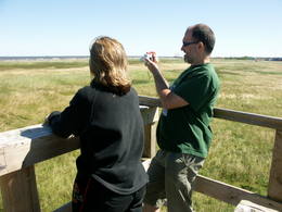
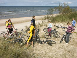
The Lake Engure Nature ParkThe key treasure in this park is that it has a lake that is one of the most intensive sites for birdwatchers in all of Latvia. It also features outstanding flora and the shallow waters of the Bay of Rīga. Recommended: Hike along the seashore from Mērsrags to Engure (20 km). See wild domestic animals (horses and cows) on the eastern shore of Lake Engure. There’s a bird-watching tower on the NW shore of the lake (approach from Kūļciems, where you can see domestic animals adapted to life in the wild, including the Blue Cows of Latvia). A bird-watching tower can be found at a place called Jomiņa near Mērsrags, where the seashore meadow is an uncommon biotope
Leistungen
1-12 Aktive SaisonmonateLeistungen - erholung
Naturpfad
NaturbeobachtungPārgājiens gar jūras piekrasti: Mērsrags – Engure (20 km); Dzīvei savvaļā pielāgotie mājlopi (zirgi, govis) Engures ezera A krastā; Putnu vērošanas tornis ezera ZR krastā (piebraucams no Ķūļciema puses, kur dzīvei savvaļā pielāgotie mājlopi, t.sk. Latvijas Zilās govis), Putnu vērošanas tornis Mērsraga piejūras pļavā (Latvijas piekrastē – reti sastopams biotops) – t.s. Jomiņā. |
 |
Lettland
The Meadows of Lake Burtnieks Nature ReserveRegelmäßig werden die Auenwiesen am Ost- und Südufer des Sees Burtnieks überflutet, sie sind ein wichtiger Nistplatz für den selten gesehenen Wachtelkönig. Ein Natur- und Informationspfad wurde in Vīsrag eingerichtet mit Richtungsangaben, Informationsständen und einem Aussichtsturm.
Leistungen
120km - Entfernung von der HauptstadtLeistungen - erholung
NaturpfadLieliska dabas taka, kurā apvienota Burtnieku apkārtnes dabas vērtību un kultūras mantojuma izziņa.
NaturbeobachtungNo Vīsraga dabas takas un tajā uzceltā putnu vērošanas torņa paveras labs kopskats uz apkārtnes palieņu pļavām u.c. biotopiem. Burtnieku parkā informācijas stendi par šejienes bioloģisko daudzveidību. |
 |
Lettland
Slitere National ParkDer Slītere Nationalpark (2000 gegründet) ist praktisch ein Freilichtmuseum, welches die Entstehungsgeschichte der Ostsee erzählt. Die geologische Entwicklung kann man in den Blauen Bergen (Zilie Kalni) von Slītere sehen, die 20 bis 30 m höher sind als die Küste des Baltischen Eissees von vor 10.000 Jahren. Die Stiebri Berge
(Stiebru kalni) entstanden vor 8 bis 9.000 Jahren, während das Litorina-Meer Europas größte Dünenwälle mit Talsenken dazwischen schuf. Das geschah vor 4.000 bis 7.000 Jahren. Das milde Klima von Nordkurzeme ist der Grund, warum es so viele seltene Pflanzen in dem Naturpark gibt – mehr als 860 insgesamt. Von gewissem Wert für die Bewahrung dieser Schätze war die Sowjetische Militärmaschinerie, sie lagen verlassen hinter Armeebasen und anderen militärischen Objekten in diesem Gebiet. Die Anwesenheit des Militärs bedeutete, daß das Gebiet des heutigen Slītere Nationalparks für 50 Jahre größtenteils ungestört blieb. Im Nationalpark befindet sich eins der beliebtesten touristischen Ziele in Kurzeme – das Kap Kolka, das jedes Jahr von mehr als 50.000 Touristen besucht wird. Während des Frühjahrsvogelzugs durchziehen stündlich mehr als 60.000 Vögel das Kap. Entlang der Küste der Ostsee befindet sich die sogenannte Livenküste, die sich von Kolka über Sīkrags bis nach Ovīši erstreckt. Fischerdörfer und andere Kulturdenkmäler, die von der weltweit kleinsten ethnischen Minderheit, den Liven, geschaffen wurden, findet man hier. Touristen können interessante Naturpfade, Fahrradrouten, Aussichtstürme usw. erkunden. Das Besucherzentrum befindet sich im Slītere Leuchtturm. Leistungen
170km - Entfernung von der HauptstadtLeistungen - komfortLeistungen - erholung
LanglaufCross-country skiing route "Pa lībiešu ciemiem", ~ 2 h
ReiseführerAt Šlītere lighthouse and SNP administration:
Fahrten mit Schiff/BootCanoeing tour "Around
the Kolka lighthouse",15 km
RadrouteBicycle route "Kolka - Mazirbe", route is marked, ~ 30 km
NaturpfadIn the Slītere National Park are Šlītere Nature Trail (only with guide), Kolkasrags Pines Trail (1,2 km), Pēterezers Nature Trail(3,5 km), Ēvaži Shoreline Walking Trail (0,3 km). Hiking route "The Kolkasrags circle", 3kmHiking route "Learn about Mazirbe", 7-10 km Hiking route "Along the seashore and coast
NaturbeobachtungFor animal watchers "Animals
in the Slītere" |
 |
Lettland
AugszemeDieses Territorium soll die Hügel und Seen des Hochlandes von Augšzeme schützen – die Seen Svente, Medums, Ilga und andere mit ihren Inseln, Landschaften und Arten. Der Naturpark, der um die Seen Svente und Medums herum eingerichtet wurde, ist Teil dieses Territoriums und es gibt mehrere Gebiete, die aus Umweltgründen geschützt werden – die Seen Bardinskis und Skujine und die Inseln der Seen Medums und Svente. Es gibt einen Aussichtsturm auf dem Egļukalns - Berg und Abfahrtsski-Routen.
Leistungen
230km - Entfernung von der HauptstadtLeistungen - erholung
AngelnSventes un Medumu ezeros saskaņā ar pastāvošo kārtību.
SkifahrenEgļukalna kalnu slēpošanas trases.
Fahrten mit Schiff/BootSventes un Medumu ezeros.
NaturpfadEgļukalna dabas izziņas taka.
NaturbeobachtungEgļukalna dabas izziņas takā un no Egļukalna skatu torņa (viens no fantastiskākajiem dienvidlatvijas skatiem!), no citiem pauguriem (skati uz Daugavas ieleju), kā arī ezeru apkārtnē.
|
 |
Lettland
Das offene Meer im Westen von TujaDas offene Meer im Westen von Tūja ist ein wichtiges Gebiet zum Schutz der Zwergmöwe während der Frühlingsmigration. Das Territorium befindet sich gegenüber der Regionen Salacgrīva, Limbaži, Saulkrasti und Carnikava. Die Fläche beträgt 58 600 ha.
|
 |
Lettland
Klanu purvsThere is picnic area and information stand at the end of the forest path leading from Muiznieki to Klanu Bog. Klanu Lake was formed in the place of Littorina marine lagoon. Nature restricted area was established to protect biotopes in the area of Klanu, Dziru and Stavu Lakes. There is wide information about the area available on the information stand.
 230
230
Leistungen
230km - Entfernung von der Hauptstadt |
 |
Lettland
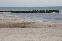
ZiemupeDas Schutzgebiet Ziemupe befindet sich an der Küste der Ostsee und schützt eine große Anzahl verschiedener Küstenbiotope. Hier gibt es die berühmten Graudünen, verschiedene Arten an Waldbiotopen, einige davon sind ganz selten in Lettland. Viele geschützte Pflanzen und Tiere findet man ebenfalls in diesem Gebiet. Der Leuchtturm Akmensrags und andere touristische Einrichtungen sind vorhanden.
|
 |
Lettland
Die Meeresenge von IrbeDie Meeresenge von Irbe ist sehr wichtig während der Vogelmigration. Von den geschützten Vogelarten begegnet man hier am meisten der Samtente, der Trauerente, der Eisente, der Zwergmöwe, dem Sterntaucher und dem Prachttaucher, sowie auch der Teiste. Das Gebiet befindet sich gegenüber der Regionen Dundaga und Ventspils. Die Fläche beträgt 172 412 ha.
|
 |
Lettland
Jurmalas parks LiepajaViens no lielākajiem cilvēka veidotajiem Latvijasparkiem (70 ha), kas izstiepies no Liepājas ostas līdz Dienvidu fortam > 3 km garumā. Tā izveidi uzsāka jau 1870. g. pēc pilsētas mēra K. Ūliha iniciatīvas, uzbūvējot kūrmāju un strūklaku. 19. - 20. gs. mijā ap Dzintaru un Liepu ielām parādījās greznu villu un savrupmāju apbūve. Viena no skaistākajām ir jūgendstilā celtā savrupmāja Liepu ielā 27, kurā atrodas Krievijas ģenerālkonsultāts. Ēkai ir slēgta uzeja, balkoni, pildrežģa konstrukcijas un kārniņu jumts (arhitekti G. Jenike un P. M. Berči). Jūrmalas parks visās sezonās ir iecienīta pastaigu un dažādu aktivitāšu norises vieta. Te meklējams stadions „Daugava”, tenisa korti, koncertestrāde “Pūt, vējiņi!”, vasaras kafejnīcas, minigolfa laukums, bērnu rotaļu laukums, skeitparks. Šeit meklējamas lielākās Latvijas bungas – vides dizaina objekts. 217
Leistungen
217km - Entfernung von der Hauptstadt |
 |
Lettland
Grinu dabas rezervatsDas Wort grinis verweist sich auf einen in Lettland sehr ungewöhnlichen Waldtyp. Es gibt zwei Typen – den Heidekrauttyp und den Grastyp. Das ist das Ergebnis einer langandauernden Wechselwirkung zwischen Natur und Mensch. Solche Gebiete findet man nur an wenigen Stellen an der Küste der Ostsee. Eine sehr seltene Pflanze, die in diesem Gebiet wächst - die Glockenheide - war der Hauptgrund, warum hier ein Naturreservat 1936 errichtet wurde. Eine stillgelegte Eisenbahnlinie zwischen Ventspils und Liepāja führt durch dieses Reservat von Norden nach Süden. Besuche des Reservats sind streng verboten.
 250
250
Leistungen
250km - Entfernung von der Hauptstadt |
 |
Lettland
Nationalpark "Razna"Lettlands jüngster Nationalpark (2007) befindet sich im “Land der blauen Seen” - der Region von Latgale. Eins der Ziele der Errichtung eines Nationalparks besteht in der Bewahrung der natürlichen Reichtümer der Region. Der See Rāzna, der zweitgrößte See Lettlands, befindet sich dort und der See Ežezers, der mehr Inseln als irgendein anderer in Lettland aufzuweisen hat. Es gibt auch andere Gewässer und auch typische Hügellandschaften und ein einzigartiges kulturelles Umfeld. Eins der beliebtesten Ziele im Park ist der Mākoņkalns Berg, von dem man einen wunderschönen Blick auf den Rāzna See hat. Die Verwaltung des kürzlich geschaffenen Parks arbeitet an einer touristischen Infrastruktur - Pfade, Routen usw. Vielleicht sollten die Touristen ihren Ausflug in den Rāzna Nationalpark noch etwas verschieben.
Leistungen
240km - Entfernung von der HauptstadtLeistungen - komfort
ÜbernachtungsmöglichkeitSelf-catering cottage "Osmany"
Self-catering cottage "Pie Rāznas" Guest house "Rāznas līcis" Guest house "Rāznas gulbis" Guest house "Zīdu kolns" Country house "Priedes" Guest house "Vītoli" Leistungen - erholung
AngelnRāznas u.c. ezeros saskaņā ar pastāvošo kārtību. 
BademöglichkeitenRāznas ezera krastos (īpaši D krastā) ir atrodamas labiekārtotas peldvietas.
Jāievēro, ka Rāznas, Salāja, Zosnas ezerā un Ežezerā nav atļauts pārvietoties ar motorizētiem peldlīdzekļiem.
FahrräderRāznas Gulbis, tālr. +371 29994444; Selēna, tālr. +371 29179338.
ReitenYou are welcome to tour the Rāzna National Park on horseback in the most beautiful display of every season: during bird-cherries’ blooming, in blossoming meadows, with pink autumn leaves or in deep winter snowdrifts.
Route The Latgale Trotters
Beeren- und PilzesammelnRāznas nacionālajā parkā var staigāt, vērot augus, dzīvniekus un ainavas, ogot, sēņot, peldēties, sauļoties, braukt ar divriteni un laivu.
Reiseführer
Fahrten mit Schiff/BootRāznas un Ežezera apkārtnē pieejama laivu noma un tiek piedāvāti (Rāznas ezerā) braucieni ar dažādiem ūdens peldlīdzekļiem.
Radroute
PicknickplatzUgunskurus kurināt drīkst tikai speciāli ierīkotās vietās.
Naturpfad
NaturbeobachtungVisā parka teritorijā - ainavas, dabas, augu un putnu vērošanas iespējas.
|
 |
Lettland
ViresiDas ist ein Abschnitt des Gauja – Flusses mit Stromschnellen an einigen Stellen. Es erstreckt sich von Vidaga bis zum Ort, wo der Fluss Vecpalsa indie Gauja fließt. Entlang der Gauja und seinen Nebenflüssen kann man Dolomitaufschlüsse an seinen Ufern sehen, die größten sind die Randati – Klippen. Das Territorium wurde vor allem eingerichtet, um die verschiedenen Arten an Wald, Wiesen, Aufschlüssen und ihre Habitate zu schützen. Das ist ein interessanter Abschnitt des zentralen Teils der Gauja, vor allem für Leute, die die schöne Landschaft genießen möchten und für Wassertouristen.
Leistungen
150km - Entfernung von der HauptstadtLeistungen - erholung
Fahrten mit Schiff/BootIespējami vairākdienu nobraucieni ar laivu pa Gauju no Virešiem līdz Valmierai un tālāk - Cēsīm un Siguldu.
NaturpfadVizlas lejtecē un pie Randātu klintīm izveidotas divas interesantas un labiekārtotas dabas takas.
NaturbeobachtungLabs veids - brauciens pa Gauju ar laivu. Gaujas ielejas vērošana no Randatu klintīm.
|
 |
Lettland
VestienaDieses Gebiet wurde errichtet, um die kulturellen und Seelandschaften des zentralen Bereiches des Vizemer Hochlandes mit den Seen Alauksts, Inesis, Tauns, etc. und mit ihren Arten und Biotopen zu schützen. In diesem Territorium sind viele wichtige Kulturobjekte – in Vecpiebalga die lutherische Kirche, die Schloßruinen, der Gutshof, sowie die Orte, wo verschiedene bedeutende Personen des lettischen Kulturlebens gelebt und gearbeitet haben. Museen wurden eingerichtet, um ihrer zu gedenken. Die Seen sind großartig zum Angeln geeignet und Skilaufwettbewerbe werden traditionell im Seengebiet von Alauksts im Winter organisiert. Das Sproģi Naturreservat wurde auf den Inseln und Halbinseln des Sees Inesis eingerichtet.
|
 |
Lettland
VecpiebalgaDieses Gebiet wurde errichtet, um die kulturellen und Seelandschaften des zentralen Bereiches des Vizemer Hochlandes mit den Seen Alauksts, Inesis, Tauns, etc. und mit ihren Arten und Biotopen zu schützen. In diesem Territorium sind viele wichtige Kulturobjekte – in Vecpiebalga die lutherische Kirche, die Schloßruinen, der Gutshof, sowie die Orte, wo verschiedene bedeutende Personen des lettischen Kulturlebens gelebt und gearbeitet haben. Museen wurden eingerichtet, um ihrer zu gedenken. Die Seen sind großartig zum Angeln geeignet und Skilaufwettbewerbe werden traditionell im Seengebiet von Alauksts im Winter organisiert. Das Sproģi Naturreservat wurde auf den Inseln und Halbinseln des Sees Inesis eingerichtet.
|
 |
Lettland
Urstromtal des Flusses DvieteEs ist ein einzigartiges Naturgebiet und kulturgeschichtliches Gebiet zwischen Kaldabruņa, Bebrene und Dviete. Durch das Urstromtal fließt der kleine Fluss Dviete, der die Seen Skuķu ezers und Dvietes ezers und die Wiesen der Flussniederung durchquert. Während der Hochwasserzeit arbeiten diese Wasserbecken als Reservoir für die Gewässer des Flusses Daugava, weil sie umfangreiche Hochwassermassen schnell aufnehmen und später langsam zurückgeben können. Wenn es im Frühling sehr viel Wasser gibt, dann ähneln die hier sichtbaren Landschaften keiner anderen in Lettland. Diese Besonderheit der Wasserstandschwankungen ist der Grund, warum dieser Ort für Pflanzen und für Vögel während der Migrations- und Nistzeit von Bedeutung ist. Zum Schutz des Gebietes ist der Naturpark der Flussniederung von Dviete eingerichtet worden. Es ist interessant, dass die höheren Stellen, die während des Hochwassers nicht überschwemmt werden, Inseln genannt werden. Im Urstromtal von Dviete sind 15 eventuelle alte Siedlungen (aus der Steinzeit, Bronzezeit und Eisenzeit) gefunden und viele Zufallsfunde mit verschiedenen Gegenständen ausgegraben worden. Man hat allen Grund zu glauben, dass dieser Ort einer der ältesten und bedeutendsten Wohnorte auf dem heutigen Gebiet von Südlettland ist. 211
Leistungen
211km - Entfernung von der Hauptstadt |
 |
Lettland
Istras pauguraineNo ģeogrāfiskā un kultūrvēsturiskā viedokļa interesanta teritorija Latgales augstienes Rāznavas paugurainē, kuras nozīmīgākie resursi ir dažāda veida biotopi, ainavas, reljefs un Šķaunes ezers. Istras pauguraines dabas parkā nav ar tūrismu saistīti labiekārtojumi, bet šo teritoriju var apskatīt arī „no malas”, braucot pa grantēto ceļu no Soboļinas uz Osinovku, kas iet līdztekus parka ziemeļu robežai (skats uz Šķaunes ezeru).
 290
290
Leistungen
290km - Entfernung von der Hauptstadt |
 |
Lettland
Kristus Karala kalnsAtrodas nepilnus 2 km austrumos no Aglonas, Aglonas – Dagdas ceļa malā. Tā ieceres autors ir Ēriks Delpers, kurš 2006. g. uzsāka vietas labiekārtošanu, izveidojot brīvdabas skulptūru dārzu un stādījumus. Kristus Karaļa kalns šobrīd atrodas izveides procesā, taču neskatoties uz to – objekts, ko ir vērts redzēt! 232
Leistungen
232km - Entfernung von der Hauptstadt |
 |
Lettland
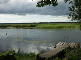
PapeDas ist ein flacher, lagunenartiger See, der mit dem ihn umgebenden Feuchtgebiet von internationaler Bedeutung ist. 271 Vogelarten wurden in diesem Gebiet gezählt, einschließlich 43 Vogelarten, die in der Lettischen Roten Liste aufgeführt sind und 15 aus der Europäischen Roten Liste. Zum Park gehören das Nida-Moor und der Teil des Meeres, das sich längsseits des Parks befindet. Zwischen dem Pape-See und der Ostsee befindet sich Lettlands älteste Vogelberingungsstation, wo nicht nur Vögel beringt werden, sondern auch Fledermäuse. Der Pape-See ist das erste Territorium in Lettland, wo Rückzüchtungen von Wildtieren ausgewildert wurden, um die überschwemmten Wiesen des Sees sachgerecht verwalten zu können. Zuerst waren es Wildpferde (Konik-Pferde), dann Auerochsen und der europäische Bison. Durch den Pape-See führt auch Lettlands einzige markierte Wassertourismusroute. Besucher können Vogel- und Naturbeobachtungstürme nutzen, Naturpfade usw. Das Dorf Ķoņi ist ein einzigartiges Beispiel für ein am Meer gelegenes Fischerdorf. Der Pape-See ist unter den Vogelbeobachtern beliebt. Das Besucherzentrum wurde im “Haus der Natur “ des WWF eingerichtet.
Leistungen
270km - Entfernung von der HauptstadtLeistungen - erholung
BooteLaivu noma braucienam pa Papes ezeru.
Fahrten mit Schiff/BootŪdenstūrisma maršruts pa Papes ezeru
RadrouteVelomaršruts "Jūrmalciema velotakas".
NaturpfadPapes dabas procesu taka (9,1 km). Kājinieku maršruts apkārt Papes ezeram. Pastaigas gar Baltijas jūras krastu.
NaturbeobachtungDzīvei savvaļā pielāgotie mājlopi - "Konik" zirgi, taurgovis, sumbri (vietējā gida pavadībā!). Putnu vērošanas slēpņi, putnu vērošanas tornis. Dabas māja ar izglītojošu ekspozīciju. |
 |
Lettland
RiezupeRiežupes dabas parks veidots g.k. Riežupes izteksmīgās ielejas, tai raksturīgo dabas vērtību – nogāžu un gravu mežu, dažādu ģeoloģisku dabas pieminekļu - smilšakmens atsegumu, alu, ūdenkritumu, upes straujteču posmu, dažādu sugu, mežu masīvu un ainavas aizsardzībai. Parka atrodas viens no Kurzemes populārākajiem tūrisma objektiem – Riežupes alas - garākais mākslīgo alu labirints Latvijā, kura eju kopgarums ir 460 m. Sākotnēji dabas veidotās alas 19. gs. vidū mākslīgi paplašināja baltās smilts ieguves nolūkos, kuras izmantoja stikla ražošanai. Parkā izveidots velotūrisma maršruts. |
|
|
Lettland
Piejuras dabas parksThis is a segment of the shore of the Bay of Rīga that is around 40 km long and features the valleys of three major rivers – the Lielupe, Daugava and Gauja river. There are dune formations, biotopes, seashore meadows and forested seashore dunes which are an important recreational resource. |
 |
Lettland
The Ance swamps and forestsDieses Gebiet befindet sich im Süden des Flusses Irbe und ist einzigartig mit mehr oder weniger unberührten Wäldern und Dünen. Die Irbe hat ein System alter Nebenflüsse. Der Dižpurvs – Sumpf liegt parallel zur Küste. Die Irbe ist in den letzten Jahren bei Wassersportlern beliebt geworden, jedoch ist die touristische Infrastruktur noch ungenügend entwickelt.
|
 |
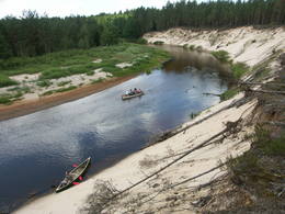
Lettland
Naturpark des Abava-UrstromtalsDas Urstromtal Abava zwischen Kandava und der Stelle, wo die Abava in die Venta fließt, ist das ausgeprägteste Flusstal in Kurzeme in Hinblick auf Landschaft und Terrain. Das Tal ist 30 bis 40 m tief und etwa 300 m breit. Das Territorium ist durch seine große Vielfalt an biologischer Natur (mehr als 800 Pflanzenarten) bekannt. Es hat viele verschiedene Biotope und natürliche Denkmäler wie z.B. Flüsse, Wasserfälle, Klippen, riesige Felsen und viele Kulturdenkmäler wie z.B. Burgberge, Kirchen, alte Gräberfelder und kleine Orte wie Kandava und Sabile. In beiden Fällen ist die historische Altstadt nationales Denkmal. Ein beliebtes Touristenziel ist der Berg Vīnakalns in Sabile, wo Wein angebaut wird sowie das Freilichtmuseum in Pedvāle. Um die kulturellen Schätze zu bewahren, wurde das kulturgeschichtliche “Abava-Tal” gegründet. Wildbestand gibt es in Drubaza und Tēvkalni, um die Landschaft zu “erhalten”. Dort gibt es Naturpfade für Touristen. Außerdem ist die Abava der beliebteste Fluß für Wassertouristen in Kurzeme. Informationen gibt es im Touristenzentrum in Kandava und Sabile.
Leistungen
100km - Entfernung von der HauptstadtLeistungen - komfortLeistungen - erholung
BooteBoat rent:
Fahrten mit Schiff/BootCanoeing tour "From Kandava to Renda", 42 km
RadrouteVelomaršruts " Skaistākās skatu vietas"
Citi velomaršruti:
NaturpfadDrubazu botānikas taka (ap 1 km), pārgājiens pa Abavas senleju z/s "Tēvkalni", Abavas ielejas takas, Čužu purva dabas taka. Visas takas ejamas tikai gida pavadībā!
NaturbeobachtungSkatu punkti/vietas Abavas ielejas krastos, no iespaidīgajiem pilskalniem, dzīvei savvaļā pielāgotie mājlopi z/s Tēvkalni un Drubazu botānikas takā u.c. |
 |
Lettland
Korneti-PelliDas ist eine der am meisten von der subglazialen Depression ausgeprägtesten Landschaften in Lettland mit 11 Seen verschiedener Größe und Tiefe. Das ist eine faszinierend schöne Landschaft mit besonders eindrucksvollen Aussichten von Drusku – Burgberg. An einem klaren Tag kann man das Hanja – Hochland von Estland sehen. Das geschütze Territorium wurde eingerichtet, um das Gebiet des Nördlichen Nadelwaldgürtel zu schützen.
|
 |
Lettland
Gebiet Pilskalnes SiguldinaEs ist ein Ort, wo man kurze und lange Spaziergänge machen kann. Hier ist der 1,6 km lange Pfad von Sprīdītis (mit Holzskulpturen der Helden aus den Märchen der Schriftstellerin Anna Brigadere), der 3,8 km lange Waldlehrpfad und der 8 km (eine Richtung) lange Landschaftspfad von Augšzeme. Alle Pfade befinden sich in einer subglazialen Bettung, wo sich einer nach dem anderen kleine Seen und Sümpfe befinden, die mit Durchflüssen verbunden sind. Zum Schutz der Landschaft und anderer Werte ist hier ein Naturschutzgebiet eingerichtet worden. An der Stelle, wo die Pfade anfangen (unweit von Pilskalne), ist der ungefähr 30 Meter hohe Hügel Melnaiskalns (Schwarzberg oder der Burgberg von Rāmava) zu besichtigen. Leistungen
240km - Entfernung von der HauptstadtLeistungen - erholung
NaturpfadTrīs dabas takas, no kurām viena speciāli bērniem - Sprīdīša taka. Jāņem vērā, ka Augšzemes takas garums - 8 km ir tikai vienā virzienā (jānāk arī atpakaļ tikpat, vai arī sagaida transports!)
NaturbeobachtungTrīs dabas taku teritorijā.
|
 |
Lettland
AdaziBaltijas mērogā unikāls dabas un cilvēkizmantots apvidus, kas veidojies kādreiz - padomju, mūsdienās - Latvijas Nacionālo bruņoto spēku pārvaldītā armijas poligona teritorijā. Poligona lielāko daļu aizņem smilšains vai ar zemiem lakstaugiem un krūmāju apaudzis kāpu masīvs ar atsevišķiem lielākiem kāpu vaļņiem. Rudens laikā šeit lielās platībās zied virši. Unikālā virsāju un aprimušo kāpu ainava un daudzu sugu dzīves vieta bija daži no iemesliem, kādēļ šai militārai teritorijai ir piešķirts arī aizsargājamas dabas teritorijas statuss. Jāatgādina, ka poligona apmeklējumi privātpersonām bez iepriekšēja saskaņojuma ir aizliegti!
|
 |
Lettland
Nord-Gauja- Landschafts-schutzgebietEin mit Wäldern bedecktes Gebiet, durch welches der Fluss Gauja fließt. Alte Flussärme, parkartige Eichenwiesen, Laubwälder und Schutzarte. Naturpfade. Leistungen
180km - Entfernung von der Hauptstadt
1-12 Aktive SaisonmonateLeistungen - erholung
Fahrten mit Schiff/BootBoat down the Gauja River from Vireši to Valmiera (133 km).
NaturpfadHike the Zīle nature trail (2.2 km), the Vekši nature trail (600 metres) with its “wild” cows, the Gaujiena nature trail (6 km), the Randāti nature trail (1 km), and the Vizla nature trail (1.2 km).
Naturbeobachtung |
 |
Lettland
KaucersSamērā liela teritorija ar mozaīkveida ainavu - mežiem, atklātām ainavām un ezeriem (Salmejs, Kaučers, Stupānu ezers, Limanu ezers u.c.), kas atrodas Latgales augstienes Feimaņu pauguraines rietumdaļā. Aizsargājamo ainavu apvidus veidots šejienes dabas un kultūrainavas (apdzīvotās vietas, Tišas vecticībnieku lūgšanas nams, krucifiksi) un daudzveidīgo biotopu (t.sk. - sugu) aizsardzībai. Apvidū atrodas arī samērā populārs tūrisma objekts - Šnepstu pilskalns.
|
 |
Lettland
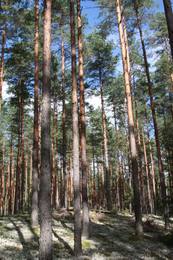
Gauja National ParkDer Gauja Nationalpark, 1973 gegründet, war Lettlands erster Nationalpark und hat eine reiche Tradition an Umweltschutz und Tourismus. In der Tat, der GNP ist einer der beliebtesten Ziele in Lettland. Die wichtigste “Pulsader” des Parks ist das Gauja Urstromtal, das entstand, als die Eiszeitgletscher verschwanden. Das Tal ist 95 km lang, mit vielen Nebenflüssen, zum Teil in tiefen Schluchten mit massiven Sandsteinfelsen aus dem Devon. Der tiefste Abschnitt des Flusstals befindet sich mit 85m Tiefe bei Sigulda. Das Territorium hat eine große Artenvielfalt – mehr als 900 Arten insgesamt. Die Gauja ist Lettlands beliebtester Fluss für Wassertourismus und man kann viele touristische Unterkünfte an seinen Ufern finden. Der Gauja Nationalpark ist einer der in Form von Naturpfaden und Tourismusrouten bestausgebauten geschützten Territorien in Lettland. Naturpfade in Līgatne verlaufen entlang von Wildgehegen – dem größten und komplettesten Objekt dieser Art in den baltischen Staaten. Der Park weist auch Kulturdenkmäler von gesamtbaltischer Bedeutung auf – das Turaida Museums Reservat, die mittelalterliche Altstadt von Cēsis mit seiner berühmten Burgruine und der Johanniskirche, die Wasserburg in Āraiši usw. Besucherzentren gibt es in Sigulda, entlang des Līgatne - Naturpfades und auf dem Zvārtes - Felsen. Die Verwaltung des GNP baut zur Zeit ein neues und modernes Besucherzentrum in Sigulda. Leistungen
50km - Entfernung von der HauptstadtLeistungen - komfort
Zeltplatzfor water tourists
Leistungen - erholung
BooteŽagarkalns, Siguldas pludmale
FahrräderJāmeklē Valmierā, Cēsīs un Siguldā.
LanglaufLigatne nature trails
ReiseführerNational park administration
Fahrten mit Schiff/BootCesis - Ligatne - Sigulda (1-2 days trip)
NaturpfadGaujas nacionālā parkā ir salīdzinoši blīvs taku, maršrutu un dabas taku tīkls. Starp tām ir jāmin: Sietiņieža dabas taka (1,5 km), Cīrulīšu dabas takas (līdz 6 km), Ieriķupītes dabas taka, taka "Meža mātes valstībā", Amatas taka (2,2 km), Līgatnes dabas takas (taku komplekss), taku tīkls Siguldas, Turaidas un Krimuldas apkārtnē, Kubeseles taka u.c. Šobrīd Gaujas nacionālā parka administrācija lveido un labiekārto kājinieku tūrisma maršrutu Gaujas krastos posmā no Murjāņiem līdz Siguldai.
NaturbeobachtungGaujas krastos, braucot pa Gauju, kā arī daudzajās dabas takās. Ieteicams izmantot arī Gaujas nacionālā parka gidu sniegtos pakalpojumus!
|
 |
Lettland
Uzavas augsteceNature restricted area is located to the South from former railroad Ventspils-Liepaja and includes approximately 6 km of Uzava River (and the old drainage system). The territory was used for agriculture during Soviet time, now it starts overgrow by scrubs. The protected nature values – rare bird species, including corncrakes, variety of grassland habitats and plant species. Territory is not useable for tourism activities. There is a possibility to get good insight into the North part of restricted area from the road Alsunga – Berzkalns where information stand is located.
|
 |
Lettland
Krustkalni Nature ReserveDas Naturreservat Krustkalni wurde 1977 geschaffen. Die Vielfalt der Pflanzen in der Region basiert sowohl auf dem Terrain – dem Madona - Damm, einer Reihe von Hügeln mit Geländesenken dazwischen, Sümpfen und kleinen Seen – als auch auf dem Biotop – natürlichen Wiesen, Waldlichtungen, Stellen, wo unterirdische Bäche an die Oberfläche sprudeln und riesigen Waldgebieten mit sehr alten Baumbeständen. Mehr als 800 Pflanzenarten wurden im Reservat bestimmt. Das Reservat darf nur in Begleitung eines Führers von der Reservatsverwaltung durchquert werden, wofür man sich vorher anmelden muß. Besucher können die Krāku - Quelle, den See Svēte-Dreimaņi und andere Stätten besuchen.
Leistungen
160km - Entfernung von der HauptstadtLeistungen - erholung
ReiseführerRezervāts apmeklējams tikai un vienīgi rezervāta gida vai reindžera pavadībā, iepriekš savulaicīgi piesakoties un noteiktā laikā.
NaturbeobachtungAinavas un lieliski skati no skatu torņa, izglītojošas ekskursijas, atsevišķu dabas objektu un apmeklētāju centra "Dreimaņos" apskate tikai un vienīgi Teiču rezervāta gidu un reindžeru pavadībā, iepriekš savulaicīgi piesakoties. Rezervāta administrācijas gidi, vides gidi un reindžeri piedalās un organizē dažādus ar vides izglītību un dabas vērošanu saistītus pasākumus. Teiču rezervāta administrācijas ēkā ir izveidota izglītojoša ekspozīcija, blakus ēkai - neliela laipu taka, informācijas stendi un kartes. |
 |
Lettland
Puzes smilsu krupja atradneNature restricted area has been established in old and overgrowing gravel pit and where rare species in Latvia - Natterjack toad (Bufo calamita) can be found. Natterjack toad needs open sand – gravel area therefore the population of it is decreasing once gravel pit is overgrowing by bushes. The population of this amphibian is depending on the activity of people in the area. There is very little chance to find Natterjack toad just by entering the restricted area, therefore please respect this area as especially sensitive.
150
Leistungen
150km - Entfernung von der Hauptstadt |
 |
Lettland
SventeDer Svente - Naturpark liegt im mittleren Teil des Augšzeme-Hochlandes mit dem See Svente in seinem Zentrum. Das ist einer der saubersten Seen in Lettland. Der Egļukalns - Berg bietet von seinem Aussichtsturm einen der schönsten Blicke in ganz Zemgalen. Besucher können die Hügel und Seen des Svente - Gebietes bestaunen. Der Egļukalns - Berg hat sowohl Skipisten als auch einen Naturpfad.
|
 |
Lettland
Kalkupes ielejaDas Kaļķupe – Flusstal wird geschützt, da der Fluss Pilsupe durch die Blauen Berge von Šlītere in den Süden nach Vīdale und Kaļķi fließt. Das ausgeprägte Flusstal hat ein verzweigtes Netz von Schluchten, in denen der Devonische Sandstein teilweise unbedeckt ist. Der Puiškalns – Hügel, der einst Burgberg und eine heilige Stätte in der Vergangenheit war , ist einer der markantesten Plätze in diesem Gebiet. Er ist ein beliebtes touristisches Ziel in der Region Talsi. Hangwälder, verschiedene Arten von Wiesen und eine große Zahl an Pflanzenarten sind ebenfalls wertvoll für die örtliche Umgebung.
|
 |
Lettland
Uzavas lejteceOpen landscape area within farming lands on both banks of Uzava River about 10 km before it flows into the Baltic Sea. There is a good open view over the area from the Vendzava-Ziri road going through the nature park. Protection of migratory birds and corncrakes has been one of the main reasons for establishment of the nature park. Bird watching is possible from the road Vendzava-Ziri during migration period in spring and fall. There is no tourist infrastructure in the nature park.
|
 |
Lettland
Bauskas dabas parksDer Bauska Naturpark verläuft für mehrere Dutzend Kilometer am Lielupe-Fluß und an seinen Nebenflüssen – der Mūsa und der Mēmele – entlang. Das ist ein geschütztes Territorium. Die Ufer dieser Flüsse enthalten einige der größten Dolomitklippen in Zemgale. Diese sind sowohl als Biotop als auch als geologisches Denkmal geschützt. Die Flüsse sind wichtige Laichplätze für Flussneunaugen und Zährten. Touristen werden von der Kulturlandschaft des Gebietes beeindruckt sein, genau wie von den Kulturdenkmälern wie z.B. vom Schloß Bauska, dem Park Jumpravmuiža, dem Mežotne - Burgberg und - Schloß, dem Vīna - Berg usw. Die Flüsse sind für Wassertourismus geeignet.
Leistungen
70km - Entfernung von der HauptstadtLeistungen - erholung
RadrouteBauskā sākas velomaršruts "Iecavas augšteces loks" (138 km).
NaturpfadMežotnes pilskalna labiekārtošanas gaitā ir izveidotas kāpnes un takas šī nozīmīgā kultūrvēstures pieminekļa iepazīšanai.
NaturbeobachtungNo Mežotnes pilskalna skatu platformas, Jumpravmuižas parka.
|
 |
Lettland
Naturpark TerveteIn diesem mehr als 50 Jahren alten Naturpark sind die Märchenhelden der lettischen Autorin Anna Brigadere (1861 – 1933) zu sehen. Ein enges Netz von Füssgängerbrücken. Ein modernes Besucherzentrum, ein Café. |
 |
Lettland
TerveteDer Tērvete Naturpark befindet sich in einem Gebiet, das nicht besonders typisch für die Zemgale Region ist – im Tērvete - Flusstal. An seinen Ufern gibt es riesige Wälder, die sich gut für Freizeitaktivitäten eignen. Es gibt Naturdenkmäler und auch hervorragende Kultur- und Geschichtsdenkmäler in dieser Gegend. Der Tērvete Landschaftspark ist einer der beliebtesten touristischen Ziele in Zemgale. Die Besucher finden hier einen Wald mit uralten Kiefern, einen herrlichen Landschaftspark, das Sprīdīši-Arboretum, die Burgberge von Tērvete, Klosterkalns and Svētkalns, das Museum “Sprīdīši”, das der großartigen lettischen Autorin Anna Brigadere gewidmet ist, verschiedene Kinderattraktionen, schöne Landschaften, ein enges Netz von Wanderpfaden usw. Dieser Naturpark ist 2004 zum familienfreundlichsten Ort in Lettland ernannt worden.
Leistungen
65km - Entfernung von der HauptstadtLeistungen - erholung
AngelnGulbju ūdenskrātuvē.
ReitenBraukšana pajūgā, jāšana pa apli vai parka teritorijā instruktoru pavadībā.
PicknickplatzParka teritorijā ir izveidotas atpūtas vietas, ugunskura vietas, telšu vietas, bērnu rotaļu laukumi u.c.
NaturpfadTērvetes dabas parku "caurauž" ļoti blīvs taku tīkls - atkarībā no katra iespējām un interesēm.
NaturbeobachtungTērvetes ielejas krastos, no Tērvetes pilskalna un skatu torņa.
|
 |
Lettland
VilceDer Vilce Naturpark ist klein und verläuft entlang der tiefen Tälern des Vilce - Flusses und seinen Nebenflüssen. Die Biotope umfassen Sandsteinklippen, Stromschnellen, Wälder, die für solche Gegenden typisch sind und die entsprechenden Pflanzen und Tiere darin. Der gut hergerichtete Burgberg von Vilce liegt neben der Zaķu-Wiese, die ein hübsch gestalteter und beliebter Platz zum Ausruhen ist.
|
 |
Lettland
Die westliche Küste der Rigaer BuchtDie westliche Küste der Rigaer Bucht ist das ganze Jahr über ein wichtiger Zufluchts- und Nahrungsort für viele migrierende Vögel. Von den geschützten Vogelarten begegnet man hier am meisten dem Sterntaucher und dem Prachttaucher, der Brandgans, der Eisente und der Zwergmöwe. Das Gebiet ist auch sehr wichtig für den Schutz der Riffe. Es befindet sich gegenüber der Regionen Dundaga, Roja und Engure, sowie der Stadt Jūrmala. Die Fläche beträgt 132 173 ha. Das Territorium enthält den Meeresteil vom Naturpark „Engure“ und dem Nationalpark von Ķemeri.
|
 |
Lettland
Ainazi-SalacgrivaAinaži – Salacgrīva ist ein wichtiges Naturschutzgebiet für Riffe. Das Gebiet befindet sich gegenüber der Region Salacgrīva und die Fläche beträgt 7239 ha.
|


