|
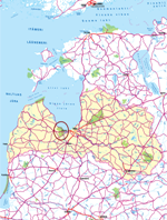
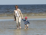
Welcome to Ķemeri! There are 7 new routes for hiking, cycling, canoeing, self-drive and bird watching developed in Ķemeri National Park. The new tourism products are aimed for tourists who are self planning their travels. Just print out the route description with attached map and enjoy your trip! Every route description includes: short description of points of interest, information about available tourism services and accommodations, contact information for bike/boat rentals, tourism information boards etc. Bird watching is suggested in a company with experienced guide.
If you plan to stay in the territory of the National Park more than one day choose one of offered accommodations or call Lauku celotajs for booking.
There is more practical information available also in our travel guides and tour maps.
|
|
|
|
 |
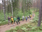
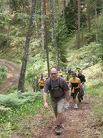
Hiking |
|
|
|
|
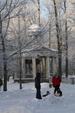
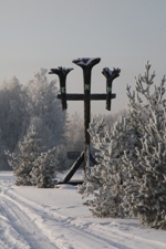
Along the Green Dune |
The route is meant for active hikers or Nordic walkers. The route covers the western part of the town of Ķemeri, as well as the Green Dune, which is one of the most interesting aspects of the Ķemeri National Park. The Green Dune is an impressive barrier of dunes which stretches at a length of several kilometres, crossing a virginal swamp and passing through a forest of coniferous trees. The Raganu swamp can occasionally be espied on the eastern side of the Green Dune, while the Zaļais swamp is on its western side. If it is rainy, bring waterproof footwear, because there are a couple of places along the routes where you’ll be crossing very old wooden pathways across a swamp. It is also true that the Green Dune has been damaged very much by people who illegally drive mechanical vehicles there, and so please, let’s all be careful with the natural treasures here – let’s go on foot.
| Season |
April - October |
| Length |
Ap 14 km |
| Duration |
~3 – 4 h |
| Difficulty |
Easy |
| Road cover |
2/3 of the way with gravel or earthen roads, 1/3 – paved roads |
| Beginning |
Ķemeri railway station, where there is a free car park |
| End |
Ķemeri railway station |
| Route |
Ķemeru railway station – Brocēnu street – Partizānu street – Green Dune – Antiņciems – Ķemeri road – Robežu street – E. Dārziņa street – Ķemeru railway station |
| Alternatives |
You can travel the route in the opposite direction. You can also extend it to Antiņciems (another 1-2 kilometres or half an hour). You can also merge this route with the hiking route “Ķemeri: The Historical Spa”. |
| Distance from Rīga |
45 km |
| Logistics |
Circular route which returns to where it started |
| Note! |
You need appropriate shoes, insect repellent, and the map that is attached to this description. If you want to learn more about the surroundings, take a guide with you (he or she will also help you to find your way). The guide will talk about the park and what you are seeing along the route. You are responsible for your own safety and that of your children while you are on the route. |
Route description/ map
|
 |
|
|
|
 |
|
|
|
 |
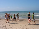
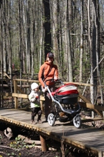
From Jaunķemeri to Klapkalnciems |
The territory of the Ķemeri National Park includes a 17-kilometre stretch of the western shore of the Bay of Rīga. The sandy beach is fine for brief strolls or longer hikes which take half a day. Between Jaunķemeri and Klapkalnciems, there are no obstacles for hikers or Nordic walkers. The route can be continued toward Rīga and Engure, depending on how much time you have. When planning the route, count on the fact that the average person will walk four kilometres an hour, while a quicker person will walk six kilometres an hour, in both cases without stopping to look at any points of interest. Presumably, we will someday soon have “normal” winters again, and that means that cross-country skiers will also be able to use this route.
| Season |
Yearround |
| Length |
~ 2 – 15 km |
| Duration |
~ 2 – 4 h |
| Difficulty |
Easy |
| Route |
Some of the suggested routes:
• Jaunķemeri – Lapmežciems
• Bigauņciems – Ragaciems
• Jaunķemeri - Klapkalnciems |
| Logistics |
We recommend that you plan a circular route which will return you to where you began. You can walk down the beach in one direction and via the streets of fishing villages in the other direction to make the route more varied. We don’t recommend walking along the Jūrmala-Talsi highway (P 128), because it will be very busy, particularly during the tourism season. There will also be lots of cars parked on the side of the road, which will make hiking more difficult. The village centres of the populated areas are a few hundred metres from the sea. You can plan your route in accordance with bus route listings along the aforementioned highway – that will allow you to return to the starting point via public transport. |
| Distance from Rīga |
45 km |
| Note! |
Print out and take the route description attached to the link below with you. You are responsible for your own safety and that of your children while on the route. |
Route description/ map
|
|
|
|
|
|
 |
|
|
|
 |
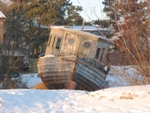
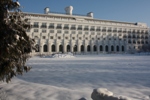
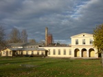
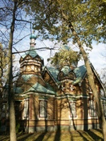
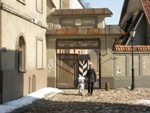
Ķemeri - The Historical SPA |
This route will inform you about the most important cultural and historical monuments in the town of Ķemeri, most of which are linked to the development of the town as a spa town. For several centuries, Ķemeri was a flourishing spa of international importance. It was established in 1838, and it had a fine infrastructure with a wide range of services. In Soviet times, Ķemeri was a spa of pan-Soviet importance, and it shut down when the Soviet system collapsed in the late 1980s and early 1990s. The ruins of hotels and the former swimming facility have now turned into a small and quiet little town with a certain sense of abandonment. The careful eye, however, will notice many important treasures, and it will be worth spending at least half a day in examining these. The route is also appropriate for Nordic walkers or bikers. The historical part of Ķemeri is a monument to urban construction.
| Season |
Yearround |
| Difficulty |
Easy |
| Beginning |
The Forest House, administrative and informational centre for the Ķemeri National Park. This is a circular route which can also be begun from the Ķemeri railroad station, where there is a free car park. |
| End |
The Forest House or Ķemeri railroad station |
| Length |
~ 8 km |
| Duration |
~ 3 - 4 h |
| Road cover |
Paved |
| Route |
The Forest House – Ķemeri Park – Karogu street – Robežu street – Tukuma street – Brocēnu street – E. Dārziņa street – Sēravotu street – Tūristu street – The Forest House |
| Distance from Rīga |
45 km |
| Logistics |
Circular route which returns to where it began |
| Alternatives |
You can merge this route with the “Along the Green Dune” hiking route or the “On a Bike Around the Ķemeri National Park” biking route. |
| Note! |
The Forest House will offer you additional information about the Ķemeri National Park. If you want to learn more about the former spa and its history, hire a guide to accompany you. Bicylcists need to observe traffic rules and polite practices. You are responsible for your own safety and that of your children along the route. |
Route description/ map
|
|
|
|
|
|
|
 |
Cycling |
|
|
|
|
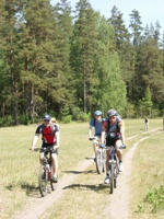
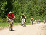
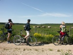
Around Ķemeri national Park |
This is a route for active and athletic people. It encircles the perimeter of the Ķemeri National Park, offering a very good idea of the natural, cultural and historical treasures that are found in the park. This is a diverse route in terms of what can be seen, but also in terms of biking conditions.
| Season |
April-October, recommended during the summer |
| Length |
Ap 80 km. Veicams vienā vai divās dienās ar nakšņošanu tūristu mītnēs. |
| Duration |
~ 8 h (bez objektu apskates) |
| Type of bike |
Mountain bike, particularly for the latter half of the route from the Smārde saloon |
| Difficulty |
Medium in two days, comparatively hard in one |
| Road cover |
Gravel and earthen roads for about half the distance |
| Beginning |
Ķemeri railway station, where there is a free car park |
| End |
Ķemeri railway station |
| Route |
Ķemeri – Jaunķemeri – Bigauņciems – Lapmežciems – Ragaciems – Klapkalnciems (via the forest route between the P 128 road and Lake Kaņieris) – part of the Lustužkalns Circle bike route – „Valguma pasaule” – Smārde – the Dunduri meadows – the Krāči hills – Kūdra - Ķemeri |
Markings
|
The Lustužkalns Circle bike route is marked with orange markings, and part of it coincides with this route |
| Alternatives |
You can travel the route in the opposite direction. In Ķemeri you can return by train from Smārde or Kūdra to avoid the most difficult part of the route, between Kūdra and Ķemeri. |
| Distance from Rīga |
45 km |
| Logistics |
Circular route, returning where it started |
| Note! |
The A 10 highway between Rīga and Ventspils is inappropriate for biking, because it is narrow, of poor quality and with intensive traffic, particularly in the area between Sloka, Kūdra and Smārde. Some parts of this route are difficult. There is a peat cement factory nearby, and that means that there can be glass and other sharp objects on some parts of the route – watch out! During the tourism season, travel along the Jūrmala-Tukums highway is not recommended, because there will be kilometres of parked cars along the way. This is the so-called Slow Mile, and you are advised to take the forest par thereof. Watch your bike and equipment always. You must be responsible for your own safety and that of your children when you travel the route. |
Route description/ map
|
|
|
|
 |
|
|
|
 |
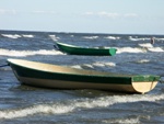
Canoeing |
|
|
|
|
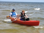
From Jaunķemeri to Klapkalnciems |
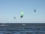
This route involves special “SitOnTop” boats which are stable and appropriate for travel on the sea, or sea kayaks. The route passes along the former fishing villages of Bigauņciems, Lapmežciems, Ragaciems and Klapkalnciems. From the sea, a very different and unseen image of the villages can be found. An interesting place is Cape Ragaciems, which stretches deep into the sea underwater – as much as 500 metres from the shore. The seabed is rocky here, and the water is no more than one metre in depth. The shoreline road between Ragaciems and Klapkalnciems has been known as the Slow Mile since olden days, because it is a long and isolated route – one along which robbers once used to lurk. The trip can be ended at the place where the Lāčupīte River flows into the sea. There is a bridge and a car park nearby. This route is appropriate for all kinds of people, particularly if the wind is relatively slow (3-4 m/s). When planning the route, choose a day when the wind is blowing from your back or side. Beginners should hire a knowledgeable guide.
| Season |
Recommended during the summer, particularly the first half thereof |
| Length |
16 km, can be handled in one day’s time |
| Duration |
~ 4h, which is “net time,” i.e., not counting stops along the way |
| Boats |
SitOnTop boats, sea kayaks |
| Difficulty |
Easy or of medium difficulty, depending on the wind direction and speed, as well as the height of waves; beginners should take the route only when the wind is slow |
| Beginning |
Jaunķemeri, with a car park nearby |
| End |
Klapkalnciems, where the Lāčupīte River flows into the sea |
| Alternatives |
You can travel the route in the opposite direction (Klapkalnciems-Jaunķemeri) if the wind is right. You can also continue along to Apšuciems (another 5 km, or slightly more than an hour) or Plieņciems (8 km, 2 h) |
| Distance from Rīga |
40 km |
| Logistics |
You can return to your car via public transport or a second car left at the final destination of the route |
| Note! |
Make sure you observe safety rules (life preservers, taking into account the speed and direction of the wind, staying close to the shore). The most dangerous possibility here is wind which drives your boat out to sea. If there are waves, watch out for fishermen’s nets. You can leave your car only at specifically designated locations. Take care of your own safety and that of your children while taking this route. |
Route description/ map
|
|
|
|
|
|
|
|
 |
Self-drive |
|
|
|
|
The Great Ķemeri Circle by Car |
This route circles perimeter of the Ķemeri National Park, offering a very good idea of the natural, cultural and historical treasures that are found in the park.
| Season |
Yearround, best between April and October |
| Length |
~120 km (another 20 km on to Tukums) |
| Duration |
One or two days, depending on the points of interest at which you stop |
Type of car
|
No specific requirements |
| Difficulty |
Easy |
| Road cover |
Paved |
| Beginning |
Ķemeri National Park (KNP) boundary on the Rīga - Ventspils highway (A 10), the Ķemeri railway station, or the Ķemeri Forest House, which is the park’s administrative and informational centre |
| End |
Depending on the selected starting point, the circular route will lead you back to where you began |
| Route |
ĶNP bondary - Kūdra – Ķemeri – Jaunķemeri – Bigauņciems – Lapmežciems – Ragaciems – Klapkalnciems – Valgums – Smārde – Ozolpils – Slampe – Lancenieki – Kaļķis – Kūdra – ĶNP bondary |
| Alternatives |
You can drive in the opposite direction, or extend the route to Milzkalne and Tukums |
| Distance from Rīga |
40 km |
| Logistics |
Circular route which will bring you back to where you began |
| Note! |
The Rīga-Ventspils highway between Sloka and Kūdra is narrow and of very poor quality, plus it is very busy with traffic. Please drive carefully, and when you stop at a point of interest, only leave your car at a place which is specifically meant for parking and which is safe from the perspective of road traffic. You are responsible for your own safety and that of your children while on the route. |
Route description/ map
|
|
|
|
|
|
 |
 |
Bird and animal watching |
|
|
Jānis Ķuze
|
|
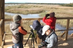
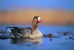
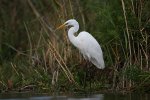
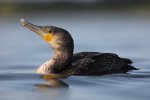
Birds at Ķemeri |
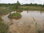
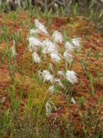
Nearly 260 of the 342 species of birds that have ever been spotted in Latvia have been seen at the ĶNP. There are both nesting and migratory birds in the park’s forests, meadows and waterways. Many species are uncommon and protected. In the autumn and spring, thousands of migrating geese and cranes use the park to rest and spend the night. Popular bird-watching locations at the ĶNP: Lakes Kaņieris and Sloka, the Dumbrāji trail, the Dunduri Meadows, the Lapmežciems seashore where the tributary of the Starpiņupe River flows into the sea, fields of Slampe and the Raganas Swamp along the Ķemeri-Antiņciems road.
Good practice in bird-watching
- Leave the birds alone!
- Remember that all species of birds are equally important
- Protect the nesting places of birds
- Respect the rights of others and yourself
- Write down you observations
- Thoughtfully share your knowledge
- Try to learn more
Route description/ map
|
|
|
Jānis Ķuze
|
Jānis Ķuze
|
|
 |

|
This project is partly financed by the European Union (ERDF) within the Baltic Sea Region Programme
|
 |
|
|
|
|


