
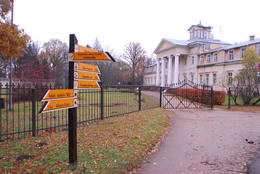
Исторические и современные центры
| Обзор | Подробности |
|---|---|
 |
Литва
Zemaisu Kalvarija (Zemaicių Kalvarija)Pirmo reizi vēstures avotos 1253. g. šī vieta ir minēta kā kuršu apdzīvota apmetne. Laikā no 1637. – 1639. g. te uzcēla pirmās 19 kapelas – t.s. „Krusta ceļa stacijas", kas atgādināja Jeruzalemes Krusta ceļu. Kopš tā laika Žemaišu Kalvarija ir pazīstama kā nozīmīgs svētceļnieku galamērķis. Dažas no Krusta ceļa kapelām ir veidotas 17. – 18 gs., bet citas – 19. gs. Jāatceras, ka vēl pavisam nesen – Padomju laikos svētceļniekus nežēlīgi vajāja un represēja. Mūsdienās pilsētā ir izveidots 21 svētceļnieku „pieturas punkts". Te ik gadu (parasti no 2. – 12. jūlijam) notiek Žemaišu Kalvarijas katoļu draudzes svētki, kas pulcina daudz ļaužu no dažādām Eiropas valstīm. Iespaidīgā katoļu bazilika ir slavena ar Vissvētākās Jaunavas Marijas Katoļu Ģimeņu Karalienes gleznu, kas 17. gs. atvesta no Romas. Tai piedēvē brīnumdarītājas spējas. Interesants ir pilsētas ielu tīklojums, kas atgādina 9. – 13. gs. apdzīvotas vietas ielu plānojumu. Noteikti apskatāms iespaidīgais Žemaišu Kalvarijas pilskalns, kas slejas mazās Varduvas (Varduva) upītes krastā.  311 311
Услуги
311km - Расстояние от столицы |
 |
Эстония
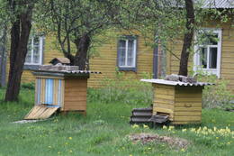
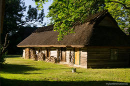
Деревня Когува и музей МухуДеревня Когува на острове Муху- один из ярчайших примеров Эстонской крестьянской архитектуры. Это деревня с относительно хорошо сохранившимися постройками, дома которой вместе с каменными заборами охраняются как архитектурные памятники. В комплексе музея Муху, которых находится в деревне, можно посмотреть некогда богатый прибрежный хутор, место рождения Эстонского писателя Юхана Смуула — хутор Тоома со всеми приусадебными постройками и домашней утварью, также старую деревенскую школу и выставку текстиля. 162
 1-12 1-12
Услуги
162km - Расстояние от столицы
1-12 Месяцы активного сезона |
 |
Латвия
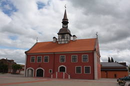
ДундагаВ свое время дундагский барон был одним из крупнейших землевладельцев в Курземе, поэтому во второй половине XIX века вокруг господской усадьбы образовался центр хозяйственной и общественной жизни. Доминантой центральной площади Дундаги была водонапорная башня, за которой начинается Дактерлея, где с 1844 по 1854 гг. в докторате работал один из первых врачей латышской национальности и языковед Я. Барс. Вплоть до 60 годов XX столетия из Дундаги в Вентспилс через Мазирбе и рыбацкие поселки курсировал паровозик. Сегодняшняя Дундага привлекает туристов своим впечатляющим дворцом, лютеранской церковью, скульптурой Крокодила, мастерской керамиста Эйзенберги и другими объектами. 152
Услуги
152km - Расстояние от столицы |
 |
Латвия
ЛИВАНЫВпервые упоминание о Ливаны, как о крупном населенном пункте, встречается в 1533 году, когда тогдашний землевладелец Ливен основал поместье и назвал его своим именем - Ливенгоф. В 1678 году здесь возвели первую католическую церковь. Город сильно пострадал во время обоих мировых воин. Название Ливаны связано со стеклянными изделиями. В 1887 году здесь был построен стекольный завод, который в наши дни прекратил свою деятельность. 167
Услуги
167km - Расстояние от столицы |
 |
Литва
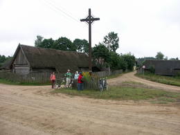
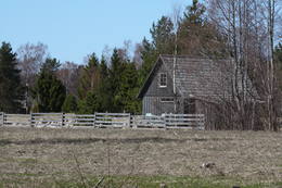
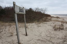
Strazdi (Strazdai)Ja mērķis ir savākt pilnvērtīgu etnogrāfisko ciemu fotokolekciju, ir jāapskata Strazdi (no lietuviešu valodas strazdai tulkojumā nozīmē strazds), kas ir pavisam neliela apdzīvota vieta Balošas (Baluošas) ezera ziemeļu krastā. Strazdi pirmoreiz rakstos minēti 1783. g. un ciema nosaukums cēlies no kādas mežziņu dzimtas uzvārda. 128
Услуги
128km - Расстояние от столицы |
 |
Эстония
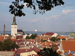
TallinnThe capital of Estonia. The Old Town of Tallinn - excellent medieval (14.-15th century) building monument. The former city of Hanza. |
 |
Латвия
Madonas Saieta laukumsMadonas centrālais laukums, kas vēl 20. gs. sākumā bija tirgus laukums. Pēc apjomīgās restaurācijas tas ir kļuvis par ievērības cienīgu pilsētvides objektu. Laukuma ziemeļu pusē atrodas pilsētas un novada pašvaldība un Madonas novada TIC. 165
Услуги
165km - Расстояние от столицы |
 |
Латвия
Городище ЕрсикаВажное место для истории Латвии, так как в 12 - 13 веке здесь находился административный и духовный центр древней Латгальской земли – Ерсика. Замок правителя Ерсики Висвалдиса возвышался на крутом берегу Даугавы высотой 18 метров. Площадку городища (100 × 75 м) окружал вал и деревянная защитная стена. Внутрь можно было попасть через охраняемые ворота, за которыми располагались жилые и хозяйственные постройки и даже небольшая церковь. В городище проводились археологические раскопки, во время которых были обнаружены остатки срубов, а также многие другие артефакты 10 - 13 века, свидетельствующие об активных торговых отношениях, в том числе с Древней Русью. В 1209 году войско епископа Альберта обманом заняло замок и древний город Ерсика. Семью правителя Висвалдиса берут в плен, поэтому латгальский король вынужден стать вассалом епископа. Территория городища находится в частной собственности, поэтому его посещение необходимо согласовать с собственником. 175
Услуги
175km - Расстояние от столицы |
 |
Литва
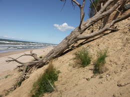
JuodkrantėOld fishermen village, which was first mentioned in 1429. Before WW2 Juodkrante was popular resort in Europe and it still has its traditions nowadays. Village has an unique scenery with its wooden houses, promenade, Lutheran Church (1885), Lithuania's Art Museum Hall and much more. 328
Услуги
328km - Расстояние от столицы |
 |
Латвия
Развалины Кокнесского замкаПодтоплены и находятся в месте слияния Даугавы и Персе. Возводился в 1209 году для нужд Рижского епископства на месте бывшей деревянной крепости древних латышей. В XIV веке во дворе замка были построены деревянные здания, приспособленные для постоянного проживания. В XVI веке построили пристройки и возвели две круглые башни. В 1701 году кажущийся несокрушимый замок взорвало войско саксонцев. Рядом с руинами замка работает центр для посетителей, в котором можно выковать монету средневековья и взять напрокат лодку для прогулки по Даугаве. Стоит прогуляться по Кокнескому парку (создан в 1900 г.), где установлены шведские пушкиXVII века, надгробные памятники средневековья и восстановлен фонтан «Голова фавна», который в 20 - 30 годах располагался неподалеку от водопада Персе (сейчас под водой). 100
Услуги
100km - Расстояние от столицы |
 |
Латвия
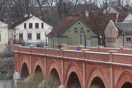
ЦЕСИСВпервые название Цесис упомянуто в 1206 году в хрониках Индрика. Первые сведения о городе исходят из Риексту калнса (Ореховая гора), именно здесь в XI - XIII вв. находился укрепленный деревянный замок вендов. Примерно в 1209 году немецкие крестоносцы приступили к строительству каменного замка, который вскоре стал политическим центром Ливонского ордена. В конце XIV - начале XV века Цесис становится членом Ганзейского союза и на протяжении столетия переживает стремительный расцвет. До XVI века на городе почти не отразились различные военные и боевые действия, но последующие события существенно изменили вид и образ жизни города. Новый этап расцвета город испытывает во второй половине XIX века – со строительством Видземского шоссе (1889 г.) и железнодорожной линии Рига – Валка (1889 г.). В 1919 году здесь происходили важные для истории Латвии бои за освобождение. В советские годы был очень популярен туристический объект здоровья и отдыха - санаторий «Цирулиши». В наши дни Цесис и развалины замка (построен современный центр для посетителей) являются одним из популярнейших мест латвийского туризма. 87
Услуги
87km - Расстояние от столицы |
 |
Эстония
PärnuMost popular Estonian resort with wide range of leisures and SPA offers. One of the rare Estonian sandy beaches. The Old Town has the main walker street - Rüütli tee. 130
Услуги
130km - Расстояние от столицы |
 |
Латвия
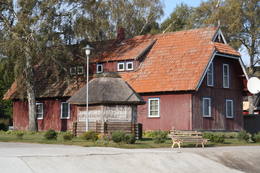
ЛиелирбеДеревня расположена в устье реки Ирбе (Dižirve, Īra), на обоих ее берегах (на «морской» стороне и на стороне «суши»). Ирбе впервые упоминается в 1310 году в пограничном договоре между Курземским епископом и Рижским домкапитулом, а название Лиелирбе (Irvemünde) впервые было внесено в арбитражный документ в 1387 году. В конце 19-го века малый порт Лиелирбе был активным центром торговли и транспорта древесины. В конце 19-го и начале 20-го века здесь было построено самое большое количество парусников среди всех поселений западного берега Курземе. В 1939 году в селе проживало около 300 жителей, насчитывалось более 70 домов и баптистская церковь (сейчас находится в Вентспилсском музее под открытым небом). Через поселок проходил узкоколейный паровоз, работало почтовое отделение и телеграф, имелись два продуктовых магазина, начальная школа 1-го класса, хор и духовой оркестр. Лиелирбе был одним из крупнейших поселений, исчезнувших после Второй мировой войны. В Лиелирбе родилась историк культуры Валда Мария Шувцане (1923 - 2007), работу которой продолжила ее дочь Байба Шувцане, создавая важные произведения о жизни ливского берега. До 2019 года планируется восстановить тросовый мост через реку Ирбе. 171
1-12
Услуги
171km - Расстояние от столицы
1-12 Месяцы активного сезона |
 |
Латвия
КУЛДИГАКулдигу заслуженно считают красивейшим латвийским провинциальным городом средневековья. На его месте еще до XIII в. находился центр древней земли куршей Бандавас. В 1242 году у водопада Венты Ливонский орден приступил к строительству каменного замка. Рядом с замком образовалось поселение, которое первым (1378 г.) в Курземе получает права города. Важным было и участие города в Ганзейском союзе. В период с 1561 по 1795 гг. Кулдига - столица Курземского герцогства. Закономерно, что в первой половине XVII века город переживает стремительный экономический подъем, который заканчивается с началом Северной войны и эпидемии чумы. Гордость курземчан и недостаток крупных индустриальных объектов является причиной того, почему в советское время город не наводнило большое количество иммигрантов, и поэтому Кулдига до сих пор остается одним из самых латышских городов Курземе. В Кулдигу стоит поехать не на один день. Любители природы могут увидеть летучих рыб, а для исследователей истории культуры здесь приоткрывается всемерно просторное поле деятельности. 152
Услуги
152km - Расстояние от столицы |
 |
Латвия
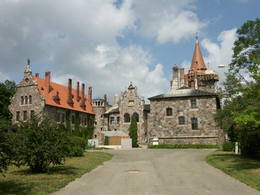
КРИМУЛДАКримулдскую лютеранскую церковь считают одним из старейших храмов Латвии. Первоначально она была построена в начале XIII века, вскоре после завоевания Кубеселе и позднее многократно перестраивалась. Рядом с церковью создан лабиринт медитации «Цветок лилии». Когда в 1217 году при участии в Виландской битве погиб предводитель ливов Каупо, то его прах согласно преданиям захоронили в церкви. Местом могилы Каупо в народе называют небольшой холмик рядом с протекающей поблизости Рунтиньупите (Рунтиньш), на правом берегу которой находится искусственно вырытая пещера Кубеселес или Рунтиньала, глубиной примерно 7 метров. На левом берегу Рунтиньупите - городище Кубеселес. Около церкви начинается Кубеселская природная тропа. По ней можно дойти до Гауи, на берегу которой лежит Большой (Рунтиня) камень. Здесь можно увидеть установленные плотовщиками Гауи якорные колодки. Кримулдский средневековый замок (в 4 км к востоку от Кримулдской церкви) построили во второй половине XIII века в месте, где правый коренной берег древней долины реки Гауя рассекает глубокий Викместский овраг. Замок (хозяйничал Рижский домский капитул – Рижский совет архиепископов) был внушительной постройкой, просторный внутренний двор которого включал защитную стену, толщиной 1,5 м. Кримулдский замок, отступая в 1601 году, взорвал шведский военноначальник Генрих Ливенс. Сейчас на поросшем лесом городище можно осмотреть незначительные развалины замка. Рядом расположена Воздушная канатная дорога, и начинается Кримулдский серпантин. Недалеко стоящая Кримулдская господская усадьба впервые в летописях упоминается в XV столетии.
Наблюдаемый сегодня дворец-усадьба построен в XIX веке в стиле неоклассицизма (владелец - князь Ливен). В 20-х годах XX столетия, после отчуждения, дворец отошел в собственность Латвийского Красного Креста, который создал детский санаторий. В наши дни во дворце расположена реабилитационная больница «Кримулда», а из хозяйственных построек сохранились конюшни господской усадьбы, хлев, дом прислуги, управляющего и т.н. Швейцарский дом, а также парк. Здесь предлагаются тематические экскурсии. Если по Гауе идем на лодке, тогда с близкого расстояния можно рассмотреть 15-метровый утес Велнала (Чёртовая пещера). Это место хорошо просматривается и с противоположного берега – с левого берега Гауи (обустроено место для отдыха). В средней части утеса находится Кримулдская Велнала (Чёртовая пещера), глубиной около 19 м, а высотой - 4,7 м. Если от утеса Чёртовой пещеры по нижней части правого коренного берега Гауи отправимся в направление Турайды, то взору приоткроется Пикенский обрыв с обнажениями песчаника. У подножья создана Пикенская бобровая тропа, протяженностью примерно 1 км. Рядом с тропой находятся Малая Чёртовая пещера (глубина 5 м) с вытекающим родничком Мудрости, и одинаковая по глубине - пещера Аунапиерес. Просматривается и небольшое староречье. 50
Услуги
50km - Расстояние от столицы |
 |
Латвия
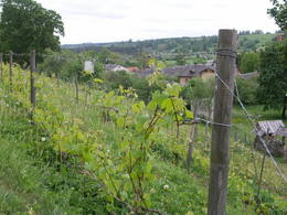
САБИЛЕНа месте городища Сабиле уже в X веке находился древний укрепленный город. После раздела земель куршей, Сабиле отошло к Ливонскому ордену, который построил каменный замок (не сохранился). В письменных источниках Сабиле впервые упоминается в 1253 г. В XV веке вокруг замка начало образовываться поселение. Права города Сабиле получил в 1917 году. Теперешний Сабиле - небольшой провинциальный городок, в окрестностях которого находятся многие известные культурно-исторические памятники. Неотъемлемая составная часть культурной среды города Сабиле - цыгане, поэтому город в простонародье зовется цыганской столицей Латвии. Сабиле издавна известен своими традициями выращивания виноградной лозы и виноделия, которые возрождаются и которыми наслаждаются во время Сабилского праздника вина. 112
Услуги
112km - Расстояние от столицы |
 |
Литва
Kretonu vienielas ciems (Kretuonių gatvinis kaimas)Kretoņu (Kretuonas) ezera dienvidu krastā (ezeru gan neredz aizauguma dēļ) meklējams Kretoņu ciems. Šķiet, ka šī vieta ir „aizķērusies" pagātnē. Cauri ciemam iet viena iela, kurai abās pusēs izvietojušās 19. – 20. gs. mijā (dažas pat mazliet agrāk – 19. gs. vidū) celtās saimniecības. Te redzamas gan dzīvojamās, gan saimniecības ēkas, kuras rada etnogrāfiska brīvdabas muzeja sajūtu. Dažas no tām gan ir „padevušās" laika zobam. Lai vai kā, šis ir viens no neparastākajiem nacionālā parka etnogrāfiskajiem ciemiem, kuru pa „galveno ielu" vērts izstaigāt visā garumā. Šim, tāpat kā pārējiem etnogrāfiskajiem ciemiem ir piešķirts kultūras mantojuma objekta statuss. 106
Услуги
106km - Расстояние от столицы |
|
|
Латвия
КалькисКалькис – населенный пункт, в
окрестностях которого попрежнему в
открытых карьерах добывают доломит
(карьер "Калнциемс2"). Часть карьеров
затоплена.
46
Услуги
46km - Расстояние от столицы |
 |
Латвия
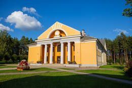
ОГРЕМатериал археологических раскопок свидетельствует о том, что берега реки Огре были заселены ливами. Огре как крупное поселение и известный курорт образовался после строительства в 1861 году железной дороги Рига – Даугавпилс. До Первой мировой войны в Орге свои услуги предлагали примерно 300 дач, которые во время войны были почти полностью уничтожены. Следующее крупномасштабное событие произошло в 1965 году, когда в Огре построили один из крупнейших в Европе трикотажный комбинат, на котором трудились рабочие из Вьетнама и других стран. Современный город Огре прежнюю славу курорта пока еще не приобрел, но стал в известной мере местом застройки эксклюзивных, главным образом, малоэтажных частных домов. 36
Услуги
36km - Расстояние от столицы |
 |
Латвия
ВалмиермуйжаНаходится в северной части Валмиеры. Господский дом поместья Валмиермуйжа (в стиле необарокко) в период времени с 1764-й по 1771-й год построил герцог Петер Август Шлезвиг-Гольштейн-Зондербург-Бекский. В последующие годы поместье принадлежало другим многочисленных хозяевам. По нынешним свидетельствам можем судить, что господский дом поместья в начале 20-го века представлял собой одноэтажное здание с барокальной башенкой и двухэтажным корпусом, находившемся рядом. Здание служило летним и охотничьим домом. В 1918-м году здание сгорело. Два года спустя в поместье разместился лагерь военнопленных. Позже пристройку к господскому дому восстановили и организовали в ней основную школу. В 1936-м году в здании была создана тюрьма, которая во время Второй мировой войны становится местом заключения военнопленных. Позже здание сгорает и руины сносятся. До наших дней сохранилась башня поместья, потолочная роспись помещений которой, а также парк являются памятниками культуры. В наше время рядом с историческим местом была создана пивоварня Валмиермуйжас и поместье обрело второе дыхание! 111
1-12
Услуги
111km - Расстояние от столицы
1-12 Месяцы активного сезона |
 |
Латвия
АлсунгаКак древняя Альшванга этот населенный пункт был впервые упомянут в 1231 году в договоре папского вице-легата Балдуина Альнского с куршами. Ливонский орден управлял здесь до 1561 года, а с 1573 по 1738 год замок ордена перешел к происходящей из Померании семье Шверина. Именно во время правления семьи Шверинов в Алсунге был воздвигут каменный храм в честь святого архангела Михаила и начато обращение местных жителей в католичество. Алсунга становится центром католической церкви в Курземе, ее обитатели - суйтами (свита Шверинов). 176
1-12
Услуги
176km - Расстояние от столицы
1-12 Месяцы активного сезона |
 |
Латвия
МАДОНАВозможно, Мадона – это единственный город в Латвии, на территории которого примерно в IX веке находилось озерное поселение. Остатки поселения сохранились под водой в северной части озера Салас (Церковный остров). До конца XIX века на месте теперешнего города находилась небольшая господская усадьба с таким же названием (Мадона), которую латыши называли Биржи. В 1898 году начато строительство узкоколейной железной дороги между Стукмани (Плявиняс) и Валкой. С развитием железной дороги, развивался и сам город. Современная Мадона – это ухоженный город Виздеме со своим шармом, характерным для провинциального городка. Интересно то, что Мадону можно считать городом Латвии, расположенным в самой высокой части рельефа. 169
Услуги
169km - Расстояние от столицы |
|
|
Латвия
Исторический центр города СубатеВпервые название Субате упоминается в 1570 г., когда Курземский герцог Готхард Кетлер продал графу Г. Платеру-Зибергу торговое место Субате. Когда род Платеров – Зибергов в середине 17 века перешел в католическую веру, лютеране Субате были недовольны и в знак протеста переправились на восточный берег озера Субате, который находился в собственности владельцев господской усадьбы «Проде» (в наши дни только развалины) рода Остен – Закенов. В 1685 году Остен – Закены построили для «перебежчиков» лютеранскую церковь, вокруг которой образуется Яунсубате. Обе части города объединились в 1894 году. В 1919 году во время борьбы за свободную Латвию Субате освободили литовцы, после чего последовал раздел города на латышский и литовский сектор (в 1921 году границу определили по предыдущей линии). Исторический центр Субате создавался в периодс16 по 19 век,и его облик связан с храмами четырех разных вер, малоэтажными деревянными постройками, которые выстроились в ряд вдоль узкой и петляющей улочки. И природные условия – месторасположение города на берегах субгляциальной ложбины (Большого и Малого Субатского озера) придают городу необычные для Латвии обзорные перспективы. 171
Услуги
171km - Расстояние от столицы |
 |
Латвия
ТУКУМСВ исторических источниках Тукумс упоминается в договоре 1253 года Ливонского ордена и епископа о разделе Курсы. Если название города переводить с ливского языка, то получается «кучи песка, горы». В начале XIV столетия рядом с каменным замком Ливонского ордена образовалось поселение немецких торговцев и ремесленников, расцвету которого способствовала близость дороги Рига - Пруссия. Позднее на развитие города существенно повлияло строительство в 1877 году железной дороги Рига – Тукумс. В советское время у восточных ворот Тукумса был построен крупнейший в Балтии военный аэродром СССР и военный городок. Современный Тукумс является краевым центром с таким же названием и широким спектром предлагаемых туристических услуг. 68
Услуги
68km - Расстояние от столицы |
 |
Латвия
МазирбеВ документе 1387 года упоминается как «Малая Ирва» (Minor Irva). До середины 20-го века Мазирбе было самым крупным поселением ливов на побережье Курземе - рыбацкая деревня и центр судоходства. В селе была церковь, школа, аптека, лесное хозяйство, несколько магазинов, контора почты и телеграф, станция, лесопилка, парикмахерская, пекарня, фотостудия. В Браусках действовала печь по обжигу кирпича. В 30-е годы 20-го века рыболовный кооператив построил цех по переработке рыбы. В 1923 году здесь был основан Союз ливов и в 1939 году был открыт Народный дом ливов. Напротив него находятся Стуриши (родовое поместье семьи Тайзелей), где можно осмотреть предметы обихода ливов и, по предварительному заказу, продегустировать местные блюда. В Мазирбе проживали первые председатели Союза ливов - Карлис Сталте и Мартиньш Лепсте. Деятель культуры Карлис Сталте (1870 - 1978) долгие годы был пономарем и органистом в Мазирбе, а Мартиньш Лепсте был учителем ливского языка в 30-е годы 20-го века. Снаружи можно осмотреть здание бывшей Морской школы, где в период с 1894 по 1914 год образование получило около 2000 студентов. В советское время здесь находился армейский пост - застава. 175
Услуги
175km - Расстояние от столицы |
 |
Литва
NidaThe most populated place in The Curonian Spit - old curonian village - Nida. Until 19th century Nida's citizens were mainly fishermen. Later it became a popular resort. Like other villages here Nida has been "moved" because of "wandering dunes". There are a lot of museums to see. During tourism season there is around ~ 200 000 – 300 000 tourists here.
357
Услуги
357km - Расстояние от столицы |
 |
Латвия
ДОБЕЛЕНазвание Добеле впервые упоминается в исторических источниках в 1254 году. Добеле было одним из наиболее укрепленных земгальских мест, поэтому в период с 1279 по 1289 гг. пережило шесть нападений немецких крестоносцев. В 1289 году земгальцы вынуждены были отступить. В 1335 году завоеватели на месте земгальского замка приступили к строительству нового, каменного замка. На противоположном левом берегу Берзе начался образовываться посад торговцев и ремесленников. Город сильно пострадал во время Северной войны и последующей эпидемии чумы. Важное событие в хозяйственной жизни города произошло в 1927 году, когда была построена железнодорожная линия Лиепая - Глудас. После Второй мировой войны в Добеле и окрестности города пришли советские военные, которые построили один из крупнейших танковых полигонов СССР «Добеле-2». Сейчас путешествующим по Добеле предлагается интересный выбор посещаемых объектов. 77
Услуги
77km - Расстояние от столицы |
 |
Литва
Dorf ZervynosEin der ethnografischen Dörfer in Dzūkija mit Holzgebäuden und Kruzifix. 98
Услуги
98km - Расстояние от столицы |
 |
Латвия
ДАУГАВПИЛСГодом основания Даугавпилса считается 1275 год. Это время, когда магистр Ливонского ордена Эрнест фон Ратцебург на Науенском городище построил Динабургский замок. Неоднократно замок выдерживал литовские и русские нападения, пока в 1577 году не был захвачен русскими войсками под командованием Ивана Грозного. После этого события Динабург был восстановлен 17-ю километрами дальше на правом берегу реки, где сегодня расположен город Даугавпилс. В период с 1810 по 1833 год была построена новая крепость. В 1826 году началась застройка тогдашнего исторического центра. В годы Первой мировой войны важные промышленные предприятия вместе с работниками были эвакуированы в Россию. Во времена первой Латвийской республики наблюдается расцвет культурной жизни Даугавпилса. Большая часть города была уничтожена во время Второй мировой войны – в июле 1944 года. Современный Даугавпилс – это второй по величине город Латвии и важный экономический центр исторического Латгальского края. Недавно началось восстановление уникальной в Европейском масштабе Даугавпилсской крепости. 229
Услуги
229km - Расстояние от столицы |
 |
Литва
PalangaPalanga is known to be the biggest by-the-sea resort in Lithuania because of its seacoast's main attractions - dunes and white sand. And because Palanga is a resort there are plenty of cafes, restaurants, bars and more for those who would like to enjoy a meal or a drink, for those who like active sport - there is possibility to cycle, go horseback riding, swim and much more. 331
Услуги
331km - Расстояние от столицы |
 |
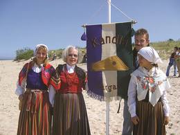
Латвия
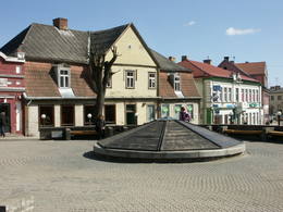
Старый город КандавыСохранившаяся на данный момент историческая застройка вокруг старой Рыночной площади образовалась после пожара 1881 года. Характерную для Кандавы городскую среду образуют ограды с хозяйственными постройками, закрытыми дворами, сквозными проездами и стенами из грубого камня. Такую застройку можно увидеть на улицах Талсу и Сабилес. Нетипичной для Латвийского ландшафта является также Большая улица. У подножья Рыцарского городища можно осмотреть установленный недавно (2010 г.) макет замка Ливонского ордена. Участок дороги Екаба от Кандавы до Ренды входит в природный парк “Древняя долина Абавы”. 94
Услуги
94km - Расстояние от столицы |
 |
Эстония
Muhu IslandThird biggest island in Estonia. Full of beautiful grown junipers, little dolomite outcrop on the coast of the sea and fishermen villages on the coastline. 153
Услуги
153km - Расстояние от столицы |
 |
Латвия
АЙНАЖИНазвание Айнажи - неотъемлемая составная часть истории мореплавания Латвии. В 1864 г. здесь было основано первое мореходное училище, в котором могли учиться дети латышских крестьян. Закономерным является то, что Айнажи стал важным судостроительным и портовым центром побережья Латвии. Экономической жизни города способствовал и открытая в 1913 году узкоколейная железнодорожная линия Смилтене –Валмиера – Айнажи. Современный Айнажи - маленький и тихий городок Латвии, в приграничном районе с Эстонией, с несколькими интересными объектами для осмотра. 114
Услуги
114km - Расстояние от столицы |
 |
Латвия
Peterupe VillageOn the right bank of the River Pēterupe is one of the historical areas of Saulkrasti – Pēterupe Village. It is believed that the village began to form around a chapel during the so-called Swedish or Catholic times. The chapel was named after the Apostle St. Peter, and therefore the river and the village also carries his name. Pēterupe Village can be considered the oldest village in the Saulkrasti region. The oldest witnesses of the origin of Pēterupe Village are: Rectory, Pēterupe Evangelical Lutheran Church, Outpatient Clinic and the wooden buildings in the old village centre. 50
Услуги
50km - Расстояние от столицы |
 |
Латвия
ЦЕСВАЙНЕНазвание Цесвайне в письменных источниках впервые упомянуто 1209 году. Для каждого путешественника Латвии город связан с родом барона Вульфа, который в 1815 году приобрел имение Цесвайне. Экономический расцвет Цесвайне наступил после строительства железной дороги Плявиняс - Гулбене. Город пострадал во время Второй мировой войны. В конце 2002 года в Цесвайнском дворце произошла трагедия - пожар, который затронул большую часть дворца. Благодаря большой поддержке общественности, государства и самоуправления Цесвайнский дворец обрел и по-прежнему сохраняет статус туристического объекта Видземского и Латвийского масштаба. 185
Услуги
185km - Расстояние от столицы |
|
|
Латвия
KudraNeliela apdzīvota vieta, kuras apkārtnē jau izsenis iegūta kūdra un ārstniecības dūņas, kas izmantotas Ķemeru kūrortā. Kūdrā atrodas padomju laikā celtā dzelzsbetona rūpnīca, kura nodrošināja ar būvniecības materiāliem tagadējo Kauguru mikrorajonu.
41
Услуги
41km - Расстояние от столицы |
 |
Латвия
Саунагс (Sǟnag)В исторических источниках упоминается в 1310 году. Согласно Пилтенскому ваковому регистру 1582-1583 года в деревне насчитывалось восемь дворов, а в Ваковой книге Дундагского поместья 1731 года - три. В 1826 году в каждом дворе проживают 16-17 человек, всего около 60. Записи 1935 года свидетельствуют, что все 49 ливов знали ливский язык, однако только 11 из них говорили по-ливски в своих семьях. В Рупниеках Саунага был магазин, владельцу которого Карлису Тилманю принадлежало производство по засолу кильки. В Саунагсе родился капитан дальнего плавания Арвидс Людевикс (1912 - 1996). В мае 1945 года на буксире «Рота» он переправлял латвийских беженцев из Вентспилса в Швецию. Корабль был задержан, а капитан депортирован в Сибирь. В Саунагсе родился также капитан дальнего плавания Висвалдис Фелдманис (1938 - 2017). 185
Услуги
185km - Расстояние от столицы |
|
|
Латвия
АЙЗПУТЕОдин из старейших городов Латвии, сведения о котором относятся к 1378 году. Как поселение он образовался на берегах Тебры (обочина дороги Рига – Прусия), где в свое время находился укрепленный деревянный замок земли куршей Бандава Бейда. В средневековье Айзпуте был центром Курземского епископства. В 1795 году после присоединения Курземе к России в Айзпуте осели еврейские поселенцы. Сегодня больше всего привлекает путешественников в Айзпуте сохранившаяся старинная городская среда, исторический центр города и развалины замка. 178
Услуги
178km - Расстояние от столицы |
 |
Латвия
ДАГДАВ исторических источниках Дагда упоминается в XVII веке торговый посад. В 1772 году Дагдский край был включен в Псковскую губернию, а в 1802 г. - в состав Витебской губернии. В 1905 году здесь происходили широкие крестьянские бунты, во время которых были разорены многие важные архитектурные памятники. Город не уберегся и во время двух мировых войн. Что посмотреть туристам? В центре Дагды сохранилась историческая застройка 20 века - дома, построенные из красного кирпича, т.е. «дома еврейских торговцев». Дагда - это единственное место в Латвии, где ежегодно в городском парке празднуют день Анн! 266
Услуги
266km - Расстояние от столицы |
 |
Латвия
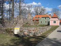
ПилтенеПилтене – это один из самых малых и древних городов Латвии. В исторических источниках Пилтене первый раз было упомянуто в 1295-м году, а стутус города был получен уже в 1557-м году. В период с 14-й по 16-й века Пилтене было административным центром Курляндского епископства. На исторических улицах, которые полукругом окружают руины замка, сохранилась деревянная застройка первой половины 19-го века. Пилтенский епископский замок был построен на рубеже 13-14 веков и использовался до 16-го века. До сего дня сохранился только фундамент и фрагменты башни на берегу Вецвенты. 175
1-12
Услуги
175km - Расстояние от столицы
1-12 Месяцы активного сезона |
|
|
Литва
Dorf MinijaEin einzigartiges Örtchen beiderseits des Flusses Minija, wo der Fluss eine „Hauptstraße” ist. Litauens Venedig. 329
Услуги
329km - Расстояние от столицы |
 |
Литва
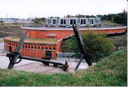
KopgalisSchon seit der früheren Zeiten – ein Platz von der militärischen und strategischen Bedeutung. Für den Schutz des Hafens von Klaipeda wurde 1866 von preussischer Militär den Bau einer Festung angefangen. Im Laufe des 2.Weltkriegs wurde die Festung in die Luft gesprängt. Die Renovierung begann 1979. 311
Услуги
311km - Расстояние от столицы |
 |
Литва
Salos II (Salos II)Maza apdzīvota vieta ar dažām viensētām uz pussalas (salos tulkojumā no lietuviešu valodas nozīmē „sala") starp vairākiem ezeriem. Salos II ir viens no sešiem Augštaitijas nacionālā parka etnogrāfiskajiem ciemiem. Ciems patiks tiem, kas meklē ļoti nomaļas vietas ar vecām guļbaļķu dzīvojamām un saimniecības ēkām. No Salos II pa sauszemes maršrutu var doties pārgājienā līdz Ladakalnim un Ginuču pilskalnam (sk. iepriekš). 121
Услуги
121km - Расстояние от столицы |
 |
Латвия
ЛИЕПАЯГород ветра, янтаря и музыкантов. В письменных источниках Лиепая впервые упоминается в 1253 году. Расцвет города как торгового порта начался уже в конце XVI века. Особенно знаменательным было правление Курземского герцога Екаба и Фридриха Казимира, когда через Лиепайский порт обеспечивался экспорт и импорт товаров из Литвы и Курземе. На месте засыпанной песком дюны реки Ливы был прорыт канал, создана пристань для кораблей. Рост города продолжался и в XVIII веке, после Северной войны и эпидемии чумы. Когда в 1795 году Курземе присоединили к Российской империи, Лиепайский порт стал одним из важнейших стремительно развивающихся западных портов империи. В конце XVIII – XIX вв. Лиепая одновременно становится излюбленным местом отдыха аристократии Санкт-Петербурга. В конце XIX века начались работы по возведению крепости и строительству военного порта. Город приобрел военно-стратегическое значение. Лиепая сильно пострадала во время Второй мировой войны. В 1967 году в Лиепае приостановил работу морской торговый порт, и город стал закрытым городом, где военный порт стал городом в городе. Сегодня военный порт и связанное с ним предложение является одним из востребованных продуктов туризма Латвии. 217
Услуги
217km - Расстояние от столицы |
 |
Латвия
ПиедруяСамое большое населенное место на юго-востоке Латвии, которое с юга омывается водами Даугавы, одновременно являющейся Латвийско-Белорусской границей. Граница государств проходит по середине реки. Пиедруя состоит из двух частей – Пиедруя и Александрова, которые разделяет центральная улица (дорога V 631). Пиедруя образовалась как «заречная» территория существующего на левом берегу Даугавы города Друя. Обе части в 17-м веке были собственностью рода магнатов Сапег Великого княжества Литовского. Малоэтажная застройка Друи с разрушенной церковью хорошо просматривается с берега Пиедруи. Пиедрую и ее окрестности стоит обойти пешком, так как малоэтажная деревянная застройка местами напоминает виденное в этнографических музеях под открытым небом. Пиедруя благоустроена, между двумя церквями разбит живописный сад. Со значимыми объектами – двумя церквями и Даугавским камнем знакомит Пиедруйская тропа. В Александрова находится гостиница «Пиедруя», предлагающая особый туристический продукт – вечеринки в латгальском, русском и белорусском стилях. Перед отправлением в Пиедрую необходимо оформить разрешение для пребывания на приграничной территории. Пост пограничного контроля находится в Пиедруе, на берегу Даугавы, где еще сравнительно недавно действовала одна из Даугавских переправ. 289
1-12
Услуги
289km - Расстояние от столицы
1-12 Месяцы активного сезона |
 |
Латвия
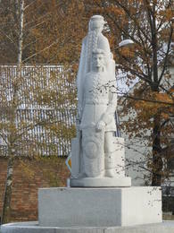
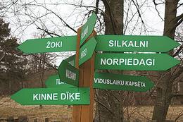
Кошрагс (Kuostrõg)Кошрагс считается самым молодым из ливских прибрежных селений (образовалось в 17-ом веке). В 1826 году в Кошрагсе было 78 жителей. В 1832 году в Жоках была открыта первая в приморских деревнях Дундаги школа чтения для ливских детей, где учителем работал первый получивший профессиональное образованние представитель ливов Ника Полманис, который перевел Евангелие от Матфея на восточный диалект ливского языка. В Кошрагсе была ветряная мельница, водяная мельница, судоверфь. Весной сюда причаливали лодки с ищущими работу эстонцами с острова Сааремаа. В 1932 году здесь был построен порт, в 1938 году – мол (волнорез) для сбора морской грязи. В 30-е годы прошлого века Кошрагс регулярно посещали финские и эстонские лингвисты, которые собрали здесь наибольшее количество единиц ливского фольклора. Дом Норпиедагу строил общественный деятель ливов – Дидрикис Волганскис (1884-1968). Там родился его сын – деятель культуры ливов, священник (в Финляндии) Эдгарc Валгама (Волганскис, 1912-2003), который перевел эпос A.Пумпурса «Лачплесис» на финский язык. В настоящее время Кошрагс является национальным памятником культуры. 182
Услуги
182km - Расстояние от столицы |
 |
Латвия
Бауская ратушаУже в 1615 году Герцог Фридрих Кетлер (1569 – 1642) предоставил городу Бауска привилегию на строительство нового здания ратуши, что и было осуществлено, и уже в 17 веке на Рыночной площади возвышалась самая большая ратуша в герцогстве. В связи с недостатком средств в 1852 году была снесена башня, а в 1871 году – второй этаж. В конце 2011 года строительство нового здания ратуши было завершено, и теперь Бауска может гордиться новым туристическим объектом, который можно осмотреть также изнутри. В восстановленной ратуше можно взвеситься и обмериться в старинных единицах измерения – в локтях, ступнях, пудах, фунтах - и получить этому соответствующий сертификат. 65
Услуги
65km - Расстояние от столицы |
 |
Латвия
Поселок ГипкаВ Гипке была основана первая мореходная школа в Курземе! Это было в 1869-м году, спустя несколько лет после основания мореходной школы в Айнажи. Это была мореходная школа 2-й категории, в которой готовили штурманов дальнего плавания и капитанов судов каботажного плавания. В 1894-м году мореходную школу перенесли в Мазирбе. До открытия мореходной школы в этом здании с 1860-го года действовала школа, а в 1867-м году специально для нужд мореходной школы в здании был надстроен второй этаж. Здание сохранилось до наших дней и переоборудовано под жилой дом. Школа (в Гипке и Мазирбе) на протяжении своего 28-и летнего существования выпустила более чем 200 профессиональных моряков и содействовала кораблестроению в прибрежных ливских поселках. (Источник: Ройский ТИЦ) |
 |
Латвия
РендаРенда – это древнее населенное место, упомянутое в исторических источниках уже в 1230-м году. В 13-м веке Ренда была одним из центров древнего куршского государства – Ванема. После раздела Курсы в 1235-м году Рендский край стал собственностью немецкого ордена и жители Ренды были вынуждены принимать участие в военных походах ордена. Во времена Курземского герцогства (1562 – 1795) несмотря на войны, чуму и другие ненастья, край процветал, особенно во времена правления герцога Екаба (1642 – 1682). В 17-м веке Ренда стала развитым центром мануфактуры, в котором развивалась деревообработка, действовали известкообжигательные печи, водяная мельница, льнопрядильная фабрика, стекольный завод, селитряный завод и мыловарня. Здесь производили вино, парфюмерные изделия, изготавливали бочки, лили чугун, делали гвозди и многое другое. Кисловатое вино, произведенное в Ренде, с наслаждением пили в Елгавском дворце. Этот дворец был разрушен во время Северной войны (1700 – 1721). На месте сгоревшего в 19-м веке Рендского замка был построен завод по производству химических веществ, действовала одна из самых больших в Курземе кожевенных мануфактур и производство скипидара. Параллельно с этим начала развиваться и культурная жизнь. Жителей Ренды не пощадили обе мировые войны 20-го века и начавшиеся позже репрессии. В результате был образован т.н. батальон «Курелиеши» – лесные братья, которые боролись против советской власти. Сегодня Ренда это маленький и тихий поселок, в котором можно осмотреть поместье Лиелрендас, Рендскую церковь, Рендскуя Чертову лодку у Абавы и водопады на реке Иванде. 131
1-12
Услуги
131km - Расстояние от столицы
1-12 Месяцы активного сезона |
 |
Латвия
ВентспилсБлижайший к берегу ливов город, в котором действует Вентспилсское отделение Сообщества ливов, ансамбль ливов «Рандалист» («Rāndalist»), а в соседнем Таргале – ансамбли ливов «Кандла» («Kāndla») и «Пишки кандла» («Piški kāndla»). 187
Услуги
187km - Расстояние от столицы |
 |
Литва
PreilaEin ehemaliges Fischerdorf am Ufer des Kurischen Haffs. Hierher sind die Bewohner der Dörfern umgezogen, deren Dörfe unter dem Sand der Wanderdünen begraben wurden. Holzbebauung des 19 – 20 Jh. 349
Услуги
349km - Расстояние от столицы |
 |
Латвия
МелнсилсСтаринный ливский поселок, ливское название которого Mustanumm. Еще в середине 20-го века здесь жили ливы. В поселке Мелнсилс у впадения речки Бакупите в Рижский залив представители семейств Ландманисов, Морицов и Отомеров построили три парусника. В поселке находятся два культурно-исторических места: церковная гора Бакю – древнее культовое место и городище пирата Троммеля. (Источник: Ройский ТИЦ) 144
1-12
Услуги
144km - Расстояние от столицы
1-12 Месяцы активного сезона |
 |
Латвия
САЛАЦГРИВАДревняя, обжитая с V – VI вв. ливами территория. В 1226 году на правом берегу устья Салацы епископ Альберт построил замок, который до наших дней не сохранился. Развитие Салацгривы (так же, как и Айнажи) было связано с образованием порта. С XIX по XX вв. Салацгрива стала важным перегрузочным и транспортным узлом производимых в Северном Видземе товаров (особенно лесоматериалов). В советское время в северной части Салацгривы был создан Парк рыбаков с одним из лучших стадионов и эстрадой под открытым небом в провинциальных городах. В это время в масштабе всего СССР становится широко известной продукция рыбоперерабатывающего завода «Бривайс вилнис», особенно - шпроты. Салацгрива - одно из двух мест Латвии, где по-прежнему ловят миногу старинным методом, используя заколы. 104
Услуги
104km - Расстояние от столицы |
 |
Латвия
Kraslavas centralais laukumsArī 18. novembra laukums. Tas sācis veidoties 18. gadsimtā kā tirgus laukums. Tā dominantes bija 1752. g. celtais rātsnams (nav saglabājies) un aptieka, kas šajā ēkā darbojas no 1810. g. līdz pat mūsdienām. 2010. gadā laukumā izveidota strūklaka, kam ir pilsētas ģerboņa forma. 264
1-12
Услуги
264km - Расстояние от столицы
1-12 Месяцы активного сезона |
 |
Латвия
Сикрагс (Sikrõg)Одна из старейших ливских деревень, которая упоминается уже в 1387 году. Древняя дорога из усадьбы Дундага в Сикрагс существовала уже в средневековые времена. В 17-ом веке в Сикрагсе был один из самых важных малых портов в северном Курземе, в который заходили корабли из Англии, Голландии и Любека, перевозящие уголь, зерно и другие товары. До Первой мировой войны действовали пять производств по переработке рыбы (кильки), в 20-30 годы 20-го века в деревне рыбной ловле занимались около 55 рыбаков. В Сикрагсе родилась деятель культуры ливского происхождения Хильда Грива (Цербаха, 1910-1984), капитан дальнего плавания Карлис Анбакс (1884-1937), баптистский священник Карлис Лацеклис (1904-1970), знаток ливского языка и традиций Петерис Дамбергс (1909-1987), родилась художник-график Байба Дамберга (1957). Сегодня Сикрагс является национальным памятником культуры. Деревню пересекает велосипедный маршрут узкоколейной железной дороги с мемориальным камнем на месте станции. Сикрагс, как и следующие деревни в восточном направлении, расположен в Национальном парке Слитере. 173
Услуги
173km - Расстояние от столицы |
 |
Эстония
Mulgimaa historic regionMulgima or Mulgi is a cultural and historical region in the south of Estonia. The part of Viljandi county located south of the rivers Raudna and Tenasilma was considered to be region of Mulgimaa. In ancient times, Mulgi farmers were famous for their sharp minds and determination, which helped to buy land from German-Baltic nobles and become rich farmers. The icons of Mulgi culture - the dialect, the well-known men's long black jacket and the traditional Mulgi porridge - have survived to this day.  160
1-12
160
1-12
Услуги
160km - Расстояние от столицы
1-12 Месяцы активного сезона |
 |
Латвия
Старый город ЦесисаХотя географически Цесис находится в центральной части национального парка Гауи, у города нет статуса национального парка. Однако в Цесисе есть много интересных достопримечательностей, которые стоит увидеть и узнать поближе. Обязательно нужно ознакомиться со старым городом Цесиса. Цесис. Истоки Цесиса нужно искать здесь, на 18-метровой горе Риексту, так как в 11 – 13 веках здесь находился деревянный замок вендов. Гора Риексту находится в центре замкового парка, и с нее открывается прекрасный вид на парк, пруд и развалины Цесиса, до которых можно дойти по длинному каскаду лестниц. Построенный в начале 13 века Цесисский замок (описание см. далее в № 44) был резиденцией магистров ордена и одной из самых сильных крепостей ордена на территории Балтии. Рядом с крепостью находится Новый замок Цесис, который построен в 1777 году на месте укрепления ворот. В здании расположен Музей истории и искусств Цесиса, а в пристройке замкового комплекса разместился Центр для посетителей и Туристический информационный центр. Если поднимемся на башню замка, с нее откроется прекрасный вид на развалины, лютеранский собор Св.Иоанна и северную часть города. Напротив Нового замка находится несколько зданий – конюшня дворцовой усадьбы, каретный двор (оба здания построены в первой половине 19 века), где сегодня находится Цесисский выставочный центр. На территории комплекса с наружной стороны дворца можно осмотреть также амбар, домик извозчика и старую пивоварню. На противоположной стороне улицы находится романтичный парк Мая, который был разбит в тридцатые годы 19 века. Направимся дальше по улицам города (Большая Екатерининская, Малая Екатерининская, Малая Калею, Калею, Большая улица Ливов и Площадь Ливов) и осмотрим деревянную застройку, произведенную на рубеже 18 – 19 веков. На улице Торня (Башенной), которая вьется вдоль крепостной стены Средневекового замка, у церкви находится скульптура М. Янсона «На протяжении веков». Поверье гласит, что потерев фонарь Старика Времени, можно заглянуть в будущее. Одно из наиболее впечатляющих зданий Цесиса - Лютеранский храм Св.Иоанна, построенный в конце 13 века как Храм Ливонского ордена. Это трехнефная базилика в романском стиле с элементами готики, с возведенной в 1853 году 65-метровой башней. Здание было несколько раз перестроено, в том числе и в 20 веке. В храме выставлены надгробные плиты магистров Ливонского ордена и Ливонских епископов, Кафедра изготовлена в 1748 году, дубовый алтарь – в 1858 году, а алтарная картина «Распятый на кресте» - в 1862. Окна алтарной части церкви украшают художественно ценные витражи. Орган был построен фирмой Е. Ф. Валкера в 1907 году, и он является одним из лучших латвийских концертных инструментов. В сваю юго-западного угла церкви вмурованы солнечные часы с годовым числом «1744». Стоит подняться на смотровую башню церкви. У подножия церкви находится Площадь Роз или бывшая Рыночная площадь (середина 13 века – 1927 год, восстановлена в 2008 году), которая в наши дни является центральной площадью города. В средние века здесь находился также позорный столб и городской колодец. Рижская улица с самого начала образования города формировалась как главная улица. Здесь располагается большая часть архитектурно значимых строений 18 -19 века – бывшая Цесиская ратуша, дом Фабера, дом Принцесс. На одном конце улицы находится площадь Ливов, где в 13 веке находилась церковь, кладбище и Рижские ворота в городской стене. Сегодня площадь украшает светящийся фонтан, на месте которого находился колодец 13 века – Леяс Шкимбегс. На другом конце улицы находится реконструированная часть фундамента и фрагментов надземной части ворот Раунас городской стены 14 - 15 века. Она дает хорошее представление о средневековой стене, размере ворот и ее основательности. |
 |
Латвия
Рожу лаукумс (Площадь Роз)Истоки площади Роз уходят в 1911 - 1913 гг., когда на этом месте разбили открытый сад с > 500 кустами роз. В советское время рядом с площадью Роз был установлен памятник Ленину. Восстановленную в 2000 году площадь окружает Лиепайская Педагогическая академия, гостиница «Лива», Центр бизнеса и сделок De Rome (построен в XIX веке, архитектор Пауль Макс Берчи, бывшая гостиница «Рим») и Лиепайский дом латышского общества (камень в основание заложил Карлис Ульманис в 1934 г.). По бордюрам грядок роз размещены памятные знаки городов содружества Лиепаи. К площади Роз подходит улица Зивью (Рыбная), получившая свое название от когда-то существовавшего рыбного рынка. На улице Зивью находится Аллея славы латвийских музыкантов (с 2006 г.), где установлено 35 плит с бронзовым рельефом ладоней музыкантов, 10 плит, посвященные популярным латвийским музыкальным группам, а 5 – ушедшим в мир иной. Здесь же установлена самая большая гитара Латвии. 216
Услуги
216km - Расстояние от столицы |
 |
Латвия
ДурбеДурбе - самый маленький город в Латвии со знаменитой историей, а также самый маленький город Латвии по численности населения (около 500 жителей). Дурбе упоминался уже в договоре 1230 года между куршами и Балдуином Альнским. В окрестностях Дурбе в 1260 году произошла знаменитая битва при Дурбе между объединенными силами Ливонского и Германского орденов и жемайшами, на сторону которых перешли курши, призванные в войско ордена. В Дурбе жил и работал один из первых садоводов Латвии Симанис Клевер (1834-1922). Благодаря ему в окрестных садах встречается много редких сортов яблонь. На гербе Дурбе, утвержденном в 1925 году, изображена серебряная яблоня. В окрестностях находится много хозяйств, специализирующихся на выращивании фруктов, и много активных садовников. Каждый сентябрь проводится праздник яблок.  188
1-12
188
1-12
Услуги
188km - Расстояние от столицы
1-12 Месяцы активного сезона |
 |
Литва
KaunasThe second biggest city in Lithuania and from 1920 – 1939 - a temporary capital. The Old Town, The Town Hall (16th century), St. Peter and Pavil cathedral - basilica (15th century), Thunder building (15th century), Laisves alley, Ciurlionis Art and Devil Museum. 103
Услуги
103km - Расстояние от столицы |
 |
Латвия
PriekuleVēstures avotos pirmoreiz minēta 1483. g. Pilsētas uzplaukums bija vērojams pēc dzelzceļa uzbūvēšanas 19. gs. beigās, kad barons Korfs sadalīja un iznomāja apbūvei muižas zemi. Pilsētas tiesības Priekule ieguva 1928. g. Pilsēta smagi cieta 2. pasaules kara pēdējos mēnešos, - t.s. Kurzemes katla laikā, kuru laikā tika sagrautas 410 no 450 ēkām. Mūsdienās tā ir neliela pilsētiņa ar mazstāvu apbūvi un nesteidzīgu dzīves ritmu. 232
Услуги
232km - Расстояние от столицы |
|
|
Латвия
IlukstePilsētā nebija lielu rūpniecības uzņēmumu, un tās iedzīvotāji
nodarbojās galvenokārt ar amatniecību, tirdzniecību un lauksaimniecību.
Ilūkste tika pilnībā nopostīta 1. pasaules kara laikā un smagi cieta arī
2. pasaules kara laikā. Šodien Ilūkste ir klusa pierobežas mazpilsēta, ko
ieskauj gleznains dabas apvidus. Apskates objekti: bijušā jezuītu klostera ēka
un Ilūkstes katoļu baznīca.
201
Услуги
201km - Расстояние от столицы |
 |
Латвия
Исторический центр ТалсиТалси называют городом на девяти холмах. Историческая застройка города вокруг Базницкалнса, Талси и Вилкмуйжских озер образовалась, главным образом, в 19 столетии. Одна из наикрасивейших – улица Лиела с малоэтажной (два - три этажа) застройкой (двускатные крыши). Красивые пейзажи открываются с окрестностей озера Талси и Кенинькалнса. 115
Услуги
115km - Расстояние от столицы |
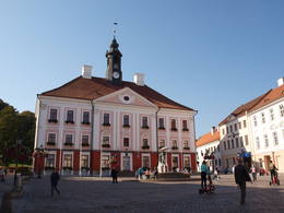 |
Эстония
Tartu Old TownFormed on the left side of river Emajõgi, in the valley of Doma Hill. The centre of The Old Town of Tartu is Town Hall Square with Town Hall and the fountain "The Kiss of the Students" (symbol of the city). 185
Услуги
185km - Расстояние от столицы |
 |
Латвия
ПРЕЙЛИВ XV столетии господская усадьба Прейли становится родовым имением графов Борхов. Борхи хозяйствовали здесь до 60-х годов XIX века. Сам город образовался в первой половине XIX века при сливании имения Прейли с селением и слободой - поселением ремесленников и торговцев. В XIX веке в Прейли построили роскошный дворец и разбили ландшафтный парк. Современный город Прейли – это важный экономический центр Латгалии (сырное и швейное производство), который бережно относится к своему фольклору, традициям ремесленничества и католицизма. По Прейли настоятельно рекомендуется экскурсия в сопровождении сотрудника ИЦТ Ирены Кяркужи. 203
Услуги
203km - Расстояние от столицы |
 |
Латвия
КАНДАВАВ письменах название Кандава впервые упомянуто в 1230 году. В 1253 году в верхней части крутого берега древней долины Абавы Ливонский орден построил каменный замок, у подножья которого образовалось поселение. В XVII веке Кандава стала важным торговым центром. Эпидемия чумы и события Первой мировой войны тяжело отразились на городке и его населении. Права города Кандава получила в 1917 году. В советское время спортивный комплекс Яункандавского сельскохозяйственного техникума стал популярным местом для проведения тренировок. 96
Услуги
96km - Расстояние от столицы |
 |
Латвия
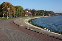
СаулкрастыКак большое населенное место Саулкрасты начало образовываться в конце 19-го века, когда маленькие рыбацкие поселки – Нейбаде, Петерупе и Катринбаде стали популярным местом для отдыха и купания жителей Риги. Это вскоре поспособствовало строительству дач. На развитие курорта также повлияло открытие водного сообщения между Ригой и Саулкрасты в 1905-м году. Были построены новые курзалы, рестораны и развивалась другая инфраструктура, связанная с курортом. В летнее время отдыхающие могли развлечься на мероприятиях, баллах и концертах с участием рижских оркестров. Следующим этапом развития курорта стало шоссе и железнодорожная линия между Ригой и Саулкрасты, построенные в 30-х годах 20-го века. Советское время охарактеризовалось строительством домов отдыха, санаториев и новыми дачными домиками. Саулкрасты получают статус города. Сегодня Саулкрасты привлекают не только белым песчаным пляжем, но и различными ежегодными общественными мероприятиями, тропой Солнечного заката и Белой дюной, уникальным музеем велосипедов, Морским парком и местом для купания «Центр», площадью Саулес и другими объектами. 46
1-12
Услуги
46km - Расстояние от столицы
1-12 Месяцы активного сезона |
|
|
Латвия
ValkaTogether with Valga on Estonian side - a peculiar frontier twin town. 158
Услуги
158km - Расстояние от столицы |
 |
Латвия
ЮРКАЛНЕСогласно древней истории, в период первой церкви, когда во время шторма проходила церковная служба, в море у старого кладбища тонул корабль, и священник с членами прихода – добровольцами в весельной лодке отправился спасать команду. Часть команды удалось спасти, остальных выбросило на берег. В честь этой с одной стороны трагической, с другой – счастливой развязки событий, капитан корабля назвал это место Феликсбергом (счастливым берегом). Это название позднее было заменено на Пилсберг, нынешнее название - Юркалне - населенный пункт получил в 1925 году. 191
Услуги
191km - Расстояние от столицы |
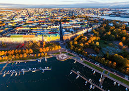 |
Финляндия
HelsinkiHelsinki is the capital of Finland and the biggest city in Finland. It offers a lot to see as it is seaside city surrounded by islands but city itself is full of wonderful parks. This city has everything to attract all kinds of people - from architecture and culture to nature and even has wide range of places where to enjoy night-time Helsinki. |
 |
Латвия
САЛАСПИЛСОдин из молодых городов Латвии, в 2013 году отметит свой 20-летний юбилей. В Саласпилсе находится несколько научных организаций Латвийского масштаба (в советское время они создавались как научные центры) - Биологический институт, Институт неорганической химии, Институт физики, Национальный ботанический сад, в советское время, а теперь уже бывший Саласпилсский атомный реактор и Институт лесоведения «Силава». Последнее десятилетие в городе развивается инфраструктура, образовались просторные районы особняков. В 1996 году в Саласпилсе построили новую католическую церковь. В сущности – это спальный район Риги. 18
Услуги
18km - Расстояние от столицы |
 |
Латвия
СИГУЛДАЗнакомство с Сигулдой можно начать с посещения развалин Сигулдского замка. Строительство замка было начато орденом Меченосцев в 1207 г., а в 1236 г. его перестроили для нужд Ливонского ордена. Сигулдский замок серьезно пострадал во время воин второй половины XVI и начала XVII веков. Во время Северной войны замок был сожжен и больше не восстанавливался. Сегодня можно осмотреть юго-западный корпус здания конвента замка и башню главных ворот, за которой находятся внутренний передний двор замка с эстрадой под открытым небом, откуда приоткрывается прекрасный вид на древнюю долину Гауи. В настоящее время ведутся работы по реконструкции развалин замка. Строительство расположенного на юге Нового Сигулдского замка (владелец - князь Кропоткин) происходило в период с 1878 по 1881 гг. С 1923 по 1940 гг. в здании размещался Дворец писателей, а в советские годы - санаторий кардиологии. С 2003 г. здесь находится дума Сигулдского края. В комплексе господской усадьбы сохранилось деревянное жилое здание (середина XIX века), дом семьи Кропоткина, клеть (XVIII –XIX вв.), дом садовника (XIX в.) и каменный забор (XIX в.). Если от Нового замка отправимся в северо-восточном направлении, то примерно через 2 км спустимся к оврагу Вейупите. Здесь расположена небольшая (3,6 м), но высокая пещера Петра (6,1 м) и глубокий овраг Пучу (Сов) с Краукльупите. В месте соприкосновения оврагов обеих рек возвышается городище Сатезелес (площадка 90 x 75 м), где вначале XIII в. находился дубовый замок вождя (старшего) ливов Дабрелиса. Неподалеку находится ущелье Крауклю (Ворона) – боковой овраг левого берега Вейупите с песчаником высотой 11 м и пещера Крауклю (Ворона) глубиной 5,2 м. В месте соприкосновения оврага Вейупите и древней долины Гауи стоит гора Парадизес (Райская) или Глезнотаю (Художников) - живописнейшее место, которое удостаивалось кисти художников и вниманию фотографов с давних времен! До горы Парадизес можно доехать на электромобиле. В западной части Сигулды можно посетить Панорамное колесо (работает в летний период) и Канатную дорогу (трамвайчик) - единственное в странах Балтии транспортное средство подобного рода (построена в 1969 г.). Несущий трос канатной дороги, протяженностью 1060 м, без опор, соединяет берега древней долины Гауи между Сигулдой и Кримулдой примерно на высоте 40 м над Гауей. Отсюда открываются великолепнейшие виды! По юго-западной части Сигулды можно дойти до громадного обрыва Бейтес, который раскалывает ущелье глубокого ручья. В западной части ущелья находится Кейзерскатс, расположенный примерно на высоте 67 м над уровнем Гауи, с открывающимся прекрасным видом на Кримулду и Турайдский замок. Смотровую площадку здесь обустроили еще в 1862 г., когда в Сигулде гостил Российский самодержец Александр II. В восточной части оврага находится высеченный из дерева Кейзаркреслс (Царский трон). 52
Услуги
52km - Расстояние от столицы |
 |
Латвия
ВалдемарпилсМаленький и тихий городок, расположенный на берегу длинного озера Сасмакас. Уже в начале 17-го века на земле имения Сасмакас образовалось поселение ремесленников и торговцев. В середине 19-го века в городке жило много еврейских торговцев и ремесленников, поэтому Сасмаку в то время называли еврейской столицей. В 1926-м году город переименовали в Валдемарпилс. Исторический центр города с застройкой 19-го века является градостроительным памятником. В Валдемарпилсе можно осмотреть лютеранскую и православную церкви, бывшую синагогу, памятник К. Валдемару, а также величественную липу Элку. 131
1-12
Услуги
131km - Расстояние от столицы
1-12 Месяцы активного сезона |
 |
Латвия
Историческая застройка ЛудзыОдноэтажная деревянная застройка жилых зданий сформировалась в XIX веке. Здесь можно увидеть характерные для Латгалии закрытые дворы, веранды, деревянную отделку и декор. Деревянная городская застройка серьезно пострадала от пожаров в 1866 и 1938 годах. Историческим центром Лудзы можно считать место Рыночной площади, а Лудзинское городище - главной доминантой, вокруг которой образовывалась сеть городских улиц. У подножья Лудзинского городища находятся развалины Лудзинского замка. В конце XIV века здесь находилась деревянная крепость древних латгалов, на месте которой Ливонский орден возвел мощный каменный Латгальский замок. В 1654 году замок разрушили войска русской армии царя Алексея Михайловича. Экскурсии предлагают гиды Лудзенского ТИЦ.  266
266
Услуги
266km - Расстояние от столицы |
 |
Латвия
Сигулда, ТурайдаСтроительство замка в Сигулде было начато орденом Меченосцев в 1207 году, а в 1236 году его переоборудовали для нужд Ливонского ордена. Замок в Сигулде сильно пострадал в войнах второй половины 16 и началa 17 века. Во время Северной войны его сжигают и более не восстанавливают. На сегодняшний день для осмотра доступно здание конвента юго-западного корпуса замка и башня главных ворот, за которой находится внутренний форбург с эстрадой под открытым небом, открывающей великолепный вид на долину реки Гауя. Строительство Нового замка Сигулды, находящегося на юге (владелец - князь Кропоткин), проводилось в период с 1878 - 1881 годa. B 1923 - 1940 годы в здании располагался Дом писателя, а во время СССР - кардиологический санаторий. С 2003 года здесь находится Сигулдская краевая дума. В комплексе имения сохранилось деревянное жилое здание (середина 19 века), в котором находился дом семьи Кропоткина, амбар (конец 18 – начало 19 века), дом садовника (19 век) и каменная ограда (19 век). Если от Нового замка мы поедем в северо-восточном направлении, менее чем через 2 км мы подъедем к оврагу Вейупите (речка Ветров). Здесь находится неглубокая (3,6 м), но высокая (6,1 м) пещера Святого Петра и глубокий Совий овраг с Крауклюпите (речка Ворона). На месте соприкосновения двух оврагов возвышается городище Сатезеле (площадка 90 × 75 м), где в начале 13 века находился дубовый замок вождя земли ливов - Дабреля. Недалеко находится ущелье Воронов - боковая ложбина левого берега Вейупите со стенами из песчаника высотой 11 метров и пещера Ворона глубиной 5,2 метра. На месте соприкосновения оврага Вейупите и русла реки Гауя возвышается Райская гора (Художников) – очень живописный ландшафт, вдохновлявший художников еще с древних времен. В западной части Сигулды можно посетить Колесо обозрения (работает в летнее время) и канатную дорогу (трамвай) - единственное транспортное средство подобного типа в странах Балтии (построена в 1969 году). Несущий трос канатной дороги тянется без поддержек 1060 метров и соединяет берега долины реки Гауя между Сигулдой и Кримулдой на высоте около 40 м над рекой. В юго-западной части Сигулды можно посетить утес Бейте, пересеченный глубоким оврагом ручья. На западной стороне оврага находится Государев вид, который находится на высоте 67 метров над уровнем реки Гауя с великолепным видом на Кримулду и Турайдский замок. Смотровую площадку здесь обустроили в 1862 году, когда Сигулду посетил российский царь Александр II. На восточной стороне оврага расположен выполненный из дерева Трон государя. На месте, где правый берег русла реки Гауя пересекает множество глубоких оврагов небольших ручейков, расположился Турайдский музей-заповедник с имеющими большую ценность для всей Балтии памятниками, история которых тянется на 1000 лет назад. Среди них следует упомянуть Турайдское имение (21 здание), могила Турайдской Розы, Турайдская Лютеранская церковь (одна из старейших деревянных церквей Латвии (1750 год)) и Турайдский замок. На располагающейся рядом горе Дайн организуются различные тематические мероприятия. 53
1-12
Услуги
53km - Расстояние от столицы
1-12 Месяцы активного сезона |
 |
Латвия
ПАВИЛОСТАПавилоста – относительно новый город, который расположился у впадения реки Сака в Балтийское море. Правда, во времена средневековья морской порт находился на расстоянии 6 км от моря - в месте слияния рек Тебры и Дурбы. Важным периодом в жизни порта было время правления герцога Екаба, когда здесь причаливали морские корабли. В результате Польско-шведской войны Сакский порт пришлось закрыть. Видимый в наши дни в устье Сака порт построен в середине XIX века рядом с т.н. рыболовецким поселком Акагала. В 1878 году углубили устье реки и построили молы. Здесь строили двухмачтовые парусные суда. Мировые войны уничтожили корабельный флот, но традиции рыболовства продолжались всегда. В 1991 населенное место получило статус города. Современная Павилоста - известное место для яхтсменов и серфингистов, а также для летнего отдыха. Яхтсменов ждут в яхтенном порту.
217
Услуги
217km - Расстояние от столицы |
 |
Латвия
СедаОдин из необыкновенных городов Латвии, который как поселок торфяной фабрики образовался в 50 - 60 годах 20 века. Его планировали по «яркому» образцу советской архитектуры, с центральной площадью (с памятником вождя) и радиально уходящими улицами. Стоит увидеть Дом культуры (в конце улицы Узварас) - образец архитектуры сталинского классицизма. 134
Услуги
134km - Расстояние от столицы |
 |
Литва
PervalkaEin ehemaliges Fischerdorf am Ufer des Kurischen Haffs. Aufgrund der Wanderdünen hat seinen Standort mehrmals seit dem Anfang des 19.Jh. geändert. Holzbebauung mit einheitlichem Stil und Traditionen. 344
Услуги
344km - Расстояние от столицы |
 |
Латвия
ТУРАЙДАПо дороге в Турайду определенно следует остановиться у пещеры Гутманя. Это самая широкая (12 м), высокая (до 10 м), с точки зрения объема, и одна из самых огромных пещер (пещерообразная ниша) Латвии, место, имеющее культурно-историческое значение, овитое преданиями (популярнейшее о Турайдской Розе), со старинными надписями, оставленными на стенах и потолке (самые давние относятся к концу XVII в.). Из пещеры вытекает ручей, обладающий целебными свойствами. В месте, где правый коренной берег древней долины Гауи раскалывают несколько глубоких оврагов с мелкими ручьями, стоит Турайдский музей-заповедник с выдающимися памятниками Балтийского масштаба, история которых уходит в далекое 1000-летнее прошлое. Ознакомление можно начать с осмотра Турайдской усадьбы (впервые упомянута в XVI в.), которая служит отличным примером Видземской господской усадьбы. До наших дней сохранилось 21 строение, которые были построены в период с XVIII до начала XX столетия. Посетители могут осмотреть конюшню господской усадьбы, тележный сарай, баню, кузницу, рыбный погреб, клеть, дом старосты, жилой дом управляющего, жилой дом прислуги господской усадьбы, сушилку и др. Следуя в направлении Турайдского замка, подойдем к могиле Турайдской Розы, с которой связана легенда о Турайдской Майе, которая пожертвовала своей жизнью ради любви. Рядом с могилой растет величавая липа (в плохом состоянии), которая как будто бы склоняется над могилой Майи. Стоящая дальше Турайдская лютеранская церковь является третьим подряд храмом и самым старым (1750 г.) памятником деревянного зодчества в Латвии – односекционный деревянный сруб с башенкой в стиле барокко. Здесь представлен к осмотру алтарь и кафедра (середина XVIII в.), алтарная икона «Голгофа» (конец XVII - начало XVIII вв.) и историческая экспозиция. На Горе Дайн раскинулся Парк народных песен, создание которого началось в 1985 году, отмечая 150-летний юбилей отца латышских дайн - Кришьяниса Баронса. В настоящее время в парке установлено более 26 каменных скульптур, созданных скульптором И. Ранка. Ежегодно здесь проводятся фольклорные мероприятия. Перед строительством каменного Турайдского замка (началось в 1214 г.) на его месте находился построенный из дерева замок ливов. Турайдский замок принадлежал Рижскому епископу. Он простоял очень долго - вплоть до 1776 года, пока не сгорел. В 1953 году здесь развернулись масштабные реставрационные работы по восстановлению верхний этаж Главной башни, здания клети (экспозиция о Сигулдском крае), полукруглую башню и южный корпус комплекса замка. Теперь в помещениях замка создана экспозиция музея, рассказывающая об исторических событиях окрестностей. 57
Услуги
57km - Расстояние от столицы |
 |
Латвия
ВАЛМИЕРАВпервые в исторических летописях Валмиера упоминается в 1323 году. До XIII века это место входило в состав латгальского государства Талава. Строительство средневекового Валмиерского замка началось в начале XIII века, а в 1283 году между Гауей и Ратсупите поднимается церковь. Экономическому развитию населенного места способствовало нахождение рядом с Псковом и торговыми путями Тербатас - Новгород. В XIV - XVI вв. Валмиера входит в Ганзейский союз. От войн, эпидемий и пожаров XVI – XVIII вв. город существенно изменился. Во второй половине XIX века начинается экономический расцвет города. Этому способствовал и построенный в 1866 году деревянный мост через Гаую и открытая в 1899 г. железная дорога Рига – Псков. В 1944 году исторический центр города был разрушен. В послевоенные годы в городе функционируют большие промышленные предприятия, например, Валмиерский завод (также и в наши дни) стекловолокна. Современная Валмиера – это экономический, образовательный и спортивный центр Видземе. 107
Услуги
107km - Расстояние от столицы |
 |
Латвия
Старый город ЛиепаиС исторической и архитектурной точки зрения – интересный памятник градостроительства 17-19 веков. Старый город Лиепаи находится в районе Старой рыночной площади и площади Куршу, где торговля велась с 60-х годов 16 века. До 1792 г. площадь Куршу была также местом исполнения наказаний. В 1910 году рядом с ней был построен теперешний павильон рынка Петра (Петертиргус). При взгляде на карту видно, что сеть улиц вплоть до наших дней сохранила частичную хаотичность средневековых городских центров. 217
Услуги
217km - Расстояние от столицы |
 |
Латвия
КРАСЛАВАДревнее латгальское поселение. В X в. Краславский край отошел к Полоцкому князю, а в XIII веке – в подчинение Ливонского ордена. До начала XVIII в. Краслава представляла центр имения. В 1729 году за 1400 далдеров Краславу купил Иоганн Людвиг Платер. Род Платеров правил в Краславе два десятилетия. В середине XVIII столетия Платеры приступили к строительству Краславского замка. После первого раздела Польши, в 1772 года Латгалию присоединили к России. Краслава стала угасать. После строительства железной дороги Рига – Даугавпилс – Витебск (1865 г.) экономическая жизнь города снова расцвела. Краславу мало затронули события Второй мировой войны, поэтому почти нетронутой сохранилась деревянная застройка начала XX столетия. 268
1-12
Услуги
268km - Расстояние от столицы
1-12 Месяцы активного сезона |
 |
Латвия
СМИЛТЕНЕДо XIII века Смилтенский край входил Талавскую землю, заселенную латгальцами. После вторжения крестоносцев им завладел Рижский архиепископ, возведя на крутом берегу реки Абулы в 1370 году каменный замок. Последующие войны и эпидемии не сберегли ни застройку населенного места, ни жителей. Очертания теперешнего города начали проявляться в конце XIX века в связи с активными действиями князя Ливена - владельца имения «Смилтене». До Первой мировой войны в Смилтене работала деревообрабатывающая фабрика, гидроэлектростанция (1901 г., первая в Балтии) и др. предприятия. Во время пожара, при отступлении немецких войск в 1944 году, сгорела большая часть исторической застройки Смилтене. 134
Услуги
134km - Расстояние от столицы |
 |
Литва
DruskininkaiDer älteste und größte Kurort Litauens (seit 1794). Mikroklima (Luft der Umgebungswälder), salzhaltigee Quellen, Heilschlamm. Die Altstadt ist ein städtebauliches Denkmal. 128
Услуги
128km - Расстояние от столицы |
 |
Латвия
ЯунциемсЯунциемс и ранее был небольшим поселением – сегодня здесь обжиты всего несколько домов. Рядом с деревней на правом берегу реки Ирбе находятся зоны отдыха. Яунциемс и Сикрагс объединяет «просека» бывшей узкоколейной железной дороги, где через речку Киканс построен пешеходный и велосипедный мост. 166
1-12
Услуги
166km - Расстояние от столицы
1-12 Месяцы активного сезона |
 |
Латвия
«Сад судьбы» (Ликтеньдарзс)Находится к югу от Кокнесе, на острове, который окружают воды Плявиньской ГЭС (соединен с берегом). Создан в память тех жителей Латвии, которые пострадали от тоталитарных режимов. Первые работы здесь начались в 2008 году. Автором художественной концепции является японский ландшафтный архитектор Шунмио Масуно (Shunmyo Masuno). Сейчас построено первое постоянное здание - Терраса видов, откуда открывается вид на развалины замка в Кокнесе и лютеранскую церковь. Каждый приглашается привести и оставить свой камень в этом значимом для нашего народа историческом памятном месте. 102
Услуги
102km - Расстояние от столицы |
|
|
Латвия
ИЕЦАВАНебольшой городок по дороге из Риги в Бауску. Название города впервые упоминается в письменных источниках в 1492 г. Объекты для осмотра: лютеранская церковь и парк бывшей господской усадьбы. 42
Услуги
42km - Расстояние от столицы |
 |
Латвия
ЛИГАТНЕИстория Лигатне неразрывно связана с Лигатненской бумажной фабрикой. В конце XIX начале XX столетия здесь построили дома для рабочих, школу, роддом, больницу, клуб, гостевой дом и другие здания, которые сохранились и по сей день. В советское время Лигатненская бумажная фабрика выпускала, главным образом, школьные тетради, по которым учились во всех республиках СССР. В наши дни главным сырьем является макулатура, из которой производится упаковочная бумага. Лигатненская бумажная фабрика является единственным функционирующим в Латвии подобного рода предприятием. Ознакомиться с производством можно в сопровождении местного гида. Историческому центру Лигатненской бумажной фабрики присвоен статус памятника культуры. В северной части Лигатне, в Гауясмале, определенно следует побывать на единственной функционирующей в наши дни и единственной речной переправе в Балтии - переправе Гауяс, которая работает на силе течения. Переправа – это транспортное средство местного масштаба. К западу от Лигатне находятся Лигатненские природные тропы, где в приближенных к естественной среде условиях (лучший объект такого рода в Балтии) живут благородные олени, косули, кабаны, лисы и рыси. На территории Лигатненских природных троп создана плотная сеть прогулочных троп и асфальтированный авто – веломаршрут, которая зимой превращается в трассу для катания на дистанционных лыжах. Здесь расположен современный центр для посетителей. К востоку от Лигатне, в реабилитационном центре «Лигатне» находится уникальное в масштабе Европы место - бывший секретный бункер советских времен, который был построен как место работы и проживания главный высших военных и гражданских лиц на случай применения ядерного или химического оружия. Бункер был обнаружен в 2003 году, поэтому до наших дней он сохранился в первозданном виде. По дороге из Аугшлигатне в Лигатне следует посетить парк Виенкочу (парк Колод), где можно увидеть созданные скульптором Рихардом Высоцким скульптуры их деревянных колод, осмотреть макеты всевозможных зданий, дом Песка, а также поучаствовать в тематических мероприятиях. 69
Услуги
69km - Расстояние от столицы |
 |
Латвия
Исторический центр Кулдиги вокруг АлекшупитеЕдинственный в Балтии подобного рода комплекс застройки провинциального города XVII - XVIII вв., который расположился по берегам небольшой речушки. Местами Алекшупите течет вдоль самих стен построек. Эти виды с мостиками послужили для возникновения названия «Латвийская Венеция». Интересные памятники культуры находятся на улицах Базницас, Лиепаяс, Кална и др. В окрестностях можно узнать как столь характерные для Кулдиги окошки верхнего света, так и флюгеры, и роскошные двери. 154
Услуги
154km - Расстояние от столицы |
 |
Латвия
Лужня (ливское название - Луж)Длинное село по обе стороны реки Лужня. В 1937 году здесь было 36 домов и 2 лодочных причала. В 60-х годах 19-го века Лужня стала одним из судостроительных мест, а в годы советской оккупации поблизости находились военные базы. В 30-е годы 20-го века сюда многократно приезжали финский лингвист Лаури Кетунен и эстонский студент Оскар Лоритс, которые составили словарь ливского языка. В Лужне жил первый ливский художник Янис Белте (1893 - 1946). Двор Лужненского рыбака и земледельца «Делини» можно осмотреть в Латвийском этнографическом музее под открытым небом. 213
Услуги
213km - Расстояние от столицы |
 |
Латвия
БАЛВИВпервые как населенное место Балви упоминается в 1224 году. На рубеже 19 – 20 вв. Балви из центра господской усадьбы и волости превратился в крупный населенный пункт. Во время борьбы за освобождение Латвии в 1919 г. Балви стал колыбелью Латгальского партизанского полка. В 1926 году Балви приобретает право посада, а с 1928 года становится городом. Во время Второй мировой войны, при отступлении немецкой армии Балви был почти полностью сожжен. Жители Балви гордятся тем, что солнце восходит здесь на три минуты раньше, чем в Риге. В последние годы поменялся облик центра города. 219
Услуги
219km - Расстояние от столицы |
 |
Латвия
САЛДУСВ исторических документах Салдус уже упомянут в 1253 году. До XIII века здесь находился старинный замок куршей Salden (Салден), который отображен на гербе города. Примерно в 1341 году недалеко от городища куршей построил замок Ливонский орден, вокруг которого образовались поселение. Своего расцвета, подобно другим населенным местам Курземе, город достиг во времена герцога Екаба, в 1642 - 1682 гг. В качестве года основания Салдуса упоминается 1856 год, когда начались работы по восстановлению разоренного Северной войной места. В конце Второй мировой войны у города проходили тяжелые бои, и вплоть до 8 мая 1945 года город оставался в оккупированной немецкой армией части Латвии. Современный Салдус привлекает своими мероприятиями - днями города, фестивалем музыки «Салдус саулес» («Салдусское солнце»), а также многими туристическими объектами, среди которых упоминается а/о «Друвас партика», где можно наблюдать за процессом приготовления мороженого, и Салдусский пищекомбинат, где можно попробовать вкусные конфеты «Коровка» и понаблюдать за производственным процессом. 120
1-12
Услуги
120km - Расстояние от столицы
1-12 Месяцы активного сезона |
 |
Латвия
JaunpilsРазвитие Яунпилса связано с замком Ливонского ордена, который до наших дней почти не поменял свой внешний облик и строительный объем. В период с 1561 по 1919 гг. замок принадлежал роду баронов Реку. В 1905 году замок был сожжен, но позднее восстановлен под руководством архитектора В. Бокслафа. Более существенные реставрационные работы в замке начались в 60-х годах XX столетия. Сейчас в замке есть музей, а гурманы могут отведать пищу средневековья в таверне замка. 88
Услуги
88km - Расстояние от столицы |
 |
Латвия
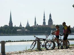
Old Town RigaThe Capital of Latvia. The Old Town of Riga (included in UNESCO Cultural Heritage list) - an excellent medieval building monument. The pearl of Art Noveau in Europe. The former city of Hanza. |
|
|
Латвия
StrenciEine Floßhauptstadt Lettlands mit dem jährlichen Flößerfest im Mai. 129
Услуги
129km - Расстояние от столицы |
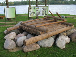 |
Латвия
ПЛЯВИНЯСВ окрестностях Плявиняс и Стукмани поселение существовало уже в III веке. Во времена Польско-шведской войны (1600 -1629 гг.) у впадения Айвиексте в Даугаву стоял военный лагерь шведов, с тех времен сохранились укрепления – окопы. Это одно из впечатляющих подобного рода военных строений в Латвии. Плявиняс как крупное поселение начало образовываться в 90 годах XIX и начале XX столетия, после строительства железной дороги. Сегодня Плявиняс больше известен как место производства доломита и щебеня и весеннего наводнения. 121
Услуги
121km - Расстояние от столицы |
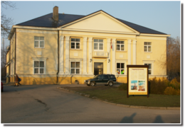 |
Латвия
ЛАПМЕЖЦИЕМСХотя во время Первой мировой войны из 104 сельских домов было разорено 97, в тридцатые годы XX столетия Лапмежциемс быстро оправился, и здесь действовал один из мощнейших рыбацких кооперативов латвийского побережья. В советское время здесь был создан один из крупнейших рыболовецких колхозов «Селга», корпуса которого видны около устья Силиньупе. Современный Лапмежциемс – это излюбленный дачный район, место отдыха и купания. Интерес для туристов представляет памятник истории рыболовства - Лапмежциемский лодочный причал - бывшая пристань для рыбацких лодок, где рыбаки строили будки для сетей и хранили инвентарь. Между улицей Пиладжу и левым берегом Силиньупе за 3 - 2 тысячи лет до Рождества Христова находилась стоянка рыбаков и охотников, на месте которой установлен памятный камень. Это известное древнейшее поселение человека на территории национального парка «Кемери». Часть находок, обнаруженных при раскопках, можно увидеть в Лапмежциемском музее, где создана краеведческая экспозиция и собраны материалы о боях финских егерей в окрестностях Клапкалнциемса. 44
Услуги
44km - Расстояние от столицы |
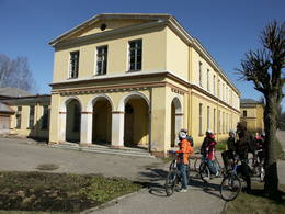 |
Латвия
КЕМЕРИВ исторических хрониках Кемери (Kemmer) впервые упоминается в 1561 году. Со второй половины XVIII и начала XIX вв. хорошо известны целебные свойства Кемерских серных источников и грязей местных болот, поэтому сюда на лечение отправляются представители Курземских высших кругов. Гостей принимают местные лесники. В это время происходят первые грязевые купания. Развитие юрмальских и кемерских купальней на какой-то момент приостанавливает Отечественная война 1812 года. Два десятилетия спустя, с 1833 по 1835 год, пользу от процедур испытал генеральный губернатор Балтии граф K. M. Пален, который обратился к российскому царю Николаю I за поддержкой для дальнейшего развития курорта. Просьба была удовлетворена, и в 1836 году царь отпускает 700 га государственной земли и предоставляет 100 000 рублей на строительство лечебницы и мощение дороги от Кемери до большака Слока - Тукумс. Два года спустя (1938 г.) открывается первое государственное купальное учреждение. Эта дата считается годом основания курорта. Слава о курорте распространяется во всей Российской империи, и курорт становится все популярнее. В несколько этапов формируется Кемерский ландшафтный парк, являющийся важной составляющей курорта. В середине и во второй половине XIX в. дальнейшему развитию курорта способствуют как движение пароходов, так и движение по железной дороге, открытой в 1877 году от Риги до Тукумса. В 1912 году открывается прямая железнодорожная линия Кемери - Москва. Незадолго до Первой мировой войны количество пациентов в год достигает 8300 человек. Линия фронта Первой мировой войны держится в болоте Кемери несколько лет, и курорт основательно разрушается. Невзирая на это, после войны происходит быстрый подъем, и Кемери становится любимым местом отдыха жителей Риги и одной из самых модных Европейских здравниц. В 1924 году в Кемери строят новое купальное учреждение с грязевыми ваннами, которое на тот момент является одним из современнейших в Европе, а в 1936 году Президент Государства Карлис Улманис открывает одно из выдающихся зданий времен Первой независимой Латвии – гостиницу «Кемери». После Второй мировой войны, в советское время, курорт значительно расширяется, и в его окрестностях открываются почти 10 санаториев, в которых работают около 100 врачей. В 1971 году Кемери присваивается статус курорта Всесоюзного значения. С 1975 по 1985 гг. в Кемери создается крупнейший из санаториев – «Лива» (первоначально – «Латвия»), имеющий два 11-этажных корпуса. В «Ливе» одновременно могли проходить лечение до 1200 пациентов, а в течение года - до 140 000 пациентов. В начале девяностых годов XX столетия санаторий закрыли как нерентабельный. Вплоть до 1994 года в Кемери действуют пять санаториев: «Чайка», «Даугава», «Дзимтене» (Родина), «Кемери» и «Лива» (Латвия) и курортная поликлиника «Кемери». Более позднее время можно рассматривать как своего рода закат Кемери в качестве крупномасштабного лечебного курорта. 46
Услуги
46km - Расстояние от столицы |
|
|
Эстония
PaldiskiVom 18. Jh wurde die Stadt ein russischer Marinestützpunkt. Von 1962 bis 1994 war Paldiski ein Übungszentrum für atomare U-Boote der Sowjetischen Marine mit zwei auf dem Festland befindlichen Kernreaktoren (ung. 16.000 Beschäftigte) und eine "geschlossene Stadt". 49
Услуги
49km - Расстояние от столицы |
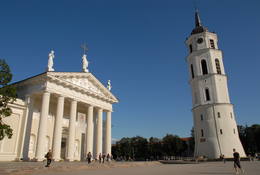 |
Литва
VilniusThe Capital of Lithuania. One of the biggest East Europe's old towns (included in UNESCO World's Cultural Heritage list) where there is a lot of representation of various architecture styles like Classicism, Baroque, Gothique, etc. |
|
|
Латвия
СмардеСмарде - старинное место, которое упоминается в документах XIII века. В наши дни - это небольшой поселок с железнодорожной станцией и магазином. К северо-востоку от Смарде, в Смардском болоте находится бывшее место добычи торфа. В Первую мировую войну недалеко от Смарде проходила линия фронта, о чем свидетельствуют находящиеся в окрестностях места памяти. 58
Услуги
58km - Расстояние от столицы |
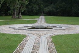 |
Латвия
СКРИВЕРИНебольшой населенный пункт на берегах Даугавы между Айзкраукле и Яунелгавой. Окрестности Скривери связаны с жизнью и работами популярного латышского писателя А.Упитиса. Недалеко от Скривери находится старейший в Латвии дендрарий. К его созданию в 1891 году приступил хозяин Скриверского поместья Максимильян фон Сиверс. Дендрологический спектр парка насчитывает около 400 пород, сортов и форм растений. Один из великолепнейших видов на Даугаву открывается с гор Крауклю – с верхней части крутого правого коренного берега Даугавы, являющимся древним городищем. 80
Услуги
80km - Расстояние от столицы |
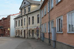 |
Латвия
Aizputes vesturiskais centrsAizputes pilsdrupas, akmens tilts pār Tebru, Jaunā pilsmuiža, ūdensdzirnavas un Sv. Jāņa luterāņu baznīca, kā arī 19. gs. beigās celtās koka ēkas starp Jāņa, Katoļu un Atmodas ielu veido neparastu pilsētbūvniecības kompleksu, kam piešķirts kultūras pieminekļa statuss. Staigājot pa vēsturisko centru, uzmanība jāpievērš ēku durvīm un to vērtnēm, logu ailēm, balkonu margām u.c. elementiem. 176
Услуги
176km - Расстояние от столицы |
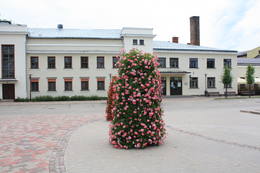 |
Латвия
Площадь старого города ЕкабпилсаИсторический центр города. На этом месте 12 февраля 1670 года Курземский герцог Екаб провозгласил факт основания города. В начале 20 столетия на площади старого города, на булыжной мостовой размещался городской рынок. Теперь на периферии площади находится Народный дом, церковь Униатов и информационный центр туризма. На площади стоит осмотреть водяной насос, огромные весы и скульптуру рыси (символ Екабпилса). Отсюда можно отправиться на прогулку по историческому центру Екабпилса с узкими улочками и малоэтажной городской застройкой. 141
Услуги
141km - Расстояние от столицы |
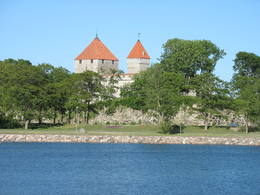 |
Эстония
KuressaareThe Capital of Saaremaa island. Popular resort. The Town Hall is built in the style of Baroque. 217
Услуги
217km - Расстояние от столицы |
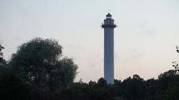 |
Латвия
Башня Микеля (ливское название – Пизе, что означает тонкий ивовый хлыст)Раньше - Пизе, по-ливски - Pizā. Теперешнее название произошло от построенного во времена императора маяка (Михайловский маяк), названного в честь племянника старого императора Александра II. На сегодняшний день виден третий по счету маяк Микеля, построенный в 1957 году и являющийся самым высоким в Латвии - 57 метров (можно осмотреть только снаружи). Лютеранская церковь Башни Микеля была построена в 1893 году. Здесь же видно здание трактира Пизе, датируемое 1857 годом (в плохом состоянии) c характерной для трактиров 19-го века планировкой и конструкцией – единственное подобное здание на побережье ливов. В башне Микеля родился первый ливский деятель культуры Янис Принцис (1796 - 1868), который вместе со своим сыном Янисом перевел евангелие от Матфея на западный диалект Курземского ливского языка. Я.Принцис – старший и Я.Принцис – младший были также авторами издания стихов «Святые песни и молитвы моряков» 1845 года. До этого сборник стихов на латышском языке был издан только слепым Индрикисом. В Олмани Башни Микеля родился ученик Вильгельма Пурвитиса - ливский живописец Андрейс Шульцс (1910-2006). На кладбище Башни Микеля в 1978 году был установлен памятник ливским поэтам (первый памятник, посвященный ливам). До 2019 года в центре села планируется открыть арт-объект «Век парусников», созданный художником Гиртом Бурвьем. 187
1-12
Услуги
187km - Расстояние от столицы
1-12 Месяцы активного сезона |
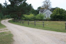 |
Латвия
ОвишиДревнее поселение. В 30-е годы 20-го века здесь насчитывалось 50 дворов, а в 1990 году - всего 10. В Овиши родился ученый - энтомолог ливского происхождения Карлис Принцис (1893 - 1978), который в 1944 году эмигрировал в Швецию. Овишский маяк (1814) - старейший действующий маяк в Латвии - высотой 38 метров. С него открывается прекрасный вид. Сохранилось здание, построенное в 1905 году для рабочих маяка, в свое время в нем была обустроена станция узкоколейной железной дороги. В подсобном помещении был создан музей Овишского маяка. Рядом с маяком – металлический Аустрас кокс (дерево Аустры). Напротив Овишрагса - хорошее место для наблюдения за птицами. 203
Услуги
203km - Расстояние от столицы |
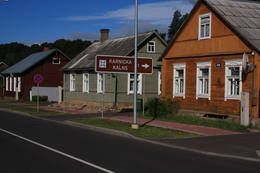 |
Латвия
Исторический центр КраславыЦентральной части Краславы, для которой характерна красивая невысокая деревянная застройка, присвоен статус памятника культуры. Лучшие виды на исторический центр города открываются с автостоянки у тропы Адамова, горы Карницкого, прилегающей территории к мосту через Даугаву (улица Проспекта) и смотровой вышки Приедайне на левом берегу Даугавы. 263
1-12
Услуги
263km - Расстояние от столицы
1-12 Месяцы активного сезона |
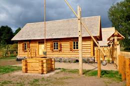 |
Латвия
Деревня СлутишкиС познавательной точки зрения - это этнографическая деревня с сельской планировкой и характерными для Латгальского края домами с наличниками на окнах и ажурными фасадами. В Силтушки в «Доме старообрядцев» находится музей, где можно узнать о культурной среде и традициях старообрядцев. С древней долины Даугавы приоткрывается один из необыкновеннейших пейзажей Латвии. Услуги
252km - Расстояние от столицыСервисы - удобства
Места для палатокСервисы - другие
Принимаются индивидуальные посетители
Принимаются туристические группы
Место с конкретным временем работы, которое следует уточнить заранееDarba laiks maijs – septembris |
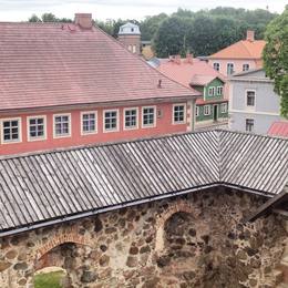 |
Латвия
ЛИМБАЖИСчитается, что на горе Кезберкалнс в Либмажи стоял замок Лемиселе государства ливов Метсеполе. Так же имеются сведения, что вплоть до XVI в. сюда по Светупе и Дуньэзерсу приходили с моря торговцы. В 1223 году епископ Альберт построил в Лимбажи каменный замок. Лимбажи, как и Валмиера, стал членом Ганзейского союза. В начале XVI в. экономическая роль поселения значительно снижается, так как Светупе и Дуньэзерс не использовались для судоходства. В период с XVI - XVIII вв. город и горожане страдали от войн, болезней и пожаров. В результате количество жителей достигло своего наивысшего упадка - восемь человек. На рубеже XIX – XX веков и в начале XX столетия хозяйственная жизнь снова восстанавливается. 92
Услуги
92km - Расстояние от столицы |
|
|
Латвия
ЛИЕЛВАРДЕНайденные в Диевукалнсе (Гора богов) свидетельства, вещают о том, что 3000 лет назад на этом месте была стоянка племени балтов, а в VII – IX вв. около Даугавы уже осело племя ливов. На скалистом берегу Даугавы (впервые упомянута в 1229 г.) Рижский епископ из валунов построил замок, развалины которого можно увидеть и сегодня. Лиелварде даволо вдохновение таким работникам культуры времен атмоды (пробуждения), как Андрею Пумпурсу (1841-1902) и Аусеклису (1850-1879). Во время Первой мировой войны (Даугава почти три года служит линией фронта) Лиелварде полностью разрушен. После Второй мировой войны, как и на другой территории Латвии, здесь приступают к созданию колхозов. В это время Лиелварде приобретает известность еще из-за одного символа – пива «Лачплесис». Сегодня Лиелварде является полюбившимся местом для тех путешественников, кто выбирает свой маршрут по правому берегу Даугавы. 52
Услуги
52km - Расстояние от столицы |
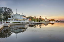 |
Эстония
HaapsaluHaapsalu was once loved by aristocrats who stayed here during summers, nowadays this town is very appealing to its visitors because of its essence - tiny streets, old wooden buildings and promenade. Worth mentioning are also town's SPAs which were one of the reasons why Haapsalu was so popular its earlier years. Interesting enough, the famous composer Tchaikovsky considered this place one of his favorite's for spending the holidays.  100
100
Услуги
100km - Расстояние от столицы |
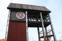 |
Латвия
Ventspils Tirgus laukumsTāpat kā Ventspils Rātslaukums, arī Tirgus laukums ir uzskatāms par pilsētas vēsturiskā centra nozīmīgu daļu, kura apkaimē ir saglabājies senais ielu plānojums. Kādreizējā Rātsnama vietā tagad slejas kariljonu zvana pulksteņu tornis. Tas zvana katru stundu, bet 12:33:44 un 00:33:44 ar īpašu melodiju ieskandina astronomisko Ventspils laiku. Tirgus laukumā ir aka, kas saulainā laikā darbojas arī kā Saules pulkstenis. Monētu automātā var izkalt īpašu piemiņas monētu. 191
Услуги
191km - Расстояние от столицы |
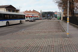 |
Латвия
Liepajas Kursu laukumsAp 200 m garajā un izstieptās formas laukumā no 16. – 20. gs. atradās Liepājas tirgus. Laukuma malās tolaik bija izveidojusies vienstāvu apbūve – iebraucamās sētas, viesnīcas un dārzi. Līdz ar Pētertirgus izveidi 1910. gadā, izmainījās arī laukuma apveidi un to ieskaujošā apbūve. Laukuma DA malā slejas iespaidīgā Liepājas Svētās Annas Luterāņu baznīca. 217
Услуги
217km - Расстояние от столицы |
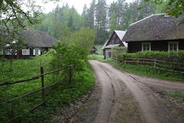 |
Литва
Vaisnoriske (Vaisnoriskė)Liela meža masīva vidū gleznainās Būkas (Būka) upes krastos starp kokiem ieslēpies teiksmainais Vaišnoriškes ciems. Šis ir viens no skaistākajiem nacionālā parka etnogrāfiskajiem ciemiem. Vaišnoriške kā apdzīvota vieta sākusi veidoties 1756. g., kad šeit sena vēsturiska ceļa malā darbojies krogs. Pirmā viensēta ciematā ir zināma no 1830. g. Šodien redzamā apbūve ir tapusi g.k. 20. gs. sākumā. Ciems ir palicis cilvēku atmiņās ar liepu medu, jo meža velšu vākšana un biškopība bija viena no galvenajām šejieniešu nodarbēm. Tagad ciemā ir piecas sētas. No Vaišnoriškes var uzsākt laivu braucienu pa seklo un dzidro Būku. 129
Услуги
129km - Расстояние от столицы |
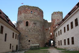 |
Латвия
БАУСКАНазвание Бауска впервые упомянуто в исторических источниках в 1443 году. Это время, когда на полуострове между слиянием Мусы и Мемеле началось строительство последнего замка Ливонского ордена на территории теперешней Латвии. Рядом с замком, в Кирбаксале образовалось поселение, т.н. Вайрогмистс. В XVII веке наблюдался быстрый расцвет города. Здесь работали золотари, серебряных дел мастера, столяры, гончары, сапожники и другие ремесленники. В поздние столетия горожане страдали от войн, чумы и армии Наполеона. Сегодня старый город Бауски с только что вновь возведенной Ратушей и восстановленным Бауским замком является одним из интереснейших исторических центров городов Латвии. Бауска известна своими ежегодными мероприятиями - фестивалем Старинной музыки, праздником города Бауски, фестивалем кантри-музыки и др. мероприятиями 67
Услуги
67km - Расстояние от столицы |
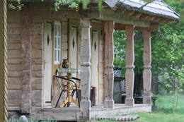 |
Литва
Sumina (Suminai)Ļoti skaists un ainavisks etnogrāfiskais ciems Balošas (Baluošas) ezera ziemeļu krastā, netālu no diviem iepriekš minētajiem ciemiem. Te apskatāmas interesantas un skaistas koka ēkas, kas celtas no guļbaļķiem, ar niedru vai lubiņu jumtiem un izrotātas ar dažāda veida dekoratīvajiem elementiem. Pirmo reizi rakstos Šumini minēti 1784. g. Savu vārdu ciems ieguva no kādreiz dzīvojošas ģimenes uzvārda. Kā interesantākā ir jāpiemin sena klēts. 127
Услуги
127km - Расстояние от столицы |
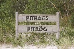 |
Латвия
Питрагс (Pitrõg)Впервые упомянут в документах в 1582 году. На мелях Питрагса лежит много затонувших кораблей. В 1826 году в Питрагсе было насчитано 11 дворов и 190 жителей. В 19-ом веке здесь был открыт трактир. В 1937 году в селе находилось 12 старохозяйств и 38 рыбных хозяйств (в основном – новохозяйства). В селе было несколько мест переработки рыбы - куры. В Питрагсе жила великолепная сказительница ливского языка Мария Шалтьяре (Бертольде, 1860 - 1930), которая поделилась более чем 200 сказками и преданиями, более 90 песнями, играми и т. д. Молитвенный дом баптистов в Питрагсе был построен в 1902 году. В Первую мировую войну он сгорел, в 1925 году был восстановлен, а в конце 20-ого века - отремонтирован. В центре Питрагса в доме Крогу хозяин создал коллекцию из 27 образцов старинных ограждений (заборов) ливского берега, предлагает копчение и дегустацию рыбы. 181
Услуги
181km - Расстояние от столицы |
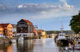 |
Литва
KlaipėdaThe former Memele. The only port city with a old town in Lithuania. 308
Услуги
308km - Расстояние от столицы |
|
| |
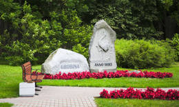 |
Латвия
ГРОБИНЯС VI – VIII вв. на месте теперешнего города Гробиня находилась крупнейшая известная в странах Балтии колония скандинавских торговцев и военнослужащих. Переселенцы из внутренних земель Готландии и Швеции основали свое поселение на холме, который находился на берегу судоходной в то время Аланды. Существует мнение, что именно здесь был упомянутый в хронике IX века замок куршей - Seeburg. После строительства замка ордена в XIII веке Гробиня стала краевым центром. Самая древняя городская застройка образовалась вокруг улицы Лиела, а также вокруг улиц Саулес и Парка. 207
Услуги
207km - Расстояние от столицы |
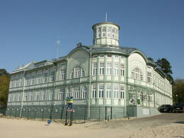 |
Латвия
ЮРМАЛАЮрмала (второй по величине город Латвии) основан в 1959 году, путем объединения городов Кемери и Слока с Юрмальским районом города Риги. Юрмала протянулась на 32 километра вдоль побережья Рижского морского залива. В свое время курорт Юрмалы был одним из известнейших объектов подобного рода в Северной Европе. Этому способствовало развитие местного и международного транспорта (дилижансы, паровозы, поезда) и движения. Первых гостей-купальщиков приняли Дубулты, где в 1834 году построили первую гостиницу, а в 1847 – первый курзал. В XIX веке начали работать первые лечебные учреждения. С 1834 г. началось стремительное строительство гостиниц. Развитие курорта прервала Первая мировая война. После войны снова наблюдался быстрый расцвет курорта – от 12 тысяч (1920 г.) до 32 тысяч (1935 г.) отдыхающих. Подобно юрмальским развивались и кемерские курорты, массовый характер которые приобрели в советский период. Современная Юрмала – популярное место проведения концертов, фестивалей, выставок, спортивных соревнований и других публичных мероприятий. 22
Услуги
22km - Расстояние от столицы |
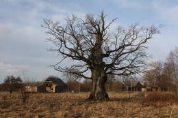 |
Латвия
ВидалеНебольшое населенное место со школой, библиотекой и магазином. К северу от Видале видны остатки ветряной мельницы. Направляясь в сторону Рижского морского залива, дорога пересекает обрыв Шлитерских Синих гор, откуда в безлиственный период открываются восхитительные виды и обнажения песчаника. Слева виден источник Синих гор - благоустроенное место для забора воды. Дорогу, ведущую из Видале в сторону Мелнсила, местные жители называют Клипелдамбой. Она, как будто бы была построена немецкой армией во время Первой мировой войны, устанавливая на дороге кругляки и засыпая их гравием. 150
Услуги
150km - Расстояние от столицы |
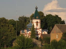 |
Латвия
Исторический центр города ЯунелгаваПамятник градостроительства 17-19 веков государственного значения. В окрестностях улиц Елгавас и Ратужа сохранилась прежняя планировка улиц, образующих закрытые застройки кварталов. В Яунелгаве действуют лютеранская, католическая, православная и баптистская церкви. Одним из выдающихся архитектурных памятников является городская ратуша, построенная в 1912-м году в стиле модерн. До нашего времени не сохранилась ни одна из пяти синагог. Вдоль исторического центра Яунелгавы по берегу Даугавы проложен променад – любимое место для прогулок, отдыха и купания местных жителей. 86
1-12
Услуги
86km - Расстояние от столицы
1-12 Месяцы активного сезона |
 |
Литва
Karaimų StraßeDie zentrale und auch schönste Straße in Trakai mit bunten Holzhäusern. Eins der seltenen Kenesa-Gebetshäuser der Welt – ein eingeschossiges Holzhaus mit einem bläulichen Dach. 29
Услуги
29km - Расстояние от столицы |
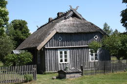 |
Латвия
Конюциемс в ПапеОдин из двух в Латвии рыбацких поселков (второй Кошрагс), который до сегодняшнего времени (насколько это возможно) сохранил дыхание аутентичности. Здесь находится филиал Латвийского Этнографического музея под открытым небом «Витолниеки» с древним рыбацким двором, лодками и предметами быта, с которыми можно ознакомиться в сопровождении гида. Сейчас в поселке ведется активное строительство современных зданий, поэтому с каждым днем он теряет свою первозданность. Находитсяв Папском природном парке . 267
Услуги
267km - Расстояние от столицы |
|
|
Латвия
ГУЛБЕНЕНазвание города впервые упоминается в исторических источниках в 1224 году. В 1340 г. Рижский архиепископ на месте латгальского городища построил каменный замок (теперь - лютеранская церковь). В 1802 г. (в собственности до 1920 г.) господскую усадьбу Вецгулбене купил барон Г. Вольф. Окрестности господской усадьбы Гулбене и Вецгулбенский замок сильно пострадали во время революции 1905 года и во время дальнейших исторических событий. В наши дни существенно изменился пейзаж города, особенно окрестности Белого замка, где в последние годы происходили масштабные реставрационные работы. Во всяком случае, Гулбене - место, в которое следует отправиться за новыми впечатлениями и знаниями. 185
Услуги
185km - Расстояние от столицы |
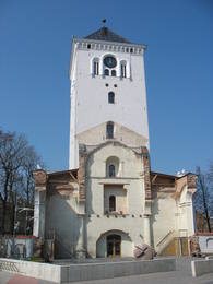 |
Латвия
ЕЛГАВАНаиболее значимый для города период связан с периодом с1561 по 1795 гг., когда Елгавский край входил в состав Курземского и Земгальского герцогства. Как только Елгава получила статус резиденции герцога (1567 г.) и столицы герцогства (1616 г.), началось быстрое развитие города, которое достигло наивысшей точки во времена правления герцога Екаба. Во время правления двух последних Курземских герцогов – Эрнста Иоганна Бирона и его сына Петра учреждается (1775 г.) Академия Петра (Academia Petrina) - первый Латвийский университет, в 1816 году создается Курземское Литературное и художественное общество, в 1822 г. выходит в свет первая газета на латышском языке «Латвиешу Авизес» («Латышские Газеты»), в 1802 г. строится первое здание театра в Латвии, а в 1898 г. – первое предусмотренное для музея здание. В 1937 г. в Елгавском замке размещается Латвийская Сельскохозяйственная камера, а через два года открывается Елгавская Сельскохозяйственная академия. Летом 1944 года погибает почти вся историческая застройка города и художественные ценности. По окончании Второй мировой войны Елгаву восстановили. Не так давно восстановлена башня церкви Святой Троицы, в которой в настоящее время создан один из лучших интерактивных музеев Латвии (очень дружественный по отношению к семьям с детьми). 42
Услуги
42km - Расстояние от столицы |
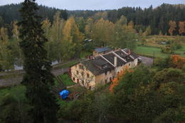 |
Латвия
Исторический центр поселка бумажной фабрики ЛигатнеИстория Лигатне неразрывно связана с бумажной фабрикой, которая является единственным подобного вида предприятием, функционирующим в Латвии (экскурсии в сопровождении гида). В конце 19 - начале 20 вв. для работников Лигатненской фабрики построили жилые здания, школу, родильный дом, больницу, клуб, гостевой дом и другие здания, сохранившиеся и по сей день. Интересны подвальные пещеры (> 200), которые по-прежнему используются как вещевые склады и овощехранилища. 72
Услуги
72km - Расстояние от столицы |
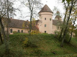 |
Латвия
ЭДОЛЕНазвание Эдоле для каждого путешествующего по Латвии связано с Эдольским замком. Истоки его уходят в середину XIII века, а пристройки замка возведены в XVI и XIX столетии, когда был построен внутренний двор. В 30-е годы XIX столетия во время перестройки фасада, замок приобрел теперешний неоготический вид. В период с XVI столетия по 1920 год в Эдольском замке находилось родовое имение баронов Беру. Во время восстания 1905 года имение было сожжено, а в 1907 году восстановлено. Эдольский замок связан со многими легендами и историями о привидениях. 170
Услуги
170km - Расстояние от столицы |
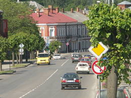 |
Lettland
RezekneDiese Stadt ist das Herz der Region Latgale, wo vom 9. bis 12. Jh. eine hölzerne Burg der Letgallen sich erheben hat. Im Jahr 1285 hat der Livländische Orden begonnen, an der Stelle dieser Burg eine gemauerte Burg zu bauen. Nach dem Zerfall des Livländischen Ordensstaates verkümmerte die Stadt (Rēzekne war ein Teil von Polen). Das wirtschaftliche Leben wurde in der zweiten Hälfte des 18. Jhs. wieder aktiv. Nach dem Ausbau der Straße (1836) und der Eisenbahn (1861) zwischen St. Petersburg und Warschau wurde Rēzekne zu einem Reiseziel für Urlauber aus St. Petersburg. Während des Zweiten Weltkriegs wurde die Bebauung der Stadt wesentlich zerstört. Heute ist die Stadt ein bedeutendes Zentrum für Wirtschaft und Kultur der Region Latgale. 242
Leistungen
242km - Entfernung von der Hauptstadt |
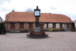 |
Lettland
Ventspils RatslaukumsVentspils Vecpilsētas vēsturiskais centrs. Nelielā Rātslaukuma (40 x 60 m) rietumu malā atrodas Starptautiskā rakstnieku un tulkotāju māja, kas ierīkota 18. gs. dzīvojamā ēkā ar baroka un klasicisma iezīmēm (19. gs. vidū te atradās pilsētas Rātsnams), bet austrumu malā – vēlīnā klasicisma stilā celtā evaņģēliski luteriskā Nikolaja baznīca. Iepretim baznīcai atrodas modernā stilā pārbūvētā Ventspils Galvenā bibliotēka un Digitālais centrs, kas ierīkots greznā 19. gs. savrupmājā. 191
Leistungen
191km - Entfernung von der Hauptstadt |
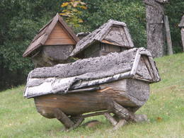 |
Litauen
Dorf StripeikiaiDas bekannteste Museum der Geschichte der Bienenzucht Litauens mit den Bienenhäusern verschidener Arte, der Arbeitsmittel der Bienenzüchter, Holzskulpturen und Hönigankauf. 125
Leistungen
125km - Entfernung von der Hauptstadt |
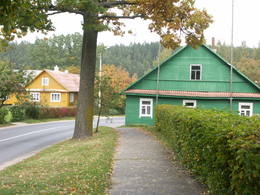 |
Litauen
Paluse (Palusė)Palūšē atrodas nacionālā parka administrācija (izveidota neliela ekspozīcija) un tūrisma informācijas centrs, kempings, nesen atjaunotā laivu bāze un viens no biežāk apmeklētajiem parka objektiem – Palūšes baznīca (Palūšės bažnyčia), kas celta 1757. gadā. 2008. g. No dievnama apkārtnes paveras jauks skats uz Lūšu (Lūšiai) ezeru, īpaši saulrietos, kad baznīca iegūst teiksmainu nokrāsu. Blakus baznīcas žogam aug vecais Palūšes ozols. Uzskata, ka tā vecums varētu būt ~ 350 – 400 gadi. 113
Leistungen
113km - Entfernung von der Hauptstadt |
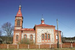 |
Lettland
Kolka (Kuolka)Zum ersten Mal wurde Kolkaurkundlich als Domesnes 1387 erwähnt und war mit diesem Namen bis zum Anfang des 20. Jh. bekannt. Nach den Angaben des Kirchenbuches von Irbe – Ģipka gab es 1770 in Kolka 4 Bauernhöfe: Krogi, Ūši, Vecvagari und Kabriki. 1844 wurde in Kolka eine Küsterschule eröffnet, in der Nika Polmanis als Lehrer gearbeitet hat, das erste Schulgebäude von Kolka wurde 1881 erbaut. Fast ein halbes Jahrhundert arbeitete dort als Lehrer der Live Kārlis Bernšteins (1881–1951). Als Führer des Aufstandes von Dundaga, der 1859 begann, ist der Sohn des Bauern von Sārnasti in Kolka, der Live Nika Šūbergs (1833–1884) anzusehen. Ende des 19. Jh. gab es in Kolka 392 Einwohner, aber 1935 sind von 343 Einwohnern 145 Liven gewesen. In den 30er Jahren des 20. Jh. sprachen in Kolka 13 Liven fließend livisch. Kolka ist das einzige Dorf an der livischen Küste, das sich auch während der sowjetischen Regelung des Küstengebietes weiter entwickelte, da es zu einem Zentrum der Fischerkolchose wurde. In den 50er–60er Jahren nahm die Bevölkerungszahl schnell zu, es wurden neue Häuser, eine Schule, ein Gesellschaftshaus, ein Kindergarten und Fischverarbeitungsfabriken gebaut. Heute ist Kolka mit 700 Einwohnern das größte Dorf an der livischen Küste. Hier gibt es die Fischverarbeitungsfabrik Līcis-93, lokale Fischer und Fischräuchereien, das Livische Zentrum „Kūolka“ und die livische Musikgruppe „Laula“. Im Bauernhof Ūši kann man livische Gerichte verköstigen. 156
Leistungen
156km - Entfernung von der Hauptstadt |
|
|
Litauen
VisaginasEntstanden als eine 6 km entfernte Arbeiterstadt des schon geschlossenen Ignalina-Atomkraftwerks. In der Stadtbebauung dominieren die für die Sowjetzeit typischen architektonischen Formen und Monumentalbauten. 150
Leistungen
150km - Entfernung von der Hauptstadt |
|
|
Lettland
JurmalciemsОдно из сравнительно редких мест, где на побережье можно понаблюдать за рыбаками в работе. Ветряная мельница «Клаюми» (1930 г.) является одним из самых высоких сельских строений. Рядом с мельницей находится Юрмалциемский Туристический информационный пункт, информационный стенд и место для отдыха.Здесь же видны старые деревянные корпуса барж, брошенных рыбаками. Экспозиция«Старинные предметы жителей Юрмалциемса» находится в восточной части поселка, где в деревянном сарае представлены собранные местными энтузиастами предметы быта и орудия труда окрестных жителей. 242
Leistungen
242km - Entfernung von der Hauptstadt |
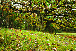 |
Lettland
Vaide (Vaid)In den historischen Quellen wurde das Dorf bereits 1582 erwähnt. Im Jahr 1736 waren im Gemeinderegister von Dundaga zwei Bauernhöfe in Vaide eingetragen: Lekši und Žonaki. Nach Angaben der Volkszählung im Frühjahr 1935 wohnten in Vaide 106 Menschen, darunter 40 Liven, 60 Letten, ein paar Esten und Deutsche. Am befanden sich im Dorf Vaide 21 Bauernhöfe. Auf dem Bauernhof Lāži von Vaide wurde der erste ausgebildete Live Nika Polmanis (1823–1903) geboren. Sein ganzes Leben verbrachte hier der livische Dichter Alfons Bertholds (1910–1993), der sein Gedicht einer neben dem Haus wachsenden Großeiche gewidmet hat. Mit dem Bauernhof Žonaki ist die große Familie Bertholds verbunden: die livische Erzählerin Marija Šaltjāre, der Segelschiffkapitän Andrejs Bertholds (USA), sein Sohn, der Bibliothekswissenschaftler Arturs Benedikts Bertholds (USA), der livische Dichter Alfons Bertholds, die livischen Sprachkenner Paulīne Kļaviņa und Viktors Bertholds, der Schweizer Arzt Marcel Berthold, der weltbekannte Pianist Arturs Ozolins (Kanada) und die livische Erzählerin und Dichterin Grizelda Kristiņa (1910–2013), die als letzte Muttersprachlerin der livischen Sprache gilt. Auch der Bauernhof Ozolnieki ist mit der Familie Bertholds, der Pflegerin livischer Traditionen und der Sprache Paulīne Kļaviņa (1918–2001) und deren Mutter, der livischen Erzählerin Katrīna Zēberga, verbunden. Die von Paulīne erstellte Sammlung der livischen ethnographischen Gegenstände ist im Lettischen Ethnographischen Freilichtmuseum, in der Scheune des livischen Bauernhofs „Dēliņi”, zu besichtigen. Im Bauernhof Purvziedi in Vaide ist eine Sammlung von Hörnern der Wildtiere zu sehen, die vom Förster Edgars Hausmanis gesammelt wurde. 166
Leistungen
166km - Entfernung von der Hauptstadt |
|
|
Lettland
Ventspils OstgalsPilsētas rajons dienvidos no Ventas grīvas, kura mūsdienās redzamā mazstāvu koka apbūve sāka veidoties 19. gs. vidū. Ostgala pirmsākumi meklējami 1836. g., kad Krievijas valdība, solot priekšrocības, aicināja apkārtnes zvejniekus apdzīvot smilšaino un kustīgo kāpu pārņemto piekrastes daļu. Ostgals ir atzīts par valsts nozīmes pilsētbūvniecības pieminekli. 191
Leistungen
191km - Entfernung von der Hauptstadt |
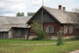 |
Lettland
Lielie MulkiApdzīvota vieta ~ 1 km dienvidos no Daugavpils – Krāslavas (A 6) ceļa, kas pazīstama ar savu neparasto nosaukumu. Interesanti, ka vietvārds saistīts arī ar iedzīvotāju uzvārdiem, ko var redzēt tāda paša nosaukuma kapos. Ciema apkaimē pazīstams ir Lielo Muļķu svētavots, kuru gan nezinātājam ir grūti atrast, tādēļ ieteicams izmantot vietējā gida pakalpojumus, apvienojot šīs vietas izziņu ar biškopības saimniecības „Cīruļi” apskati. 254
Leistungen
254km - Entfernung von der Hauptstadt |
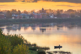 |
Lettland
Jekabpils / KrustpilsKrustpils wurde das erste Mal 1237 in Zusammenhang mit einem Bau der Kreuzburg am rechten Daugava-Ufer historisch erwähnt. 1511 wurde Krustpils als eine Ortschaft erwähnt. 1585 hat der König von Polen Stephan Báthory die Ortschaft Krustpils dem Nikolaus von Korff geschickt und gehörte Krustpils den Baronen von Korff bis 1920. 1626 geschahen nahe Krustpils die Schlachten zwischen schwedischen und polnischen Truppen. Die ruinierte Ortschaft hatte keine Entwicklung bis zum 19. Jahrhundert. Seinerseits wurde Jēkabpils in der Mitte des 17. Jahrhunderts als eine Siedlung der verfolgten Altgläubigen aus Russland – Sloboda gegründet. Auf dem Fluss Daugava befinden sich gegenüber Krustpils un Jēkabpils die Flussschnellen, deswegen mussten die Flößer anhalten und die Waren auf die Fuhren verladen. Demzufolge blühte die Siedlung auf und 1670 verlieh die die Stadtrechte und den Namen Jēkabpils zu Ehren des Herzogs von Kurland. 1861 begann das Aufblühen von Krustpils nach der Eröffnung der Eisenbahnstrecke Rīga – Daugavpils und endete sich von Jēkabpils. 1962 wurden Krustpils und Jēkabpils zu einer Verwaltungseinheit mit dem Namen Jēkabpils. Bis heutzutage sind in Jēkabpils eine für das 19. Jahrhundert typische einstöckige Holzbebauung, die um die Wende des 19. und 20. Jahrhunderts errichteten Gebäude aus rotem Stein, Kirchen von sieben verschiedenen Konfessionen erhalten geblieben. Einer das linke Daugava-Ufer umschließende Schutzdamm (Anfang des Baues 1861) wurde mit dem Ziel gebaut, die Stadt von Überflutungen zu schützen. Heutzutage ist der Damm zu einer Promenade umgebaut, die ein beliebter Platz der Bewohner für Spaziergänge und Erholung ist. 143
1-12
Leistungen
143km - Entfernung von der Hauptstadt
1-12 Aktive Saisonmonate |


