
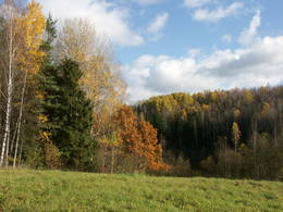
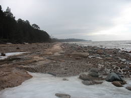
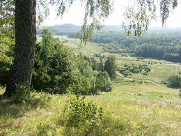
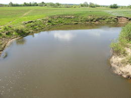
Andere Naturgebiete
Naturgebiete
| Überblick | Details |
|---|---|
 |
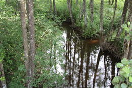
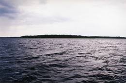
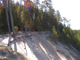
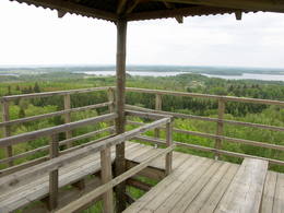
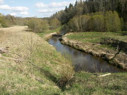
Lettland
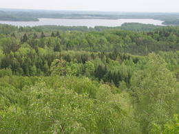
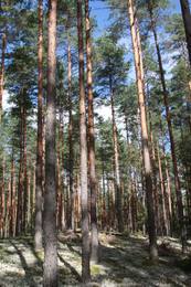
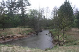
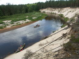
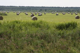
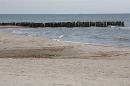
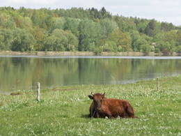
AugszemeDieses Territorium soll die Hügel und Seen des Hochlandes von Augšzeme schützen – die Seen Svente, Medums, Ilga und andere mit ihren Inseln, Landschaften und Arten. Der Naturpark, der um die Seen Svente und Medums herum eingerichtet wurde, ist Teil dieses Territoriums und es gibt mehrere Gebiete, die aus Umweltgründen geschützt werden – die Seen Bardinskis und Skujine und die Inseln der Seen Medums und Svente. Es gibt einen Aussichtsturm auf dem Egļukalns - Berg und Abfahrtsski-Routen.
Leistungen
230km - Entfernung von der HauptstadtLeistungen - erholung
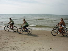
AngelnSventes un Medumu ezeros saskaņā ar pastāvošo kārtību.

SkifahrenEgļukalna kalnu slēpošanas trases.

Fahrten mit Schiff/BootSventes un Medumu ezeros.

NaturpfadEgļukalna dabas izziņas taka.

NaturbeobachtungEgļukalna dabas izziņas takā un no Egļukalna skatu torņa (viens no fantastiskākajiem dienvidlatvijas skatiem!), no citiem pauguriem (skati uz Daugavas ieleju), kā arī ezeru apkārtnē.
|
 |
Lettland
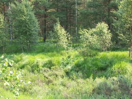
Daiku ivju audzeThe forest covered area formed to protect tort protected plant species as yew-tree etc. Territory is not suitable for visitors as visitor without environmental knowledge will see “regular” forest.
|
 |
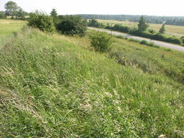
Lettland
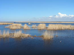
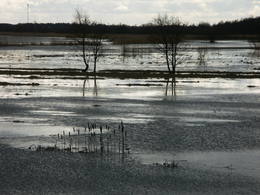
Aiviekstes palieneTeritorija, kas aptuveni 20 km garumā „piekļāvusies” abiem Aiviekstes upes krastiem. Dabas parka galvenā vērtība ir palieņu pļavas (un citi pļavu biotopi), kas ir ļoti nozīmīga daudzu augu un dzīvnieku (īpaši – putnu) sugu dzīves vieta. Ūdenstūristiem, kas laivo pa Aivieksti, nakšņošana ir jāplāno tikai šim mērķim paredzētās vietās!
|
 |
Lettland
VecdaugavaDas ist ein großes Territorium mit Küstenwiesen, alten Flüssen und Schilf. Es befindet sich in einem Gebiet, wo die Daugava floss – zwischen Vecmīlgrāvis und Vecāķi. Hier gibt es Binnendünenwiesen, mit dem sehr seltenen Silbergras bedeckt. Vecdaugava ist ein wichtiges Nistgebiet, hier werden verschiedene seltene Pflanzenarten gefunden. Am südlichen Ende der Vecdaugava – Insel, bei Skanstnieki, kann man noch Überreste von schwedischen Befestigungsanlagen aus dem Mittelalter finden. Das Regionale Forschungs- und Fischereimuseum von Vecdaugava befindet sich auch hier.
|
 |
Latvija
Ziemeļgaujas aizsargājamo ainavu apvidusIzstiepta teritorija no Valmieras līdz Apes novadam, kuras galvenā "ass" ir neregulētās Gaujas ieleja ar blīvu vecupju sistēmu, ozolu parkveida pļavām to krastos, ozolu un platlapju audzēm. Daudzu retu un aizsargājamu putnu, īpaši griežu, dzeņu, medņu u.c. sugu dzīves un vairošanās vieta. Viena no nozīmīgākajām lapkoku praulgrauža dzīves vietām.
Pakalpojumi
180km - Attālums no valsts galvaspilsētas
1-12 Aktīvie sezonas mēnešiPakalpojumi - atpūta
Izbraukumi ar kuģīti/laivuGauja: Vireši – Valmiera (133 km)
Dabas takaZīles dabas taka (2,2 km), Vekšu dabas taka (0,6 km) ar „savvaļas” govīm, Gaujienas dabas taka (6 km), Randātu dabas taka (1 km), Vizlas dabas taka (1,2 km)
Dabas vērošana |
 |
Latvija
Krustkalni Nature ReserveKrustkalnu dabas rezervāta (dibināts 1977. g.) teritorijas augu sugu daudzveidību nosaka gan reljefa īpatnības – Madonas trepes valnis, pauguri, to nogāzes, starppauguru ieplakas ar purviem un ezeriņiem, gan arī šejienes biotopi – dabiskas pļavas, mežu lauces, avoksnāji un plašais mežu masīvs ar vecām koku audzēm. Rezervāta teritorijā konstatētas > 800 augu sugu. Rezervāta apmeklējums (Krāku avoti, Svētes – Dreimaņu ezers, jaunais apmeklētāju centrs "Dreimaņos" u.c.) iespējams tikai un vienīgi Teiču dabas rezervāta administrācijas gidu/reindžeru pavadībā, savlaicīgi piesakoties un noteiktos laikos! Pakalpojumi
160km - Attālums no valsts galvaspilsētasPakalpojumi - atpūta
Gida pakalpojumiRezervāts apmeklējams tikai un vienīgi rezervāta gida vai reindžera pavadībā, iepriekš savulaicīgi piesakoties un noteiktā laikā.
Dabas vērošanaAinavas un lieliski skati no skatu torņa, izglītojošas ekskursijas, atsevišķu dabas objektu un apmeklētāju centra "Dreimaņos" apskate tikai un vienīgi Teiču rezervāta gidu un reindžeru pavadībā, iepriekš savulaicīgi piesakoties. Rezervāta administrācijas gidi, vides gidi un reindžeri piedalās un organizē dažādus ar vides izglītību un dabas vērošanu saistītus pasākumus. Teiču rezervāta administrācijas ēkā ir izveidota izglītojoša ekspozīcija, blakus ēkai - neliela laipu taka, informācijas stendi un kartes. |
 |
Latvija
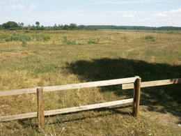
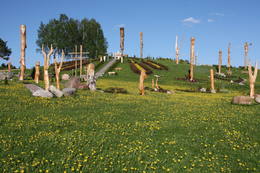
Pilskalnes SiguldiņaVieta, kur var nodoties īsākām un garākām pastaigām. Te izveidota 1,6 km garā Sprīdīša taka (ar Annas Brigaderes pasaku varoņu koka skulptūrām), 3,8 km garā Meža ainavu mācību taka un 8 km (vienā virzienā) garā Augšzemes ainavu taka. Takas atrodas ledāja veidotā subglaciālā iegultnē, kur viens aiz otra izvietojušies vairāki ar caurtekām savienoti ezeriņi un purvi. Ainavas un citu vērtību aizsardzības nolūkā izveidots dabas liegums. Taku sākumā (netālu no Pilskalnes) ir apskatāms ap 30 m augstais Melnaiskalns (Rāmavas pilskalns).
Pakalpojumi
240km - Attālums no valsts galvaspilsētasPakalpojumi - atpūta
Dabas takaTrīs dabas takas, no kurām viena speciāli bērniem - Sprīdīša taka. Jāņem vērā, ka Augšzemes takas garums - 8 km ir tikai vienā virzienā (jānāk arī atpakaļ tikpat, vai arī sagaida transports!)
Dabas vērošanaTrīs dabas taku teritorijā.
|
 |
Latvija
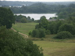
Rāznas nacionālais parksLatvijas jaunākais nacionālais parks (2007. g.) atrodas „Zilajā ezeru zemē” – Latgales novadā. Parka viens no izveides mērķiem ir Latvijas ūdeņiem bagātākā – Rāznas ezera, salām bagātākā – Ežezera un citu ūdeņu, Latgales augstienei raksturīgās pauguraiņu ainavas un kultūrvides saglabāšana. Šobrīd viens no populārākajiem nacionālā parka objektiem ir Mākoņkalns ar skaisto skatu uz Rāznas ezeru. Jaunizveidotajā parkā šobrīd tikai tiek plānota un veidota ar tūrismu saistīto labiekārtojumu – taku, maršrutu u.c. izveide, tādēļ būtu vēlams apmeklēt g.k. šobrīd jau labiekārtotos objektus.
Pakalpojumi
240km - Attālums no valsts galvaspilsētasPakalpojumi - ērtības
Piedāvā naktsmītniNaktsmītnes
RNP teritorijā un tuvākajā apkārtnē
Brīvdienu māja "Osmany" Brīvdienu māja "Pie Rāznas" Viesu māja "Rāznas līcis" Viesu māja "Rāznas gulbis" Viesu māja "Zīdu kolns" Lauku māja "Priedes" Viesu māja "Vītoli" Pakalpojumi - atpūta
MakšķerēšanaRāznas u.c. ezeros saskaņā ar pastāvošo kārtību. 
PeldvietaRāznas ezera krastos (īpaši D krastā) ir atrodamas labiekārtotas peldvietas.
Jāievēro, ka Rāznas, Salāja, Zosnas ezerā un Ežezerā nav atļauts pārvietoties ar motorizētiem peldlīdzekļiem.

Velosipēdu nomaRāznas Gulbis, tālr. +371 29994444; Selēna, tālr. +371 29179338.

Zirgu izjādesRāznas nacionālā parka teritorijā ir vismaz 80 saimniecības, kurās ir
zirgi. Zirgu izjādes ir piemērotas jebkuram gadalaikam, protams, īpaši
gadalaiku skaistākajās izpausmēs: ievziedu laikā, ziedošo puķu pļavās,
sārtajās rudens lapās vai dziļajās ziemas kupenās.
Maršruts zirga mugurā Latgales rikšotāji 
Sēņošana un ogošanaRāznas nacionālajā parkā var staigāt, vērot augus, dzīvniekus un ainavas, ogot, sēņot, peldēties, sauļoties, braukt ar divriteni un laivu.
Gida pakalpojumi
Izbraukumi ar kuģīti/laivuRāznas un Ežezera apkārtnē pieejama laivu noma un tiek piedāvāti (Rāznas ezerā) braucieni ar dažādiem ūdens peldlīdzekļiem. 
VelomaršrutsNacionālā parka teritorijā ietilpst vairāki velomaršruti (šobrīd nav
marķēti) - sk. LLTA "Lauku ceļotājs" sagatavotos izdevumus.
Velomaršruts ar divriteni apkārt Rāznas ezeram. 
Piknika vietaUgunskurus kurināt drīkst tikai speciāli ierīkotās vietās.
Dabas takaMākoņkalna
apskates taka, kāpnes un skatu vieta.
Dabas vērošanaVisā parka teritorijā - ainavas, dabas, augu un putnu vērošanas iespējas.
|
 |
Latvija
Užavas augšteceDabas liegums atrodas dienvidos no bijušā Ventspils – Liepājas dzelzceļa un ietver Užavas upi (t.sk. vecupes un veco meliorācijas sistēmu) ieskaujošās pļavas aptuveni 6 kilometru garumā, kas padomju laikā tika izmantotas kā kolhoza lauki (dažādas lauksaimniecības kultūras, siens), bet tagad pamazām aizaug ar krūmāju (nepieciešama regulāra pļaušana). Aizsargājamās vērtības – retas putnu sugas, t.sk. griezes, dažādi pļavu biotopi un augu sugas. Teritorija nav piemērota tūrisma aktivitātēm. Pietiekami labs priekšstats par Užavas augšteci rodas arī to vērojot „no malas” – no Alsungas - Bērzkalnu ceļa, kura malā pie Užavas upes izveidots informācijas stends. No tā pārskatāma lieguma ziemeļu daļa.
|
 |
Latvija
Tērvetes dabas parksVairāk nekā pusgadsimtu vecais dabas parks ir populārs tūrisma objekts un latviešu rakstnieces Annas Brigaderes (1861. - 1933) pasaku lugu varoņu apskates vieta. Sava mūža pēdējo desmitgadi (no 1922. līdz 1933. g.) rakstniece strādā un atpūšas Tērvetes „Sprīdīšos” (ēka uzbūvēta 1840 g.). Laikā no maija līdz oktobrim mazos apmeklētājus sagaida arī „dzīvie” pasaku tēli. Pazīstamas ir Tērvetes vecās priedes, kuru vecums sasniedzis trīs gadsimtus. Parka teritoriju caurvij takas, tādēļ šī ir piemērota vieta dažāda garuma un grūtības pastaigām. Nesen izveidots mūsdienīgs apmeklētāju centrs. |
 |
Latvija
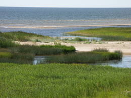
Randu pļavu dabas liegumsAr niedrēm un meldriem klāts piejūras pļavu, lagūnu, dūņainu ezeriņu un smilšainu sēkļu mozaīkas izraibināts Rīgas līča austrumu krasta posms starp Ainažiem un Kuivižiem – Randu pļavas ("rand" - no igauņu valodas - krasts), kas ir ļoti nozīmīga ūdensputnu atpūtas un retu augu sugu (kopumā konstatētas ap 500 augu sugas) dzīves vieta. Pļavu iepazīšanai izveidots jauns putnu vērošanas tornis un dabas taka.
|
 |
Latvija
Engures ezera dabas parksParka nozīmīgākās dabas vērtības ir viens no bagātākajiem Latvijas putnu ezeriem, tā apkaimes augu valsts un Rīgas līča seklūdeņi.
Pakalpojumi
1-12 Aktīvie sezonas mēnešiPakalpojumi - atpūta
Dabas taka
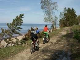
Dabas vērošanaPārgājiens gar jūras piekrasti: Mērsrags – Engure (20 km); Dzīvei savvaļā pielāgotie mājlopi (zirgi, govis) Engures ezera A krastā; Putnu vērošanas tornis ezera ZR krastā (piebraucams no Ķūļciema puses, kur dzīvei savvaļā pielāgotie mājlopi, t.sk. Latvijas Zilās govis), Putnu vērošanas tornis Mērsraga piejūras pļavā (Latvijas piekrastē – reti sastopams biotops) – t.s. Jomiņā. |
 |
Latvija
Paradīzes (Gleznotāju) kalnsĻoti ainaviska vieta Siguldā, kas gleznota (no tā arī vēlāks nosaukums) un fotografēta kopš seniem laikiem! Paradīzes kalns būtībā nav kalns, bet gan vieta, kur Gaujas senlejas kreisā pamatkrasta nogāzi „pāršķeļ" varenā Vējupītes grava. No Paradīzes kalna paveras izcils skats uz Turaidas pili un Gaujas senleju, kur izveidota atpūtas vieta un skatu laukums. Līdz Paradīzes kalnam var nokļūt ar elektromobili. 54
Pakalpojumi
54km - Attālums no valsts galvaspilsētas |
 |
Latvija
Vitrupe-Tūja„Vitrupe - Tūja” - nozīmīga teritorija rifu aizsardzībai. Teritorija atrodas iepretim Salacgrīvas novadam, tās platība ir 3577 ha. Teritorija ietver dabas lieguma „Vidzemes akmeņainā jūrmala” jūras daļu.

|
 |
Latvija
Jūrmalas parks LiepājāViens no lielākajiem cilvēka veidotajiem Latvijasparkiem (70 ha), kas izstiepies no Liepājas ostas līdz Dienvidu fortam > 3 km garumā. Tā izveidi uzsāka jau 1870. g. pēc pilsētas mēra K. Ūliha iniciatīvas, uzbūvējot kūrmāju un strūklaku. 19. - 20. gs. mijā ap Dzintaru un Liepu ielām parādījās greznu villu un savrupmāju apbūve. Viena no skaistākajām ir jūgendstilā celtā savrupmāja Liepu ielā 27, kurā atrodas Krievijas ģenerālkonsultāts. Ēkai ir slēgta uzeja, balkoni, pildrežģa konstrukcijas un kārniņu jumts (arhitekti G. Jenike un P. M. Berči). Jūrmalas parks visās sezonās ir iecienīta pastaigu un dažādu aktivitāšu norises vieta. Te meklējams stadions „Daugava”, tenisa korti, koncertestrāde “Pūt, vējiņi!”, vasaras kafejnīcas, minigolfa laukums, bērnu rotaļu laukums, skeitparks. Šeit meklējamas lielākās Latvijas bungas – vides dizaina objekts. 217
Pakalpojumi
217km - Entfernung von der Hauptstadt |
 |
Lettland
ZiemupeDas Schutzgebiet Ziemupe befindet sich an der Küste der Ostsee und schützt eine große Anzahl verschiedener Küstenbiotope. Hier gibt es die berühmten Graudünen, verschiedene Arten an Waldbiotopen, einige davon sind ganz selten in Lettland. Viele geschützte Pflanzen und Tiere findet man ebenfalls in diesem Gebiet. Der Leuchtturm Akmensrags und andere touristische Einrichtungen sind vorhanden.
|
 |
Lettland
MezoleDies sind Hügel im nördlichen Ende des Vidzemer Hochlandes. Sie sind ein wichtiges Gebiet für den Nördlichen Nadelwaldgürtel und seine Sümpfe. Hier werden verschiedene Sumpfarten gefunden, sie sind Heimat einer Anzahl wirbelloser Tiere.
|
 |
Lettland
The Ance swamps and forestsDieses Gebiet befindet sich im Süden des Flusses Irbe und ist einzigartig mit mehr oder weniger unberührten Wäldern und Dünen. Die Irbe hat ein System alter Nebenflüsse. Der Dižpurvs – Sumpf liegt parallel zur Küste. Die Irbe ist in den letzten Jahren bei Wassersportlern beliebt geworden, jedoch ist die touristische Infrastruktur noch ungenügend entwickelt.
|
 |
Lettland
ParabaineSalīdzinoši liela un cilvēka mazskarta teritorija ziemeļos no Lubāna ezera, kas izceļas ar lielu purvu un mitro mežu, kā arī tajā dzīvojošo organismu daudzveidību. Cauri teritorijas austrumu daļai tek Aiviekste. Dabas liegums ir grūti pieejams, tajā nav izveidota ar tūrismu saistīta infrastruktūra, tādēl vislabākais veids ir to aplūkot no Lubānas - Gaigalavas ceļa, kā arī putnu vērošanas torņa pie Gomeļa ezera (Gūmelis), kurš gan 2007. g. rudenī bija cietis no apmeklētāju vandālisma. Teritorija ietilpst Lubāna mitrāja kompleksā.
|
 |
Lettland
Naturpark Daugavas loki (Daugavabögen)Dieser Park ist einer der reichsten und ungewöhnlichsten Naturparks in Lettland in Bezug auf seine natürlichen Ressourcen, die umgebende Natur, die Landschaften, die biologische Vielfalt des Gebiets und seiner Kulturdenkmäler, die man hier findet. Der größte Schatz ist das kaum veränderte Daugava-Flusstal mit seinen acht großen Windungen auf einer Länge von vier bis acht Kilometern. Dort sind ebenfalls die Schluchten der Nebenflüsse. Einen besonders schönen Blick kann man von den Steilufern des Daugava - Flusstales werfen, besonders bei den Slutiški- und Ververi - Klippen und dem Elerne - Hügel. Es gibt mehr als 20 archäologische Denkmäler an den Ufern des Tales, uralte Burgberge in Najene, Markova, Vecračina usw., unzählige Kirchen – wie die Kirchen Juzefova, Sprukti, Borovka, Elerne, Sīķele, Kaplava und andere, die Gutshöfe Rozališki, Lielborne und andere, das einzigartige Altgläubigendorf Slutiški. Es gibt interessante Naturpfade und Fahrradrouten in diesem Gebiet. Man kann auf Pferden ausreiten und es gibt einen Aussichtsturm mit weiteren Möglichkeiten für Touristen. Die Daugava hinunter zu paddeln ist eine interessante Möglichkeit, seine Zeit zu verbringen.
Leistungen
260km - Entfernung von der HauptstadtLeistungen - komfort
ZeltplatzLeistungen - erholung
AngelnDaugavā saskaņā ar esošo kārtību.
FahrräderMeklējama Krāslavā.
ReitenZemnieku saimniecībā "Klajumi" (Sējējs - 2007. laureāti). Viena no retajām saimniecībām, kas piedāvā vienas - vairākdienu pārgājienus ar zirgiem. Pieejami reiterapijas pakalpojumi.

Fahrten mit PferdeschlittenZ/s "Klajumi"
Fahrten mit Schiff/BootPopulārs ūdenstūrisma maršruts no Krāslavas līdz Naujenei vai Daugavpilij.
RadrouteVairāki velomaršruti Krāslavā un tās apkaimē, no kuriem kā interesantākais jāmin "Daugavas loki" (ap 46 km).
NaturpfadDinaburgas taka, Markovas izziņas taka (ap 1,6 km), Adamovas taka u.c.
NaturbeobachtungAinavas un putnu vērošana no skatu torņiem Vasargeliškos un Krāslavā. |
 |
Lettland
Durbes ezera plavasNature restricted area includes eastern side of the lake with Lanupe River and North-east and South-east coastal areas. Restricted area has been established for protection of birds and floodplain meadows of the lake. To see the nature restricted area visitors do not have to enter it. There are great view points with wind generators of Grobina on the background from the road Vecpils – Rava – Aistere. Coastal areas which are not included in the restricted area are perfectly suitable for bird watching. There is located the smallest city by its population in Latvia to the South from the lake.
|
 |
Lettland
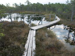
Teicu dabas rezervatsDas Naturreservat Teiči wurde 1982 eingerichtet und ist eins der größten Hochmoore in der baltischen Region. Es besteht aus dem Teiči und dem Pelečāre Moor, mit einer Vielfalt an Pflanzen und Tieren sowie den angrenzenden Territorien, die unter Schutz stehen. Das Teiči - Moor ist das größte Nistgebiet für eine Reihe von Vogelarten einschließlich dem Kranich, dem Regenbrachvogel, dem Goldregenpfeifer und dem Strandläufer. Während des Vogelzugs gibt es hier Tausende von Gänsen verschiedener Art. Das Reservat kann nur gemeinsam mit einem Führer der Reservatsverwaltung durchquert werden. Man muß sich für so eine Tour vorher anmelden. Besucher begehen den Pfad auf Holzplankenwegen entlang dem See Silda sowie auf der Siksala Insel, wo man von einem Aussichtsturm einen phantastischen Blick auf das lettische Moorland hat.
Leistungen
200km - Entfernung von der HauptstadtLeistungen - erholung
ReiseführerRezervāts apmeklējams tikai un vienīgi rezervāta gida vai reindžera pavadībā, iepriekš savulaicīgi piesakoties un noteiktā laikā.
NaturpfadSildu - Siksalas dabas taka (ap 5 km).
NaturbeobachtungTeiču purvs - Sildu - Siksalas dabas taka. Rezervāta administrācijas gidi, vides gidi un reindžeri piedalās un organizē dažādus ar vides izglītību un dabas vērošanu saistītus pasākumus. Teiču rezervāta administrācijas ēkā ir izveidota izglītojoša ekspozīcija, blakus ēkai - neliela laipu taka, informācijas stendi un kartes. |
 |
Lettland
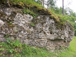
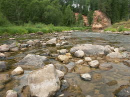
ViresiDas ist ein Abschnitt des Gauja – Flusses mit Stromschnellen an einigen Stellen. Es erstreckt sich von Vidaga bis zum Ort, wo der Fluss Vecpalsa indie Gauja fließt. Entlang der Gauja und seinen Nebenflüssen kann man Dolomitaufschlüsse an seinen Ufern sehen, die größten sind die Randati – Klippen. Das Territorium wurde vor allem eingerichtet, um die verschiedenen Arten an Wald, Wiesen, Aufschlüssen und ihre Habitate zu schützen. Das ist ein interessanter Abschnitt des zentralen Teils der Gauja, vor allem für Leute, die die schöne Landschaft genießen möchten und für Wassertouristen.
Leistungen
150km - Entfernung von der HauptstadtLeistungen - erholung
Fahrten mit Schiff/BootIespējami vairākdienu nobraucieni ar laivu pa Gauju no Virešiem līdz Valmierai un tālāk - Cēsīm un Siguldu.
NaturpfadVizlas lejtecē un pie Randātu klintīm izveidotas divas interesantas un labiekārtotas dabas takas.
NaturbeobachtungLabs veids - brauciens pa Gauju ar laivu. Gaujas ielejas vērošana no Randatu klintīm.
|
 |
Lettland
KaucersSamērā liela teritorija ar mozaīkveida ainavu - mežiem, atklātām ainavām un ezeriem (Salmejs, Kaučers, Stupānu ezers, Limanu ezers u.c.), kas atrodas Latgales augstienes Feimaņu pauguraines rietumdaļā. Aizsargājamo ainavu apvidus veidots šejienes dabas un kultūrainavas (apdzīvotās vietas, Tišas vecticībnieku lūgšanas nams, krucifiksi) un daudzveidīgo biotopu (t.sk. - sugu) aizsardzībai. Apvidū atrodas arī samērā populārs tūrisma objekts - Šnepstu pilskalns.
|
 |
Lettland
Die westliche Küste der Rigaer BuchtDie westliche Küste der Rigaer Bucht ist das ganze Jahr über ein wichtiger Zufluchts- und Nahrungsort für viele migrierende Vögel. Von den geschützten Vogelarten begegnet man hier am meisten dem Sterntaucher und dem Prachttaucher, der Brandgans, der Eisente und der Zwergmöwe. Das Gebiet ist auch sehr wichtig für den Schutz der Riffe. Es befindet sich gegenüber der Regionen Dundaga, Roja und Engure, sowie der Stadt Jūrmala. Die Fläche beträgt 132 173 ha. Das Territorium enthält den Meeresteil vom Naturpark „Engure“ und dem Nationalpark von Ķemeri.
|
 |
Lettland
Uzavas lejteceOpen landscape area within farming lands on both banks of Uzava River about 10 km before it flows into the Baltic Sea. There is a good open view over the area from the Vendzava-Ziri road going through the nature park. Protection of migratory birds and corncrakes has been one of the main reasons for establishment of the nature park. Bird watching is possible from the road Vendzava-Ziri during migration period in spring and fall. There is no tourist infrastructure in the nature park.
|
 |
Lettland
PapeDas ist ein flacher, lagunenartiger See, der mit dem ihn umgebenden Feuchtgebiet von internationaler Bedeutung ist. 271 Vogelarten wurden in diesem Gebiet gezählt, einschließlich 43 Vogelarten, die in der Lettischen Roten Liste aufgeführt sind und 15 aus der Europäischen Roten Liste. Zum Park gehören das Nida-Moor und der Teil des Meeres, das sich längsseits des Parks befindet. Zwischen dem Pape-See und der Ostsee befindet sich Lettlands älteste Vogelberingungsstation, wo nicht nur Vögel beringt werden, sondern auch Fledermäuse. Der Pape-See ist das erste Territorium in Lettland, wo Rückzüchtungen von Wildtieren ausgewildert wurden, um die überschwemmten Wiesen des Sees sachgerecht verwalten zu können. Zuerst waren es Wildpferde (Konik-Pferde), dann Auerochsen und der europäische Bison. Durch den Pape-See führt auch Lettlands einzige markierte Wassertourismusroute. Besucher können Vogel- und Naturbeobachtungstürme nutzen, Naturpfade usw. Das Dorf Ķoņi ist ein einzigartiges Beispiel für ein am Meer gelegenes Fischerdorf. Der Pape-See ist unter den Vogelbeobachtern beliebt. Das Besucherzentrum wurde im “Haus der Natur “ des WWF eingerichtet.
Leistungen
270km - Entfernung von der HauptstadtLeistungen - erholung
BooteLaivu noma braucienam pa Papes ezeru.
Fahrten mit Schiff/BootŪdenstūrisma maršruts pa Papes ezeru
RadrouteVelomaršruts "Jūrmalciema velotakas".
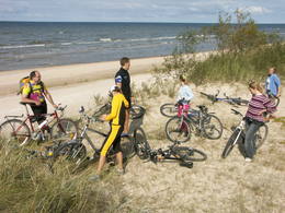
NaturpfadPapes dabas procesu taka (9,1 km). Kājinieku maršruts apkārt Papes ezeram. Pastaigas gar Baltijas jūras krastu.
NaturbeobachtungDzīvei savvaļā pielāgotie mājlopi - "Konik" zirgi, taurgovis, sumbri (vietējā gida pavadībā!). Putnu vērošanas slēpņi, putnu vērošanas tornis. Dabas māja ar izglītojošu ekspozīciju. |
 |
Lettland
The Meadows of Lake Burtnieks Nature ReserveRegelmäßig werden die Auenwiesen am Ost- und Südufer des Sees Burtnieks überflutet, sie sind ein wichtiger Nistplatz für den selten gesehenen Wachtelkönig. Ein Natur- und Informationspfad wurde in Vīsrag eingerichtet mit Richtungsangaben, Informationsständen und einem Aussichtsturm.
Leistungen
120km - Entfernung von der HauptstadtLeistungen - erholung
NaturpfadLieliska dabas taka, kurā apvienota Burtnieku apkārtnes dabas vērtību un kultūras mantojuma izziņa.
NaturbeobachtungNo Vīsraga dabas takas un tajā uzceltā putnu vērošanas torņa paveras labs kopskats uz apkārtnes palieņu pļavām u.c. biotopiem. Burtnieku parkā informācijas stendi par šejienes bioloģisko daudzveidību. |
 |
Lettland
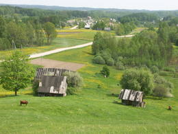
VestienaDieses Gebiet wurde errichtet, um die kulturellen und Seelandschaften des zentralen Bereiches des Vizemer Hochlandes mit den Seen Alauksts, Inesis, Tauns, etc. und mit ihren Arten und Biotopen zu schützen. In diesem Territorium sind viele wichtige Kulturobjekte – in Vecpiebalga die lutherische Kirche, die Schloßruinen, der Gutshof, sowie die Orte, wo verschiedene bedeutende Personen des lettischen Kulturlebens gelebt und gearbeitet haben. Museen wurden eingerichtet, um ihrer zu gedenken. Die Seen sind großartig zum Angeln geeignet und Skilaufwettbewerbe werden traditionell im Seengebiet von Alauksts im Winter organisiert. Das Sproģi Naturreservat wurde auf den Inseln und Halbinseln des Sees Inesis eingerichtet.
|
 |
Lettland
Nida - PerkoneDas geschütze Meeresgebiet „Nida – Pērkone“ ist ein von den biologisch vielfältigsten und für den Naturschutz wichtigsten Meeresgebieten an der offenen Küste der Ostsee. Hier kann man die hervorragendsten Riffe anfinden. Während der Vogelmigration wird das Territorium vom größten Teil der in Lettland festgestellten migrierenden Vogelarten überquert. Das Gebiet ist besonders wichtig zum Schutz vom Gänsesäger und der Zwergmöwe. Es befindet sich gegenüber der Regionen Rucava und Nīca. Die Fläche beträgt 36 703 ha. Das Gebiet überdeckt sich Teilweise mit dem Meeresgebiet vom Naturpark „Pape“ und enthält das Meeresgebiet vom Naturpark „Bernāti“.
|
 |
Lettland
Amatas ielejaAmata ir viena no straujākajām Latvijas upēm, tādēļ pavasaros šeit pulcējas ūdenstūristi – sportisku aktivitāšu un asu izjūtu cienītāji! Lejpus Rīgas-Veclaicenes autoceļa Amata ieplūst dziļā ielejā, kur upes vidējais kritums pārsniedz 3 m/km, lejtecē sasniedzot pat 8 - 10 m/km. Ūdenstūristi parasti izmanto upes posmu no Melturiem līdz Zvārtes iezim vai Līgatnes–Kārļu ceļa tiltam (Veclauču tilts). Taču jāatceras, ka Amata nav domāta iesācējiem! Pēc ilgstošām lietavām upe var būt braucama arī citos gadalaikos. Amatas ieleja ir pievilcīga ar saviem iespaidīgajiem smilšakmens un dolomīta atsegumiem, sauktiem par iežiem, no kuriem zināmākie ir Vizuļu iezis (te var veidoties skaists leduskritums), Ainavu krauja, Ķaubju iezis, Dzilnas iezis, Zvārtes iezis un Lustūzis. No Melturiem līdz Veclaužu tiltam gar upes labo krastu ir nomarķēta (oranži punkti uz koku stumbriem) t.s. Amatas ģeoloģiskā taka. Takai ir trīs posmi: Melturi – Kārļu zivjaudzētava, Kārļu zivjaudzētava – Zvārtes iezis (abi posmi var būt ekstrēmi!) un Zvārtes iezis – Veclauču tilts. Pārgājienu var veikt jebkurā laikā, izņemot dziļā sniegā. Iespaidīgākie skati būs vērojami bezlapu laikā. Tiesa, braucot ar laivu, atsegumu vērošanai un fotografēšanai nesanāks laiks, jo būs jākoncentrējas uz šķēršļiem upē. |
 |
Latvija
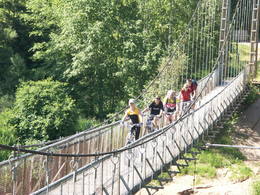
Gaujas nacionālais parksPirmais Latvijas nacionālais parks (dibināts 1973. g., otrais vecākais Baltijā) ar senām dabas aizsardzības un tūrisma tradīcijām, kā arī viens no Latvijas populārākajiem tūrisma galamērķiem. Parka „galvenā artērija” ir Eiropas mērogā nozīmīgā ledāja kūstošo ūdeņu veidotā Gaujas senleja (95 km garš senlejas posms) ar daudzo sānu pieteku dziļajām gravām, kuru krastos paceļas Baltijas skaistākie un iespaidīgākie Devona perioda smilšakmens atsegumi. Pie Siguldas Gaujas senleja sasniedz maksimālo dziļumu – 85 m. Teritorija izceļas ar lielu sugu daudzveidību (ap 900 augu sugu). Gauja ir arī Latvijas populārākā ūdenstūristu upe, kuras krastos ir izveidotas tipveida tūristu apmetnes. Infrastruktūras, t.sk. dabas taku un tūrisma maršrutu ziņā Gaujas nacionālais parks ir viena no vislabāk labiekārtotākajām Latvijas īpaši aizsargājamām dabas un NATURA 2000 teritorijām. Līgatnes dabas takas ar savvaļas dzīvnieku voljēriem ir lielākais un bagātākais šāda mēroga objekts Baltijā. Gaujas nacionālā parka teritorijā atrodas arī populāri Baltijas mēroga kultūras pieminekļi – Turaidas muzejrezervāts, Cēsu viduslaiku vecpilsēta ar pils kompleksu un Sv. Jāņa baznīcu, Āraišu ezerpils u.c. Parka apmeklētāju centri atrodas Siguldā, Līgatnes dabas takās un pie Zvārtes ieža. Šobrīd Gaujas nacionālā parka administrācija Siguldā veido jaunu un modernu apmeklētāju centru, kura izveidi plāno pabeigt 2008. g. pirmajā pusē. Pakalpojumi
50km - Attālums no valsts galvaspilsētasPakalpojumi - ērtības
Telšu vietasGaujas krastos no Valmieras līdz Siguldai ir izveidots vienota "standarta" tūristu apmetņu tīkls, kuru uztur nacionālā parka administrācija. Uzmanību! Braucot pa Gauju drīkst nakšņot tikai šim mērķim paredzētajās tūristu apmetnēs!
Pakalpojumi - atpūta
Laivu nomaPiedāvā vairāki ūdenstūrisma operatori - Campo, Eži, Baiļi, Žagarkalns, Rāmkalni, Makara birojs u.c.
Velosipēdu nomaJāmeklē Valmierā, Cēsīs un Siguldā. 
Apvidus slēpošanaLīgatnes dabas takās, Siguldas, Cēsu un Valmieras apkārtnē.
Gida pakalpojumiGaujas nacionālā parka vides gidi piedāvā un organizē dažādus ar vides izglītošanu saistītus pasākumus. Vietējie gidi ir pieejami arī populārākajos tūrisma objektos.
Izbraukumi ar kuģīti/laivuPopulārākie ūdenstūrisma maršruti sākas Valmierā un Cēsīs (g.k. līdz Siguldai). Sk. arī informāciju iepriekš!
Dabas takaGaujas nacionālā parkā ir salīdzinoši blīvs taku, maršrutu un dabas taku tīkls. Starp tām ir jāmin: Sietiņieža dabas taka (1,5 km), Cīrulīšu dabas takas (līdz 6 km), Ieriķupītes dabas taka, taka "Meža mātes valstībā", Amatas taka (2,2 km), Līgatnes dabas takas (taku komplekss), taku tīkls Siguldas, Turaidas un Krimuldas apkārtnē, Kubeseles taka u.c. Šobrīd Gaujas nacionālā parka administrācija lveido un labiekārto kājinieku tūrisma maršrutu Gaujas krastos posmā no Murjāņiem līdz Siguldai.
Dabas vērošanaGaujas krastos, braucot pa Gauju, kā arī daudzajās dabas takās. Ieteicams izmantot arī Gaujas nacionālā parka gidu sniegtos pakalpojumus!
|
 |
Latvija
Korneti-PeļļiViena no Latvijas izteiktākajām subglaciālo iegultņu sistēmām, kurā izvietojušies 11 dažāda lieluma un dziļuma ezeri. Izcili ainaviska teritorija, kurā īpaši tāli un skaisti skati līdz pat Hānjas augstienei Dienvidigaunijā paveras no Drusku – senču pilskalna. Teritorija veidota arī biotopu, piemēram, boreālo un nogāžu mežu aizsardzībai. Lai arī teritorijai piemīt ārkārtīgi liels ainaviskais un tūrisma potenciāls, tas līdz šim ir minimāli izmantots. Dabas liegums atrodas Veclaicenes aizsargājamo ainavu apvidū (sk. sadaļu "Aizsargājamo ainavu apvidi").
|
 |
Latvija
Irbes šaurums"Irbes šaurums” – īpaši nozīmīga teritorija putnu migrācijas laikā - biežāk sastopamās aizsargājamās putnu sugas – tumšā pīle, melnā pīle, kākaulis, mazais ķīris, brūnkakla un melnkakla gārgales, kā arī melnais alks. Teritorija atrodas iepretim Dundagas novadam un Ventspils novadam, tās platība ir 172 412 ha.
|
 |
Latvija
Papes dabas parksNozīmīgākās vērtības ir seklais lagūnas tipa ezers – Papes ezers ar palieņu pļavām, Baltijas jūras piekraste, Nidas purvs un bagātīgā putnu valsts (konstatētas > 270 putnu sugas). Starp Papes ezeru un Baltijas jūru atrodas Latvijā vecākā (no 1966. g.) putnu gredzenošanas stacija, kurā ķer un gredzeno putnus un sikspārņus. Papes ezera apkārtne ir pirmā vieta Latvijā, kur ezera palieņu pļavu apsaimniekošanas nolūkā izlaida t.s. „savvaļas” zirgus („Konik” šķirne).
Pakalpojumi
1-12 Aktīvie sezonas mēnešiPakalpojumi - atpūta
Dabas takaDabas procesu taka (9,1 km) ar skatu torni, pārgājiens apkārt Papes ezeram (26 km, var būt ekstrēms!);
Dabas vērošanaDzīvei savvaļā pielāgoto zirgu, taurgovju un sumbru vērošana gida pavadībā; Putnu vērošana migrāciju laikā; Putnu vērošanas tornis Papes ezera D krastā. |
 |
Latvija
BeberbeķiDabas parks veidots g.k. Rīgas „zaļās zonas” aizsardzībai. Tā lielāko daļu aizņem ar priežu silu un mētrāju apaugušas kāpas, bet tā dienviddaļā atrodas Beberbeķu ezers. Ezera apkārtnē ir labiekārtota. Pakalpojumi
10km - Attālums no valsts galvaspilsētasPakalpojumi - atpūta
Apvidus slēpošanaTeritorijā piemērotā laikā distanču slēpotāji izveido špūru tīklu ar jaukiem nobraucieniem no stāvajām kāpu mugurām.
Dabas takaLai arī teritorijā nav speciāli veidotu dabas taku, tā piemērota pastaigām un nelieliem pārgājieniem, apvienojot tos ar citiem pierīgas mežiem un apskates objektiem.
|
 |
Latvija
Kaļķupes ielejaKaļķupes ieleja veidojusies, Pilsupei (veidojas satekot Kaļķupei un Mazupei) šķērsojot Šlīteres Zilo kalnu turpinājumu dienvidos no Vīdales un Kaļķiem. Tā rezultātā izveidojusies izteikta upes ieleja ar ļoti sazarotu gravu un sānu gravu tīklu, kur vietām redzami Devona perioda smilšakmens atsegumi. Viena no teritorijas izteiksmīgākajām reljefa formām ir Puiškalns (Kaļķupes un Mazupes satekas vietā) – pilskalns un sena svētvieta, kas pazīstams kā iecienīts Talsu rajona tūrisma objekts. Nogāžu meži, dažādi pļavu tipi un bagātīgais augu sugu klāsts ir vēl viena šejienes dabas vērtība. Dabas lieguma teritorija ietver arī no Pilsupes ziemeļos esošo Šlīteres Zilo kalnu nogāzi, Lorumupes gravu sistēmu u.c. gravas.
|
 |
Latvija
Selga uz rietumiem no Tūjas„Selga uz rietumiem no Tūjas” – nozīmīga teritorija mazā ķīra aizsardzībai pavasara migrācijas laikā. Teritorija atrodas iepretim Salacgrīvas, Limbažu, Saulkrastu un Carnikavas novadam, tās platība ir 58 600 ha.
|
 |
Latvija
Grīņu dabas rezervātsLatvijai neparastais meža tips – grīnis (ir divi grīņu tipi – viršu un zāļu grīnis), kas radies ilgstošā dabas un cilvēka mijiedarbības rezultātā, sastopams tikai dažviet Latvijas Baltijas jūras piekrastē un šeit augošā retā augu suga – grīņu sārtene (u.c. retas sugas) bija galvenie iemesli, kādēļ 1936. g. tika izveidots Grīņu dabas rezervāts. Rezervātu ziemeļu – dienvidu virzienā šķērso bijušā Ventspils – Liepājas dzelzceļa līnija. Rezervāta apmeklējums ir aizliegts!  250
250
Pakalpojumi
250km - Attālums no valsts galvaspilsētas |
 |
Latvija
VeclaiceneApvidus veidots, lai saglabātu Alūksnes augstienes augstākās un izteiktākās daļas dabas un kultūras ainavu, ko veido augstākie pauguri – Dēliņkalns, Dieva kalns, Saules kalns, Drusku pilskalns un Kornetu – Peļļu subglaciālā iegultne (šeit redzama viena no lielākajām reljefa starpībām Latvijā) ar Pilskalna, Dzērves, Ievas, Raipala u.c. ezeriem, kā arī nozīmīgi biotopi – nogāžu un gravu meži, dažāda tipa purvi, pļavas, mitrie meži un tajos mītošās sugas. Teritorijā izveidotas dabas takas, distanču un kalnu slēpošanas maršruti, kā arī lokāli velomaršruti. Aizsargājamo ainavu apvidū ietilpst arī trīs dabas liegumi: Korneti – Peļļi, Avotu mežs un Dēliņkalns. Pakalpojumi
170km - Attālums no valsts galvaspilsētasPakalpojumi - atpūta
MakšķerēšanaEzeros saskaņā ar pastāvošo kārtību.
Kalnu slēpošanaĶauķu kalnā.
Apvidus slēpošanaDēliņkalna un Ķauķu kalna apkārtnē.
Gida pakalpojumiIeteicams izmantot vietējo gidu pakalpojumus. Alūksnē - "Vides labirints" ar vides izglītību saistīts pasākums.
VelomaršrutsJaunalūksnes apkārtnē tiek piedāvāti lokāli nemarķēti velomaršruti.
Dabas takaDrusku pilskalnā.
Dabas vērošanaNo pauguriem, īpaši Drusku pilskalna, Dēliņkalna, Ķauķu kalna u.c. paveras fantastiskas ainavas.
|
 |
Latvija
Dvietes palieneUnikāla dabas teritorija – Dvietes senleja ar Skuķu un Dvietes ezeriem un senlejai pieguļošajām palieņu pļavām, kas plūdu laikā darbojas kā sava veida Daugavas ūdeņu „uzkrājējs” jeb ventilis. Tā ātri uzņem lielas palu ūdeņu masas, bet vēlāk tās lēnām atdod. Senlejas ūdens līmeņa svārstību īpatnības ir iemesls savdabīgajai senlejas ekosistēmai, kas ir nozīmīga augu un putnu dzīves vieta gan migrāciju, gan ligzdošanas laikā. Skatīt arī Dvietes palu zinasPakalpojumi
200km - Attālums no valsts galvaspilsētasPakalpojumi - ērtības
Piedāvā naktsmītniPakalpojumi - atpūta
Izbraukumi ar kuģīti/laivuMaršruts laivotājiem Dvietes
palos, maršruta garums 13 km.
VelomaršrutsVelobraucējiem un autoceļotājiem maršruts pa Dvietes
palienes dabas parku un tā tuvāko apkārtni.
Dabas takaAkmeņupītes
dabas taka (netālu no dabas parka teritorijas).
Pilskalnes Siguldiņa. Taka Pilskalnes Siguldiņā: Pilskalnes Siguldiņas taka
Dabas vērošanaDvietes senlejas un Daugavas ielejas ainavas. Dzīvei savvaļā pielāgotie
mājlopi, putni. Ir izvietoti informācijas stendi. Ievērojiet putnu
vērošanas ētikas kodeksu!
Maršruts dabas vērotājiem spāres Dvietes palienē Maršruts putnu vērotājiem putni Dvietes palienē. |
 |
Latvija
Raķupes ielejaDabas lieguma teritorija veidota Raķupes upes vidustecē, kuras krastos sastopami daudzveidīgi pļavu un mežu biotopi, kā arī lielu dimensiju ozoli un dižozoli, kas aug senajās viensētu vietās, kas, diemžēl, mūsdienās vairs nav apdzīvotas. Nozīmīga retu augu un dzīvnieku sugu dzīves vieta. Šobrīd teritorija nav labiekārtota tūristu apmeklējumiem, tādēļ piemērotākais veids to apmeklēt ir zinoša vietējā gida pavadībā, cilvēkiem, kuru interese ir saistīta ar vides izziņu. Raķupe nav piemērota arī ūdenstūrismam, jo ir ļoti daudz koku sagāzumu un bebru dambju.
|
|
|
Latvija
Piejūras dabas parks~40 km garš Rīgas jūras līča piekrastes posms ar trīs lielu upju – Lielupes, Daugavas un Gaujas grīvām, aprimušu kāpu veidojumiem un biotopiem, jūrmalas pļavām un mežainām jūrmalas kāpām, kas ir nozīmīgs rekreatīvais resurss. |
 |
Latvija
AugšdaugavaApvidus veidots neregulētās Daugavas augšteces ielejas, dabas un kultūrainavas un bioloģiskās daudzveidības aizsardzībai. Parka teritorijā ir izveidotas dabas takas, velomaršruti, bet Daugava ir piemērota braucieniem ar laivām. Teritorijā ietilpst Daugavas loku dabas parks (sk. sadaļu „Dabas parki”). |
 |
Latvija
ĀdažiBaltijas mērogā unikāls dabas un cilvēkizmantots apvidus, kas veidojies kādreiz - padomju, mūsdienās - Latvijas Nacionālo bruņoto spēku pārvaldītā armijas poligona teritorijā. Poligona lielāko daļu aizņem smilšains vai ar zemiem lakstaugiem un krūmāju apaudzis kāpu masīvs ar atsevišķiem lielākiem kāpu vaļņiem. Rudens laikā šeit lielās platībās zied virši. Unikālā virsāju un aprimušo kāpu ainava un daudzu sugu dzīves vieta bija daži no iemesliem, kādēļ šai militārai teritorijai ir piešķirts arī aizsargājamas dabas teritorijas statuss. Jāatgādina, ka poligona apmeklējumi privātpersonām bez iepriekšēja saskaņojuma ir aizliegti!
|
 |
Latvija
VilceTeritorijas ziņā nelielais Vilces dabas parks izvietojies dziļās Vilces upītes un tās pieteku gravu krastos. Aizsargājamie biotopi - smilšakmens atsegumi, upju straujteču posmi un gravu nogāžu meži ar tajos sastopamajām augu un dzīvnieku sugām ir šejienes dabas vērtumi. Pie labiekārtotā Vilces pilskalna atrodas Zaķu pļava – labiekārtota un iecienīta parka apmeklētāju atpūtas vieta. |
 |
Latvija
Kristus Karaļa kalnsAtrodas nepilnus 2 km austrumos no Aglonas, Aglonas – Dagdas ceļa malā. Tā ieceres autors ir Ēriks Delpers, kurš 2006. g. uzsāka vietas labiekārtošanu, izveidojot brīvdabas skulptūru dārzu un stādījumus. Kristus Karaļa kalns šobrīd atrodas izveides procesā, taču neskatoties uz to – objekts, ko ir vērts redzēt! 232
Pakalpojumi
232km - Attālums no valsts galvaspilsētas |
 |
Latvija
Pavasaru - Odiņu polderisAtklāta teritorija 3,5 km garumā un 2 km platumā, kas atrodas Lielupes kreisajā krastā starp Pavasaru ciemu un Odiņu mājām. Polderis veidots padomju laikā ar mērķi iegūt lauksaimniecībā izmantojamās zemes un tolaik arī intensīvi izmantots. Mūsdienās tas pamazām aizaug. Neskatoties uz to, šeit ir Eiropā novērotais lielākais griežu blīvums. Ziemeļu – dienvidu virzienā polderi šķērso grantēts ceļš, kas ir piemērota vieta griežu klausīšanai. 40
Pakalpojumi
40km - Attālums no valsts galvaspilsētas |
 |
Latvija
TērveteTērvetes dabas parks atrodas Zemgales ainavai nepierastā un neraksturīgā – izteiktajā Tērvetes upes ielejā un tās skaistajos krastos, kurus ieskauj plašs mežu masīvs, kas veiksmīgi pielāgots apmeklētāju atpūtai, apvienojot gan dabas vērtumus, gan šejienes kultūrvēsturisko mantojumu. Tērvetes dabas parks ir viens no Zemgales populārākajiem tūrisma objektiem, un apmeklētājus piesaista ar Veco priežu parku, dižsilu, Sprīdīšu dendrāriju, pilskalniem (Tērvetes, Klosterkalns, Svētkalns), A. Brigaderes memoriālo muzeju „Sprīdīši”, daudzveidīgajiem pasaku tēliem, bērnu atrakcijām, ainavām, blīvo taku tīklu u.c. Dabas parks 2004. g. tika nominēts kā ģimenei draudzīgākā vieta. Šobrīd parkā izveidots un kursē "Pasaku vilcieniņš". Pakalpojumi
65km - Attālums no valsts galvaspilsētasPakalpojumi - atpūta
MakšķerēšanaGulbju ūdenskrātuvē.
Zirgu izjādesBraukšana pajūgā, jāšana pa apli vai parka teritorijā instruktoru pavadībā.
Piknika vietaParka teritorijā ir izveidotas atpūtas vietas, ugunskura vietas, telšu vietas, bērnu rotaļu laukumi u.c.
Dabas takaTērvetes dabas parku "caurauž" ļoti blīvs taku tīkls - atkarībā no katra iespējām un interesēm.
Dabas vērošanaTērvetes ielejas krastos, no Tērvetes pilskalna un skatu torņa.
|
 |
Latvija
Istras pauguraineNo ģeogrāfiskā un kultūrvēsturiskā viedokļa interesanta teritorija Latgales augstienes Rāznavas paugurainē, kuras nozīmīgākie resursi ir dažāda veida biotopi, ainavas, reljefs un Šķaunes ezers. Istras pauguraines dabas parkā nav ar tūrismu saistīti labiekārtojumi, bet šo teritoriju var apskatīt arī „no malas”, braucot pa grantēto ceļu no Soboļinas uz Osinovku, kas iet līdztekus parka ziemeļu robežai (skats uz Šķaunes ezeru).
 290
290
Pakalpojumi
290km - Attālums no valsts galvaspilsētas |
 |
Latvija
Moricsalas dabas rezervātsVecākais Latvijas dabas rezervāts un valsts vecākā aizsargājamā dabas teritorija, ko ieskauj Latvijas piektā lielākā – Usmas ezera ūdeņi, dibināta 1912. g. pēc Rīgas dabaspētnieku biedrības iniciatīvas, lai aizsargātu uz Moricsalas augošo platlapju – ozolu, mežu un tā floru un faunu. Moricsalas dabas rezervātā ietilpst arī Lielalksnītes sala. Jebkāda veida rezervāta un tajā ietilpstošās ūdens akvatorijas apmeklējumi ir aizliegti! |
 |
Latvija
EmbūteAinaviska teritorija Embūtes pauguraines daļā, kas veidota Embūtes ainavas, biotopu un sugu aizsardzībai. Embūtes senlejas ekotūrisma taka un Embūtes dabas parka meža taka (tikai gida pavadībā) iepazīstina ar ledāja veidoto Embūtes pauguraini, gravām (gravas un nogāžu meži – aizsargājami biotopi) un nozīmīgiem dabas un kultūras pieminekļiem – Embūtes pilskalnu, muižas, pils un baznīcas drupām, Kuršu virsaiša Induļa nāves vietu, Joda dambi, pļavām, skatu torni u.c. Apkārtnē izveidoti šobrīd nemarķēti velomaršruti. Pakalpojumi
170km - Attālums no valsts galvaspilsētasPakalpojumi - atpūta
Velosipēdu noma
VelomaršrutsTrīs nemarķēti (plānots ieviest marķējumu) velomaršruti 20 - 25 km garumā.
Dabas takaEmbūtes senlejas ekotūrisma taka un Embūtes dabas parka meža taka. Vēlams izmantot vietējā gida pakalpojumus.
Dabas vērošanaAinavas vērošana no Embūtes pauguraines augstākajām virsotnēm, Embūtes pilskalna un skatu torņa. Embūtes ekotūrisma informācijas un izglītības centrs.
|
 |
Latvija
Dvietes senlejaUnikāla dabas un kultūrvēsturiska teritorija starp Kaldabruņu – Bebreni un Dvieti. Senlejai cauri tek mazā Dvietes upīte, kas plūst cauri Skuķu un Dvietes ezeriem un senlejai pieguļošajām palieņu pļavām. Tās plūdu laikā darbojas kā sava veida Daugavas ūdeņu „uzkrājējs”, ātri uzņemot lielas palu ūdeņu masas, bet vēlāk tās lēnām atdod. Ūdeņainos pavasaros šeit redzamie skati nelīdzinās nekur Latvijā citur redzamajiem. Senlejas ūdens līmeņa svārstību īpatnības ir iemesls, kādēļ šī ir nozīmīga augu un putnu dzīves vieta gan migrāciju, gan ligzdošanas laikā. Teritorijas aizsardzības nolūkā ir izveidots Dvietes palienes dabas parks. Interesanti, ka augstākās vietas, kas palu laikā neapplūst, sauc par salām. Dvietes senlejā ir atrastas 15 iespējamās seno cilvēku (akmens, bronzas, dzelzs laikmeta) apmetnes un ļoti bagātīgs dažādu seno priekšmetu - savrupatradumu klāsts. Ir pamats uzskatīt, ka šī ir viena no senākajām un nozīmīgākajām cilvēka dzīves vietām tagadējā Latvijas dienviddaļā.
211
Pakalpojumi
211km - Attālums no valsts galvaspilsētas |
 |
Latvija
Klāņu purvsUz Klāņu purvu no Muižniekiem aizved meža ceļš, kura galā ir informācijas stends un atpūtas vieta, no kurā labi pārskatāms Klāņezers. Tas veidojies Litorīnas jūras lagūnā. Dabas liegums veidots Klāņu, Dziru un Stāvu, kā arī seklā un aizaugušā Klāņezera un to apkārtnē esošo biotopu aizsardzībai. Iepazīstieties ar stendā iekļauto informāciju.
 230
230
Pakalpojumi
230km - Attālums no valsts galvaspilsētas |
 |
Latvija
Bernātu dabas parksDabas parks aptver Baltijas jūras piekrastes un jaunizveidotās aizsargājamās jūras teritorijas “Nida – Pērkone” daļu ar savulaik kustīgām, bet mūsdienās apstādinātām un aprimušām smilšu kāpām, kas tiek uzskatītas par augstākajiem Latvijas piekrastes kāpu veidojumiem. Šejienes vērtības ir arī Baltijas jūras krasta ainavas, smilšainās pludmales un nelielie zvejniekciemi. Dabas parka apskates nolūkos – Pūsēnu kalnā (viena no augstākajām Latvijas kāpām) izveidota dabas taka.
|
 |
Latvija
MedzeTeritorija veidota izteiktās Baltijas ledus ezera senkrasta kāples aizsardzībai, kuras izteiktākais posms stiepjas līdztekus Grobiņas – Ventspils šosejai vairāk nekā 10 kilometru garumā (ceļa austrumu pusē). Kaut arī no senkrasta augšpuses paveras plašs skats uz Piejūras zemienes ainavu, diemžēl, šobrīd nav izveidota neviena labiekārtota skatu vieta, kā arī atbilstoša informācija. Teritorijā sastopamas aizsargājamas augu sugas un biotopi. |
 |
Latvija
Abavas senlejas dabas parksAbavas senlejas posms no Kandavas līdz tās ietekai Ventā ir ainaviskā un reljefa ziņā izteiksmīgākais upes ielejas posms Kurzemes novadā. Abavas ielejas dziļums sasniedz 30 – 40 m, platums – līdz pat 300 un vairāk metriem. Teritorija izceļas ne tikai ar lielu bioloģisko (> 800 augu sugu) un biotopu daudzveidību, dabas pieminekļiem – avotiem, ūdenkritumiem, iežu atsegumiem, dižakmeņiem, bet arī ar daudzajiem kultūrasvēstures pieminekļiem – pilskalniem, baznīcām, senkapiem, kultūrainavu, kā arī mazpilsētām – Kandavu un Sabili, kuru centri ir pilsētbūvniecības pieminekļi. Sabiles Vīnakalns un Pedvāles mākslas brīvdabas muzejs ir ļoti populāri tūrisma objekti. Kultūras vērtību aizsardzības nolūkos izveidota kultūrvēsturiskā teritorija „Abavas ieleja”. Lai „uzturētu” ielejas ainavu, Drubazās un Tēvkalnos „saimnieko” dzīvei savvaļā pielāgotie mājlopi. Tūristiem izveidotas dabas takas, bet Abava ir populārākā Kurzemes ūdenstūristu upe. Diemžēl, neskatoties uz ārkārtīgi lielo tūrisma un resursu potenciālu Latvijas mērogā, tie šobrīd ir nepietiekami minimāli izmantoti. Pakalpojumi
100km - Attālums no valsts galvaspilsētasPakalpojumi - ērtībasPakalpojumi - atpūta
Laivu noma
Izbraukumi ar kuģīti/laivuŪdenstūrisma maršruti pa Abavu: Maršruts laivotājiem "No Kandavas līdz Rendai", 42 kmAugu vērošanas maršruts laivotājiem "Augi Abavas upē", 47 km Dzīvnieku vērošanas maršruts laivotājiem "Dzīvnieki upes krastā", 36 km
Ūdenstūrisma maršrutus pa Imulu un Amulu. Skatiet Lauku ceļotāja sagatavotajā izdevumā "Ceļvedis ūdenstūristam"
VelomaršrutsVelomaršruts " Skaistākās skatu vietas"
Citi velomaršruti:
Dabas takaDrubazu botānikas taka (ap 1 km), pārgājiens pa Abavas senleju z/s "Tēvkalni", Abavas ielejas takas, Čužu purva dabas taka. Visas takas ejamas tikai gida pavadībā!
Dabas vērošanaSkatu punkti/vietas Abavas ielejas krastos, no iespaidīgajiem pilskalniem, dzīvei savvaļā pielāgotie mājlopi z/s Tēvkalni un Drubazu botānikas takā u.c. |
 |
Latvija
Bauskas dabas parksBauskas dabas parks ir veidots vairāku desmitu kilometru gara Lielupes upes tecējuma posma un to sateku – Mūsas un Mēmeles posmu un tiem pieguļošo teritoriju aizsardzībai. Minēto upju krastos atrodas vieni no lielākajiem Zemgales dolomīta atsegumiem (aizsargājami biotopi un ģeoloģiski dabas pieminekļi), bet minētās ūdensteces ir nozīmīgas upes nēģu un vimbu nārsta vietas. Svarīgas tūristu piesaistes ir arī dabas parka apkārtnē esošie kultūras pieminekļi – Bauskas pils komplekss, Jumpravmuižas parks, Mežotnes pilskalns, Vīna kalns, Mežotnes pils u.c. Mūsa un Mēmele ir populāri ūdenstūrisma galamērķi. Pakalpojumi
70km - Attālums no valsts galvaspilsētasPakalpojumi - atpūta
VelomaršrutsBauskā sākas velomaršruts "Iecavas augšteces loks" (138 km).
Dabas takaMežotnes pilskalna labiekārtošanas gaitā ir izveidotas kāpnes un takas šī nozīmīgā kultūrvēstures pieminekļa iepazīšanai.
Dabas vērošanaNo Mežotnes pilskalna skatu platformas, Jumpravmuižas parka.
|
 |
Latvija
Daugavas ielejaDaugavas ielejas dabas parks ir vienīgā vieta, kur starp Daugavas HES ūdenskrātuvju kaskādēm vēl salīdzinoši īsā upes posmā saglabājusies Daugavas ieleja un tās sānu pieteku gravas tādas, kādas tās apmēram izskatījās pirms teritorijas appludināšanas. Īpaši skaisti skati paveras no Daugavas labā pamatkrasta nogāzes pie Aizkraukles baznīcas un pilskalna. Nogāžu meži, pļavas, avotu izplūdes vietas un nelielie dolomīta atsegumi ir aizsargājami biotopi. Aizkraukles pilskalnā izveidota atpūtas vieta. Netālu no tā apskatāmas arī Aizkraukles pilsdrupas. |
 |
Latvija
Puzes smilšu krupja atradneDabas liegums veidots veca un aizaugoša grants karjera vietā, kuru apdzīvo Latvijā reta abinieku suga – smilšu krupis. Karjeriem aizaugot arī samazinās smilšu krupju daudzums (tiem vajadzīgas arī atklātas smiltāju – grants platības), kas uzskatāmi parāda apstākli, ka bieži vien konkrēta suga ir saistīta ar tikpat konkrētu cilvēka saimnieciskās darbības formu un cilvēkam aizejot, nereti pazūd arī dabas vērtības. Ir ļoti maza cerība šo abinieku sastapt dabā, vienkārši ieejot lieguma teritorijā, tādēļ pieņemsim šo faktu zināšanai un attieksimies pret liegumu kā Latvijas mērogā īpaši saudzējamu.
150
Pakalpojumi
150km - Attālums no valsts galvaspilsētas |
 |
Latvija
Ziemeļvidzemes biosfēras rezervātsLatvijas lielākajā īpaši aizsargājamā dabas teritorijā (ap 6 % no valsts teritorijas), kas aptver daļu no Limbažu, Valmieras un Valkas rajoniem, sastopams ļoti daudzveidīgs un atšķirīgs ainavu, biotopu un sugu kopums. Salaca (ietilpst Salacas ielejas dabas parkā) ir viena no Baltijas jūras reģiona nozīmīgākajām lašu nārstu vietām. Upes ielejas ainava ar smilšakmens atsegumiem piesaista daudzus apmeklētājus – ne velti tā ir otra populārākā Vidzemes ūdenstūristu upe. Rīgas jūras līča austrumu piekraste salīdzinoši īsā krasta posmā izceļas ar lielu ainavu un biotopu atšķirību. Tās ziemeļos plešas piejūras Randu pļavas, vidusdaļā – smilšaini liedagi, bet dienviddaļā – akmeņaina krastmala divu desmitu kilometru garumā. Igaunijas pierobežā ir izvietojušies t.s. Ziemeļu purvi (ZBR dabas lieguma zona, NATURA 2000 teritorija "Ziemeļu purvi"), bet Sedas tīrelis ir viena no nozīmīgākajām putnu atpūtas un barošanās vietām migrāciju laikā. Rezervāta teritorija izceļas ar lielu mežu daudzveidību un tajā sastopami visi Latvijā esošie mežu tipi. Apmeklētājiem izveidotas interesantas dabas takas ar skatu torņiem vai platformām Randu pļavās, Burtnieka ezera krastā, Planču purvā, Niedrāju - Pilkas purvā, Dziļezera un Lielezera krastos u.c. Mazsalacas Skaņākalna parks ir viens no populārākajiem Ziemeļvidzemes tūrisma objektiem. Teritorijā atrodas arī daudzi nozīmīgi kultūras pieminekļi, t.sk. viena no pirmajām Latvijas apdzīvotām vietām, kur šodien atrodas t.s. Zvejnieku kapulauks (5. – 2. g.t. pr. Kr.). ZBR atrodas vēl divas dabas lieguma zonas - NATURA 2000 teritorijas "Vidusburtnieks" un "Augstroze".
Pakalpojumi
50km - Attālums no valsts galvaspilsētasPakalpojumi - ērtības
Piedāvā naktsmītniBrīvdienu māja "Vējavas"
Kempings "Rakari" Brīvdienu māja "Roķi" Viesnīca "Kapteiņu osta" Viesnīca "Brīze" Brīvdienu māja "Ķurmrags" Brīvdienu māja "Saules ligzda" Lauku māja "Duntes urdziņas" Pakalpojumi - atpūta
MakšķerēšanaSalacā, Burtniekā, Rīgas līcī u.c. ūdeņos - saskaņā ar pastāvošo kārtību.
Apvidus slēpošanaMazsalacas apkārtnē u.c.
Sēņošana un ogošana
Gida pakalpojumiZiemeļvidzemes biosfēras rezervāta administrācijā strādā vides gidi,
kas piedāvā un organizē dažādus ar vides izglītību saistītus pasākumus.
Gidi pieejami arī citos tūrisma objektos
ZBR pieejamo servisu lapu un karti, kurā apkopoti rezervātā pieejamie pakalpojumi skatieties šeit.
Izbraukumi ar kuģīti/laivuSalaca ir viena no populārākajām ūdenstūristu upēm. Tās krastos ir
izveidotas ūdenstūristu apmetnes (daudzas no tām apsaimnieko
privātīpašnieki - maksas). Ieteicamais maršruts no Mazsalacas līdz
Staicelei vai Vecsalacai.
Laivotājiem maršruts no Tūjas lidz Salacgrīvai, maršruta garums 13 km.
VelomaršrutsTeritorijā ir vairāki nemarķēti velomaršruti: Sigulda - Aloja - Ainaži
- Salacgrīva (136 km), Ainaži - Sarkanās klintis (10 km), Rūjiena -
Karksi Nuia (32 km) u.c.
Velomaršruts pa Vidzemes piekrasti, maršruta garums ~ 56 km
Dabas takaZBR ir dabas un
izziņas takas, kuras veidojusi gan rezervāta administrācija, gan
vietējie uzņēmēji un pašvaldības. Starp tām ir jāmin: Randu pļavu taka,
Planču
purva taka (0,5 km), Niedrāju
- Pilkas purva taka (ap 1 km), Dziļezera
dabas taka (ap 3 km), Minhauzena
meža taka (5,3 km), Vīsraga
dabas taka, Jēču dabas
maršruti (5 - 7 km), Augstrozes pilskalna taka, Dabas taka
apkārt Ozolmuižas Mazezeram, Skaņākalna
takas, Ķirbižu meža izziņas taka, Oleru taka u.c. 2007. g.
ZBR administrācija ir izveidojusi jaunu, ap 10 km garu dabas taku,
kuras sākums atrodas pie Skaņākalna.
Pārgājiena maršruts gar Vidzemes akmeņaino jūrmalu, garums 19 km. Pārgājiena maršruts botānikas tūre kājāmgājējiem, garums ~ 14 km.
Dabas vērošanaDabas vērošanai ir piemērota ZBR piekraste, ūdeņi (Salaca, Burtnieks),
purvi, kuros ir šim nolūkam izveidotas takas, skatu torņi (Randu pļavu
un Vīsraga dabas takās) u.c. Randu pļavas un Sedas tīrelis ir populāras
putnu vērošanas vietas. Ievērojiet putnu vērošanas ētikas kodeksu!
Putnu vērošanas maršruts gar Vidzemes piekrasti. Maršruts autoceļotājiem gar Vidzemes krastu: Ainaži - Dunte. |
 |
Latvija
VecpiebalgaVeidots Vidzemes augstienes centrālās daļas kultūrainavas un ezeraiņu ainavas ar Alaukstu, Inesi, Taunu u.c. ezeriem, kā arī sugu un biotopu aizsardzībai. Vecpiebalgā atrodas daudzi nozīmīgi kultūras tūrisma objekti – Vecpiebalgas luterāņu baznīca, Vecpiebalgas pilsdrupas, Vecpiebalgas muiža un vairāku nozīmīgu Latvijas kultūras darbinieku dzīves un darba vietas, kurās izveidoti memoriāli muzeji. Ezeri piesaista makšķerniekus, bet ap Alaukstu ziemā tiek organizētas tradicionālās distanču slēpošanas sacensības. Ineša salās un pussalā izveidots Sproģu dabas liegums.
|
 |
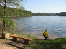
Latvija
SventeSventes dabas parkā, kas atrodas ainaviskajā Augšzemes augstienes vidusdaļā, izvietojies Sventes ezers – viens no dzidrākajiem Latvijas ezeriem un Egļukalns, no kura skatu torņa paveras viens no skaistākajiem Zemgales skatiem uz Sventes pauguraines un ezeraines ainavu. Egļukalnā izveidotas kalnu slēpošanas trases un dabas taka. Dabas parks ietilpst lielākā īpaši aizsargājamā dabas teritorijā - Augšzemes aizsargājamo ainavu apvidū. |
 |
Latvija
Ainaži-Salacgrīva„Ainaži – Salacgrīva” - nozīmīga teritorija rifu aizsardzībai. Teritorija atrodas iepretim Salacgrīvas novadam, tās platība ir 7239 ha.
|
 |
Latvija
Cārmaņa ezersDabas parks, kura lielāko daļu aizņem neprastās formas un līčiem bagātais Cārmaņa (arī Cārmins) ezers. Ezera ūdens ir ļoti tīrs, tādēļ tajā sastopamas Latvijai retas augu sabiedrības. Tā kā parka teritorijā nav tūristiem veidota infrastruktūra, interesenti var baudīt skatus, kas paveras uz ezera un tā apkārtni no Aulejas – Grāveru ceļa.
|
 |
Latvija
Slīteres nacionālais parksSlīteres nacionālo parku (dibināts 2000. g.) pamatoti dēvē par Baltijas jūras iepriekšējo attīstības stadiju „brīvdabas muzeju”. Šo ģeoloģisko notikumu mūsdienu „dzīvi” liecinieki ir Šlīteres Zilie kalni – stāvā, līdz 20 – 30 m augstā Baltijas ledus ezera senkrasta kāple (Baltijas jūras stadija pirms 10 000 gadu), Stiebru kalni – Ancilus ezera senkrasts (pirms 8 – 9 tūkstošiem gadu ), bet Eiropā lielākā – kangaru (kāpu vaļņi) un vigu (mitras starpkāpu ieplakas) ainava ir Litorīnas jūras laika veidojums (pirms 4 – 7 tūkstošiem gadu). Maigais Ziemeļkurzemes klimats ir iemesls daudzu Latvijā retu augu (liela daudzveidība, ap 860 augu sugu, t.sk. reti sastopamā parastā īve un Baltijas efeja) sastopamībai. Sava veida „nopelns” šejienes dabas vērtību saglabāšanā ir bijis arī jūras piekrastē kādreiz pastāvošajam padomju militāram režīmam, kura dēļ tā pusgadsimta garumā saglabājās apmeklētāju un būvniecības ziņā mazskarta. Tā laika liecinieki ir pamestās PSRS armijas bāzes un dažādi militārie objekti. Slīteres nacionālā parkā atrodas viens no populārākajiem Latvijas tūrisma objektiem – Kolkas rags, kuru gada laikā apmeklē vairāk nekā 50 000 ceļotāju, bet putnu pavasara migrāciju laikā stundas laikā pār to pārlaižas desmitiem tūkstoši putnu. Baltijas jūras krasta posmā – t.s. „Lībiešu krastā” no Kolkas līdz Sīkragam un Ovīšiem ir saglabājušies pasaulē mazākās minoritātes – lībiešu zvejniekciemi un citi to kultūras liecinieki. Tūristu vajadzībām izveidotas četras dabas takas, velomaršruti, skatu tornis, apmeklējama Šlīteres bāka u.c. Nacionālā parka administrācija regulāri organizē vides izglītības pasākumus, ka pieejami ikvienam interesentam.
Pakalpojumi
170km - Attālums no valsts galvaspilsētasPakalpojumi - ērtībasPakalpojumi - atpūta
Apvidus slēpošanaSlēpošanas maršruts "Pa lībiešu ciemiem", ~ 2 h
Gida pakalpojumiMeklējami Šlīteres bākā un Slīteres nacionālā parka administrācijā:
Izbraukumi ar kuģīti/laivuLaivotājiem "Apkārt
Kolkas bākai", 15 km
VelomaršrutsVelomaršruts "Kolka - Mazirbe", marķēts, ap 30 km
Dabas takaSlīteres nacionālā parkā ir izveidotas vairākas dabas un izziņas takas: Slīteres dabas taka (tikai vietējā gida pavadībā), Kolkas raga priežu taka (1,2 km), Pēterezera dabas taka (3,5 km), Ēvažu stāvkrasta taka. Pārgājienu maršruts "Kolkasraga aplis", 3kmPārgājienu maršruts "Iepazīsti Mazirbi", 7-10 km Pārgājienu maršruts "Gar jūras krastu
Dabas vērošanaDabas vērošanai piemērota ir Rīgas līča un Baltijas jūras piekraste,
īpaši Kolkas rags, kas ir nozīmīga putnu vērošanas vieta. Dabu var
vērot arī no skatu torņa Šlīteres Zilajos kalnos, Šlīteres bākā, dabas takās u.c. |
 |
Latvija
RiežupeRiežupes dabas parks veidots g.k. Riežupes izteksmīgās ielejas, tai raksturīgo dabas vērtību – nogāžu un gravu mežu, dažādu ģeoloģisku dabas pieminekļu - smilšakmens atsegumu, alu, ūdenkritumu, upes straujteču posmu, dažādu sugu, mežu masīvu un ainavas aizsardzībai. Parka atrodas viens no Kurzemes populārākajiem tūrisma objektiem – Riežupes alas - garākais mākslīgo alu labirints Latvijā, kura eju kopgarums ir 460 m. Sākotnēji dabas veidotās alas 19. gs. vidū mākslīgi paplašināja baltās smilts ieguves nolūkos, kuras izmantoja stikla ražošanai. Parkā izveidots velotūrisma maršruts. Pakalpojumi
150km - Attālums no valsts galvaspilsētasPakalpojumi - atpūta
MakšķerēšanaVentā saskaņā ar esošo kārtību.
VelomaršrutsVelomaršruts "Kuldīga - Riežupe" (ap 16 km).
Dabas vērošanaDabas un ainavas vērošana Ventas krastos un Riežupes silos. Netālu no dabas parka izveidots skatu tornis. |
 |
Latvija
Ķemeru nacionālais parksĶemeru nacionālais parks (dibināts 1997. g.) veidots g.k. mitrāju – seklās Rīgas līča piekrastes, aizaugošo piejūras ezeru, plašo purvu masīvu, mitro mežu (piemēram, dumbrāju) un palieņu pļavu - kā nozīmīgu daudzu augu (konstatētas 25 % no Latvijas Sarkanā grāmatā ierakstītajām augu sugām) un dzīvnieku, īpaši ligzdojošo un migrējošo putnu dzīves vietu aizsardzībai. Parka teritorijā atrodas viens no lielākajiem Latvijas purviem – Lielais Ķemeru tīrelis, kā arī citi – Zaļais purvs, Raganu purvs. Lielie purvu masīvi ir nozīmīga sērūdeņu izplūdes un ārstniecībā izmantojamo dūņu atrašanās vieta, kas savulaik bija slavenā Ķemeru kūrorta izveides pamats. Parka galvenie kultūras un vēstures objekti ir saistīti ar piekrastes kā atpūtas un veselības atgūšanas vietas izmantošanu. Parka teritorijā ir izveidotas izglītojošas dabas takas, velo un kājāmgājēju maršruti, putnu vērošanas torņi u.c. Parka apmeklētāju un informācijas centrs atrodas atjaunotajā Ķemeru „Meža mājā”.
Pakalpojumi
30km - Attālums no valsts galvaspilsētasPakalpojumi - ērtības
Piedāvā naktsmītniViesu māja "Stērstītes"
Ciema māja "Monikas" Viesu māja "Jūras mols" Brīvdienu māja "Līdakas" Viesu māja "Valguma pasaule" Viesu māja "Pilsētnieki" Viesu māja "Eglieni" Brīvdienu māja "Nordes" Pakalpojumi - atpūta
MakšķerēšanaVisās publiskajās ūdenstilpēs saskaņā ar pastāvošo kārtību; Kaņiera un Valguma ezeros iespējama laivu noma. Kaņiera ezerā atļauts izmantot tikai laivu bāzes laivas, makšķerēšanai jāiegādājas licence!
Laivu nomaLaivu bāze Kaņiera ezerā;
www.juraslaivas.lv
Velosipēdu noma
Apvidus slēpošanaMaršruts "No Jaunķemeriem līdz Klapkalnciemam" 2-15 km
Gida pakalpojumiĶemeru nacionālajā parkā pieejamas ekskursijas gida pavadībā, ir iespēja arī apmeklēt ikgadējos dabas izglītības pasākumus. Ieteicams to izmantot!
Izbraukumi ar kuģīti/laivuMaršruts laivotājiem "No Jaunķemeriem līdz Klapkalnciemam" ~ 4 h
VelomaršrutsTrīs marķēti velotūrisma maršruti Valguma ezera apkārtnē: Šlokenbekas aplis, Meža aplis un Lustūžkalna aplis; viens marķēts velomaršruts Ķemeru apkārtnē Ķemeri-Slokas ezers-Kūdra-Ķemeri.
Velomaršruts "Apkārt Ķemeru nacionālajam parkam" ~ 8 h (bez objektu apskates) Maršruts "Ķemeri - vēsturiskais kūrorts" ~3-4 h
Dabas takaĶNP teritorijā ir izveidotas vairākas dabas takas: Slokas ezera pastaigu taka ar putnu vērošanas torni (galvenais loks ~3 km, maršrutu var pagarināt līdz pat 12 km), Dumbrāja taka (550 m), kā arī atjaunotās Slampes upes un savvaļas govju un zirgu apskate Dunduru pļavās. Bigauņciemā apskatāma Kupskalnu dabas taka.
Dabas vērošanaĶemeri National Park is one of the best places for woodpecker watching. In the autumn and spring, thousands of migrating geese and cranes use the park to rest and spend the night.
Dabas vērošanaDabas takās, Rīgas līča piekrastē (ievērojiet putnu vērošanas ētikas kodeksu!), u.c. Dunduru pļavās apskatāmi lielie zālēdāji, uzbūvēts skatu tornis. Interesantas ir ĶNP organizētās putnu vērošanas dienas un Sikspārņu nakts.
Tūre "Putni Ķemeros " |


