
Nature objects in Lithuania
What's special about the nature in Lithuania?
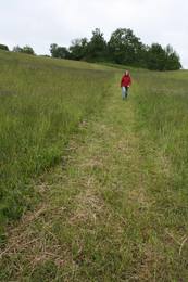
The Curonian spit - a sandy, desert-like stretch of land between the Baltic see and the Curonian Inlet, teh hilly landscapes of the Žemaitija region, the blue mirror labyrinths of the lakes in teh Aukštaitija region, the pine forests in teh Dzūkija region, the curves of the Nemuna river valley, and the many regional nature parks, created not only to protect the nature but also for people's recreation and interest - these are the nature values attracting guests of Lithuania.
Act responsibly - follow the Green advice!
| Overview | Details |
|---|---|
 |
Lithuania
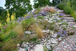
The Traupis botanical gardenThe only school-based botanical garden in Lithuania was planted in 1989 at the Traupis school. More than 8,000 types of plants grow in the garden, and all of them have been collected by Sigutis Obelevičius. 
 4-9 4-9


Services
4-9 Active season monthsServices - other
Accepts tourist groups
Accepts individual travellers
This destination has specific opening hours which you must determine in advance
Must register in advance |
 |
Lithuania
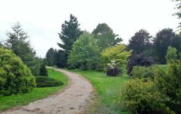
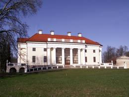
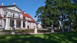
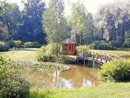
The Birzuvenai Estate ParkThis park surrounds the mansion of the Biržuvenai Estate, and it is based on the terrain of the Virvite River and an old river that provides water for the park. The central part of the park is regularly designed, while the rest has elements of landscape. Opposite the estate is a glass sculpture, and on its western side is a wooden pergola. Local trees dominate in the park, but there are also trees from other countries. Of importance is a group of oak trees on the banks of the river, as is an alley of linden trees that leads to the pond in the direction of the estate. 1-12
Services
1-12 Active season monthsServices - other
Accepts individual travellers
Accepts tourist groups
This destination has specific opening hours which you must determine in advance |
 |
Lithuania
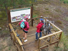
The Zemaitija National ParkThis park is located in the northern part of the Žemaitija Highlands, and much of it is taken up by Lake Plateliai. The park was established to protect lakes, rivers, wetlands and forest ecosystems, as well as the local cultural environment.
ServicesServices - recreational
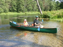
Boat tourTake a boat to the Pilies island in Lake Plateliai. 
Bicycle trailBike around the lake (~25 km). 
Nature trailHike the Šierė nature trail (4.1 km), the Plokštinė information trail (3.1 km), which runs past a former Soviet military base, or the Mikytai information trail (1 km). 
Nature watchingLook for birds from a tower near Lake Maudutis in the village of Virkšai. A viewing location from the village of Plateliai offering a look at the lake. There’s a visitor centre in Plateliai, as well. For more information: www.zemaitijosnp.lt (available in English). |
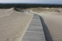 |
Lithuania
The Dunes of Courland National ParkThis is the only place in the Baltic States where there is such a vast territory of open-air sand dunes which still change the local terrain very actively because of the wind. The only Sea Museum and Dolphinarium in the Baltic States can be found here.
Services
325km - Distance from countries capital cityServices - recreational
Bicycle trailYou can bike from Nida to Smiltynė (>50 km along a bike route).
Nature trailHike the Raganu Hill trail (1.6 km), the Naglių pathway in the sandy area of the nature reserve (~1.5 km), or the Parnidžio dune information trail (~2 km).
Nature watchingWatch for birds on Garnių Hill and throughout the area during migration season. Views from the Naglių and Parnidžio dunes, as well as from the Hageno and Miškos galva dunes. For more information: www.nerija.lt (available in English). |
 |
Lithuania
The Dubrava ArboretumWork on this arboretum began in 1958 at a local forest research station that is near the village of Vaišvidava. The arboretum collects and exhibits various local and imported plants for scholarly, educational and decorative purposes. The arboretum covers some 50 ha of land, with more than 800 types of plants. Some parts of the arboretum have rare and protected trees and bushes, and these can only be visited if you contact the arboretum in advance. 1-12
Services
1-12 Active season monthsServices - other
Accepts tourist groups
Accepts individual travellers
This destination has specific opening hours which you must determine in advance
Must register in advance |
 |
Lithuania
Hügel LadakalnisVermutlich ein heidnischer Hügel. Schöner Blick auf die 6 Seenlandschaften. Ein Symbol vom Nationalpark. 122
Services
122km - Distance from countries capital city |
 |
Lithuania
The Dubysa Regional ParkThis park was set up to protect the lovely ancient valley of the Dubysa River. This is one of the most popular rivers for water tourism in Lithuania, because it has a significant drop with rapids and beautiful shorelines.
ServicesServices - recreational
Boat tourA one-day boat trip from the Raseiniai-Baisogala road bridge to the Ariogala bridge. For more information: www.dubysa.info (very little information available in English). |
 |
Lithuania
Vilnius University Siauliai Academy Botanical GardenThe botanic garden is part of the Siauliai University and is the newest and smallest botanical garden in Lithuania, covering 6.54 ha of land.
3-10
Services
3-10 Active season monthsServices - other
Accepts tourist groups
Accepts individual travellers
This destination has specific opening hours which you must determine in advance
Must register in advance |
 |
Lithuania
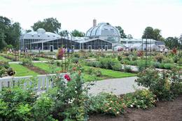
The Vytautas the Great University's Kaunas Botanical GardenThis botanical garden was opened in 1923 as a scholarly centre. The garden covers more than 60 hectares, and approximately 30 ha are open to the public.
4-10

Services
4-10 Active season monthsServices - amenities
No pets allowedServices - other
Accepts tourist groups
Accepts individual travellers
This destination has specific opening hours which you must determine in advance
Must register in advance |
 |
Lithuania
The Nemuna Delta Regional ParkThe Nemuna River divides up into two large streams at its estuary at Kuršių Marios, and this has established the Rusnė Island. This is a unique environmental territory with wetlands, streams, ancient rivers, lagoon lakes and flood plains which are important places for birds to nest and rest during migration season. Vast tracts of this territory are flooded each spring. The park includes the territory to the N and W of Rusne (lagoons, swamps, fishing ponds, Kuršių Marios).
Services
330km - Distance from countries capital cityServices - recreational
Bicycle trailBike the route Rusne-Pakalne-Uostadvaris-Rusne (20 km).
Nature trailHike the Aukštumalos swamp information trail (1.7 km).
Nature watchingBird watching on Rusnė Island, as well as at Ventės ragas (Cape Venta), where there is a bird ringing station. There is a viewing tower on the NW end of Rusnė Island, with a visitors centre in the village of Rusne. For more information: www.nemunodelta.lt (available in English). |
 |
Lithuania
The University of Klaipeda Botanical GardenThe botanical garden was established in 1993 in the lovely Dane River valley. It covers approximately 9.3 hectares, and in 2002, it was given the status of a dendrological park.
4-9
Services
4-9 Active season monthsServices - other
Accepts individual travellers
Accepts tourist groups
This destination has specific opening hours which you must determine in advance
Must register in advance |
 |
Lithuania
Sarneles (Zviedru) pilskalns (Sarnelės (Svedų) piliakalnis)Viens no iespaidīgākajiem nacionālā parka pilskalniem, kura piekājē atradusies senpilsēta. Arheoloģisko izrakumu gaitā te atrastas kuršu senlietas. Tiesa, mežs un biezais augājs traucē uztvert šī nozīmīgā arheoloģijas pieminekļa patiesos apjomus un formu. Uz pilskalnu vasarās ved izpļauta taka. Ja esat Žemaišu Kalvarijas pusē un atliek brīvs brīdis, tad savā maršrutā var iekļaut arī šo apskates objektu. 317
Services
317km - Distance from countries capital city |
 |
Lithuania
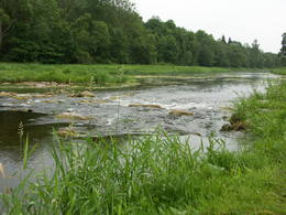
Ula (Ula) un Merke (Merkys)Ūla ir viena no skaistākajām un likumsakarīgi – arī populārākajām Lietuvas ūdenstūristu upēm. Tās galvenā pievilcība ir skaistā ainava ar augstajiem upes krastiem, kuros slejas iespaidīgas smilšu kraujas līdzīgi kā Irbes krastos Latvijā. Laivošanu var sākt no Mančagires (Mančiagirė) vai Zervinos ciemiem un turpināt līdz Ūlas ietekai Merķē un tālāk pa Merķi līdz pat Merķinei un Nemunai. Ūla nav plata, taču posmā no Zervinos ciema tajā nav neviena koku aizgāzuma vai cita šķēršļa, kuram laiva būtu jānes apkārt. Ašā straume, asie līkumi, dzidrais ūdens un tajā redzamā zemūdens pasaule rada patiesi patīkamu sajūtu! Upes krastos atrodas gan publiskas (apsaimnieko Lietuvas valsts meži), gan privātas ūdenstūristu apmetnes un atpūtas vietas. Šī ir vienīgā Baltijas upe, kur ūdenstūristiem ir jāpērk licence. Ūlas krastos atrodas divi interesanti apskates objekti – Ūlas atsegums (Ūlos atodanga) un spēcīgs avots – Ūlas acs (Ūlos akis). Savukārt, Merķe jau ir jau krietni platāka upe, taču ar acīm redzamu straumi un dažviet pat jaukām straujtecēm. Kaut arī Merķes krasti ir mazapdzīvoti, tajos atradīsim piemērotas nakšņošanas vietas. Pa Ūlu un Merķi no Zervinos līdz Merķinei sanāk „mierīgs” pusotras - divas dienas ilgs brauciens. |
 |
Lithuania
Plokstines izzinas taka (Plokstinės pazintinis takas)Ja apskatīta kodolraķešu bāze, tad var iziet 3,2 km garo Ploštines izziņas taku, kas sākas turpat netālu. Taka ved cauri dažādiem mežu tipiem, iepazīstinot ar sikspārņu būrīšiem (cilvēka radītas sikspārņu dzīves vietas), apkaimes augiem un putniem, kā arī aizsargājamu dabas pieminekli – Pileļu avotu (Pilelio šaltinis). 302
Services
302km - Distance from countries capital city |
 |
Lithuania
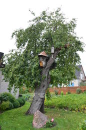
Oldest apple tree in LithuaniaThe oldest apple tree in Lithuania is a forest apple tree and is part of the country's botanical heritage and the only protected apple tree in Lithuania.
|
 |
Lithuania
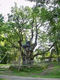
The Stelmuze Estate parkThis park dates back to the mid-18th century and is to the south of Lake Stelmuže. There are winding trails on all sides of the hillock that lead to the Christ the King Church, with linden, maple, oak, birch, fir, elm and pine trees. At the foot of the hillock is the Laime stream, and visitors are welcome to stroll along the alley of oak trees. The oldest and fattest oak tree in Lithuania is one of the oldest ones in Europe. It is though that it is 1,500 to 2,000 ears old, and its record-setting diameter is 3.5 metres (eight or nine people linking hands are needed to encircle it). The tree is 23 m high. 1-12
Services
1-12 Active season monthsServices - other
Accepts individual travellers
Accepts tourist groups |
 |
Lithuania
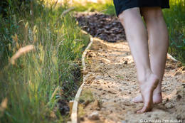
The Survilai village countryside tourism farmEnjoy nature with all of your senses in the Survilai village tourism farm, which is a Swiss village in the Jonavos district. Walk down paths barefoot! The paths are covered with pine cones, puddles, peat, clay, granite, smooth glass, pine needles, hay, an obstacle course, etc. The path is more than a kilometre long, and you will feel unbelievable and positive emotions, as well as an inflow of energy. 1-12

Services
1-12 Active season monthsServices - amenities
Accommodation availableServices - other
Accepts tourist groups
Accepts individual travellers
This destination has specific opening hours which you must determine in advance
Must register in advance |
 |
Lithuania
Varniku izzinas taka (Varnikų pazintis takas)Varniku mežā (Varnikų miškas) ir izveidota patiesi interesanta dabas izziņas taka, kas iet cauri dažādiem biotopiem – skujkoku un ozolu mežiem, purvainu mežu un sūnu purvu ar akačiem un nelieliem purva ezeriņiem, kur uzceltas divas skatu platformas. Mitrajās vietās un purvā ir izveidotas koka laipas. Šī ir populāra pastaigu vieta. Taka ir lokveida un marķēta. Tās apskatei būs nepieciešama ~ pusotra stunda. |
 |
Lithuania
The Varniai Regional ParkIn the central part of the Žemaitija Highland, this park was established to protect local landscapes. Lithuania’s highest hillocks are found here – Mėdvegalis (235 m above sea level) and Šatrija (229 m). There are also other hillocks which offer a great view of the area – make up your own tour here.
ServicesServices - recreational
Nature trailHike the Debesnos botany trail (2 km).
Nature watchingViews from the Mėdvegalis, Šatrija, Moteraitis and Bilioniai castle hills. There’s a visitor centre at Varniai. For more information: www.varniai.lt (only in Lithuanian). |
 |
Lithuania
The Pakrujo Estate parkThis landscape park has survived to the present day and was installed between 1850 and 1860. On one side the territory has a boundary that is the dammed Kruoja River, and on the other side there is a fence made of fieldstones. The English park principles at that time meant that advantage was given to a natural landscape with imitations of nature. There are some 26 types of trees in the park, and some of them were introduced from various parts of the world a few centuries ago. 1-12

Services
1-12 Active season monthsServices - amenities
Accommodation availableServices - other
Accepts individual travellers
Accepts tourist groups
This destination has specific opening hours which you must determine in advance
Must register in advance
Optional meals |
 |
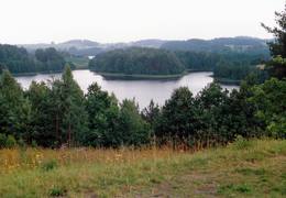
Lithuania
Tauragns (Tauragnas)Ap 9,5 km garais un līdz kilometru platais ezers atrodas subglaciālā – t.i. ledāja veidotā vagā, tādēļ tas ir ne tikai Lietuvas, bet arī otrs Baltijas dziļākais ezers (pēc dažādiem avotiem 60,5 m vai 62,5 m). Tauragna dienvidu krastā paceļas Taurapils pilskalns (Taurapilio piliakalnis). Saglabājušies nostāsti gan par pagānu priesteri, kas te dzīvojis, gan nogrimušu baznīcu, gan laikiem, kad pilskalnu no visām pusēm apņēmis ūdens. No pilskalna plakuma paveras visaptverošs skats uz Tauragnu. 117
Services
117km - Distance from countries capital city |
 |
Lithuania
Botanikas takaKaut arī Augštaitijas nacionālo parku uzskata par floristiskā ziņā ļoti bagātu teritoriju, šī ir vienīgā vieta, kur varam iepazīt augu valsts bagātību. To īstenot palīdz takas malās izvietotie informācijas stendi. 3,8 km garās lokveida takas sākums ir meklējams Palūšē, Lūšu (Lūšiai) ezera galējā austrumu punktā. Taka ved gar ezera krastu, mežainām kāpām, nelielu strautu ielejām un pa purvāju. Nenomaldīties palīdz krāsu marķējums uz koku stumbriem. 113
Services
113km - Distance from countries capital city |
 |
Lithuania
The Ilzenbergo Estate parkThis mixed-type park dates back to the latter half of the 19th century and has remained all but unchanged. It is in a lovely place between two lakes, and its spatial structure was preserved when it was restored. The park covers 10 ha and has two parts. One is a fairly precisely rectangular territory alongside the state, surrounded by a stand of linden trees and introduced trees. The other part has a natural forest. The largest oak tree in the park has been declared to be a protected element of natural heritage. The mighty trunk of the tree is 6.3 m around, has a 2m diameter and stands 30.5 m high. 1-12
Services
1-12 Active season monthsServices - amenities
Accommodation availableServices - other
Accepts tourist groups
Accepts individual travellers
This destination has specific opening hours which you must determine in advance
Optional meals |
 |
Lithuania
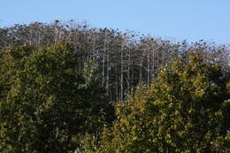
Garnu kalns (Garnių kalnas)Aiz Jodkrantes (Nidas virziens) ceļa labajā pusē ir izveidots autostāvlaukums un labiekārtota vieta, no kuras apskatāma Lietuvas (atrodamas ziņas, ka arī Eiropas) lielākā zivju gārņu Ardea cinerea un jūras kraukļu Phalacrocorax carbo kolonija, kur kopā varētu būt ~ 3000 putnu. Neaizmirstiet līdzi paņemt tālskati! 355
Services
355km - Distance from countries capital city |
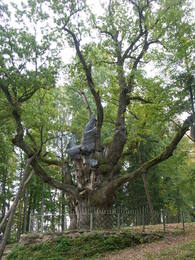 |
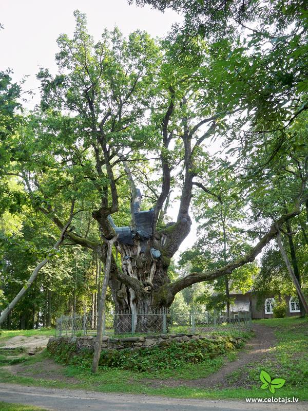
Lithuania
The Stelmuzės oak treeThis is the thickest English oak (Quercus robur) in Lithuania, with a circumference of 9.4 m (as opposed to the Kaive oak in Latvia, which has a circumference of 10.18 m).
|
 |
Lithuania
Bernsteinhaff1855, als einen Schiffahrtsweg getieft wurde, wurde im Haff unerwartet eine Bernsteinablagerung gefundet. In der Zeit zwischen 1860 und 1890 wurde dort 2250 Tonen Bernstein gewonnen, einbezogen einzigartige Bernsteingegenstände aus der Jungsteinzeit und der Bronsezeit. 319
Services
319km - Distance from countries capital city |
 |
Lithuania
Regionalpark GrazutėsGegründet für den Schutz der Landschaften und der Seen der Aukštaitija-Anhöhe, Arten und Biotope. 139
Services
139km - Distance from countries capital city |
 |
Lithuania
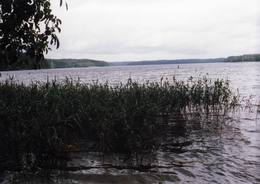
The Asveja Regional ParkThis park was established to protect Lithuania’s longest lake, Lake Asveja (> 20 km). The lake is in a sub-glacial valley carved out by ice during the Ice Age, and it actually resembles a wide and curvy river.
ServicesServices - recreational
Boat tourSpend one or two days boating on the lake and its bays.
Nature watchingViews from the Dubingiai castle hill. For more information: www.asvejosparkas.lt (only in Lithuanian). |
 |
Lithuania
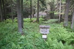
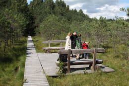
The Cepkelių Nature ParkThis is Lithuania’s largest mossy swamp, and the Čepkeliu Nature Reserve was established to protect it. Before visiting the swamp, you must register at the Dzūkijos National Park’s visitor centre (Marcinkonys, Šilagėlių gatve 11). ServicesServices - recreational
Nature trailYou can hike or bike a sandy forest road from Marcinkonys (where the reserve has a museum) (~5 km), which will bring you to the western edge of the swamp. There’s a viewing tower atop a high dune, and from there you will be able to scan a broad territory. There’s a 1.5 km trail right there with a viewing platform atop the swamp. For more information: www.cepkeliai.lt (only in Lithuanian).
|
 |
Lithuania
The Izidoras Navidanskas Zemaitija Botanical ParkOne of the oldest botanical parks in Lithuania, this one was opened by Izidoras Navidanskas in 1928, when he was only 16. In 1965, the park because the Žemaitija botanical park, and Navidanskas and his son, Rapolas, who is the current owner, did a lot to expand it.
1-12
Services
1-12 Active season monthsServices - other
Accepts individual travellers
Accepts tourist groups
This destination has specific opening hours which you must determine in advance |


