
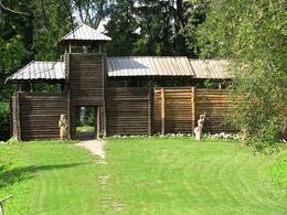
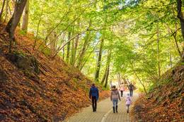
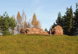
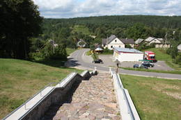
Ancient historical sites
| Overview | Details |
|---|---|
 |
Estonia
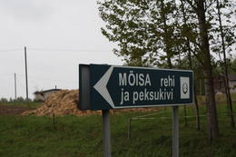
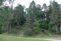
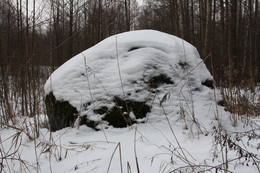
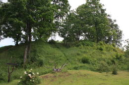
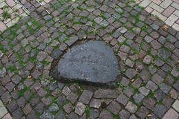
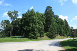
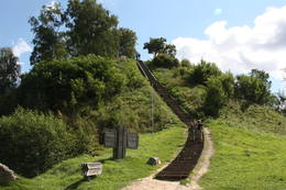
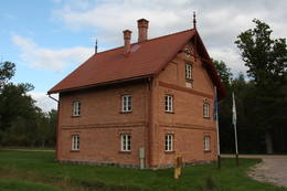
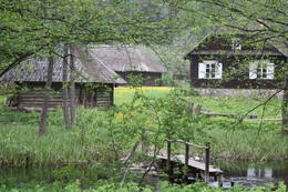
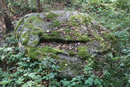
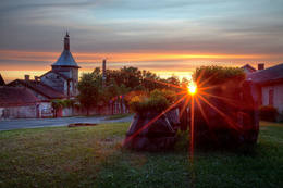
Rebasemeiza (Rebasemõisa)Neliela apdzīvota vieta nacionālā parka ziemeļrietumu daļā, kur kādreiz atradusies Rebases muiža. Mūsdienās no tās saglabājušās klēts atliekas, pie kurām apskatāms interesants vēstures liecinieks – sens akmens, ko izmantoja kulšanas procesā (Peksukivi).  260 260
Services
260km - Distance from countries capital city |
 |
Estonia
Alte Straße Pärnu-RigaDie Straße führt durch die ehemaligen Fischerdörfer. Eine bessere Radfahr-Alternative auf der Strecke zwischen Häädemeeste und Ainaži. |
 |
Latvia
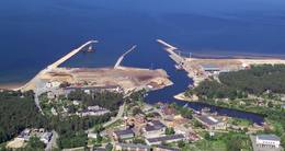
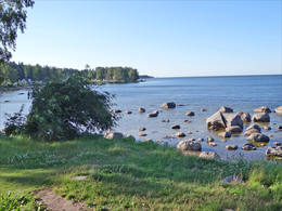
Skulte Port and ZvejniekciemsIn the 19th century at the seaside of Skulte, a small village formed, which was inhabited by fishermen. The name “Zvejniekciems” (Fishermen’s village) arose from the population's main activity. In 1967 the Skulte part of Zvejniekciems was added to the Saulkrasti township. Nowadays Zvejniekciems is the home of Skulte Port, and the rocky beach of Zvejniekciems is located between the port and Saulkrasti Beach, while the village itself can be proud of the creative heritage left by the architect Marta Staņa (1913–1972). 54
 1-12 1-12
Services
54km - Distance from countries capital city
1-12 Active season months |
 |
Latvia
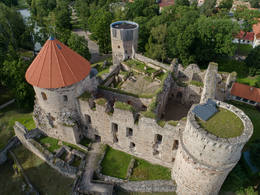
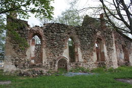
CESU CASTLECesis Castle complex is a place where the past meets the future. 
 89
89


Services
89km - Distance from countries capital cityServices - amenities
Disable AccessPilī ir lifts, kas aizved uz visiem 4 stāviem; pils dārzs ir izbraucams ar ratiņkreslu; ēkās nav sliekšņu; visās tualetēs ir viena kabīne, kas paredzēta cilvēkiem ratiņkrēslā. Vienīgā nepieejamā vieta ir abi torņi, taču var piebraukt pie īpaši ierīkota stenda, kurā ar datora palīdzību virtuāli var izstaigāt tās telpas, kuras fiziski nevar izstaigāt. Services - other
Accepts individual travellers
Accepts tourist groups |
 |
Latvia
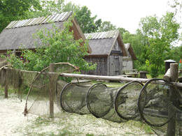
The Ragaciems fishing area with net hutsThis is a very interesting monument to the history of fishing in the region. These areas had docks and areas where fishermen built huts to store their nets and other inventory. The areas also had a social role – men came together to discuss work that had to be done, while women and children wove nets. The huts at Bigauņciems were eventually washed into the sea, and the areas at Ragaciems have been partly destroyed. The ones at Lapmežciems are the ones which are best preserved. One of the net huts has been restored, but the others are in very poor condition, indeed. That may be why you should focus on these huts as you walk along the beach. Make sure that you take some pictures of this historic location. 47
Services
47km - Distance from countries capital city |
 |
Latvia
Dzerbenes Augstais kalnsAtrodas 0,5 km ziemeļaustrumos no Dzērbenes baznīcas, ceļa otrajā pusē. Vizuāli izteiksmīgs pilskalns ar 50 x 50 m lielu plakumu, kura kultūrslānī atrastas vēlā dzelzs laikmeta apmetnes atliekas. Pilskalna rietumu nogāzē ir izveidots ceļš, pa kuru nonāksim līdz tā plakumam ar estrādi. 115
Services
115km - Distance from countries capital city |
 |
Estonia
Kassinurme hills and a sacred groveKassinurme hills were formed during the last Ice Age, and an ancient stronghold and a sacred grove can be found in the hills. At the foot of the stronghold a stage has been built; a swing, tepees, a campfire place and a model of the stronghold are located in the forecourt. Nature, health and antiquities trails are located nearby. 155
1-12
Services
155km - Distance from countries capital city
1-12 Active season months |
 |
Latvia
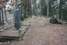
Warewolf's tombA place fraught with many legends and ghost stories about the old burial mound at the church of Mazirbe, an ancient tomb covered by stones– the only known grave of warewolves in Latvia. 177
Services
177km - Distance from countries capital city |
 |
Latvia
The place where Krisjanis Valdemars saw the seaThe biography of Krišjānis Valdemārs tells us that during the summer of 1839, teachers and students from the Lubezere school spent a few days on the coastline in Roja, where Valdemārs would later help to build a maritime school. The area was breath-taking and unforgettable for the little boy. “The noble appearance of the sea grabbed the spirit of the young man so powerfully that during those three days, I thought about nothing other than the noble sea, with childish courage that allowed me to prepare a plan for a deeper port in the Roja River so that larger boats and small ships could enter it,” Valdemārs wrote. (Source: Roja TIC) 120
1-12
Services
120km - Distance from countries capital city
1-12 Active season months |
 |
Latvia
The site of the Oak tree of loveThe site of the Oak tree of love, which was
once a symbol of the growth of Ķemeri on the
left bank of the Vēršupīte.
50
Services
50km - Distance from countries capital city |
 |
Latvia
Icas apmetnes ciemsIčas apmetnes ciems ir sena dzīvesvieta Ičas upes krastos. Apmetne atklāta 1937. gadā. Tā bijusi apdzīvota neolītā (4500 - 1500 pr.Kr.) un bronzas laikmetā (1500 - 500 pr.Kr.). Apmetnē dzīvojuši amatnieki, zvejnieki, mednieki.
 231
6-8
231
6-8
Services
231km - Distance from countries capital city
6-8 Active season months |
 |
Latvia
A monument to the founders and directors of the Kemeri spaA monument to the founders and
directors of the Ķemeri spa (1861) on the
banks of the Vēršupīte.
48
Services
48km - Distance from countries capital city |
 |
Latvia
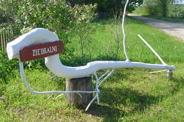
Ezermuiza-DumeleTo the East of the Ezermuiža-Dūmele road you will find the bed of the ancient Lake Dieviņezers. It was one of the largest lakes in Kurzeme in the past, being 7.5 km long and 1.6 km wide. A canal was dug in 1838 (Melnsilupe River today), and the water from the lake was siphoned to the sea so as to create fertile farmland. Residents of Ezermuiža have been involved in forestry work since the age when barons ruled the land. Dūmele is connected to Košrags by a lonely forest road that is known as the Bottom Road. A bike route runs down it. The Ziedkalni weekend house is in Dūmele. The "Ziedkalni" homestead in Dūmele offers spa services, cod fishing and accommodations. 148
1-12
Services
148km - Distance from countries capital city
1-12 Active season months |
|
|
Latvia
The Cemetery of the Brethren of LacukrogsThe Cemetery of the Brethren of
Lāčukrogs offers a final resting place to
men who fell during World War I.
47
Services
47km - Distance from countries capital city |
|
|
Latvia
The Old Suiti road(V-1279) linked Kuldīga and Alsunga before a new road was built. The lovely gravel road weaves through forests and farmland. During appropriate weather, it can be used as an alternative road to learn about the landscapes of the Suiti region. You can also bike down the road. 176
1-12
Services
176km - Distance from countries capital city
1-12 Active season months |
|
|
Latvia
Jomas StraßeBeliebte und eine der ältesten Straßen in Jurmala zwischen Dzintari und Majori. Die 1,1 km lange Straße mit Wirtshäusern, Sommercafés und Souvenirladen. 23
Services
23km - Distance from countries capital city |
 |
Latvia
Boundary-mark between Kurzeme and VidzemeThe historic stone, on which there is carved over 200 years old boundary-mark, sets the border between the Duchy of Courland and the Russian province. Nowadays, it sets the Babīte and Jelgava district boundary. The stone lies to the East of Kalnciems–Peat road (the south of the swamp Labais purvs) at the edge of a forest firebreak and it can be hard to find. To this end, the description of the road map may help: around 400 m south of the car parking lot at Lily Lake from Kalnciems-Peat road to the right (in the east) turns a forest road which leads down from hills Krāču kalni. It should be around 170 m to go until it abruptly turns to the right (to the southeast). Then you must go in this direction until after ~ 0.5 km to turn to the northeast where after further ~ 0.4 km of the current forest road intersection turn to the north. After ~ 0.4 km turn right (to the east) on a big firebreak, on the left (the north) side of which behind the drainage ditch during the non-leaf period there can be seen a rounded stone. Due to the poor condition of roads, the stone can be reached only on foot. 53
Services
53km - Distance from countries capital city |
 |
Latvia
The Lasu castle hillThe Lašu castle hill is 0.2 km from the Vecumnieki-Ilūkste road at Laši. It is an ancient Selonian castle hill, and it was populated between the 1st millennium BC and the 10th or 12th century. Very little remains of the old Veclaši (Tiesenhausen) Estate, which had an impressive mansion designed in the Neo-Gothic style in the late 19th century. What remains are an ancillary building, the foundations of the mansion, fragments of the gates, and a park. Until 1920, the estate belonged to the Pshezdzetski dynasty, and before that it was owned by the Tiesenhausen and Fittinghoff dynasties. Before visiting the location, look for photographs of the old mansion on the Internet. Sadly, the important cultural monument has not experienced any major improvements over the past 20 years.
184
Services
184km - Distance from countries capital city |
 |
Estonia
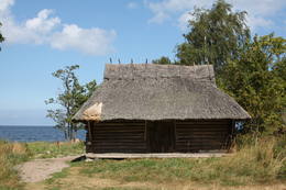
Metsanurme Village CentreIn Metsanurme Village Centre you can see restored old threshing barn, limestone barn oven and few tools that were used ages ago. You could be also interested in seeing an outdoor exhibition which focuses on historical agricultural tools. All of this is made to look interesting to not only locals but also visitors. |
 |
Latvia
Svetkalns (Zviedru kalns)Svētkalnā atradusies krustnešu nocietinātā pils. Zemgaļiem to nebija pa spēkam ieņemt, tādēļ, nodedzinādami savu pili Tērvetes pilskalnā (1286. g.), tie aizgāja uz Raktes (Žagares) novadu Lietuvā. Kad Svētkalna nocietinājumi bija zaudējusi savu militāro nozīmi, krustneši to nojauca. 1701. g. Ziemeļu kara laikā Svētkalnā atradās zviedru armijas nocietinātā apmetne, no kā arī cēlies vietvārds. Domājams, ka pirms tam šajā vietā atradusies seno zemgaļu svētvieta. No Svētkalna paveras viena no skaistākajām un biežāk fotografētajām Tērvetes ainavām. 75
Services
75km - Distance from countries capital city |
 |
Latvia
Grisku kalnsAtrodas 0,3 km ziemeļos no Vecpiebalgas pilsdrupām. Ap 10 m augsto, bet visnotaļ izteiksmīgo Grišku kalnu sauc arī par Piebalgas, Balgas un Veļķu pilskalnu. 13. gs. šeit bijusi svarīga apmetnes vieta ar mākslīgi nostāvinātām nogāzēm un dziļu aizsarggrāvi. Vēstures notikumi ir atstājuši ap metru biezu kultūrslāni. Bezlapu laikā no kalna paveras skats uz Vecpiebalgas baznīcu un pilsdrupu vietu. Pilskalna piekājē ir aka ar Griškavotu. 128
Services
128km - Distance from countries capital city |
|
|
Estonia
Roter Turm von PärnuDer Turm war der Eckturm der mittelalterlichen Stadtmauer von Pärnu. Der Turmhof ist ein beliebter Ort für Kunsthandwerkermärkte und ein Veranstaltungsort. 129
Services
129km - Distance from countries capital city |
 |
Latvia
A walk through historical locations in KalteneKaltene features several homes where shipbuilders used to live – Caurnāši, which was home to the Bertliņi family, Ilmati, where six ailing ships were built, Maizītes, where the Stahl family of ship builders built 16 two-mast and three-mast ships, and Dambekalni, which was once one of the first canned fish factories on the coastline. To the side of the sea are the old boat piers of Kaltene. In 1936, a board pier was built by the Freijs family from Roja. It was 200 m long and had room for some 50 boats. All that is left are wooden poles that have been eaten away by the sea and time. If you want to learn about the specifics, difficulties and challenges of fishermen today, visit Ervīns Vilciņš in Ķirķrags. He will tell interesting stories on the basis of his experience. You can watch as he fishes in the morning and then taste the fish that he has caught. (Source: Roja TIC) 112
1-12
Services
112km - Distance from countries capital city
1-12 Active season months |
 |
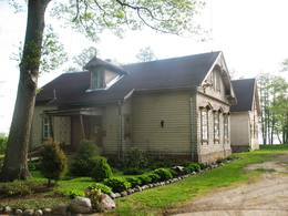
Latvia
VecvalkiThis set of buildings represents a homestead for a fisherman and a farmer. The house was built in 1926, and the ancillary buildings all date back to the first half of the 20th century. The homestead can be seen from the road. 172
Services
172km - Distance from countries capital city |
 |
Estonia
Raja-Kükita-Tiheda-Kasepää one-street villageOld Believers, who fled persecution from the Russian Orthodox church because of their refusal to adapt to church reforms, settled down on the western shore of Lake Peipsi in the 17th and 18th centuries. 180
1-12
Services
180km - Distance from countries capital city
1-12 Active season months |
 |
Latvia
The Struves ParkThe Strūves Park is toward the northwest of Jēkabpils, on the left bank of the Daugava, and opposite the Ādamsona (Krustpils) island. The park was established in the 19th century as a place where the city’s residents could relax and hold celebrations. It can be said with absolute certainty that this is a place of global importance, because the park contains a memorial stone to Professor Friedrich Georg Wilhelm Struwe (1793-1864) from the University of Tartu. He was an astronomer and geodesist. The stone is at a place where Struwe completed his land survey of the Vidzeme Province of the Russian Empire. The meridian location which Struwe identified (and other points related to those locations are found in many other European countries) is on the UNESCO list of world heritage. 141
Services
141km - Distance from countries capital city |
|
|
Latvia
The former Kirbizi ship building facilityDuring the latter half of the 19th century, one of the largest ship building facilities was located here between the Dzeņi and Lielkalni homesteads. It was known as the Ķirbiži and then the Vitrupe shipyard, though nothing remains of it. 28 ships were built here between the 1860s and 1929. 90
1-12
Services
90km - Distance from countries capital city
1-12 Active season months |
 |
Estonia
Käsmu Captains' VillageIn 1804 Käsmu founded the first Estonian naval school and from 1798 – 1920 built more than 40 ships. Now there is a museum about seafaring. 79
Services
79km - Distance from countries capital city |
 |
Latvia
The Baki castle hillThis may be an ancient cult object, and today it is a little hill in the dunes that is a bit larger than other local hills. It is said that a church once sank into the dune. This tale suggests that there was a Christian or pagan prayer place here at one time. (Source: Roja TIC) 143
1-12
Services
143km - Distance from countries capital city
1-12 Active season months |
 |
Estonia
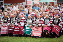
SetomaaSetomaa in South-East Estonia is a unique area for its people (the Seto) and culture. The historic location in the borderland between East and West, straddling two languages and cultures has shaped the local language, life style, clothes and food. A very specific type of singing – leelo – is incorporated in the UNESCO list of Masterpieces of the Oral and Intangible Heritage of Humanity.
1-12
Services
1-12 Active season months |
 |
Latvia
KlosterkalnsAtrodas Tērvetē, Dobeles – Elejas ceļa malā, 0,2 km dienvidrietumos no Tērvetes pilskalna. Ar mežu apaugušais paugurs ir sena apmetnes vieta, kas bijusi apdzīvota jau 1. g.t. pr. Kr. Teika stāsta, ka kalnā bijis klosteris, kura mūki pēc klusēšanas pārkāpuma saulgriežu laikā kopā ar visu celtni nogrimuši kalna dzīlēs. 75
Services
75km - Distance from countries capital city |
|
|
Latvia
The Cemetery of the BrethrenThe Cemetery of the Brethren. A wood
pathway leads from the RīgaVentspils highway
(A10) to a memorial rock dedicated to men who
fell during World War II.
41
Services
41km - Distance from countries capital city |
 |
Latvia
The Kemeri Post OfficeThe building was erected during the first period of Latvian independence, and it maintained its functions for a long time. The building is located at Tukuma Street 30. Beginning in 1940, the post office had an automated telephone central. The Postal Service no longer uses it, and the building can only be viewed from the outside. 47
Services
47km - Distance from countries capital city |
 |
Latvia
Bijusi Grobinas dzelzcela stacijas ekaTaisnā Celtnieku iela ir bijušās Liepājas – Aizputes šaursliežu dzelzceļa (celta 1900. gadā, 49 km gara) līnijas „trase”, kuras malā (Celtnieku ielā 50) redzama bijusī dzelzceļa stacijas ēka. 204
Services
204km - Distance from countries capital city |
 |
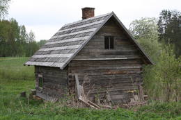
Latvia
Sepi (Seppes), KalsiApproximately 200 metres to the North-East from the Liv People's Centre, along the Mazirbe-Košrags road, there is the Seppes homestead. The little log granary was built in the 1920s and 1930s by an Estonian fisherman and builder who arrived in Mazirbe from Saaremaa. He was called Jēkabs Jaga. On the other side of the road is the Kalši home, which was built in the early 20th century. It has been restored, but the bricks that were made in a local kiln were preserved for its walls. 172
Services
172km - Distance from countries capital city |
 |
Latvia
Vesturiskais serpentina celsŠis ir viens no retajiem ceļiem, kurš saglabājies kā notikumu liecinieks. Ceļš ved no Krimuldas uz Siguldu. Jau vācbaltu apgaismotāja novadpētnieka – mākslinieka Johana Kristofa Broces 1794. gada zīmējumā "Siguldas un Krimuldas pilsdrupas" redzams lauku ceļš gar Krimuldas pili, pa kuru iet zemnieks un darba ratus velk zirgs. Lai braukšana pa Gaujas senlejas nogāzi ar zirga pajūgu būtu droša, ceļu izveidoja līkloča formā, tā uzbrauktuvi padarot daudz lēzenāku. Domājams, ka ceļš atjaunots 19 gs., kad Krievijas cars Aleksandrs otrais un viņa sieva ieradušies uz vizīti siguldā. Pāri ceļam bijuši vairāki mazi tiltiņi, ko iedzīvotāji dēvējuši par velna tiltiem. Tagad serpentīna ceļš kļuvis par romantisku pastaigu vietu. 53
1-12
Services
53km - Distance from countries capital city
1-12 Active season months |
 |
Latvia
Liepajas Petera I naminsНаходится на ул. Кунгу, д. 24.Одно из старейших зданий города - деревянный сруб с черепичной крышей, построенный во второй половине XVII века и прозванный в народе гостиницей мадам Хойер. Здесь в 1697 году во время путешествия «Великого посольства» в западную Европу останавливался (инкогнито) русский царь Петр I. Находящееся по соседству здание на ул. Кунгу, д. 26, является вторым старейшим жилым зданием Лиепаи (1699 г.) – жилой дом бургомистра города. Во время Северной войны здесь останавливался король Швеции Карл XII. Оба здания подлежат осмотру только снаружи. 217
Services
217km - Distance from countries capital city |
 |
Lithuania
Tomas-Mann-HausEin zweistöckiges Holzhaus auf dem Uošvės-Hügel mit wunderschönem Blick aufs Haff. Hier hat drei Sommer der Träger des Nobelpreises, deutscher Schriftsteller Thomas Mann (1875 – 1955) verbracht. 357
Services
357km - Distance from countries capital city |
 |
Latvia
The stone age settlement of the river SilinupeIt lies between Pīlādžu street and the left bank of the river Siliņupe. In the 3rd to 2nd millenium B.C., there was a fishermen and hunters' settlement in the place of which there is installed an informational commemorational stone (Sculptor O.Skarainis). The settlement near the river Siliņupe is the oldest known human settlement in the area of the Ķemeri National Park. There are found many artifacts: pottery fragments and arrow tips, flint and amber pieces, etc..It is possible that the adjacent residential area has been the place of a cemetery. A small portion of the finds is displayed at the Lapmežciems Museum, the other ones are located in the National History Museum of Latvia. 44
Services
44km - Distance from countries capital city |
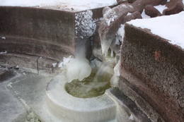 |
Latvia
Sulphur water spring with pavilionBuilt in the turn of the19th to 20th century. Next to it-on the right bank of the river Vēršupīte, there is located one of the most popular Latvian sulphur water springs, called "Small lizard". The spring runs out from a stone-designed lizard sculptured in 1949 (Sculptor J. Bajārs). Its water is healthy for using both internally and externally. Not far from the pavilion there can be found Jānis Lībietis alley sign. J. Lībietis worked in the position of a director for the sulphur water spring authority of Kemeri from 1928 to 1944. 58
Services
58km - Distance from countries capital city |
 |
Latvia
Vartajas pilskalnsAtrodas Vārtājas ielejas labajā krastā un labi saskatāms no Priekules – Grobiņas (P106) ceļa. Senās kuršu zemes – Piemares pilskalns, kas vēstures avotos pirmo reizi minēts 1253. gadā – līgumā starp Kurzemes bīskapu un Livonijas ordeni. Viens no lielākajiem Dienvidkurzemes pilskalniem. Iespējams, ka iepriekš – arī sens kulta kalns. Pagājušā gadsimta sešdesmitajos gados veiktajos arheoloģiskajos izrakumos konstatēts, ka pilskalns bijis apdzīvots jau vidējā dzelzs laikmetā. Pie tā konstatēta liela senspilsētas vieta. 216
Services
216km - Distance from countries capital city |
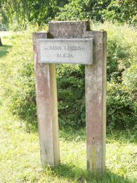 |
Latvia
Marking of the Janis Libietis AlleyMarking of the Jānis Lībietis Alley in the
Ķemeri Park – Lībietis directed the institution
which managed the Ķemeri sulphurous springs
from 1928 until 1944, and the monument to
him is at the end of the Jānis Lībietis Pathway
48
Services
48km - Distance from countries capital city |
 |
Latvia
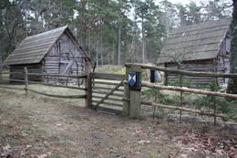
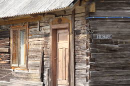
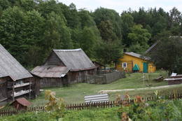
The most interesting buildings and homesteadsVāldamõ – a residential building that is yellow and has natural roofing materials. It was built as a new farm at the beginning of the last century. Virgo is the next homestead to the North from Vāldamõ, and it was established as a new farm in the 1920s. The house (1930) features interesting wood carvings. Next to the North is Fīlmaņi, which has a building that appears antique, but was built in the early 20th century as a single roof. Silkalni is the homestead that we find if we turn to the right toward Pitrags at the crossroads. The yellow building was built around 1906 as a single room. Norpiedagi is to the South from Silkalni – a brown and larger house than the previous one. The home was built around 1906 as a one-room granary by the active Liv public activist and boat builder Diriķis Volganskis (1884-1968). His son, Edgars Valgamā, who was also a Liv cultural activist and worked as a pastor in Finland, was born here. Anduļi can be found at the aforementioned crossroads. This is one of the largest old farms in the village, and it is owned by the village elder. The history of the homestead was first recorded in 1680, when it was called Kūkiņi. The homestead includes a residential building (c. 1909), a threshing barn (1905), a granary (mid-19th century), and a smokehouse made of a boat that was cut in two. Under the part of the threshing barn which is on the back of the dune, there is the medieval, so-called Plague cemetery. Žoki is a homestead that is on the other side of the road from Anduļi. The building that is there now was built on the foundation of an older one. In the mid-19th century, Žoki was home to the first reading school for Liv children from the seashore villages of the Dundaga region. Liv Nika Polmanis (1823-1903) worked there as a teacher. Next to the North of Žoki is the Tilmači homestead, with several buildings that were built in the late 19th and early 20th century – a brown residential building, a stable and part of a granary. When the residential building was restored, the owner found a board reading "1825. Kurlyandskaya gubernya." The seven historical homesteads and buildings were at one time considered for listing on the UNESCO list of world heritage. 175
Services
175km - Distance from countries capital city |
 |
Latvia
Stafenhagena namsНаходится на ул. Базницас, д. 17. Здание построено в XVII веке, как жилой дом кулдигского бургомистра. В 1701 году здесь гостил король Швеции Карл XII, который в передней оставил огромный сундук (2 х 2,5 м), на который после реставрации можно взглянуть и сегодня. 156
Services
156km - Distance from countries capital city |
 |
Latvia
A memorial stone to Augusts MuizulisThe memorial stone to Augusts Muižulis,a recipient of the Lāčplēsis Military Order, is placed in the Lapmežciems, at the edge of the road (P 128, Jūrmala-Talsi) at the marker for the 9th kilometre. A. Muižulis, (189 –1941) was a lieutenant colonel in the No. 4 Valmiera Infantry Brigade. The adjacent Tuteņi homestead is his native home. 44
Services
44km - Distance from countries capital city |
 |
Latvia
Death IslandThis was an island after the Rīga hydroelectric power plant created a reservoir, and before that it was a peninsula on the Left Bank of the Daugava. During World War I, there were massive battles between Latvian Riflemen and a much larger German army on Death Island. On December 25, 1916, the Germans used poisonous gas against the Latvian troops. In honour of this, the architect Eižens Laube designed a monument to fallen Latvian riflemen on the northern shore of Death Island. It was unveiled in 1924. Death Island can be reached by boat, and the trenches and graves there are of interest. There is a pier for boats on the north-western shore of the island, and nearby is a location for leisure. Some of the trenches and dugouts have recently been restored. The battles were described by Aleksandrs Grīns in his masterpiece, “Snowstorm of Souls.” 34
Services
34km - Distance from countries capital city |
 |
Latvia
The Vacsloboda castle hillThis partly forested hillock stands 40 metres above the surrounding area and offers impressive views. The fact that this was once a castle hill is attested by the presence of a moat and remnants of defensive fortifications. It is thought that Lettigalian tribes settled here in the 10th century AD. You can climb the hillock to take a look at the surrounding landscapes. 270
Services
270km - Distance from countries capital city |
 |
Latvia
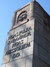
SudrabkalninsThis is a sand dune that is covered with pines and has a monument to soldiers from Company 6 in Rīga, who defended the city in 1919. It was from this place that the soldiers went into battle against the numerically much larger army of Bermont-Avalov to liberate Rīga and its Pārdaugava neighbourhood. Created by the sculptor Kārlis Zāle, the monument features a wall facing Slokas Street that is 12 metres tall and is a depiction of the head of a lion that was once part of the gates to Rīga. The side walls on both sides have bas relief depictions of Ancient Latvians and soldiers from 1919. Atop the dune is an area with an altar, a sacrificial dish, and a memorial plaque to commemorate those who fell in battle. The monument was unveiled in 1937 by President Kārlis Ulmanis. 1-12
Services
1-12 Active season months |
 |
Latvia
The Skrunda Castle hillLocated on the left bank of the Venta River 100 m to the Northwest of the Liepāja (A9) highway bridge across the river. The antique castle hill was the site of a Livonian Order that existed from the 14th to the 18th century before being sacked during the Great Northern War. No part of the castle has survived. A stage was built on the castle hill in 1987, and it is a popular venue for various events. The hill is surrounded by a park with wooden chairs that were designed by the sculptor Ģirts Burvis in honour of the kings of Courland. There is a viewing platform, and there are legends about underground passages and a white lady who appears only once every 100 years. 147
1-12
Services
147km - Distance from countries capital city
1-12 Active season months |
|
|
Latvia
The Apakscels roadThe Apakšceļs road – a lonely, forested and ancient road between
Košrags and Dūmele, with lots of interesting stories about the old Pitragupe
windmill, which never did grind any grain (the foundations are still there), and
about the boiler of a wrecked ship which a local baron used to produce tar.
This used to be a horse path which crossed the Bažas swamp. The great rock
of Dūmele is impressive, indeed.
182
Services
182km - Distance from countries capital city |
 |
Estonia
Ringwall MuuksiEine der größten befestigten Siedlungen im Bezirk Harju, befindert sich auf einer Erhebung des natürlichen Kliffs Nordestlands. 49
Services
49km - Distance from countries capital city |
 |
Latvia
KurgatiTo the North-west from the Pitrags Baptist church (in the direction of the sea) is a fishing and farming homestead, Kurgati, which was established in the 1930s. This brought new building elements to the Liv Shore – a split roof end which was not typical of buildings in Liv villages. 176
Services
176km - Distance from countries capital city |
 |
Lithuania
MerkinėEine der ältesten Ortschaften Litauens. Schon im 14. Jh befand sich hier eine Holzburg. Der 20 m hohe Merķine-Burgberg an der Mündung der Flüsse Merkys und Nemunas. 104
Services
104km - Distance from countries capital city |
 |
Latvia
Robezu StreetA straight street which runs through Ķemeri in the northwestern-southeastern direction. The street's name is a proof that it is the former historical boundary between the regions of Vidzeme and Kurzeme. Near the intersection of Robežu and Tukuma streets, you can notice the former pharmacy building-the memory of the former resort of the all-union significance. On the walls there has survived the pharmacy-related symbolism. 47
Services
47km - Distance from countries capital city |
 |
Lithuania
Linezeris (Lynezeris)Grūti iedomāties, ka vēl joprojām Eiropā ir apdzīvotas vietas, kuru sasniegšanai ir labu laika sprīdi jābrauc pa neapdzīvotu mežu ieskautu smilšainu ceļu, kur tikai paretam var redzēt kādu sēņotāju vai ogotāju! Tāpat kā Zervinos ciemam, arī šim ir piešķirts kultūras mantojuma pieminekļa statuss, jo Linežeris ir viens no dažiem nacionālā parka etnogrāfiskajiem ciemiem. Linežerī ir aplūkojamas 19. – 20. gs. mijā celtās ēkas un apskatāms tā laika ciema plānojums. Šejieniešu tāpat kā citu dzūku galvenā nodarbošanās bija mežistrāde un meža velšu vākšana. Nelielā mērā – arī lauksaimniecība. Apceļojot nacionālā parka etnogrāfiskos ciemus, rodas pamatots jautājums: „Ar ko mūsdienās te nodarbojas cilvēki. Kā viņi spēj dzīvot tik nomaļā vietā”? Jāatzīst, ka lielākā daļa te ierodas tikai vasaras laikā. Neskatoties uz to, etnogrāfiskie ciemi ir ļoti sakopti un joprojām „dzīvi”! 117
Services
117km - Distance from countries capital city |
 |
Latvia
Old Burial MoundThe Middle Ages and the beginning of the last century cemetery at the church of Mazirbe. It is surrounded by a moss-covered stone fence. There you can find a number of interesting sights-Werewolf's Tomb, Old Taizelis Tomb, Grand Pine, etc.. 175
Services
175km - Distance from countries capital city |
 |
Estonia
Altja fishing villageAltja village in Lahemaa National Park was first recorded in writing in 1465. It is a typical seaside village with houses along one street. Traditional farmsteads of Uustalu and Toomarahva from the late 19th C are open to visitors. Renovated fishnet sheds are located on Altja Cape. The village has a swing and a tavern (Altja Kõrts) providing national food 89
1-12
Services
89km - Distance from countries capital city
1-12 Active season months |
 |
Latvia
The remnants of the Vardite sulphurous springThe remnants of the Vardīte sulphurous
spring – not easy to find, but the location is
between the Forest House and the Ķemeri
Hotel.
48
Services
48km - Distance from countries capital city |
 |
Estonia
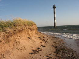
Kipsares baka (Kiipsaare tuletorn)Harilaidas galā no jūras ūdens paceļas 26 m augstā Kīpsāres bāka – viena no neparastākajām Igaunijas bākām. Tā celta 1933. g., kad jūra no bākas atradās ~ 100 m attālumā. Krastu noskalošanas rezultātā tā tagad ir viļņu ieskauta. 273
Services
273km - Distance from countries capital city |
 |
Estonia
Mustvee villageA haven for Russian Old Believers. Mustvee village has held fairs for the past two centuries. It is also a traditional fishing town.
174
Services
174km - Distance from countries capital city |
 |
Latvia
Vijciems, pine cone dryingVijciema čiekurkalte ir viena no retajām vēsturiskajām čiekurkaltēm Eiropā, kas celta 19. gadsimtā, un ir ne vien teicami saglabājusies līdz mūsdienām, bet arī, izmantojot vairāk nekā 100 gadus senas iekārtas, čiekurkaltē arvien tiek žāvēti čiekuri, lai iegūtu augstas kvalitātes meža sēklas. Pateicoties ēkas bagātajai vēsturei un senajām čiekuru žāvēšanas tradīcijām, Vijciema čiekurkalte ir iecienīts tūristu objekts, kas piesaista vēstures, dabas un tehnoloģiju interesentus. Vijciema čiekurkaltes apmeklētājiem ir iespēja doties izzinošā ekskursijā gan individuāli, gan grupās. Ekskursijas laikā ir iespēja atklāt čiekurkaltes vēsturi, skatīt čiekuru apstrādes cikla demonstrāciju, kā arī uzzināt, kur, kā un kāpēc čiekuri tiek lasīti. Ekskursijas un individuālos apmeklējumus iepriekš jāpiesaka, zvanot 26478620. Cena
159
1-12
Services
159km - Distance from countries capital city
1-12 Active season months |
 |
Latvia
Swedish scanst (Kuce Hill, Jumprava Hill)Swedish scanst (Kuce Hill, Jumprava Hill). Medieval fortification. The monument of national meaning
is located in the village Stari 450 m from Atspuki mill, 70 mto the Southeast from the ruins of Jumpravmuiža.
The territory is 0,7 – 1 m deep outside and 1 – 1,5 m high inside. The new road to the ruins of Jumpravmuiža
leads through the West side of the fortification.
|
 |
Estonia
Kolski un Kobasare (Koobasaare)Divas mazas apdzīvotas vietas nacionālā parka dienvidrietumu daļā. No kādreiz piecām Kolski ciema saimniecībām līdz mūsdienām ir saglabājusies tikai viena. Kolski iedzīvotājus līdzīgi kā citviet Baltijas valstīs pēc 2. pasaules kara deportēja uz Sibīriju. Kolski apkārtnē redzamie mājdzīvnieki „apsaimnieko” šejienes pļavas, neļaujot tām aizaugt ar mežu. Tādējādi tiek uzturēta apkaimes vēsturiskā ainava. 3 km dienvidrietumos meklējams Kobasāres ciems. Tā nosaukums (koopa no igauņu valodas nozīmē ala, saar – sala) atgādina par Ziemeļu kara notikumiem, kura laikā cilvēki slēpušies pašu raktās alās. Kobasārē un tam blakus esošajā Apjas (Apja) ciemā var izbaudīt patiesi 21. gadsimtam nepierastas lauku ainavas. 265
Services
265km - Distance from countries capital city |
 |
Lithuania
LiskiavaEine alte Ortschaft am linken Ufer des Flusses Nemunas. Liškiava-Kirche und Kloster, heiliger Berg und Burgberg mit den Ruinen der am Ende des 14. Jh unter Leitung von Vytautas der Großen gebauten Burg. Ein Kultstein mit einem Kühstapfen.
125
Services
125km - Distance from countries capital city |
 |
Lithuania
Etnografische DörfeSalos, Vaišnoriškė, Strazdai, Šuminai sind die bewohnten Dörfe im Augštaitija- Nationalpark, in denen historische Einzelgehöfte mit Holzgebäuden erhalten sind. 125
Services
125km - Distance from countries capital city |
 |
Latvia
Stupelu HillStupeļu Hill is 3 km to the South of the Vecumnieki-Ilūkste road. There are no signs, so the castle hill might be difficult to find. The Great Stupeļu Rock, which is discussed further on in this guidebook, is also hard to find when there is vegetation. Stupeļu Hill is approximately 30 m high, and it was one of the highest castle hills in the historical district of Selonia. Archaeologists say that it was first abandoned at the beginning of our era and then populated again during the late Iron Age. It is interesting that iron was extracted and processed near the castle hill. Archaeologists believe that this is the site of one of the earliest “cities” in the region. To the West of the hill is the Great Stupeļu Rock, which is 6.7 m long, 5.6 m wide and up to 2.7 m high. Above ground, it is 35 m3 large, and it may have been a cult location. During archaeological digs in the late 1970s, antiquities from the 10th to the 13th century were found here. 130
Services
130km - Distance from countries capital city |
 |
Latvia
Tirgonu iela LiepajaPirmā Liepājas gājēju iela. 140 m garā iela par gājējiem piemērotu tika pārveidota mūzikas festivāla “Mēs Liepājai” (1988. g.) laikā savāktajiem līdzekļiem. Daudzo veikalu un kafejnīcu dēļ iela ir dzīva, tāpēc vietējo iedzīvotāju un viesu iecienīta. 216
Services
216km - Distance from countries capital city |
 |
Latvia
A walk down the old Kaltene roadThe cosy land road along the sea is 1 km long, and it offers a look at the wonderful aspects of the village. To the right are rocks from the sea, as well as miniature flower gardens on the seashore with tempting benches and overturned boats. On the side of the shore is the Kaltene library, which is more than 100 years ago. It was initially a summer home for Baron Nolken, and it was built in 1899. Later it was rebuilt several times and took on new roles. An elementary school was installed here in 1926, after which it became a club and then, in 1992, a primary school once again. The path runs along beautiful seashore homesteads, among which one can find the former homes of old fishermen and ship builders such as Burliņi. At one time, the Žulnieki portage at Smilgas was the site of the kiln of blacksmith Pēteris Valdemārs. He was the main blacksmith for ships between Kaltene and Upesgrīve. (Source: Roja TIC) 112
1-12
Services
112km - Distance from countries capital city
1-12 Active season months |
 |
Latvia
The trail of historical rocksNear Mākoņkalns hill there is a trail that is mowed in the summer and leads to several historical rocks – Plakanais (Flat) rock, Āža muguras (Ram's Back) rock (on which you can clamber), and the Jaunstašuļi Velna pēdas (Devil's Footprint) rock, on the surface of which is a shape similar to a human footprint. There are signs along the side of the road leading to the trail. 283
Services
283km - Distance from countries capital city |
 |
Latvia
Mezabralu bunkursPie Vidzemes šosejas pirms Melturu tilta pāri Amatai ir privātais muzejs "Mežabrāļu bunkurs". Bunkurs izveidots, lai varētu vēstīt par Nacionālo partizānu mežabrāļu cīņu laikā no 1944.-1956. gadam, kad mežos pret okupācijas varu cīnījās ap 20 000 Latvijas patriotu. Nacionālo partizānu bunkurs izveidots balstoties uz savāktajām mežabrāļu atmiņām, dienasgrāmatu pierakstiem un fotogrāfijām. Uz bunkuru ved meža taka ar informāciju par dažādiem mežabrāļu piedzīvojumiem un cīņām. Bunkura pazemes daļā apskatāmi vēsturiskie priekšmeti, kas viņus pavadīja dzīvē un cīņā. Saimnieks piedāvā pastaigu pa meža taku, kur izvietota informācija par mežabrāļiem un slēpņu spēle bērniem. Ar iepriekšēju pieteikšanos iespējams iekļūt bunkurā un apskatīt iekārtotu bunkuru ar mežabrāļu izmantoto ieroču, munīcijas un citu priekšmetu ekspozīciju. Stāstījumu papildina savāktās mežabrāļu interviju videoieraksti. Apmeklētājiem iespējams pasūtīt mednieku desiņu cepšanu lapenē pie bunkura. |
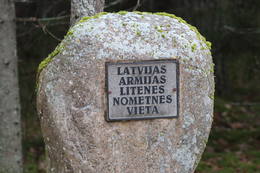 |
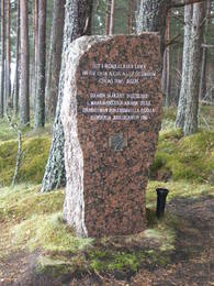
Latvia
Latvijas armijas Litenes vasaras nometnes vietaName of Litene is associated with one of the most tragic pages of Latvian history. In twenties and thirties of the 20th century a Latvian Army summer camp was located nearby, where in the summer of 1941 Latvian officers faced the communist terror: Nearly five hundred officers of Latvian army were sent to Norilsk in Siberia, part of them was shot and secretly buried in the nearby forest. At the end of the summer of 1941 about 300 civilians, mostly Jews, were shot there by the army of Nazi Germany. Today, honouring the memory of people killed, memorial and memorial sites are created. 202
Services
202km - Distance from countries capital city |
 |
Latvia
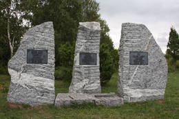
Sluggish MileAround 6 km in length and an isolated route stretching between Ragaciems and Klapkalnciems where, as stories about olden days tell, robbers used to attack travelers. Around 1.5 km before Klapkalnciems (going from the side of Ragaciems), in the dune by the sea there is installed a commemorational stone dedicated to the Finnish jaeger battles. It was installed on December 09, 1997. The stone has "travelled" from the south-eastern part of Finland where in 1940 it served as an anti-tank defense. In the monument, there are engraved the words, "Here during World War I, from August 1916 to December fought the Finnish yeagers". In turn, in Klapkalnciems there is installed a commemorational stone in the place where there are buried five Finnish soldiers. 52
Services
52km - Distance from countries capital city |
 |
Latvia
Vilces pilskalnsNo Vilces muižas pa pastaigu taku var aiziet līdz pilskalnam (12 m virs apkārtnes, labiekārtots), kas atrodas Vilces un Rukūzes upīšu satekā. Atradumi liecina, ka cilvēku apmetne šeit ir pastāvējusi jau vidējā dzelzs laikmetā. Pilskalna piekājē atrodas atpūtai labiekārtotā Zaķu pļava. Nostāsti vēsta, ka Vilces grava bijusi laupītāja Kaupēna slēpšanās vieta. 78
Services
78km - Distance from countries capital city |
 |
Latvia
The Trommel castle hillNear the place where the Kilmiņupe River flows into the sea is the legendary Trommel castle hill, which was a Medieval fortification. It is some 100 m from the Kraujas homestead. An archaeological dig in 1977 found fragments of bricks and pot-bellied stoves, which suggests that the fortifications date back to the Middle Ages. The location also is linked to stories about a pirate, Trommel, who buried his loot here. The holes in the area have been left behind by treasure hunters. Trommel supposedly robbed ships in the Bay of Rīga from the shores of Kurzeme to Roņu Island. Many ships docked here in ancient times, waiting for better winds so that they could pass by Cape Kolka. The pirate made use of this fact, also pillaging property from sunken ships. It is said that Trommel lived in a stone castle. (Source: Roja TIC) 143
1-12
Services
143km - Distance from countries capital city
1-12 Active season months |
 |
Lithuania
Margionis (Margionys)Neliela apdzīvota un ainaviska vieta plašajā Skrobļa (Skroblus) strauta ielejā. Ciema austrumu pusē atrodas Lietuvas mērogā unikāls objekts – klēts - rija, kur no 1929. g. vietējie cilvēki uzveda un skatījās lauku teātra izrādes. Netālu no tās (uz abiem objektiem ir norādes) atrodas Skrobļa avoti (Skroblaus versmės), kas iztek no dziļas starppauguru ieplakas. Avotu gan ir appludinājis bebru uzceltais dambis. Dienvidos no ciema atrodas vecs grants karjers, kas ir viena no retajām vietām Baltijā, kur dabā ir atrodami krama ieža gabali, kas atnesti ar ledāju. 115
Services
115km - Distance from countries capital city |
 |
Latvia
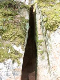
The Vejupite ravineThe Vējupīte ravine is meant for those who are not afraid of long and steep wooden stairs of the type that lead you up and down the ravine. From the Līvkalns guesthouse, you can climb the stairs downward, where you will find a shallow (3.6 m) but high (6.1 m) cave – the Pēters Cave. It is something of a gap or a niche. Another 10 minutes or so downstream (toward the Gauja) will lead you to the deep Pūces ravine and its Kraukļupīte River. The Satezele castle hill is at the confluence of the two rivers (90 x 75 m). A wooden castle was there during the feudal era in the early 13th century. Its main entrance was on the western side of the castle hill. You can get to the hill from the depths of the ravine via a wooden staircase. The Kraukļi ravine, in turn, is accessible if you climb down the same stairs and continue on your way toward the Gauja. The ravine is found on the left bank of the Vējupīte, and its sandstone walls are up to 11 m high. The Kraukļi cave, which is 5.2 m deep, is on the wall. Another 10-15 minutes (crossing the Vējupīte on a wooden bridge), and you will find another staircase leading you to Paradīze Hill (see the description above). 59
Services
59km - Distance from countries capital city |
 |
Latvia
The Dignaja castle hillThis is one of comparatively few castle hills along the banks of the Daugava River that is not overgrown with trees and bushes, which means that it has a classical castle hill form that is part of the local landscape. The Dignāja castle hill was settled during several periods, particularly between the 5th and the 9th century AD, when it was an important centre. Archaeologists have found that Lettigalian tribes lived here. After the Holy Crusade invasion, the Livonian Order built a castle on the hill that has not survived. It is said that there was once an underground passageway under the hill. The hill itself offers a lovely view of the Daugava River valley. World War I trenches have been preserved the area. There was once a settlement at the foot of the hill. 183
1-12
Services
183km - Distance from countries capital city
1-12 Active season months |
 |
Latvia
The Grobina castle hillThis ancient Courlandian castle hill has remnants of an ancient city. Historical sources indicate that in 1263, the Courlandians handed the castle over to the Livonian Order without a battle and that the castle was then burned down. The name of the place, Skābaržkalns, has to do with the name of the city, because hornbeam trees in the area were once known as grobi. 206
Services
206km - Distance from countries capital city |
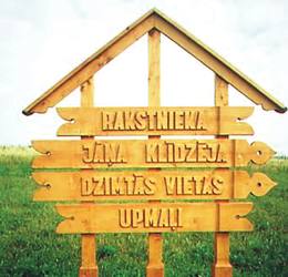 |
Latvia
„Upmali”„Upmaļi” is the family house of writer Janis Klīdzējs who has written 8 novels, 11 storybooks, 2 essay books
and reflections about Latgalian catholic-Latvian mentality. Janis Streičs (famous Latvian film director) shot a film
based on the novel of Janis Klīdzējs called „The Child of a Man”.
|
 |
Latvia
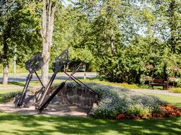
Atslegu skversParkā blakus pusloka tiltiņam ir novietotas trīs milzīgas dzelzs atslēgas, kuras balsta akmens mūris un metāla arkas. Tās simbolizē trīs vēsturiskos centrus un to vienotību – Siguldu, Turaidu, Krimuldu. Dobēs pie šī objekta sezonāli zied dažādi kultūraugi. 53
1-12
Services
53km - Distance from countries capital city
1-12 Active season months |
 |
Latvia
The old Kemeri roadOne of the most interesting objects in Bigauņciems, the road begins at the seashore, crosses the Vecslocene River (there is no bridge, but hikers and bikers can get across it), and then continues as a forest road to Lake Melnezers. 44
Services
44km - Distance from countries capital city |
 |
Latvia
The Obiteli windmillThe Narūta River which flows out of Lake Ežezers is approximately 1 km long and ends at the small Obiteļi windmill lake. On the right bank of the river is a windmill that was built around 1900. Today the site has the Obiteļa leisure centre with a sauna and banquet facilities. 270
Services
270km - Distance from countries capital city |
 |
Latvia
Temple HillTemple Hill is steep (with artificially created steepness) and about 30 m high, and it is opposite Marijas Island. It is an ancient Lettigalian castle hill, 80 m long and 40 m wide, with several artificial ramparts. One of the oldest objects found in the region is an axe from the 2nd to 3rd millennium BC. Archaeologists believe that the island was populated at that time. There was a Lettigalian castle on the hill during the 10th and 11th century, but it was sacked by the Holy Crusade. The surface of the castle hill was transformed comparatively recently in 1807, when a granite rotunda was built there in honour of Russian Field Marshall Sheremetev and Swedish captain Wulff. The view of Lake Alūksne and the town is one of the most beautiful ones in all Vidzeme. The Sun Bridge (1937) is also worth a look. A wooden viewing platform is nearby. 200
1-12
Services
200km - Distance from countries capital city
1-12 Active season months |
 |
Latvia
Burgberg in TerveteDas alte zemgalicshe wirtschaftspolitische Zentrum, das eine stark befestigte Siedlung vor der Ankunft der Kreuzritter war. Die Ruinen der Burg des Livländischen Ordens. 75
Services
75km - Distance from countries capital city |
 |
Estonia
Valjala Fort HillOne of the biggest castle hills in Estonia, which is surrounded by walls built of stone. It is mentioned in Livonian Chronicle of Henry as one of the best fortifications at that time. 193
Services
193km - Distance from countries capital city |
 |
Latvia
Veca Cesu alus daritavaTiek uzskatīta par vecāko alus darītavu Ziemeļeiropā. Tā tika uzcelta 1878. gadā, un tās pirmais īpašnieks bija grāfs Emanuels fon Zīverss (Sievers), Cēsu pils muižas saimnieks. Savukārt 1922. gadā alus darītavu pārpirka Cēsu uzņēmēji un sāka tur ražot arī vīnu, sulas un minerālūdeni. Uzņēmums "Cēsu alus" šeit alu un atspirdzinošus dzērienus ražoja no 1976. līdz 2001. gadam, bet šobrīd tas ir pārcēlies uz jaunām telpām. Šobrīd ēkā tiek organizētas dažādas izstādes, kā arī ēku var apskatīt no ārpuses. 88
1-12
Services
88km - Distance from countries capital city
1-12 Active season months |
 |
Lithuania
Dorf ZervynosEin der ethnografischen Dörfer in Dzūkija mit Holzgebäuden und Kruzifix. 98
Services
98km - Distance from countries capital city |
 |
Estonia
Kolkja-Kasepää-Varnja one-street villageKolkja, Kasepää and Varnja are another example of one-street villages of Old Believers who fled to Estonia from Russia in the 17th and 18th centuries. 221
1-12
Services
221km - Distance from countries capital city
1-12 Active season months |
|
|
Latvia
Cesu vienibas laukumsCēsu centrālais laukums – Vienības laukums (20.gs.sākumā – Konventa laukums) – atgādina par Cēsu kauju notikumumiem, kuru nozīme un ikviena dalībnieka ieguldījums aprakstīti devīzē uz pieminekļa “No zobena saule lēca”. Cēsu kaujas 1019.gada jūnijā bija svarīgs Latvijas valstiskuma vēstures pagrieziena punkts, kad apvienotais latviešu un igauņu karaspēks sakāva vācu landesvēru, kas apdraudēja Baltijas valstu pastāvēšanu. Vienības laukums turpina būt par nozīmīgu notikumu liecinieku. 1989.gada 23.augustā daudzu cēsnieku ceļi veda uz Vienības laukumu, kuram cauri vijās Baltijas ceļš. 88
1-12
Services
88km - Distance from countries capital city
1-12 Active season months |
 |
Latvia
Karogu StreetThis is the one street in Ķemeri where the towns' wooden buildings have been preserved to the greatest degree. Turning onto Durbes Street from Karogu Street, you will find the Miervaldis Ķemers Museum, which is focused on the well known Latvian cultural activist, pastor and painter (1902-1980). The museum is at Durbes Street 21. 47
Services
47km - Distance from countries capital city |
|
|
Latvia
The Smarde saloonThe Smārde saloon has a very long history,
and food is served here. There is a car park, and
approx. 100 m to the East is a cemetery and
monument to commemorate soldiers who fell
during World War II.
54
Services
54km - Distance from countries capital city |
 |
Estonia
Lulleme (Lüllemäe)Lullemē atrodas blakus parka robežai, bet arī šo vietu ir vērts pieminēt kā vienu no apskates objektiem. Lullemē uzmanību piesaista viena otrai blakus stāvošās baznīcas. Mūsdienās redzamās 15. gs. celtās Sv. Marijas baznīcas drupas ir liecinieks 2. pasaules kara notikumiem, kad 1944. g. baznīcu sagrāva. Jaunā baznīca ir celta 1997. gadā. Ciema rietumdaļā uzstādīts piemineklis, kas veltīts brīvības cīņās (1919. – 1920.) kritušajiem. 257
Services
257km - Distance from countries capital city |
 |
Latvia
The Selpils castle hillThe castle hill is an island in the reservoir of the Pļaviņas hydroelectric power plant, and it can be accessed by boat. The ancient Selonian castle hill was settled several times between the 6th and the 12th century. This was the political and military centre of the Selonian region. In 1373, the Livonian Order built a stone castle on the hill, as it did on many other ancient hillocks. The castle was sacked in 1704 during the Great Northern War. Remnants of a square tower, a guard room and the 12 m embankment that once protected the castle are all that survive. Approximately 300 m to the North of the Sēlpils castle hill is Oliņkalns hill, which is underwater. 125
1-12
Services
125km - Distance from countries capital city
1-12 Active season months |
 |
Lithuania
Musteika (Musteika)Musteikas pirmsākumi ir meklējami jau 18. gs. Līdz Musteikai no Marcinkones puses var nokļūt pa grantētu ceļu, kas ved gar bijušajiem kolhoza zivju dīķiem. Automašīnu var atstāt ciema sākumā un izstaigāt to ar kājām, izjūtot veco ēku smaržu un šarmu. Musteikā atrodas Dzūkijas biškopības vēsturei veltīts „dzīvs” muzejs, kur stropos dzīvo bites, bet tā saimnieks ir biškopis pēc aicinājuma un būtības. Ja palūgsiet, viņš demonstrēs – kā ar krama, metāla un posas piepes palīdzību senos laikos ieguva uguni. 118
Services
118km - Distance from countries capital city |
 |
Latvia
The Daugmale castle hillThis is an ancient and important place for trade and craftsmanship on the left shore of the Rīga hydroelectric power plant reservoir. It rises some 15 m above the Daugava River. The Zemgale port that is described in historical documents is thought to have been located alongside the castle hill and at the mouth of the little Varžupīte stream. Antiquities that have been dug up here suggest that the castle hill and its adjoining ancient settlement were populated until the late 12th century, when the importance of Daugmale began to shrink because of rapidly growing Rīga. The foundations of the castle hill have been shored up. 32
1-12
Services
32km - Distance from countries capital city
1-12 Active season months |
 |
Latvia
The Lake Castle of AraisiThe Lake Castle of Āraiši is of pan-European importance. It is a reconstructed Lettigalian lake castle from the 9th or 10th century, and it is the only place in the Baltic States at which visitors can learn about how people lived more than 1,000 years ago. The castle offers various thematic events.
82
Services
82km - Distance from countries capital city |
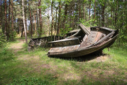 |
Latvia
The Boat CemeteryIn the 1960s, the Soviet Union banned individual fishing in the sea, and the motor boats which had no other purpose were simply beached in the dunes. It is said that members of the Border Guard often set the boats on fire. Another story is that the Border Guard banned an ancient tradition of burning old boats on Summer solstice Eve. Along the road to the cemetery is the old net barn, which is a residential building today. 176
Services
176km - Distance from countries capital city |
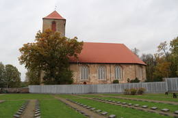 |
Latvia
Lestene Cemetery of the BrethrenThe graveyard that is alongside the Lestene Lutheran Church is the final resting place for more than 900 soldiers who fell during World War II, particularly during battles at the so-called Fortress of Kurzeme, as well as in Zemgale and Vidzeme. The sculptress Arta Dumpe designed the commemorative monument “Mother Motherland – Latvia.” The cemetery of the brethren is the second largest resting place for soldiers from World War II after the Cemetery of the Brethren in Rīga. The names of some 11,000 soldiers are engraved on the gravestones. 80
1-12
Services
80km - Distance from countries capital city
1-12 Active season months |
|
|
Estonia
Tallinner TorAuch Königstor (Kuningavärav) genannt. Im Barockstil gebaut ist ein Teil der früheren mittelalterlichen Stadtbefestigung. Der Beginn des alten Postweges. 128
Services
128km - Distance from countries capital city |


")


