
Walking
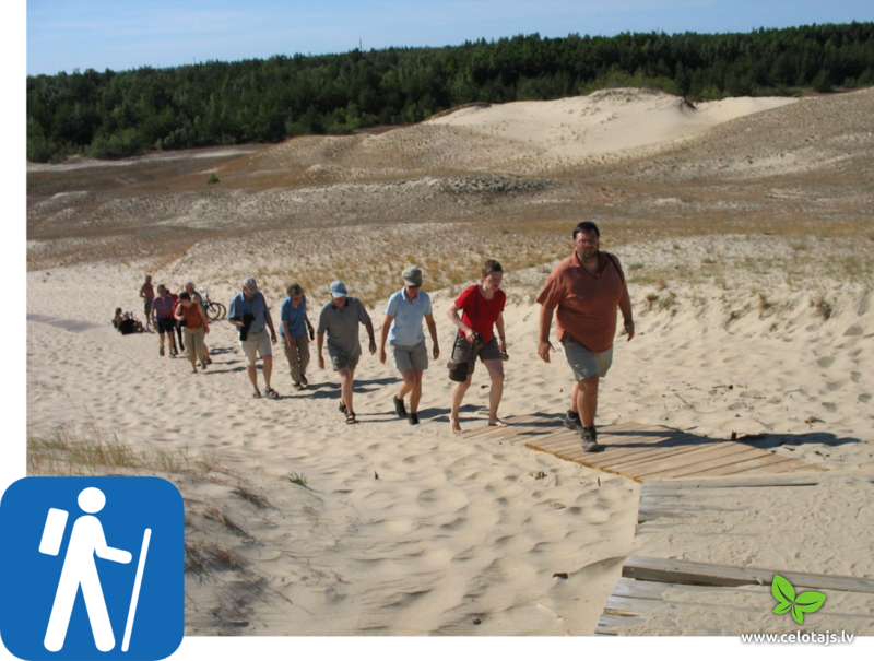
Walking you can really get a good sense of the diversity of natural beauty. You can walk along the beach, wander through picturesque river valleys, mature forests and through bogs. There are lots of nature trails with information stands and viewing platforms. Trails lead through national parks and other areas that are under environmental protection. Bog shoe walking is also available in some national parks.
- Walking tours run from May until September.
- For your convenience we can organize a luggage transfer from one accommodation place to the next.
- We provide GPS routes for some tours.
- Private specialist guides can be arranged within the national parks and museum reserves.
- Before your arrival, we shall send you a personalised tour program with dates, accommodations and extra services you booked (please see the optional extra services available in each tour description in the price section).
- Upon your arrival at the first hotel of your tour you will receive detailed road maps for each day, descriptions with sites, attractions, eating places on the way, travelling instructions from place to place, and vouchers for your booked services as well as tour . To see an example of the travelling instructions please click here (pdf file). GPS tracks are available for some tours.
- For our clients, we operate 24h emergency phone.
If you have an idea how you'd like to travel around the Baltic, we can help you to put the tour together and you can count on our local advice.
Walking routes
| Latvia, Slītere NP | 1 day (~ 1-2 hrs) | |
| Latvia, Slītere NP | 1 day (~ 4 hrs) | |
| Latvia, Slītere NP | 1 - 2 days | |
| Latvia, Ķemeri NP | 1 day (~ 3-4 hrs) | |
| Latvia, Ķemeri NP | 1 day | |
| Latvia, Ķemeri NP | 1 day (~ 3-4 hrs) | |
| Latvia, Rocky Seashore of Vidzeme | 1 day (~ 7 hrs) |
 2 days
Total distance walking 27 km
|
Latvia
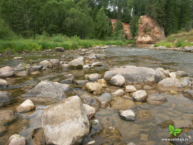
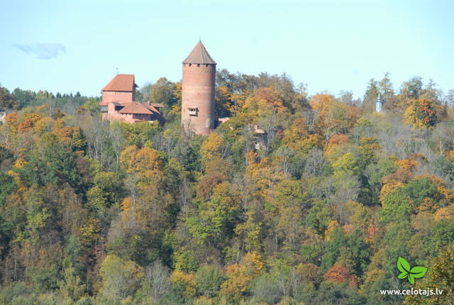
Gauja National Park: Ligatne - Amata River valley - CesisThis is appropriate for active hikers who enjoy looking at nature and learning about cultural and historical environments. The hike is down the valley of the most impressive river in the Baltic States – the Gauja, as well as the deep and ancient valley of one of its tributaries – the Amata. Lovely Devonian sandstone cliffs rise above both sides of the rivers. The Līgatne Paper Factory village is an outstanding example of industrial heritage at the European level, with a unique environment from the 19th and 20th century. The Cēsis castle that is at the end of the route was once the mightiest Medieval fortress in Livonia. Route information from Latvijas Lauku forums 

 5-9 5-9
Services
5-9 Active season months |
 2 days
|
Latvia
The Gauja National Park: Sigulda-LigatneThis route is best for active hikers who want to travel down the valley of the mightiest river in the Baltic States to see lovely landscapes and feel powerful emotions. The route begins in Sigulda, which has been known as the Switzerland of Vidzeme and offers some of the loveliest views in Latvia. The route crosses the deep valleys of several Gauja River territory, offering a look at shores that are known at the Baltic level for their mighty Devonian cliffs. The nature trails in Līgatne are the only place in Latvia to see forestland that is close to natural circumstances, with forest animals living in large fenced areas so that they can be seen. There are also animals and tracks of their activities out in the wild as you walk down the forest and other trails of the Gauja National Park. Route information from Latvijas Lauku forums
|
 1 day
|
Latvia
Shores of the Daugava by train and on footThe Daugava is the largest river in Latvia and the river of destiny for the Latvian people. Since the end of the Ice Age, plants and animals travelled into what is now Latvia along the Daugava River valley, followed then by humans. The shores of the river have some of the oldest settlements in Latvia, as well as a true wealth of different kinds of plants. The density of outstanding cultural and historical monuments is why tourists love the shores of the river. The Rīga-Daugavpils rail line offers comfortable travel between Rīga and Jēkabpils. Below, find other train stations where it is worth disembarking to take circular hikes that last for a few hours or half a day before returning to the station. Route information from Latvijas Lauku forums
5-10
Services
5-10 Active season months |
 6 days
Total distance walking 137 km
|
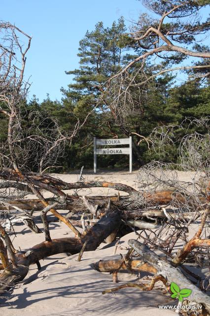
Latvia
Kurzeme-Mazjura coastline: Jurmala-Cape KolkaYou will start your hike from the popular Latvian spa town of Jūrmala. The route is great for those who like to hike along the coastline, with former fishing villages full of unique coastline charm, as well as lonely and seldom visited beaches. Many villages have small smokehouses where dried fish can be bought. Your destination is Cape Kolka, which the father of Latvia’s maritime school, Krišjānis Valdemārs, considered to be the centre of Europe. The cape has been known as a very hazardous shipping route since the age of the Vikings. Cape Kolka is also a fantastic place to watch birds. Route information from Latvijas Lauku forums
6-8
Services
6-8 Active season months |
 2 days
Total distance walking 25 km
|
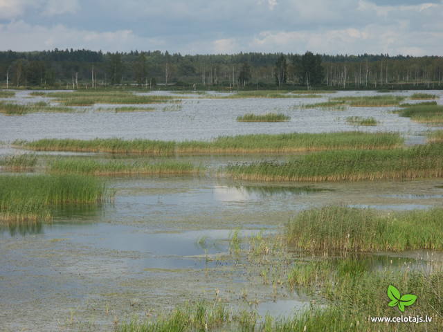
Latvia
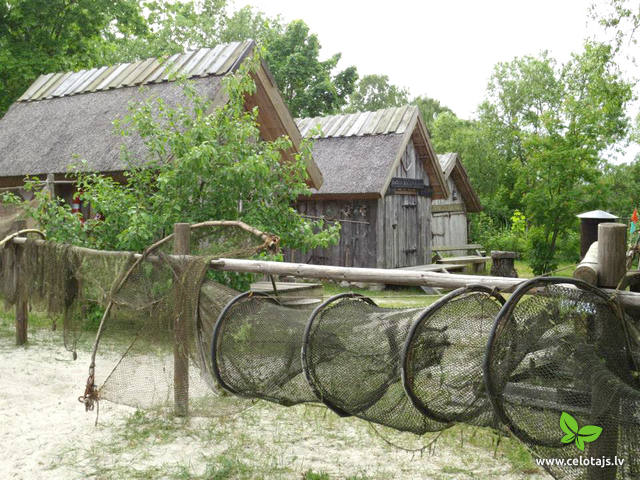
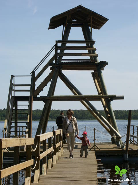
The Kemeri National ParkThe Ķemeri National Park (est. 1997) covers wetlands, the shallow waters of the Bay of Rīga, overgrown seaside lakes, swamps, damp forests and wetland meadows. There are many important plants (including some 25% of those that are declared to be rare) and animals, including an area where the locations of nesting and migrating birds are protected. The park includes one of the largest swamps in Latvia – the Great Ķemeri Swamp. This is an important location for sulphurous waters and medicinal dunes, and back in history, that was the reason for the establishment of popular spas in Ķemeri. Visitors to the park are interested by educational nature trails, bike and hiking routes and bird watching towers. Route information from Latvijas Lauku forums
 45
6-8 45
6-8
Services
45km - Distance from countries capital city
6-8 Active season months |
 4 days
Total distance walking 74 km
|
Latvia
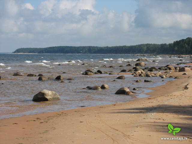
Vidzeme coastlineThis route passes along one of the most diverse and beautiful parts of the coastline of the Bay of Rīga. You will see the Randu meadows, which are known as Latvia’s open-air “herbarium” because of the diversity of plants that can be found there. The coast features various sizes of rocks and stones, as well as no shortage of lovely and sandy beaches. This is the only place in Latvia where Devonian sandstone cliffs can be seen. Past each horn there is a different landscape, and the last 20 kilometres of the route are paradise for bird watchers during migration season. The route is in the Northern Vidzeme Biosphere Reserve. Route information from Latvijas Lauku forums
5-9
Services
5-9 Active season months |
 2 days
Total distance walking 45 km
|
Latvia
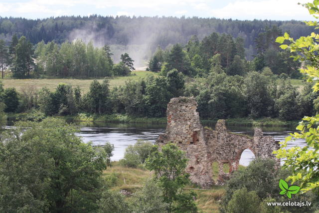
Curves of the Daugava, Kraslava-JuzefovaThis route leads through the Curves of Daugava nature park, which is an area that was once to be flooded for the construction of the Daugavpils hydroelectric power plant. The central artery in the park is the ancient Daugava River valley, and the specific here is eight grand curves with a length of 4-6 km. The highest banks of the river are at the so-called Daugava gate, with the mighty Ververi and Slutiški cliffs. More than ½ of the territory is forested for hiking, nature watching, berry picking and mushroom hunting. The Daugava River valley has one of the greatest diversities of flora -- >800 different kinds in all. This is also a multinational environment with Lettigalian, Lithuanian, Polish, Russian and Belarusian traditions and heritage. The Slutiški village, which is unique in Latvia, is popular among tourists. Route information from Latvijas Lauku forums
5-9
Services
5-9 Active season months |
 2 days
Total distance walking 26 km
|
Latvia
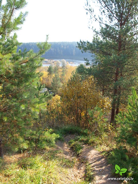
The Slitere National ParkThe legendary blue hills of Šlītere have been known since ancient days, when pirates lit false campfires that led ships to run aground near Cape Kolka. The shoreline in the Slītere National Park is known as the open-air geological museum of the Baltic Sea, because the ancient shores of the Baltic ice sea, Lake Ancylus, and dunes from Littorina Sea can be seen here. These offer a fine view of the history of the Baltic Sea. The territory was historically populated by the Liv people, and their fishing villages are a cultural environment of one of the smallest ethnic minorities in the world. The route between Kolka and Mazirbe goes down the old shore road that passes through Liv villages. The Slītere National Park has one of the greatest amounts of plants in Latvia, while Cape Kolka is one of the country’s most popular bird watching sites. Route information from Latvijas Lauku forums
5-9
Services
5-9 Active season months |
 2 days
Total distance walking 24 km
|
Latvia
Seda - Seda Swamp - StrenciThis route offers most unusual views. Seda is the only town in Latvia with Soviet-era planning from the middle of the last century, featuring a central square and streets stretching from it in a star pattern. The architectural style of apartment and public buildings is rather exotic. The Seda Swamp yielded peat moss during the first period of Latvia’s independence and is one of the largest industrial and environmental territories of its kind in Latvia and the Baltic States. Former peat fields have partly become flooded and are overgrown with reeds, thus creating an outstanding environment for nesting water birds and migrating birds which rest at the swamp. Peat is still being extracted, and perhaps you will be lucky enough to spot the “little peat moss train.” Route information from Latvijas Lauku forums
6-8
Services
6-8 Active season months |


