
| No | Name | Description |
|---|---|---|
 |
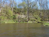
Relatīvi grūti pieejama un cilvēka mazskarta teritorija kūdrā izstrādātajā Cenas tīreļa ziemeļaustrumu daļā, kur saglabājušies augstā purva biotopi ar purva ezeriem, kas kopumā veido nozīmīgu vietu ligzdojošām un migrējošām zosveidīgo, tārtiņveidīgo u.c. putnu sugām. Teritorija nav piemērota (un nav vēlams) tūrisma aktivitātēm.
|
|
 |
Bērzes upes labajā krastā, vietā, kur tagad paceļas Dobeles pilsdrupas, jau 1. gadu tūkstotī p. m. ē. atradās zemgaļu apmetne un vēlāk – koka pils. Gandrīz simts gadus pils izturēja vairākus krustnešu uzbrukumus un aplenkumus, un tikai 1289. g., kad vācieši bija pilnībā izpostījuši apvidu un tālāka pretošanās kļuva bezcerīga, zemgaļi paši nodedzināja savu koka pili un neuzvarēti aizgāja uz Lietuvu. 700 gadus vēlāk, 1989. gadā, godinot zemgaļu cilšu piemiņu, bijušās senpilsētas vietā tika atklāta piemiņas zīme, ko veidojis mākslinieks Mārtiņš Zaurs. Akmenī iecirsts teksts: “Zini, no šīs vietas pirms 700 gadiem zemgaļi aizgāja lepni un brīvi”, kā arī dzejnieka Viļa Plūdoņa vārdi : “Mēs svešā malā ejam, bet sirds mums paliek te”. |
|
 |
Šis avots ir pazīstams kopš seniem laikiem. Kalpo kā laba dzeramā ūdens ņemšanas vieta. |
|
 |
Jaunstašuļi Devil's Footstone is situated in the village of Jaunstašuļi in overgrown place beside the
derelict houses. It is hard to find it without the guide. The boulder is 0,75 m high and its circuit is 5,85 m.
On the surface there is the human foot: the length 0,3 m, width 0,09 m, depth 0,02. There was another foot.
It’s obviously scaled off. The North side of the boulder has three casted steps.
|
|
 |
Pēteris Barisons (1904-1947) was a Latvian composer and conductor, and this is his birthplace – the Skudras homestead. The exhibition features the composer’s personal items, including musical instruments, documents and other bits of evidence about his life. Call +371-6512-9504 to arrange for a visit. |
|
 |
Small sandstone outcrops on the shores of the Ciecere River. Fish fossils have been found here.
|
|
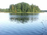 |
This restricted area protects Lake Jumurda, which is in the central part of the Vidzeme highlands, along with its three islands, the local broadleaf forests, and the surrounding landscapes.
|
|
 |
The café is alongside the Top store in the centre of the village. Latvian cuisine: Potato pancakes with ham, grey peas with bacon, carrot buns. Special foods: The special “Apsīte” potted dish. |
|
|
|
Vom 18. Jh wurde die Stadt ein russischer Marinestützpunkt. Von 1962 bis 1994 war Paldiski ein Übungszentrum für atomare U-Boote der Sowjetischen Marine mit zwei auf dem Festland befindlichen Kernreaktoren (ung. 16.000 Beschäftigte) und eine "geschlossene Stadt". |
|
|
|
Taka ap Ozolu Mazezeru. Purvaino krastu posmā, ap ezera rietumu galu, ierīkotas gājēju laipas. Novērojami purva, meža un ezera augi, dzīvnieki un biotopi. Jūlija beigās īpaši krāšņi zied ūdensrozes. Blakus atrodas Ozolmuiža ar parku.
|
|
|
|
There’s hardly anything left of the zenith missile base which once stood here for the purpose of protecting the western boundaries of the USSR – even specialists would have a hard time finding the location.
|
|
 |
The zenith missile base at Rucava is in the forests of the Baltic coastline. The facility is owned by the regional local government and is not used at this time.
|
|
 |
This cosy tavern in the centre of Elva will not only provide you with a delicious meal, but also a friendly atmosphere. Even the most demanding of visitors, including vegans, will find their favourites on the vast menu. It is possible to rent the premises, order meals. The outdoor terrace is also available during the summer season. |
|
 |
The café is located the Krūziņi guesthouse in the centre of Dundaga. Latvian cuisine: Sauerkraut soup, grey peas with curdled milk, roast perch or cod, sorrel soup with potatoes. Special foods: “A tower of cottage cheese” or crème from the ingredients of the Dundaga Dairy. |
|
 |
The open kitchen of the restaurant allows the guests to experience an exciting performance by its chefs, who cook various fish and meat dishes on a fiery charcoal grill. Chef: Lauris Aleksejevs. Three-time consecutive winner of the Best Restaurant in Jūrmala title. |
|
 8 days
|
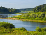
The Daugava River is known as our river of destiny, the Daugava of our hearts, or our beloved mommy. It is a large and full-blooded artery of water that has flowed through our land and our history. The Vikings were aware of the river during the 5th century AD. Krāslava is the site of an ancient castle hill, and the fearless sailors were well aware of it in that downriver from it, the ships could sail with raised sails. It is known in Viking sagas as Dynasaiforgarðr. Goods from the East sail down the river to Rīga, where it is reloaded into seafaring ships for delivery to Europe. That has been the case for many centuries. Many powers wanted to control and govern the process, as is seen in the large number of castle hills, castles and populated areas around the river’s banks. The majestic ruins of the Koknese Castle, Krustpils, the grassy and mighty castle hill at Aizkraukle, another one at Daugmale. The unique fortresses at Daugavgrīva and Daugavpils are like large keys that lock or unlock this mighty and ancient trade route. Under the water in the Daugava are the ruins of the ancient Ikšķile Castle that was built by St Maynard himself. It is seen as the first brick building in the Baltic States. Nearby is Death Island, where Latvian riflemen fought for the future of their country and their land, defending each square metre of land. The Daugava proved insurmountable for Bermont’s troops, and the riflemen defended Rīga successfully. The curves of Daugava are unique. The village of Slutišķi is particularly known because the Daugava there is just like it has been in the past. The high dolomite shorelines and canyons that once made the Daugava unique in all of Northern Europe have now been lost in the reservoirs of hydroelectric power plants, as has the eternally weeping cliff of Staburags, the Liepavotu stream and the Pērse waterfall. The age of national renaissance in Latvia importantly began with a battle against the construction of another power plant on the Daugava, which would have fully destroyed the beauty of the noble river. We managed to protect it, if only a small part of it, but we succeeded. We must not stop! |
|
 |
The carpenter’s workshop offers special excursions and events for grown-ups and children; there are some thematical programmes available. Under the guidance of a craftsman it is possible to work with traditional wood-working tools and get to know ancient games. In the end you will have a chance to try special „strengthening” tea and have a picnic in a romantic Bonfire house. It is possible to buy wooden souvenirs as well as order them. |
|
 |
Ģipka is a village that once was the site of the first maritime school in Kurzeme. It was opened in 1869, just a few years after a similar school in Ainaži. This was a Category 2 maritime school, which trained helmsmen for long-distance trips and captains for short-distance trips. The school was moved to Mazirbe in 1894. Before the maritime school, the building housed a different kind of school, and a second floor was added in 1867 specifically for the maritime school. Today this is a residential building. During 28 years, the school trained more than 200 professional sailors, and it was of great importance in facilitating ship building in shoreline Liv villages. (Source: Roja TIC) |
|
 |
The town of Talsi is known as the “town of the nine hillocks,” and it is worth touring the location on foot. You’ll find the best views from the Talsi castle hill (views of Lake Talsi and Ķēniņkalns Hill), Sauleskalns (Lake Talsi, the castle hill, Ķēniņkalns Hill), and the hiking trails of Ķēniņkalns (Lake Talsi, the castle hill, the historical town centre).
|
|
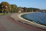 |
The most populated place in The Curonian Spit - old curonian village - Nida. Until 19th century Nida's citizens were mainly fishermen. Later it became a popular resort. Like other villages here Nida has been "moved" because of "wandering dunes". There are a lot of museums to see. During tourism season there is around ~ 200 000 – 300 000 tourists here.
|
|


