
| No | Name | Description |
|---|---|---|
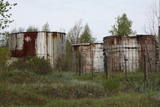 |
The former missile transport facility at Karaosta is not used any more. The territory is mostly closed off to visitors.
|
|
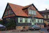 |
From the historical and architectural perspective, this is an interesting monument to urban construction between the 17th and 19th centuries. Old Liepāja is in the area of the old market and Kuršu Square, where merchants sold their wares beginning in the 1560s. Until 1792, Kuršu Square was also where punishments were implemented. The current Pētertirgus pavilion was installed alongside the square in 1910. A map shows that the network of streets has partly preserved the chaos of street planning that was typical in Medieval towns. |
|
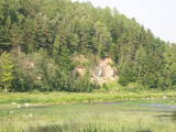 |
One of the most beautiful areas along the Venta River and its tributary, the Šķērvelis River. The river valleys and gullies along them are quite deep, and dolomite and sandstone cliffs can be spotted here and there. There are also rapids on the river. The largest cliffs in Kurzeme – the Ātraiskalns and Gobdziņi cliffs – can be seen on the banks of the Venta. The Lēni Catholic Church is near the restricted area. There are no tourist elements in the restricted territory at this time. The Venta is a popular destination for water tourists, however, from Nīgrande to Kuldīga. |
|
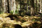 |
The forest around Kaltene features a natural miracle – the rocks of Kaltene, which are also known as the barrier rocks. The rocks are 2-3 m from the sea and date back to the Ice Age. The Devil’s rock is the largest one. It used to be a beautiful pile of rocks that “stretched to the tops of the trees.” In older maps it is described as being 20 m high. It had many natural rocks, including some that were completely round, while others resembled plates. The rock was almost completely destroyed in the 1960s and 1970s, when it was chopped up to build roads. A fairly small part of the rock survives today, and it is 300 m long and 2 m high. Scientists believe that these rocks used to be sacred locations, because there are many legends and stories about them. There is a forest path with wooden pathways, information stands and a small car park there. (Source: Roja TIC) |
|
 |
Labiekārtota (informācijas stendi, atpūtas vietas) un marķēta taka, kas ved apkārt Kokšu ezeru virknei, kurā ietilpst Zāļu, Dziļais un Dibena ezers. Iepazīstami mežu biotopi, dzīvnieki un to darbības pēdas. Iespējami trīs dažādi takas izziešanas varianti: 7 km, 4,5 km, 2,7 km. Maršrutu var braukt ar divriteni. Ietilpst Ziemeļvidzemes biosfēras rezervātā. |
|
 3 days
|
This programme allows participants to learn about Latvian ethnography and traditions through meeting local craftsmen and having master classes with them in knitting traditional mittens and gloves, making amber jewellery and cooking traditional foods. There is chance to have a unique experience because of the authenticity of some places and traditions, for example the ethnographic house of living history Zvanītāji still retains its original appearance - massive ceilings, large family room with bread oven and natural, unpainted wooden floor. The carew chimney is still in the kitchen. The house is filled with characteristic looms, a family table, beds, wardrobe, cradle, various items and tools used on the farm. |
|
 |
This farm has been offering cheese for 20 years, with milk coming from its own dairy cows. The farm sells cheese at major markets and fairs in Latvia. |
|
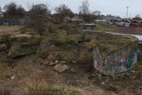 |
On the shore of the Daugava River, to the East of Lielupes Street and South-east of Jātnieku Street, there are the remnants of four battery positions that were blown up in their day. The batteries had 152-mm cannons, and this was part of the former system of fortifications in Rīga (see also Komētforts, the Daugavgrīva fortress, and the fortifications of Mangaļsala). The aim was to protect the city from invaders who came from the sea. From the top of the batteries you can see the Daugava and the northern segment of the manmade Krievu Island (a huge pile of sand). It does have to be said that the condition of this historical monument is quite pitiful.
|
|
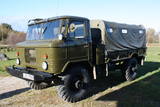 |
Edgars Kārklevalks, operator of a guesthouse Pūpoli, has a restored Soviet military GAZ-66 truck in which he offers historical and informational tours of Northern Kurzeme. The route includes former military territories.
|
|
 |
The word “Luitemaa” means “land of the dunes” in Estoninan. This coastline territory stretches for 13 km between Vöiste and Häädemeste with shallow waters, large coastal plains, Estonia’s highest dunes, and the Tokuse swamp (Tokuse raba). There are lots of birds here.
|
|
 |
The Peppermint Hut offers various teas, cookies, candies, honey with peppermint and peppermint syrups. Periodically, new products area added to the range. Creative workshops are used to produce peppermint soap, plates with images of peppermint, decorative candles and many other things. The owner of the house also uses peppermint to produce powders and facial tonics. |
|
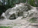 |
This is a sandstone cliff with several arches, pillars and niches. The set of caves (Little Hell, Devil’s Kiln, Devil’s Cave, Liepmuiža Cave and Liepa Cave) are a bit more than 20 m, with a ceiling height of 3.5 m and a width of 5 m. A powerful stream flows from the cave, which is thought to have been formed around 7,000 years ago. The cave is much damaged, because white sand was dug from it in the early 20th century. Great Ellīte is an ancient cult site. Today the site has been much improved. |
|
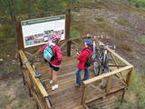 |
This is Lithuania’s largest mossy swamp, and the Čepkeliu Nature Reserve was established to protect it. Before visiting the swamp, you must register at the Dzūkijos National Park’s visitor centre (Marcinkonys, Šilagėlių gatve 11). |
|
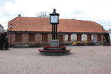 |
Ventspils Vecpilsētas vēsturiskais centrs. Nelielā Rātslaukuma (40 x 60 m) rietumu malā atrodas Starptautiskā rakstnieku un tulkotāju māja, kas ierīkota 18. gs. dzīvojamā ēkā ar baroka un klasicisma iezīmēm (19. gs. vidū te atradās pilsētas Rātsnams), bet austrumu malā – vēlīnā klasicisma stilā celtā evaņģēliski luteriskā Nikolaja baznīca. Iepretim baznīcai atrodas modernā stilā pārbūvētā Ventspils Galvenā bibliotēka un Digitālais centrs, kas ierīkots greznā 19. gs. savrupmājā. |
|
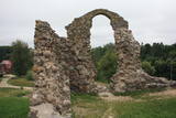 |
The Rēzekne castle hill is an impressive hillock (15 m) on the right bank of the Rēzekne River. From the 9th to the 12th century, there was a Lettigalian castle here. In 1285, the Livonian Order began to build a two-story stone castle on the site, and its ruins have survived to this very day. Alongside the castle hill is the Eastern Latvian Creative Service Centre - „Zeimuļs”, along with a tourism information centre. |
|
 |
This is a brewery in a lovely part of Lithuania known as Little Switzerland, surrounded by forests, lakes and castle hills. "Čizo" beer is light, unfiltered and alive, and it is produced on the basis of ancient traditions with forest bee honey. The brewer has not just a recipe, but also equipment so that he can offer a look at ancient methods of beer brewing. |
|
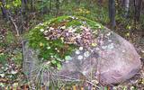 |
The Stone of Āžmugura is a fawn- coloured triangular prism boulder
which recalls the goat's back.
|
|
|
|
Observatory which was built (1808. – 1810. g.) Southeast of Doma Hill is called pearl of Estonian's science. There's a museum inside. |
|
 11 days
|
This tour of the Forest Trail covers the national parks of Dzūkija and Žemaitija and the Nemunas Loops Regional Park in Lithuania. The starting point of the route is Druskininkai, a popular SPA and mineral water resort on the banks of the river Nemunas. Here, we recommend dipping yourself in mineral water baths, enjoying the trip with the cable car over the river Nemunas, visiting the musical fountain, and walking along the river promenade. For the next two days from Druskininkai, the Forest Trail passes through the Dzūkija National Park to the town of Merkinė. In this most forested and unpopulated region in Lithuania you can enjoy hiking along solitary forest roads, visit ancient mounds and ethnographic villages, where the traditions of bee-keeping, crafts, mushrooms and berry harvesting are still kept alive. You will then head to Birštonas, one of the key resorts in Lithuania with its valuable mineral waters. The town finds itself in the Nemunas Loops Regional Park, which includes four large and one smaller loops of the river. The Forest Trail stretches from Birštonas through the entire Nemunas Loops Regional Park up till the town of Prienai. Next, hikers will get to Kaunas, the second largest city in Lithuania and its former capital city. Kaunas is notable for its modernist architecture. The catchment area of the river Nemunas and the river Neris is situated here. Heading on, from Lampėdžiai to Vilkija, the Forest Trail runs for two days along trails and small countryside gravel roads next to the right bank of the river Nemunas, also crossing resort territory of Kulautuva. This section is characteristic of beautiful riverscapes, waterfront meadows and small villages. For the final section, first you must get to the Žemaitija National Park, where the Forest Trail runs around the Lake Plateliai, which is the largest lake in the historic Samogitian region. Old pine and fir forests and mixed forests are among the most precious natural values of |
|
 |
The farm borders the city of Zilupe. Melons, watermelons, and pumpkins are grown here in an open field. The host is one of the few Latvian birch bark craft masters, the hostess comes from an old family of gardeners and is a certified floral designer, and their son is a potter. All of them offer demonstrations, creative workshops, and accept orders. |
|


