
Nature objects in Lithuania
What's special about the nature in Lithuania?
The Curonian spit - a sandy, desert-like stretch of land between the Baltic see and the Curonian Inlet, teh hilly landscapes of the Žemaitija region, the blue mirror labyrinths of the lakes in teh Aukštaitija region, the pine forests in teh Dzūkija region, the curves of the Nemuna river valley, and the many regional nature parks, created not only to protect the nature but also for people's recreation and interest - these are the nature values attracting guests of Lithuania.
Act responsibly - follow the Green advice!
| Overview | Details |
|---|---|
 |
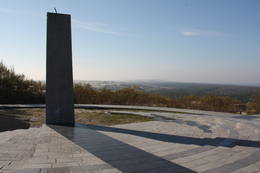
Lithuania
BrändeNahe der Beerkopfdüne ist im Frühling 2006 „ein Brand der Jahrhunderte” gewessen. Es wurde der hundert Jahre alte Wald in der Fläsche von 235h ausgebrannt. Ein Pfad mit Holzbelag.  314 314
Services
314km - Distance from countries capital city |
 |
Lithuania
The Dubrava ArboretumWork on this arboretum began in 1958 at a local forest research station that is near the village of Vaišvidava. The arboretum collects and exhibits various local and imported plants for scholarly, educational and decorative purposes. The arboretum covers some 50 ha of land, with more than 800 types of plants. Some parts of the arboretum have rare and protected trees and bushes, and these can only be visited if you contact the arboretum in advance.  1-12 1-12


Services
1-12 Active season monthsServices - other
Accepts tourist groups
Accepts individual travellers
This destination has specific opening hours which you must determine in advance
Must register in advance |
 |
Lithuania
Tauragns (Tauragnas)Ap 9,5 km garais un līdz kilometru platais ezers atrodas subglaciālā – t.i. ledāja veidotā vagā, tādēļ tas ir ne tikai Lietuvas, bet arī otrs Baltijas dziļākais ezers (pēc dažādiem avotiem 60,5 m vai 62,5 m). Tauragna dienvidu krastā paceļas Taurapils pilskalns (Taurapilio piliakalnis). Saglabājušies nostāsti gan par pagānu priesteri, kas te dzīvojis, gan nogrimušu baznīcu, gan laikiem, kad pilskalnu no visām pusēm apņēmis ūdens. No pilskalna plakuma paveras visaptverošs skats uz Tauragnu. 117
Services
117km - Distance from countries capital city |
 |
Lithuania
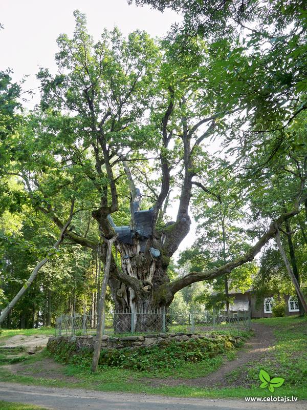
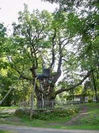
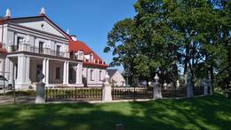
The Stelmuze Estate parkThis park dates back to the mid-18th century and is to the south of Lake Stelmuže. There are winding trails on all sides of the hillock that lead to the Christ the King Church, with linden, maple, oak, birch, fir, elm and pine trees. At the foot of the hillock is the Laime stream, and visitors are welcome to stroll along the alley of oak trees. The oldest and fattest oak tree in Lithuania is one of the oldest ones in Europe. It is though that it is 1,500 to 2,000 ears old, and its record-setting diameter is 3.5 metres (eight or nine people linking hands are needed to encircle it). The tree is 23 m high. 1-12
Services
1-12 Active season monthsServices - other
Accepts individual travellers
Accepts tourist groups |
 |
Lithuania
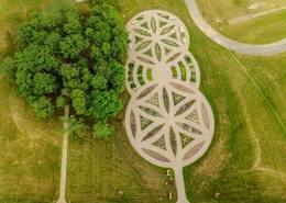
The Kurtuvenai Estate ParkThis estate is surrounded by an ancient and geometric landscape. During the latter half of the 19th century, it had a landscape style with various elements of geometry. The park covers 4.2 ha and has ancient linden, maple, elm, oak and other decorative bushes, with more than 20 types of plants that have turned into wood. 1-12
Services
1-12 Active season monthsServices - other
Accepts tourist groups
Accepts individual travellers
This destination has specific opening hours which you must determine in advance |
 |
Lithuania
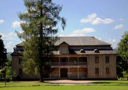
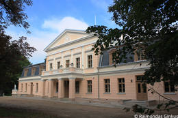
The Birzuvenai Estate ParkThis park surrounds the mansion of the Biržuvenai Estate, and it is based on the terrain of the Virvite River and an old river that provides water for the park. The central part of the park is regularly designed, while the rest has elements of landscape. Opposite the estate is a glass sculpture, and on its western side is a wooden pergola. Local trees dominate in the park, but there are also trees from other countries. Of importance is a group of oak trees on the banks of the river, as is an alley of linden trees that leads to the pond in the direction of the estate. 1-12
Services
1-12 Active season monthsServices - other
Accepts individual travellers
Accepts tourist groups
This destination has specific opening hours which you must determine in advance |
 |
Lithuania
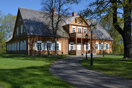
The Plunge Estate parkThe Plunge Estate is famous because its park, which is a mixed-type park that was established during the 18th and 19th century at a holy forest that used to be a sacrificial place. The pride and joy of the park is the Thunder oak tree, a legendary weeping linden tree and an elm tree with five trunks. The lord of the state ordered the digging of seven ponds with cascades. These are linked by rock bridge sluices. The Babrungo River, which flows alongside the estate offers an outstanding landscape for the park. 1-12
Services
1-12 Active season monthsServices - other
Accepts individual travellers
Accepts tourist groups
This destination has specific opening hours which you must determine in advance |
 |
Lithuania
The Baltu Plant MuseumThis museum was established in 2014 in partnership with the Siauliai University botanical garden. The museum is 85 m long and 40 m wide on a territory that covers 0.34 ha.  5-9
5-9
Services
5-9 Active season monthsServices - other
Accepts individual travellers
Accepts tourist groups
This destination has specific opening hours which you must determine in advance
Must register in advance |
 |
Lithuania
The Zagare Estate parkThis is one of the most colourful and architecturally interesting parks in Lithuania. It was rebuilt and expanded between 1898 and 1900 by the renowned dendrologist G.F. Kuphaldt. The park had more than 200 types of plants, more than 100 of which are still growing. There are various roads and pathways that offer a sense of the mightiness and beauty of the park. A dendrological trail with markers offers information about 15 rare trees. 1-12
Services
1-12 Active season monthsServices - other
Accepts individual travellers
Accepts tourist groups
This destination has specific opening hours which you must determine in advance |
 |
Lithuania
The Aukstadvaris Regional ParkThis territory in the northern part of the Dzūkija Highlands with lots of hillocks and lakes. The most interesting tourist destination is Velnio duobė (Devil’s Flowerbed) – a funnel-shaped hole that is up to 40 m deep and 200 m wide and is thought to have originated during the Ice Age.
Services
56km - Distance from countries capital cityServices - recreational
Nature trailVelnio duobė is the most interesting geological formation of its type in the Baltic States – hike to it. 
Nature watchingViews from the Aukštadvaris castle hill. For more information: www.aukstadvaris.lt/parkas.htm (only in Lithuanian). |
 |
Lithuania
The Ilzenbergo Estate parkThis mixed-type park dates back to the latter half of the 19th century and has remained all but unchanged. It is in a lovely place between two lakes, and its spatial structure was preserved when it was restored. The park covers 10 ha and has two parts. One is a fairly precisely rectangular territory alongside the state, surrounded by a stand of linden trees and introduced trees. The other part has a natural forest. The largest oak tree in the park has been declared to be a protected element of natural heritage. The mighty trunk of the tree is 6.3 m around, has a 2m diameter and stands 30.5 m high. 1-12


Services
1-12 Active season monthsServices - amenities
Accommodation availableServices - other
Accepts tourist groups
Accepts individual travellers
This destination has specific opening hours which you must determine in advance
Optional meals |
 |
Lithuania
Parniddene DüneIn der Umgebung von der 52 m hohen Parniddenen Düne sind die im 18. Jh. bei einem Holzeinschlag entstandene Wanderdünen zu sehen! Aussichtsplatz. 358
Services
358km - Distance from countries capital city |
 |
Lithuania
Tituvenu regionalais parksTītuvēnu reģionālais parks (Tytuvėnų regioninis parkas) dibināts 1992. gadā. Parkam raksturīga ainavu daudzveidība – te ir sastopami lieli mežu masīvi, purvi, ezeri, upītes. Šejienes reljefa veidotājs tāpat kā citur Baltijas valstīs ir bijis ledājs, kas atnesis un atstājis aiz sevis garas laukakmeņu grēdas. Kopumā parkā ir konstatētas 603 augu un 787 dzīvnieku sugas. Parkā aug veci un dabiski boreālie (ziemeļu) meži, veci un jaukti platlapju meži ar ozoliem, liepām, kļavām, ošiem un gobām, sugām bagāti egļu meži, staignāju meži, nogāžu un gravu meži, purvaini meži un aluviālie (pārplūstošie) meži. Parkā esošās pļavas un tīrumi ir nozīmīga dzērvju atpūtas vieta migrāciju laikā, kad te pulcējās tūkstošiem putnu. Šiluvas baznīca un Tītuvēnu klosteris ir svētceļnieku galamērķis vairāk nekā 500 gadu garumā.  200
200
Services
200km - Distance from countries capital city |
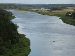 |
Lithuania
The Curves of Nemuna Regional ParkThis lovely part of the Nemuna River between Alytus and Pakuonis meanders through cliffs that are up to 40 m high.
Services
91km - Distance from countries capital cityServices - recreational
Boat tourSpend two days boating from Alytus to Birštonas. 
Bicycle trailBike the Žvėrinčius forest trails (15 km).
Nature trailHike the Velniabliūdis information trail (1.5 km) or the Škėvoniai information trial (1.6 km).
Nature watchingViews from the Balbieriškis and Škėvonis cliffs, as well as the Punia and Rumbanių castle hills. For more information: www.nemunokilpos.lt (available in English). |


