Nature objects in Lithuania
What's special about the nature in Lithuania?
The Curonian spit - a sandy, desert-like stretch of land between the Baltic see and the Curonian Inlet, teh hilly landscapes of the Žemaitija region, the blue mirror labyrinths of the lakes in teh Aukštaitija region, the pine forests in teh Dzūkija region, the curves of the Nemuna river valley, and the many regional nature parks, created not only to protect the nature but also for people's recreation and interest - these are the nature values attracting guests of Lithuania.
Act responsibly - follow the Green advice!
| Overview | Details |
|---|---|
 |
Lithuania
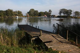
Bernsteinhaff1855, als einen Schiffahrtsweg getieft wurde, wurde im Haff unerwartet eine Bernsteinablagerung gefundet. In der Zeit zwischen 1860 und 1890 wurde dort 2250 Tonen Bernstein gewonnen, einbezogen einzigartige Bernsteingegenstände aus der Jungsteinzeit und der Bronsezeit.  319 319
Services
319km - Distance from countries capital city |
 |
Lithuania
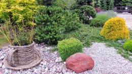
The University of Klaipeda Botanical GardenThe botanical garden was established in 1993 in the lovely Dane River valley. It covers approximately 9.3 hectares, and in 2002, it was given the status of a dendrological park. 
 4-9 4-9


Services
4-9 Active season monthsServices - other
Accepts individual travellers
Accepts tourist groups
This destination has specific opening hours which you must determine in advance
Must register in advance |
 |
Lithuania
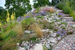
Vilnius University Siauliai Academy Botanical GardenThe botanic garden is part of the Siauliai University and is the newest and smallest botanical garden in Lithuania, covering 6.54 ha of land.
3-10
Services
3-10 Active season monthsServices - other
Accepts tourist groups
Accepts individual travellers
This destination has specific opening hours which you must determine in advance
Must register in advance |
 |
Lithuania
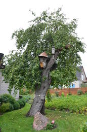
Oldest apple tree in LithuaniaThe oldest apple tree in Lithuania is a forest apple tree and is part of the country's botanical heritage and the only protected apple tree in Lithuania.
|
 |
Lithuania
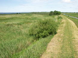
The Nemuna Delta Regional ParkThe Nemuna River divides up into two large streams at its estuary at Kuršių Marios, and this has established the Rusnė Island. This is a unique environmental territory with wetlands, streams, ancient rivers, lagoon lakes and flood plains which are important places for birds to nest and rest during migration season. Vast tracts of this territory are flooded each spring. The park includes the territory to the N and W of Rusne (lagoons, swamps, fishing ponds, Kuršių Marios).
Services
330km - Distance from countries capital cityServices - recreational
Bicycle trailBike the route Rusne-Pakalne-Uostadvaris-Rusne (20 km). 
Nature trailHike the Aukštumalos swamp information trail (1.7 km). 
Nature watchingBird watching on Rusnė Island, as well as at Ventės ragas (Cape Venta), where there is a bird ringing station. There is a viewing tower on the NW end of Rusnė Island, with a visitors centre in the village of Rusne. For more information: www.nemunodelta.lt (available in English). |
 |
Lithuania
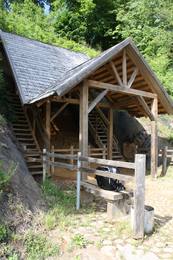
The Venta Regional ParkThe park was established to protect the Venta River valley and the landscapes that are around its tributaries. On the west bank of the Venta, at Papilė, there is a cliff from the Jurassic period which is unique in the Baltic States, has been known since 1925, and has layers in which more than 300 forms of life have been identified over the course of time.
ServicesServices - recreational
Boat tourTake a 1-2 day boat ride down the Venta, from Papilė to Mažeikiai.
Nature trailHike to the cliff.
Nature watchingViews form the Papilė castle hill and a viewing tower. For more information: www.ventosparkas.lt (available in English). |
 |
Lithuania
Regionalpark GrazutėsGegründet für den Schutz der Landschaften und der Seen der Aukštaitija-Anhöhe, Arten und Biotope. 139
Services
139km - Distance from countries capital city |
 |
Lithuania
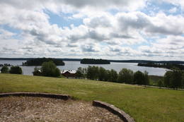
The Zemaitija National ParkThis park is located in the northern part of the Žemaitija Highlands, and much of it is taken up by Lake Plateliai. The park was established to protect lakes, rivers, wetlands and forest ecosystems, as well as the local cultural environment.
ServicesServices - recreational
Boat tourTake a boat to the Pilies island in Lake Plateliai.
Bicycle trailBike around the lake (~25 km).
Nature trailHike the Šierė nature trail (4.1 km), the Plokštinė information trail (3.1 km), which runs past a former Soviet military base, or the Mikytai information trail (1 km).
Nature watchingLook for birds from a tower near Lake Maudutis in the village of Virkšai. A viewing location from the village of Plateliai offering a look at the lake. There’s a visitor centre in Plateliai, as well. For more information: www.zemaitijosnp.lt (available in English). |
 |
Lithuania
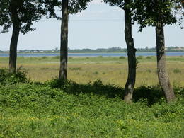
The Meteliai Regional ParkThere are three large lakes at the centre of this park – Lake Dusia, Lake Metelys, and Lake Obelija. Lake Dusia has very clear and transparent water, and its southern and south-eastern beaches are popular among swimmers. The lakes and their nearby wetlands are important during the migration season of birds.
ServicesServices - recreational
Bicycle trailBike around Lake Dusia (25 km) or Lake Metelys (27 km).
Nature trailHike the information trail in the Bijotų and Širvinto forests (4 km).
Nature watchingWatch birds along the shores of the lake during migrating season. Views from the Prelomčiškė castle hill and from the side of the Seirijai-Meteliai road. For more information: www.meteliuparkas.lt (available in English). |
 |
Lithuania
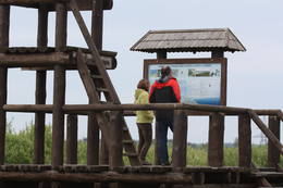
Putnu verosanas tornisReškutenu (Reškutėnai) ciema apkārtnē ir atjaunots neliels mitrājs, kura malā uzcelts putnu vērošanas tornis. Ja paveicas, pavasaros te var dzirdēt vai redzēt tādas retas un aizsargājamas putnu sugas kā ķikutu Gallinago media, ormanīti Porzana porzana, melnkakla dūkuri Podiceps nigricollis, griezi Crex crex u.c. Ciema ainava īpaši pievilcīga ir pieneņu un ābeļu ziedēšanas laikā. No putnu vērošanas torņa var redzēt vietas, kur akmens laikmetā dzīvojuši cilvēki. Blakus esošajā purvainajā pļavā bijis ezera līcis, kur tika būvēti ciemati līdzīgi kā Āraišu ezerpils gadījumā. 108
Services
108km - Distance from countries capital city |
 |
Lithuania
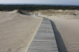
The Dunes of Courland National ParkThis is the only place in the Baltic States where there is such a vast territory of open-air sand dunes which still change the local terrain very actively because of the wind. The only Sea Museum and Dolphinarium in the Baltic States can be found here.
Services
325km - Distance from countries capital cityServices - recreational
Bicycle trailYou can bike from Nida to Smiltynė (>50 km along a bike route).
Nature trailHike the Raganu Hill trail (1.6 km), the Naglių pathway in the sandy area of the nature reserve (~1.5 km), or the Parnidžio dune information trail (~2 km).
Nature watchingWatch for birds on Garnių Hill and throughout the area during migration season. Views from the Naglių and Parnidžio dunes, as well as from the Hageno and Miškos galva dunes. For more information: www.nerija.lt (available in English). |
 |
Lithuania
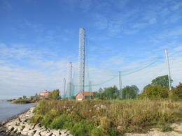
Ventė CapePlace for bird ringing and bird watching. 333
Services
333km - Distance from countries capital city |
 |
Lithuania
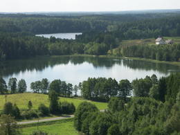
The Labanoras Regional ParkThis territory is rich with forestland and lakes (some 285 in all). There are extensive opportunities for active recreation or calm leisure.
Services
82km - Distance from countries capital cityServices - recreational
Boat tourTake a one or two-day boat ride through the park’s lakes and streams.
Nature trailHike the Peršokšnai information trail (4 km).
Nature watchingThere’s a viewing tower at the Ethno-Cosmology Museum. A visitor centre is found in the village of Labanora. For more information: www.labanoroparkas.lt (only in Lithuanian). |
 |
Lithuania
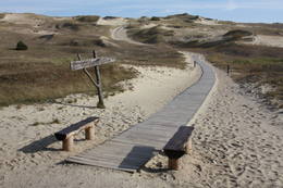
Negelsches Naturreservat (Naglių rezervatas)Die Dünen nördlich Pervalka über dem ehemaligen Dorf Negeln. Eine 9 km lange Strecke mit den wüstenartigen Landschaften. Stegpfade. 356
Services
356km - Distance from countries capital city |
|
|
Lithuania
Veisieji regionalais parksVeisieji reģionālais parks (Veisiejų regioninis parkas) veidots (1992.g.) Sudavas augstienes (Sūduvos aukštuma) ainavu, bioloģiskās daudzveidības un kultūras pieminekļu aizsardzībai. Viena no parka bagātībām ir ezeri, kuru iegarenās formas liecina par ledāja darbības rezultātu. Pēdējā apledojuma laikā šeit atradusies ledāja mala. Ezerus (kopā – 37) ieskauj lielāki meža masīvi uz kontinentālām (iekšzemes) kāpām, kas piemēroti atpūtai dabā, dabas vērošanai, ogošanai un sēņošanai. Parkā ir iekārtotas peldvietas, kur patīkami gremdēties vasaras tveicē, izveidotas dabas takas, bet mazās upītes, kas savieno ezerus, ir piemērotas braucieniem ar kanoe laivām. Veisieji reģionālā parka teritorijā ir liela augu un dzīvnieku daudzveidība. Šeit tiek aizsargātas arī tādas retas sugas kā Eiropas kokuvarde Hyla arborea (parka simbols), purva bruņurupucis Emys orbicularis, dažādas orhideju sugas u.c.  138
138
Services
138km - Distance from countries capital city |
 |
Lithuania
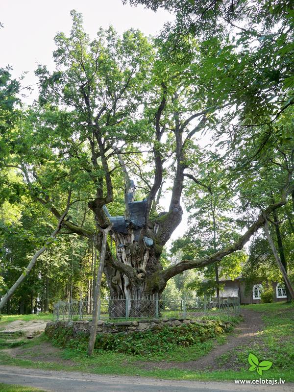
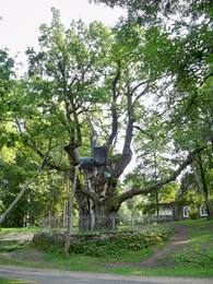
The Stelmuze Estate parkThis park dates back to the mid-18th century and is to the south of Lake Stelmuže. There are winding trails on all sides of the hillock that lead to the Christ the King Church, with linden, maple, oak, birch, fir, elm and pine trees. At the foot of the hillock is the Laime stream, and visitors are welcome to stroll along the alley of oak trees. The oldest and fattest oak tree in Lithuania is one of the oldest ones in Europe. It is though that it is 1,500 to 2,000 ears old, and its record-setting diameter is 3.5 metres (eight or nine people linking hands are needed to encircle it). The tree is 23 m high. 1-12
Services
1-12 Active season monthsServices - other
Accepts individual travellers
Accepts tourist groups |
|
|
Lithuania
The Kursiu Dune (Kursių nerija)In terms of territory, it is the most impressive dune range in the Baltics. This is the only place in the Baltics, where one can enjoy open dune sands that are still active and, under the influence of wind, form the so-called eolian relief forms. There are trails, wooded trails and a paved bikeway for the conveniences of visitors. In order to protect the dune, The Dunes of Curonian spit National Park has been established . 340
Services
340km - Distance from countries capital city |
 |
Lithuania
Botanikas takaKaut arī Augštaitijas nacionālo parku uzskata par floristiskā ziņā ļoti bagātu teritoriju, šī ir vienīgā vieta, kur varam iepazīt augu valsts bagātību. To īstenot palīdz takas malās izvietotie informācijas stendi. 3,8 km garās lokveida takas sākums ir meklējams Palūšē, Lūšu (Lūšiai) ezera galējā austrumu punktā. Taka ved gar ezera krastu, mežainām kāpām, nelielu strautu ielejām un pa purvāju. Nenomaldīties palīdz krāsu marķējums uz koku stumbriem. 113
Services
113km - Distance from countries capital city |
 |
Lithuania
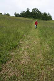
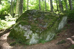
Sarneles (Zviedru) pilskalns (Sarnelės (Svedų) piliakalnis)Viens no iespaidīgākajiem nacionālā parka pilskalniem, kura piekājē atradusies senpilsēta. Arheoloģisko izrakumu gaitā te atrastas kuršu senlietas. Tiesa, mežs un biezais augājs traucē uztvert šī nozīmīgā arheoloģijas pieminekļa patiesos apjomus un formu. Uz pilskalnu vasarās ved izpļauta taka. Ja esat Žemaišu Kalvarijas pusē un atliek brīvs brīdis, tad savā maršrutā var iekļaut arī šo apskates objektu. 317
Services
317km - Distance from countries capital city |
 |
Lithuania
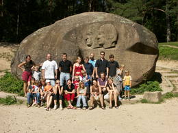
Mikitai izzinas taka (Mikytų pazintinis takas)Vienu kilometru garā lokveida taka, kas ved pa lielāku nacionālā parka meža masīvu, uzskatāmi attēlo Žemaitijas augstienes un tuvākās apkārtnes reljefa veidošanās vēsturi. No takas augstākā punkta – Mikitai kalna, kas ir sens pagānu upurkalns, paveras (ainaviska stiga) tālākas apkārtnes skats. Kā takas interesantākie apskates objekti ir jāmin teikām apvītais akmens ar Velna pēdu un ar akmeņiem izliktas akas paliekas. 316
Services
316km - Distance from countries capital city |
 |
Lithuania
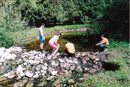
The Anyksciai Regional ParkThe “backbone” to this park is the valley of the Šventoji (Holy) River. One of the most impressive Devonian cliffs in Lithuania can be seen from the river – Vetygalos atodanga. On the shores of the Varius stream is a cliff made of quartz and sand – Variaus atodanga. 6 km to the S of Anykščiai is Lithuania’s second largest rock (5.7 m high, ~100 m3) – Puntukas akmuo.
ServicesServices - recreational
Boat tourBoat from Anykščiai to Kavarskas (one day), or boat in Lake Rubikiai.
Bicycle trailBike the route Anykščiai-Puntukas-Anykščiai (12 km).
Nature trailHike the Švenoji trail (5.5 km).
Nature watchingViews from cliffs and the Šeimyniškėliai castle hill. For more information: www.anyksciuparkas.lt (available in English). |
 |
Lithuania
The Birzai Regional ParkThis is one of the most outstanding areas in the entire Baltic States with active underground waterways which still, to this very day, dissolve local gypsum rock. Parts of the area collapse regularly, and there are legends about all of this. Underwater rivers, streams, the so-called Karvės (Cow) cave, etc., can be seen in the area.
ServicesServices - recreational
Nature trailHike along the Smardones šaltiniai stream, with a walking bridge across Lake Širvėnos (500 m). Hike other trails around the little lakes in the area. There’s a visitor centre in Biržai. For more information: www.birzuparkas.lt (available in English). |
 |
Lithuania
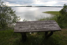
Platelu ezers (Platelių ezeras)Nacionālā parka galvenā ainavas dominante. Ezers ir ~ 8,4 km garš un līdz 3,3 km plats. Tā austrumu krasti pārsvarā ir ar mežiem apauguši, ziemeļrietumu krasts – purvains, bet rietumu krastā parādās apdzīvotas sētas un simpātiskā Plateļu (Plateliai) pilsētiņa, kur meklējamas skaistākās skatu vietas. Ezera krastos ir labi attīstīta infrastruktūra - tūristu mītnes, ēdināšanas uzņēmumi (Plateļos), ūdenssporta un atpūtas inventāra noma. Ūdens dzidruma dēļ, Plateļu ezeru ir iecienījuši zemūdens niršanas entuziasti. Ezerā ir vairākas salas, no kurām interesanta ir Pils salas (Pilies sala), uz kuras no 15. – 16. gs. atradās muiža. Pastāv uzskats, ka senie Plateļu apkārtnes iedzīvotāji sākotnēji ir dzīvojuši uz salas, kuru ar krastu savienojis uz pāļiem celts tilts. Jāpiemin, ka 15 gs. pirmoreiz pieminētā Plateļu pilsētiņa atradusies uz Šventorkalņa (Šventorkalnis) kalna. Apkārt Plateļu ezeram ir izveidots ~ 24 km garš velomaršruts. Tā ir ļoti laba iespēja iepazīt parku videi un ceļotāja veselībai draudzīgā veidā. 307
Services
307km - Distance from countries capital city |
 |
Lithuania
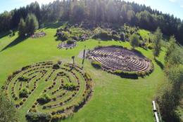
The Energetic Labyrinth and Geometric Figure ParkThis park has five labyrinths with decorative plants, flowers and various kinds of medicinal plants. The longest path in the labyrinth is 1.7 km long. The total distance of the paths is 4.5 km. The park has three geometric figures -- a cupola, a mandala and a Merkabah. 1-12


Services
1-12 Active season monthsServices - other
Accepts individual travellers
Accepts tourist groups
This destination has specific opening hours which you must determine in advance
Pre-order required
Optional meals |
 |
Lithuania
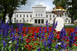
The Plunge Estate parkThe Plunge Estate is famous because its park, which is a mixed-type park that was established during the 18th and 19th century at a holy forest that used to be a sacrificial place. The pride and joy of the park is the Thunder oak tree, a legendary weeping linden tree and an elm tree with five trunks. The lord of the state ordered the digging of seven ponds with cascades. These are linked by rock bridge sluices. The Babrungo River, which flows alongside the estate offers an outstanding landscape for the park. 1-12
Services
1-12 Active season monthsServices - other
Accepts individual travellers
Accepts tourist groups
This destination has specific opening hours which you must determine in advance |
 |
Lithuania
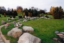
The Salantai Regional ParkThe terrain in this territory was created during the Ice Age. There are the ancient river valleys of the Minija, Salantas and Erla rivers, along with groups of rocks.
ServicesServices - recreational
Nature trailFor hikers, the largest collection of open-air rocks can be found in the village of Mosėdis (the collection was put together by Vaclavas Intas). There is also a museum of unique rocks there. At Salantai-Orvydų sodyba is a unique farm with installations featuring rocks and other objects. You can also hike the Šaukliai nature trail (2 km). For more information: www.salanturp.lv (only in Lithuanian). |
 |
Lithuania
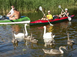
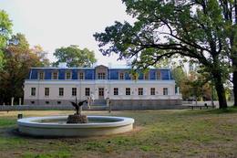
The Aukstaitija National ParkThis was the first national park in Lithuania, and it is in the northern part of the Aukštaitija Higland, where hillocks interweave with lots of little lakes and ethnographic villages. Many of the lakes are connected with streams, forming long chains of lakes that are perfect for water tourists.
Services
124km - Distance from countries capital cityServices - recreational
Boat tourSpend one or two days boating along the lakes of the national park (Palūšė-Ginunčiai, Palūšė-Kaltanėnai, etc.).
Bicycle trailBike the route Ignalina-Palūšė-Antalksnė-Ginučiai-Stripeikiai-Trainiškis-Ignalina (45 km).
Nature trailHike the Palūšė botany trail (3.5 km).
Nature watchingA bird-watching tower at Reškutėnai, views from Ladakalnis Hill. There’s a visitor centre at Palūšė. For more information: www.anp.lt (available in English). |
 |
Lithuania
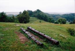
The Zagare Regional ParkŽagare has long since been known for a special type of cherries. There are various varieties which only differ in terms of when they are ripe and productive. There are different types of trees. The cherries grow at nearly home, and that is an exclusive symbol of Žagare. |
 |
Lithuania
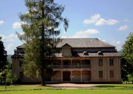
The Varniai Regional ParkIn the central part of the Žemaitija Highland, this park was established to protect local landscapes. Lithuania’s highest hillocks are found here – Mėdvegalis (235 m above sea level) and Šatrija (229 m). There are also other hillocks which offer a great view of the area – make up your own tour here.
ServicesServices - recreational
Nature trailHike the Debesnos botany trail (2 km).
Nature watchingViews from the Mėdvegalis, Šatrija, Moteraitis and Bilioniai castle hills. There’s a visitor centre at Varniai. For more information: www.varniai.lt (only in Lithuanian). |
 |
Lithuania
The Kurtuvenai Estate ParkThis estate is surrounded by an ancient and geometric landscape. During the latter half of the 19th century, it had a landscape style with various elements of geometry. The park covers 4.2 ha and has ancient linden, maple, elm, oak and other decorative bushes, with more than 20 types of plants that have turned into wood. 1-12
Services
1-12 Active season monthsServices - other
Accepts tourist groups
Accepts individual travellers
This destination has specific opening hours which you must determine in advance |