Nature objects in Estonia
What's special about the nature in Estonia?
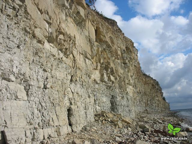
In Estonia, there stands the most impressive rock wall in the Baltics - the so called North Estonian "glint" (from Estonian language). Estonia has its own "Land of Inlets" - the Lahemaa region with its national park, the "Land of Islands" - the Saaremaa island and the Monzund archipelago. The Matsalu bay is one of the most significant rest stops for birds during their migration. In Estonia there is one of the most prominent impact craters in Europe, there are the greatest waterfalls and boulders in the Baltics, the Munamagi hill - the highest spot in the Baltics, the Lake Peipus - the 5th largest lake in Europe, - with long-standing fishing traditions, and the great variety of nature from West to East, from North to South.
Act responsibly - follow the Green advice!
| Overview | Details |
|---|---|
|
Estonia
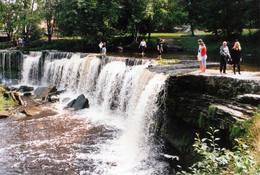
Keila waterfallThis is one of the loveliest waterfalls in Estonia – up to 6 m in height and 50 m in width. Recommended: The rapid Keila River has carved a cliffy canyon behind the waterfall, with a flow of water that falls down a major distance. It’s worth hiking through the Keila park to the shore of the Bay of Finland (~1 km), then returning along the other bank of the river.
|
|
|
Estonia
Anhöhe OtepääOne of the three highlands of Southern Estonia with scenic hills and beautiful sights. In its center lies the bay-rich Lake Pühajärv (translating from Estonian - Holy Lake). |
|
|
Estonia
Rebases ainavu taka (Rebäse maastikurada)Ap 7 km garš lokveida pārgājienu maršruts (marķēts), kas ved pa dažādiem biotopiem – mežiem, mitrājiem un pļavām, mezdams līkumus pa stāvo pauguru nogāzēm. Takas malās ir izvietoti informācijas stendi un norādes. Rebases ainavu taka ir domāta tiem, kurus nebaida garāka iešana un orientēšanās pa ļoti dabisku un mazapdzīvotu apvidu. |
|
|
Estonia
Vilsandi sala (Vilsandi saar)Vilsandi nacionālā parka „sirds” un divpadsmitā lielākā Igaunijas sala (garums - 6 km, platums – 2 km). Tā ir ļoti „jauna” sala, kas sākusi veidoties pirms ~ 2000 gadiem zemes garozas celšanās rezultātā, savienojoties divām salām, kas noticis pirms ~ 350 gadiem. Cilvēki salu sāka apdzīvot 18. gs. un to galvenā nodarbe bija zvejniecība, kuģu būve, nelielā apjomā – lauksaimniecība. Līdz 2. pasaules karam te bija ap 200 iedzīvotāju, kuri vēlāk salu bija spiesti pamest PRSR pierobežas režīma zonas dēļ. Nozīmīgu Vilsandi daļu aizņem mežs un kadiķu lauki. To visā garumā šķērso grantēts - zemes ceļš ar atzariem uz jūras krastu. Salu ar kājām var izstaigāt vairāku stundu laikā, iepazīstot vietējo apbūvi (daļa arī mūsdienās celtas ēkas) un Tolli sētu, kur pēc nostāstiem dzīvojis nīderlandiešu jūras braucējs Johans Dolls, kā arī vējdzirnavas. Noteikti ir jāaiziet līdz salas rietumu krastam, kur atrodas Vilsandi bāka un bākas uzrauga saimniecības ēkas. No šejienes ir labi redzamas Vaikas salas. Šodien uz salas pastāvīgi (visa gada garumā) dzīvo tikai trīs cilvēki. |
|
|
Estonia
Eldas klints (Elda pank) un pussalaNacionālā parka dienvidrietumdaļā jūrā iestiepjas Eldas pussala – skaists un ļoti omaļš ar kadiķu mežu (alvāriem) noaudzis zemes pleķītis ar interesantu jūras krastu, kur atsedzas silūra perioda nogulumieži. No pussalas gala, kurā slejas vecs Padomju armijas robežsargu tornis (apmeklējumam bīstams!), paveras visaptverošs skats uz Vilsandi salu (atpazīstama pēc bākas), Lonalaidas salu (Loonalaid) – otru lielāko Vilsandi arhipelāgā, Salavu (Salava) un citām mazākām saliņām. Dabas mīļotāji var uzmeklēt Eldas klinti (Elda pank) – ~ 2 m augstu un 0,4 km garu atsegumu, kura piekājē var atrast interesantas ūdens izskalotas fosilijas. |
|
|
Estonia
Halbinsel KäsmuEine von Nadelbaumwäldern bedeckte Halbinsel. Malerisches Käsmu Steinfeld, Matsikivi Stein, Vana Jüri Stein u.a. Bei passenden Bedingungen kann man sich auf einer steinernen Landzunge bis zur 0,5 km entfernt liegenden Insel Saartneem schleppen. |
|
|
Estonia
Nemmeveski udenskritums (Nõmmeveski juga)No vairākiem parka ūdenskritumiem noteikti ir jāapmeklē divi. 1,2 m augstais vienpakāpes Nemmeveski ir izveidojies uz Valgejegi upes (Valgejõgi), vietā kur tā šķērso Ziemeļigaunijas glintu. Šeit Valgejegi atgādina krāčainu (īpaši – pavasaros) kalnu upi, kas plūst pa vairākus metrus augstu klinšu ieskautu kanjonu. Palu laikā šo upes posmu ir iecienījuši ekstrēmie ūdenssporta veidu cienītāji. Pie ūdenskrituma un tālāk pa upi lejup redzamas ap 1920. g. celtās hidroelektrostacijas konstrukciju paliekas. |
|
|
Estonia
The Vilsandi National ParkThe national park was established to protect the 100 or so small islands that make up the archipelago of the local area. The largest island, the Vilsandi Island, is 6 km long and up to 2 km wide. You can rent a boat to get there, or, during appropriate conditions, you can walk across the sea and the small islands from the southern end of the Kuusnõmme peninsula.
|
|
|
Estonia
Leti tornis (Läti torn)Jēsū – Kepu ceļa malā pie Leti (Läti) ciema ir izveidots autostāvlaukums ar putnu vērošanas torni, no kura paveras skats uz Hallistes upes palieņu pļavām un tuvējā ciema apkārtni. Stipru palu laikā arī no šī torņa redzamā apkārtne (izņemot ceļus) var atrasties zem ūdens. Laba putnu vērošanas vieta. Läti tulkojumā no igauņu valodas nozīmē Latvija. |
|
|
Estonia
The Matsalu National ParkThis is one of the most popular bird-watching locations in Estonia, and during spring and autumn migration there are a great many different kinds of birds resting and feeding in the meadows and shallow coastal waters of the Bay of Matsalu and the Kasari River.
|
|
|
Estonia
Naissaar islandNaissaar is a small island near Tallinn which was exclusively used by the Soviet military from 1945 to 1993. Attractions on the island include walking trails, varied habitats, a narrow-gauge railway, fortifications from the early 20th C, and a Soviet naval mines factory. |
|
|
Estonia
Aegna IslandThis is an entirely forested island in the Bay of Finland, ~14 km from Tallinn. A network of small pathways covers the entire island. Recommended hike along the seashore of the island, which will offer dunes, as well as a coastline that is sandy in some parts, rocky in others, and covered with reeds in still others (~9 km). A ferry boat will take you to the island from the Pirita port.
|
|
|
Estonia
Suitsu tornis (Suitsu torn)Suitsu tornis celts 1979. g. kā pirmais Matsalu rezervāta metāla tornis. To atjaunoja 1998. g. Torņa augstums ir 21 m, tādēļ no tā paveras izcila dabas un kultūrainava uz Kazari deltas niedrājiem un blakus esošo Suitsu upi (Suitsu jõgi), kuras krastā ir uzceltas vairākas zvejnieku laivu būdas. |
|
|
Estonia
The Viidumäe ReserveThis reserve dates back to Lake Ancilus, which was one of the original elements of what is now the Baltic Sea. The lake’s ancient shores feature wetlands, forests and flora which are all protected by the reserve.
|
|
|
Estonia
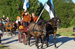
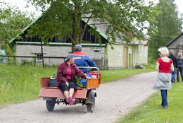
Tihuse Riding Farm heritage trailTihuse farm provides accommodation and horse riding from trekking to carriage rides. A signposted heritage trail starts at the farm and tells the story of people and Nature; you can also learn about old beliefs and customs. The teahouse exhibits photos of places linked to Muhu island’s heritage. |
|
|
Estonia
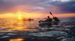
Reimann RetkedThe company runs wildlife tours: rafting in early spring, kayaking in summer (with beaver watching upon request), bog and snowshoeing round the year, kick-sledging in winter. Our experienced guides tell exciting stories of wildlife and history. |
|
|
Estonia
Erdi taka (Öördi rada)1,2 km gara taka, kas pa purvainu mežu aizved līdz Ērdi purvam (Öördi raba) un tā austrumu daļā esošajam Ērdi ezeram (Öördi järv), pie kura izveidota atpūtas un peldvieta. |
|
|
Estonia
Piirissaar islandThe island of 7.5 km2 in Lake Peipsi is largely inhabited by Russian-speaking Old Believers who have broadly retained their old traditions through time. Traditional trades are fishing and growing vegetables, mainly onion. |
|
|
Estonia
Joaveski udenskritumi (Joaveski joastik)Krāčains Lobu upes (Loobu jõgi) posms pie Joaveski ciema, kur ~ 160 m garumā upes gultnē, tai šķērsojot Ziemeļigaunijas glintu, izveidojušās izmēros nelielas, tomēr ļoti ainaviskas un skaistas 0,5 – 1 m augstas ūdenskritumu kaskādes. 1898. g. šeit uzcēla hidroelektrostaciju, kuras atliekas ir redzamas upes labajā krastā. Iecienīta pavasara laivotāju treniņu vieta. |
|
|
Estonia
Putnu verosanas tornis Puises ragaPuises ragā (Puise nina) ir uzcelts divstāvīgs atpūtas nams, kas apvienots ar putnu vērošanas torni. No tā paveras skats uz piekrasti, kas ir iecienīta migrējošo zosu atpūtas vieta. Šī ir privāta teritorija, kuras apskati vēlams saskaņot ar īpašnieku. |
|
|
Estonia
NaisaarThis is a forested island in the Bay of Finland which is the 6th largest Estonian island and is found 14 km to the N of Tallinn. Two decades ago it was a closed zone, because the Soviet Union had a highly secretive manufacturing plant for maritime mines here.
|
|
|
Estonia
Ehijervs (Ähijärv)Karulas nacionālā parka lielākais ezers - 2,8 km garš, līdz 1 km plats. Ezera ziemeļaustrumu krastā atrodas parka apmeklētāju centrs. 5,5 m dziļais ezers ir gan zivīm, gan nostāstiem bagāta vieta. Ezera un tuvākās apkārtnes iepazīšanas nolūkā ir izveidota 3,5 km garā Ehijerva taka (Ähijärve teerada). Tās sākums atrodas pie iepriekš minētā apmeklētāju centra, kur izveidota atpūtas vieta un atraktīvs bērnu spēļu laukums. Taka sākumā ved gar ezera krastu, nelieliem mitrājiem un meža ceļiem, kas izmantoti iepriekšējos gadsimtos. |
|
|
Estonia
Kaali meteorite cratersThis is actually a group of nine craters, and some of them are as much as 100 m in diameter and 16 m in depth. This is the most visually expressive meteorite crater in the Baltic States and, indeed, in all of Europe. Remnants of the meteorite – some 2.5 kg in all – yielded iron and nickel. It is thought that this pan-Baltic natural catastrophe occurred 2,600 to 4,000 years ago. Kaali Visitor Centre comprises the meteoritics and limestone museum, a conference hall and a hotel.The museum exhibits genuine meteorite pieces amongst other items. The hotel has all modern conveniences, tasty food is provided at Kaali Tavern nearby. |
|
|
Estonia
Saka-Ontika-Toila-pank (cliff)This is a cliff with various levels. Known as the North Estonian cliff, it stretches all along the shore of the Bay of Rīga in Estonia, including some of the local islands. The most expressive part in geological and landscape terms is the Saka-Ontika-Toila cliff, which is around 22 km long and offers an unusual natural environment. The cliff is as much as 53 m high, and it has a fairly virginal forest along its slopes. The layers of clay, sandstone, limestone, etc., come from the Cambrian and Ordovician periods. The Valaste juga (Valaste waterfall) is 24 metres high. After a longer period of freezing temperatures, the waterfall has a particularly impressive appearance. Seasonal waterfalls (8-10 m) can be found near the villages of Ontika and Toila.
|
|
|
Estonia
Mejekoses pargajienu taka (Meiekose matkarada)~ 3 – 5 km gara taka, kas ved pa veco ceļu gar Tēramā upes (Tõramaa jõgi) kreiso krastu. Takas malās izvietoti interaktīvi elementi bērniem, kas palīdz labāk uztvert dabā notiekošo. Taku ieskauj mitrie meži un palieņu pļavas, kas palu laikā atrodas zem ūdens. Tēramā (Tõramaa) ciemā apkārtnē atrastas cilvēka darbības pēdas jau no akmens laikmeta. |
|
|
Estonia
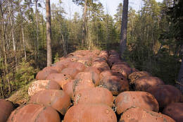
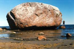
The Letipea Ehalkivi rockThis is the largest rock in the Baltic States and, according to some sources, in all of the segment of Northern Europe which was affected by the last Ice Age. Its size is 930 m3! The rock is 7.5 m high, 16.5 m long and 14 m high, with a circumference of 48.5 m. The rock resembles a huge pebble from a distance, and it is on the sandy and rocky beach. Depending on the season, it can be out in the water. The Ice Age carried the rock to its current location from the southern shore of Finland. It is made of pegmatite.
|
|
|
Estonia
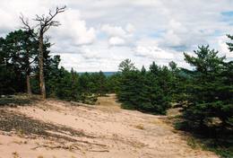
LuitemaaThe word “Luitemaa” means “land of the dunes” in Estoninan. This coastline territory stretches for 13 km between Vöiste and Häädemeste with shallow waters, large coastal plains, Estonia’s highest dunes, and the Tokuse swamp (Tokuse raba). There are lots of birds here.
|
|
|
Estonia
Penije tornis (Penijõe torn)Lai nokļūtu līdz šim tornim, ir jāveic apmēram 20 – 30 min ilgs pārgājiens pa dabas taku no Penijē muižas gar Penijegi (Penijõgi) kreiso krastu. Te redzami bebru darbi un to celtās zaru mājas. No torņa paveras skats uz Kazari deltu, kas dabā izpaužas kā monolīts un nepārskatāms niedrājs. To vairākās daļās sadala Kazari un mazāka izmēra upītes. Katrai deltas daļai ir savs vēsturiskais nosaukums: no torņa pa kreisi no Penijegi redzama Lihula meri (Lihulas „jūra”), bet tās labajā pusē - Kloostri meri (Klostri „jūra”). Putnu vērotāji var iziet garāku (7 km) dabas takas loku, kas ved pa palieņu pļavām. Jārēķinās, ka pavasaros būs nepieciešami piemēroti apavi! Pļavas ierobežotās platībās apsaimnieko mājdzīvnieki, tādēļ neaizmirstiet aizvērt vārtiņus aiz sevis un netraucējiet to ikdienas gaitas! No maršruta nav atļauts novirzīties, lai netraucētu putnus. |
|
|
Estonia
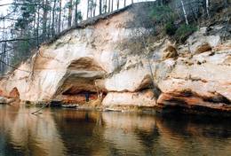
Ancient Võhandu River valleyThis is one of the most beautiful ancient river valleys in Estonia – 12 km long with nearly 40 revealed Devonian sandstone cliffs. Among these, the most important ones are Viira müür, Kalamatu müür, and Põdramüür.
|
|
|
Estonia
Terama taka (Tõramaa matkarada)Divarpus kilometrus gara taka (vienā virzienā) aizved līdz Hallistes palieņu pļavām, kur Hallistes upes labajā krastā ir uzcelts divstāvīgs koka skatu tornis. No tā paveras visaptverošs skats uz atjaunotajām (izcirsti krūmi) Hallistes palieņu pļavām. Pavasara palu laikā no torņa redzamā apkārtne un tornis atrodas ūdenī. |
|
