Nature objects in Estonia
What's special about the nature in Estonia?
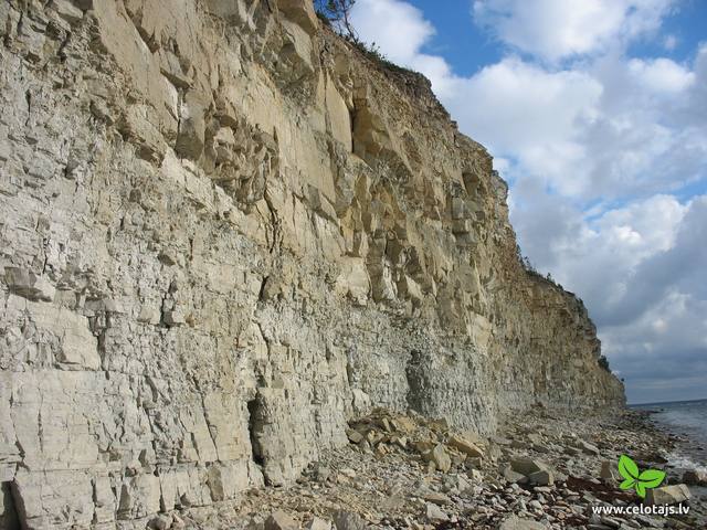
In Estonia, there stands the most impressive rock wall in the Baltics - the so called North Estonian "glint" (from Estonian language). Estonia has its own "Land of Inlets" - the Lahemaa region with its national park, the "Land of Islands" - the Saaremaa island and the Monzund archipelago. The Matsalu bay is one of the most significant rest stops for birds during their migration. In Estonia there is one of the most prominent impact craters in Europe, there are the greatest waterfalls and boulders in the Baltics, the Munamagi hill - the highest spot in the Baltics, the Lake Peipus - the 5th largest lake in Europe, - with long-standing fishing traditions, and the great variety of nature from West to East, from North to South.
Act responsibly - follow the Green advice!
| Overview | Details |
|---|---|
|
Estonia
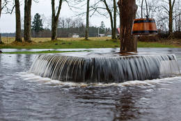
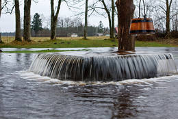
Tuhala Nature Centre and NõiakaevTuhala region has settlements of about 3000 years of age. There are 11 ancient settlement sites, 30 cult stones, 3 burial sites, 4 sacred groves, etc. Tuhala Landscape Reserve has a unique natural feature - the Nõiakaev (Witch´s Well) which “boils” up water during floods at 100 l/s, and 5 mightiest energy columns of the country. |
|
|
Estonia
Lemmje pargajienu taka (Lemmjõe matkarada)Taka, kas izveidota Lemmjegi (Lemmjõgi) un Raudnas (Raudna jõgi) satekas vietā, iepazīstina ar palieņu pļavām un veciem pārmitriem mežiem, kas ir vieni no lielākajiem Igaunijā. Takas sākumā dominē atklātas lauku ainavas. Viens no 4,9 km garās lokveida takas apskates objektiem ir Lemjē dižozols. Mitrā laikā noderēs ūdensizturīgi apavi. |
|
|
Estonia
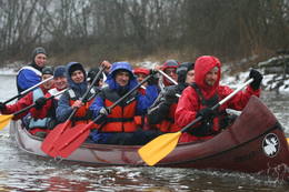
360° adventuresThe company runs wildlife tours: kayak trips at sea in summer, bogshoeing in bogs in autumn, snowshoeing trips in winter and canoeing on rivers in spring. |
|
|
Estonia
Kuranidu macibu taka (Kuuraniidu õpperada)1,7 km gara lokveida taka, kas iepazīstina ar dažādiem meža biotopiem, to iemītniekiem un meža apsaimniekošanas pamatprincipiem. Apmeklētāju ērtības nolūkā ir izveidotas koka laipas un neliels skatu tornis. |
|
|
Estonia
Neri akmeni (Näärikivid)Trīs lielāka izmēra laukakmeņi – aizsargājami dabas pieminekļi, kas atrodas Matsalu līča krastā starp Sāstnas (Saastna) un Metskjulas (Metsküla) ciemiem. Tuvējā ceļa malā ir izvietots informācijas stends un norādes, bet līdz akmeņiem var nokļūt pa iezīmētu taku. Pēc kāda tautas nostāsta, lielas vētras laikā, kas notikusi Jaungada naktī, lielais akmens sašķēlies trīs daļās. No tā arī cēlies vietvārds. Apkārtnē redzamās pļavas ir nozīmīga daudzu augu sugu dzīves vide un svarīga putnu ligzdošanas un atpūtas vieta. Šī iemesla dēļ taku drīkst apmeklēt tikai no 1. jūlija līdz septembra beigām. Akmeņi ir arī labi redzami no minētā ceļa. Tie ar ledāju atceļojuši no Turku (Somija) apkārtnes. |
|
|
Estonia
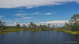
The Endla ReserveThis reserve was set up to protect local swamps and surrounding wetlands. Please note that before you can visit the reserve, you must register with the local administration and visitor centre in the village of Tooma.
|
|
|
Estonia
Gas mixtureGas mixture is the main raw material for Estonia’s energy and chemical industries, and it is extracted in our day from open quarries or underground shafts. This layer was established during the Ordovician Period between 450 and 480 million years ago, and it is made up of the remnants of plants and animals from that age. In the Kohtla-Nõmme suburb, there is a shaft which can be toured in the company of a guide who will tell you that this is the only layer of its kind in the Baltic States. He will tell you about how the gas mixture has been extracted over the course of history.
|
|
|
Estonia
Kidevas (Kiideva) putnu verosanas platformasPirmā ir uzcelta uz vienstāvīgā apmeklētāju centra jumta. No tās paveras plašs skats uz Kīdevas ciemu, ostu un niedrēm apaugušo Matsalu līča ziemeļdaļu. Austrumos no šīs atrodas vēl viena - divstāvīga putnu vērošanas platforma. No Kīdevas līdz Puisei gar Matsalu līča var doties pārgājienā pa 5 km garo dabas taku. To izejot, novēroto putnu sugu klāsts noteikti būs lielāks! |
|
|
Estonia
The Panga cliffsThe highest and most beautiful wall of cliffs on Saaremaa Island (up to 21 m high), stretching along some 3 km. During strong winds from the W or NW, a part of the cliff is washed by the waves of the sea. The open face of the cliff has limestone, marls and dolomite, and there is a wealth of fossils at the base of the cliff – corals, stromatoporids, etc.
|
|
|
Estonia
Risas purva taka (Riisa rabarada)Izcila lokveida taka (4,5 km), kuras lielākā daļa (koka laipas) ved pa Rīsas purvu (Riisa raba). No takas un divstāvīgā koka skatu torņa ir vērojami purva ezeriņi, lāmas, un purvaini meži. Ja nacionālā parka apskati sāk no ziemeļu puses, tad šī taka ir labs ceļojuma iesākums! |
|
|
Estonia
Hjupasares pargajienu taka (Hüpassaare matkarada)Iepazīstina ar Somā nacionālā parka lielākā purva – Kureso (Kuresoo) ziemeļaustrumu daļu, kur redzamas purva ezeriņu un lāmu ainavas. Takas sākumā atrodas igauņu komponista, ērģelnieka un folkloras vācēja Marta Sāra (Mart Saar) (1882. – 1963.) dzimtās mājas. To apkaimē pļavas apsaimnieko aitas. Lokveida takas garums ir 4,2 km. |
|
|
Estonia
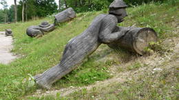
Theme park of GothamitesThe theme park of wise men of Gotham (Kilpla) is located in Müüsleri village; the park’s attractions arise from legends told in Germany some 400 years ago. Gothamites are funny characters famous for their irrational, impractical and foolish actions. Fun-packed tours and activities are on offer along with craft workshops, themed souvenirs, catering (groups should book in advance), and grounds for pitching tents. |
|
|
Estonia
Skatu platforma Puises ciemaPuises „centrā” uz vienstāvu koka mājiņas jumta izveidota skatu platforma. No tās paveras laba ainava uz ciemu, ostu un piekrastes kadiķu laukiem. |
|
|
Estonia
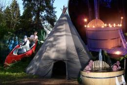
Lahemaa Hiking CentreThe Centre promotes sustainable lifestyle and the great outdoors, there you can plant trees and make and install nest boxes. Canoeing, bog walks, bow and crossbow shooting ranges are available for the more adventurous. There is a log house for functions and accommodation and a sauna with a hot tub. |
|
|
Estonia
Harilaidas pussala (Harilaid)Sāmsalas ziemeļrietumu daļā jūrā iestiepjas iespaidīgā Tagameizas pussala (Tagamõisa poolsaar). Tās ziemeļrietumu daļā meklējama mazāka – ap 5 km garā Harilaidas pussala (Harilaid). Pussalas vidusdaļā viļņojas Lajalepas ezers (Laialepa järv) - bijušais jūras līcis, kas zemes garozai ceļoties, kļuvis par iekšēju ūdenstilpi. Arī pati Harilaida (igauniski „laid” nozīmē „saliņa”) vairāk nekā trīs gadsimtus atpakaļ bijusi sala. Harilaidu iecienījuši ne tikai migrējošie putni, bet arī roņi, kurus piesaista vientuļi līči un akmeņainās sēres. Harilaidu var apmeklēt tikai ar kājām vai ar divriteni, bet spēkrati ir jāatstāj autostāvlaukumā. No tā ~ 1 km attālumā atrodas vieta, kur pēc 17. gs. radies Harilaidas savienojums ar Sāmsalu. Šeit paveras nepierasti klaja un akmeņaina ainava. Pārējā Harilaidas daļa ir apmežota pirms ~ 40 gadiem. Kopumā būs jāveic ~ 10 km garš pārgājiens. |
|
|
Estonia
Paunas taka (Pauna rada)Kultūrvēsturiska taka (garums ~ 2 km) Tipu (Tipu) ciemā, kas iepazīstina ar vairākiem interesantiem objektiem: veco skolu (1931. g.), Hallistes upi, pirti un Paunas saimniecību, kurā dzimis viens no Igaunijas nacionālās kustības līderiem Villems Reimans (1861. – 1917.). |
|
|
Estonia
Oksas (Oksa) takaBijušā piecstāvīgā metāla skatu torņa apkaimē plešas Lemmjegi upes palieņu pļavas. Netālu atrodas kādreizējā Oksas kroga (Oksa kõrts) vieta, kur saglabājies iespaidīgs manteļskurstenis. Apkaimes apskatei izveidota 0,8 km gara koka laipu taka. |
|
|
Estonia
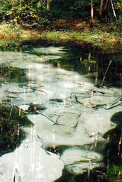
The blue streams of SaulaThree little lakes can be found on the left bank of the Pirita River with many erupting “eyes” of streams, each with its own colour (bluish-green, white, dark). This puts together various colour combinations. These are often known as the most beautiful streams in Estonia. Some pump out as much as 20-30 litres of water per hour. It is said that the waters are good medical resources, particularly for the eyes. There are improvements in the area of tourists.
|
|
|
Estonia
Perajerva meza taka (Pärajärve metsarada)Četrus kilometrus gara marķēta lokveida taka, kas ved pa lielāku meža masīvu, iepazīstina ne tikai ar augiem un dzīvniekiem, bet arī mežsaimniecības tradīcijām. Takas sākums atrodas pie nelielā Perejerves ciema, uz kuru paveras labs skats no tuvējā paugura. Pie autostāvlaukuma izveidota atpūtas un piknika vieta. |
|
|
Estonia
Skats uz Vaikas salam (Vaika saared)No Vilsandi bākas un tai tuvākās apkaimes ir labi saskatāmas leģendārās Vaikas salas. Tām ir piešķirts rezervāta statuss, tādēļ salas var apskatīt tikai no attāluma. Mazākā no saliņām - Kullipank ir tikai pārdesmit metrus diametrā. Tā ir jūras ūdeņu izrobots zemas un asas dolomīta klints fragments, kas klāts ar oļiem, nelieliem laukakmeņiem un kādu atsevišķi stāvošu lakstaugu. Domājams, ka vētru laikā tā pazūd zem jūras ūdens. Savukārt, Alumine Vaigas – Apakšējā Vaikas sala ir lielākā no sešām salām. Šīs salas diametrs ir ~ 150 m un tā paceļas vismaz kādus divus metrus virs jūras līmeņa. Uz salas ir bagātīga veģetācija un pat kāds zems krūms salas centrā. Redzami arī metru augsti atsegumi. Uz salas vēl joprojām atrodas 20. gs. sākumā celto „putnu māju” paliekas, kas bija domātas ligzdojošo putnu piesaistīšanai. |
|
|
Estonia
Stein MajakiviDer dritgrößte Feldstein im Baltikum (584 m3, 7 m hoch, Durchmesser bei dem Grund – 32 m ). Auf estnisch bedeutet „Hausstein”. Befindet sich am Rande des Pikanõmme – Majakivi Pfades (4,5 km lang). |
|
|
Estonia
Halbinsel PärispeaAuf der Küste der Halbinsel befinden sich sowohl ehemalige Fischerdörfer, als auch die Reste eines Militärstützpunkts der Sowjetarmee. Großartige von den Gletschern des Eiszeitalters eingebrachte Feldsteine. |
|
|
Estonia
Moor TolkuseDurch das höchste Dünen-Massiv Estlands und den Moor führt der Lehr-Wanderweg. Blick vom Aussichtsturm bis auf die Insel Kihnu. |
|
|
Estonia
Domberg TartuVom 19. Jh. ist der Domberg ein offentlicher Park mit Pfaden, Gehwegen, Brücken (Engelsbrücke, Teufelsbrücke) und den Denkmälern für die Wissenschaftler der Tartu Universität. Hier befinden sich die Domkirche, das Anatomicum, das Observatorium u.a. interessante Objekte. |
|
|
Estonia
KassariThe Kassari Island is the fifth largest Estonian island, and it is found to the South of the Hiiumaa Island. There are two dams between the two islands, and a road for motor vehicles has been installed atop them.
|
|
|
Estonia
Meenikunno swampThis is a highland swamp with several little lakes. At the SE of the area is a wooden trail.
|
|
|
Estonia
Rannaje putnu verosanas tornis (Rannajõe linnutorn)Divstāvīgs skatu tornis pie Laikjula (Laiküla) – Hāpsalu ceļa, no kuras paveras plaša ainava uz Matsalu līcī ietekošo upīšu palieņu pļavām. Te var vērot migrējošās dzērves un zosis, bet pavasaros varbūt laimēsies redzēt vai dzirdēt ķikutu Gallinago media. Viens no retajiem torņiem, kas ir pielāgots cilvēkiem ar īpašām vajadzībām. |
|
|
Estonia
Viking villageA unique theme park on the River Pirita evokes interest in ancient Vikings. Facilities include: stronghold, chamber of spells, smithy, Viking boat and dugout canoe trips, shows and battles with ancient weapons, a catapult, archery, axe throwing, cave and smoke saunas, trout fishing, accommodation, catering etc. |
|
|
Estonia
The Lahemaa National ParkThis is the first national park in Estonia and the Baltic States. Perfect for a day trip out from Tallinn for a hiking trip and nature watching. It was established in 1971 to protect the area that is along the Bay of Finland – the shoreline, forests, swamps, meadow biotopes, species, natural monuments, rocks, waterfalls, cliffs and cultural monuments such as ancient cemeteries, castle hills, baronial estates, fishing villages, etc. |
|
|
Estonia
Sõrve säärDie Südspitze der Insel Saaremaa – eine aus Geröll in der Irbenstraße langgestreckte Landzunge. Militärbefestigungen, Leuchtturm (1960), Vogelbeobachtungsort. |
|
