Nature objects in Estonia
What's special about the nature in Estonia?
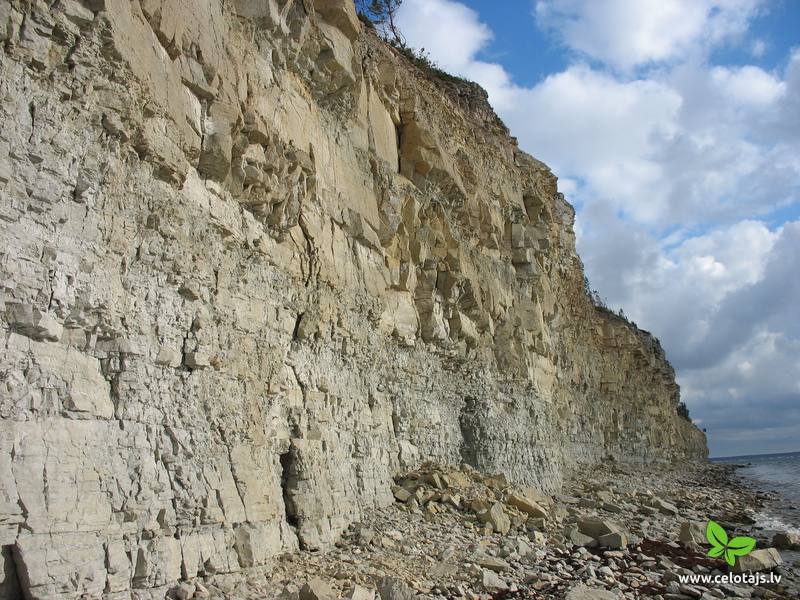
In Estonia, there stands the most impressive rock wall in the Baltics - the so called North Estonian "glint" (from Estonian language). Estonia has its own "Land of Inlets" - the Lahemaa region with its national park, the "Land of Islands" - the Saaremaa island and the Monzund archipelago. The Matsalu bay is one of the most significant rest stops for birds during their migration. In Estonia there is one of the most prominent impact craters in Europe, there are the greatest waterfalls and boulders in the Baltics, the Munamagi hill - the highest spot in the Baltics, the Lake Peipus - the 5th largest lake in Europe, - with long-standing fishing traditions, and the great variety of nature from West to East, from North to South.
Act responsibly - follow the Green advice!
| Overview | Details |
|---|---|
 |
Estonia
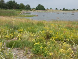
Aegna IslandThis is an entirely forested island in the Bay of Finland, ~14 km from Tallinn. A network of small pathways covers the entire island. Recommended hike along the seashore of the island, which will offer dunes, as well as a coastline that is sandy in some parts, rocky in others, and covered with reeds in still others (~9 km). A ferry boat will take you to the island from the Pirita port.
|
 |
Estonia
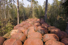
Naissaar islandNaissaar is a small island near Tallinn which was exclusively used by the Soviet military from 1945 to 1993. Attractions on the island include walking trails, varied habitats, a narrow-gauge railway, fortifications from the early 20th C, and a Soviet naval mines factory.  12 12
 1-12 1-12
Services
12km - Distance from countries capital city
1-12 Active season months |
 |
Estonia
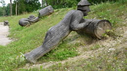
Theme park of GothamitesThe theme park of wise men of Gotham (Kilpla) is located in Müüsleri village; the park’s attractions arise from legends told in Germany some 400 years ago. Gothamites are funny characters famous for their irrational, impractical and foolish actions. Fun-packed tours and activities are on offer along with craft workshops, themed souvenirs, catering (groups should book in advance), and grounds for pitching tents. 107
1-12
Services
107km - Distance from countries capital city
1-12 Active season months |
 |
Estonia
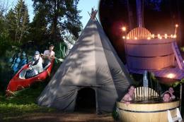
Lahemaa Hiking CentreThe Centre promotes sustainable lifestyle and the great outdoors, there you can plant trees and make and install nest boxes. Canoeing, bog walks, bow and crossbow shooting ranges are available for the more adventurous. There is a log house for functions and accommodation and a sauna with a hot tub. 70
1-12
Services
70km - Distance from countries capital city
1-12 Active season months |
 |
Estonia
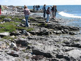
The Vilsandi National ParkThe national park was established to protect the 100 or so small islands that make up the archipelago of the local area. The largest island, the Vilsandi Island, is 6 km long and up to 2 km wide. You can rent a boat to get there, or, during appropriate conditions, you can walk across the sea and the small islands from the southern end of the Kuusnõmme peninsula.
Services
255km - Distance from countries capital cityServices - recreational
Boat tourBoat along the islands of the archipelago, but keep in mind that the Vaika Island and the Nootamaa Island are nature reserves which are closed to visitors. 
Nature trailHike the route Loona-Kuusnõmme (8 km), hike around the Vilsandi Island (~12-15 km), hike the Harilaid peninsula (~10 km). 
Nature watchingBird-watching from the southern end of the Vilssandi Island – the nearby Vaika Island is closed to visitors. There is a viewing tower on the N end of the Kuusnõmme peninsula. The visitor centre of the park is found at the Loona estate (Loona mõis). |
 |
Estonia
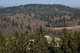
The Haanja Nature ParkThis park was set up to protect the landscape and cultural environment of the Haanja highland. At the central part of the park are the two highest hills in the Baltic States – Suur Munamägi, which stands 318 m above sea level, and Vällamägi, which is 304 m above sea level. The ancient Rõuge River valley (Rõuge ürgorg) is found in the western part of the park. It is 7.5 km long and up to 60 m deep. The valley dates back to the Ice Age, and it has seven lakes, including the deepest one (38 m) in Estonia – Lake Rõuge Suurjärv.
ServicesServices - recreational
Bicycle trailBike the route Rõuge-Nursi-Tindi-Rõuge (15 km).
Nature trailThe Vällamäe nature trail (2.2 km) is the highest trail in terms of elevation in the Baltic States. You may hike the wooden trail of the Hinni canyon and the hiking route of the Rõuge River valley (10 km), or the trail of Lake Kavadi (Kavadi järv) (4.5 km).
Nature watchingThere are viewing towers at Suur Munamägi and on the eastern shore of Rõuge Suurjärv. For more information: www.haanjapark.ee (only in Estonian). |
 |
Estonia
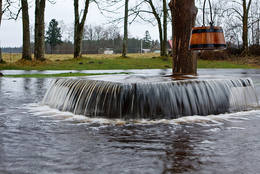
Tuhala Nature Centre and NõiakaevTuhala region has settlements of about 3000 years of age. There are 11 ancient settlement sites, 30 cult stones, 3 burial sites, 4 sacred groves, etc. Tuhala Landscape Reserve has a unique natural feature - the Nõiakaev (Witch´s Well) which “boils” up water during floods at 100 l/s, and 5 mightiest energy columns of the country. 32
1-12
Services
32km - Distance from countries capital city
1-12 Active season months |
 |
Estonia
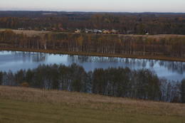
The Vooremaa field of drumlinsThis is the most visually impressive drumlin field in the Baltic States, and it is close to the village of Tabivere. The drumlins were established by ice glaciers, and they point in the direction in which the ice moved long ago. In terms of their appearance, the drumlins resemble loaf-shaped hillocks. From their “backs,” there are lovely views of the local landscape and the lakes that are around the area. The visitor centre is in the village of Äksi.
|
 |
Estonia
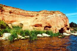
The sandstone cliffs of KallasteThis is one of the few places in the Baltic States where one can find Devonian period sandstone cliffs featuring abrasion caves, arches, etc. The cliffs are on the shores of Lake Peipsi (Peipsi järv), near Kallaste, and they are between two and four (in some cases – nine) metres high, stretching for a distance of around one km.
ServicesServices - recreational
Nature trailHike along the shores of the lake to and from the cliffs (3 km).
Nature watchingThere is a viewing tower which offers a good look at Lake Peipsi and the shoreline. For more information: www.kallaste.ee (only in Estonian). |
 |
Estonia
Lemmje pargajienu taka (Lemmjõe matkarada)Taka, kas izveidota Lemmjegi (Lemmjõgi) un Raudnas (Raudna jõgi) satekas vietā, iepazīstina ar palieņu pļavām un veciem pārmitriem mežiem, kas ir vieni no lielākajiem Igaunijā. Takas sākumā dominē atklātas lauku ainavas. Viens no 4,9 km garās lokveida takas apskates objektiem ir Lemjē dižozols. Mitrā laikā noderēs ūdensizturīgi apavi. 155
Services
155km - Distance from countries capital city |
|
|
Estonia
Castle Hill OtepääVery expressive form of relief with wide look over the neighborhood. On its peak there's ruins of the castle of bishop Hermanis which was built in 1224. The world's oldest firearm was found here. 225
Services
225km - Distance from countries capital city |
 |
Estonia
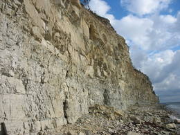
The Panga cliffsThe highest and most beautiful wall of cliffs on Saaremaa Island (up to 21 m high), stretching along some 3 km. During strong winds from the W or NW, a part of the cliff is washed by the waves of the sea. The open face of the cliff has limestone, marls and dolomite, and there is a wealth of fossils at the base of the cliff – corals, stromatoporids, etc.
Services
230km - Distance from countries capital cityServices - recreational
Nature trailHike along the foot of the cliffs (watch for falling rocks) in one direction, and then along the top of the cliffs along the other (~6 km).
Nature watchingFrom the top of the cliff, you can see the Bay of Finland and the Tagaranna peninsula to the West. |
 |
Estonia
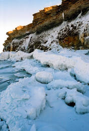
Pakri peninsulaAt the end of the Pakri peninsula is the most visually impressive shoreline cliff in the Baltic States – the Pakri cliff (Pakri pank), which is as much as 24 metres high. During cold winters, streams which flow from the layers of limestone cliffs form fantastic and unusual shapes of ice.
|
 |
Estonia
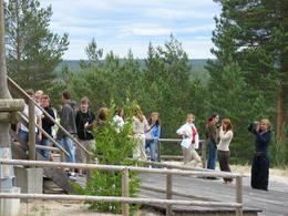
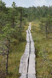
LuitemaaIn Estonian, Luitemaa means ‘the land of dunes’. It is the seashore territory of the Gulf of Pärnu, 13 km between Vöiste and Häädemeeste with shallow waters, vast coastal meadows, the highest dune range in Estonia and the Tolkuse Mire (Tolkuse raba). The Tolkuse mire trail (~2.2 km) and watching tower are available for dune and mire sightseeing tours. Situated in Luitemaa Nature Reserve. |
 |
Estonia
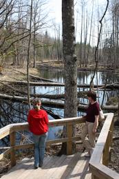
Bebru taka (Koprarada)Divus kilometrus garās lokveida takas sākums ir meklējams pie Somā nacionālā parka apmeklētāju centra (atklāts 2000. gadā) – Tēramā ciemā. Tā ved gar Mardu strauta (Mardu oja) krastu, kur krustām šķērsām ir sakrituši bebru nogāztie koki, radot diezgan juceklīgu skatu. Apmeklētāju centrā var iegūt nepieciešamo informāciju, noskatīties videofilmu un nacionālajam parkam veltītu ekspozīciju. 171
Services
171km - Distance from countries capital city |
 |
Estonia
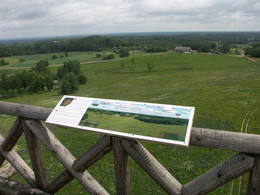
Torna kalns (Tornimägi)Karulas augstienes augstākais reljefa punkts (137 m.vjl.), kas virs tuvākās apkārtnes paceļas par ~ 60 m. Torņa kalnā ir uzbūvēts skatu tornis ar ļoti plašu apkārtskatu. Uz tā platformas ir novietoti panorāmas fotoattēli, kuros atzīmēti zīmīgākie plašākā apkaimē redzamie objekti – apdzīvotas vietas, pilskalni, baznīcu torņi u.c. Turpat izveidota atpūtas vieta un meklējams Rebases ainavu takas sākums. 260
Services
260km - Distance from countries capital city |
 |
Estonia
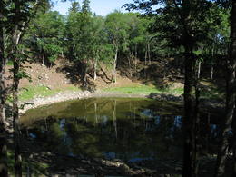
Kaali meteorite cratersThis is actually a group of nine craters, and some of them are as much as 100 m in diameter and 16 m in depth. This is the most visually expressive meteorite crater in the Baltic States and, indeed, in all of Europe. Remnants of the meteorite – some 2.5 kg in all – yielded iron and nickel. It is thought that this pan-Baltic natural catastrophe occurred 2,600 to 4,000 years ago. Kaali Visitor Centre comprises the meteoritics and limestone museum, a conference hall and a hotel.The museum exhibits genuine meteorite pieces amongst other items. The hotel has all modern conveniences, tasty food is provided at Kaali Tavern nearby. 204
1-12
Services
204km - Distance from countries capital city
1-12 Active season months |
 |
Estonia
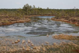
Moorpfad ViruEin 3,5 km langer Pfad quert den Viru Moos in Richtung Süd–Nord. Von einem Holzaussichtsturm eröffnet sich einen Blick auf eine typische Hochmoorlandschaft mit einigen Seen, Aushöhlungen und morastigen Stellen. 56
Services
56km - Distance from countries capital city |
 |
Estonia
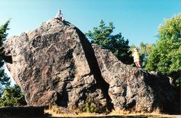
The Rock of Jana - TomaThe Rock of Jana - Toma is claiming itself to be the highest (almost 8 m) rock in The Baltic. It is located in Kasispea village. 72
Services
72km - Distance from countries capital city |
 |
Estonia
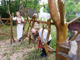
Hjupasares pargajienu taka (Hüpassaare matkarada)Iepazīstina ar Somā nacionālā parka lielākā purva – Kureso (Kuresoo) ziemeļaustrumu daļu, kur redzamas purva ezeriņu un lāmu ainavas. Takas sākumā atrodas igauņu komponista, ērģelnieka un folkloras vācēja Marta Sāra (Mart Saar) (1882. – 1963.) dzimtās mājas. To apkaimē pļavas apsaimnieko aitas. Lokveida takas garums ir 4,2 km. 169
Services
169km - Distance from countries capital city |
 |
Estonia
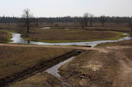
Metsamoori (Woods Crone) Family ParkThis park is a network of farms in Kaika area where visitors can learn about healthy life styles and alternative medicine. Farms have programmes on using herbs and leech in therapies, on the magical worlds of bees and mushrooms, spells and meditation. In workshops you can learn to use weeds in cooking, make bread and herbal drugs. Individual travellers are welcome to explore the farm on their own. 275
5-9
Services
275km - Distance from countries capital city
5-9 Active season months |
 |
Estonia
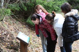
Terama taka (Tõramaa matkarada)Divarpus kilometrus gara taka (vienā virzienā) aizved līdz Hallistes palieņu pļavām, kur Hallistes upes labajā krastā ir uzcelts divstāvīgs koka skatu tornis. No tā paveras visaptverošs skats uz atjaunotajām (izcirsti krūmi) Hallistes palieņu pļavām. Pavasara palu laikā no torņa redzamā apkārtne un tornis atrodas ūdenī. |
 |
Estonia
Perajerva meza taka (Pärajärve metsarada)Četrus kilometrus gara marķēta lokveida taka, kas ved pa lielāku meža masīvu, iepazīstina ne tikai ar augiem un dzīvniekiem, bet arī mežsaimniecības tradīcijām. Takas sākums atrodas pie nelielā Perejerves ciema, uz kuru paveras labs skats no tuvējā paugura. Pie autostāvlaukuma izveidota atpūtas un piknika vieta. |
 |
Estonia
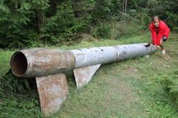
Kap JumindaDer weiteste Nordpunkt der Juminda Halbinsel mit einer Raketen-Attrappe der Sowjetarmee, der alten Grabstätten, dem Juminda-Leuchtturm und einem Denkmal für die Opfern des Zweiten Weltkriegs. 69
Services
69km - Distance from countries capital city |
 |
Estonia
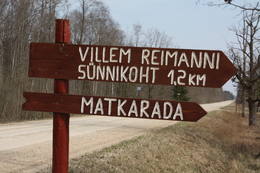
Paunas taka (Pauna rada)Kultūrvēsturiska taka (garums ~ 2 km) Tipu (Tipu) ciemā, kas iepazīstina ar vairākiem interesantiem objektiem: veco skolu (1931. g.), Hallistes upi, pirti un Paunas saimniecību, kurā dzimis viens no Igaunijas nacionālās kustības līderiem Villems Reimans (1861. – 1917.). |
 |
Estonia
Ancient Piusa River valley and Piusa caveThe area of the ancient Piusa River valley that is between the villages of Vana-Vastseliina and Ignasõ is around 15 km long, features some substantial rapids, and offers a view of beautiful Devonian period cliffs. The largest, Härma müür, is 43 metres high and is the highest sandstone cliff in Estonia. There are caves from old mines in the village of Piusa. A small part of the mines, which have tunnels that are more than 10 km long in all, has been tured into a local museum.
ServicesServices - recreational
Boat tourBoat from Vana-Vastseliina to Ignasõ (1 day, extreme boating, only during flood season). For more information: www.piusa.ee (available in English).
Nature trailHike down the river valley along its entire length (~20 km). |
 |
Estonia
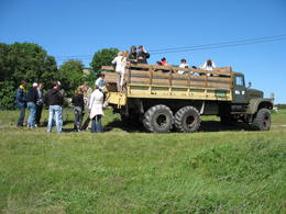
Kusnemmes pussala (Kuusnõmme poolsaar)Ap 6 km garā pussala ir vieta, kur jānokļūst tiem, kas grasās doties vienā no neparastākajiem pārgājieniem pāri jūras šaurumam. Cauri Kūsnemmes pussalai līdz tās ziemeļu daļai iet šaurs un ļoti līkumains grants ceļš (ar garāku tūristu autobusu jābrauc lēni un uzmanīgi), kura galā izveidots autostāvlaukums, neliels namiņš, kur patverties lietus un vēja laikā, kā arī informācijas stends. Turpat redzamas divas Padomju armijas „KRAZ” tipa automašīnas. Lai sasniegtu robežkontroles posteni, Padomju robežsargi brauca pa jūru un mazajām saliņām, kas kā pērļu virtene savieno Kūsnemmes pussalas galu ar Vilsandi salas dienviddaļu. Turpat divas desmitgades pēc Igaunijas neatkarības atjaunošanas „KRAZ” automašīnu kravas kastēs vasaras laikā uz Vilsandi vizināja tūristus, taču spēkrati savu mūžu ir nokalpojuši un unikālais piedāvājums vairs nav spēkā! Ko darīt? Pa mazajām saliņām uz Vilsandi var doties ar kājām. To var īstenot tikai siltā laikā, kad nav gaidāms stiprs vējš un ir zināma laika prognoze vismaz divām tuvākajām dienām. Kā sava veida orientieris var kalpot augstsprieguma elektrolīnija. Kopumā ir jārēķinās arī ar 1 h 40 – 2 h ilgu un ~ 4 km garu gājienu. Dziļākā vieta (ja ietur pareizo „kursu”) atrodas pārgājiena sākumdaļā, kur starp saliņām izveidots laivu ceļš - ~ 1 m dziļa vieta atkarībā no vēja virziena un ūdens līmeņa. Zināmu priekšstatu par maršrutu sniegs redzamā ainava, kas paveras no skatu torņa. Kaut arī šis maršruts tiek reklamēts dažādos informatīvajos materiālos, atbildību par tā veikšanu uzņemas katrs pats! 257
Services
257km - Distance from countries capital city |
 |
Estonia
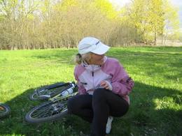
Koiva heritage culture trailThe 60 km cross-border cycling trail along the Koiva/Gauja River in Estonia and Latvia was completed in 2010. The trail begins at Tellingumäe car park, start and finish points of the trail and the border crossing site are supplied with resting areas and information boards with maps. Signposts are located at crossroads where there may be confusion for cyclists; attractions near the main route are also signposted. Information boards are provided in Estonian, Latvian and English. Tellingumäe car park is also a starting point for an 18-km cycling route. 267
1-12
Services
267km - Distance from countries capital city
1-12 Active season months |
 |
Estonia
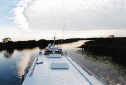
Tartu-PiirissaareThis is a quick boat ride from Tartu down the Emajõgi River to Piirissaare Island in Lake Peipsi (Peipsi järv). Along the lower reaches of the river are major wetlands which are of enormous importance for birds.
ServicesServices - recreational
Boat tourTake the ship from Tartu to Piirissaare (65 km) and just enjoy the landscapes along the banks of the river.
Nature watchingThere is a viewing tower on Piirissaare Island. For more information: www.visittartu.com (available in English). |
 |
Estonia
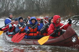
360° adventuresThe company runs wildlife tours: kayak trips at sea in summer, bogshoeing in bogs in autumn, snowshoeing trips in winter and canoeing on rivers in spring. 37
1-12
Services
37km - Distance from countries capital city
1-12 Active season months |