
| No | Name | Description |
|---|---|---|
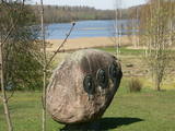 |
The main goal of the Vestiena protected landscape area is to protect the landscape values in the Vidzeme highlands. The protected area is in the middle of the Vidzeme highlands with the highest and most prominent relief, including Gaiziņkalns, the highest spot in the country. The many lakes found in the area - Viešūrs, Talejas, Kāls, Pulgosnis and others – not only add to the variety of the landscape, but also offer tourism and recreation options. The Vestiena protected landscape area encloses several other especially protected/Natura2000 sites – the Gaiziņkalna nature park, the island of the lake Kāla, the lake Ilziņa restricted natural area. Among the most interesting tourist attractions are the Vestiena estate, the Piekūnu wandering trails, the Gaiziņkalna nature trail. The area is rich in landscapes, however, there are no viewing spots or towers installed to observe the landscape. On the top of the Gaiziņkalns, the Latvia’s highest spot, there still stands the wreck of the former viewing tower.
|
|
 |
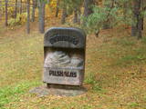
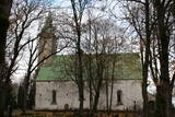
The grave of Ida Apsāne, who was known as the “moon daughter” of the great Latvian poet and playwright Rainis can be found in the old Lašu Lutheran Cemetery, which is 200 m to the North of the Lašu Lutheran Church. The text on the grave reads “Ida Marie Apsahn, b. March 23, 1867, d. April 10, 1887.” Other members of her family are also buried here. |
|
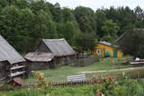 |
Grūti iedomāties, ka vēl joprojām Eiropā ir apdzīvotas vietas, kuru sasniegšanai ir labu laika sprīdi jābrauc pa neapdzīvotu mežu ieskautu smilšainu ceļu, kur tikai paretam var redzēt kādu sēņotāju vai ogotāju! Tāpat kā Zervinos ciemam, arī šim ir piešķirts kultūras mantojuma pieminekļa statuss, jo Linežeris ir viens no dažiem nacionālā parka etnogrāfiskajiem ciemiem. Linežerī ir aplūkojamas 19. – 20. gs. mijā celtās ēkas un apskatāms tā laika ciema plānojums. Šejieniešu tāpat kā citu dzūku galvenā nodarbošanās bija mežistrāde un meža velšu vākšana. Nelielā mērā – arī lauksaimniecība. Apceļojot nacionālā parka etnogrāfiskos ciemus, rodas pamatots jautājums: „Ar ko mūsdienās te nodarbojas cilvēki. Kā viņi spēj dzīvot tik nomaļā vietā”? Jāatzīst, ka lielākā daļa te ierodas tikai vasaras laikā. Neskatoties uz to, etnogrāfiskie ciemi ir ļoti sakopti un joprojām „dzīvi”! |
|
 |
Traķu pussalas pils austrumu mūrim pieguļ ar mežu apaudzis iespaidīgs pilskalns (uzved koka kāpnes) – t.s. Upurkalns, kurā pirms mūra pils celtniecības stāvējusi koka pils. 1779. g. dominikāņu mūki sagrautās Pussalas pils vietā uzsāka baznīcas celtniecību. Jau vēlāk – 1822. – 1823. g. vienā tās daļā uzcēla dominikāņu klosteri, bet otrā – kapelu. 1990. g. šeit izvietoja Traķu vēstures muzeja administrāciju, bet 2005. g. kapelā izveidoja Sakrālās mākslas izstādi. 2011. g. ēku kompleksā notika vērienīgi rekonstrukcijas darbi. |
|
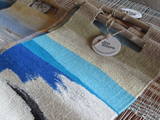 |
The artist’s workshop is in a lovely single family farm. She weaves tapestries, allows visitors to watch her at work, accepts commissions for tapestries, and sells finished ones. Many of her artworks are practical souvenirs or could be fine gifts for others. |
|
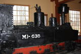 |
In 1916, during the German military occupation of Latvia, prisoners of war were put to work in installing narrow-gauge railroads via which the Germans exported Latvian timber. A narrow-gauge rail network was built through the forests and across the swamps of the Viesīte area. The track width was round 600 mm, and there was a total of 130 km of tracks to connect Viesīte (the central station) to Nereta, Aknīste, Jēkabpils and Daudzeva. The train was used after world War II to transport timber and passengers. The last trip along the line occurred on August 31, 1972.
You can tour the museum individually or with the assistance of a guide. You’ll see an Mi-635 locomotive, wagons for passengers and cargo, a platform to transport timber materials, and two trolleys.
|
|
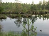 |
This territory is around 9 square kilometres in size and is found to the North of the village of Kūdra, where the so-called old peat quarries are found. Peat was extracted here during the first period of Latvian independence. Today the territory is overgrown, preserving the old and flooded quarries which offer a very unusual landscape. The best way to examine them is on foot or bike, taking the road from the Kūdra railroad station which leads to Lake Sloka. |
|
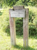 |
Marking of the Jānis Lībietis Alley in the
Ķemeri Park – Lībietis directed the institution
which managed the Ķemeri sulphurous springs
from 1928 until 1944, and the monument to
him is at the end of the Jānis Lībietis Pathway
|
|
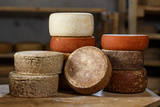 |
This is a biological goat farm and cheese-making plant that offers various cheeses made of goat’s milk and cow milk. The farm has some 100 dairy cows. Owners Ruta and Stefans welcome guests and speak Latvian, German and Russian. The cheese is available on site, at the Kalnciems market in Rīga and elsewhere in Latvia. Production - goat’s and cow’s milk cheeses. Offers excursions in the farm and cheese-making plant, tasting. |
|
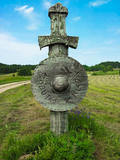 |
Embūtes dabas parks, saukts par Embūtes senleju, ir viena no skaistākajām, interesantākajām un noslēpumainākajām Kurzemes vietām. Nav Latvijā otras tādas vietas, kur ieejas vārtus dabas parka teritorijā simbolizē stilizēti zobeni ar vairogiem ceļa abās pusēs, radot mītisku un cienījamu noskaņu. Par Embūtes apkārtnes vēsturi stāsta daudzas teikas un leģendas. Viena no pazīstamākajām ir romantiskā teika par kuršu vadoņa Induļa un vācu komtura meitas Ārijas mīlestību. Vietā, kur viņi pirmoreiz tikušies joprojām atrodas Ārijas un Induļa ozoli. Embūtes dabā parkā ieteicams apskatīt - ekotūrisma taku, Embūtes viduslaiku pilsdrupas, Embūtes luterāņu baznīcas mūrus, Induļa pilskalnu, Pilskalna avotiņu, Induļa un Ārijas ozolu. Dabas parks aprīkots ar labiekārtotu pastaigu taku, skatu platformām, skatu torni, labierīcībām un atpūtas vietu. |
|
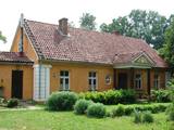 |
Approximately 6 km to the south-west of Iecava is the home of the father of author Edvarts Virza (born Jēkabs Eduards Liekna, 1883-1940), Billītes. The author and his wife, Elza Stērste, moved to the house in 1901. Virza was one of Latvia's most outstanding 20th century authors, poets and prose writers, as well as publicist and translator. He wrote many poems at Billītes, and in 1933 he produced his masterpiece, "Straumēni," which depicts the life of a Latvian farmer. A museum dedicated to Virza is at the house today. It was opened by his children and grandchildren. Contact the museum in advance for a tour. |
|
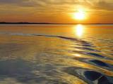 |
Lake Rāzna (57,8 m2) is often called the sea of Latgale. It is the biggest lake in Latvia. Rāzna is situated
on the hill Rāznava. You should see beautiful landscapes, high peaks and Latgalian castle hills. Enjoy the
recreation places beside the lake, the National park of Rāzna and its surroundings. The place is included in
the European Union network of protected areas NATURA 2000. The lake has 10 islands and two gulfs. The
level of the water reaches 163.8m.
|
|
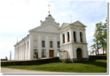 |
The Bebrene Catholic Church is opposite the Bebrene Estate on the side of the Ilūkste-Birži road. Work on the church began in 1797, but it was only completed in 1883. The outside of the church is in the style of Classicism, while the interior was designed in Baroque forms. The interior of the church can be viewed during worship services. |
|
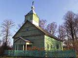 |
Guriliški Old-Believers Prayer House was built in the beginning
of the 20th century. It has a very old bell that was made in 1939.
|
|
 |
From the Markova castle hill, which you will access from the local information trial, you will see a view of the Daugavsargi curve of the Daugava. Further along, you will reach the open shore of the Daugava to see one of the most unique landscapes of Latvia’s river valleys. The Slutišķi village of Old Believers and the mighty Slutišķi cliff will be in the background.
|
|
 |
The Wine Hill of Sabile has been known since the age of the Duchy of Courland as the northernmost place where grapes were grown to produce more or less sour wine for the duchy. A wine festival has been held each year during the latter half of July in Sabile since 1999. The hill offers an excellent view of the small town that is on the banks of the ancient Abava River Valley. |
|
 |
There are six islands in the Great Baltezers lake – the Auzu, Priežu, Mazā, Liepu, Ropažu and Meldru islands. These are distinguished by a great diversity of plants, including forests of broadleaf trees, black alders and pines. The territory can be surveyed quite well from the side of the Ādaži Lutheran Church. The Great Baltezers lake is a popular place for fishing, including ice fishing during the winter.
|
|
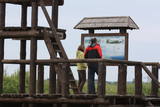 |
Reškutenu (Reškutėnai) ciema apkārtnē ir atjaunots neliels mitrājs, kura malā uzcelts putnu vērošanas tornis. Ja paveicas, pavasaros te var dzirdēt vai redzēt tādas retas un aizsargājamas putnu sugas kā ķikutu Gallinago media, ormanīti Porzana porzana, melnkakla dūkuri Podiceps nigricollis, griezi Crex crex u.c. Ciema ainava īpaši pievilcīga ir pieneņu un ābeļu ziedēšanas laikā. No putnu vērošanas torņa var redzēt vietas, kur akmens laikmetā dzīvojuši cilvēki. Blakus esošajā purvainajā pļavā bijis ezera līcis, kur tika būvēti ciemati līdzīgi kā Āraišu ezerpils gadījumā. |
|
 |
Vienīgā baznīca nacionālā parka teritorijā. Tā atrodas Kirblas (Kirbla) ciemā – uz neliela pacēluma, kas Baltijas ledus ezera laikā bijusi sala, kuru no visām pusēm ietvēris ūdens. Kirblas baznīcas pirmsākumi ir meklējami 16. gs. un par tās celtniecību saglabājušies dažādi interesanti nostāsti. Tas ir viens no mazākajiem Igaunijas dievnamiem (29 x 11 m). |
|
 |
This farm is engaged in dairy farming and rearing chickens; the obtained eggs and milk is processed in its very own dairy plant. You can taste various dairy products, including ice-cream in the farm, and also get to know the entire production process. You can also order meals for a picnic and apply for a dairy product masterclass. |
|


