

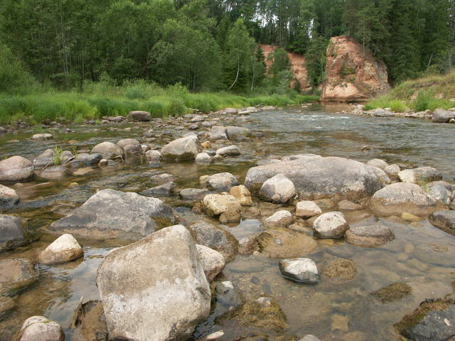
The Amata is one of Latvia's swiftest river, and water tourists congregate there each spring to engage in extreme activities. From the Rīga-Veclaicene highway, the Amata flows into a deep valley, with an average drop of more than 3 m/km or, downriver, as much as 8-10 m/km. Water tourists usually use the segment of the river between Melturi and the Zvārte cliff or the Veclauči bridge that spans the Līgatne-Kārļi road. Please remember that the Amata is not a friendly river for beginners. After lengthy rainfall, the river can be navigable during other times of the year, as well. The surrounding valley is attractive because of impressive sandstone and dolomite cliffs, among which the best known are the Vizuļi cliff (which can be the site of beautiful frozen waterfalls in winter), the Ainavu cliff, the Ķaubju cliff, the Dzilna cliff, the Zvārte cliff, and the Lustūzis cliff. Between Melturi and Veclauči, there is the Amata geological trail, which is marked with orange paint on tree trunks. There are three segments to the trail – from Melturi to the Kārļi fish farm, from the fish farm to the Zvārte cliff (both segments can be extreme!), and from the Zvārte cliff to the Veclauči bridge. You can hike the trail at any time except when there is deep snow. The most impressive views will be found when the trees are bare. If you boat down the river, you will not have time to look at or photograph the cliffs, because all of your attention will be focused on the river itself and the obstacles therein.


