
Naturobjekte in Estland

Was ist das Besondere an der Natur in Estland?
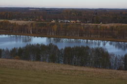
In Estland steht die beeindruckendste Felswand im Baltikum - das sogenannte nordestnische "Glitzern" (aus estnischer Sprache). Estland hat sein eigenes "Land der Buchten" - die Region Lahemaa mit ihrem Nationalpark, das "Land der Inseln" - die Insel Saaremaa und den Monzund-Archipel. Die Matsalu-Bucht ist eine der wichtigsten Raststätten für Vögel während ihrer Wanderung. In Estland gibt es einen der bekanntesten Einschlagkrater in Europa, es gibt die größten Wasserfälle und Felsbrocken im Baltikum, den Munamagi-Hügel - den höchsten Punkt im Baltikum, den Peipus-See - den fünftgrößten See in Europa - mit langen Hervorragende Fischertraditionen und die Vielfalt der Natur von West nach Ost, von Nord nach Süd.
Handle verantwortungsbewusst - folge dem Grünen Rat!
| Überblick | Details |
|---|---|
 |
Estland
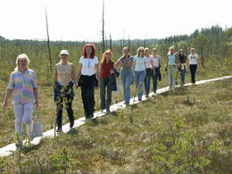
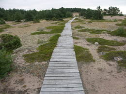
Meenikunno swampThis is a highland swamp with several little lakes. At the SE of the area is a wooden trail.
|
 |
Estland
Rannaje putnu verosanas tornis (Rannajõe linnutorn)Divstāvīgs skatu tornis pie Laikjula (Laiküla) – Hāpsalu ceļa, no kuras paveras plaša ainava uz Matsalu līcī ietekošo upīšu palieņu pļavām. Te var vērot migrējošās dzērves un zosis, bet pavasaros varbūt laimēsies redzēt vai dzirdēt ķikutu Gallinago media. Viens no retajiem torņiem, kas ir pielāgots cilvēkiem ar īpašām vajadzībām. |
 |
Estland
Eldas klints (Elda pank) un pussalaNacionālā parka dienvidrietumdaļā jūrā iestiepjas Eldas pussala – skaists un ļoti omaļš ar kadiķu mežu (alvāriem) noaudzis zemes pleķītis ar interesantu jūras krastu, kur atsedzas silūra perioda nogulumieži. No pussalas gala, kurā slejas vecs Padomju armijas robežsargu tornis (apmeklējumam bīstams!), paveras visaptverošs skats uz Vilsandi salu (atpazīstama pēc bākas), Lonalaidas salu (Loonalaid) – otru lielāko Vilsandi arhipelāgā, Salavu (Salava) un citām mazākām saliņām. Dabas mīļotāji var uzmeklēt Eldas klinti (Elda pank) – ~ 2 m augstu un 0,4 km garu atsegumu, kura piekājē var atrast interesantas ūdens izskalotas fosilijas.  261 261
Leistungen
261km - Entfernung von der Hauptstadt |
 |
Estland
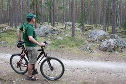
Insel SaaremaaDie größte Insel Estlands. Saaremaa heißt wörtlich übersetzt "Inselland". Der 3 km lange Damm verbindet Saaremaa mit der Insel Muhu. Auf dem Damm kann man sich mit dem Fahrrad bewegen. 160
Leistungen
160km - Entfernung von der Hauptstadt |
 |
Estland
Anhöhe OtepääEine der drei Anhöhen im Südestland mit malerischen Hügeln und schönen Aussichtsplätzen. Im „Zentrum” der Anhöne legt sich der mit Buchten reiche Pühajärv See (Heiliger See). 230
Leistungen
230km - Entfernung von der Hauptstadt |
 |
Estland
Pakri islandsThere are two islands here – Suur Pakri (Great Pakri) and Väike Pakri (Small Pakri). They are 3 km to the West of Paldiski. During Soviet times, the islands were used for target practice by the Soviet air force, which is seen in the many craters and spent munitions that can be found on the island even today. The island is mostly covered with scrappy areas of juniper, but the limestone cliffs at the northern and north-eastern end of the island are quite impressive – as much as 6 m in height.
|
 |
Estland
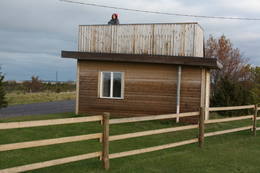
Skatu platforma Puises ciemaPuises „centrā” uz vienstāvu koka mājiņas jumta izveidota skatu platforma. No tās paveras laba ainava uz ciemu, ostu un piekrastes kadiķu laukiem. 121
Leistungen
121km - Entfernung von der Hauptstadt |
 |
Estland
Penije tornis (Penijõe torn)Lai nokļūtu līdz šim tornim, ir jāveic apmēram 20 – 30 min ilgs pārgājiens pa dabas taku no Penijē muižas gar Penijegi (Penijõgi) kreiso krastu. Te redzami bebru darbi un to celtās zaru mājas. No torņa paveras skats uz Kazari deltu, kas dabā izpaužas kā monolīts un nepārskatāms niedrājs. To vairākās daļās sadala Kazari un mazāka izmēra upītes. Katrai deltas daļai ir savs vēsturiskais nosaukums: no torņa pa kreisi no Penijegi redzama Lihula meri (Lihulas „jūra”), bet tās labajā pusē - Kloostri meri (Klostri „jūra”). Putnu vērotāji var iziet garāku (7 km) dabas takas loku, kas ved pa palieņu pļavām. Jārēķinās, ka pavasaros būs nepieciešami piemēroti apavi! Pļavas ierobežotās platībās apsaimnieko mājdzīvnieki, tādēļ neaizmirstiet aizvērt vārtiņus aiz sevis un netraucējiet to ikdienas gaitas! No maršruta nav atļauts novirzīties, lai netraucētu putnus. |
 |
Estland
WikingerdorfEinzigartiger Themenpark am Fluss Pirita, wo sich alles um die alten Wikinger dreht. Leistungen: Wikingerburg, Zauberstube, Schmiede, prähistorische Kampfspiele, Schauspiele, Abenteuerreisen mit Wikingerboot auf dem Fluss Pirita, Wanderungen mit Einbaumboot, Wurfwaffen, Bogenschiessen, Axtwerfen, Höhlensauna, Rauchsauna, Forellenfang, Erlebnisunterkunft, Verpflegung u.a.  30
30
 1-12 1-12
Leistungen
30km - Entfernung von der Hauptstadt
1-12 Aktive Saisonmonate |
|
|
Estland
Aegna IslandAn afforested island in the Gulf of Finland, approximately 14 km to the North of Tallinn. There is a network of small roads and trails on the island. Forests: Mostly 1.1, 1.2 and 4.2. Information: www.aegna.ee. A ferry boat to the island departs from the port at Pirita. Hike around the shore of the island, where you will find all kinds of environments – dunes, sandy areas, rocky areas and places with lots of reeds (~9 km). |
 |
Estland
Halbinsel KäsmuEine von Nadelbaumwäldern bedeckte Halbinsel. Malerisches Käsmu Steinfeld, Matsikivi Stein, Vana Jüri Stein u.a. Bei passenden Bedingungen kann man sich auf einer steinernen Landzunge bis zur 0,5 km entfernt liegenden Insel Saartneem schleppen. 81
Leistungen
81km - Entfernung von der Hauptstadt |
 |
Estland
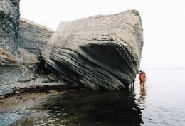
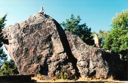
Stein Jaani - ToomaEiner der größten Feldsteine im Baltikum (bis 8 m). 72
Leistungen
72km - Entfernung von der Hauptstadt |
 |
Estland
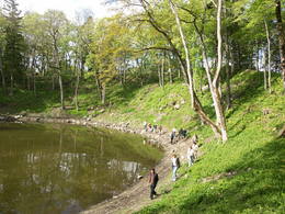
The Haanja Nature ParkThis park was set up to protect the landscape and cultural environment of the Haanja highland. At the central part of the park are the two highest hills in the Baltic States – Suur Munamägi, which stands 318 m above sea level, and Vällamägi, which is 304 m above sea level. The ancient Rõuge River valley (Rõuge ürgorg) is found in the western part of the park. It is 7.5 km long and up to 60 m deep. The valley dates back to the Ice Age, and it has seven lakes, including the deepest one (38 m) in Estonia – Lake Rõuge Suurjärv.
LeistungenLeistungen - erholung
RadrouteBike the route Rõuge-Nursi-Tindi-Rõuge (15 km). 
NaturpfadThe Vällamäe nature trail (2.2 km) is the highest trail in terms of elevation in the Baltic States. You may hike the wooden trail of the Hinni canyon and the hiking route of the Rõuge River valley (10 km), or the trail of Lake Kavadi (Kavadi järv) (4.5 km). 
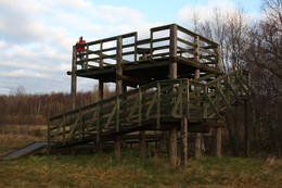
NaturbeobachtungThere are viewing towers at Suur Munamägi and on the eastern shore of Rõuge Suurjärv. For more information: www.haanjapark.ee (only in Estonian). |
 |
Estland
Mohni sala (Mohni saar)Igaunijas jūras ūdeņos ir saskaitīta 1521 sala! Salu sarakstā pēc platības (63 ha) ~ 2,5 km garā Mohni sala ieņem 38. vietu. Lai saudzētu salas trauslo veģetāciju (vietām nedaudz atgādina krūmainu tundru), tās vidusdaļā ir izveidotas koka laipas. Salas dienviddaļā atrodas sašaurinājums, kuru tāpat kā blakus esošo jūras krastu klāj viens no savdabīgākajiem Igaunijas akmeņu laukiem. Salas ziemeļos esošās Mohni bākas (Mohni tuletorn) celtniecība pabeigta 1871. g. un tās gaisma ir redzama 10 jūras jūdžu attālumā. Šī ir viena no skaistākajām Ziemeļigaunijas bākām! Līdz Mohni salai var nokļūt ar laivu (iepriekšēja pieteikšanās) no ~ 5 km attālās Vīnistu ostas (Viinistu sadam). Ar jūras laivu vai kajaku piemērotos apstākļos būs ~ 1h ilgs brauciens. Jārēķinās, ka uz salas nav pastāvīgo iedzīvotāju! Vīnistu ciemā apskatāms 2002. g. izveidotais Vīnistu mākslas muzejs (Viinistu kunstimuuseum). Apmeklētājus iespaidos ne tikai tā āriene, bet arī tapšanas vēsture. 76
Leistungen
76km - Entfernung von der Hauptstadt |
 |
Estland
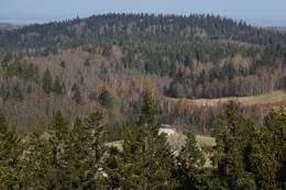
The Vooremaa field of drumlinsThis is the most visually impressive drumlin field in the Baltic States, and it is close to the village of Tabivere. The drumlins were established by ice glaciers, and they point in the direction in which the ice moved long ago. In terms of their appearance, the drumlins resemble loaf-shaped hillocks. From their “backs,” there are lovely views of the local landscape and the lakes that are around the area. The visitor centre is in the village of Äksi.
|
|
|
Estland
Burgberg OtepääEine sehr ausgeprägte und vom Mensch ausgebaute Reliefgestaltung mit breiter Sicht aufs Umland. Auf dem Burgberg steht die Ruine der 1224 vom Bischof Herman gebauten Burg. In den Ausgrabungen wurde die älteste Schußwaffe der Welt gefunden. 225
Leistungen
225km - Entfernung von der Hauptstadt |
 |
Estland
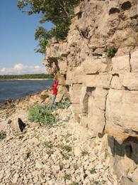
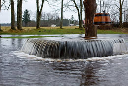
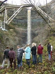
Saka-Ontika-Toila-pank (cliff)This is a cliff with various levels. Known as the North Estonian cliff, it stretches all along the shore of the Bay of Rīga in Estonia, including some of the local islands. The most expressive part in geological and landscape terms is the Saka-Ontika-Toila cliff, which is around 22 km long and offers an unusual natural environment. The cliff is as much as 53 m high, and it has a fairly virginal forest along its slopes. The layers of clay, sandstone, limestone, etc., come from the Cambrian and Ordovician periods. The Valaste juga (Valaste waterfall) is 24 metres high. After a longer period of freezing temperatures, the waterfall has a particularly impressive appearance. Seasonal waterfalls (8-10 m) can be found near the villages of Ontika and Toila.
LeistungenLeistungen - erholung
RadrouteBike from Saka to Taoil (20 km) along the road that is at the top of the cliffs.
NaturpfadHike along the seashore during the season when trees are bare, moving from Saka to Toila (~22 km).
NaturbeobachtungThere is an impressive viewing platform at the Valaste waterfall. |


