| Нo | Название | Описание |
|---|---|---|
|
В мастерской рождаются полезные в хозяйстве вещи - суповые миски, горшки, посуда для соли и сахара, блюда и др. Посетителей знакомят с гончарными традициями и приглашают на открытие печи. |
||
|
Творчество хозяйки проявляется в приготовлении различных даров села – сыроварении, выпекании сырных палочек и др. Биологически сертифицированное хозяйство, в котором используют самовыращенные продукты. Предлагают дегустации и приобретение продукции, а также экскурсии для групп от 10 человек. |
||
|
After a big storm in 2005, the nature trail of the Randu meadows was restored. It is about 4 km long, and there is a bird-watching tower which offers a fine view of unique shoreline meadows with small lagoons and areas of reeds. It is a fine place to watch migrating birds. This is part of the Northern Vidzeme Biosphere Reserve (ZBR).
|
||
|
The Kurzeme Peninsula has the largest landscape of hillocks and valleys in Europe in the shoreline segment from Melnsils and Kolka to Oviši and Liepene. It is a unique landscape in Latvia, and part of it is in the Slītere National Park. The Pēterezers Nature Trail offers the best chance to look at the landscape. There are hillocks and valleys elsewhere, too – near shoreline villages where the Kukšupe valley (one of the longest ones – 8 km in all) is crossed by the Ventspils-Kolka highway, as well as near Apakšceļš. The only thing is that you need to learn how to spot the areas out in nature. |
||
|
Кафе Bastions расположено в историческом центре Валмиеры ‒ на бывших средневековых укреплениях. Здесь предлагается широкий выбор блюд латышской кухни, подходящих и для завтрака, и для обеда, и для ужина. Кафе сотрудничает с местными крестьянами и производителями сельскохозяйственной продукции. Летом здесь можно пообедать на уличной террасе, с которой открывается красивый вид на озеро Дзирнаву. |
||
|
Pirmā ir uzcelta uz vienstāvīgā apmeklētāju centra jumta. No tās paveras plašs skats uz Kīdevas ciemu, ostu un niedrēm apaugušo Matsalu līča ziemeļdaļu. Austrumos no šīs atrodas vēl viena - divstāvīga putnu vērošanas platforma. No Kīdevas līdz Puisei gar Matsalu līča var doties pārgājienā pa 5 km garo dabas taku. To izejot, novēroto putnu sugu klāsts noteikti būs lielāks! |
||
|
Этот тур позволит вам насладиться латвийской зимой в лучшем ее проявлении. Он начинается в шумной столице Латвии — Риге, с ее рождественскими базарами, украшениями, торговыми центрами, множеством культурных мероприятий и музеев, а также очаровательным Старым Городом. Затем маршрут ведет за город, где вы сможете насладиться зимними забавами — катанием на лыжах и санках со склонов. После активного дня приходит время для релаксации в спа-гостинице, а также возможность испробовать оздоровительный и уникальный ритуал латвийской сауны. Для ознакомления с достопримечательностями посетите руины средневекового замка в Сигулде, Турайдский замок и отведайте домашнее вино в поместье в Кримулде. На природных тропах Лигатне сможете понаблюдать за местными дикими животными: волками, медведями, лосями и другими, а затем насладиться катанием на санной упряжке на близлежащей ферме. |
||
|
Ботанический сад является подразделением Шяуляйского университета. Это самый молодой и самый небольшой по площади ботанический сад в Литве. Сад был заложен в 1958 г. Его общая площадь составляет 6,54 га. |
||
|
"Anima Candles" sveces ir roku darbs. Svecēm pieejami vairāki dizaini, kas variē gan krāsās, gan izgatavošanas metodē. Krāsu un smaržu klāsts ir plaši pieejams. Tās izgatavotas no pārtikas rūpniecībā izmantojamā parafīna vai ekoloģiskās sojas. Sveču ražotnē tiek piedāvātas sveču liešanas meistarklases.
|
||
|
Находится на 25-ом километре шоссе Рига - Бауска у речки Кекавиня. |
||
|
Впервые упоминание о Ливаны, как о крупном населенном пункте, встречается в 1533 году, когда тогдашний землевладелец Ливен основал поместье и назвал его своим именем - Ливенгоф. В 1678 году здесь возвели первую католическую церковь. Город сильно пострадал во время обоих мировых воин. Название Ливаны связано со стеклянными изделиями. В 1887 году здесь был построен стекольный завод, который в наши дни прекратил свою деятельность. |
||
|
Расположенное в порту место для ночлега предлагает гостям Кихну преимущественно блюда местного происхождения ‒ если же на острове чего-то не хватает, то предпочтение в любом случае отдается эстонским продуктам. Блюда местной кухни в большей или меньшей степени готовятся из рыбы и выращенных на острове овощей. |
||
|
Atrodas ceļa, kas ved uz Miķeļtorņa bāku – līkuma malā. Unikālā ēka (vienīgais lībiešu ciemu krogs ar raksturīgo plānojumu, kas saglabājies līdz mūsdienām) šobrīd atrodas avārijas stāvoklī un apskatāma tikai no ārpuses. Pizes krogs celts 1853. gadā. |
||
|
Ja no Pervalkas (Pervalka) pa Kuršu jomas krastu ar kājām (neliela taka) dosimies Klaipēdas (ziemeļu) virzienā, pēc 10 – 15 min gājiena nonāksim līdz Arkļu ragam (Arklių ragas, citās kartēs – Žirgų ragas), kam iepretim ~ 0,2 km attālumā no krasta uz mākslīgi veidotas akmeņainas salas slejas 14 m augstā bāka. Tā celta ~ 1900. g. vietā, kur savienojas trīs kuģu ceļi no Klaipēdas, Nidas un Ventes raga (Ventės ragas). No šejienes paveras fantastisks skats un Nagļu dabas rezervāta iespaidīgajām kāpām. |
||
|
SIA “North Latgallian Firewood” darbības pamatnozare ir mežsaimniecība un kokmateriālu sagatavošana - uzņēmumā nodarbojas ar malkas sagatavošanu un tirdzniecību, kā arī piedāvā malkas gabalošanu un skaldīšanu izbraukumā pie klienta. Uzņēmuma piedāvātie pakalpojumi – malkas sagatavošana, malkas tirdzniecība lielos apjomos, kokmateriālu sagatavošanas pakalpojumi. Brīvajā laikā uzņēmuma īpašnieks restaurē senus motociklus un ir izveidojis plašu retro motociklu un senlietu kolekciju. |
||
|
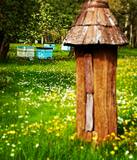
Красивый сельский двор с экологической философией управления и ~ 300 пчелиных семей. Для посетителей построен магазинчик и дегустационный зал. Покупка меда разных цветов, цветочной пыльцы, прополиса, пчелиного хлеба, восковых свечей и сувениров. Дегустация продуктов пчеловодства (в т.ч. медового вина) и экскурсия. |
||
|
В одном из зданий Калнмуйжи построена печь, в которой хозяйка печет ржаной хлеб с семечками, кисло-сладкий хлеб и хлеб с сушеными фруктами. Предлагает позновательную экскурсию, участие в процессе подготовки хлеба, дегустацию и приобретение испеченных буханок. |
||
|
The viewing area on the Ērgļi (Ērģeles) cliffs offers an impressive view of Latvia’s most monolith sandstone cliffs (up to 22 metres high) – this is the highest location in the Gauja River valley. Please be very careful and don’t go anywhere near the edge of the cliff!
|
||
|
Адажский полигон (бывший полигон армии СССР) и в наши дни используется для боевой стрельбы и тактических учений. На территории полигона можно организовать соревнования по авто- и мотоспорту, а также тестовые заезды или обучение военных (охранных) организаций, согласовывая заранее время проведения мероприятий. Наблюдение за растениями и животными на территории природного заказника. Гражданские лица могут посещать территорию только в установленном порядке.
|
||
|
Dodieties ekskursijā, lai gūtu ieskatu lauku profesijā un dzīvesveidā, kā arī iegūtu jaunus iespaidus un labu atpūtu visai klasei. Ekskursijas laikā apmeklējiet cigoriņu kafijas ražotni, kur kafija tiek ražota pēc senām receptēm. Pēc tam dodieties uz piemājas saimniecību, kur saimnieks parādīs govis un piedāvās saldos ķiršus un ābolus no sava dārza. Saukas dabas parka teritorijā, pie Saukas ezera, apmeklējiet lauku māju - kultūrvēsturisko pieminekli, kur, iepriekš piesakot, ir iespējams nobaudīt uz ugunskura vārītu zupu. Visbeidzot - saimniecība, kur plašās teritorijās audzē ābolus, bumbierus, plūmes, ķiršus, zemenes un upenes. Iespēja iegādāties produkciju un piedalīties ražas novākšanā. |
||


