Природные объекты в Эстонии
Ar ko ievērojama daba Igaunijā?
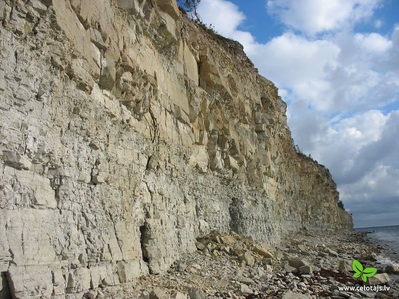
Iespaidīgākā Baltijas klinšu siena – t.s. Ziemeļigaunijas glints, „Līču zeme” – Lahemā ar nacionālo parku, „Salu zeme” – Sāremā sala un Monzunda salu arhipelāgs, Matsalu līcis kā viena no nozīmīgākajām masveida putnu atpūtas vietām migrāciju laikā, viens no izcilākajiem Eiropas meteorīta krāteriem, izcilākie Baltijas dižakmeņi un ūdenskritumi, Munameģis – Baltijas augstākā virsotne, Peipuss – piektais lielākais Eiropas ezers – ar senām zivju ieguves tradīcijām un ārkārtīgi lielā dabas daudzveidība, kas ir acīmredzami mainīga gan austrumu – rietumu, gan ziemeļu – dienvidu virzienā, ir tikai dažas no Igaunijas valsts dabas pievilcībām.
Lai uzzinātu vairāk par apmeklējamām teritorijām aicinām izmantot vides vai vietējo gidu pakalpojumus. Esiet saudzīgi pret dabu ceļojuma laikā - ievērojiet Zaļos padomus!
| Обзор | Подробности |
|---|---|
 |
Эстония
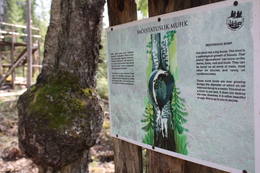
Kuranidu macibu taka (Kuuraniidu õpperada)1,7 km gara lokveida taka, kas iepazīstina ar dažādiem meža biotopiem, to iemītniekiem un meža apsaimniekošanas pamatprincipiem. Apmeklētāju ērtības nolūkā ir izveidotas koka laipas un neliels skatu tornis.  159 159
Услуги
159km - Расстояние от столицы |
 |
Эстония
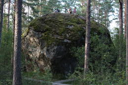
Stein MajakiviDer dritgrößte Feldstein im Baltikum (584 m3, 7 m hoch, Durchmesser bei dem Grund – 32 m ). Auf estnisch bedeutet „Hausstein”. Befindet sich am Rande des Pikanõmme – Majakivi Pfades (4,5 km lang). 60
Услуги
60km - Расстояние от столицы |
 |
Эстония
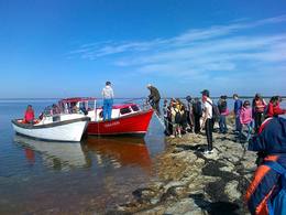
Туристическая фирма Heritage ToursПредприятие организует природные походы, целью которых является знакомство с природой (наблюдение за тюленями, пешие, велосипедные и лыжные природные походы, на резиновых лодках по островкам национального парка Вилсанди, вылазки к орхидеям и т. д.) и культурным наследием (мыза, сельская и городская жизнь, сегодняшний день Эстонского ремесла, морское наследие). В находящемся на территории национального парка Вилсанди лесном парке Мику можно познакомиться со старинными работами в лесу и даже поучаствовать в них. 200
 1-12 1-12
Услуги
200km - Расстояние от столицы
1-12 Месяцы активного сезона |
 |
Эстония
Aegna IslandAn afforested island in the Gulf of Finland, approximately 14 km to the North of Tallinn. There is a network of small roads and trails on the island. Forests: Mostly 1.1, 1.2 and 4.2. Information: www.aegna.ee. A ferry boat to the island departs from the port at Pirita. Hike around the shore of the island, where you will find all kinds of environments – dunes, sandy areas, rocky areas and places with lots of reeds (~9 km). |
 |
Эстония
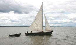
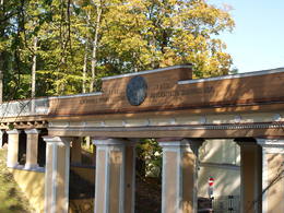
Прогулки на парусной лодкеВ качестве судна на Выртсъярв традиционно применялся деревянный траловый парусник, который благодаря его грациозному внешнему виду часто использовался и для увеселительных поездок. Обладающий статным корпусом парусник имеет два треугольных паруса. В 2005 году при поддержке целевого фонда Выртсъярв была изготовлена лодка "Паула", и в 2009 году - лодка "Лийзу". Катаясь на парусной лодке, Вы получите незабываемые впечатления. 181
5-9
Услуги
181km - Расстояние от столицы
5-9 Месяцы активного сезона |
 |
Эстония
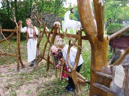
Domberg TartuVom 19. Jh. ist der Domberg ein offentlicher Park mit Pfaden, Gehwegen, Brücken (Engelsbrücke, Teufelsbrücke) und den Denkmälern für die Wissenschaftler der Tartu Universität. Hier befinden sich die Domkirche, das Anatomicum, das Observatorium u.a. interessante Objekte. 185
Услуги
185km - Расстояние от столицы |
 |
Эстония
Семейный парк ЛесовницыСемейный парк Лесовницы - расположенное между холмами Кайка объединение хуторов, которое предлагает различные возможности для ознакомления с близким к природе здоровым образом жизни и народной медициной. В рамках предлагаемых хуторами программ можно познакомиться с траволечением, гирудотерапией, волшебным миром пчел и грибов, а также ощутить на себе влияние заклинаний и мест для медитации. Также можно научиться готовить блюда из сорняков, домашний хлеб и лекарство из трав. Одиночные посетители могут самостоятельно познакомиться с хутором. 275
5-9
Услуги
275km - Расстояние от столицы
5-9 Месяцы активного сезона |
|
|
Эстония
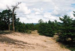
Klostri (Kloostri) skatu tornisMetāla tornis Kazari upes kreisajā krastā, ~ 5 km attālumā no Matsalu līča. No torņa redzamās Kazari deltas palieņu pļavas atrodas tikai 0,3 – 1 m augstumā virs jūras līmeņa, tādēļ pavasara palos un stipru vētru (īpaši rietumvēju) laikā ūdens appludina milzīgu teritoriju. Uzskata, ka platības ziņā šīs ir vienas no lielākajām Eiropas palieņu pļavām, kas ir nozīmīga dažādu tārtiņveidīgo putnu sugu ligzdošanas, dzērvju un zosveidīgo putnu atpūtas un barošanās vieta. Ir pagājis laiks, kad zemnieki Matsalu pļavās ganīja govis un pļāva sienu, tādēļ šobrīd pļavu apsaimniekošanu veic nacionālā parka administrācija. |
 |
Эстония
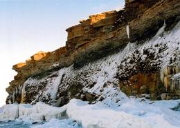
NaisaarThis is a forested island in the Bay of Finland which is the 6th largest Estonian island and is found 14 km to the N of Tallinn. Two decades ago it was a closed zone, because the Soviet Union had a highly secretive manufacturing plant for maritime mines here.
УслугиСервисы - отдых
Веломаршрутa route around the entire perimeter of the island (~20 km). A ferry boat will take you to the island from the Pirita port. 
Природная тропаThere is a hiking route along the southern part of Naisaar Island (13 km), as well as a military route (10 km), a central route (11 km) 
Наблюдение за природой |
 |
Эстония
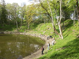
Felsen PakriDie mächtigste Steilküste im Baltikum (bis zu 24 m hoch). In den kalten Winter werden hier phantastische Gletscherstürze entstanden. Pakri Leuchtturm. 50
Услуги
50km - Расстояние от столицы |
 |
Эстония
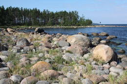
Saaremaa IslandThe biggest sea island in Estonia. In translation - "Land of The Islands". A bridge, where cyclists can drive connects Saaremaa island to Muhu island . 160
Услуги
160km - Расстояние от столицы |
 |
Эстония
The Lahemaa National ParkThis is the first national park in Estonia and the Baltic States. Perfect for a day trip out from Tallinn for a hiking trip and nature watching. It was established in 1971 to protect the area that is along the Bay of Finland – the shoreline, forests, swamps, meadow biotopes, species, natural monuments, rocks, waterfalls, cliffs and cultural monuments such as ancient cemeteries, castle hills, baronial estates, fishing villages, etc. Услуги
50km - Расстояние от столицыСервисы - отдых
Беговая лыжняFor cross-country skiers, the Käsmu peninsula is perfect during the season.
ВеломаршрутFor bikers, there’s the Käsmu peninsula (~10 km), the route Loksa-Pärispea-Viinistu-Kasispea on the Pärispea peninsula (here you will find the highest rock in the Baltic States – the Jaani-Tooma rock (kivi, 7.8 metres high).
Природная тропаYou can hike a wooden train over the Viru swamp (Viru raba, 3.5 km), another trail on the Käsmu peninsula (~15 km), and the Pikanõmme-Majakivi trail (4.5 km), along which you will find the third largest rock in the Baltic States – the so-called House Rock (Majakivi), which has a size of 584 m3. We also suggest the informational Altja trail (3 km).
Наблюдение за природойThere are viewing towers in the Viru raba swamp and along the Piaknõmme-Majakivi trail. There is a visitor centre at Palmse. |
|
|
Эстония
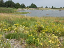
Castle Hill OtepääVery expressive form of relief with wide look over the neighborhood. On its peak there's ruins of the castle of bishop Hermanis which was built in 1224. The world's oldest firearm was found here. 225
Услуги
225km - Расстояние от столицы |
 |
Эстония
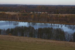
Aegna IslandThis is an entirely forested island in the Bay of Finland, ~14 km from Tallinn. A network of small pathways covers the entire island. Recommended hike along the seashore of the island, which will offer dunes, as well as a coastline that is sandy in some parts, rocky in others, and covered with reeds in still others (~9 km). A ferry boat will take you to the island from the Pirita port.
|
 |
Эстония
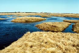
The Vooremaa field of drumlinsThis is the most visually impressive drumlin field in the Baltic States, and it is close to the village of Tabivere. The drumlins were established by ice glaciers, and they point in the direction in which the ice moved long ago. In terms of their appearance, the drumlins resemble loaf-shaped hillocks. From their “backs,” there are lovely views of the local landscape and the lakes that are around the area. The visitor centre is in the village of Äksi.
|
 |
Эстония
Kostivere karst fieldThis is one of Estonia’s most beautiful karst fields, covering 125 hectares which feature different karst processes – subterranean streams, the dry Jõelähtme River bed, karst streams, funnels, ditches, caves, cliffs, a unique rock “mushroom,” etc. During the spring, the field is flooded, but at other times of the year, its contents are easily visible.
|
 |
Эстония
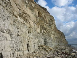
The Panga cliffsThe highest and most beautiful wall of cliffs on Saaremaa Island (up to 21 m high), stretching along some 3 km. During strong winds from the W or NW, a part of the cliff is washed by the waves of the sea. The open face of the cliff has limestone, marls and dolomite, and there is a wealth of fossils at the base of the cliff – corals, stromatoporids, etc.
Услуги
230km - Расстояние от столицыСервисы - отдых
Природная тропаHike along the foot of the cliffs (watch for falling rocks) in one direction, and then along the top of the cliffs along the other (~6 km).
Наблюдение за природойFrom the top of the cliff, you can see the Bay of Finland and the Tagaranna peninsula to the West. |