
| Nr | Nosaukums | Apraksts |
|---|---|---|
 |
Amatnieki piedāvā ekskursiju, keramikas tapšanas procesa vērošanu un iespēju pašiem darināt savus suvenīrus, izmantojot veidošanas, virpošanas un gravēšanas tehniku uz iepriekš sagatavotām veidnēm. Keramikas izstrādājumu pasūtīšana un iegāde. Vietu iecienījuši bērni un kāzinieki. |
|
 |
Atrodas Lielvārdē, Ausekļa ielā 14A, netālu no A6 ceļa. Kafejnīca ”Panna” atrodas Lielvārdes centrā un nodrošina pilnu ēdināšanas servisu kā brokastis, pusdienas, vakariņas, izbraukuma banketus. Tāpat ir iespējams pasūtīt sev tīkamus ēdienus, salātus, kulinārijas izstrādājumus un arī apkalpo banketus kafejnīcas telpās. |
|
 |
Botāniskais dārzs ir Šauļu universitātes apakšnodaļa.Tas ir jaunākais un platības ziņā mazākais botāniskais dārzs Lietuvā. 1958.gadā uzsākta dārza izveidošanas. Kopējā tā platība – 6,54 ha. |
|
 |
Krodziņš "Rančo" atrodas Rīgas - Liepājas šosejas 136. kilometrā, un saviem apmeklētājiem piedāvā gardus ēdienus un omulīgu atmosfēru. Ēdienkartē iekļauti latviskie ēdieni, ir iespējams pasūtīt banketus. Latviešu virtuve: Skābu kāpostu zupa, skābeņu biezzupa, aukstā zupa, asinsdesa, pelēkie zirņi ar speķi, siļķe ar biezpienu un kartupeļiem, kartupeļu pankūkas, plānās pankūkas. |
|
 |
Restorāns "Goldingen Room" atrodas Kuldīgas vecpilsētas sirdī - Rātslaukumā. Tajā tiek piedāvāta Vidusjūras virtuve un tai pieskaņoti Itālijas un Francijas vīni, kā arī vietējie dzērieni. Maltīti iespējams baudīt arī āra terasē. |
|
 |
Kafejnīca "Apsīte" atrodas Apšuciema centrā pie veikala „Top”. Latviešu virtuve: Kartupeļu pankūkas ar šķiņķi, pelēkie zirņi ar speķi, sklandrauši. Īpašais ēdiens: Podiņš „Apsīte”. |
|
 |
Paides ordeņa pilī Vallimē ir izveidots Wittenstein laika centrs, kur laika mašīnas funkcijas pilda lifts, kas apmeklētājus pārved no viena laikmeta otrā. Dažādos stāvos var iepazīties ar senajiem un ordeņa laikiem, karaļu un caru laikiem, okupācijas periodu, neatkarīgās Igaunijas un neatkarības atdzimšanas laiku. Centrā ir plaši izmantotas skaņas un gaismas, videoprogrammas un ilūziju radoši efekti. |
|
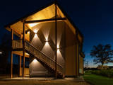 |
Bestes apartamenti ir jauna viesu māja, kas spēj vienlaicīgi uzņemt 45 viesus (+10papildvietas). Viesu nams būvēts un veidots latviskā stilā (koka ēka, kas galavota tepat Mūrmuižā), izmantotas Latvijā ražotas gultas (Nakts mēbeļu meitas uzņēmums), Latvijā ražota gultasveļa (Mežroze) utt. |
|
 |
Privātais Zigurda Safranoviča senlietu muzejs dibināts 2010.gada maijā. Muzeja krājumā atrodas ap 50 tūkstošiem priekšmetu, no kuriem 99% eksponātu ir ziedoti. Vecākā un retākā, pēc leģendas, 300 gadu veca manta – Ernsta Glika ledusskapis. Muzeja apkārtne ir plašs bijušā barona Vulfa muižas parks, kur šobrīd ir iespējams nakšņot teltīs, kā arī pieejamas atpūtas vietas - nojumes, ugunskura vietas, grils, piederumi ēdiena pagatavošanai utt., dzeramais ūdens (no akas), pieejama elektrība telefonu, fotoaparātu u.tml. uzlādei. Lielākām grupām (sākot no 10 personām) uz ugunskura vārīta putra. |
|
 |
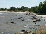
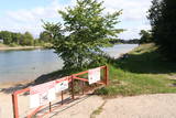
Neliels Daugavas ielejas posms starp Lielvārdi un Dzelmēm ar salām un sēkļiem Daugavā, kā arī niedrājiem un mitrajām pļavām, kas migrāciju laikā piesaista daudzus zosveidīgos un tārtiņveidīgos putnus kā atpūtas un barošanās vieta. Arī nozīmīga dažu sugu ligzdošanas vieta. Daugavas ziemeļu krastā vietumis ir nelieli dolomīta atsegumi ar tiem raksturīgām augu sugām. Teritorija nav labiekārtota, tādēļ vasaras laikā piemērots apskates veids ir brauciens ar laivu pa Daugavu.
|
|
 |
Atrodas Kaibēnu kalnā (226 m v.j.l.) – 7 km uz rietumiem no Inešiem. Nominēts kā Latvijas vecākais (no 1929. g.) memoriālais muzejs. „Kalna Kaibēnu” ēkas ir celtas laika posmā no 18. – 19. gs., un tajās apskatāmi tautskolotāju un rakstnieku Reiņa (1839. – 1920.) un Matīsa (1848. – 1926.) Kaudzīšu pašu būvētā veranda, kāpnes, sienas skapji, parketa imitācijas un R. Kaudzītes izveidotā ratiņu virpotava. Ratnīcā ir izvietota seno darba rīku kolekcija. Autentisko viensētu ieskauj rakstnieku stādītais dārzs ar koktēlnieka K. Kugras veidotajiem romāna “Mērnieku laiki” tēliem. „Kalna Kaibēnos” tapis leģendārais romāns „Mērnieku laiki”. Laikā no 1868. – 1882. g. dzīvojamā ēkā atradusies pagastskola, kurā Matīss strādāja par skolotāju, bet Reinis – par skolotāja palīgu. Muzeju ieteicams apskatīt gida pavadībā. |
|
 1 diena
|
Dodieties ekskursijā, lai gūtu ieskatu lauku profesijā un dzīvesveidā, kā arī iegūtu jaunus iespaidus un labu atpūtu visai klasei. Ekskursijas laikā apmeklējiet podnieku, kurš skolēniem māca, kā praktiski darboties ar rokām, kā no māla izveidot skaistu darbus ar saviem parakstiem un zīmējumiem. Pēc tam apmeklējiet maiznīcu, kur saimniece piedāvā maizes degustāciju un picu cepšanu. Ekskursijas noslēgumā dodieties uz agro saimniecību, lai redzētu, kā siltumnīcās tiek audzēti tomāti, izmantojot mūsdienīgas fotosintēzes tehnoloģijas. |
|
 |
Kājāmgājējiem un putnu vērotājiem domāta taka, kas izveidota ļoti interesantā Rīgas līča krastā pie Kaltenes, kur vērojami mazi līcīši un zemesragi, akmeņaina vai aizaugusi piekraste. Takas galā atrodas putnu vērošanas tornis, jo pavasara un rudens migrāciju laikā Kaltenes apkārtnē novērojama liela zosveidīgo, tārtiņveidīgo u.c. putnu daudzveidība.
|
|
 |
Liepājas Karostas kanāls ar tajā izvietoto Padomju armijas jūras kara flotes bāzi un zemūdeņu bāzi veidots pēc Krievijas cara pavēles vēl pirms Pirmā pasaules kara. Bijusī zemūdeņu osta šobrīd ir slēgta teritorija un tiek izmantota saimnieciskām vajadzībām. Karostas kanāls labi pārskatāms no Pulvera ielas puses un nu jau atjaunotā Kalpaka tilta. Starp citu, kur palika unikālais militārais mantojums - padomju laika zemūdenes? Tas ir atsevišķa stāsta vērts. Lieki piebilst, ka igauņiem - vienīgajiem Baltijas valstīs saglabātā zemūdenē (Lembit) ir izveidots unikāls muzejs...
|
|
 |
Zāļu tējas, ārstniecības augi, žāvēti āboli, garšaugi. Saimniecība piedāvā kvalitatīvu, vietējas izcelsmes produkciju no Doles dabas parkā sastopamajiem un pašu audzētiem augiem. Ģimenes uzņēmums, kas ciena un glabā tradīcijas. Viesiem piedāvā savas zināšanas un personisku attieksmi. |
|
 |
Putnu gredzenošanas stacija un putnu vērošanas vieta. |
|
 |
No 19. gs. – publisks parks ar takām, celiņiem, tiltiem (Eņģeļu tilts, Velna tilts) un pieminekļiem, kas veltīti Tartu universitātes zinātniekiem. Te meklējama Doma baznīca, anatomikums, observatorija u.c. interesanti objekti. |
|
 11 dienas
|
A panoramic tour of Lithuania, Latvia, Estonia and Finland with highlights of nature experiences in the National parks and nature reserves. A variety of landscapes, nature attraction sites, birds and wild animals, forests and seashore. The tour also offers some cultural and historical insights. |
|
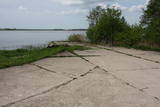 |
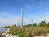
Hidroaviācijas lidlauku, kas atradās Durbes ezera A krastā netālu no Līgutiem, būvēja laikā no 1939. g. – 1941. g. Padomju laikā te atradās 43. aviācijas eskadriļa ar 13 hidroplāniem MBR – 2. Mūsdienās par bijušo objektu liecina tikai betona plāksnes ezera krastā. Lidostas vietas un pamestās estrādes apskate.
|
|
 |
Dabas saldumu maģijā saimniece ir Ilze Kupča. Ilze gatavo kūkas un tortes, zefīrus, vafeles, pīrādziņus, plātsmaizes, ruletes, konfektes, u.c. Gardumi tiek gatavoti no īstiem lauku produktiem - no Latvijas zemniekiem. Daudz izmantotas ogas - no mājražotājiem, pašu audzētas vai salasītas mežos. Ilze no vecmāmiņas mantojusi viņas kūku recepti ar nosaukumu “Vecmāmiņas mantojums”. |
|


