
| No | Name | Description |
|---|---|---|
 |
Zemnieku saimniecība "Sprogas" ir Tīcu ģimenes dārzkopības uzņēmums, kura saknes veidojušās 90-to gadu sākumā, bet strauju attīstību tas ieguvis pēdējo desmit gadu laikā. Jau iepriekš "Sprogās" saimniekots ar vērienu – audzētas zemenes, narcises, lefkojas. Saimniecības vadītājs Ivars Tīcs darbošanās prieku dārzniecības jomā mantojis vairākās paaudzēs. "Sprogas" nodarbojas ar vasaras puķu stādu, augļu koku, dekoratīvo stādu, augļu un ogu audzēšanu. |
|
 |
The farm is on the Right Bank of the Venta River. It breeds goats and makes cheese. Visitors can taste the cheese and buy products. Orders are accepted in advance. |
|
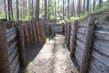 |
Ar Kara muzeja informatīvo atbalstu Garā kāpā pie Antiņiem ir rekonstruēta daļa latviešu strēlnieku nocietinājumu sistēmas. Aspkatāmas ierakumu pozīcijas un vairākas zemnīcas. Netālu atrodas bijusī un no dzelzsbetona veidotā medikamentu glabātuve. |
|
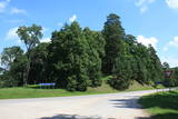 |
Atrodas Tērvetē, Dobeles – Elejas ceļa malā, 0,2 km dienvidrietumos no Tērvetes pilskalna. Ar mežu apaugušais paugurs ir sena apmetnes vieta, kas bijusi apdzīvota jau 1. g.t. pr. Kr. Teika stāsta, ka kalnā bijis klosteris, kura mūki pēc klusēšanas pārkāpuma saulgriežu laikā kopā ar visu celtni nogrimuši kalna dzīlēs. |
|
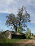 |
This is a large, outstanding and expressive tree, Latvia’s thickest Norway Maple (Accer platanoides).
|
|
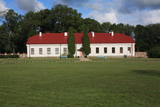 |
Atrodas Grāfu Plāteru parkā, blakus Krāslavas jaunajai pilij. Tas izvietojies vienā no 18. gs. celtajām muižas saimniecības ēkām. Muzeja ekspozīcija ir veidota interesantā veidā – 17 m garā laivā, kas (laiva ar pieciem airiem) ir pilsētas ģerbonis. Muzeja krājums iepazīstina ar Krāslavas novada vēsturi, sākot no akmens laikmeta līdz mūsdienām. Muzejā tiek organizētas Krāslavas mākslinieku izstādes. |
|
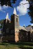 |
В1699 в центре Нюкши Пасиенские доминиканские монахи построили часовню, на месте которой в 1765 году помещик Хилзен возвел новую церковь. Помещения были маленькие, и в 1922 - 1926 гг. на фундаменте старой церкви строится новая и большая – теперешняя церковь, которую называют одним из самых красивейших деревянных храмов Латгалии. В здании находится центральный алтарь работы второй четверти XVIII века и два боковых алтаря работы примерно 1700 г. Церковь можно осмотреть изнутри. |
|
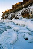 |
At the end of the Pakri peninsula is the most visually impressive shoreline cliff in the Baltic States – the Pakri cliff (Pakri pank), which is as much as 24 metres high. During cold winters, streams which flow from the layers of limestone cliffs form fantastic and unusual shapes of ice.
|
|
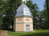 |
The creamery or clock tower (so known because a clock was installed in the round roof window of the structure) is near the gate to the Naukšēni Estate. The eight-corner brick building has a domed roof that is covered with tin. The clock tower has two floors. The second is easily ventilated because of small windows on all sides of the building. The creamery is seen in a picture drawn by J.K. Brotze around 1800. It suggests that the building has not lost its initial shape even today. The tower deteriorated during the Soviet era, when a barn was attached to it and a large gate opening was broken into it. In 2002, the tower was renovated (architect Inese Maurāne). The interior preserves the historical brick floor and the stairs to the second floor. Historical objects are displayed in the creamery, and today it is one of the main tourist attractions for the Naukšēni Estate. |
|
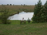 |
Along with the Nagļu ponds, these are Latvia’s largest fishing ponds. They were established on the flood-land peat areas of Lake Lubāns in the 1970s, when the hydrotechnical system of the lake was first established. The Lubāna-Gaigalava road bisects the Kvāpāni-Īdeņa ponds. There are three bird-watching towers on the dams of the ponds. The ponds are a major location for water bird nests, as well as places for migrating birds to rest. There are extensive bird-watching opportunities in the area.
|
|
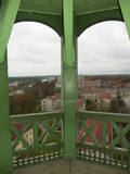 |
From the tower of St Simon’s Lutheran Church, you can see the central part of Valmiera and the banks of the Gauja River. During clear weather, you can see Zilaiskalns Hill. The church contains some cultural and historical treasures, as well as one of Latvia’s most resonant pipe organs.
|
|
 |
A relaxed café in Ādaži with a terrace that offers a wide panorama over the banks of the River Vējupe and is the perfect spot for enjoying beautiful sunsets. Modern world cuisine with salads, snacks, soups, rich main courses, burgers, and soft drinks. |
|
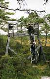 |
This restricted area was established to protect a high-type swamp, a swampy forest and a series of rare birds. The Niedrāji-Pilka swamp can be crossed with dry feet while enjoying almost virginal nature. This is possible on the narrow-gauge railroad embankment which runs through the swamp for three to four kilometres from the North-east to the South-west, or on the well-appointed circular wood pathway which is on the eastern size of the embankment.
|
|
 |
The café welcomes guests with healthy, local, ecologically clean food. Here you can also get acquainted with cultural heritage, learn various legends, as well as purchase snacks and souvenirs. |
|
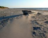 |
"Valgums" is a word referring to the sandy coastline zone between dunes and water, and once there were boats and nets that were being dried at this location. Each village had several areas of this type, and in the 1920s and 1930s, these were of great importance in the preservation of the Liv language. |
|
 |
Sääniku farm recreation centre is located on the banks of the Kavilda former river course, and is a great place to spend free time with the family, enjoying activities and nature. You can taste the house beer, home-made bread and order meals here. |
|
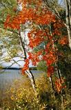 |
This area protects the landscape of the Lielauce hillocks, which are a part of the Eastern Kurzeme highlands. Lake Zebrus and Lake Svēte are in this territory. On the north-eastern shore of Lake Zebrus one can see the Ezerlūķi castle hill. On the eastern shore of the lake is a boating area, along with a viewing tower and a set of information about the area. The territory includes protected biotopes such as stream swamps and swampy forests, along with protected birds and species of bat. |
|
 |
The café is located 200 m south of the Stāmeriena Castle in Vecstāmeriena. It is in one of the historical buildings of the local baronial estate and has an antique interior. It is possible to try out dishes typical for Gulbene district. |
|
 |
No ūdens tūrisma attīstības centra „Bāka” skatu laukuma, kas atrodas Lubāna ezera ziemeļdaļā pie V 560 autoceļa, paveras viens no labākajiem Lubānas ezera skatiem. Redzams milzīgais Latvijas lielākā ezera klajs un Kvāpānu – Īdeņas zivju dīķu ar dambjiem ainava. |
|
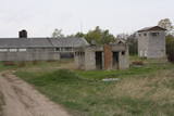 |
The former communications facilities at Pļavmalas are used as a farm warehouse at this time. They belong to a local farm.
|
|


