
| No | Name | Description |
|---|---|---|
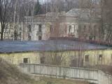 |
The Swedish army built a modern fortress during the 1640s with five bastions and two gates. There were 120 cannons and mortar throwers, barracks for soldiers, flats for officers, a garrison church and warehouses for food at munitions. After the Great Northern War in 1710, the fortress was taken over by the Russian army. After the Soviet occupation in 1940, the Soviet navy took over the fortress. Alongside it is a former Soviet army facility with abandoned buildings and a monument to sailors who served in submarines. The fortress is open for tours on Saturdays and Sundays. |
|
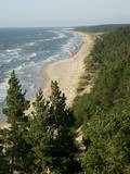 |
Construction on the lighthouse was initially completed in 1879. The structure suffered damage during both world wars and was restored several times. The structure is 19 metres high and stands 46.5 metres above the wavy sea. Here you will find one of the loveliest views of the shores of the Baltic Sea.
|
|
 |
Kadarbiku estate is located in Harju, in the municipality Saue, in the village Tula (Tuula). Agriculture started to work here in 1989, while the family company Kadarbiku Köögivili OÜ was established in 2004. Kadarbik farms specializes in growing and processing vegetables. The farm uses 500 hectares of land, which grows carrots, cabbage, beets and various summer crops. They also make juices and smoothies. |
|
 3 days
|
This tour will take you exploring the peculiar island of Rusnė and the delta of the river Nemunas in Lithuania. The island of Rusnė in the Nemunas Delta Regional Park is enclosed by waters of the river Nemunas and its tributaries. It is a resting place for migratory birds and home to a cormorant colony. The area of the island is 45 km2 and it is connected to the mainland by a bridge. The island of Rusnė is the lowest place in Lithuania, lying below sea level. The historic centre of the town Rusnė is characteristic of authentic wooden architecture, buildings painted in bright colours, colourful window shutters and decorations. The Baltic Coastal Hiking Route leads through the small town of Šilutė, revealing architecture that was once common to East Prussia. From Šilutė to Kintai, the Baltic Coastal Hiking Route runs along a low plain. To protect this area from flood waters of Nemunas, there is a system of dams, polders and canals established. After crossing the river Minija, the route invites you to visit the ethnographic village of Minija. Here you can enjoy the lowland landscape of the seaside region with vast wetlands and ponds. |
|
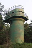 |
The battery is to the South of Ventspils, not far from the Piejūras Park. Work on the battery began in 1939. Today the site is a complete mess, standing out in a negative way from the tidy city itself. People seeking building materials and ferrous metals helped to tear the place down. It’s too bad that this historical location – one that might be of interest to tourists – is in such sad shape, and right at the gates of the city, to boot.
|
|
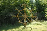 |
Folkloras taka "Jāņkalni" iepazīstina ar mūsu senču rakstiem, zīmēm un dievībām, kas ir mūsu folkloras mantojums. Folkloras takas (garums: apm. 1,5 km vai 2 stundas) mērķis ir arī iepazīstināšana ar senlatviešu ieražām, folkloru, kā arī tautu dainu izprašana. Piedāvā iziet Latvijas karti - labirintu ar 19 etnogrāfiskajiem novadiem. Gids Jums sniegs izsmeļošu stāstījumu un atbildes uz interesējošiem jautājumiem.
|
|
 |
The restaurant is in Bocmaņa Square in the centre of Salacgrīva and on the banks of the Salaca River. The well-known “Pie Bocmaņa” saloon has been redesigned and features the topic of Baron Munchhausen. Latvian cuisine: Herring salad, herring with cottage cheese, fish soup, breast of pork with onions, grey peas with bacon, fried livers, baked plaice, baked filet of pike-perch, stacked rye bread. |
|
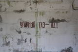 |
The Staldzene Zenith Missile Brigade used a large territory and a number of major buildings. Some of these are now privately owned, and a fish smoking facility has been installed at one of them.
|
|
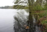 |
It is rare type of lake in Latvia and there are only of few this type of lakes in Kurzeme region. The lake is characterized by high water limpidness (very attractive for tourists) and very rare plant species for Latvia. Nature park includes the lake, costal area and forest on the East from the lake, few smaller lakes and Sarlote Pond. There are several tourist accommodations located around the lake.
|
|
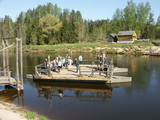 |
Ligatne history is inextricably linked to Ligatne paper mill. At the end 19th century and beginning of 20th century here was built houses, schools, maternity homes, hospitals, clubs, guest houses and other buildings for workers that have survived to the present. During the Soviet period Ligatne mill produced mainly school exercise books, which was sent to all the Soviet republics. Nowadays, the main raw material is recovered paper used for production of wrapping paper. Ligatne paper mill is the only one functioning Latvian company of this kind, and it can be explored with a local guide. Historic centre of Ligatne paper mill has been awarded the status of cultural monument. In the northern part of Ligatne - Gauja river bank the only functioning Gauja river ferry can be found and the only river ferry in the Baltic States, which is powered by river current. The ferry is vehicle of local scale. In the west of Ligatne, Ligatne nature trails are located; where close to natural environment conditions (the best object of this type in the Baltic States) lives red deer, roe deer, wild boar, fox and lynx. Within the territory of Ligatne nature trail a dense network of hiking trails and paved road - cycling route has been created, during the winter it becomes a cross-country ski track. A modern visitor centre is available here. East of Ligatne at Ligatne rehabilitation centre a unique place on the Europen scale can be found - a former Soviet secret bunker that was built as the main living and working place of Latvian senior military and civilian persons in case the nuclear or chemical weapons were used. Bunker was opened in 2003; therefore it remained intact to this day. On the way from Augsligatne to Ligatne go to see Vienkoci Park, where you can explore boats made of single wood peace by the creator of Park Richard Vidzicka, look at the different building models, sand home, and participate in themed activities. |
|
 1 day
|
Tūrisma gide Ineta Jansone piedāvā ekskursijas grupām gar Kaņiera ezeru, iepazīstinot ar putniem, kuri mīt tā tuvumā. Kaņiera ezers ir vieta, kur migrācijas laikā apmetas daudzi tūkstoši ūdensputnu. Ezerā un tā apkārtnē sastopamas vairāk nekā 200 putnu sugu. Putnu vērotāju ērtībām vienā no Kaņiera ezera pussalām uzcelts putnu vērošanas tornis. Netālu no putnu vērošanas torņa izveidota koka laipa uz pontoniem, kura stiepjas cauri niedrāju audzei. Kaņiera ezers izceļas ar lielu daudzums zivju – tajā konstatētas gandrīz 20 zivju sugu. Izsens zvejnieku ciems - Lapmežciems atrodas skaistā vietā uz šauras zemes strēles starp Kaņiera ezeru un Rīgas jūras līci. Lapmežciemā izveidots zvejnieku muzejs, kuru var apmeklēt ekskursijas laikā, kā arī nobaudīt svaigi kūpinātas zivis. |
|
 |
Cafe Vizbuļi atrodas Bērzciemā, Engures novadā, apmeklētājiem piedāvā nobaudīt gardu maltīti, svaigi ceptas smalkmaizītes, izbaudīt Bērzciema jūru, atpūsties un relaksēties. Ziemas sezonā kafejnīca atvērta tikai nedēļas nogalē, vasaras sezonā - katru dienu, ir āra terase. |
|
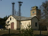 |
The Cape of Kolka is freely accessible to local residents and tourists today, but the border guard facility still serves its purposes and is not open to civilians.
|
|
 2 days
|
This tour will give you an impression of the eastern part of Latvia, which is less populated and also less popular among tourists. You will first arrive in Aluksne and explore the town, which is located at Alūksne highland, on the shore of Lake Alūksne. It is worth visiting Temple Hill – an old Latgalian castle mound and the place of the old town, Sun bridge, and the Castle manor park, Alūksne Lutheran Church and the Bible Museum. After staying there overnight you will go by bus to the start point of the hike in Ape. This Forest Trail section winds through a hilly farmland landscape, then enters a large dark forest, occasionally interrupted by the blue surfaces of lakes. After Peļļi, it crosses the Latvian/Estonian border and winds along the shores of the lakes Smilšājs, Sūneklis and Ilgājs for 2 km on the Estonian side, known as Paganamaa (translation: Devil's Land). There it descends and enters the Korneti-Peļļi subglacial depression, one of the most impressive ravines in Latvia. The Forest Trail returns to Latvia at Lake Ilgājs and, after a steep climb, takes you through a hilly area to the Drusku castle mound. Here you can enjoy a beautiful view. At the end of this tour, you will reach Korneti. The section is located in the protected landscape area “Veclaicene”. |
|
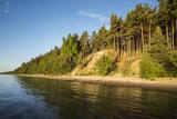 |
Viewing area is at the end of the Ēvaži shore trail (300 metres). The shore here has been washed by the waves and is up to 15 metres high. This is the only place along the Kurzeme shore of the Bay of Rīga where a high dune opens up such a lovely view of the bay water.
|
|
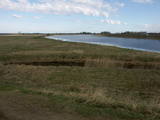 |
One of the most important locations for migrating water birds in terms of rest and feeding in Latvia is the Svēte flood-land, which overflows in the spring time, along with the Svēte polder. It has been calculated that when circumstances are good, tens of thousands of birds can be seen in the area – swans, geese, corn-crakes, pintails, predatory birds, plover-type birds, etc. |
|
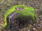 |
Zīleņu Sacrificial Boulder.You will find it on Zelenpole Golden hill beside the escarpment. The boulder
has an annular curvy. It was an ancient Latgalian cult place where people sacrificed to Gods, released themselves
from the bad things and took a positive energy.
|
|
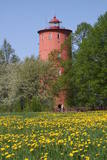 |
is the second oldest navigation structure in Latvia and the only one that is five kilometres from the shore, at the upper edge of the ancient Lake Baltic Ice. Since 2000 the lighthouse has not served its initial purpose, and now it is the home to the Nature Education Centre "Slītere" of the Slītere National Park. The centre offers exhibitions about lighthouses in Latvia and the history of the Baltic Sea. From the upper floor (102 m above sea level) one can see the coast of Saaremaa (approximately 33 km away). Alongside the lighthouse is the 1.2 km Šlītere nature trail. |
|
 |
Divstāvīgā ēka ir redzama no Dundagas – Ģipkas ceļa (ap 3,7 km no Ģipkas ciema). Šis nav tūrisma objekts, bet gan vēsturiska vieta, kurai vērts pievērst uzmanību kaut vai no attāluma. Ēkas pirmajā stāvā no 1860. g. darbojās skola, kurā par skolotāju strādāja rakstnieks Antons Austriņš. 1867. g. tai uzbūvēja otro stāvu, kurā uzsāka jūrskolas izveidi. Jūrskola darbojās līdz 1894. g., kad to pārcēla uz Mazirbi. |
|
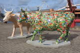 |
The largest city near the Liv Coastline, where visitors will find the Ventspils branch of the Liv Association and the Liv ensemble "Rāndalist." In nearby Tārgale are the Liv ensembles "Kāndla" and "Piški kāndla." |
|


