
| No | Name | Description |
|---|---|---|
 |
Café Ugandi is a cosy place in the very heart of Otepää, filled with a warm atmosphere, pleasant feelings, pure and delicious flavours. As soon as you arrive, you will feel the aroma of premium quality coffee and sweet pastries. The large showcase is filled with delicious cakes - you can enjoy them here or take them with you to enjoy later at home. |
|
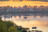 |
Krustpils was first recorded in documents in 1237 in relation to the construction of the Kreutzburg castle on the right bank of the Daugava River. A 1511 document lists it as a village. In 1585, Polish King Stefan Báthory gifted the town to Nicholas Korff, whose family continued to own it until 1920. Battles between Swedish and Polish forces occurred outside of Krustpils in 1626, and the sacked village was in poor shape until the mid-19th century. Jēkabpils, in turn, was constructed as a settlement for Old Believers who were persecuted in Russia. The Daugava has rapids opposite Krustpils and Jēkabpils, which means that boats had to dock there and reload their goods into wagons. The settlement flourished, and in 1670 it was given the rights of a city. It is named after Duke Jacob. When the Rīga-Daugavpils rail line opened in 1861, Krustpils flourished, and Jēkabpils did not flourish. The two cities were administratively merged in 1962, keeping the name of Jēkabpils. There are typical one-story wooden buildings from the 19th century, red brick buildings built at the turn of the 20th century, as well as seven churches used by different denominations. The dam along the left bank of the Daugava was built in 1861, and it was aimed at protecting the city against flooding. Today it is a promenade that is popular among local residents for strolling and leisure. |
|
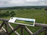 |
This park is in a region of hillocks in the Karula highlands, and Lake Ähijärve is at its centre. The park offers a cultural environment of small farms, and it was set up to protect the unique cupola-shaped hillocks of the area. Main attractions: Scenic Lake Ähijärv (176ha), Rebasemõisa Tornimägi hill (137.8 m above sea level), undulating landscapes. |
|
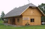 |
The carpenter’s workshop offers special excursions and events for grown-ups and children; there are some thematical programmes available. Under the guidance of a craftsman it is possible to work with traditional wood-working tools and get to know ancient games. In the end you will have a chance to try special „strengthening” tea and have a picnic in a romantic Bonfire house. It is possible to buy wooden souvenirs as well as order them. |
|
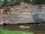 |
This ancient river valley stretches from Koorvere to the Otteni Windmill, and there are nearly 40 revealed sandstone cliffs from the Devonian age. Two of them, Väike and Suur Taevaskoja (the latter is 22 m high) are popular tourist destinations.
|
|
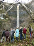 |
This is a cliff with various levels. Known as the North Estonian cliff, it stretches all along the shore of the Bay of Rīga in Estonia, including some of the local islands. The most expressive part in geological and landscape terms is the Saka-Ontika-Toila cliff, which is around 22 km long and offers an unusual natural environment. The cliff is as much as 53 m high, and it has a fairly virginal forest along its slopes. The layers of clay, sandstone, limestone, etc., come from the Cambrian and Ordovician periods. The Valaste juga (Valaste waterfall) is 24 metres high. After a longer period of freezing temperatures, the waterfall has a particularly impressive appearance. Seasonal waterfalls (8-10 m) can be found near the villages of Ontika and Toila.
|
|
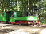 |
This little tram offers a great opportunity to return to history, when small trams were found all over Latvia. Until the 1960s, there was a narrow-gauge railroad that linked shoreline fishing villages along the shores of Northern Kurzeme. Only a few remnants of the old tracks can still be found in nature, and there are only a few train stations or parts thereof. Visitors to the Ventspils Open Air Museum can take the 1.4 km Circle Line or the 3 km Mountain Line. The locomotive was built in Germany in 1916, and the museum features a station building with all of its elements. |
|
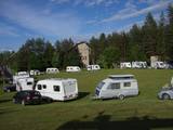 |
In the summer season we offer trips by raft and boats, camps for children, an area for organizing events, camping for the night. In the winter season "Baili" has a ski center - downhill ski tracks, ski and snowboard equipment rental, instructor services. Catering offer in a cafe. |
|
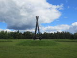 |
Not far from the Rīga ring road on the Right Bank of the Daugava is a monument designed by the sculptor Ģirts Burvis in 1994, which is dedicated to the Livs of the Daugava region and their Mārtiņsala leader, Ako, who led a battle against the Holy Crusades in 2016. Around the monument is a large area for leisure and perambulations. This is one of the loveliest locations in the lower reaches of the river. A bit further along are information stands about the history of the banks of the river before the construction of the Rīga hydroelectric power plant. |
|
 |
The restricted area was established to protect this part of the Ogre River valley, which has ancient river beds and meadows with relevant biotopes and populations. Among these are the wych elm and the European white elm, which are not often found in Latvia.
|
|
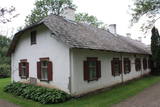 |
Between 1883 and 1891, the estate that was once owned by the Šadurskis family was rented by the father of the great poet Rainis, Krišjānis Pliekšāns. Rainis spent his youth at the estate, as reflected in the poet’s The Land of My Youth Days. Rainis translated Pushkin’s Boris Godunov while at the state. In honour of the poet and his contributions in the world of literature, an exhibition, “Rainis’ High School and University Years,” was opened at the estate in 1964. The restored cattle shed today offers a look at the work of potters in Latgale. |
|
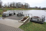 |
Gar Grobiņas ūdenskrātuvi (Ālandes labais krasts) izveidota mūsdienīga un labiekārtota pastaigu un atpūtas vieta - promenāde, uz kuras izvietotas plāksnes ar Zentas Mauriņas un Jāņa Raiņa citātiem. No promenādes paveras labi skatu punkti uz Skābaržkalnu un Grobiņas pilsdrupām. Grobiņas ūdenskrātuves sašaurinājumā pāri Ālandei ved neliels tiltiņš, kas ir bijušā Liepājas – Aizputes šaursliežu dzelzceļa tilta ferma. |
|
|
|
An afforested island in the Gulf of Finland, approximately 14 km to the North of Tallinn. There is a network of small roads and trails on the island. Forests: Mostly 1.1, 1.2 and 4.2. Information: www.aegna.ee. A ferry boat to the island departs from the port at Pirita. Hike around the shore of the island, where you will find all kinds of environments – dunes, sandy areas, rocky areas and places with lots of reeds (~9 km). |
|
|
|
Tavern Vedu is located 10 minutes’ drive from Tartu, going in the direction of Narva. In the historic tavern you can taste delicious dishes from local ingredients. |
|
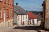 |
Kandava is first mentioned in the articles in 1230. In 1253 the Livonian Order built a stone castle at the upper part of Abava valley shore, at the foot which of an urban area formed. In the 17th century Kandava became an important trading centre. The plague epidemic and developments of World War I hit the town and its people hard. Kandava got the town rights in 1917. During soviet Soviet times, Sports Complex of Jaunkandavas agricultural Technical School became a popular training venue. |
|
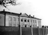 |
The roots of Saulkrasti Secondary School reach back to Pabaži, to 1912, when a young teacher – Olga Veicmane (after marriage: Cīrule) arrived from Riga to teach the sea captain Reisons’ daughter. Soon many other tutor-seekers joined her and in autumn of 1912 a school was established in Pabaži. The school had a good reputation, and pupils came from the entire surrounding area. In January of 1913, the school was moved to more spacious premises at 20 Rīgas Street. |
|
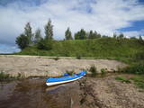 |
This is an ancient and important place for trade and craftsmanship on the left shore of the Rīga hydroelectric power plant reservoir. It rises some 15 m above the Daugava River. The Zemgale port that is described in historical documents is thought to have been located alongside the castle hill and at the mouth of the little Varžupīte stream. Antiquities that have been dug up here suggest that the castle hill and its adjoining ancient settlement were populated until the late 12th century, when the importance of Daugmale began to shrink because of rapidly growing Rīga. The foundations of the castle hill have been shored up. |
|
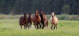 |
The “Dabas zirgi” centre for horse and human welfare is in the historical Mežinieku neighbourhood in suburban Rīga, and it will be a revelation to those who wish to have a sense of belonging related to Latvia and its environment. Touch the forest, enjoy the cool water of the Misa River, encounter a swamp or see the breath of a horse on a foggy morning. You’re welcome to spend a longer amount of time at this venue with new glamping opportunities in a lovely forested area next to the steep shores of the Misa River. This offers complete silence with only the woods and the river nearby. Along with the horses, of course. “Dabas zirgi” offers strolls with a horse, tours involving feeding the animals, as well as horseback rides. Family celebrations are perfect here with a lean-to, a grill, and a pot on a campfire. Contact the venue in advance to arrange for prepared breakfast, lunch and dinner. There is also a sauna with a jacuzzi. |
|
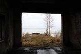 |
Today it seems unbelievable that just 20 years ago there were buildings on the coastline with massive projectors that were rolled onto a platform at night so as to shed light on the nearby sea and beach and to look for potential violators of the border regime. Only the buildings and the ruins of the platform are still there – they have been seriously damaged by the waves of the sea.
|
|
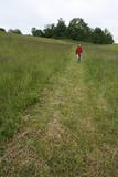 |
Viens no iespaidīgākajiem nacionālā parka pilskalniem, kura piekājē atradusies senpilsēta. Arheoloģisko izrakumu gaitā te atrastas kuršu senlietas. Tiesa, mežs un biezais augājs traucē uztvert šī nozīmīgā arheoloģijas pieminekļa patiesos apjomus un formu. Uz pilskalnu vasarās ved izpļauta taka. Ja esat Žemaišu Kalvarijas pusē un atliek brīvs brīdis, tad savā maršrutā var iekļaut arī šo apskates objektu. |
|


