
| No | Name | Description |
|---|---|---|
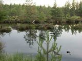 |
This territory is around 9 square kilometres in size and is found to the North of the village of Kūdra, where the so-called old peat quarries are found. Peat was extracted here during the first period of Latvian independence. Today the territory is overgrown, preserving the old and flooded quarries which offer a very unusual landscape. The best way to examine them is on foot or bike, taking the road from the Kūdra railroad station which leads to Lake Sloka. |
|
 |
Ārkārtīgi ainaviska teritorija Augšzemes augstienes centrālajā daļā ar vairākiem ezeriem - Medumu, Lielo un Mazo Ilgas, Šķirsteņu un dažām mazākām ūdenstilpēm. Medumu ezera salām ir dabas lieguma statuss. Teritoriju šķērso vairāki grantēti ceļi, no kuriem dažviet paveras brīnišķīgas, bet nelabiekārtotas skatu vietas. Teritorijā atrodas Medumu katoļu baznīca. Piemērota teritorija dažādu aktīvā tūrisma veidu attīstībai. Dabas parks ietilpst Augšzemes aizsargājamo ainavu apvidū. |
|
 |
Atrodas Kokneses tūrisma centra telpās (1905. gada ielā 7). 160 cm garais un 120 cm augstais makets ir Vittingenas (Vācija) dāvinājums Koknesei, atzīmējot 10 gadu sadraudzības jubileju. Šāda Kokneses pils izskatījās ap 1701. gadu. |
|
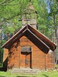 |
Krupenišku Old-Believer Prayer House was built in 1908. The autor of the
design is engineer I. Ivanov. At present the church is in bad tehnical condition.
|
|
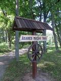 |
Asares muižas romantiskā stila dendroloģiskais ainavu parks veidots 18. gs. un papildināts 19. gs. 2. pusē. Muižas parka teritoriju ieskauj laukakmeņu mūris. Bet parkā sastopamas daudz interesantas krūmu un koku sugas: Sibīrijas baltegles, Eiropas lapegles, duglāzijas, šķeltlapainie baltalkšņi, Švedlera kļavas, košumkrūmi, dažādi lakstaugi. Liepu alejā - 2 dižkoki. Tempļa kalna atjaunotajā lapenē - muižnieku tējas dzeršanas vieta ar skatu uz pili. |
|
 |
The saloon is in the centre of Vecumnieki and features antique household objects as part of its interior design. Breakfast, lunch and dinner are all prepared on an open fire, making use of an ancient spirit and the cookbooks of grannies. Desserts, too, are all made from natural ingredients. Latvian cuisine: Pork with sauerkraut. Special foods: Handmade pierogi with home-cured meat. |
|
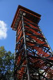 |
Labi redzams no Kornetu centra. Līdz tornim var nokļūt pa taku, kas ved pāri pļavai uz uzlokas pa stāvā Dzērves kalna nogāzi. No torņa paveras viens no skaistākajiem Vidzemes un Latvijas skatiem. Redzams Dēliņkalns, blakus esošie Dzērves un Ievas ezeri, Hānjas augstiene un Lielais Munameģis (acīgākiem vērotājiem). |
|
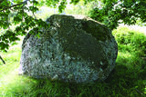 |
The great Black Plague rock, which has engraved text that can still be seen
to a certain extent – it tells future generations about the local pastor who died
from the plague, about how the parsonage was established at Sīkrags and then
moved to Mazirbe. The rock is also a monument to six pastors of the nearby
congregations. All the three stones tell about the horrors of the Black Plague in
1710, the texts have been engraved during the parson Peterson in 1711-1734.
|
|
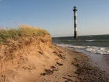 |
Harilaidas galā no jūras ūdens paceļas 26 m augstā Kīpsāres bāka – viena no neparastākajām Igaunijas bākām. Tā celta 1933. g., kad jūra no bākas atradās ~ 100 m attālumā. Krastu noskalošanas rezultātā tā tagad ir viļņu ieskauta. |
|
 |
Restaurant Ankur is a cosy place where home-made dishes are served, mostly from local products. Peipus Lake fish are of special value. There is also a hotel in the same building. |
|
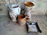 |
The ceramicist works in the household building of the Durbe Castle. You can watch her at work, try your hand at ceramics work, order artworks and purchase clay souvenirs. You can also tour the Durbe Castle complex, which is undergoing renovations at this time (2013). |
|
|
|
Ātrās apkalpošanas kafejnīcas ar plašu ēdienu sortimentu visas dienas garumā. Sortimentā iekļauti latviešu nacionālie ēdieni, kā arī citu tautu ēdieni. Izbraukuma banketi, dažādu viesību mielasti, semināru apkalpošana, sporta spēļu un sporta nometņu ēdināšana. |
|
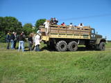 |
Ap 6 km garā pussala ir vieta, kur jānokļūst tiem, kas grasās doties vienā no neparastākajiem pārgājieniem pāri jūras šaurumam. Cauri Kūsnemmes pussalai līdz tās ziemeļu daļai iet šaurs un ļoti līkumains grants ceļš (ar garāku tūristu autobusu jābrauc lēni un uzmanīgi), kura galā izveidots autostāvlaukums, neliels namiņš, kur patverties lietus un vēja laikā, kā arī informācijas stends. Turpat redzamas divas Padomju armijas „KRAZ” tipa automašīnas. Lai sasniegtu robežkontroles posteni, Padomju robežsargi brauca pa jūru un mazajām saliņām, kas kā pērļu virtene savieno Kūsnemmes pussalas galu ar Vilsandi salas dienviddaļu. Turpat divas desmitgades pēc Igaunijas neatkarības atjaunošanas „KRAZ” automašīnu kravas kastēs vasaras laikā uz Vilsandi vizināja tūristus, taču spēkrati savu mūžu ir nokalpojuši un unikālais piedāvājums vairs nav spēkā! Ko darīt? Pa mazajām saliņām uz Vilsandi var doties ar kājām. To var īstenot tikai siltā laikā, kad nav gaidāms stiprs vējš un ir zināma laika prognoze vismaz divām tuvākajām dienām. Kā sava veida orientieris var kalpot augstsprieguma elektrolīnija. Kopumā ir jārēķinās arī ar 1 h 40 – 2 h ilgu un ~ 4 km garu gājienu. Dziļākā vieta (ja ietur pareizo „kursu”) atrodas pārgājiena sākumdaļā, kur starp saliņām izveidots laivu ceļš - ~ 1 m dziļa vieta atkarībā no vēja virziena un ūdens līmeņa. Zināmu priekšstatu par maršrutu sniegs redzamā ainava, kas paveras no skatu torņa. Kaut arī šis maršruts tiek reklamēts dažādos informatīvajos materiālos, atbildību par tā veikšanu uzņemas katrs pats! |
|
 |
Druvienas muižas pirmsākumi ir meklējami 17. gs. beigās. Tagad redzamā apbūve ir veidojusies 19. – 20. gs. Līdz mūsdienām ir saglabājusies muižas pils (1898. g.) un saimniecības ēkas – klētis, kūtis, kalpu mājas. Muižas pilī 20. gs. 50. gados izvietoja pamatskolu. Diemžēl sākotnējie ēkas interjeri nav saglabājušies. Pili ieskauj parks. Šobrīd ēkā atrodas Druvienas Latviskās dzīvesziņas centrs, kas piedāvā dažādas aktivitātes un radošās darbnīcas. |
|
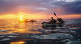 |
The company runs wildlife tours: rafting in early spring, kayaking in summer (with beaver watching upon request), bog and snowshoeing round the year, kick-sledging in winter. Our experienced guides tell exciting stories of wildlife and history. |
|
 1 day
|
This outing combines fine dining at one of the most beautiful estates in Latvia with an outdoor experience at a cranberry plantation tasting cranberry-based products. The Bīriņi Castle complex is part of Latvia’s national architectural heritage. The Neo-Gothic main castle building is surrounded by a picturesque park and buildings including the stables and the water tower, which showcase the country’s industrial heritage. The castle hotel is a very popular venue for wedding celebrations. The cranberry plantation in Laugas swamp at Gundegas Farm was started in 1989 as a research farm. Cranberries are well known for their refreshing taste and medicinal qualities. They are used both for culinary purposes and in traditional medicine. Today six types of cranberries are grown in Latvia. The cranberry plantation offers the opportunity for guests to ‘pick-your-own’ during the harvest in September. |
|
 |
Pie ceļa, kas no Bernātu ciema centra ved uz jūru, redzamas augstas ar mežu apaugušas kāpas. Uz vienas kāpas (ir norāde) novietots piemiņas akmens ar pirmā Latvijas Valsts prezidenta Jāņa Čakstes 1924. g. teiktiem vārdiem: “Te jābūt kūrortam.” Atrodas Bernātu dabas parkā. |
|
 |
Located on the main pedestrian thoroughfare in town, the baker offers bacon pierogi, cottage cheese and cinnamon pastries, sweet pretzels and tortes. Vintage bicycles can be rented. |
|
 |
Near the place where the Kilmiņupe River flows into the sea is the legendary Trommel castle hill, which was a Medieval fortification. It is some 100 m from the Kraujas homestead. An archaeological dig in 1977 found fragments of bricks and pot-bellied stoves, which suggests that the fortifications date back to the Middle Ages. The location also is linked to stories about a pirate, Trommel, who buried his loot here. The holes in the area have been left behind by treasure hunters. Trommel supposedly robbed ships in the Bay of Rīga from the shores of Kurzeme to Roņu Island. Many ships docked here in ancient times, waiting for better winds so that they could pass by Cape Kolka. The pirate made use of this fact, also pillaging property from sunken ships. It is said that Trommel lived in a stone castle. (Source: Roja TIC) |
|
 7 days
|
This long tour of Latvia includes some of the best and most beautiful parts of Jūrtaka in Latvia. Hikes along the sea alternate with trips and excursions in the cities. You will go along the coast of the Baltic Sea from Mazirbe to Kolka, seeing Slītere National Park and Livonian villages. You will see Engure Nature Park and the overgrown seaside meadows that are suitable for bird watching. Along the way, you will be able to purchase smoked fish from local fishermen and learn about fishing traditions in Latvia. Further, the route will take you through the most popular seaside resort in Latvia, Jūrmala; you will also have time to visit the capital city - Rīga. The second part of the route runs along the Vidzeme coast from Saulkrasti to Svētciems. In terms of landscapes and views, the most multifaceted section of the Baltic Coastal Hiking Route in Latvia, which includes both sandy and rocky beach, coastal meadows, reeds, dunes, sandstone outcrops, forests, capes and small coves, fishing villages and pubs. |
|


