
| No | Name | Description |
|---|---|---|
 |
The main goal of the Vestiena protected landscape area is to protect the landscape values in the Vidzeme highlands. The protected area is in the middle of the Vidzeme highlands with the highest and most prominent relief, including Gaiziņkalns, the highest spot in the country. The many lakes found in the area - Viešūrs, Talejas, Kāls, Pulgosnis and others – not only add to the variety of the landscape, but also offer tourism and recreation options. The Vestiena protected landscape area encloses several other especially protected/Natura2000 sites – the Gaiziņkalna nature park, the island of the lake Kāla, the lake Ilziņa restricted natural area. Among the most interesting tourist attractions are the Vestiena estate, the Piekūnu wandering trails, the Gaiziņkalna nature trail. The area is rich in landscapes, however, there are no viewing spots or towers installed to observe the landscape. On the top of the Gaiziņkalns, the Latvia’s highest spot, there still stands the wreck of the former viewing tower.
|
|
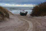 |
Ceļa, kas ved uz jūru – galā, redzami Latvijas piekrastei samērā reti skati. Ja palaimējas, šeit var novērot vietējos zvejniekus darbībā, kas joprojām iet zvejā. Krasta kāpās aplūkojamas vecas, pamestas un arī sagrieztas zvejas liellaivas un dažādi mūsdienu zvejniecībā izmantojami „darba rīki”. |
|
 1 day
|
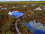
The Great Ķemeri Bog Boardwalk is located in Ķemeri National Park. The national park covers an area of 38,165 hectares. The Great Ķemeri Bog Boardwalk immerses visitors in the world of moss, small pine trees, deep pools, tiny dark lakes and the smell of wild rosemary. An astute visitor will notice the carnivorous sundew plant and a variety of birds – wood sandpipers, white wagtails and tree pipits – and will also be able to hear cranes further away. Those who prefer shorter strolls can take the small boardwalk loop (approx. 1.4 km), while those who choose the great loop (approx. 3.4 km) will be rewarded with the opportunity to climb to a viewing platform that offers a magnificent view of the bog from above. The Great Ķemeri Bog Boardwalk has become a popular place for landscape and wildlife photographers. The whole trail is laid to wooden boardwalk and therefore is fully accessible and can be walked without a professional guide. |
|
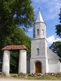 |
Renda is a very old town, first mentioned in historical sources in 1230. During the 13th century, Renda was one of the centres of the ancient Courlandian land of Vanema. When Courland was split up in 1235, Renda was taken over by the German Order, and local residents were forcibly drafted into its military. During the age of the Duchy of Courland (1562-1795), the region flourished despite wars, the bubonic plague and other problems, particularly during the rule of Duke Jacob (1642-1682). During the 17th century, Renda became something of a manufacturing centre, churning out timber products, with local lime kilns, watermills, flax weaving facilities, a glass factory and a boiling house for saltpetre and soap. Wine, perfumes and barrels were produced in Renda, as was cast iron for nails and many other things. The court at the Jelgava Castle loved the sour wines from Renda. All of this was destroyed during the Great Northern War (1700-1721). During the 19th century, a chemicals factory was built on the site of the burned Renda castle, and nearby was one of the largest leather tanning plants in Kurzeme, along with a manufacturing facility for turpentine. Cultural life began to develop in parallel to this. Renda suffered much during the two world wars and the subsequent Soviet repressions. The so-called Courelian Battalion of partisans went into the forests after the occupation to continue their struggle against the Soviet regime. Renda today is a small and quiet village with the Lielrenda Estate, a local church, the “devil’s boat” at the Abava River, and the Īvande waterfalls. |
|
 |
Izcila lokveida taka (4,5 km), kuras lielākā daļa (koka laipas) ved pa Rīsas purvu (Riisa raba). No takas un divstāvīgā koka skatu torņa ir vērojami purva ezeriņi, lāmas, un purvaini meži. Ja nacionālā parka apskati sāk no ziemeļu puses, tad šī taka ir labs ceļojuma iesākums! |
|
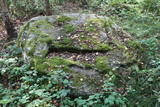 |
Near Mākoņkalns hill there is a trail that is mowed in the summer and leads to several historical rocks – Plakanais (Flat) rock, Āža muguras (Ram's Back) rock (on which you can clamber), and the Jaunstašuļi Velna pēdas (Devil's Footprint) rock, on the surface of which is a shape similar to a human footprint. There are signs along the side of the road leading to the trail. |
|
 |
The owner of the Vālodzes farm is a beekeeper. The farm is on the banks of a lovely river in a place where a homestead existed long ago. The hive are on a hillock and in a lovely meadow in the forest. Alongside the bees is a lovely apple orchard, and the owner is happy to have help in harvesting the apples in the fall. He has slowly restored the farm since 1996, and it has a lovely and large lake, a lake hut, a granary with a renovated upper floor and balcony, the beekeeping operation and the apple orchard. |
|
 |
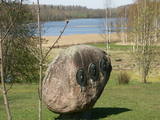
Medinski Vincīši boulder also called Magoņkalns (Poppy hill). Red rapakivi granite boulder is found
in the tree cluster only 40 m to the left of Jaunviļāni – Medinski road and about 40 m from the right side of
the river Malta. The boulder is 6,6 m long, 5,4 m wide and 3,3 m high. The circuit of the boulder is 20 m
and the volume 40 – 45 m3.
|
|
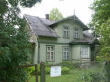 |
The Miervaldis Ķemers Museum (Durbes
street 21) is dedicated to a well known cultural
worker in Latvia (19021980) who was also a
clergyman and a painter.
|
|
 |
The cafe Staburadze is situated in the centre of the city Kuldiga. |
|
 |
Organic family farm Võrumaa, Haanja Nature Park (Haanja rahvuspark). The farm rears goats and makes goat’s cheese. Tastings and excursions are organised here; you will see how the milk from the cowshed turns into a cheese wheel. |
|
|
|
Ļoļi Devil’s Footprint is situated in Mākoņkalns rural territory in a small forest lawn several meters from the
ditch, which is a borderline of the Rēzekne and Krāslava districts. It is about 1,9 m high truncated cone, the base
perimeter 1,8 m. According to the legend, the boulder had a curvy of the horseshoe prints. Now it’s shapeless. For the
first time the stone as a geological monument was established in the 1930s. It was in Andrupene rural territory.
|
|
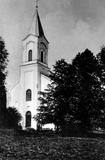 |
The first building of the church was built in 1641. The fourth building of the church was only built in 1856 – during the times of Pastor Johann Wilhelm Knierim. Its altar painting – The Crucified Christ (Golgotha) was painted in 1856 by Jozeps Millers, who was influenced by the altar piece in Munich Louis Church created by his teacher Peter Cornelius. An epitaph of Baroness Auguste Amalija von Pistohlkros, the sister of the owner of Bīriņi Manor and the patroness of the church, was immured in the memorial wall. Construction of the tower was completed on 11 June 1856, as evidenced by a memorial plaque on the wall of the church with an inscription “Erbaut von August Pistolkors 1856”. The church was consecrated in 1864. And a year later an organ by Martin Company with 8 registers, which was extended to 14 registers in 1903, was installed in the church. Unfortunately, the organ was destroyed in WW2. Saulkrasti (Pēterupe) Evangelical Lutheran Church survived both World War 2 and the Soviet period. The Soviet era was one of the most difficult times for the church, because many churches in the area were destroyed, pastors were discharged and the congregation fell apart. The Pēterupe congregation remained. As an architectural monument the church was lucky enough to undergo roof repairs of the tower even during Soviet times. Funds were granted by the Chairlady of the Executive Committee Ņina Manzūrova. |
|
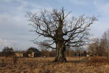 |
A small settlement with a school, library and shop. North from the Vidale are visible remains of the windmill. Going towards the Gulf of Riga, the road crosses Shlitere Zilie mountain precipice with spectacular views during late autumn, early spring and winter, when there are no leaves on the trees and sandstone outcrops. To the left you can see Zilie mountain spring - a landscaped water taking place. Road that runs from the Vidale to Melnsils side, is called by the locals Knipeldambi. They say that it was built by the German army first During World War I, putting logs on the road and covering them with sand. |
|
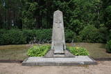 |
This is the largest cemetery of the brethren from the World War I period, and it is the final resting place for some 1,800 Latvian Riflemen, as well as some 2,000 soldiers who served in various Russian army units and were reinterred during the 1930s. There is a monument at the centre of the graveyard. |
|
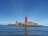 |
The Kolka lighthouse is on an artificial island which was created
between 1872 and 1875. The original lighthouse was made of wood, and
its light was first lit in June 1875. As the island settled into the sea, the
current tower was built. It began operations on July 1, 1884. Today the
lighthouse is six kilometres from Kolkasrags at the end of its sandy
shallows (back when it was built, it was just five kilometres away). The
island still has the building for the lighthouse supervisor, as well as
several outhouses. The metal lighthouse which is there now was built in
St Petersburg. It has been an automated lighthouse since 1979.
|
|
 |
В давние времена проспект Курмаяс был главной дорогой, ведущей на пляж. Вдоль проспекта стоят роскошные дома и виллы рубежа XIX – XX века, принадлежащие аристократам – обожателям моря и побережья. Здесь установлены отлитые в бронзе скульптуры из гимна Лиепаи «Город, в котором рождается ветер» - «Лодочник», «Янтарные латыши», «Ворона» и др. В конце проспекта возвышается памятник погибшим морякам и рыбакам (установлен в 1977 г.). Он символизирует женщину, которая ждет возвращения домой своего мужчины. На проспекте Курмаяс 16/18 находится Лиепайский историко-художественный музей. Музейный фонд (всего более 100 000 экспонатов)разместился в построенном в 1901 году в стиле эклектизма (с элементами готики) доме, который строился по эскизам берлинского архитектора Эрнеста фон Ине и проекту П. М. Берчи. В экспозиции представлена каменная стела – единственная подобного рода находка в странах Балтии с могильника под Гробиней (могильник Скандинавов). |
|
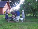 |
Latgale Farmstead „Mežmalas”. The owners of the farmstead created an interesting collection of the old
household items, tools and equipment of the 19th and 20th century. The visitors are offered to try plainting of
the scale basket. Sale of baskets and herbal tea. Enjoy walking along the energetic path through the pine forest.
Working hours: on request |
|
|
|
Together with Valga on Estonian side - a peculiar frontier twin town. |
|
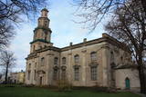 |
The church was built between 1742 and 1578 after a design by J.K. Dorn and for the needs of the local German congregation. The 55 metre steeple was completed only in 1866. The façade and interior of the church are in the style of late Baroque and Classicism (with elegant Rococo elements inside the church). The church is known for the organ that was built by H.A. Koncius between 1773 and 1780. Since a reconstruction in 1885, the instrument has more than 7,000 pipes, 131 registers and four manuals. It is suggested that it is the largest mechanical organ in the world, and its sound is just wonderful. Visitors can visit the church, examine the organ and climb the steeple. |
|


