
Nature objects in Estonia

What's special about the nature in Estonia?
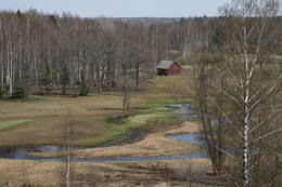
In Estonia, there stands the most impressive rock wall in the Baltics - the so called North Estonian "glint" (from Estonian language). Estonia has its own "Land of Inlets" - the Lahemaa region with its national park, the "Land of Islands" - the Saaremaa island and the Monzund archipelago. The Matsalu bay is one of the most significant rest stops for birds during their migration. In Estonia there is one of the most prominent impact craters in Europe, there are the greatest waterfalls and boulders in the Baltics, the Munamagi hill - the highest spot in the Baltics, the Lake Peipus - the 5th largest lake in Europe, - with long-standing fishing traditions, and the great variety of nature from West to East, from North to South.
Act responsibly - follow the Green advice!
| Overview | Details |
|---|---|
 |
Estonia
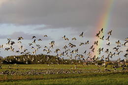
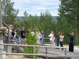
The Matsalu National ParkThis is one of the most popular bird-watching locations in Estonia, and during spring and autumn migration there are a great many different kinds of birds resting and feeding in the meadows and shallow coastal waters of the Bay of Matsalu and the Kasari River.
Services
1-12 Active season monthsServices - recreational
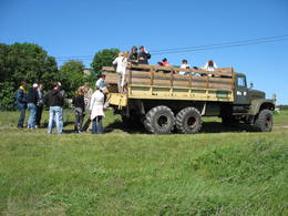
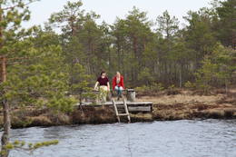
Boat tourBoating on the Bay of Matsalu and the Kasari River can be organised. 
Nature trailThe Kiideva-Puise hiking trial (5 km), the Penijõe trail (3 km), the Salevere information trail (1.5 km). 
Nature watchingBird-watching is possible throughout the park, especially on the shorelines, in wetland meadows and heaths. There are bird-watching towers or platforms at Puise, Kiideva, Haeska, Rannajõe, Kasari jõgi, Penijõe, Suitsu and Keemu. The visitor centre is in the village of Matsalu. For more information: www.matsalu.ee (available in English). |
 |
Estonia
Saleveres Salumegi kalns (Salevere Salumägi)Litorīnas jūras laikā (pirms ~ 6000 gadiem) Saleveres Salumegi kalns bija sala, bet mūsdienās tas kā izteikta kāple (īpaši - ziemeļu pusē) paceļas virs Piejūras līdzenuma. Salumegi ziemeļu pusē slejas 4 - 5 metrus augsts kaļķakmens atsegums – silūra perioda (> 400 mlj. gadu) koraļļu rifa paliekas, kuru noskalojuši Litorīnas jūras viļņi. Atseguma piekājē izplūst Acu avots, kam piedēvē dziednieciskas īpašības. Salumegi apskates nolūkos izveidota lokveida taka (1,5 km). No kalna augšas paveras labs skats uz Matsalu līci. Šeit atradies arī sens pilskalns.  132 132
Services
132km - Distance from countries capital city |
 |
Estonia
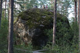
Stein MajakiviDer dritgrößte Feldstein im Baltikum (584 m3, 7 m hoch, Durchmesser bei dem Grund – 32 m ). Auf estnisch bedeutet „Hausstein”. Befindet sich am Rande des Pikanõmme – Majakivi Pfades (4,5 km lang). 60
Services
60km - Distance from countries capital city |
 |
Estonia
Kusnemmes pussala (Kuusnõmme poolsaar)Ap 6 km garā pussala ir vieta, kur jānokļūst tiem, kas grasās doties vienā no neparastākajiem pārgājieniem pāri jūras šaurumam. Cauri Kūsnemmes pussalai līdz tās ziemeļu daļai iet šaurs un ļoti līkumains grants ceļš (ar garāku tūristu autobusu jābrauc lēni un uzmanīgi), kura galā izveidots autostāvlaukums, neliels namiņš, kur patverties lietus un vēja laikā, kā arī informācijas stends. Turpat redzamas divas Padomju armijas „KRAZ” tipa automašīnas. Lai sasniegtu robežkontroles posteni, Padomju robežsargi brauca pa jūru un mazajām saliņām, kas kā pērļu virtene savieno Kūsnemmes pussalas galu ar Vilsandi salas dienviddaļu. Turpat divas desmitgades pēc Igaunijas neatkarības atjaunošanas „KRAZ” automašīnu kravas kastēs vasaras laikā uz Vilsandi vizināja tūristus, taču spēkrati savu mūžu ir nokalpojuši un unikālais piedāvājums vairs nav spēkā! Ko darīt? Pa mazajām saliņām uz Vilsandi var doties ar kājām. To var īstenot tikai siltā laikā, kad nav gaidāms stiprs vējš un ir zināma laika prognoze vismaz divām tuvākajām dienām. Kā sava veida orientieris var kalpot augstsprieguma elektrolīnija. Kopumā ir jārēķinās arī ar 1 h 40 – 2 h ilgu un ~ 4 km garu gājienu. Dziļākā vieta (ja ietur pareizo „kursu”) atrodas pārgājiena sākumdaļā, kur starp saliņām izveidots laivu ceļš - ~ 1 m dziļa vieta atkarībā no vēja virziena un ūdens līmeņa. Zināmu priekšstatu par maršrutu sniegs redzamā ainava, kas paveras no skatu torņa. Kaut arī šis maršruts tiek reklamēts dažādos informatīvajos materiālos, atbildību par tā veikšanu uzņemas katrs pats! 257
Services
257km - Distance from countries capital city |
 |
Estonia
Oksas (Oksa) takaBijušā piecstāvīgā metāla skatu torņa apkaimē plešas Lemmjegi upes palieņu pļavas. Netālu atrodas kādreizējā Oksas kroga (Oksa kõrts) vieta, kur saglabājies iespaidīgs manteļskurstenis. Apkaimes apskatei izveidota 0,8 km gara koka laipu taka. 175
Services
175km - Distance from countries capital city |
 |
Estonia
Haeskas putnu verosanas tornis (Haeska linnutorn)Pamatīgs trīsstāvu koka tornis, no kura atklājas viens no labākajiem Matsalu līča un tā apkaimes palieņu pļavu skatiem, kuras apsaimnieko mājlopi, veidodami piemērotu vidi dažādām putnu un augu sugām. Laba migrējošo zosveidīgo putnu vērošanas vieta. Tā kā tornis ietilpst Tūlingu (Tuulingu) saimniecības teritorijā – spēkrats ir jāatstāj netālu esošajā autostāvlaukumā, bet suņi jāved piesieti kakla siksnā. |
 |
Estonia
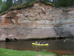
Ancient Ajha River valleyThis ancient river valley stretches from Koorvere to the Otteni Windmill, and there are nearly 40 revealed sandstone cliffs from the Devonian age. Two of them, Väike and Suur Taevaskoja (the latter is 22 m high) are popular tourist destinations.
|
 |
Estonia
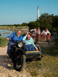
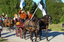
Kihnu islandCultural space of Kihnu (www.kultuuriruum.ee) is incorporated in the UNESCO list of Masterpieces of Oral and Intangible Heritage of Humanity, and is a quaint mix of old and modern. The local history museum displays tools, clothes, handicraft and furniture. 180
1-12
Services
180km - Distance from countries capital city
1-12 Active season months |
 |
Estonia
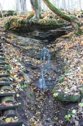
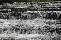
Joaveski udenskritumi (Joaveski joastik)Krāčains Lobu upes (Loobu jõgi) posms pie Joaveski ciema, kur ~ 160 m garumā upes gultnē, tai šķērsojot Ziemeļigaunijas glintu, izveidojušās izmēros nelielas, tomēr ļoti ainaviskas un skaistas 0,5 – 1 m augstas ūdenskritumu kaskādes. 1898. g. šeit uzcēla hidroelektrostaciju, kuras atliekas ir redzamas upes labajā krastā. Iecienīta pavasara laivotāju treniņu vieta. |
|
|
Estonia
Aegna IslandAn afforested island in the Gulf of Finland, approximately 14 km to the North of Tallinn. There is a network of small roads and trails on the island. Forests: Mostly 1.1, 1.2 and 4.2. Information: www.aegna.ee. A ferry boat to the island departs from the port at Pirita. Hike around the shore of the island, where you will find all kinds of environments – dunes, sandy areas, rocky areas and places with lots of reeds (~9 km). |
 |
Estonia
Tihuse Riding Farm heritage trailTihuse farm provides accommodation and horse riding from trekking to carriage rides. A signposted heritage trail starts at the farm and tells the story of people and Nature; you can also learn about old beliefs and customs. The teahouse exhibits photos of places linked to Muhu island’s heritage. 148
1-12
Services
148km - Distance from countries capital city
1-12 Active season months |
 |
Estonia
Moor TolkuseDurch das höchste Dünen-Massiv Estlands und den Moor führt der Lehr-Wanderweg. Blick vom Aussichtsturm bis auf die Insel Kihnu. 175
Services
175km - Distance from countries capital city |
 |
Estonia
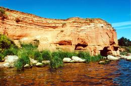
The sandstone cliffs of KallasteThis is one of the few places in the Baltic States where one can find Devonian period sandstone cliffs featuring abrasion caves, arches, etc. The cliffs are on the shores of Lake Peipsi (Peipsi järv), near Kallaste, and they are between two and four (in some cases – nine) metres high, stretching for a distance of around one km.
ServicesServices - recreational
Nature trailHike along the shores of the lake to and from the cliffs (3 km).
Nature watchingThere is a viewing tower which offers a good look at Lake Peipsi and the shoreline. For more information: www.kallaste.ee (only in Estonian). |
 |
Estonia
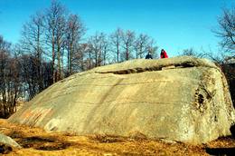
Muuga Kabelikivi rockThis is the second largest rock in the Baltic States in terms of size (728 m3). It is the only rock in the Baltic States with this form and size. It is 7 m high, 19 m long, 11 m wide, and 58 m in perimeter. Kabelikivi looks like a cliff that is halfway sunk into the earth. During the Ice Age, the rock “travelled” to this location from southern Finland. It is made of granite, and there are two other very impressive rocks alongside it.
|
 |
Estonia
LuitemaaThe word “Luitemaa” means “land of the dunes” in Estoninan. This coastline territory stretches for 13 km between Vöiste and Häädemeste with shallow waters, large coastal plains, Estonia’s highest dunes, and the Tokuse swamp (Tokuse raba). There are lots of birds here.
|
 |
Estonia
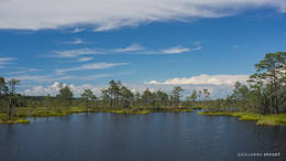
Erdi taka (Öördi rada)1,2 km gara taka, kas pa purvainu mežu aizved līdz Ērdi purvam (Öördi raba) un tā austrumu daļā esošajam Ērdi ezeram (Öördi järv), pie kura izveidota atpūtas un peldvieta. |
 |
Estonia
Metsamoori (Woods Crone) Family ParkThis park is a network of farms in Kaika area where visitors can learn about healthy life styles and alternative medicine. Farms have programmes on using herbs and leech in therapies, on the magical worlds of bees and mushrooms, spells and meditation. In workshops you can learn to use weeds in cooking, make bread and herbal drugs. Individual travellers are welcome to explore the farm on their own. 275
5-9
Services
275km - Distance from countries capital city
5-9 Active season months |


