
Naturobjekte in Estland

Was ist das Besondere an der Natur in Estland?
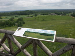
In Estland steht die beeindruckendste Felswand im Baltikum - das sogenannte nordestnische "Glitzern" (aus estnischer Sprache). Estland hat sein eigenes "Land der Buchten" - die Region Lahemaa mit ihrem Nationalpark, das "Land der Inseln" - die Insel Saaremaa und den Monzund-Archipel. Die Matsalu-Bucht ist eine der wichtigsten Raststätten für Vögel während ihrer Wanderung. In Estland gibt es einen der bekanntesten Einschlagkrater in Europa, es gibt die größten Wasserfälle und Felsbrocken im Baltikum, den Munamagi-Hügel - den höchsten Punkt im Baltikum, den Peipus-See - den fünftgrößten See in Europa - mit langen Hervorragende Fischertraditionen und die Vielfalt der Natur von West nach Ost, von Nord nach Süd.
Handle verantwortungsbewusst - folge dem Grünen Rat!
| Überblick | Details |
|---|---|
 |
Estland
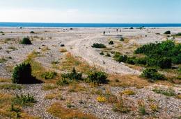
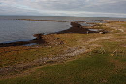
OsmussaarThis is a “peripheral” island in the Bay of Finland, 9 km from the Dirhami port. The special fact about this island is that it offers fields of juniper, a rocky and grassy seashore that is around 2 km long, and limestone cliffs that are a few metres high along the northern and the eastern shores of the island. These are designated with the words Osmussaare pank.
|
 |
Estland
ErbetourenDer Unternehmen bietet auf Indrl Saaremaa unterschiedliche Naturtouren zum Kennenlernen der Natur-und Kulturerbe: Robbenbeobachtung, Naturwanderungen zu Fuss oder mit Fahrrädern, Skitouren, Schlauchboottouren zu den Holmen im Nationalpark Vilsandi,Orchideetouren etc. Im Waldpark Miku im Nationalpark Vilsandi kann man Forstarbeit beobachten und auch selbst ausprobieren.  200 200
 1-12 1-12
Leistungen
200km - Entfernung von der Hauptstadt
1-12 Aktive Saisonmonate |
 |
Estland
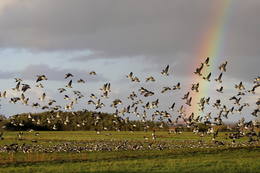
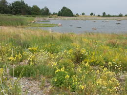
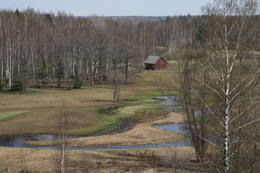
Nationalpark MatsaluDer Nationalpark Matsalu (48 610 ha) wurde als Schutzgebiet für die zahlreichen Vogelarten eingerichtet. Im 1976 wurde Matsalu zu der bedeutendsten Feuchtgebiete der Welt aufgenommen und auf die Ramsar Liste eingetragen. Matsalu ein wichtiger Zwischenstopp für Zugvögel und ein Nistplatz für viele Watvögel und gehört zu den populärsten Vogelbeobachtungsgebieten in Europa. Hier gibt es viele Naturpfade und 8 Vogelbeobachtungstürme. Vogelbeobachtungstouren und Pauschalen für Familien, sowie Kanuwanderungen in Matsalu bietet der Reiseveranstalter Estonian Nature Tours (www.naturetours.ee). Leistungen
1-12 Aktive SaisonmonateLeistungen - erholung
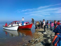
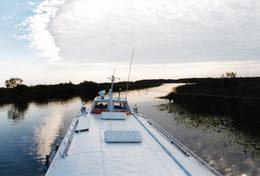
Fahrten mit Schiff/BootBoating on the Bay of Matsalu and the Kasari River can be organised. 
NaturpfadThe Kiideva-Puise hiking trial (5 km), the Penijõe trail (3 km), the Salevere information trail (1.5 km). 
NaturbeobachtungBird-watching is possible throughout the park, especially on the shorelines, in wetland meadows and heaths. There are bird-watching towers or platforms at Puise, Kiideva, Haeska, Rannajõe, Kasari jõgi, Penijõe, Suitsu and Keemu. The visitor centre is in the village of Matsalu. For more information: www.matsalu.ee (available in English). |
 |
Estland
Abruka IslandThis is the 11th largest Estonian island, and its central section is covered by a broadleaf forest (linden, oak, elm and other trees) that is more than 100 years old. Along the shores, the Abruka Island has meadows and small areas of wetlands. Only the northern part of the island is populated. Few tourists come to call, which means that the island is relatively untouched by humankind.
LeistungenLeistungen - erholung
NaturpfadHike across the island or along its NE shoreline (7 km). For more information: www.abruka.ee (available in English).
Naturbeobachtung |
 |
Estland
Insel PiirissaareInsel Piirissaare im Peipussee hat eine Fläche von 7,5 km². Die Inselbewohner sind grossenteils ussische Altgläubige. Die alte Kultur ist während Jahrhunderten gut erhalten geblieben. Die Hauptbeschäftigung der Inselbewohner ist Fischfang. Auf den Feldern wird Gemüse, hauptsächlich Zwiebel angebaut. 262
1-12
Leistungen
262km - Entfernung von der Hauptstadt
1-12 Aktive Saisonmonate |
 |
Estland
Tartu-PiirissaareThis is a quick boat ride from Tartu down the Emajõgi River to Piirissaare Island in Lake Peipsi (Peipsi järv). Along the lower reaches of the river are major wetlands which are of enormous importance for birds.
LeistungenLeistungen - erholung
Fahrten mit Schiff/BootTake the ship from Tartu to Piirissaare (65 km) and just enjoy the landscapes along the banks of the river.
NaturbeobachtungThere is a viewing tower on Piirissaare Island. For more information: www.visittartu.com (available in English). |
 |
Estland
Felsen PangaDie höchste Felsenwand der estnischen Inseln (21 m hoch), ausgedehnt in die Länge von 2 km. Leistungen
230km - Entfernung von der HauptstadtLeistungen - erholung
NaturpfadHike along the foot of the cliffs (watch for falling rocks) in one direction, and then along the top of the cliffs along the other (~6 km).
NaturbeobachtungFrom the top of the cliff, you can see the Bay of Finland and the Tagaranna peninsula to the West. |
 |
Estland
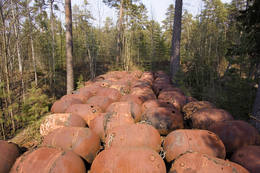
Muuga Kabelikivi rockThis is the second largest rock in the Baltic States in terms of size (728 m3). It is the only rock in the Baltic States with this form and size. It is 7 m high, 19 m long, 11 m wide, and 58 m in perimeter. Kabelikivi looks like a cliff that is halfway sunk into the earth. During the Ice Age, the rock “travelled” to this location from southern Finland. It is made of granite, and there are two other very impressive rocks alongside it.
|
 |
Estland
Meteoritenfeld von Kaali, Besucherzentrum, Wirtshaus KaaliDer Meteoriteneinschlag auf Insel Saaremaa liegt ungefähr 7500-7600 Jahre zurück und verursachte einen Krater von 110 m Durchmesser und 22 m Tiefe und 8 weiter kleine Krater. In der Rangliste der Riesenkrater der Welt liegt der Kaali Krater an achter Stelle. Das Kaali Meteoritenkraterfeld auf Saaremaa ist das seltenste Naturdenkmal Estlands und gleichzeitig das eindrucksvollste Kraterfeld in Eurasien. Auf dem Kraterfeld befindet sich das Besucherzentrum von Kaali samt dem Museum für Meteoritik und Kalkstein, einem Konferenzsaal und dem Hotel. Im Museum sind echte Meteoritenstücke ausgestellt. Im Hotel sind kompfortable Zimmer, nebenan befindet sich historisches Wirtshaus Kaali. 204
1-12
Leistungen
204km - Entfernung von der Hauptstadt
1-12 Aktive Saisonmonate |
 |
Estland
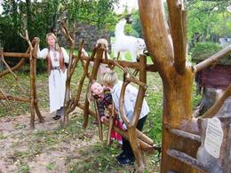
Familienpark der Waldweisen (Metsamoori perepark)Der Familienpark der Waldweisen in der Hugellandschaft Kaika ist ein Netzwerk von Bauernhöfen und bietet verschiedene Möglichkeiten an, um sich mit gesunden Lebensweisen und der Volksmedizin vertraut zu machen. In den Programmen kann man die Pflanzen- und Blutegelbehandlung, die Zauberreiche von Bienen und Pilzen kennen lernen sowie den Einfluss von Zauberworten und Meditationsorten erleben. Zubereitung von Speisen aus Unkraut, von Hausbrot und Kräuterheilmitteln. 275
5-9
Leistungen
275km - Entfernung von der Hauptstadt
5-9 Aktive Saisonmonate |
 |
Estland
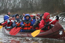
360° AbenteuerAngebote zum Natururlaub: Seekajakwanderungen im Sommer, Schneesschuhwanderungen im Moor im Herbst und im Winter, Kanuwanderungen auf Flüssen im Frühjahr 37
1-12
Leistungen
37km - Entfernung von der Hauptstadt
1-12 Aktive Saisonmonate |
 |
Estland
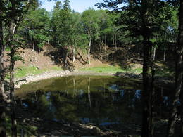
The Ilumetsa meteor cratersThere are three craters here, and the biggest one, known locally as Põrguhaud, or Grave of Hell, has a diameter of 80 m and a depth of up to 12 m. There are barriers around the crater that are several metres high. The other two craters are hard to spot. The craters around 6,000 years old. No scraps of the supposed meteorite have been found, however, and so the origins of the craters cannot be confirmed with certainty.
LeistungenLeistungen - erholung
NaturpfadThe trail to the Põrguhaud crater is around 700 metres in length. For more information: http://www.ut.ee/BGGM/vaatamis/ilumetsa.html (only in Estonian). |
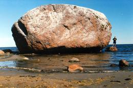 |
Estland
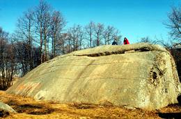
The Letipea Ehalkivi rockThis is the largest rock in the Baltic States and, according to some sources, in all of the segment of Northern Europe which was affected by the last Ice Age. Its size is 930 m3! The rock is 7.5 m high, 16.5 m long and 14 m high, with a circumference of 48.5 m. The rock resembles a huge pebble from a distance, and it is on the sandy and rocky beach. Depending on the season, it can be out in the water. The Ice Age carried the rock to its current location from the southern shore of Finland. It is made of pegmatite.
|
 |
Estland
Aegna IslandThis is an entirely forested island in the Bay of Finland, ~14 km from Tallinn. A network of small pathways covers the entire island. Recommended hike along the seashore of the island, which will offer dunes, as well as a coastline that is sandy in some parts, rocky in others, and covered with reeds in still others (~9 km). A ferry boat will take you to the island from the Pirita port.
|
 |
Estland
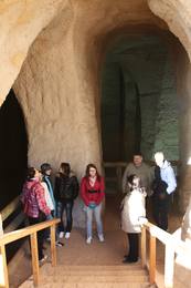
Ancient Piusa River valley and Piusa caveThe area of the ancient Piusa River valley that is between the villages of Vana-Vastseliina and Ignasõ is around 15 km long, features some substantial rapids, and offers a view of beautiful Devonian period cliffs. The largest, Härma müür, is 43 metres high and is the highest sandstone cliff in Estonia. There are caves from old mines in the village of Piusa. A small part of the mines, which have tunnels that are more than 10 km long in all, has been tured into a local museum.
LeistungenLeistungen - erholung
Fahrten mit Schiff/BootBoat from Vana-Vastseliina to Ignasõ (1 day, extreme boating, only during flood season). For more information: www.piusa.ee (available in English).
NaturpfadHike down the river valley along its entire length (~20 km). |
 |
Estland
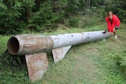
Kap JumindaDer weiteste Nordpunkt der Juminda Halbinsel mit einer Raketen-Attrappe der Sowjetarmee, der alten Grabstätten, dem Juminda-Leuchtturm und einem Denkmal für die Opfern des Zweiten Weltkriegs. 69
Leistungen
69km - Entfernung von der Hauptstadt |
 |
Estland
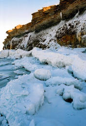
Pakri peninsulaAt the end of the Pakri peninsula is the most visually impressive shoreline cliff in the Baltic States – the Pakri cliff (Pakri pank), which is as much as 24 metres high. During cold winters, streams which flow from the layers of limestone cliffs form fantastic and unusual shapes of ice.
|
|
|
Estland
Lemmje pargajienu taka (Lemmjõe matkarada)Taka, kas izveidota Lemmjegi (Lemmjõgi) un Raudnas (Raudna jõgi) satekas vietā, iepazīstina ar palieņu pļavām un veciem pārmitriem mežiem, kas ir vieni no lielākajiem Igaunijā. Takas sākumā dominē atklātas lauku ainavas. Viens no 4,9 km garās lokveida takas apskates objektiem ir Lemjē dižozols. Mitrā laikā noderēs ūdensizturīgi apavi. 155
Leistungen
155km - Entfernung von der Hauptstadt |
 |
Estland
NaisaarThis is a forested island in the Bay of Finland which is the 6th largest Estonian island and is found 14 km to the N of Tallinn. Two decades ago it was a closed zone, because the Soviet Union had a highly secretive manufacturing plant for maritime mines here.
LeistungenLeistungen - erholung
Radroutea route around the entire perimeter of the island (~20 km). A ferry boat will take you to the island from the Pirita port.
NaturpfadThere is a hiking route along the southern part of Naisaar Island (13 km), as well as a military route (10 km), a central route (11 km)
Naturbeobachtung |
 |
Estland
The Karula National ParkThis park is in a region of hillocks in the Karula highlands, and Lake Ähijärve is at its centre. The park offers a cultural environment of small farms, and it was set up to protect the unique cupola-shaped hillocks of the area. Main attractions: Scenic Lake Ähijärv (176ha), Rebasemõisa Tornimägi hill (137.8 m above sea level), undulating landscapes. Leistungen
280km - Entfernung von der HauptstadtLeistungen - erholung
Angeln
RadrouteBike the route Ähijärve-Peräjärve-Kolski-Rebasemõisa-Kaika-Ähijärve (26 km).
NaturpfadHike the Ähijärve nature trail (3.5 km), the Rebase landscape trail (7 km), or the Peräjärve nature trail (4 km).
NaturbeobachtungThere are viewing towers on Tornimägi hill and at Mäekonnu. The visitor centre is in the village of Ähijärve. For more information: www.karularahvuspark.ee (available in English). |
|
|
Estland
Insel HiiumaaDie zweitgrößte Insel Estlands mit breiter Waldung, Sand- und Steinstränden und einem der ältesten Leuchttürme Europas. 132
Leistungen
132km - Entfernung von der Hauptstadt |
 |
Estland
Joaveski udenskritumi (Joaveski joastik)Krāčains Lobu upes (Loobu jõgi) posms pie Joaveski ciema, kur ~ 160 m garumā upes gultnē, tai šķērsojot Ziemeļigaunijas glintu, izveidojušās izmēros nelielas, tomēr ļoti ainaviskas un skaistas 0,5 – 1 m augstas ūdenskritumu kaskādes. 1898. g. šeit uzcēla hidroelektrostaciju, kuras atliekas ir redzamas upes labajā krastā. Iecienīta pavasara laivotāju treniņu vieta. |
 |
Estland
Kulturerbe-Fahrradroute von KoivaSeit Herbst 2010 gibt es am Fluss Koiva (Grenzfluss zwischen Estland und Lettland) eine 60 km lange Fahrradroute, die Kulturerbeobjekte beider Staaten präsentiert. Die Route beginnt im Parkplatz am Berg Tellingumäe parklast, an den beiden Enden und am Grenzübergang sind Rastplätze und Karten. Wegweiser auf den Kreuzungen zur Navigation vorhanden, ausserdem sind die Sehenswürdigkeiten etwas abseits leicht zu finden. Beschreibungen bei den Objekten sind auf Estnisch, Lettisch und Englisch. Im Startpunkt beginnt auch eine andere 18 km lange Route. 267
1-12
Leistungen
267km - Entfernung von der Hauptstadt
1-12 Aktive Saisonmonate |
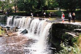 |
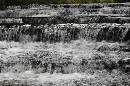
Estland
Wasserfall Keila - JoaEins der malerischen Wasserfälle Estlands. Der Wasserfall ist 6 m hoch und fast 50 m breit. Keila-Joa-Park. Leistungen
31km - Entfernung von der HauptstadtLeistungen - erholung
NaturpfadThe rapid Keila River has carved a cliffy canyon behind the waterfall, with a flow of water that falls down a major distance. It’s worth hiking through the Keila park to the shore of the Bay of Finland (~1 km), then returning along the other bank of the river. |
 |
Estland
Insel NaissaarEstnische Kleininsel Naissaar war nach dem Zweiten Weltkrieg bis 1993 militärisches Sperrgebiet der sowjetischer Armee. In seiner Zeit – ein geheimes sowjetisches Militärobjekt mit einem Lagerkomplex einer verlassenen Minenfabrik. Besuchenswert auf der Insel sind die artenreiche Natur, Wanderwege, Schmalspurbahn, zaristische Artilleriebatterien und sowjetische Minenfabrik. 12
1-12
Leistungen
12km - Entfernung von der Hauptstadt
1-12 Aktive Saisonmonate |
|
|
Estland
Kap TahkunaDer weiteste Nordpunkt der Insel Hiiumaa. Der höchste Leuchtturm Estlands aus Roheisen (1873 – 1875) und das Denkmal zur Errinerung an die bei dem Unglück des Schiffes ‘Estonia” Umgekommenen. 175
Leistungen
175km - Entfernung von der Hauptstadt |
 |
Estland
Oksas (Oksa) takaBijušā piecstāvīgā metāla skatu torņa apkaimē plešas Lemmjegi upes palieņu pļavas. Netālu atrodas kādreizējā Oksas kroga (Oksa kõrts) vieta, kur saglabājies iespaidīgs manteļskurstenis. Apkaimes apskatei izveidota 0,8 km gara koka laipu taka. 175
Leistungen
175km - Entfernung von der Hauptstadt |
 |
Estland
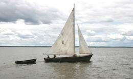
Lustfahrten mit Kale-SegelbootKale ist ein traditionelles Trawlerboot aus Holz, das auf dem Võrtsjärv eingesetzt wurde und das man wegen seines graziösen Aussehens oft auch für Vergnügungsfahrten nutzte. Das schlanke Segelboot hat zwei dreieckige Segel. Mit Unterstützung der Stiftung Võrtsjärve SA wurde im Jahr 2005 das Kale-Segelschiff „Paula“ 2009 das Kale-Segelschiff „Liisu“ angefertigt. Ein Kale-Segelschiff bietet ein echtes Erlebnis auf traditionellste Weise an. Auf Vorbestellung gibt es Fischsuppe und frischen Räucherfisch. 181
5-9
Leistungen
181km - Entfernung von der Hauptstadt
5-9 Aktive Saisonmonate |
 |
Estland
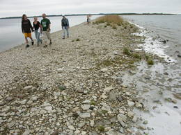
Insel KassariDie fünftgrößte Insel Estlands. Naturpfade, Vogelbeobachtungsturm, Kapelle von Kassari (18. Jh.) und Sääre tirp – eine 3 km schmale weit ins Meer reichende Landzunge aus Geröll, auf der man spazierengehen kann. Leistungen
150km - Entfernung von der HauptstadtLeistungen - erholung
RadrouteBike the route Käina-Orjaku-Kassari-Esiküla-Käina (22 km).
NaturpfadThe Orjaku nature trail (up to 2 km); the Sääre tirp – a 3-km hike along a rocky path on the southern end of the Kassari Island;
NaturbeobachtungBirdwatchers will enjoy the Bay of Käina, where a colony of great cormorants and other water birds can be found. There is a bird-watching tower at Orjaku, as well as a viewing platform at the Bay of Vemla (Vaemla laht). |
 |
Estland
Putnu verosanas tornis Puises ragaPuises ragā (Puise nina) ir uzcelts divstāvīgs atpūtas nams, kas apvienots ar putnu vērošanas torni. No tā paveras skats uz piekrasti, kas ir iecienīta migrējošo zosu atpūtas vieta. Šī ir privāta teritorija, kuras apskati vēlams saskaņot ar īpašnieku. 123
Leistungen
123km - Entfernung von der Hauptstadt |


