| Нo | Название | Описание |
|---|---|---|
|
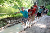
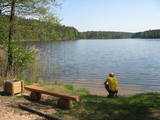
The first barefoot trail created in the Baltic States in the recreation complex "Valguma pasaule", which is located on the forested shores of Lake Valguma. When walking on the path, the feet "massage" sand, wood chips, clay, peat, gravel, cones and various other materials. |
||
|
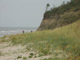
The Ziemupe nature restricted territory is on the shore of the Baltic Sea, and it protects a wide variety of coastline biotopes. The distinguished grey dunes are found here, as are various kinds of forest biotopes, some of them quite rare in Latvia. There are many protected plants and animals in the area, too. The Akmensrags lighthouse and several tourist accommodations, like camping Laikas who "Sējējs" award, are in the territory. On the sea shore not far from center of Ziemupe there is well-appointed parking area with information stands. |
||
|
Volzbahs ir stāva nogāze ar elpu aizraujošu skatu pāri gravai. Ziemā šeit pieejams vairāk nekā 100 m garš nobrauciens ar slēpēm, sniega dēli vai ragaviņām. Citos gadalaikos Volzbaha kalns ir lieliska atpūtas vieta- šeit ir labiekārtota vieta piknikam, pastaigām, foto sesijām. Rudenī Volzbaha kalns ir viena no labākajām vietām Vaiņodes novadā, kur vērot krāšņos rudens skatus. Volzbahs atrodas 2 km no Vaiņodes centra ZR virzienā. Kalnam ērti var piebraukt klāt ar automašīnām. Adrese: Vaiņodes pagasts, Dienvidkurzemes novads, LV-3435 Facebook: facebook.com/biedribavolzbahs Twitter: Volzbahs |
||
|
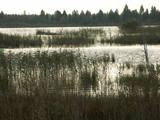
The tower is locatede in the Niedrāji-Pilka swamp. Access it via the old Ainaži-Valmiera-Smiltene narrow gauge rail line, which dates back to 1912, and then take the wooden footpaths which are approximately one kilometre long. This is a high-type swamp with small lakes at the foot of the tower. It is in the ZBR. |
||
|
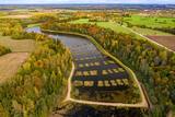
Peat moss has been extracted from the Seda heath since the middle of the last century, but it is nevertheless one of the most important NATURA 2000 territories in Latvia, with a great diversity of landscapes, biotopes and biology – birds in particular. This is a good place for bird-watching during migration season, and viewing towers have been set up on the edge of the swamp for this purpose.
|
||
|
Плунге славится парком князей Огинских. Парк смешанного типа был разбит на месте жемайтийской священной рощи в XVIII–XIX вв. Гордостью парка являются один из древнейших и крупнейших в Литве дубов, получивший имя языческого бога Перкунаса (Перуна), легендарная Плачущая липа и Пятиствольный ясень. По указанию князя Огинского здесь было вырыто семь каскадных прудов, соединенных каменными мостами-шлюзами. Уникальную живописность парку придает протекающая по нему река Бабрунгас. |
||
|
Gegründet für den Schutz der Landschaften und der Seen der Aukštaitija-Anhöhe, Arten und Biotope. |
||
|
Teritorija, kas aptuveni 20 km garumā „piekļāvusies” abiem Aiviekstes upes krastiem. Dabas parka galvenā vērtība ir palieņu pļavas (un citi pļavu biotopi), kas ir ļoti nozīmīga daudzu augu un dzīvnieku (īpaši – putnu) sugu dzīves vieta. Ūdenstūristiem, kas laivo pa Aivieksti, nakšņošana ir jāplāno tikai šim mērķim paredzētās vietās!
|
||
|
This is an entirely forested island in the Bay of Finland, ~14 km from Tallinn. A network of small pathways covers the entire island. Recommended hike along the seashore of the island, which will offer dunes, as well as a coastline that is sandy in some parts, rocky in others, and covered with reeds in still others (~9 km). A ferry boat will take you to the island from the Pirita port.
|
||
|
The rock is not too big (2.1 m high, 15 m in circumference), but since the early 20th century it has been a popular tourist destination. There is a lovely view of the
|
||
|
Sāmsalas ziemeļrietumu daļā jūrā iestiepjas iespaidīgā Tagameizas pussala (Tagamõisa poolsaar). Tās ziemeļrietumu daļā meklējama mazāka – ap 5 km garā Harilaidas pussala (Harilaid). Pussalas vidusdaļā viļņojas Lajalepas ezers (Laialepa järv) - bijušais jūras līcis, kas zemes garozai ceļoties, kļuvis par iekšēju ūdenstilpi. Arī pati Harilaida (igauniski „laid” nozīmē „saliņa”) vairāk nekā trīs gadsimtus atpakaļ bijusi sala. Harilaidu iecienījuši ne tikai migrējošie putni, bet arī roņi, kurus piesaista vientuļi līči un akmeņainās sēres. Harilaidu var apmeklēt tikai ar kājām vai ar divriteni, bet spēkrati ir jāatstāj autostāvlaukumā. No tā ~ 1 km attālumā atrodas vieta, kur pēc 17. gs. radies Harilaidas savienojums ar Sāmsalu. Šeit paveras nepierasti klaja un akmeņaina ainava. Pārējā Harilaidas daļa ir apmežota pirms ~ 40 gadiem. Kopumā būs jāveic ~ 10 km garš pārgājiens. |
||
|
Доле является самым большим островом на Даугаве. С северо-востока его омывают быстрые воды Даугавы, а с юго-запада – спокойные и понемногу зарастающие воды бокового русла Даугавы. Острову присвоен статус природного парка (Особо охраняемая природная территория). Парк основан в 1987-м году с целью сохранения оставшегося после постройки Рижской ГЭС ландшафта острова и культурно-исторических ценностей, а также редких и охраняемых видов растений и животных. Еще одна цель образования парка – способствование просвещению и отдыху общества. Одним из известнейших объектов осмотра острова Доле является музей Даугавы, размещенный в жилом здании поместья Доле. В коллекции музея находятся ~ 13 000 различных экспонатов – свидетелей истории острова Доле и берегов Даугавы – одежда балтов и ливов, орудия труда, предметы быта. Экспозиция знакомит с историей Даугавы как значимого водного пути, а также с историей плотовщиков и транспортных средств этого пути. В парке поместья Доле размещена музейная экспозиция под открытым небом с реконструкцией заколов для миног и запруды для ловли лосося и коллекцией рыболовных снастей. Возле музея на обрывистом берегу бокового русла Даугавы находится доломитовое обнажение. На юго-востоке острова на берегу Даугавы возле хутора Бечи можно осмотреть руины замка Вецдоле. |
||
|
Baltijas mērogā unikāls dabas un cilvēkizmantots apvidus, kas veidojies kādreiz - padomju, mūsdienās - Latvijas Nacionālo bruņoto spēku pārvaldītā armijas poligona teritorijā. Poligona lielāko daļu aizņem smilšains vai ar zemiem lakstaugiem un krūmāju apaudzis kāpu masīvs ar atsevišķiem lielākiem kāpu vaļņiem. Rudens laikā šeit lielās platībās zied virši. Unikālā virsāju un aprimušo kāpu ainava un daudzu sugu dzīves vieta bija daži no iemesliem, kādēļ šai militārai teritorijai ir piešķirts arī aizsargājamas dabas teritorijas statuss. Jāatgādina, ka poligona apmeklējumi privātpersonām bez iepriekšēja saskaņojuma ir aizliegti!
|
||
|
The Lake Lubāns depressions which are alongside the lake’s western and south-western parts feature little-changed forests and swamps, where many rare and protected birds nest. Many uncommon and protected habitats are in the region.
|
||
|
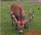
he wetland meadows that are around the Pededze River are the site of this 200 ha farm with some 350 red deer, other deer and wild boar. There are towers from which you can watch the graceful animals, and there are ponds for commercial fishing. Please contact the owner well in advance for a tour. |
||
|
Atrodas ~ 0,4 km no Latvijas – Lietuvas robežas, Sventājas ielejas labā krasta nogāzē. Atrodama informācija, ka avotu tīrot, atklājusies 5 x 5 m ozolkoka „grīda”. Avots ir labiekārtots – virs tā slejas lapene ar niedru jumtu. Vēl pavisam nesen pie tā auga Latvijas dižākā ieva (nolūza), kuras vietā tagad kuplo biezs atvašu pulks. |
||
|
Ap 100 gadus veca priežu audze, ko iesēja pagājušā gadsimta sākumā. Sēklu materiāls bija nācis no kādas Vācijas (Darmštatē) sēklu tirdzniecības firmas. Mūsu klimatiskajos apstākļos priežu stumbri izauga līki un kroplīgi. Savdabīgā audze labi redzama no šosejas malas.
|
||
|
The Akmeņupīte river starts in the highlands and ends at the Daugava, and it is a rapid river only during the spring or after lots of rain. Otherwise it is a shallow little river with a rocky bottom. On the shores of the river is a nice path with several places to relax or to build a campfire (firewood is available). Water from the local streams is potable.
|
||
|
This is one of the most lovely and expressive castle hills in Latvia, with a very fine view of territory all the way to Lithuania. According to Ernests Brastiņš, a researcher of castle hills in Latvia, this was the site of the Semigalian Sidrabene castle. There are no improvements in the area.
|
||
|
The aim of this territory is to regulate the natural and cultural landscapes of the upper reaches of the Daugava River valley, where there is a great deal of biological diversity. Nature trails have been installed in the park, as have bicycle routes. The river is good for boating in this area, too. The Curves of the Daugava nature park is part of the territory (see “Nature Parks”). |
||
