| No | Name | Description |
|---|---|---|
|
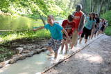
The first barefoot trail created in the Baltic States in the recreation complex "Valguma pasaule", which is located on the forested shores of Lake Valguma. When walking on the path, the feet "massage" sand, wood chips, clay, peat, gravel, cones and various other materials. |
||
|
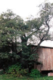
This is the thickest Black Alder (Alnus glutinosa) in Latvia
|
||
|
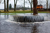
Tuhala region has settlements of about 3000 years of age. There are 11 ancient settlement sites, 30 cult stones, 3 burial sites, 4 sacred groves, etc. Tuhala Landscape Reserve has a unique natural feature - the Nõiakaev (Witch´s Well) which “boils” up water during floods at 100 l/s, and 5 mightiest energy columns of the country. |
||
|
Taka, kas izveidota Lemmjegi (Lemmjõgi) un Raudnas (Raudna jõgi) satekas vietā, iepazīstina ar palieņu pļavām un veciem pārmitriem mežiem, kas ir vieni no lielākajiem Igaunijā. Takas sākumā dominē atklātas lauku ainavas. Viens no 4,9 km garās lokveida takas apskates objektiem ir Lemjē dižozols. Mitrā laikā noderēs ūdensizturīgi apavi. |
||
|
The Naujene castle hill is on the steep bank of the Daugava River, is up to 25 metres high and has two valleys on its sides. Between 1275 and 1277, the master of the Livonian Order, Ernst von Ratzenburg, organised the construction of a brick castle to replace a Lettigalian wooden castle that had stood there before. The castle had a drawbridge and an external and internal forecastle. Until the middle part of the 16th century, the castle was the residence of one of the top officials in Dünaburg. The forces of Ivan the Terrible sacked the castle in 1577, after which the location lost its strategic importance. New fortifications were built in the location that is now the city of Daugavpils. Alongside the ruins of the castle is a miniature model that helps to imagine the appearance of the location many centuries ago. A well-appointed pathway leads from the car park to the castle hill. The hill offers one of the loveliest views of the curvy Daugava River and its surrounding nature park. |
||
|
Molu (sākotnēji – pāļu rindas ar akmeņu krāvumiem) izbūve pie Sakas ietekas jūrā tika uzsākta 1878. gadā, lai nodrošinātu ostas darbību. 1929. gadā notiek molu pārbūve, pagarinot tos ar masīviem betona blokiem. Pēdējā rekonstrukcija notika 2010. gadā, pārveidojot molus par ērtu pastaigu un makšķerēšanas vietu, no kuras var vērot arī saulrietu. |
||
|
Ap 100 gadus veca priežu audze, ko iesēja pagājušā gadsimta sākumā. Sēklu materiāls bija nācis no kādas Vācijas (Darmštatē) sēklu tirdzniecības firmas. Mūsu klimatiskajos apstākļos priežu stumbri izauga līki un kroplīgi. Savdabīgā audze labi redzama no šosejas malas.
|
||
|
This tree is the one in Latvia and perhaps the Baltic States that has the densest foliage. Its crown measures 33 x 31 metres.
|
||
|
Before a great storm in 2005, this was one of the tallest and most noble lime trees in Latvia. Now only one branch is still alive.
|
||
|
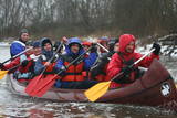
The company runs wildlife tours: kayak trips at sea in summer, bogshoeing in bogs in autumn, snowshoeing trips in winter and canoeing on rivers in spring. |
||
|
Arī Senču pilskalns, Baznīckalns un Velna gulta. Pirmo reizi minēts 1230. gadā kā viens no senās kuršu zemes Vanemas centriem. Ar šo objektu var sākt Abavas senlejas skaistāko skatu apzināšanu. Līdz pilskalna plakumam ved kāpnes, un no tā redzami senlejas vārti un upes ielejas kreisā krasta nogāze, kuras piekājē izvietojusies Jaunkandava.
|
||
|
In 2006, a wooden pathway was installed across the Planči swamp – 500m long, which means that the visitor will spend around 20 minutes there. This is probably the only nature trail in Latvia for which there are plans to post information in Braille for people with impaired vision.
|
||
|
Varniku mežā (Varnikų miškas) ir izveidota patiesi interesanta dabas izziņas taka, kas iet cauri dažādiem biotopiem – skujkoku un ozolu mežiem, purvainu mežu un sūnu purvu ar akačiem un nelieliem purva ezeriņiem, kur uzceltas divas skatu platformas. Mitrajās vietās un purvā ir izveidotas koka laipas. Šī ir populāra pastaigu vieta. Taka ir lokveida un marķēta. Tās apskatei būs nepieciešama ~ pusotra stunda. |
||
|
An impressive two-trunk tree at the Nigliņi homestead, this is one of the most impressive trees on the Liv Shore. The Liv language teacher Zoja Sīle was born here. The Medieval Old Cemetery Hill – once used as burial grounds – is nearby. |
||
|
1,7 km gara lokveida taka, kas iepazīstina ar dažādiem meža biotopiem, to iemītniekiem un meža apsaimniekošanas pamatprincipiem. Apmeklētāju ērtības nolūkā ir izveidotas koka laipas un neliels skatu tornis. |
||
|
Kalētu muižas bijušais medību dārzs. Muižas laikos šeit ierobežotās platībās turēja meža dzīvniekus, kuru medības bija populārs muižniecības izklaides veids. Parkā uzmeklējams piemiņas akmens Krievijas imperatoram Aleksandram III, kurš šeit nošāvis briedi (irsi). No Kalētiem Latvijas teritorijā „ienāca” staltbrieži, kurus medību vajadzībām 1848. g. atveda no Vācijas. Parkā izveidotas takas un atpūtas vietas. |
||
|
Kaņieris is a seriously overgrown and
shallow seaside lake. Its water level was
adjusted several times during the 20th
century so as to obtain agricultural lands.
The lake has 14 islands, among which nine
are natural and the rest are artificial and
aimed at attracting nesting water birds.
Lake Kaņieris has one of the richest
diversities of birds in Latvia. An
ornithological nature reserve was
established here in 1964. In 1989, the lake
was placed on the list of major birding
locations in Europe, and in 1995 it was put
on the list of the Ramsar Convention. At
the southeastern shore of the lake is a
boating facility (only rented boats are
permitted on the lake). A bird-watching
tower was erected on the Riekstu
peninsula in 2009
|
||
|
Trīs lielāka izmēra laukakmeņi – aizsargājami dabas pieminekļi, kas atrodas Matsalu līča krastā starp Sāstnas (Saastna) un Metskjulas (Metsküla) ciemiem. Tuvējā ceļa malā ir izvietots informācijas stends un norādes, bet līdz akmeņiem var nokļūt pa iezīmētu taku. Pēc kāda tautas nostāsta, lielas vētras laikā, kas notikusi Jaungada naktī, lielais akmens sašķēlies trīs daļās. No tā arī cēlies vietvārds. Apkārtnē redzamās pļavas ir nozīmīga daudzu augu sugu dzīves vide un svarīga putnu ligzdošanas un atpūtas vieta. Šī iemesla dēļ taku drīkst apmeklēt tikai no 1. jūlija līdz septembra beigām. Akmeņi ir arī labi redzami no minētā ceļa. Tie ar ledāju atceļojuši no Turku (Somija) apkārtnes. |
||
|
The most important aspect of the Sasaļi forest is the eutrophic Lake Sasalis, as well as the unusual Lake Melnezers. Also of importance are various types of forestland in the area. Lake Sasalis is a popular place for leisure and swimming.
|
||
|
Teritorijas apskates nolūkos ir izveidota un labiekārtota dabas izziņas taka. Dabas liegums atrodas Abavas senlejas dabas parka teritorijā. Taka iepazīstina ar vienīgo krūmu čužas savvaļas augšanas vietu Latvijā. |
||
