
| No | Name | Description |
|---|---|---|
 1 day
|
This section of the Baltic Coastal Hiking Route is a comparatively short hike across a beautiful sandy beach, the coastal side of which is bounded by brightly colored pine forests with spectacular dunes and dams of dunes. To get from the beach to Carnikava, the Baltic Coastal Hiking Route will take you through a forest via a promenade. Then it takes a stroll around the Old Gauja River via a levee and reaches the pedestrian bridge over the Gauja River. Both as you start and end the hike, it is nice to sit in one of the pubs and summer cafés located on Vecāķi beach and in Carnikava. |
|
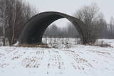 |
Few Soviet military objects are associated with more legends than this one. During Soviet times, this was a reserve airfield, as well as a storage site (just 50 kilometres from the republic’s capital city) for nuclear weapons. These were hidden in two cement hangars that were covered with soil and vegetation. Public information suggests that an RX-24 nuclear bomb weighing 430 kg and a RX-26 nuclear bomb weighing 1,030 kg were stored here, as were air-to-land missiles equipped with nuclear explosives. If there had been an accident here, what would have happened to Rīga, to Latvia, to the Baltic States and to Northern Europe? The airfield is a closed territory today.
|
|
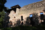 |
The ruins of the Rauna castle (which was built in 1262 and was a main residence of the Livonian archbishop) have a modern viewing tower which offers a view of the impressive castle walls, the place where the former Medieval city was located, and the centre of Rauna. The local government office has the keys to the tower.
|
|
 |
Based on the tower of a former Soviet army radar installation, there is an 18-metre viewing tower at the Southern breakwater of Ventspils (Medņu Street) today. The tower offers a good view of the port territory, with the sea gate at the mouth of the Venta River and the city beach. Binoculars are available at the tower. It is worth walking down the Southern breakwater to get a better look at the sea.
|
|
 |
Atrodas dienvidos no Vienības nama. Skvērs veidots 19. gs. otrajā pusē. Tajā atrodas vairāki ievērības cienīgi objekti: strūklaka (20. gs. 20. gadi), latviešu tautas dzejnieka Andreja Pumpura krūšu tēls, piemiņas akmens Nevainīgajiem sarkanā terora upuriem un Sv. Aleksandra Ņevska pareizticīgo kapela. Vienības ielas otrā pusē paceļas iespaidīgā Daugavpils universitātes ēka ar Raiņa pieminekli un saules pulksteni priekšplānā. |
|
 |
Skaisto un mūsdienās atjaunoto zilā krāsojuma ēku Karaīmu ielas 5 malā sākotnēji (1810. g.) cēla Dominikāņu mūki. Kopš 1864. g. tajā 23 gadus saimniekoja policija, līdz 1887. g. te izvietoja pastu un telegrāfu. Šobrīd ēkā atrodas nacionālā parka administrācija. |
|
 |
The farm borders the city of Zilupe. Melons, watermelons, and pumpkins are grown here in an open field. The host is one of the few Latvian birch bark craft masters, the hostess comes from an old family of gardeners and is a certified floral designer, and their son is a potter. All of them offer demonstrations, creative workshops, and accept orders. |
|
 2 days
|
A scenic and tradition-rich stretch of the Forest Trail symbolised by the onion. Onions were brought to the region by Old Believers in the 17th century. Ladies and gentlemen selling home-made onion strings on the roadside have become somewhat of a business card of the villages. The villages on the twenty-four kilometre stretch of road between Varnja and Kallaste are connected by the tourist route called Onion Road. The landscape is decorated by colourful wooden houses, small fish shops and a restaurant where you can enjoy tea made in the samovar, true to the traditions of Old Believers. You can visit the Kostja’s onion farm, where the host welcomes the guests and shows them onion cultivation. It is also worth visiting the Chicory Museum in Kolkja to get acquainted with the history of chicory cultivation in row villages near Lake Peipus. At the end of the trail you will reach Alatskivi, where the famous Alatskivi Castle is located. |
|
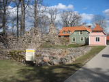 |
For the first time Valmiera is mentioned in the historical sources in 1323. Until the 13th century this place was in the composition of Talava, inhabited by Latgalians. Construction of Valmiera medieval castle began in the beginning of the 13th century, but in 1283, between the Gauja River and Rate River towered church. Location near to the Tartu-Pskov and Novgorod trade routes greatly facilitated the economic development of the populated area. During the 14th-16th century Valmiera was a part of the Hanseatic League. It suffered greatly from wars, epidemics and fires in 16th to 18th century. In the second half of the 19th century the economic boom started again. It was also facilitated by the building of wooden bridge across the Gauja in 1866 and Riga-Pskov railway opened in 1899. Historic centre is destroyed in 1944. During post-war years, large industrial companies such as - Valmiera glass fiber factory (to this day) are opeating in the town. Today, Valmiera is economic, educational and sports centre of Vidzeme. |
|
 |
Restaurant Agnese takes you on a culinary tour around the world. Local fruits of nature and produce by farmers are prepared with love, highlighting the value of Latvian flavours. The menu also includes several globally recognised recipes. |
|
 |
The fisherman offers you a chance to engage in string-based fishing at the seashore near Nida and Pape, fishing out in the sea (1-2 people), and ice fishing during the winter. You can smoke what you catch or cook fish soup with it. |
|
 |
In Põlvamaa, on the side of the historic post road, a farmer’s kitchen and leisure home Kopli is located, surrounded by joy and delicious flavours. Farmer's kitchen Kopli offers a comfortable way to spend time and private restaurant services. The café operates during summer. Enjoy gelato type ice-cream here all year round. |
|
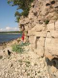 |
Nacionālā parka dienvidrietumdaļā jūrā iestiepjas Eldas pussala – skaists un ļoti omaļš ar kadiķu mežu (alvāriem) noaudzis zemes pleķītis ar interesantu jūras krastu, kur atsedzas silūra perioda nogulumieži. No pussalas gala, kurā slejas vecs Padomju armijas robežsargu tornis (apmeklējumam bīstams!), paveras visaptverošs skats uz Vilsandi salu (atpazīstama pēc bākas), Lonalaidas salu (Loonalaid) – otru lielāko Vilsandi arhipelāgā, Salavu (Salava) un citām mazākām saliņām. Dabas mīļotāji var uzmeklēt Eldas klinti (Elda pank) – ~ 2 m augstu un 0,4 km garu atsegumu, kura piekājē var atrast interesantas ūdens izskalotas fosilijas. |
|
 |
The café, located between Talsi and Laidze, on the side of the Talsi-Upesgrīva highway (P127), offers traditional Eastern European lunch and dinner dishes. |
|
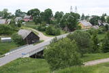 |
Pirmo reizi vēstures avotos 1253. g. šī vieta ir minēta kā kuršu apdzīvota apmetne. Laikā no 1637. – 1639. g. te uzcēla pirmās 19 kapelas – t.s. „Krusta ceļa stacijas", kas atgādināja Jeruzalemes Krusta ceļu. Kopš tā laika Žemaišu Kalvarija ir pazīstama kā nozīmīgs svētceļnieku galamērķis. Dažas no Krusta ceļa kapelām ir veidotas 17. – 18 gs., bet citas – 19. gs. Jāatceras, ka vēl pavisam nesen – Padomju laikos svētceļniekus nežēlīgi vajāja un represēja. Mūsdienās pilsētā ir izveidots 21 svētceļnieku „pieturas punkts". Te ik gadu (parasti no 2. – 12. jūlijam) notiek Žemaišu Kalvarijas katoļu draudzes svētki, kas pulcina daudz ļaužu no dažādām Eiropas valstīm. Iespaidīgā katoļu bazilika ir slavena ar Vissvētākās Jaunavas Marijas Katoļu Ģimeņu Karalienes gleznu, kas 17. gs. atvesta no Romas. Tai piedēvē brīnumdarītājas spējas. Interesants ir pilsētas ielu tīklojums, kas atgādina 9. – 13. gs. apdzīvotas vietas ielu plānojumu. Noteikti apskatāms iespaidīgais Žemaišu Kalvarijas pilskalns, kas slejas mazās Varduvas (Varduva) upītes krastā. |
|
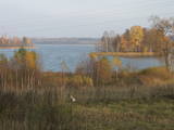 |
Ārkārtīgi ainaviska teritorija Augšzemes augstienes centrālajā daļā ar vairākiem ezeriem - Medumu, Lielo un Mazo Ilgas, Šķirsteņu un dažām mazākām ūdenstilpēm. Medumu ezera salām ir dabas lieguma statuss. Teritoriju šķērso vairāki grantēti ceļi, no kuriem dažviet paveras brīnišķīgas, bet nelabiekārtotas skatu vietas. Teritorijā atrodas Medumu katoļu baznīca. Piemērota teritorija dažādu aktīvā tūrisma veidu attīstībai. Dabas parks ietilpst Augšzemes aizsargājamo ainavu apvidū. |
|
 |
Another example of a costal defence battery along the Kurzeme shoreline is found here.
|
|
|
|
Gegründet für den Schutz der Landschaften und der Seen der Aukštaitija-Anhöhe, Arten und Biotope. |
|
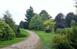 |
Work on this arboretum began in 1958 at a local forest research station that is near the village of Vaišvidava. The arboretum collects and exhibits various local and imported plants for scholarly, educational and decorative purposes. The arboretum covers some 50 ha of land, with more than 800 types of plants. Some parts of the arboretum have rare and protected trees and bushes, and these can only be visited if you contact the arboretum in advance. |
|
 |
SIA "Lubeco" audzē zemenes un cidonijas 7 ha platībā Talsu novadā, pie ciematiņa Lubezere, kas atrodas netālu no Valdemārpils. Uzņēmums jau gadu ir mājražotājs. Sezonas laikā zemenes pārdod svaigas, bet rudenī un ziemā pārstrādātas dažādos produktos. Cidonijas tiek pārstrādātas sukādēs, sīrupos un sulā. |
|


