
| No | Name | Description |
|---|---|---|
 6 days
|
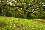
The tour passes through national parks and protected nature territories of interntional importance, following the sea shore. It also stops at small charming towns, several historic sites and traditional villages. During the tour you learn not only about rare and protected plants and local traditions but also enjoy beautiful landscapes, wilderness and solitude. At the Ķemeri National Park you will follow a fenland trail, see wild meadows and stop at a bird-watching tower beside Lake Kaņieris. Then we explore the Engure Lake Nature Park where 22 types of orchids can be found. Next day thr route heads to Slitere National Park, the former territory of the Baltic Ice Lake and Litornic Sea. You will follow the Cape Kolka pine-tree trail and Peterezers Lake trail with ancient dunes and landscape. Then head to Stiklu Bog trail, in the largest bog territory in Latvia. At Užava you will discover the largest 'grey' dune in the Baltics before following the wild banks of the River Venta and visiting the charming town of Kuldiga, with its well-preserved wooden architecture and the widest waterfall in Europe. The route follows the Abava valley created by the melting of ancient ice. At Sabile you can stop at its famous Wine Hill - location of the most northerly grown grapes from which wine is produced - and follow a botanic trail with stops at the grandest oak tree in Europe. On the way to Riga, walk 5 km long Cena Heath trail which features low, high and transit bogs and related plants. |
|
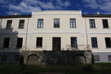 |
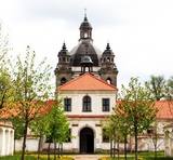
Atrodas stāvā Tebras (Dzirnavdīķa) ziemeļu krasta augšdaļā (Skolas ielā 1). Ēka celta 19. – 20. gs. mijā kā Aizputes muižas jaunā kungu māja. Tajā atrodas Aizputes novadpētniecības muzejs (no 1999. g.) un Aizputes TIC. Ekspozīcija par Aizputes pilsētas un apkārtnes vēsturi tiek pasniegts saistošā veidā, ļaujot apmeklētājiem iejusties vairāku gadu desmitu seno notikumu atmosfērā. |
|
 6 days
|
This tour includes a walk along the Baltic Sea coast Lithuania through the Curonian Spit from Nida to Smiltynė (see a detailed description under tour No. 9) and continues further north from Klaipėda to Šventoji located at the Lithuanian/Latvian border. Klaipėda and Palanga are popular seaside resorts with lots of pubs, hotels, street cafés and musicians. Klaipėda is the only port city and the third largest city in Lithuania. Šventoji is also a popular seaside town located next to the mouth of the river Šventoji. Between Klaipėda and Palanga, the Baltic Coastal Hiking Route leads through the Seaside Regional Park (Lithuanian: Pajūrio regioninis parkas). It was founded for the protection of coastal and marine landscapes, biodiversity and local cultural heritage. The most famous place of the seaside is the Dutch Hat (also called Dutch Cap, Dutchman’s Cap or Holland’s Cap) – a 20 m high cliff, which used to serve as a landmark and guide for seafarers and fishermen. |
|
 |
It is possible to look at African ostriches of different ages; to listen to stories about or of ostriches. It is possible to buy crafts made of ostrich feathers, skin and grease, fresh ostrich eggs. |
|
 |
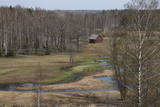
Litorīnas jūras laikā (pirms ~ 6000 gadiem) Saleveres Salumegi kalns bija sala, bet mūsdienās tas kā izteikta kāple (īpaši - ziemeļu pusē) paceļas virs Piejūras līdzenuma. Salumegi ziemeļu pusē slejas 4 - 5 metrus augsts kaļķakmens atsegums – silūra perioda (> 400 mlj. gadu) koraļļu rifa paliekas, kuru noskalojuši Litorīnas jūras viļņi. Atseguma piekājē izplūst Acu avots, kam piedēvē dziednieciskas īpašības. Salumegi apskates nolūkos izveidota lokveida taka (1,5 km). No kalna augšas paveras labs skats uz Matsalu līci. Šeit atradies arī sens pilskalns. |
|
 |
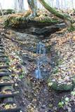
Bijušā piecstāvīgā metāla skatu torņa apkaimē plešas Lemmjegi upes palieņu pļavas. Netālu atrodas kādreizējā Oksas kroga (Oksa kõrts) vieta, kur saglabājies iespaidīgs manteļskurstenis. Apkaimes apskatei izveidota 0,8 km gara koka laipu taka. |
|
 |
This is a “peripheral” island in the Bay of Finland, 9 km from the Dirhami port. The special fact about this island is that it offers fields of juniper, a rocky and grassy seashore that is around 2 km long, and limestone cliffs that are a few metres high along the northern and the eastern shores of the island. These are designated with the words Osmussaare pank.
|
|
 |
Ein hervorragendes Sakralensemble im Barockstil (17 – 18 Jh.), eine Kirche und ein tätiger Nonnenkloster. |
|
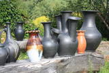 |
The potter is happy to welcome guests, offer them tours and demonstrations, and allow visitors to help in producing ceramics. Particularly interesting is the opening of the kiln, and pottery can be purchased at the site. |
|
 |
Saimniecība "Dižgāļi" Alsungā nodarbojas ar bioloģisko lauksaimniecību, gaļas liellopu audzēšanu un aitu audzēšanu. Apmeklētājiem ir iespēja aplūkot saimniecību, tajā esošos dzīvniekus, kā arī iegādāties svaigo produkciju. Saimniece pastāstīs par vietas vēsturi, kā arī pacienās viesus ar vistas zupu. |
|
 |
The farm specializes on growing and reprocessing cranberries and blueberries. They offer tastings of the products and purchasing those in a small local shop, as well as a 2-hour-long excursion around the farm. |
|
 |
On the third Saturday of each month from 9:00 to 13:00 the Green market takes place in Gulbene, where there are gathered outworkers, craftsmen and farmers from different districts of Latvia. There are offered goods made by the outworkers, seasonal vegetables and fruit, as well as beauty and design products, including other useful household and pretty goods. |
|
 |
The tavern and pastry shop is located near the Vidzeme highway, by the natural trails of Cecīļi and Ieriķi. Tourist Information Centre is also nearby. We offer traditional dishes and our specialities |
|
 |
The Talsi Dairy was established in 1922 after merging several other dairies. The Talsi Dairy company was established later on these foundations. One of the best known products is “Talsu Ritulis” cheese. Products such as milk, kefir, cottage cheese, butter, cheese, etc., can be purchased at the “Piena sēta” store that is alongside the company. |
|
 |
Laidze Parish Farm "Cukuriņi" is engaged in sea buckthorn cultivation. The farm covers about 10,000 sea buckthorns on an area of 6 hectares. The fields are treated with a computerized irrigation system. The owners of the grown berries both sell and process it themselves, obtaining sea buckthorn juice, oil and frozen berries. |
|
 12 days
|
The tour combines the most beautiful southern parts of the Forest Trail in Lithuania and Latvia. The route starts in Druskininkai, Lithuania, and for the next day you will walk through forests of the Dzūkija National Park. After getting to Vilnius and Kurtuvėnai Regional Park, two sections of the Forest Trail will take you from Dengtiltis to Šaukėnai. Since it is among the most forested areas of Central Lithuania, the Kurtuvėnai Regional Park with its glaciated valleys is a wonderland of forests, waters and wetlands. The Forest Trail will run along small forest paths, tourist trails, beautiful tree alleys and wetlands. Next you will take public transportation to reach the Žemaitija National Park, where you will taketwo sections of the Forest Trail from the pilgrimage town of Žemaičių Kalvarija along the lakes of Plateliai, Ilgis and Beržoras to the town of Plateliai. It is one of the most beautiful towns of Samogitia taking pride in its manor park and the viewing platform on Lake Plateliai. Žemaitija National Park takes pride in its old pine and fir forests, as well as mixed forests. From there on the Forest Trail takes you along the riverside promenade in Kuldīga, continues through the nature park “Abavas senleja” from Renda to the wine and cider town Sabile and Kandava. The section along the Abava River Valley Nature Park is the most diverse river valley in Kurzeme in terms of landscapes and terrain. The final section of the tour takes you to the Ķemeri National Park, which is an important place for the protection of wetlands. As to the town – Ķemeri – it is the former balneological and sulphur springs resort. The tour ends on the seaside – the village of Bigauņciems, from where you can easily get to Rīga. Optionally, one can take a detour along the Lake Sloka trail with its bird-watching tower or pay a visit to the “Forest House” – the visitor’s centre of the Ķemeri National Park. |
|
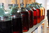 |
This location produces alcoholic beverages, including vodka called “Red Cliff Water”, other vodkas, and liqueurs made of cranberries, lingonberries, blackberries, mountain-ash, sea buckthorn, as well as a special “Christmas balsam.” Tours are available with interesting stories about how the beverages are produced. |
|
 |
was first mentioned in written form in 1582. A census in 1736 found two farms, Lekši and Žonaki. A census in 1935 found that there were 106 people in Vaide, including 40 Livonians, 60 Latvians and a few Estonians and Germans. In 1939, there were 21 homesteads in the village. Nika Polmanis (1823-1903) was born at the Lāži homestead. He was the first educated Livonian and lived in the region for all his life. Livonian poet Alfons Bertholds (1910-1993) wrote a poem about a noble oak tree that grows alongside the homestead. The vast Berthold family is linked to Žonaki -- Livonian storyteller Marija Šaltjāre, yacht captain Andrejs Bertholds (USA), his son, library scholar Artūrs Benedikts Bertholds (USA), Livonian poet Alfons Bertholds, Livonian language specialists Paulīne Kļaviņa and Viktors Bertholds, Swiss doctor Marsels Bertholds, globally renowned pianist Arturs Ozoliņš (Canada), and Livonian language storyteller and poet Grizelda Kristiņa (1910-2013), who was the last native speaker of Livonian. The Ozolnieki homestead is also linked to the Bertholds family. Paulīne Kļaviņa (1918-2001), a specialist in the fields of Livonian traditions and language, and her mother, Livonian storyteller Katrīna Zēberga, both lived there. Paulīne collected ethnographic objects that can be seen at the Latvian Ethnographic Open Air Museum in the granary of the Livonian Dēliņi farm. The Purvziedi homestead in Vaide is owned by forest ranger Edgars Hausmanis, who has a collection of forest animal horns and antlers. |
|
 |
A family shop in Ikšķile that offers the produce of small Latvian producers and craftsmen. The store is a favourite, not only of the residents of Ikšķile and the surrounding area, but also for shoppers from Riga, Ķekava, Ogre and other cities. An online store is also available. |
|
 |
Astoņus kilometrus no Kroņauces, saimnieks izveidojis lielāko orhideju kolekciju Latvijā. Interesanti apskatīt arī eksotiskos dzīvniekus - iguānas, sarkanausainie bruņurupuči, pitons un šņācējtarakāni, kuri šeit atraduši mājvietu. Saimniecībā ir arī Šetlandes poniji, ar kuriem var jāt bērni.Piedāvā makšķerēšanu zivju dīķos un teltsvietas.
|
|


