
| No | Name | Description |
|---|---|---|
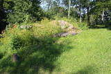 |
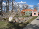
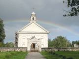
The Lašu castle hill is 0.2 km from the Vecumnieki-Ilūkste road at Laši. It is an ancient Selonian castle hill, and it was populated between the 1st millennium BC and the 10th or 12th century. Very little remains of the old Veclaši (Tiesenhausen) Estate, which had an impressive mansion designed in the Neo-Gothic style in the late 19th century. What remains are an ancillary building, the foundations of the mansion, fragments of the gates, and a park. Until 1920, the estate belonged to the Pshezdzetski dynasty, and before that it was owned by the Tiesenhausen and Fittinghoff dynasties. Before visiting the location, look for photographs of the old mansion on the Internet. Sadly, the important cultural monument has not experienced any major improvements over the past 20 years.
|
|
 |
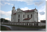
Gulbenes novada vēstures un mākslas muzejs dibināts 1982.gadā un apsaimnieko trīs ēkas – Vecgulbenes muižas oranžēriju, klēti un Sarkano pili. Oranžērijas ēkā izvietotas izstāžu zāles un apskatāmas divas pastāvīgās ekspozīcijas „Gulbenes vēsture” un „Jūlijs Madernieks”. Regulāri tiek atklātas dažāda satura tematiskās izstādes. Vecgulbenes muižas klētī apskatāma ekspozīcija „Tautsaimniecība”, kur apmeklētāji var iesaistīties vairākās aktivitātēs (malt ar rokas dzirnavām, pārbaudīt smaržas un taustes iemaņas, noteikt kokus, graudus, vīt virves u.c.). |
|
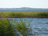 |
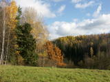
A beautiful part of the Rēzekne-Dagda-Krāslava road – along two km or so, you can see Lake Rāzna and Mākoņkalns hill, which is 10 km away on the other shore of the lake. |
|
 |
Das Gedenkzeichen in Ošvalki, das den lettischen Flüchtlingen (1944 – 1945) gewidmet ist, die über die Ostsee in Fischerbooten nach Schweden geflüchtet sind. |
|
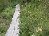 |
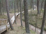
Teritorijas apskates nolūkos ir izveidota un labiekārtota dabas izziņas taka. Dabas liegums atrodas Abavas senlejas dabas parka teritorijā. Taka iepazīstina ar vienīgo krūmu čužas savvaļas augšanas vietu Latvijā. |
|
 |
The café is along the Rīga-Ventspils highway (A10). A summer terrace is available during the season. Latvian cuisine: Beef tongue salad, chilled soup, stock with dumplings, “little farmer,” pork ribs, potato pancakes and crepes, whipped fool. Special foods: Kharcho a la “Pie Jānis”. |
|
 |
Was mentioned in 1387, where it was called Domesnes. That was the name until the early 20th century. A ledger at the Irbe-Ģipka church states that there were four farms in Kolka in 1770 -- Krogi, Ūši, Vecvagari and Kabriki. In 1844, a school for vergers was established, and Nika Polmanis worked there as a teacher. Kolka's first school was built in 1881, and Livonian Kārlis Bernšteins (1881-1951) worked there for nearly half a century as a teacher. The Dundaga riots that began in 1859 were led by Livonian Nika Šūbergs (1833-1884), the son of the owner of the Sārnasti farm. At the end of the 19th century, there were 392 residents in Kolka, and in 1935, 145 of the 343 residents were Livonians. During the mid-1980s, 13 Livonians spoke their language freely. Kolka is the only coastal Livonian village that continued to develop during the frontier regime of the Soviet Union, because it was the centre of a fishing kolkhoz. The number of residents increased rapidly in the 1950s and 1960s because new homes, a school, a people's centre, a kindergarten and several fish processing factories were built there. Today Kolka has 700 residents and is the largest village along the Livonian coastline. The "Līcis-93" fish processing factory is there, and local fishermen and smokers of fish work in the village. The Kūolka Livonian Centre and the Livonian ensemble Laula operate there, as well. The Ūši farm offers tastings of Livonian foods. |
|
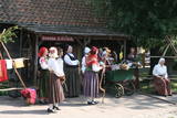 |
2003.gada decembrī folkloras kopa „Atštaukas” izveidoja folkloras centru „Namīns”, kurā svin svētkus, organizē Jāņu ielīgošanu, Lieldienu iešūpošanu, Miķeļdienas tirgu, Annas dienas Saimnieču svētkus, tautiskos Ziemassvētkus. „Atštaukas” palīdz saglabāt un popularizēt dažādus latviešu tautas godību rituālus, gan kāzu, gan arī bēru tradīcijas. Folkloras centrā „Namīns” darbojas arī skola, kurā bērniem tiek mācīta folklora un tautas tradīcijas. |
|
 |
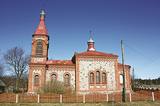
The Dviete Catholic Church is in the centre of the small village of Dviete. The white church can be seen from a distance. The first wooden church was built here in 1775 by the owner of the local estate, Count J.K. Wischling. Later the church was dismantled and brought the Zarinki cemetery. The Neo-Baroque Catholic church that is seen today has two towers, and its construction was financed by Count Kazimir Plater-Sieberg. The church was destroyed during World War I, and until it was rebuilt and consecrated, the granary of the Dviete Estate magazine, with its ridged roof, was used as a prayer house. It is on the side of the Dviete-Bebrene road and has recently been restored. In 1940, a stone fence was installed around the church with a tiled roof, and a building for the congregation was built in the 1970s. The church features a particularly ornate sacral Baroque interior, which is seen as the most ornate interior of its type in the former Daugavpils District. |
|
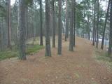 |
This territory is meant to protect the “green zone” of Rīga. Most of the park is covered with pine forest and dunes with shrubs on them, but Lake Beberbeķi is found at the southern end of the park. The area around the lake has been improved. |
|
 3 days
|
This route section takes you to the Dzūkija National Park – it is among Lithuania’s most forested and desolate nature areas –, and to the town of Druskininkai – a popular SPA and mineral water health resort on the banks of the river Nemunas. When in Druskininkai, we recommend dipping yourself in mineral water baths, enjoying the trip with the cable car over the river Nemunas, visiting the musical fountain, and walking along the river promenade. The starting point of the hiking route is the village of Didžiasalis, which is reached by bus from Druskininkai. From there, the route will take you through vast coniferous forests, rich in berries and mushrooms, and small villages. As you get to Druskininkai, the Forest Trail will meander along the small streets and parks of the historic resort of Druskininkai, crossing the river Ratnyčia and the forest park on the right bank of the Nemunas valley. Leaving the resort town behind, the Forest Trail runs on the side of the village revealing you the beautiful landscapes and the view of the Liškiava monastery on the other bank of the river Nemunas. Up to the village of Žiogeliai, the route goes along forest roads and continues along the banks of the Nemunas valley, surrounded by the vast Dzūkija forests. Towards the end of the route, climb up the Merkinė Mound and it will surprise you with breathtaking views of southern Lithuania. |
|
 |
The Krustkalni Nature Reserve was established in 1977, and the diversity of plants in the region is based both on the terrain – the Madona-Trepe embankment, a series of hillocks with low areas among them, swamps and small lakes – and on the biotope – natural meadows, forest glades, places where underground streams bubble up to the surface, and vast areas of forest with very old stands of trees. Some 800 types of plants have been defined in the reserve. It can be toured only in the company of a guide from reserve headquarters, and one must apply in advance. Visitors can visit the Krāku streams, Lake Svēte-Dreimaņi, and other sites. |
|
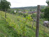 |
Already in the 10th century, an ancient village was located at the Sabile hill fort. After the division of Course land, Sabile was won by the Livonian Order, which built a stone castle (not preserved) here. Sabile is first time mentioned in written sources in 1253. During the 15th century an urban area started to develop at the castle. Town right was awarded to Sabile in 1917. Today Sabile is a small town, surrounded by many notable monuments. Roma culture is an integral part of Sabile and therefore, Sabile is also known as the Latvian capital city of Roma. Sabile has long been known for its wine-growing and oenological traditions, which have been reborn and enjoyable during the Sabile wine festival. |
|
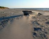 |
"Valgums" is a word referring to the sandy coastline zone between dunes and water, and once there were boats and nets that were being dried at this location. Each village had several areas of this type, and in the 1920s and 1930s, these were of great importance in the preservation of the Liv language. |
|
 |
For the first time Valmiera is mentioned in the historical sources in 1323. Until the 13th century this place was in the composition of Talava, inhabited by Latgalians. Construction of Valmiera medieval castle began in the beginning of the 13th century, but in 1283, between the Gauja River and Rate River towered church. Location near to the Tartu-Pskov and Novgorod trade routes greatly facilitated the economic development of the populated area. During the 14th-16th century Valmiera was a part of the Hanseatic League. It suffered greatly from wars, epidemics and fires in 16th to 18th century. In the second half of the 19th century the economic boom started again. It was also facilitated by the building of wooden bridge across the Gauja in 1866 and Riga-Pskov railway opened in 1899. Historic centre is destroyed in 1944. During post-war years, large industrial companies such as - Valmiera glass fiber factory (to this day) are opeating in the town. Today, Valmiera is economic, educational and sports centre of Vidzeme. |
|
 |
Divine Providence Catholic Church of Rikava (Baltini) was built in Doric style in 1929 by the donations
of landlord Alexander Riks. The church has icons „St. Antony” and „Jesus Christ appears to Mary
Magdalene”. Beside the church there is a cemetery and family vault of Riks.
|
|
 |
Atrodas Ķekavā, autoceļa Rīga – Grenctāle (A 7) malā. Iekārtots vēsturiskā ēkā ar atbilstošu koka interjeru. Piedāvā maltītes visām ēdienreizēm, organizē muzikālus vakarus. |
|
 |
The nature park in the city of Jūrmala was set up to protect dune, pine forest and shoreline habitats. This park features one of the most attractive nature trails in the Rīga area, and it is found near the famous Ragakāpa dune, which can be as much as 17 metres high. This is an excellent opportunity to study dune habitats and the plants, birds, insects, etc., which live there. Visitors can also see pine trees that are 100 years old and older. |
|
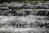 |
Krāčains Lobu upes (Loobu jõgi) posms pie Joaveski ciema, kur ~ 160 m garumā upes gultnē, tai šķērsojot Ziemeļigaunijas glintu, izveidojušās izmēros nelielas, tomēr ļoti ainaviskas un skaistas 0,5 – 1 m augstas ūdenskritumu kaskādes. 1898. g. šeit uzcēla hidroelektrostaciju, kuras atliekas ir redzamas upes labajā krastā. Iecienīta pavasara laivotāju treniņu vieta. |
|
 |
Angla Tuulikumägi (Windmill Hill) is the only site in Saaremaa which has retained its historical mill scenery with four post mills characteristic of the area and one Dutch-type mill. All windmills are open to visitors. |
|


