| Nr | Name | Beschreibung |
|---|---|---|
|
A panoramic tour of Lithuania, Latvia, Estonia and Finland with highlights of nature experiences in the National parks and nature reserves. A variety of landscapes, nature attraction sites, birds and wild animals, forests and seashore. The tour also offers some cultural and historical insights. |
||
|
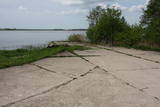
The hydroplane airfield is on the eastern shore of Lake Durbe, not far from Līguti. It was built between 1939 and 1941. During the Soviet era, the 43rd aviation escadrille was located here, and it had 13 MBR-2 hydroplanes. All that’s left today are the cement sheets on the shore of the lake. You can look at the site itself.
|
||
|
Der bäuerliche Betrieb wurde 1992 gegründet. Für die Herstellung der Erzeugnisse wird die Milch von eigenen Kühen verwendet. Betriebsbesichtigung, Verkostung und Erwerb der Erzeugnisse. Käse kann man bestellen. |
||
|
The small bar is situated in the city of Madona and there are seating places for 35 people. |
||
|
Ein Geschenkeladen in der Altstadt von Cēsis am Rosenplatz im Gebäude des ehemaligen Hotels Baltischer Hof. Der Laden trägt den Namen der ehemaligen Hotelbesitzerin Karlīne. Es gibt Geschenke, Erzeugnisse der Handwerker, Souvenirs sowie köstliche hausgemachte Produkte, hausgemachten Wein und Hausbranntwein zum Kaufen. |
||
|
Latgale rehabilitation centre „Rāzna”. The rehabilitation centre „Rāzna” is built on a small hillock at
Lake Zosna. Sanatorium „Rāzna” is surrounded by many trees. Originally, the house was built as a summer
house for artists. The centre is an architectural monument of local importance.
|
||
|
Gar Grobiņas ūdenskrātuvi (Ālandes labais krasts) izveidota mūsdienīga un labiekārtota pastaigu un atpūtas vieta - promenāde, uz kuras izvietotas plāksnes ar Zentas Mauriņas un Jāņa Raiņa citātiem. No promenādes paveras labi skatu punkti uz Skābaržkalnu un Grobiņas pilsdrupām. Grobiņas ūdenskrātuves sašaurinājumā pāri Ālandei ved neliels tiltiņš, kas ir bijušā Liepājas – Aizputes šaursliežu dzelzceļa tilta ferma. |
||
|
Kihnu is the largest island in the Gulf of Riga with an area of 16.4 km2, it is only 7 km long and 3.3 km wide. There are four villages on the island and the unique atmosphere of the island can be experienced by visiting a local family at Kuraga Farm. Three generations live in this farm and are happy to welcome guests. |
||
|
Dieses Gebiet wurde errichtet, um die kulturellen und Seelandschaften des zentralen Bereiches des Vizemer Hochlandes mit den Seen Alauksts, Inesis, Tauns, etc. und mit ihren Arten und Biotopen zu schützen. In diesem Territorium sind viele wichtige Kulturobjekte – in Vecpiebalga die lutherische Kirche, die Schloßruinen, der Gutshof, sowie die Orte, wo verschiedene bedeutende Personen des lettischen Kulturlebens gelebt und gearbeitet haben. Museen wurden eingerichtet, um ihrer zu gedenken. Die Seen sind großartig zum Angeln geeignet und Skilaufwettbewerbe werden traditionell im Seengebiet von Alauksts im Winter organisiert. Das Sproģi Naturreservat wurde auf den Inseln und Halbinseln des Sees Inesis eingerichtet.
|
||
|
The hosts produce mixtures of dried herbs and vitamin tea in a full cycle - from seeds to a packet of spices. The farm beds and greenhouses grow a wide range of vegetables and herbs - dill, onions, garlic, chives, mint, sage, thyme, coriander, hyssop, tarragon, peppermint, chili, basil. Also used wild plants - nettle, gooseberry, viburnum, dandelion, yarrow, oregano. |
||
|
Muiža sāka veidoties 16. gs. beigās (īpašnieki - Tīzenhauzeni, vēlāk Bēri), bet no 1753. g. tā kļūst par Mēdemu dzimtas īpašumu. Tagad redzamo muižas pili (mūsdienās tikai atliekas) cēla 1806. - 1810. g. klasicisma stilā (Johana Georga Ādama Berlica projekts) pēc itāļu izcelsmes Pēterburgas galma arhitekta Džakomo Kvarengi meta. Muižas īpašnieks tajā laikā bija Johana Frīdriha Mēdema dēls - Kristofs Johans Frīdrihs (saukts par Žanno). Elejas pilī bija savākti daudzi nozīmīgi Eiropas mākslinieku darbi, kā arī iekārtots izcils interjers. 18 muižas kompleksa ēkas nodedzināja Pirmā pasaules kara laikā (1915. g.) un līdz mūsdienām ir saglabājušies tikai nelieli pils pirmā stāva drupu fragmenti ar kaltiem portika kolonu kapiteļiem, pārvaldnieka māja (apskatāma no ārpuses), atsevišķas saimniecības ēkas un parks. No pils drupām pa aleju var aiziet līdz Tējas namiņam (bēdīgā stāvoklī). 0,5 km ziemeļos no pils drupām atrodas 1912. g. izveidotā Mēdemu dzimtas kapsēta. Elejas pils mūra žoga arkādē iemūrēts dobumakmens. |
||
|
Kaninchenfarm, die Kaninchenfleisch, Kaninchenleder und Lederwaren anbietet. Der Schlüssel zum Erfolg sind qualitatives Futter, Veterinärpflege und gute Haltungsbedingungen für die Kaninchen. |
||
|
Ebenso kann man den Stolz des Hofe besichtigen, den Keller mit einer großen Kollektion im Hof erzeugter Weine. Im Hof kann man neben Wein auch diverse Obstweine aus Apfel, Kirsche, Schwarzer Johannisbeere, Moosbeeren, Rhabarber oder Stachelbeeren kaufen. |
||
|
In der Stadt Pļaviņas neben der Einmündung des Flusses Skanstupīte in Daugava (Park der Freundschaft) befindet sich Überreste der nicht großen und niedrigen Schützwälle und Bastionen von Anfang des 17. Jahrhunderts – sogenannten Schwedischen Schützgräben. Da sich im 17 Jahrhunder an diesem Ort die Grenzen von Vidzeme (schwedische Verwaltung), Latgale (polische Verwaltung) und Herzogtum von Kurland (am gegenüberliegenden Ufer von Daugava) kreuzten, war hier ein militärisch strategischer und politisch bedeutender Ort. Im Jahr 1625 haben die Polen hier eine Niederlage für die Schweden beigebracht und der schwedische König Gustav Adolf ist fast ums Leben gekommen. Es gibt auch noch anderswo in Lettland solche mittelalterische Militärobjekte - Schutzgräben erhalten geblieben.
|
||
|
Eine kleine Stadt unterwegs von Riga nach Bauska. Der Name der Stadt ist in den schriftlichen Quellen im Jahr 1492 erwähnt worden. Hier kann man die evangelisch-lutherische Kirche und den Park des ehemaligen Landgutes besichtigen. |
||
|
Svētkalnā atradusies krustnešu nocietinātā pils. Zemgaļiem to nebija pa spēkam ieņemt, tādēļ, nodedzinādami savu pili Tērvetes pilskalnā (1286. g.), tie aizgāja uz Raktes (Žagares) novadu Lietuvā. Kad Svētkalna nocietinājumi bija zaudējusi savu militāro nozīmi, krustneši to nojauca. 1701. g. Ziemeļu kara laikā Svētkalnā atradās zviedru armijas nocietinātā apmetne, no kā arī cēlies vietvārds. Domājams, ka pirms tam šajā vietā atradusies seno zemgaļu svētvieta. No Svētkalna paveras viena no skaistākajām un biežāk fotografētajām Tērvetes ainavām. |
||
|
The manor is in Basi in the Gudenieki Parish of Kuldīga District, some 20 km from the district centre. The manor was built in the 19th century, burned down in 1905, and then restored. A former residence for servants and an old magazine barn have survived. The surrounding park covers 4.5 ha, and the estate is a cultural and historical monument of local importance. The barn was fully reconstructed in 2009 and 2010 with co-financing from the European Union, and today it is the Basi Culture Centre. In 2019, there is to be an interactive exhibition about Suiti events in Gudenieki -- baptisms, weddings, funerals, etc. |
||
|
Die Strecke führt durch die historischen Regionen Selonia und Latgallen. Sie beginnt und endet in Daugpilis (Dünaburg), der zweitgrößten Stadt Lettlands. In der Baumschule Selija beginnen wir mit einer Führung durch die Apfelplantage, die Fruchtlager und die Verarbeitungsräume. Probieren Sie ein Glas Apfelsaft und hören Sie die Geschichte der Apfelweinherstellung! Auf dem Weg dann ein Halt bei der Gedenkstätte für den berühmten lettischen Schriftsteller und Aktivisten Rainis in Birkinele. Der Anbau von Wein und die Zucht von Rebsorten war die große Leidenschaft von Pauls Sukatnieks, der Besuch der Gedenkstätte für ihn ist daher besonders zur Erntezeit geraten. In Kaldabruna kann man ein ganz besonderes Wiesenmuseum und eine Kunstgalerie in der Scheune besichtigen. Der im romantizistischen Stil angelegte dendrologische Naturpark das Gutes Asare hat seine Anfänge im 18. Jh. und bietet eine große Vielfalt an interessanten Bäumen und Sträuchern. Der Hof Riekstiņi in Nereta ist ein authentisch erhaltener Familienhof, mit der für die Region Selonia typischen Atmosphäre. Die evangelische Kirche von Nereta stammt aus dem Jahr 1584 und ist damit eins der ältesten erhaltenen Bauwerke aus Stein in der Region. Im Naturpark Sauka bietet sich vom Borīšukalns und von weiteren Hügel in der Nähe ein gute Sicht auf die Landschaft des Sees Sauka. Der Weinberg im Winzerhof „Rudzīši“ hat über 80 Rebsorten und im Hof „Bānīši“ kann man leckere Schwarze Johannisbeeren nach Bedarf pflücken. In Gundegas gibt es den reizvoll gestalteten Landschaftsgarten. Im Park in Varkava stehen 200-jährige Eichen. Im Regionalmuseum können Sie eine Ausstellung zum Haushalt und Hof eines wohlhabenden Bauern im 19. und 20. Jahrhundert besichtigen. Der Aussichtsturm Vasargeliški hat eine Höhe von 24 m und bietet großartige Sicht über die Daugava. Im Haus von Altgläubigen in Slutiški befindet sich ein Museum (als Filiale des Regionalmuseums Naujene), wo man sich mit Kultur und Traditionen der Altgläubigen (einer Richtung die von der orthodoxen Kirche abgespalten ist) bekannt machen kann. Im Hof Kurmīši werden heimische Arzneipflanzen angebaut, wie Dost, Johanniskraut, Kornblume, Katzenpfötchen usw. |
||
|
Auf dem Bauernhof Suhka werden die alten Traditionen befolgt und das örtliche Essen serviert. Es wird auch Unterkunft an einem malerischen Ort angeboten. Außerdem können Sie hier Wanderrouten durch die Orte kennen lernen, die Sie selbst nicht finden werden. |
||
|
Das Wirtshaus befindet sich unweit von der Umleitung von Kuldiga. Es ist ein Wirtshaus der langsamen Bedienung, wo die Gerichte auf lebendigem Feuer aus Erlenholz in der Anwesenheit des Klienten nach dem Slowfood-Prinzip vorbereitet werden. Angebot Mahlzeit im Garten. Lettische Küche: Bohnensalat, Anschovis mit Quark, Gerstengrütze mit geräuchertem Fleisch, falsche Gans, im Sauerrahm geschmorter Zander, Kabeljau mit Zwiebeln und Tomaten, Lammfleischtopf, Zwiebelklops, Schweineleber nach Jägergeschmack, geschmorte Gemüse im Topf, heiße Suppe mit Klößen und Heidelbeeren, lettische Waldbeeren mit Schlagsahne, im Honig karamellisierte Äpfel, Dessert aus Quark. |
||


