
| No | Name | Description |
|---|---|---|
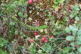 |
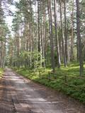
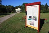
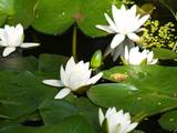
The territory has been established for protection of the bog and its habitat species. It is not appropriate for visits. North-east part of the bog can be slightly seen from the road Neveja – Lapmezciems on winter season. Further on Cirste direction is located on of most impressive oak trees in Latvia – Rigzemju ozols.
|
|
 |
Ļoļi Devil’s Footprint is situated in Mākoņkalns rural territory in a small forest lawn several meters from the
ditch, which is a borderline of the Rēzekne and Krāslava districts. It is about 1,9 m high truncated cone, the base
perimeter 1,8 m. According to the legend, the boulder had a curvy of the horseshoe prints. Now it’s shapeless. For the
first time the stone as a geological monument was established in the 1930s. It was in Andrupene rural territory.
|
|
|
|
10 km garais pārgājienu maršruts iepazīstina ar vienu no vēl retajiem, cilvēka mazāk ietekmētajiem Daugavas senlejas posmiem. Tā sākums – Aizkraukle, finišs – Skrīveri. Gar upes krastu izvietotas atpūtas vietas. Maršrutu var braukt arī ar velosipēdu. |
|
|
|
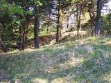
Iespaidīgs pilskalns ar izveidotu apskates taku. Blakus ūdenstūristu apmetne „Kvēpene”.
|
|
 |
Kirkas Hill in Micāni. In 1792, a small castle on the hill Priežukalns (Kirkas kalns) was rebuilt into
Lutheran Church. Nowadays, the hill still is called Kirkas kalns (in German „Kirche” means „church”).
Old people say – under the church there is a big cellar where the jewellery of church and the Mantefel
family is hidden; Manteifel family vault is there too.
|
|
 |
Samērā liela teritorija ar mozaīkveida ainavu - mežiem, atklātām ainavām un ezeriem (Salmejs, Kaučers, Stupānu ezers, Limanu ezers u.c.), kas atrodas Latgales augstienes Feimaņu pauguraines rietumdaļā. Aizsargājamo ainavu apvidus veidots šejienes dabas un kultūrainavas (apdzīvotās vietas, Tišas vecticībnieku lūgšanas nams, krucifiksi) un daudzveidīgo biotopu (t.sk. - sugu) aizsardzībai. Apvidū atrodas arī samērā populārs tūrisma objekts - Šnepstu pilskalns.
|
|
|
|
Atrodas Zebrus ezera austrumu krastā pie Latvijas Valsts mežu laivu bāzes. No torņa labi pārskatāms Zebrus ezers, ziemeļu virzienā – Ezerlūķu pilskalns. Laivu bāzē – atpūtas vietas. |
|
 |
Ķurmrags is one of the most distinct capes along the Vidzeme shore of the
|
|
 |
Established: 1959
60 coniferous and 350 deciduous trees
Brief description: Between the Tukums-Kolka road, the Lāčupīte stream and the sea, Igors Mednis has planted a series of foreign trees and shrubs. He has conducted experiments to see how different foreign plants adapt to different conditions. The best time to visit is in May and June, when the rhododendrons are in bloom.
|
|
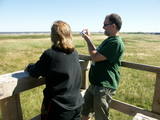 |
The viewing tower is in a seaside meadow near Mērsrags. It is an unusual type of biotope in Latvia and is located to the North of the Mērsrags port. The tower offers a good view of reed-filled meadows, areas where wild cattle have grazed, and an amazing wealth of different kinds of plants. |
|
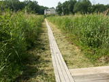 |
Near the Lielauce manor house start of a wooden pathway which crosses the transition-type swamp that is on the shore of Lake Lielauce to a boating facility near the open part of the lake. Boating and fishing are possible – here, too, the population of fish is regularly restored. The area is a part of the Vīķi swamp restricted zone. |
|
 |
This is an uncommon landscape for the Kurzeme region with a protected biotope – open inland dunes with meadows of silver grass and forests of deciduous trees, including the common hornbeam. Tourists can visit the Muiža (Lejas) sacred stream on the right bank of the Sventāja valley, above which they will find Latvia’s most noble bird-cherry trees. A nice reed pergola has been installed above the stream. Wide are of Sventāja River valley can be overseen from the road before the stream. |
|
|
|
Near the Priedīši homestead, there is a nature trail which allows visitors to study Lake Dziļezers and the surroundings. There are various lakes in this region which are found in a depression left behind by the Ice Age – Lake Dziļezers, Lake Riebezers, Lake Mazezers, Lake Auziņš, Lake Skuja and Lake Bruņķītis are all there. Along their shores, there are various kinds of forests, including ones with broadleaf trees that are under environmental protection. The trail is 3km in length and will take an hour or so to traverse. This is a part of the environmentally restricted territory of Lake Dziļezers and Lake Riebezers.
|
|
 |
The Rubeņu (Rubenes) park dates back to the mid-1950s and is toward the north of Rubeņi, on the banks of the little Dzirnavupīte River. There are beautiful ponds, a stage, a rock garden and a playground for the kids. The cultural centre that is alongside the park features a monument to the poet Rainis which was unveiled during Poetry Days in 1969 and was produced by the sculptor Kārlis Baumanis. |
|
 |
This restricted area protects the eutrophic Lake Istra and the biotopes that are alongside it – various kinds of forests and meadows. This is a particularly lovely part of the Latgale region. Interestingly, the so-called system of “rope farms” can still be seen in the nature park.
|
|
 |
Lustužkalns Hill (72 m ASL). A hunting
castle owned by Livonian Order master
Walther von Plettenberg was located here
in the 16 century. During the reign of
Russian Empress Catherine the Great, a
recreational castle was built here. A
legend from the time says that a golden
carriage is at the bottom of the local Lake
Valgums.
|
|
 |
1,2 km garā taka atrodas netālu no vietas, kur Gauju šķērso Vidzemes šoseja (A 2). Izejot taku, var iepazīt vienu no Latvijas augstākajiem dolomītiežu atsegumiem – Randātu klintis, kas paceļas 25 m virs Gaujas. Taka ir apļaveida un tās apskatei nepieciešamas ~ 45 minūtes. |
|
|
|
The Boulder of Subinaite can be found in Sakstagala rural municipality opposite Vaļenieku House that
is on the left side of the river Rēzekne. The base of the boulder is below the river level; it is 5,2 m long, 4,4
m wide, it rises about 1,6 m above the water level, about 2,5 m below the water level, capacity 26 m3.
Reddish surface is heavily eroded and full of moss. Protected since 1977.
|
|
 |
Lēdurgas dendroparks ir viens no bagātākajiem parkiem Latvijā. Parkā var iepazīt vairāk kā 1000 koku un krūmu sugas, pasugas un varietātes. Gadu gaitā Lēdurgas dendroparks kļuvis par dabas un kultūrvēsturisku aizsargājamu objektu. Piedāvājumā - skuju un lapu koki, dekoratīvie un ogu krūmi, vīteņaugi, ziemcietes, tējas augi u.c. |
|
 |
The barrow which offers a good view is at the northern end of the Dunduri meadows – at the end of Melnragi. It is an artificial barrow which follows along with the bed of the little Slampe River. The meadows are home to livestock allowed to live in the wild, and you can see a bit of the restored Slampe. The view is particularly interesting during flooding season, when the surrounding wetlands become saturated. This is a location for bird-watching.
|
|


