
| No | Name | Description |
|---|---|---|
 |
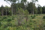
This is Latvia’s largest lake island and is found in the middle of Lake Usma. The island is restricted to protect old stands of pine, as well as various plants and birds. |
|
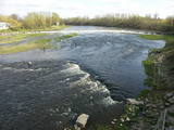 |
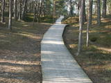
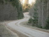
Above and below the town of Kuldīga, the Venta River is distinguished by a variety of biotopes – hillside forests, sandstone and dolomite cliffs, meadows, protected plants and animals, and diverse landscapes. There are popular tourism objects in this part of Kurzeme – the Venta dam, the stone bridge of Kuldīga, the Veckuldīga castle hill, etc. An ecological tourism trail runs along the banks of the Venta, and a bicycling trail has been installed on its left bank. |
|
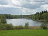 |
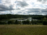
This restricted area protects the eutrophic Lake Istra and the biotopes that are alongside it – various kinds of forests and meadows. This is a particularly lovely part of the Latgale region. Interestingly, the so-called system of “rope farms” can still be seen in the nature park.
|
|
 |
Palieņu un mitrās pļavas abos Dubnas upes krastos, kuras nelielā posmā var vērot no Rožupes - Vārkavas ceļa. Piemērotā laikā šeit dzirdēsiet griezes balsi, kas ir Eiropā izzūdoša putnu suga.
|
|
|
|
The only island in Lake Ciecere has a more or less virgin forest of oak, linden and elm. Some of the oaks are huge. This is an important habitat for woodpecker-type birds. The island has not been improved. |
|
 |
Zilais (Blue) Hill is the highest point in the Idumeja highlands – it is a very distinct hillock covered by forest, and from it there is a “narrow” landscape featuring the northern part of the highlands, as well as the Burtnieks flatlands. The restricted area is there to protect habitats such as gullies, hillsides and the boreal (northern) forest of the area. Zilais Hill is a popular tourist destination.
|
|
 |
One of few places in Latvia (around 1 km to the North from Lapmezciems) where used to be beautiful juniper meadows. Since no agriculture activity (grass cutting, cattle grazing) has been implemented in the area, juniper meadows are overgrowing and disappearing. To save the area sustainable management is needed. Slitere National Park with Blue Mountain cliff and Slitere lighthouse is located in short distance from Kadiku nora (Juniper meadow).
|
|
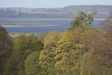 |
Nature restricted area includes eastern side of the lake with Lanupe River and North-east and South-east coastal areas. Restricted area has been established for protection of birds and floodplain meadows of the lake. To see the nature restricted area visitors do not have to enter it. There are great view points with wind generators of Grobina on the background from the road Vecpils – Rava – Aistere. Coastal areas which are not included in the restricted area are perfectly suitable for bird watching. There is located the smallest city by its population in Latvia to the South from the lake.
|
|
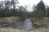 |
Nature restricted area is located to the South from former railroad Ventspils-Liepaja and includes approximately 6 km of Uzava River (and the old drainage system). The territory was used for agriculture during Soviet time, now it starts overgrow by scrubs. The protected nature values – rare bird species, including corncrakes, variety of grassland habitats and plant species. Territory is not useable for tourism activities. There is a possibility to get good insight into the North part of restricted area from the road Alsunga – Berzkalns where information stand is located.
|
|
 |
One of the rare places (see also Rucavas ivju audze) in Latvia where two rare and protected wild tree species grow - yew-tree and Baltic ivy. Territory is not marked on site with information signs or stands. Territory is not suitable for visitors as visitor without environmental knowledge will see “regular” forest. On the East side of the restricted area is located extending low wall – former narrow gauge railway (600 mm, length 41 km) line Dulbeni – Rucava. Railway was built by German military forces with the goal – to export wood.
|
|
 |
Along with the Nagļu ponds, these are Latvia’s largest fishing ponds. They were established on the flood-land peat areas of Lake Lubāns in the 1970s, when the hydrotechnical system of the lake was first established. The Lubāna-Gaigalava road bisects the Kvāpāni-Īdeņa ponds. There are three bird-watching towers on the dams of the ponds. The ponds are a major location for water bird nests, as well as places for migrating birds to rest. There are extensive bird-watching opportunities in the area.
|
|
 |
This restricted area was established to protect a high-type swamp, a swampy forest and a series of rare birds. The Niedrāji-Pilka swamp can be crossed with dry feet while enjoying almost virginal nature. This is possible on the narrow-gauge railroad embankment which runs through the swamp for three to four kilometres from the North-east to the South-west, or on the well-appointed circular wood pathway which is on the eastern size of the embankment.
|
|
 |
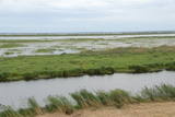
Periodically flooded flood-land meadows on the eastern and southern shores of Lake Burtnieks are an important nesting location for the rarely seen corncrake. A nature and information trail has been established at Vīsrags with directions, information stands and a viewing tower.
|
|
 |
This comparatively large territory is found to the South of the Irbe River and Stende River, and it is unique with more or less virginal forests and dunes. The Irbe River has a system of ancient tributaries, and the Dižpurvs swamp is parallel to the shoreline. The Irbe has become a popular river for water tourism in recent years, but the tourist infrastructure on its banks remains insufficient. Territory has good road connections and has potential for nature education activities. |
|
 |
The nature reserve “Plieņciema kāpa” is founded in 1987 and covers 60.6 hectares of land. Since 2005 it is a Natura2000 site. The nature reserve protects a 150-200m wide and 3.5km long part of a distinct, continuous dune rampart. The dunes shelter Plieņciems village protecting from sea winds. The key natural values here are rare and protected biotopes of national and European significance: “Wooded dunes of the coast 2180” in the area of 61.8 ha, “Fixed dunes with herbaceous vegetation, 2130 (grey dunes)” in the area of 8.27 ha, “Shifting dunes along the shoreline with Ammophila arenaria (white dunes) 2120 in the area of 3.20 ha”, “Black alder swamp forests 9080”, ) in the area of 2,68 ha, as well as rare and protected species of Latvian and European significance including eastern pasqueflower (pulsatilla patens), Rolling Hen-and-chicks(Jovibarba sobolifera), Nothorhina muricata, Wryneck (Jynx torquilla), Woodlark (Lullula arborea). In the nature reserve, there is a “Vabu square” – a deflation in the dune where for centuries local fishermen have been drying nets. In the 18th and 19th centuries ships were built here. Nine ships have been built here in 1882 - 1925. The four-masted gaff-rigged schooner with hoisting engine “Eurasia” was completed in 1925, the largest ship built by the Kurzeme fishermen. It was one of the works of Martin Morgenstern (1866-1945), a famous shipbuilding master. Thanks to dunes, Plieņciems village was a popular holiday resort and has been mentioned in written sources already in 1738. Clergymen and landlords with their families used to stay here. In 1808, a merchant from Riga bought the local pub and replaced it with a massive two-storey building with a large ball-room and dining hall. On July 15, 1810, a sea bathing facility was opened for health treatment. For arrival of the empress Elisabeth Alexeievna, the wife of emperor Alexander I of Russia, who was a grandson of Catherine the Great, the road from Tukums town was repaired, the two highest hills were levelled, a road passage was dug across the Plieņciems dune, and a lime-tree alley was planted to facilitate access to the beach and bathing spot. Later, in 1920ies, the resort circles consisted mainly of the Kurzeme region landlords. There was a dance-floor in the park of Plieņciems village, and a special orchestra played music for resort guests three times a day. |
|
 |
Dabas liegumā ietilpst divi aizauguši ezeri ar grūti pieejamiem krastiem - Lielais un Mazais Asūnes ezers, kas atrodas dienvidos no Asūnes ciema. Abus ezerus var vērot, atrodoties ārpus lieguma teritorijas - no blakus esošo pauguru augstākajām daļām, kas atrodas austrumos no abiem ezeriem. Ja līdzi būs paņemts tālskatis, iespējams, izdosies iztālēm novērot šeit esošās aizsargājamās putnu sugas, piemēram, melno zīriņu. |
|
 |
Dabas liegums atrodas dienvidaustrumos no Lubāna ezera un tas veidots purva un meža biotopu un tajos esošo sugu aizsardzībai. Gar teritorijas ziemeļu robežu iet Nagļu - Degumnieku ceļš (iekļaujas kopējā Lubāna dambju sistēmā), pa kuru apkārt Lubāna ezeram izveidots velomaršruts. Tas nozīmē, ka teritoriju var aplūkot arī "no malas", netraucējot tās dabiskās norises. Teritorija ietilpst arī Lubāna mitrāja kompleksā.
|
|
 |
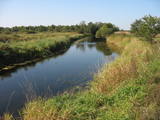
A distinct area of the lower reaches of the Vitrupe River, with small sandstone cliffs and many rare species of plants and molluscs. Visitors can visit the Ķirbiži Forest Museum and its information and botany trail. It weaves along both banks of the river and allows people to look at the most typical examples of flora in the region. The noble Vāloži oak tree is a key element there.
|
|
 |
This structure is smaller than the Great Kangari hills – approximately 10 kilometres long and 16 metres high. This structure is near the Buļļi swamp, and the restricted area is meant to protect the structure, the swamp and the various forest types and rare plants that are in the area.
|
|
 |
Ilziņš jeb Vestienas dzirnavezers pazīstams ar nostāstiem par tajā "periodiski uzpeldošām kūdras salām". Saskaņā ar vietējo iedzīvotāju sniegtajām ziņām, minētā parādība gan sen jau vairs nav novērota. Tajā pat laikā ezers un tā apkārtne ir nozīmīga daudzu aizsargājamu biotopu un sugu dzīves vieta. Ezers ietilpst Vestienas aizsargājamo ainavu apvidū. Ezeru var redzēt, braucot pa Ērgļu - Gaiziņkalna ceļu. Var pakāpties arī blakus esošajā paugurā (ziemeļos no minētā ceļa un ezera), no kura paveras plašāka skatu perspektīva.
|
|


