
| Nr | Name | Beschreibung |
|---|---|---|
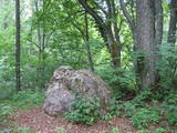 |
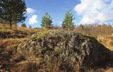
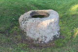
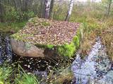
Ja Rušona ezeru iepazīstiet ar laivu, tad var apmeklēt Lielo salu (ezera rietumdaļā),kur (augstākajā vietā) ir jāuzmeklē ap 1,2 m augstais akmens. Konstatēts, ka tā apkārtnē un uz virsmas kurināta uguns. Atrastas arī senlietas. Nostāsti vēsta, ka akmens virsmā bijušas iekaltas zīmes (nav saskatāmas) un pie tā upurēti jēri. Tikai nedodieties ezerā, ja ir vai gaidāms stiprs vējš! Rušona ezera salas ir dabas liegums. |
|
 |
Ļoļi Devil’s Footprint is situated in Mākoņkalns rural territory in a small forest lawn several meters from the
ditch, which is a borderline of the Rēzekne and Krāslava districts. It is about 1,9 m high truncated cone, the base
perimeter 1,8 m. According to the legend, the boulder had a curvy of the horseshoe prints. Now it’s shapeless. For the
first time the stone as a geological monument was established in the 1930s. It was in Andrupene rural territory.
|
|
 |
Im Wald von Kaltene ist ein sagenumwobenes Naturwunder – Kalvas von Kaltene bzw. von Valna zu besichtigen. Das Entstehen dieser Anhäufung im Wald, 2 – 3 km von der Küste entfernt ist mit den Küstenbildungen des Baltischen Eissees verbunden. Die größte Anhäufung ist Velna kalva (Teufels-Kalva). Seinerzeit war Velna kalva eine schöne Anhäufung, so große, dass “sich bis Gipfeln der Bäume streckte”. Auf den früheren Karten wurde die absolute Höhe dieser Anhäufung angegeben – 20 m. Diese Anhäufung bestand aus Steinen verschiedener Formen. Die Steine waren sowohl voll kugelförmig als auch in einer Tellerform. Diese Anhäufung wurde fast vollständig in den 1960er – 1970er Jahren vernichtet, da daraus die Schotter für Straßenbau gewonnen wurde. Heutzutage ist nur ein ziemlich kleines Fragment des Unterteils von Kalva erhalten geblieben. Die Länge dieses Fragments beträgt ca. 300 m, aber die Höhe – 2 m. Die Wissenschaftler äußern eine Meinung, dass diese Anhäufungen im Altertum Sakralorte sein könnten, da viele Sagen und Legenden sind darüber geblieben. Um die Anhäufung zu besichtigen, wurde einen Naturpfad mit den Informationsständen und einem nicht großen Parkplatz errichtet. (Die Quelle: Roja TIZ) |
|
 |
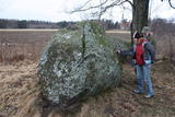
The Stone of Āžmugura is a fawn- coloured triangular prism boulder
which recalls the goat's back.
|
|
 |
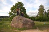
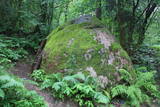
The Boulder of Purmaļi is the biggest boulder in Rēzekne district and one of the 20 biggest boulders in
Latvia. It is located on the escarpment surrounded by the trees and the bushes. Perimeter 18,5 m, height 3,2 m,
lenght 5,6 m, width 4,7, surface volume 30 m3.
|
|
 |
Horse's Footstone has a curvy that recalls a horse's footprint.
|
|
 |
Atrodas Kalēju ielas malā. Savu popularitāti ieguvis ar nostāstu, ka Ziemeļu kara laikā pie tā pusdienojis Krievijas cars Pēteris I un Polijas valdnieks Augusts (Stiprais). |
|
 |
The Boulder of Labvārži is located in the Northern side of Adamova Nature Park, in the SW of Lake
Vizulītis (Labvārži). It is located 0,70 km from the Labvārži or Laboržu House. The boulder is 5.9m long and
4,0 m wide.
|
|
 |
The rock is not too big (2.1 m high, 15 m in circumference), but since the early 20th century it has been a popular tourist destination. There is a lovely view of the
|
|
 |
The Pinnu (Dievekļa) Sacrificial Stone is at Ulmale, some 300 m from the Liepāja-Ventspils highway (there are signs). This is a very beautiful and distinct bowl-type rock, and the indentation at the top is 15 cm deep and up to 61 cm in diameter. It is thought that this was an ancient cult location, particularly between the 16th and 18th centuries. |
|
|
|
Medinski Vincīši boulder also called Magoņkalns (Poppy hill). Red rapakivi granite boulder is found
in the tree cluster only 40 m to the left of Jaunviļāni – Medinski road and about 40 m from the right side of
the river Malta. The boulder is 6,6 m long, 5,4 m wide and 3,3 m high. The circuit of the boulder is 20 m
and the volume 40 – 45 m3.
|
|
 |
The rock is along the main street of Krāslava and is found at Augusta Street 12. After major reconstruction of the city’s infrastructure, the rock was successfully integrated into the surrounding landscape. The rock is 2.8 m long, 2.2 m wide and 700 cm high. It once served as a border stone for the village of Krāslava. It was placed there in 1729 to commemorate the day when the noble Plater dynasty bought Krāslava. The dynasty’s seal is engraved in the side of the rock along with the date when it was installed. Legend has it that Polish King Augustus II dined at the rock after a hunt, and that is why it is known as Augustus’ Rock. |
|
 |
Rīgas - Daugavpils šosejas (A 6) 157. kilometrā skats jāpavērš Daugavas (rietumu) virzienā, kur cauri koku alejai klajā laukā 50 m attālumā no ceļa iegūlis Vaiķu akmens (7 m garš, 4,7 m plats un 1,7 m augsts). Akmens, kura tilpumu vērtē ~ 45 m³, pēc formas atgādina plakanu galdu. Nostāsti vēsta, ka to šeit atnesis velns. Kā jau šādiem akmeņiem „pienākas”, stāsta, ka te pusdienojis gan Krievijas cars Pēteris I, gan pats Napoleons. |
|
 |
Rīgas – Daugavpils šosejas (A 6) malā (vietā, kur no Zemkopības institūta nogriežas ceļš uz Skrīveriem) redzama zema ieplaka ar Kraukļu akmeni, kas ir sena kulta vieta. Pie akmens veikti arheoloģiskie izrakumi, kuru laikā atrastas senlietas. Vecākā ir no 12. gadsimta. Akmens aprakstīts slavenajā Andreja Upīša (1877. – 1970.) darbā „Sūnu ciema zēni”. |
|
 |
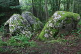
Platais Boulder (Wide boulder). You can find it in the rural municipality of Mākoņkalns not far from a
small meadow close to the boulder of Āžmugura. Both the boulders have their legends. Some say that the
boulder of Āžmugura is the part of Platais boulder and the rainwater from its cavity heals the warts.
|
|
 |
Ziemeļos no Viļāniem (Jaunviļānos) atrodas ar mežu apaudzis osveidīgs paugurs – t.s. Kaupra kalns, kurā virsotnē meklējams (ceļa uz Trūpiem malā izvietota norāde) minētais akmens. Trīsdaļīgā akmens, kas atrodas mežā, garums ir 4 m, platums 3 m, augstums 1,9 m. Lielākās daļas virspusē var saskatīt nelielu dobumu, tādēļ pastāv viedoklis, ka šis ir sens kultakmens. |
|
 |
200 m attālumā no Gulbenes – Madonas ceļa mežainā nogāzē iegūlis 2,4 m augstais akmens. Tā lēzenajā virsmā iekalta ap metru gara, 0,3 m plata un ap 4 cm dziļa iedobe, bet akmens šķautnē - pakāpieni. Uzskata, ka šis ir sens kultakmens, pie kura ziedots. Lai nokļūtu līdz akmenim, vasaras otrajā pusē var nākties brist pa garu zāli. |
|
|
|
The Boulder of Subinaite can be found in Sakstagala rural municipality opposite Vaļenieku House that
is on the left side of the river Rēzekne. The base of the boulder is below the river level; it is 5,2 m long, 4,4
m wide, it rises about 1,6 m above the water level, about 2,5 m below the water level, capacity 26 m3.
Reddish surface is heavily eroded and full of moss. Protected since 1977.
|
|
 |
Zīleņu Sacrificial Boulder.You will find it on Zelenpole Golden hill beside the escarpment. The boulder
has an annular curvy. It was an ancient Latgalian cult place where people sacrificed to Gods, released themselves
from the bad things and took a positive energy.
|
|
 |
К северо-востоку от Мазирбской лютеранской церкви – в полемежду храмом и домом «Пакални» видны два чумных камня. На поверхности бóльшего был высечен (сейчас стерся) текст о ливах, которых одолел король Швеции Карл IX и чума. Сбоку на большой камень опирается второй (самый маленький) чумной камень, который в свое время был установлен у близлежащих домов. Стертый текст рассказывал об армиях, ходивших по Курземе, о голоде и чуме. Третий – Большой чумной камень находится заМазирбским имением священника. Высеченный на нем текст (еще немного просматривается) повествует будущим поколениям о местном священнике (умер во время чумы) и о создании пастората в Сикрагсе. Одновременно камень является памятником шести пасторам обширной окрестной общины. Все три камня повествуют о Большой эпидемии чумы 1710 года, и тексты высечены на них в период с 1711 по 1734 год. |
|
