
| Нo | Название | Описание |
|---|---|---|
 |
Construction on the lighthouse was initially completed in 1879. The structure suffered damage during both world wars and was restored several times. The structure is 19 metres high and stands 46.5 metres above the wavy sea. Here you will find one of the loveliest views of the shores of the Baltic Sea.
|
|
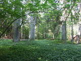 |
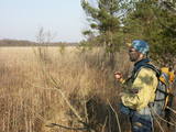
This is a fairly unique territory in Latvia – a vast forest of oak trees (many of them very large, indeed), linden trees, elms and various other deciduous trees. In the company of a forest guide, the visitor can walk through a small part of the forest, learning about the inhabitants of the area and their importance. This is an environmentally protected zone.
|
|
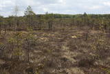 |
Territory established mainly for protection of bog myrtle and various bird species. An interesting fact is that bog myrtle or sweet gale is used as ingredient for making famous Riga Black Balsam. Brienamais purvs (wade bog) is hard to find and reach therefore it is not suitable for tourism.
|
|
 |
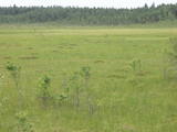
There is no need to enter the bog to see it, there are good views from the highway Ventspils – Riga (77 km, bus stop “Pagrieziens uz Elkskeni”). The main value of restricted area is chalky fen bog with brown bog-rush (greatest habitat finding in Latvia). Be careful when stopping on the highway – mind the traffic! A couple of kilometers towards Riga, on the right side of the highway, there is sign to Grizu Velna kresls ( Grizu Devil Chair) which is an attractive boulder (protected).
|
|
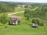 |
One of the most distinct sub-glacial depressions in Latvia, with 11 lakes of various sizes and depths. This is a magnificently lovely territory, with particularly good views from the Drusku castle hill. On a clear day, one can even see the Hanja highlands of Estonia. The restricted territory was set up to protect boreal and hillside forests I the area.
|
|
 |
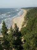
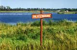
Одна из самых интересных особо охраняемых природных территорий Риги, предназначенных для защиты прибрежных биотопов – дюн, приморских береговых лугов и обитающих на них птиц и растений (здесь находится 29% видов орхидей). В этом природном заказнике была создана маркированная образовательная тропа со смотровой вышкой для наблюдения за птицами - единственная в Латвии смотровая вышка под открытым небом, приспособленная для людей в инвалидных колясках. |
|
 |
A restricted area with a set of artificial ponds to the South-west of Saldus. The ponds attract many different kinds of birds during nesting and migration season. The location has not been improved for tourist purposes, but it is still an interesting place for some bird-watching. The forests around the ponds are also home to many protected birds and species of bat. |
|
 |
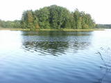
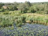
At the centre of this restricted area is the eutrophic Lake Tosmare, a former lagoon from the Littorina Sea. The lake and its surroundings offer protection to many plants and birds. At the southern end of the lake one can spot remnants of the former Liepāja fortification system, and to the West is one of the most important parts of that system – the Fortress canal. |
|
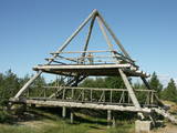 |
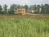
This is the only viewing platform of its kind. It is north of Pāvilosta, between the sea and Latvia’s largest gray dune. The second level of the platform offers a good view of the habitats which surround the dune, as well as the seashore and the largest seashore rock on the shores of the Baltic Sea – the Pāvilosta sea rock. You can also see the northern part of Pāvilosta. When it is windy outside, you’ll see kiteboard riders showing their tricks.
|
|
 |
Dabas liegums veidots salīdzinoši neliela pārejas tipa purva aizsardzībai. Purvu lieliski var pārredzēt no nelielā skatu torņa.
|
|
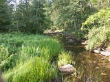 |
A distinct area of the lower reaches of the Vitrupe River, with small sandstone cliffs and many rare species of plants and molluscs. Visitors can visit the Ķirbiži Forest Museum and its information and botany trail. It weaves along both banks of the river and allows people to look at the most typical examples of flora in the region. The noble Vāloži oak tree is a key element there.
|
|
 |
This restricted area protects Lake Jumurda, which is in the central part of the Vidzeme highlands, along with its three islands, the local broadleaf forests, and the surrounding landscapes.
|
|
 |
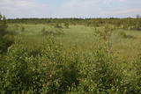
This lime swamp of grasses is in an area among dunes which floods from time to time, and it is an important location for many protected plants. The swamp is easily surveyed from the forested dunes which are on the south-eastern side of the swamp. |
|
 |
Above and below the town of Kuldīga, the Venta River is distinguished by a variety of biotopes – hillside forests, sandstone and dolomite cliffs, meadows, protected plants and animals, and diverse landscapes. There are popular tourism objects in this part of Kurzeme – the Venta dam, the stone bridge of Kuldīga, the Veckuldīga castle hill, etc. An ecological tourism trail runs along the banks of the Venta, and a bicycling trail has been installed on its left bank. |
|
 |
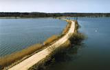
This is a territory which regularly floods when the Lielupe River crosses its banks. These are flood-land meadows of importance to birds. The area can be surveyed from the Rīga-Liepāja highway and the Kalnciems road which runs along it. |
|
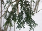 |
The forest covered area formed to protect tort protected plant species as yew-tree etc. Territory is not suitable for visitors as visitor without environmental knowledge will see “regular” forest.
|
|
 |
This territory is to the North of Skrunda, and it is an important location for water birds during their migration. Northern swans nest in the ponds, and sea eagles and other birds such as falcons and plovers use them for feeding. This is a good place for bird-watching, although it has not been particularly structured for that purpose. |
|
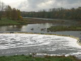 |
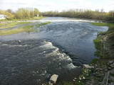
The recently renovated old brick bridge and the viewing area that is on the left bank of the Venta beyond the castle guard’s hut offers a lovely view of the widest and most impressive waterfall in Latvia – the Venta falls. It is worth visiting during the spring floods, when fish are migrating.
|
|
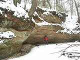 |
The Kaļķupe River valley was established as the Pilsupe River (formed by Kaļķupe River and Mazupe River) crossed the Blue hills of Šlītere to the South of Vīdale and Kaļķi. The distinct river valley has a branched network of gullies in which Devonian sandstone has been uncovered and can be seen in some locations. Puiškalns Hill (located at confluence of Kaļķupe River and Mazupe River), which was used as a castle hill and as a sacred location long in the past, is one of the most distinctive parts of the area. It is a popular tourist destination in the Talsi District. Hillside forests, various kinds of meadows and a wide range of plants are also of value in the local environment. |
|
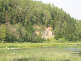 |
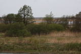
One of the most beautiful areas along the Venta River and its tributary, the Šķērvelis River. The river valleys and gullies along them are quite deep, and dolomite and sandstone cliffs can be spotted here and there. There are also rapids on the river. The largest cliffs in Kurzeme – the Ātraiskalns and Gobdziņi cliffs – can be seen on the banks of the Venta. The Lēni Catholic Church is near the restricted area. There are no tourist elements in the restricted territory at this time. The Venta is a popular destination for water tourists, however, from Nīgrande to Kuldīga. |
|


