
| Нo | Название | Описание |
|---|---|---|
 |
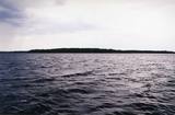
Витрупе – Туя - территория важна для охраны рифов. Она расположена напротив Салацгривского края, ее площадь составляет 3577 га. В территорию входит морская часть природного заказника «Видземское каменистое побережье».
|
|
 |
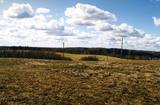
Nature restricted area includes eastern side of the lake with Lanupe River and North-east and South-east coastal areas. Restricted area has been established for protection of birds and floodplain meadows of the lake. To see the nature restricted area visitors do not have to enter it. There are great view points with wind generators of Grobina on the background from the road Vecpils – Rava – Aistere. Coastal areas which are not included in the restricted area are perfectly suitable for bird watching. There is located the smallest city by its population in Latvia to the South from the lake.
|
|
 |
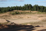
This territory protects the shore of the onetime Baltic lake of ice, which most significant part stretches for 10 kilometres on the eastern side of the Grobiņa-Ventspils highway from Kapsēde till Vērgale bus stop. From the top of this ancient shoreline there is a lovely view of the Piejūra lowlands, but no specific viewing areas or information stands have been installed. There are protected species and habitats in the territory. |
|
 |
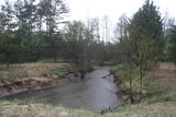
This territory is on both sides of the central section of the Raķupe River. On the banks of the river, there are many different meadow habitats, as well as massive oaks growing in the places of former farmsteads which are uninhabited by now. This is an important place for rare plants and animals. There is no tourism infrastructure for visitors in the area. Visitors who are especially interested in the environmental cognition are advised to visit the territory in attendance of experienced local guide. Raķupe is not usable for water tourism because of tilts of trees and beaver dams. |
|
 |
This territory was established so as to preserve the natural and cultural landscape of the most distinct part of the Alūksne highlands – a landscape which is made up of the highest hillocks in the area – Dēliņkalns Hill, Dieva Hill, Saules Hill, the Drusku castle hill, and the Kornetu-Peļļu sub-glacial river bed (one of the most significant terrain differences in Latvia). There are lakes, too – Lake Pilskalns, Lake Dzērve, Lake Ieva, Lake Raipals, etc. There are also significant biotopes – hillside and gully forests, various kinds of swamps and meadows, damp forests, etc., all with their own species of flora and fauna. There are nature trails and tracks for cross-country and downhill skiing in the area. There are three restricted natural areas in the territory – Korneti-Peļļi, the Avotu forest, and Dēliņkalns Hill. |
|
 |
Уникальная природная и культурно-историческая территория между Калдабруни - Бебрене и Двиете. По древней долине бежит маленькая речушка Двиете, протекающая через озера Скукю и Двиете и прилегающие к древней долине пойменные луга. Во время наводнения она ведет себя как своего рода «накопитель» вод Даугавы, быстро принимает большую массу вод половодья, а позднее медленно их отдает. Водянистыми веснами отсюда открываются такие виды, которые не увидишь нигде в Латвии. Особенности колебания уровня вод древней долины являются причиной тому, почему это место жизни растений и обитания птиц является таким важным как во время миграции, так и во время гнездования. В целях охраны территории создан природный парк поймы Двиете.Интересно, что места, находящиеся на возвышенности, которые во время половодья не подтопляются, называются островами. В древней долине Двиете обнаружено 15 возможных поселений древних людей (каменный, бронзовый, железный век) и много всевозможных старинных предметов – отдельные находки. Есть основание полагать, что это - одно из древнейших и важнейших мест поселения людей в южной части тогдашней Латвии. |
|
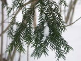 |
The forest covered area formed to protect tort protected plant species as yew-tree etc. Territory is not suitable for visitors as visitor without environmental knowledge will see “regular” forest.
|
|
 |
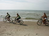
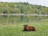
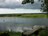
The key treasure in this park is that it has a lake that is one of the most intensive sites for birdwatchers in all of Latvia. It also features outstanding flora and the shallow waters of the Bay of Rīga. Recommended: Hike along the seashore from Mērsrags to Engure (20 km). See wild domestic animals (horses and cows) on the eastern shore of Lake Engure. There’s a bird-watching tower on the NW shore of the lake (approach from Kūļciems, where you can see domestic animals adapted to life in the wild, including the Blue Cows of Latvia). A bird-watching tower can be found at a place called Jomiņa near Mērsrags, where the seashore meadow is an uncommon biotope
|
|
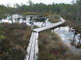 |
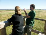
The Teiči Nature Reserve was established in 1982 and is one of the largest areas of moss swamps in the Baltic region. It consists of the Teiči and the Pelečāre swamps, with a variety of plants and animals, as well as adjacent territories which are under protection. The Teiči swamp is the largest nesting ground for a number of bird species, including the common crane, the whimbrel, the golden plover and the wood sandpiper. During migratory seasons, thousands of geese of various kinds are found in the area. The reserve can be toured only in the company of a guide from reserve headquarters, and one must apply in advance for such a tour. Visitors will see the pathway of footbridges on Lake Silda, as well as Siksala island, which offers a magnificent view of Latvian swampland from a viewing tower. |
|
 |
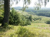
The main goal of the Vestiena protected landscape area is to protect the landscape values in the Vidzeme highlands. The protected area is in the middle of the Vidzeme highlands with the highest and most prominent relief, including Gaiziņkalns, the highest spot in the country. The many lakes found in the area - Viešūrs, Talejas, Kāls, Pulgosnis and others – not only add to the variety of the landscape, but also offer tourism and recreation options. The Vestiena protected landscape area encloses several other especially protected/Natura2000 sites – the Gaiziņkalna nature park, the island of the lake Kāla, the lake Ilziņa restricted natural area. Among the most interesting tourist attractions are the Vestiena estate, the Piekūnu wandering trails, the Gaiziņkalna nature trail. The area is rich in landscapes, however, there are no viewing spots or towers installed to observe the landscape. On the top of the Gaiziņkalns, the Latvia’s highest spot, there still stands the wreck of the former viewing tower.
|
|
 |
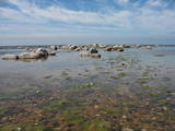
Охраняемая морская территория Нида – Перконе является одной из биологически многообразных и важных с точки зрения охраны природы морских территорий на побережье открытой части Балтийского моря – здесь находятся выдающиеся территории рифов. В период миграции территорию пересекает большинство мигрирующих пород птиц, встречающихся в Латвии. Расположенная напротив Руцавского и Ницского края территория площадью 36 703 га особенно важна для защиты большого крохаля и малой чайки. Территория частично перекрывается морской частью природного парка «Папе» и включает морскую часть территории природного парка «Бернаты».
|
|
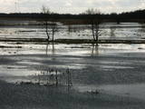 |
This is an open territory which is 3.5 km long and 2 km wide. It is located on the left bank of the Lielupe River between the village of Pavasari and the Odiņi homestead. The polder was established during the Soviet era to obtain farmland, and back then it was used very intensively. Today, it is slowly becoming overgrown, and despite this, this is one of the most important locations in Europe for corn-crakes. A gravel road crosses the polder from the North to the South, and this is an excellent place to hear the songs of the corn-crake. |
|
 |
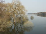
This is Latvia’s oldest nature reserve and, indeed, the country’s oldest protected natural territory. Moricsala is an island in Lake Usma, which is the fifth largest lake in Latvia. The reserve was established in 1912 at the initiative of a group of nature students from Rīga. They wished to protect the deciduous forest of oak trees on the island, along with the local flora and fauna. The nature reserve also includes the Lielalksnīte island. Visits to the reserve, however, are strictly prohibited. |
|
 |
The nature park in the Daugava River valley is the only place between the cascades of the Daugava hydroelectric power plants there is still a chance to see the Daugava River valley and the ravines of its tributaries as they appeared before the area was flooded so that the power plants could be constructed. Particularly lovely views are found on the right bank of the river near the Aizkraukle church and castle hill. Forests, meadows, origins of streams and small dolomite cliffs in this area are all protected biotopes. Leisure facilities have been installed on the Aizkraukle castle hill, and the Aizkraukle castle ruins are not far away. |
|
 |
Nature restricted area is located to the South from former railroad Ventspils-Liepaja and includes approximately 6 km of Uzava River (and the old drainage system). The territory was used for agriculture during Soviet time, now it starts overgrow by scrubs. The protected nature values – rare bird species, including corncrakes, variety of grassland habitats and plant species. Territory is not useable for tourism activities. There is a possibility to get good insight into the North part of restricted area from the road Alsunga – Berzkalns where information stand is located.
|
|
 |
No ģeogrāfiskā un kultūrvēsturiskā viedokļa interesanta teritorija Latgales augstienes Rāznavas paugurainē, kuras nozīmīgākie resursi ir dažāda veida biotopi, ainavas, reljefs un Šķaunes ezers. Istras pauguraines dabas parkā nav ar tūrismu saistīti labiekārtojumi, bet šo teritoriju var apskatīt arī „no malas”, braucot pa grantēto ceļu no Soboļinas uz Osinovku, kas iet līdztekus parka ziemeļu robežai (skats uz Šķaunes ezeru).
|
|
 |
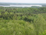
These are hillocks at the northern end of the Vidzeme highlands, and this is an important location for boreal (Northern) forests and swamps. Various kinds of swamps are found here, and the area is home to a variety of protected invertebrates.
|
|
 |
This is a large set of coastal meadows, ancient rivers and areas of reeds. It is found at a location where the Daugava River used to flow – between Vecmīlgrāvis and Vecāķi. There are inland dune meadows here, complete with the very rare silver grass. Vecdaugava is an important location for nesting birds and several uncommon plant species. On the southern end of the Vecdaugava peninsula, at a place called Skanstnieki, one can find remnants of medieval Swedish fortifications. The Vecdaugava Regional Research and Fishing Museum is here, as well.
|
|
 |
Viens no lielākajiem cilvēka veidotajiem Latvijasparkiem (70 ha), kas izstiepies no Liepājas ostas līdz Dienvidu fortam > 3 km garumā. Tā izveidi uzsāka jau 1870. g. pēc pilsētas mēra K. Ūliha iniciatīvas, uzbūvējot kūrmāju un strūklaku. 19. - 20. gs. mijā ap Dzintaru un Liepu ielām parādījās greznu villu un savrupmāju apbūve. Viena no skaistākajām ir jūgendstilā celtā savrupmāja Liepu ielā 27, kurā atrodas Krievijas ģenerālkonsultāts. Ēkai ir slēgta uzeja, balkoni, pildrežģa konstrukcijas un kārniņu jumts (arhitekti G. Jenike un P. M. Berči). Jūrmalas parks visās sezonās ir iecienīta pastaigu un dažādu aktivitāšu norises vieta. Te meklējams stadions „Daugava”, tenisa korti, koncertestrāde “Pūt, vējiņi!”, vasaras kafejnīcas, minigolfa laukums, bērnu rotaļu laukums, skeitparks. Šeit meklējamas lielākās Latvijas bungas – vides dizaina objekts. |
|
 |
This territory is meant to protect the large hillocks and lakes of the Augšzeme highlands – Lake Svente, Lake Medums, Lake Ilga and others, with their islands, landscapes and species. The nature park which has been established around Lake Svente and Lake Medums is part of this territory, and there are several areas that are restricted for environmental reasons – Lake Bardinskis, Lake Skujine, and the islands of Lake Medums and Lake Svente. There is a viewing tower on Egļukalns Hill, along with downhill ski routes. |
|
