
| Нo | Название | Описание |
|---|---|---|
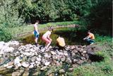 |
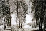
This is one of the most outstanding areas in the entire Baltic States with active underground waterways which still, to this very day, dissolve local gypsum rock. Parts of the area collapse regularly, and there are legends about all of this. Underwater rivers, streams, the so-called Karvės (Cow) cave, etc., can be seen in the area.
|
|
 |
This is Lithuania’s largest mossy swamp, and the Čepkeliu Nature Reserve was established to protect it. Before visiting the swamp, you must register at the Dzūkijos National Park’s visitor centre (Marcinkonys, Šilagėlių gatve 11). |
|
 |
In the central part of the Žemaitija Highland, this park was established to protect local landscapes. Lithuania’s highest hillocks are found here – Mėdvegalis (235 m above sea level) and Šatrija (229 m). There are also other hillocks which offer a great view of the area – make up your own tour here.
|
|
.JPG?size=160) |
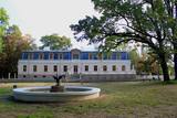
This park was established mostly to protect a wide range of cultural and historical objects such as the Trakai lake castle, the ancient Trakai cloister, the Užutrakai castle, the Bražole castle hill, the heritage of ancient local tribes, etc.
|
|
 |
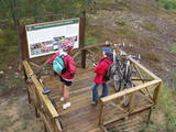
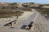
The territory is established in order to protect the dunes and the seashore habitats. There are beautiful beaches and wooded dunes, and the paved Klaipēda–Palanga bikeway trails through the park, which is worth travelling at full length. |
|
 |
Veisieji reģionālais parks (Veisiejų regioninis parkas) veidots (1992.g.) Sudavas augstienes (Sūduvos aukštuma) ainavu, bioloģiskās daudzveidības un kultūras pieminekļu aizsardzībai. Viena no parka bagātībām ir ezeri, kuru iegarenās formas liecina par ledāja darbības rezultātu. Pēdējā apledojuma laikā šeit atradusies ledāja mala. Ezerus (kopā – 37) ieskauj lielāki meža masīvi uz kontinentālām (iekšzemes) kāpām, kas piemēroti atpūtai dabā, dabas vērošanai, ogošanai un sēņošanai. Parkā ir iekārtotas peldvietas, kur patīkami gremdēties vasaras tveicē, izveidotas dabas takas, bet mazās upītes, kas savieno ezerus, ir piemērotas braucieniem ar kanoe laivām. Veisieji reģionālā parka teritorijā ir liela augu un dzīvnieku daudzveidība. Šeit tiek aizsargātas arī tādas retas sugas kā Eiropas kokuvarde Hyla arborea (parka simbols), purva bruņurupucis Emys orbicularis, dažādas orhideju sugas u.c. |
|
 |
This territory in the northern part of the Dzūkija Highlands with lots of hillocks and lakes. The most interesting tourist destination is Velnio duobė (Devil’s Flowerbed) – a funnel-shaped hole that is up to 40 m deep and 200 m wide and is thought to have originated during the Ice Age.
|
|
 |
Die Dünen nördlich Pervalka über dem ehemaligen Dorf Negeln. Eine 9 km lange Strecke mit den wüstenartigen Landschaften. Stegpfade. |
|
 |
This territory was established to protect the lovely central section of the Neries River, local species, and Lithuania’s largest oak forest.
|
|
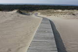 |
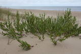
This is the only place in the Baltic States where there is such a vast territory of open-air sand dunes which still change the local terrain very actively because of the wind. The only Sea Museum and Dolphinarium in the Baltic States can be found here.
|
|
 |
Жагаре с давних пор славится особым сортом вишен «Žagarvyšnė» («Жагарская вишня»). Существует несколько разновидностей этого сорта, которые различаются по времени созревания, урожайности, форме деревьев и другим признакам. Эти вишни и сейчас растут почти в каждом местном саду, став уникальным символом поселка Жагаре. |
|
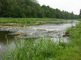 |
This park was set up to protect the lovely ancient valley of the Dubysa River. This is one of the most popular rivers for water tourism in Lithuania, because it has a significant drop with rapids and beautiful shorelines.
|
|
 |
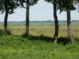
This territory is rich with forestland and lakes (some 285 in all). There are extensive opportunities for active recreation or calm leisure.
|
|
 |
The terrain in this territory was created during the Ice Age. There are the ancient river valleys of the Minija, Salantas and Erla rivers, along with groups of rocks.
|
|
 |
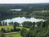
There are three large lakes at the centre of this park – Lake Dusia, Lake Metelys, and Lake Obelija. Lake Dusia has very clear and transparent water, and its southern and south-eastern beaches are popular among swimmers. The lakes and their nearby wetlands are important during the migration season of birds.
|
|
 |
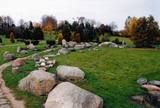
The “backbone” to this park is the valley of the Šventoji (Holy) River. One of the most impressive Devonian cliffs in Lithuania can be seen from the river – Vetygalos atodanga. On the shores of the Varius stream is a cliff made of quartz and sand – Variaus atodanga. 6 km to the S of Anykščiai is Lithuania’s second largest rock (5.7 m high, ~100 m3) – Puntukas akmuo.
|
|
 |
This park was established to protect Lithuania’s longest lake, Lake Asveja (> 20 km). The lake is in a sub-glacial valley carved out by ice during the Ice Age, and it actually resembles a wide and curvy river.
|
|
 |
The park was established to protect the Venta River valley and the landscapes that are around its tributaries. On the west bank of the Venta, at Papilė, there is a cliff from the Jurassic period which is unique in the Baltic States, has been known since 1925, and has layers in which more than 300 forms of life have been identified over the course of time.
|
|
|
|
Gegründet für den Schutz der Landschaften und der Seen der Aukštaitija-Anhöhe, Arten und Biotope. |
|
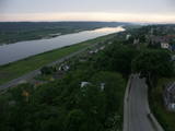 |
This park covers the Nemuna River valley between the villages of Seredžius and Geldaudišķis, with lovely views of castle hills, medieval castles, aristocratic estates, etc., along the shores.
|
|

